Access to Lake Onslow in Central Otago
Lake Onslow, located in the highlands of Central Otago, is a remote and scenic lake with stunning views of the surrounding landscapes. As you drive there on the Lake Onslow Road, you'll encounter breathtaking vistas of the Teviot Valley and the Umbrella Mountains.
Driving to Lake Onslow Road
Start your trip by taking the Millers Flat Bridge from State Highway 6 over the Clutha River / Mata-Au to Millers Flat. From Millers Flat, head northwest on Teviot Road. Turn right onto Oven Hill Road, then continue onto Tima Burn Road. This well-maintained metal road ascends the north side of the Lammerlaw Range, throiugh sheep stations, leading you to Lake Onslow Road at an elevation of 698 metres. Along the way, you'll be treated to spectacular views across the highlands.
If you are wondering how Oven Hill got its name, it’s because it was the site of many moa ovens dating back to the Māori moa-hunting period, pre-1600. The name is the only surviving evidence of this.
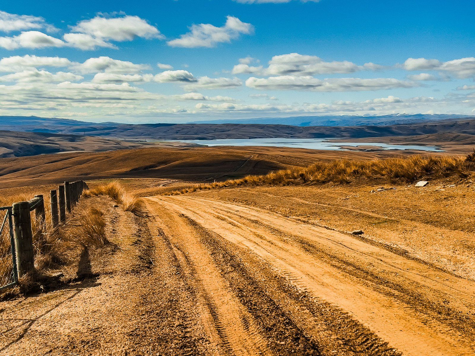
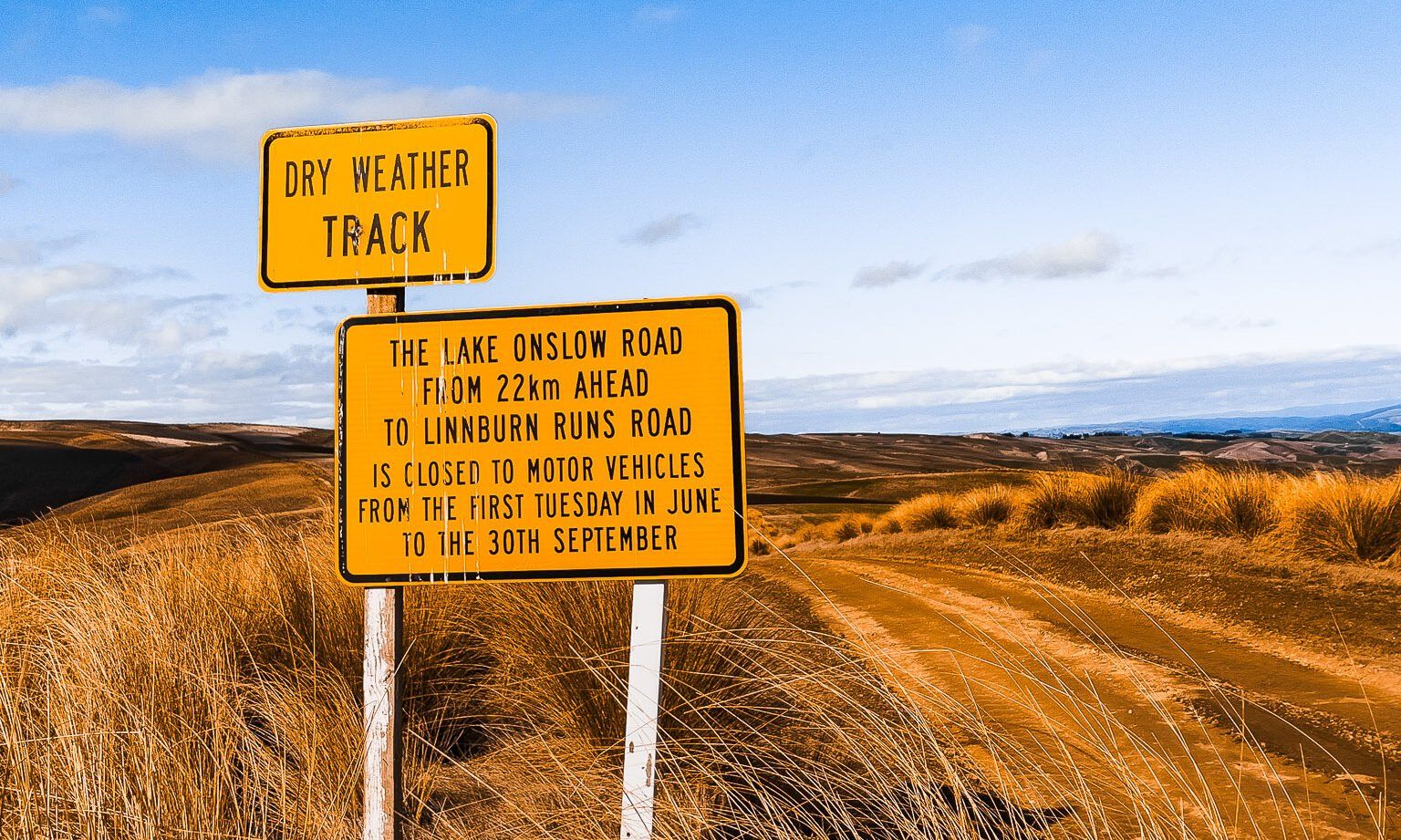
Continuing on Lake Onslow Road
While the roads to the end of Tima Burn Road are in good condition, Lake Onslow Road is more challenging, and a roadside warning sign indicates the change in road quality. Although standard cars can navigate this road in dry conditions, it's advisable to use a 4WD due to the large ruts and the presence of forestry vehicles. An exotic pine forest along this route provides visual variety but requires cautious driving.
The road continues to climb into mountain tussock lands, reaching a high point at 900 metres belwo the peak of Mount Teviot, which stands at 977 metres. From this elevation, the road descends through golden tussocks to Lake Onslow at 700 metres. You can park near the dam or continue to the fishing cribs for further exploration.
Alternative Routes to Lake Onslow
The drive is 26 km, but can take up to an hour of careful driving.
There are several alternative routes to access Lake Onslow Road. From Roxburgh, you can take Wright Road, then Saunders Road, or opt for Three Brothers Road from Teviot Road between Roxburgh and Millers Flat. Another option is to approach from Serpentine Flat to the northeast, using Deep Creek Road to reach the east end of Lake Onslow Road. This is a strict 4WD route.
Around the region, other remote highland roads to explore include the Nevis Road, the Old Dunstan Road, Poolburn and the Upper Manorburn.
Nearby places to explore include Roxburgh, the Roxburgh Dam and Beaumont.