Tuapeka Mouth's Unique Reaction Ferry
Tucked into the bend where the Tuapeka River meets the Clutha / Mata-au, Tuapeka Mouth is a quiet South Otago settlement with one remarkable draw: New Zealand’s last public reaction ferry. About 20 minutes southwest of Lawrence via Tuapeka West Road, it’s a detour that rewards slow travel with history, riverside scenery, and a rare way to cross the Clutha.
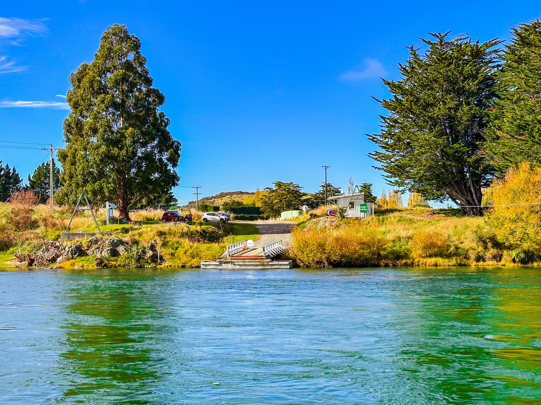
The Punt and River Confluence
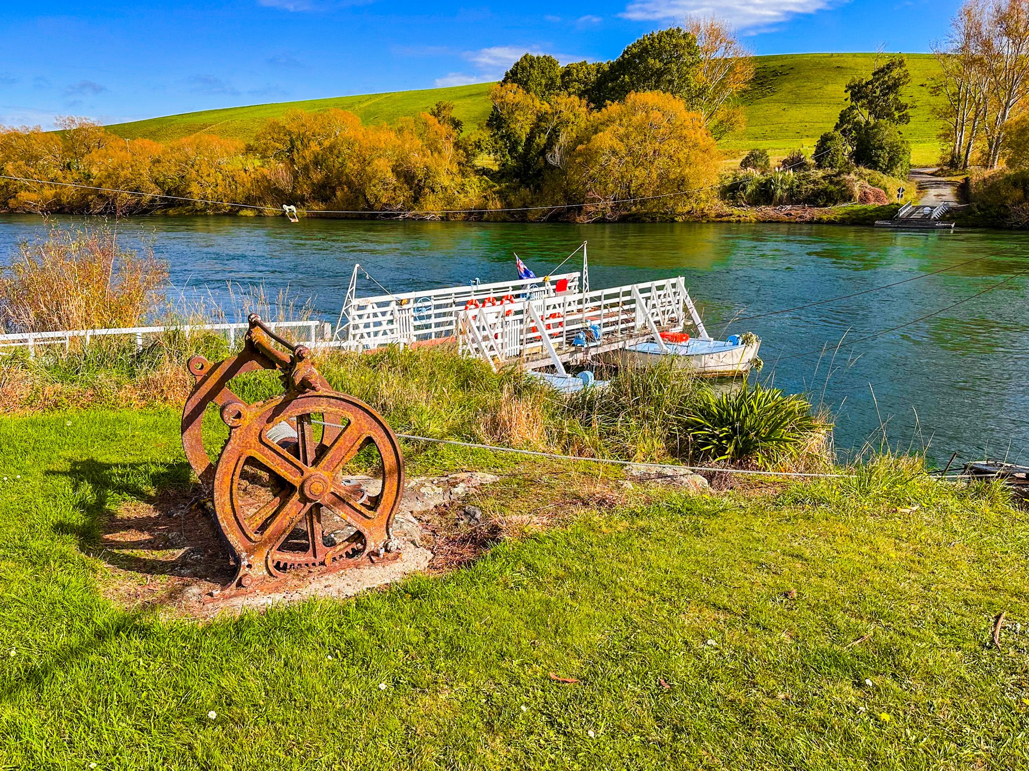
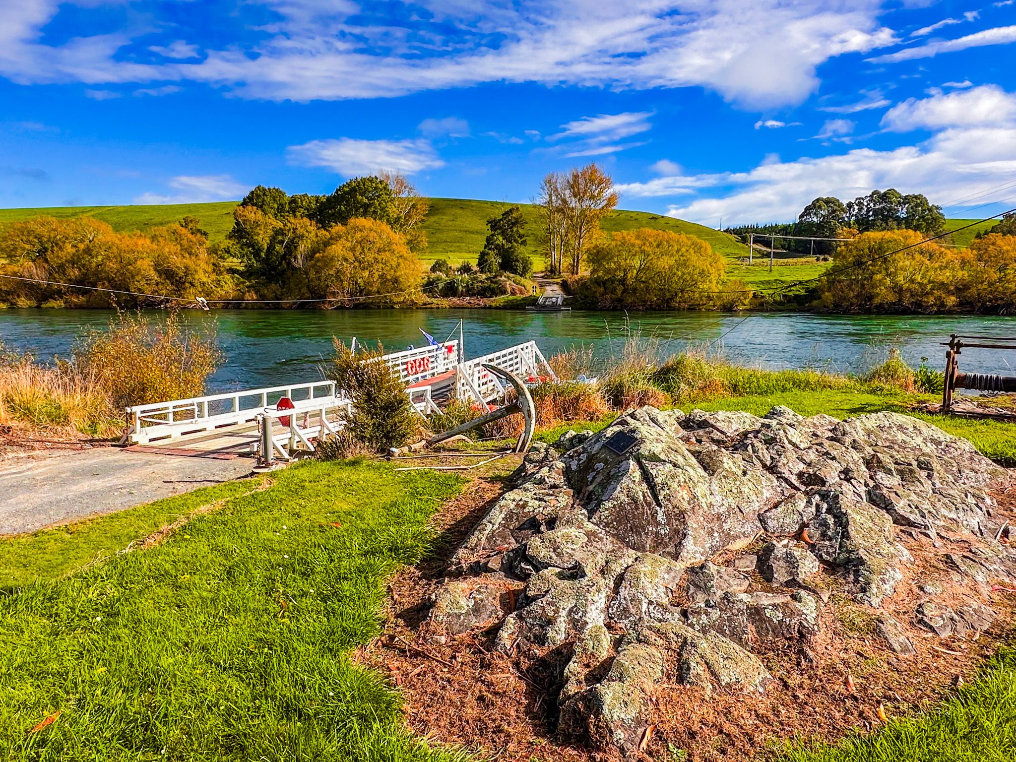
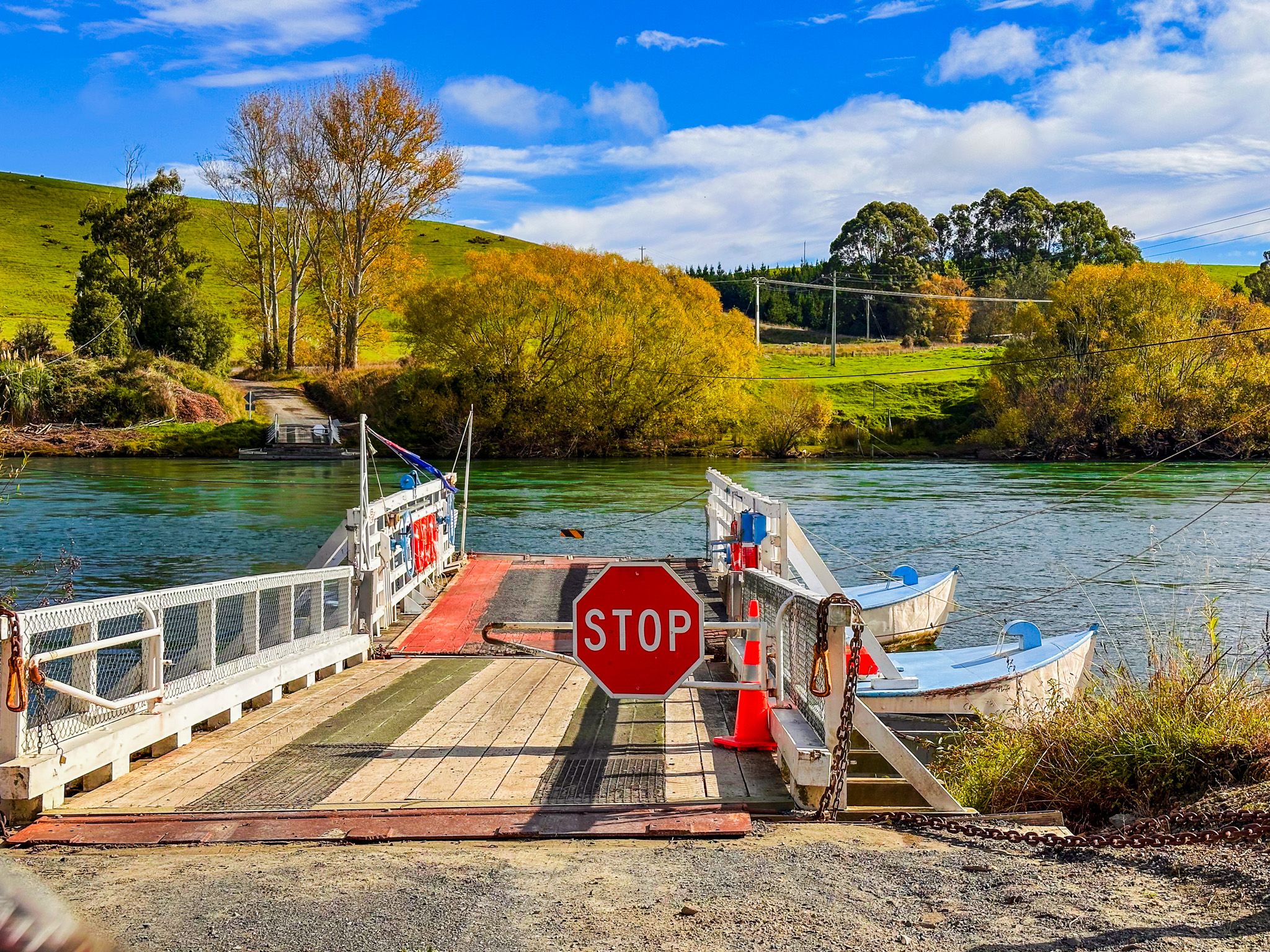
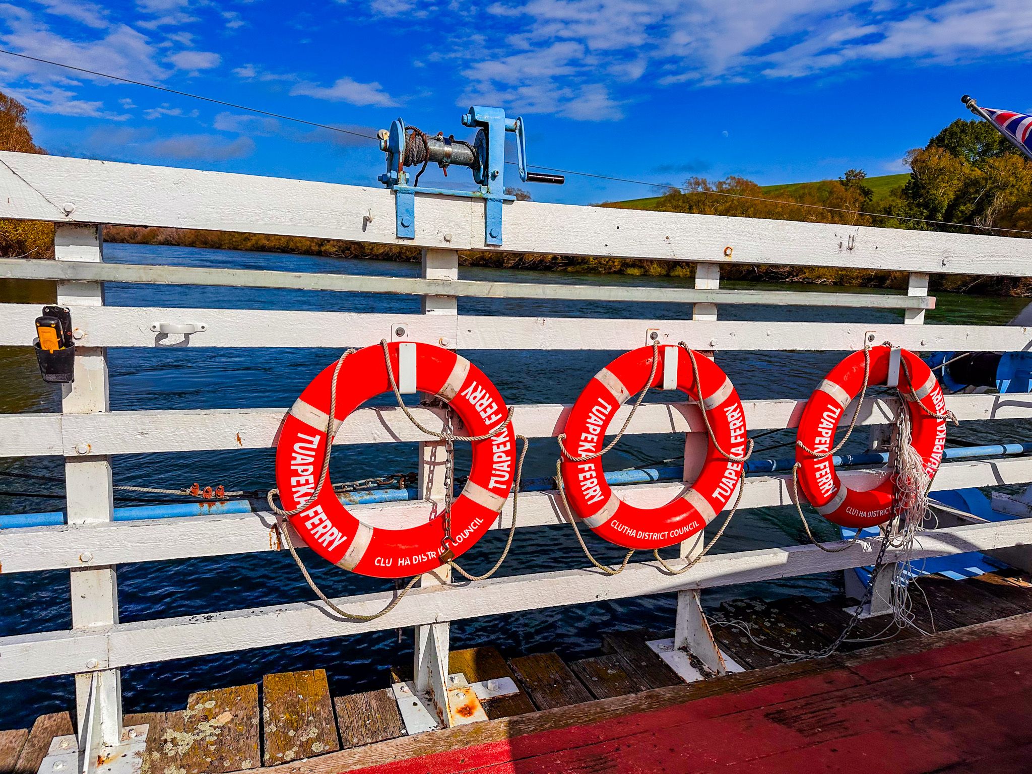
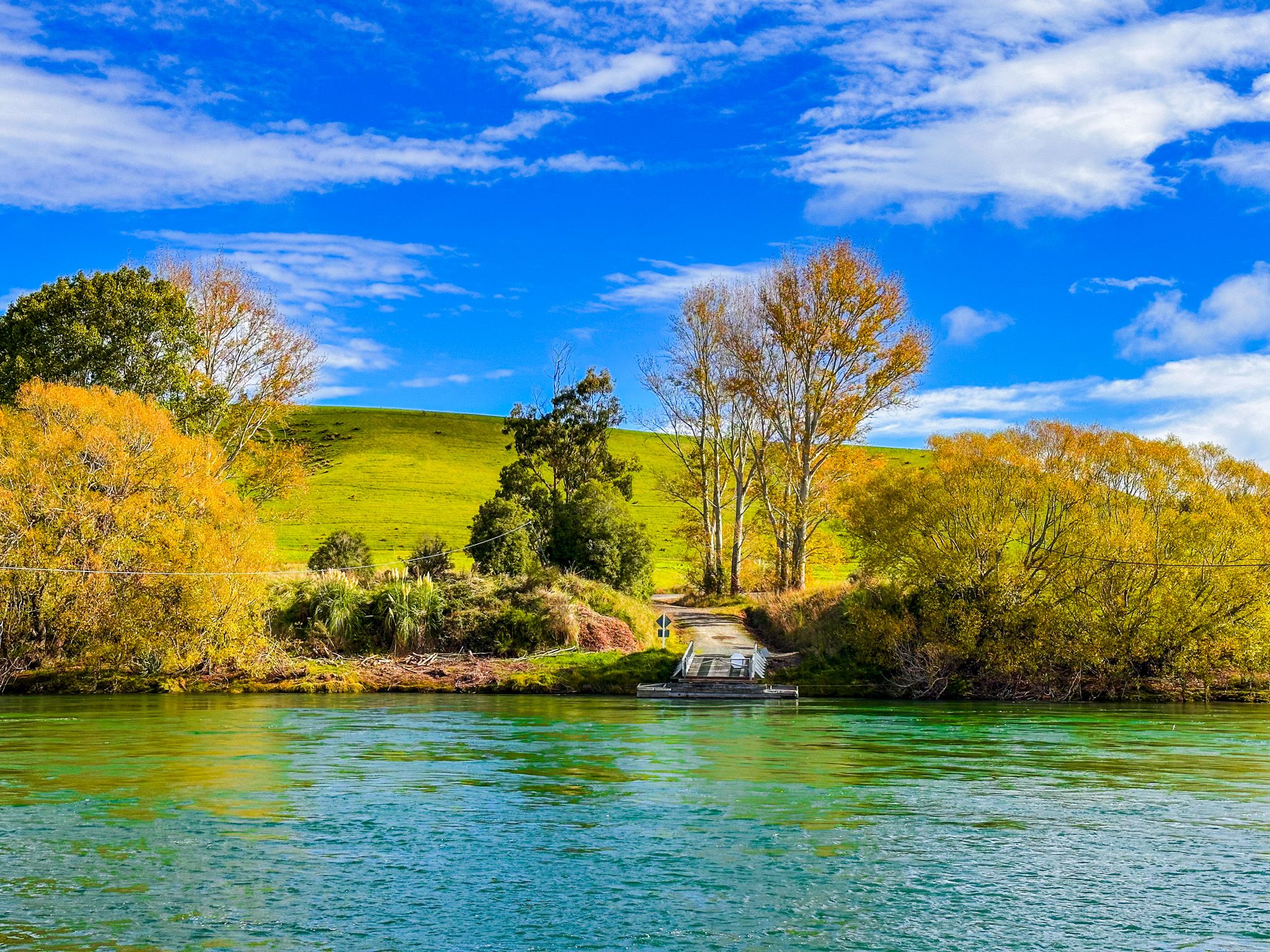
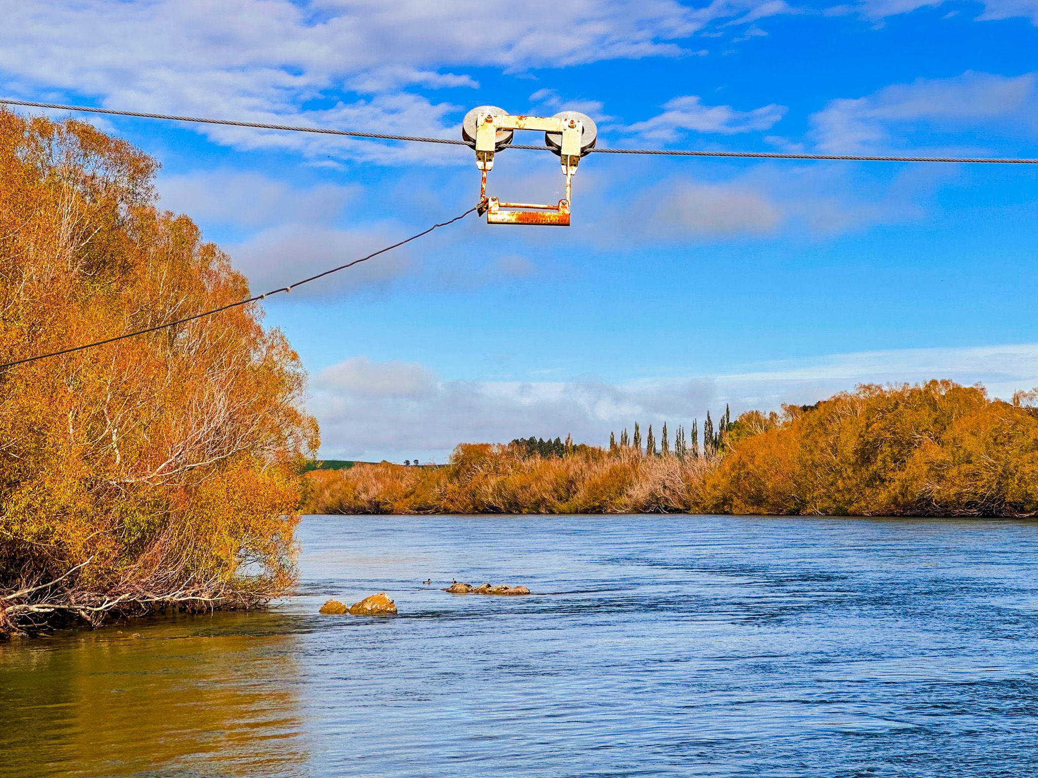
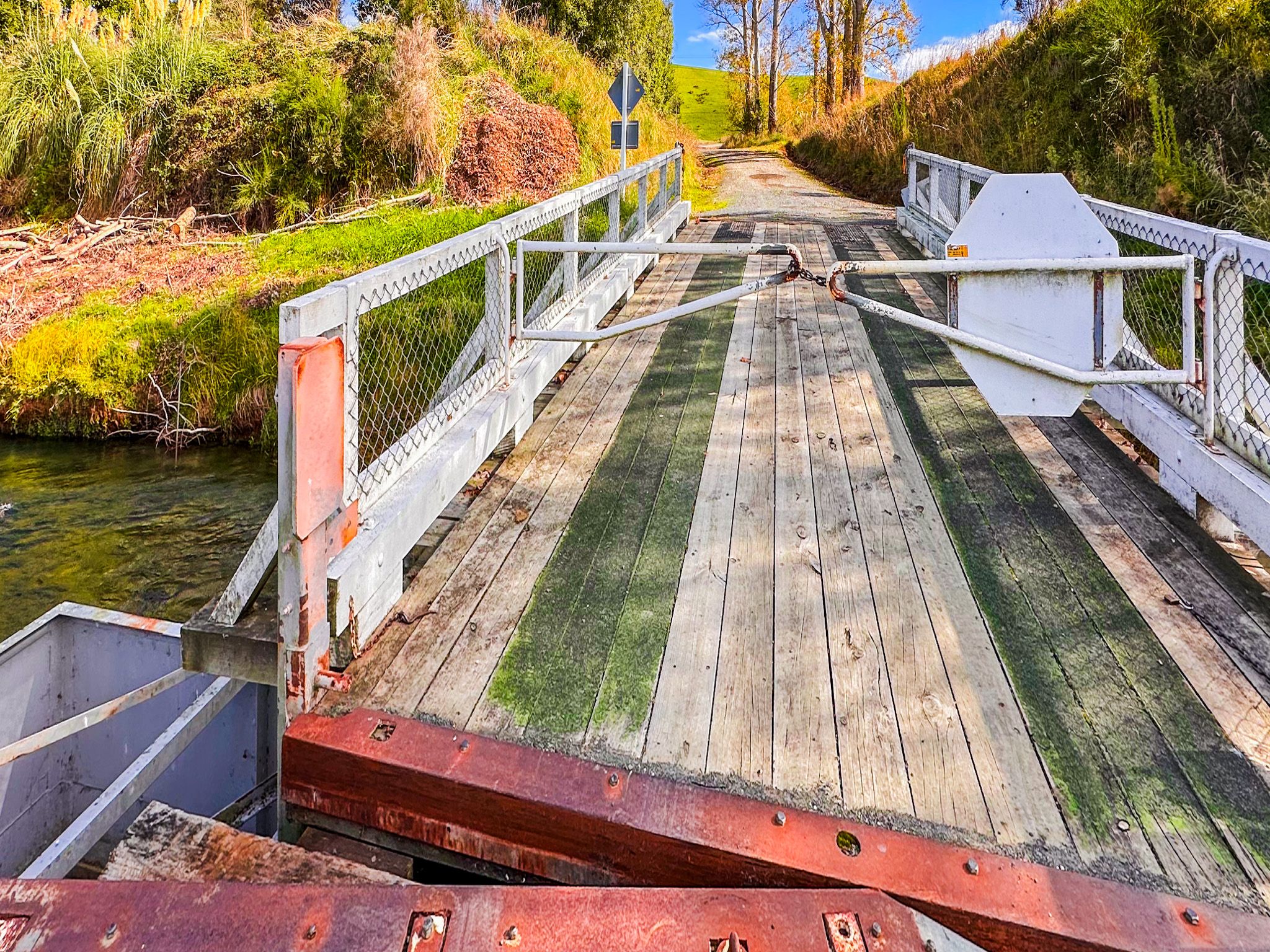
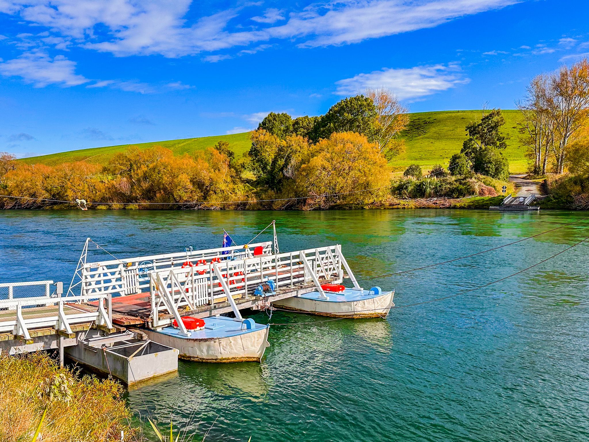
The Tuapeka Mouth Punt has carried people and vehicles across the Clutha since 1896. It works without a motor, harnessing the river’s current against a guide cable to swing across the water. When operating, it is free to use and still serves as a functional piece of living heritage. Crossing by punt is a rare experience, literally and figuratively. The river glides beneath, and the hillside settlement disappears behind.
Here, the Clutha flows wide and fast. Autumn brings bursts of gold from poplars and willows along the banks, and the ferry landing provides one of the region’s best river photo vantage points.
Walking the Tuapeka River Dam Track
Upstream from the ferry landing, a local walking track follows the Tuapeka River to the remnants of two early dams. The first, a timber crib dam from 1907, and a later concrete structure built around 1914, once fed water races to power gold sluicing operations. The riverside track is informal but easy to follow, with stretches of shaded bush and clearings.
Layers of History and Naming
The name Tuapeka may derive from a southern Māori term meaning "to cut down a branch for firewood," although other translations suggest meanings such as "to deceive" or "to mislead." The area was part of a key Ngāi Tahu seasonal travel and food-gathering route. Later, during the gold rush era, Tuapeka Mouth became the uppermost point accessible by steamboat on the Clutha.
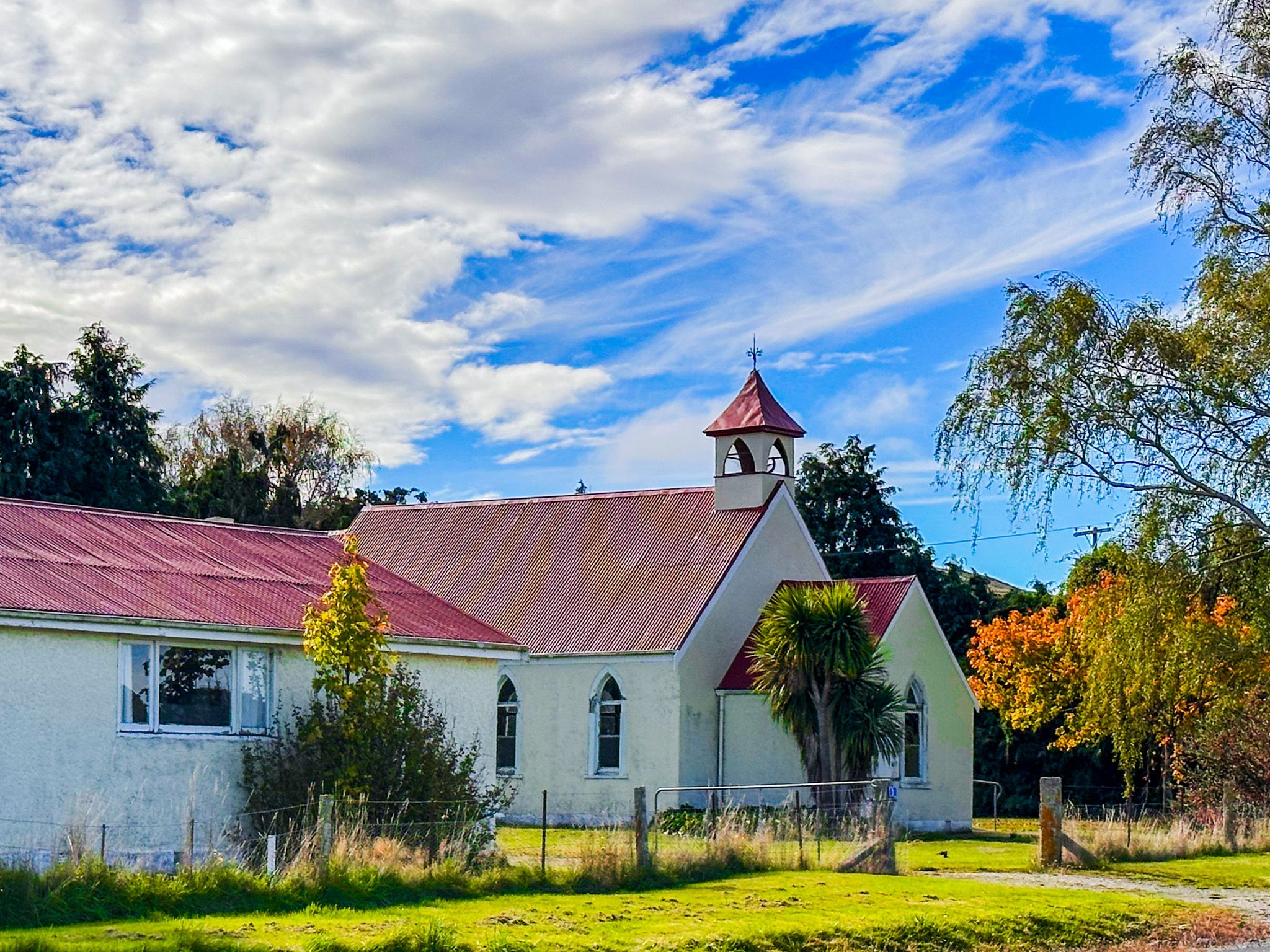
In addition to the historic ferry and jetty, the former Presbyterian church serves as a community-run Heritage Hub. Look for interpretation signs and locally curated displays if the Hub is open.
Scenic Drive to Beaumont
Crossing the punt leads to the quieter Clutha River Road on the Clutha’s west bank, with excellent river access and forested gullies. This stretch is especially scenic in autumn, with flashes of amber leaves and a surprising pocket of native beech forest. Several lay-bys allow river access for fishing or photography, before the road rejoins State Highway 8 at Beaumont.
How to Get There
From Lawrence, drive west on Whitehaven Street, then turn onto Tuapeka West Road. Follow this winding rural road for 21 km to reach Tuapeka Mouth. The punt operates daily (weather and river conditions permitting) between 10:00 am and 2:00 pm. For updates, check with Clutha District Council. After crossing, continue along the river to Beaumont and reconnect with State Highway 8.
Other nearby places to visit include Roxburgh, Millers Flat and the Clutha Gold Trail.