Langsview Track Ridge Top Walk
The Langsview Track is a 6.5 km ridge-top trail in Northland’s Brynderwyn Hills. Forming part of Te Araroa, it offers a combination of coastal views, regenerating native forest, and access to the Tanekaha Forest. The track is quite wide and a mostly easy walk, but it takes a bit of effort to get to. Options include from the north on Cullen Road, also a section of Te Araroa, or the south via the Tanekaha Falls Track or the Forest Tanekaha Track. There is a third option from Cove Road in the east, with a short bush walk followed by a private access road that climbs steadily to the ridge.
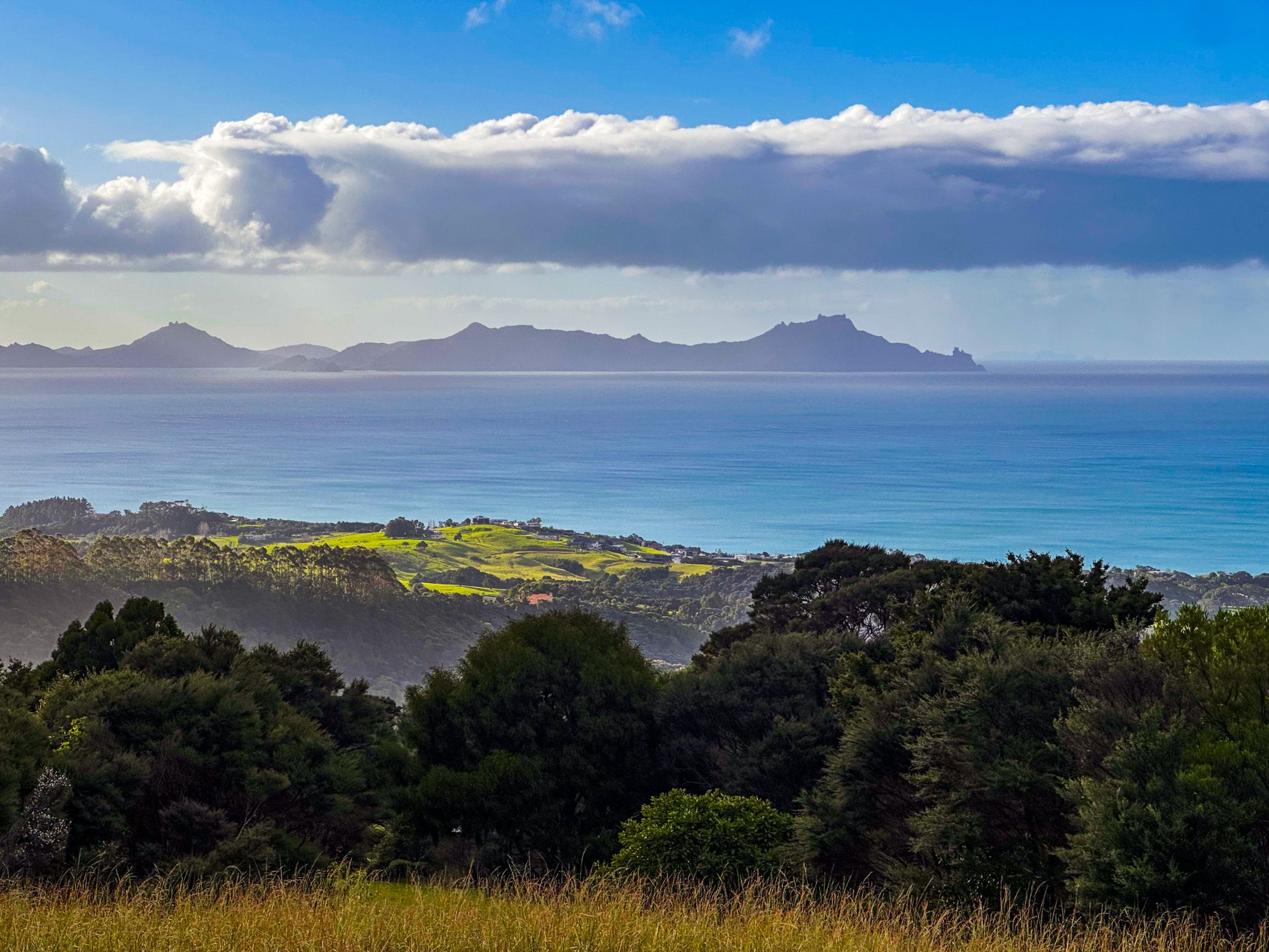
Much of the track has become shrouded in forest regrowth, particularly kānuka and mānuka scrub and trees. However, there are viewpoints, including at the 297 high point, with spectacular vistas north across Bream Bay toward Whangārei Heads and south toward Mangawhai’s coastline and offshore islands.
Waorahi Campsite
About halfway along the track, a basic campsite with a toilet and shelter is located. This is near the access to the Tanekaha Forest Track.
A Tanekaha Forest Loop Track
At the western end, the track connects with the Tanekaha Falls Track and the Tanekaha Forest Track, forming a loop for hikers through the Tanekaha Forest. This loop includes access to the kauri dam remnant, several waterfalls, and the large pūriri trees near the Puriri Track junction. At the eastern end, the Langsview Track meets the Mangawhai Walkway, extending the route down to the coast.
History and Culture
The Brynderwyn Hills, within the rohe of Ngātiwai, were historically used by Māori as inland travel routes linking the coast to forest resources. The ridgeline offered both vantage points and safe inland passages. With European settlement came the harvesting of the native forest, farming, and later pine plantations, many of which are being replaced by regenerating native forests. Today, the forest edges on the Langsview track are regenerating into a mix of native species, starting with mānuka and kānuka.
Getting There
The eastern access is from Cove Road, where there is a small car park and a marked entry to the trail. The northern access is reached via Cullen Road, which climbs into the Brynderwyn Hills from Waipū and Waipū Cove. After a 6 km drive from Cove Road, the road narrows to one lane and passes a warning sign. About 600 metres further on, near water tanks, there is space for a few cars to park. From here, a short walk along the road leads to the western end of the Langsview Track.
From the south, take King Road from Cove Road near Mangawhai Heads and park at the entrance to the Tanekaha Forest. It takes about an hour to hike up to the Langsview Track on either the Tanekaha Forest Track or the Tanakaha Falls Track.
In addition to the tracks of the Tanekaha Forest, nearby activities include the beaches, walks and cafes of Mangawhai Heads, including the Mangawhai Walkway, Goldschmidt Track and Mangawhai Heads Beach.


