
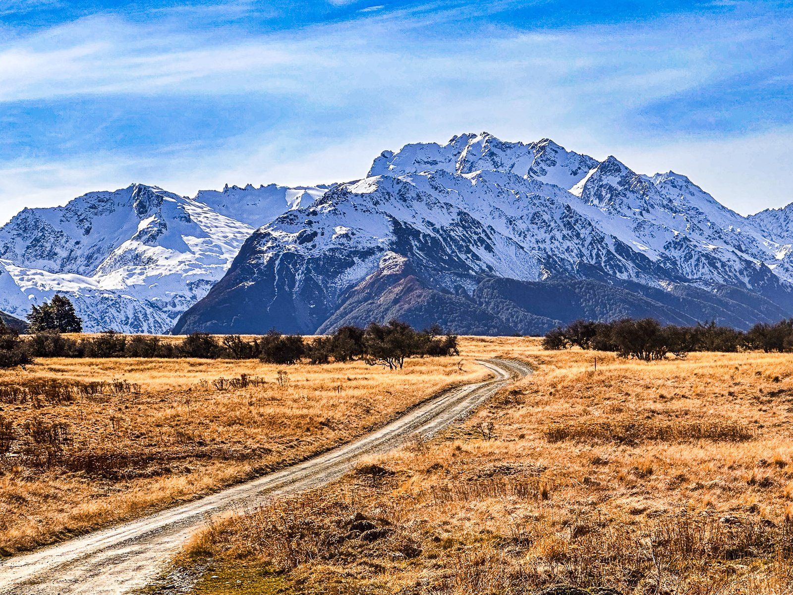
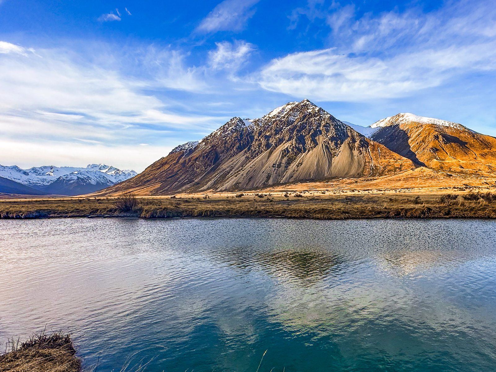
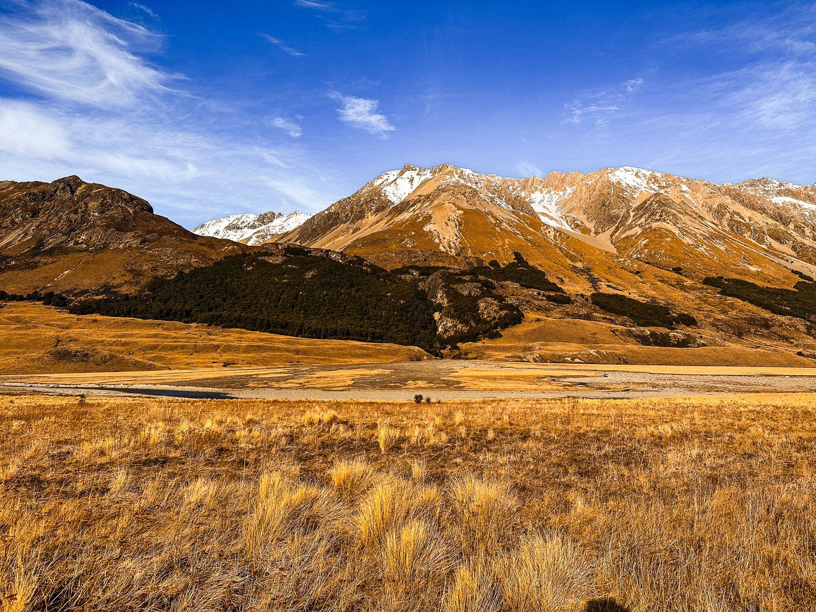
The Ahuriri Valley is a beautiful glacial valley on the eastern side of the Main Divide of the Southern Alps, Canterbury. Access is on Birchwood Road, with the turnoff from State Highway 8 near the northern end of Lindis Pass. The main features of the valley are the Ahuriri River and surrounding mountains. These rise from around 1200 metres at the valley’s south end to over 2200 metres as the valley narrows. Here you find yourself between the Huxley and Barrier Range to the north.
The first half of the valley is relatively dry and farmed by high-country sheep stations, Ben Avon and Longslip. The stations provide easement access to conservation lands and mountains on either side of the valley and various hiking tracks.
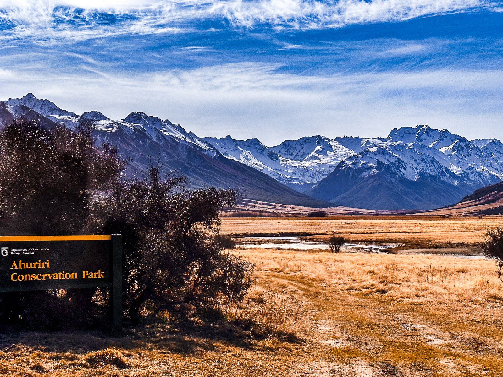
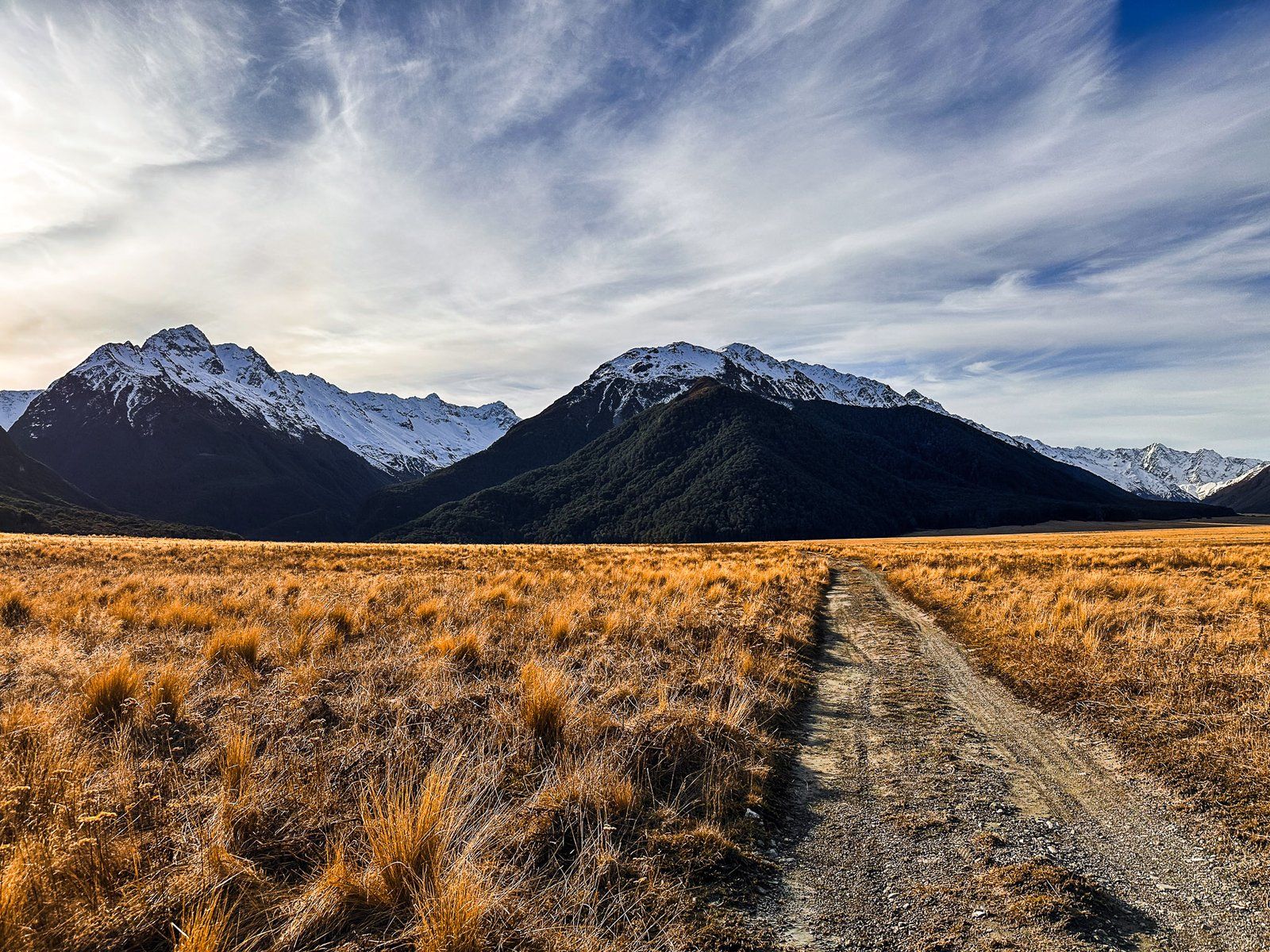
After passing through Ben Avon and Longslip, you are in the 49,000-hectare Ahuriri Conservation Park. This was Birchwood Station until 2004 when the Nature Heritage Fund bought it. The valley starts to narrow, and beech forests appear on the side of the mountain ranges, snow-capped in winter. You can drive to the Birchwood Picnic Area (with various old farm buildings) in a standard car. Beyond that, it is 4WD to the end of Birchwood Road.
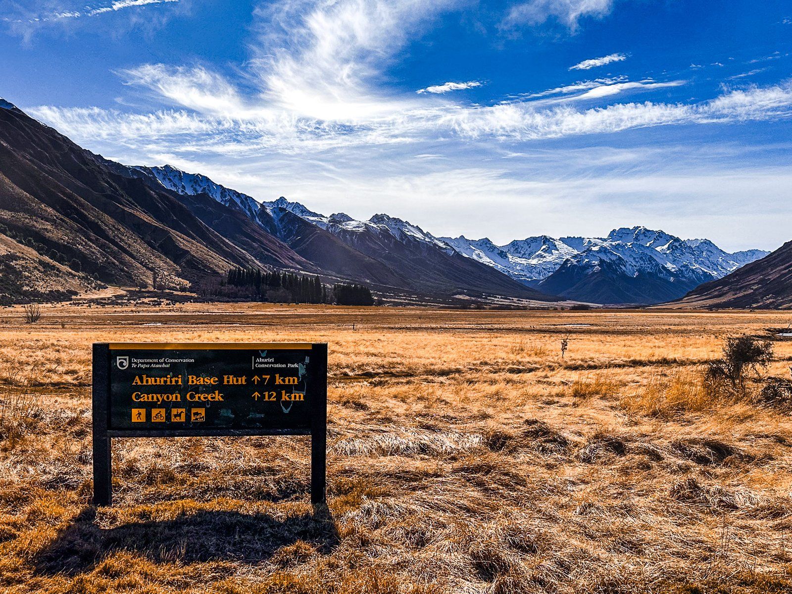
You can hike into the valley on the Ahuriri Valley Track or along Canyon Creek in the Huxley Range. As it is conservation land, you can camp anywhere, in addition to several small DOC huts.
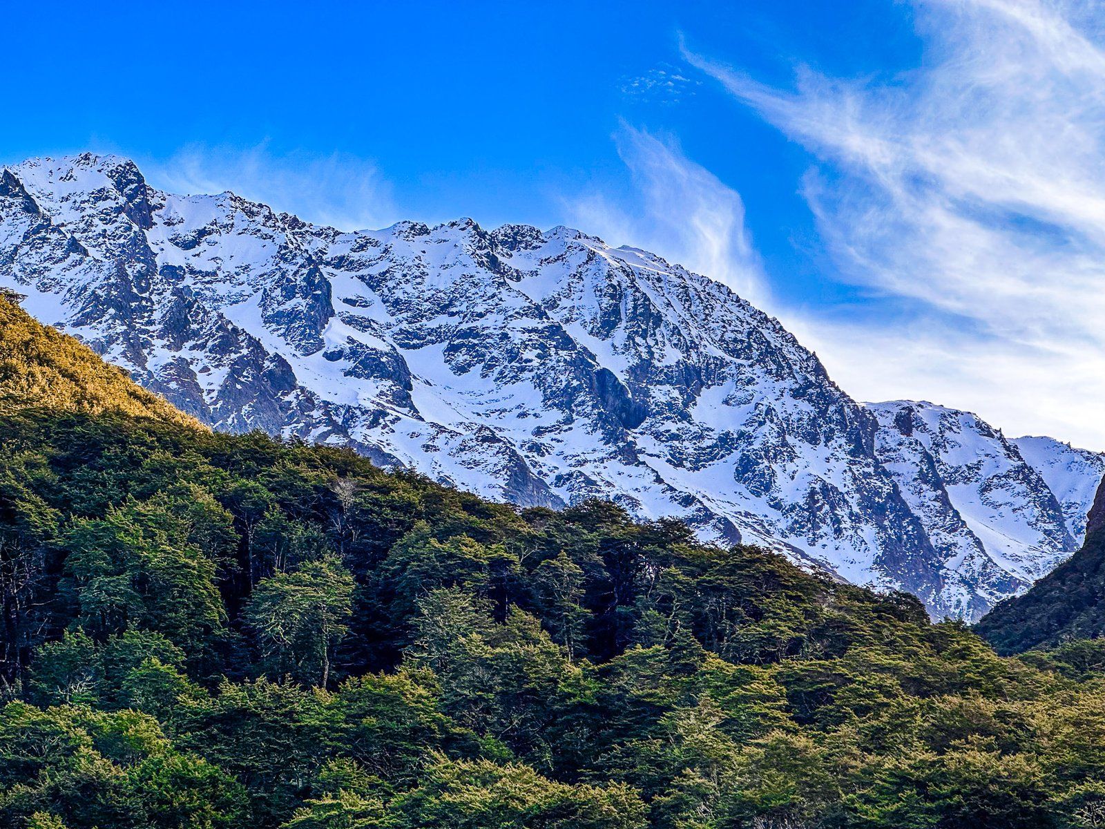
The Ahuriri Glacier carved out the valley in the last ice age. It extended 40 km from 2505 metre Mount Huxley at the head of the valley. The local temperature warmed over 6 degrees from the end of the last ice age. Hence, today there are only high remnant glaciers in the Huxley range. The largest is Thurneysen Glacier, which sits on the south side of Mount Barth. It can be approached on the Canyon Creek Track from the end of the road.
The river and valley are named after the Ngāi Tahu chief, Tu Ahuriri. For Māori, it was an option for accessing pounamu (greenstone) on the West Coast. However, it was more arduous and less attractive than taking Lindis Pass. Māori also used the Ahuriri Valley as a kāika nohoaka (seasonal settlement) and kāika mahika kai (food-gathering place).


Birchwood Road
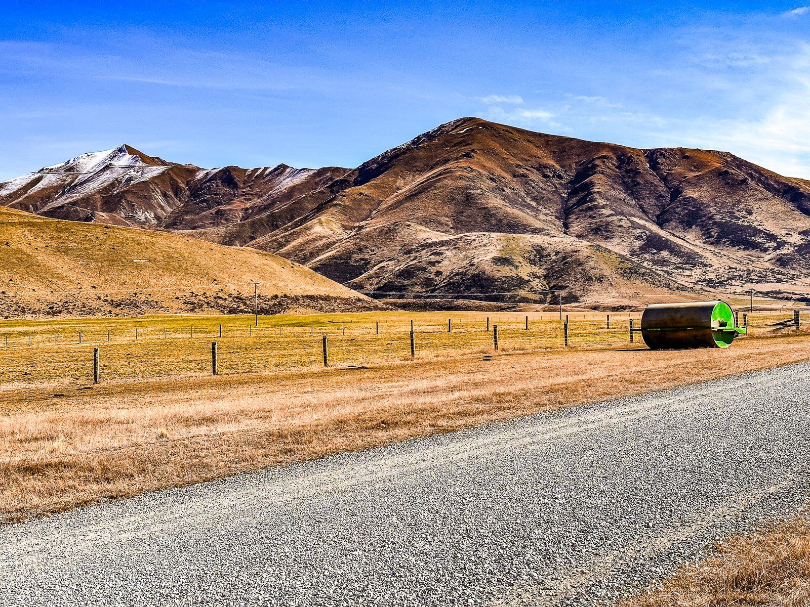
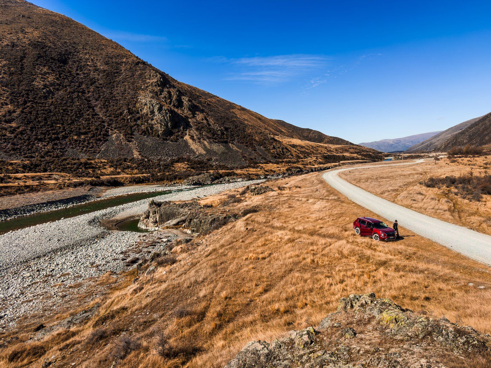
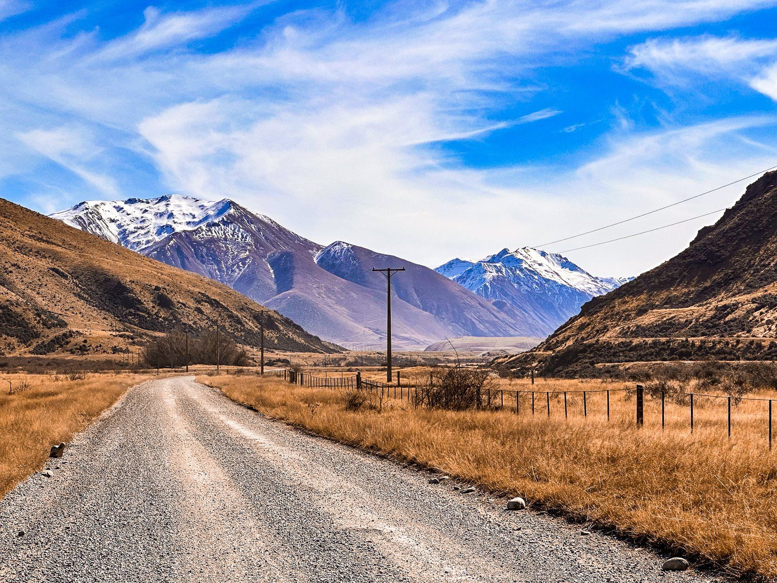
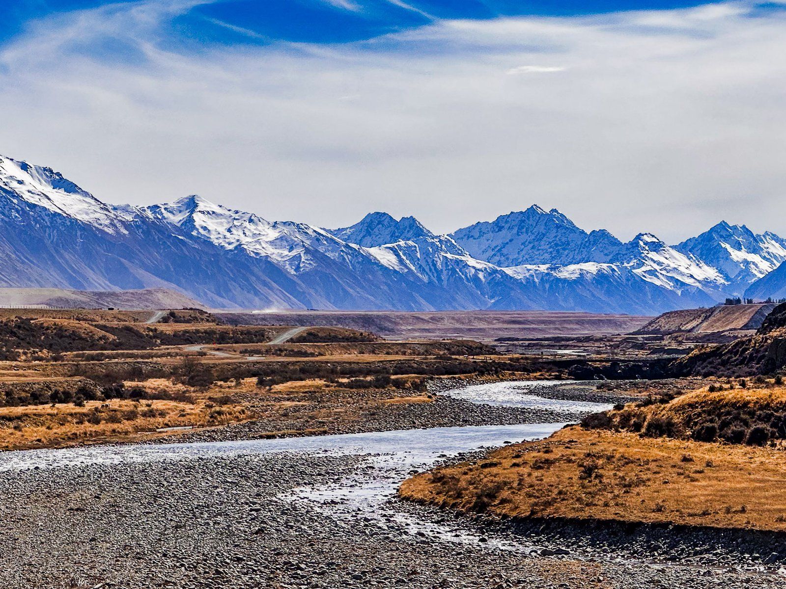
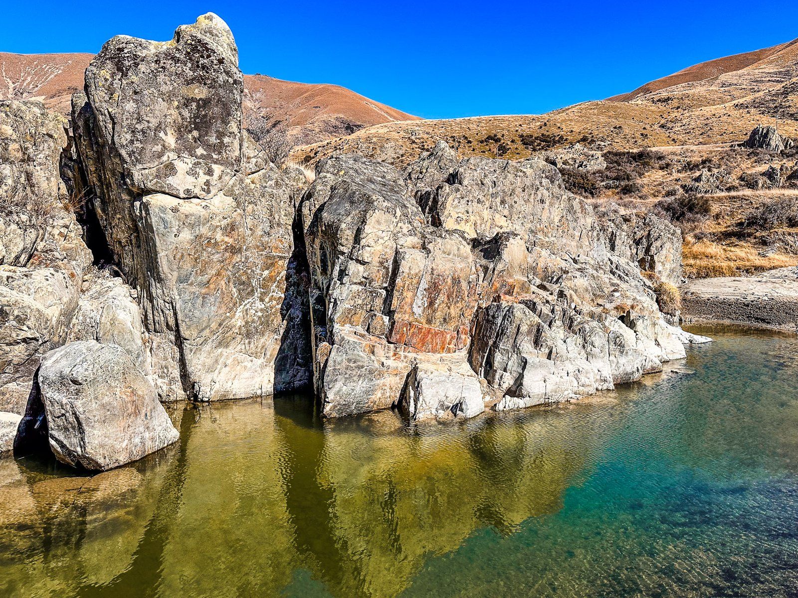
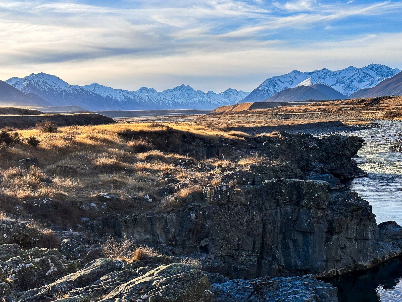
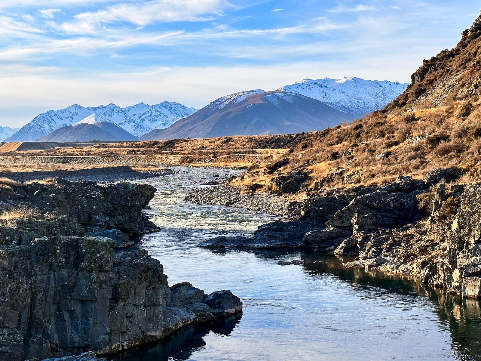
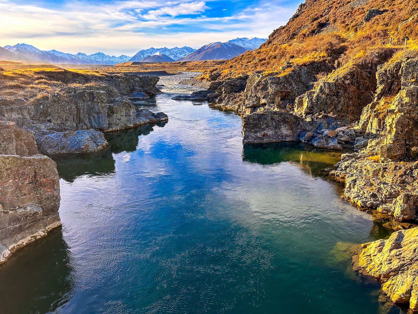
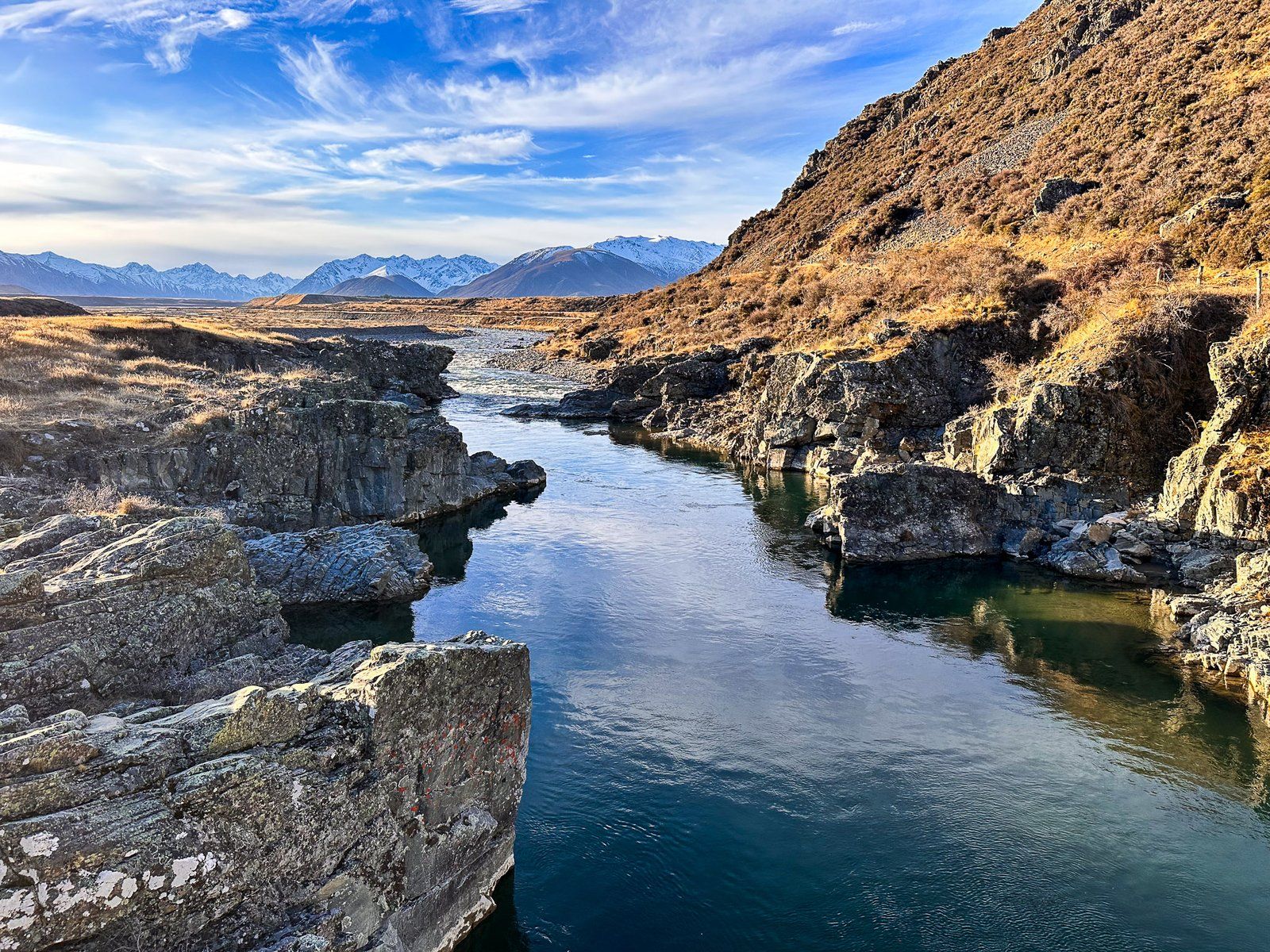
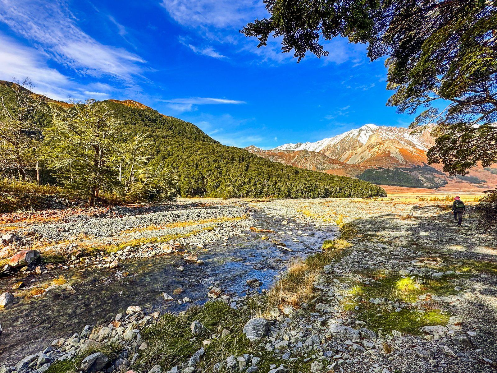
Birchwood Road is a metal road that provides access to Ahuriri Valley and the Ahuriri Conservation Park. It starts from State Highway 8, between Omarama and Lindis Pass, and runs along the western side of the valley for about 34 km. Near the start of the road, there are some interesting rock formations. The location also offers easy access to the Ahuriri River, known for its trout fishing. After this, the valley narrows, and five km later, there is a short turnoff to a bridge at Ireland Road. The bridge over the gorge has a gate, but it is a picturesque spot with nearby river access.
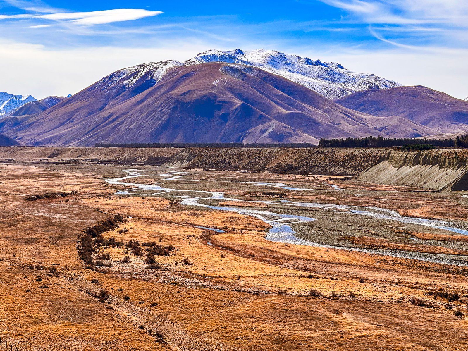
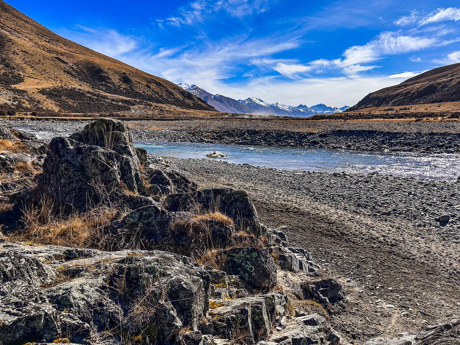
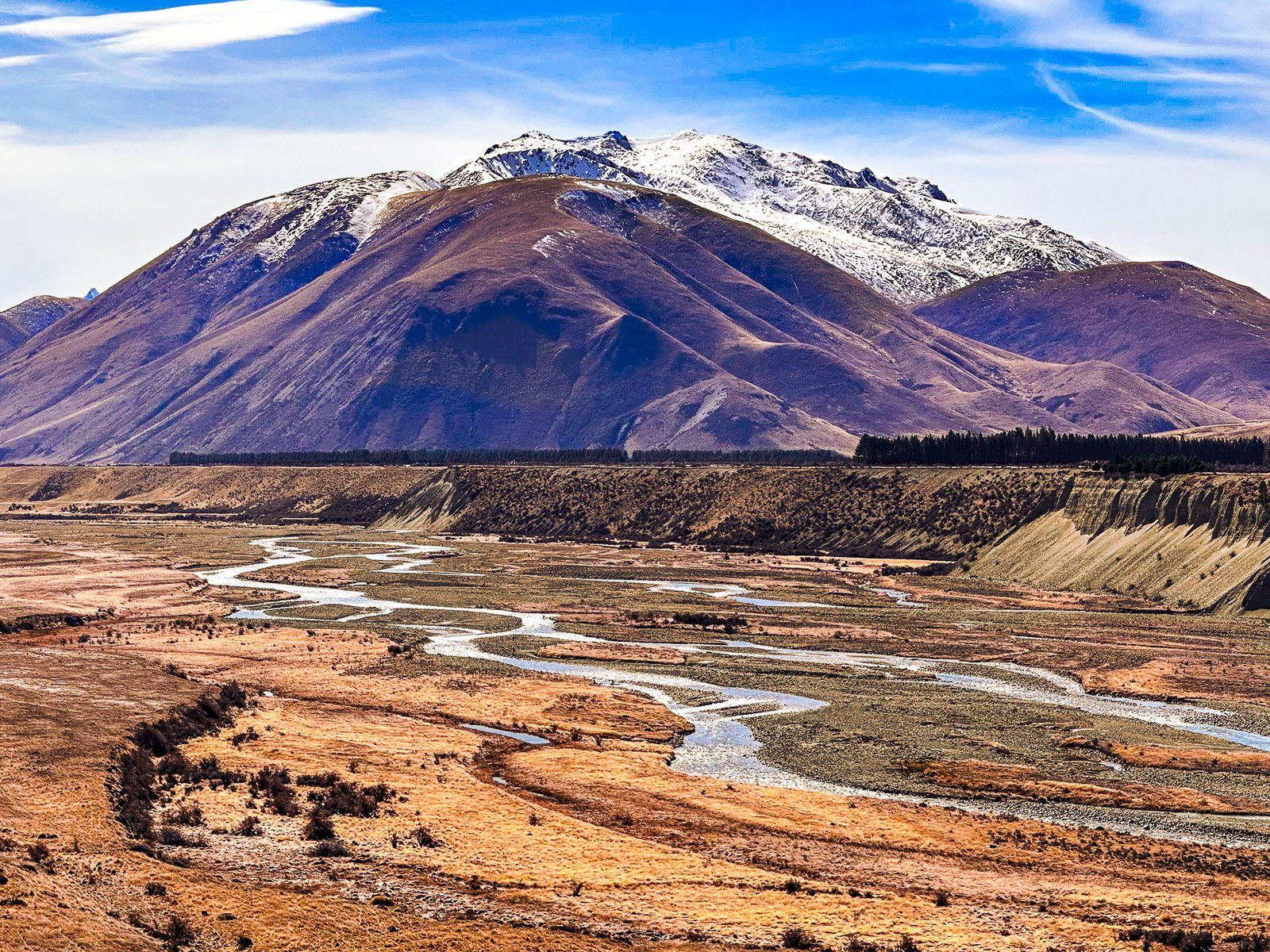
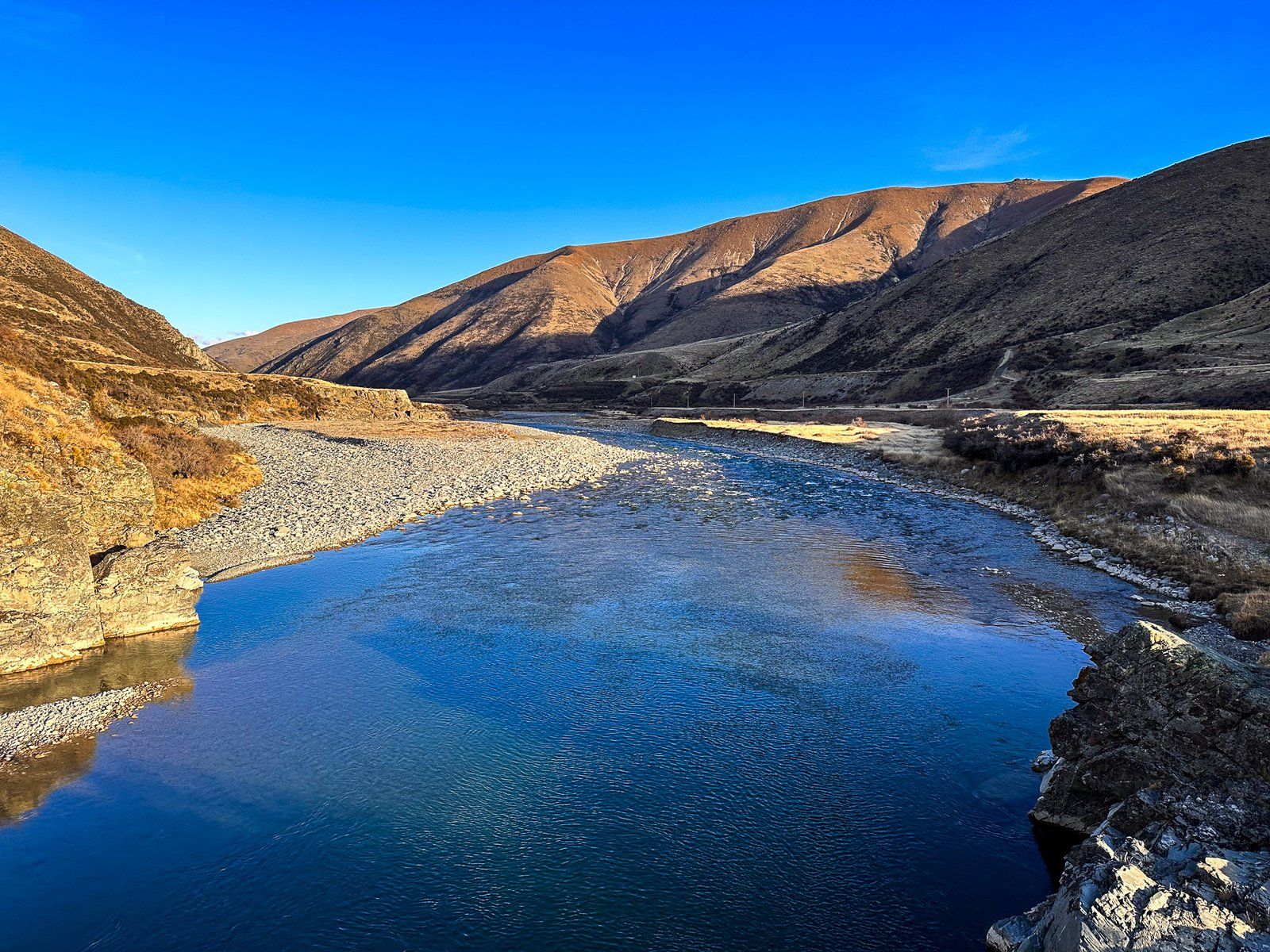
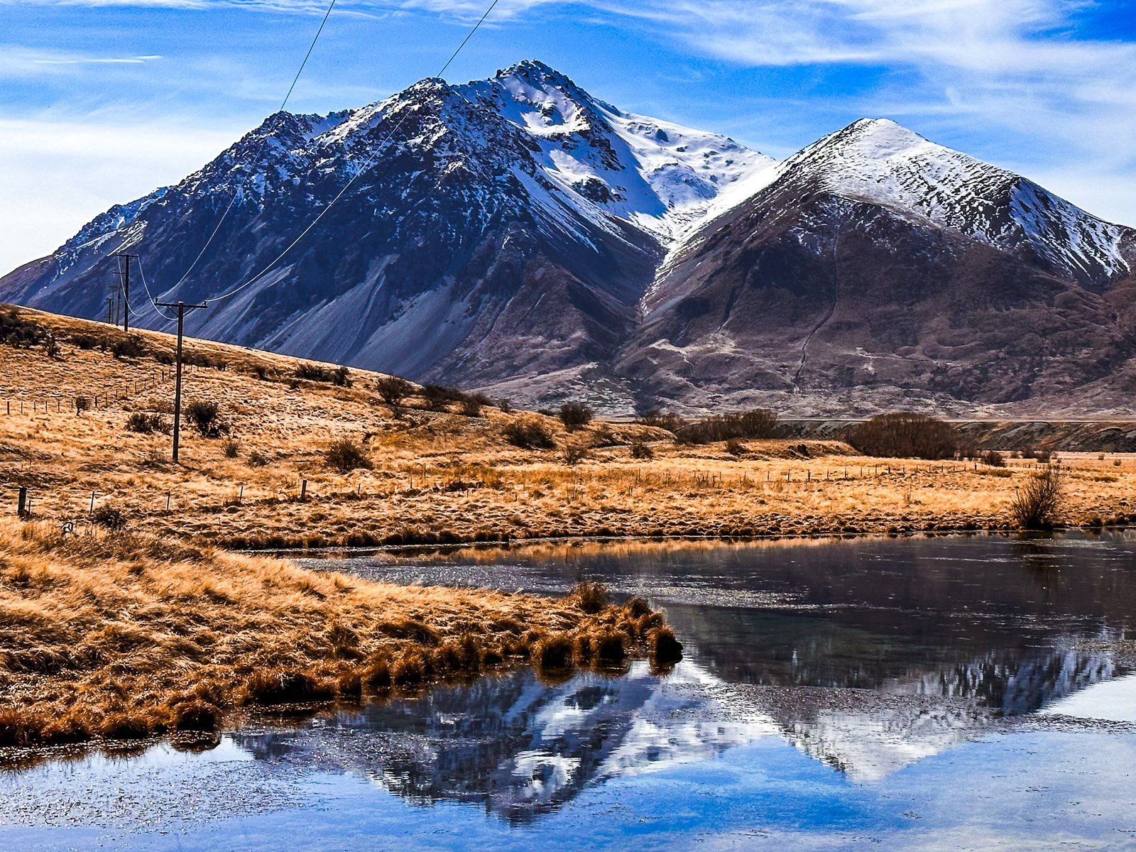
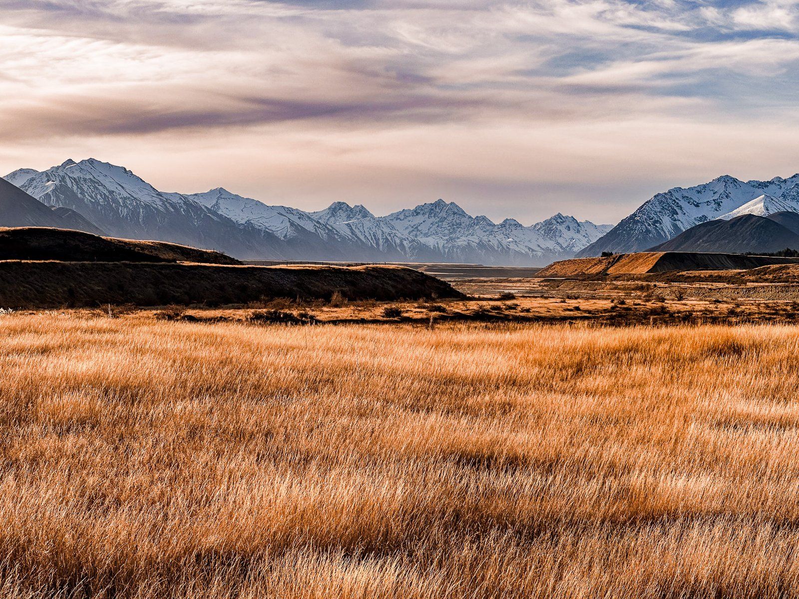
A further three km along the road, there is a fantastic view of the valley and the river. You can see how the braided river has carved out a channel through the gravel moraine left over from the Ahuriri Glacier 20,000 years ago.
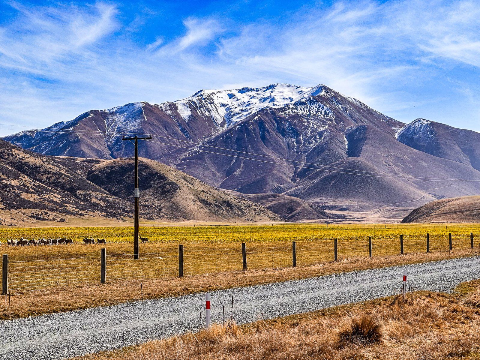
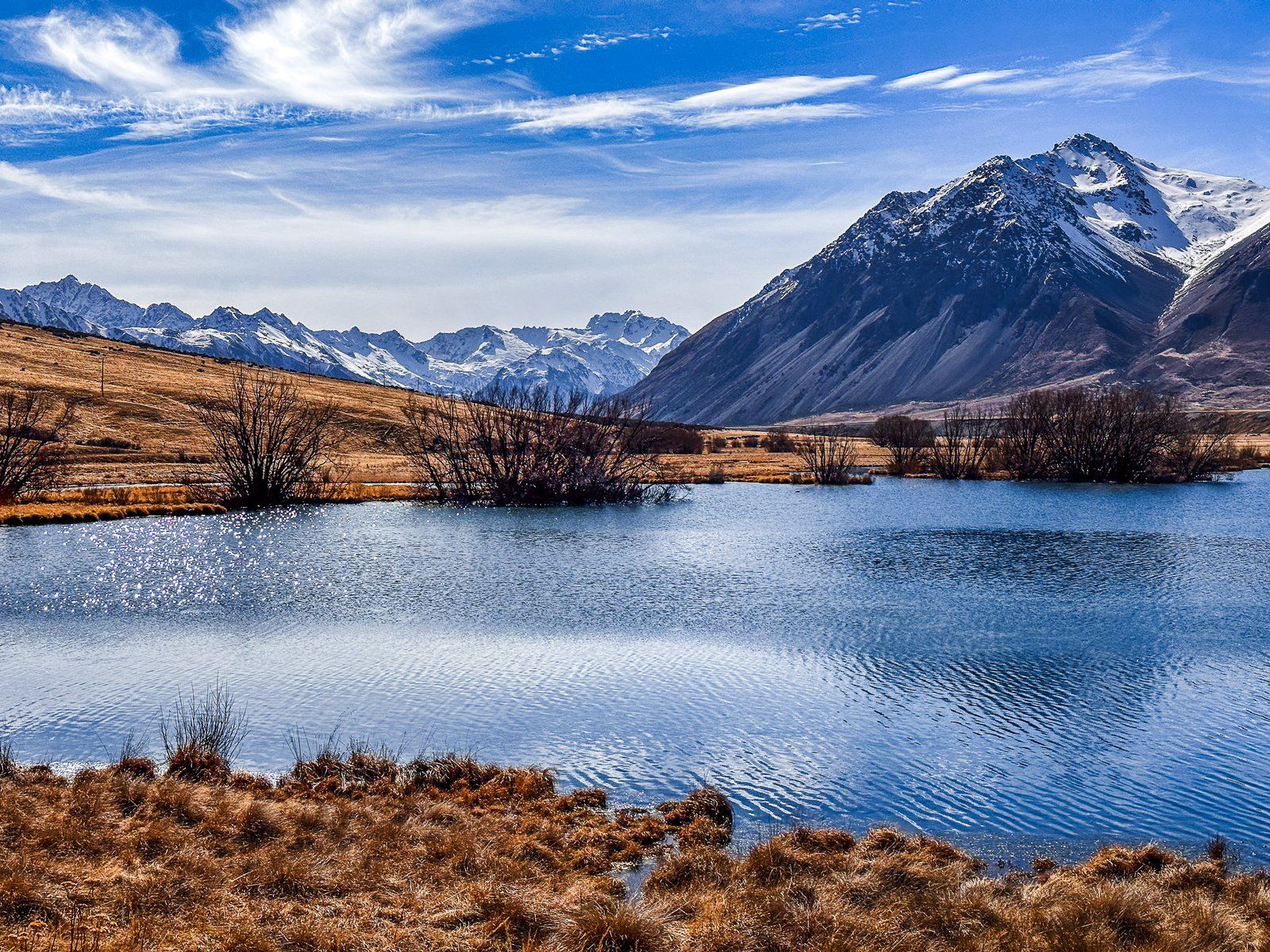
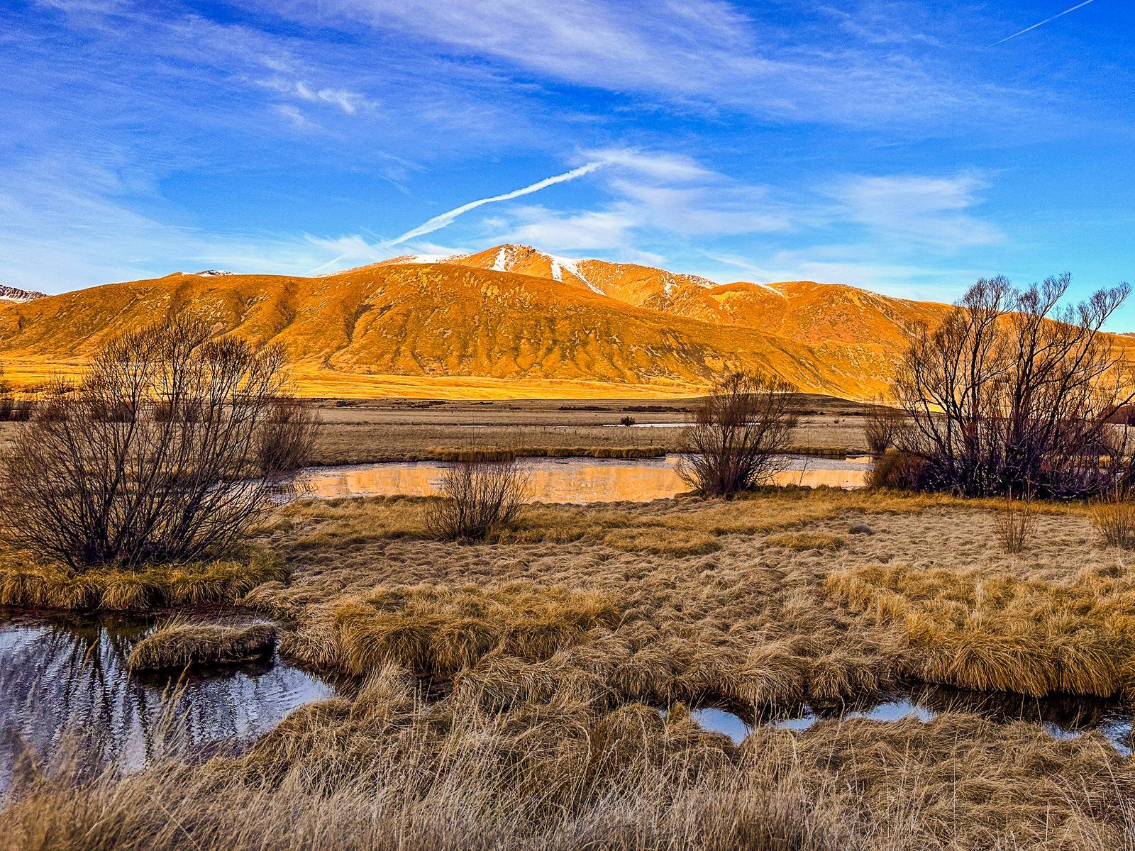
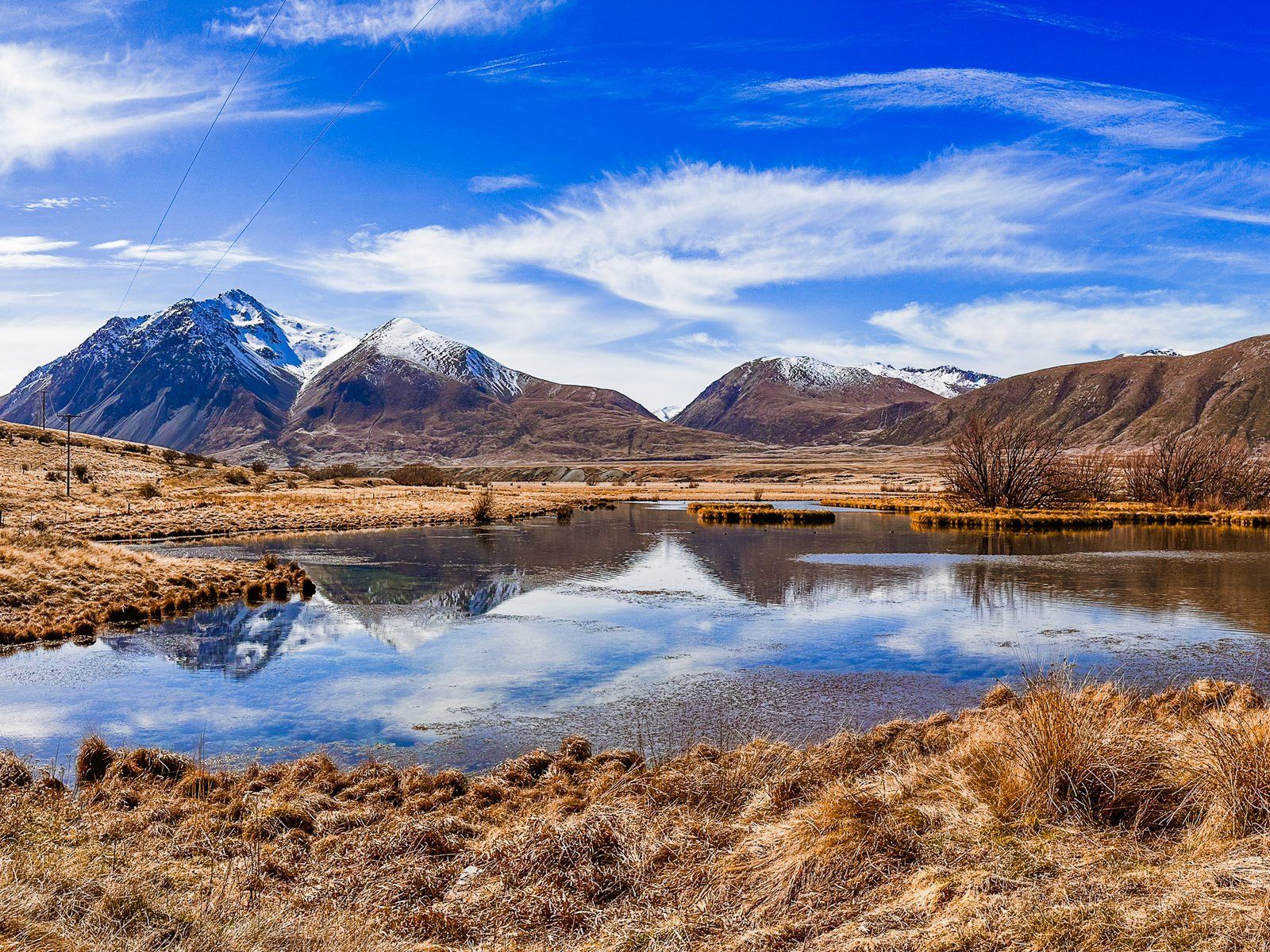
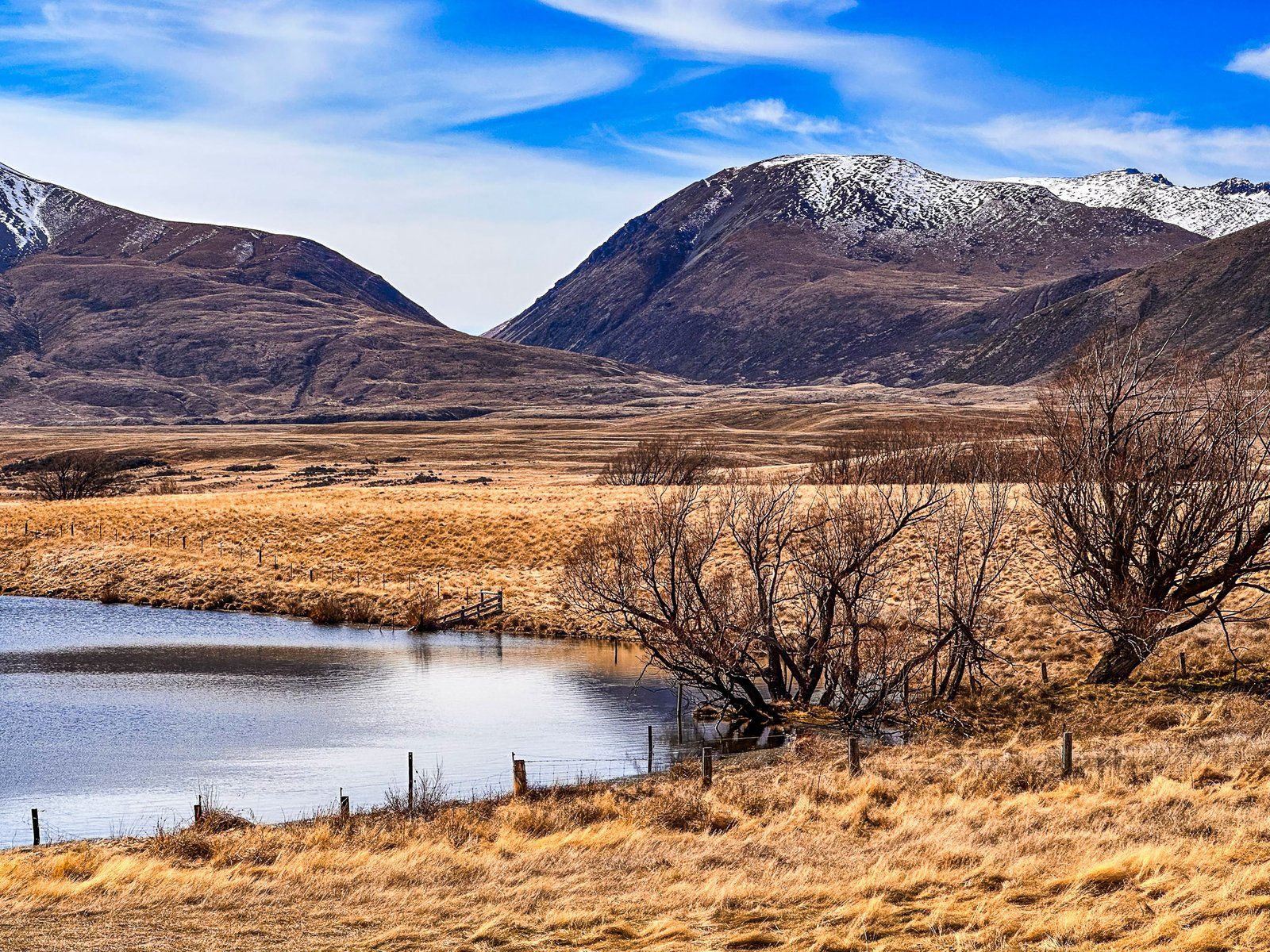
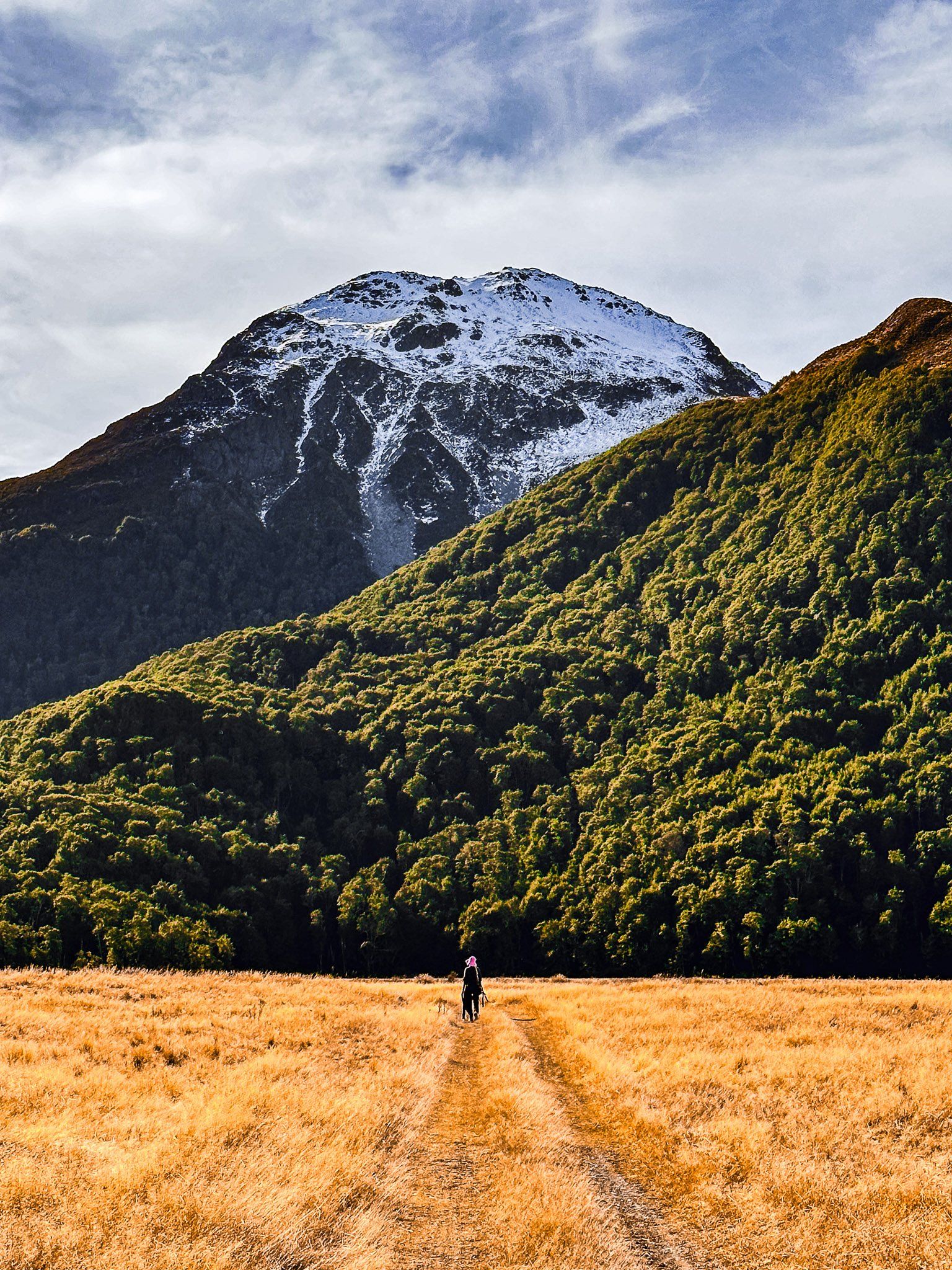
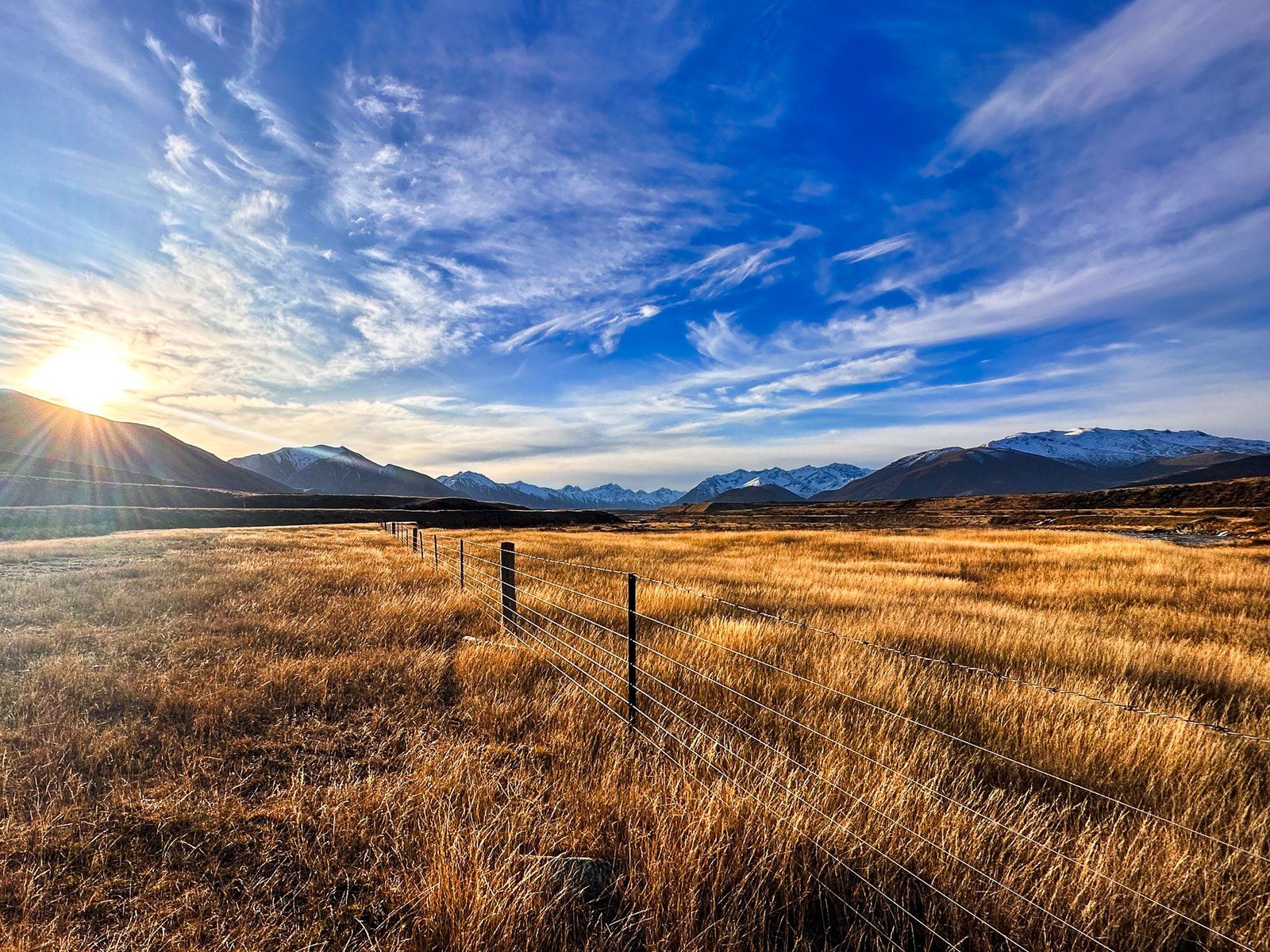
At the halfway mark, you reach the Avon Burn car park. Here you’ll find an explanatory panel and easement access to the southwest into the Avon Burn Valley. You can tramp through the mountains to Lake Hāwea, then Wānaka on Te Araroa (multi-day). Ben Avon is the sizable rolling mountain west of the car park, at 1705 metres. On the northeast side of the car park is an easement to the river, also part of Te Araroa, as it heads northeast to Lake Ohau.
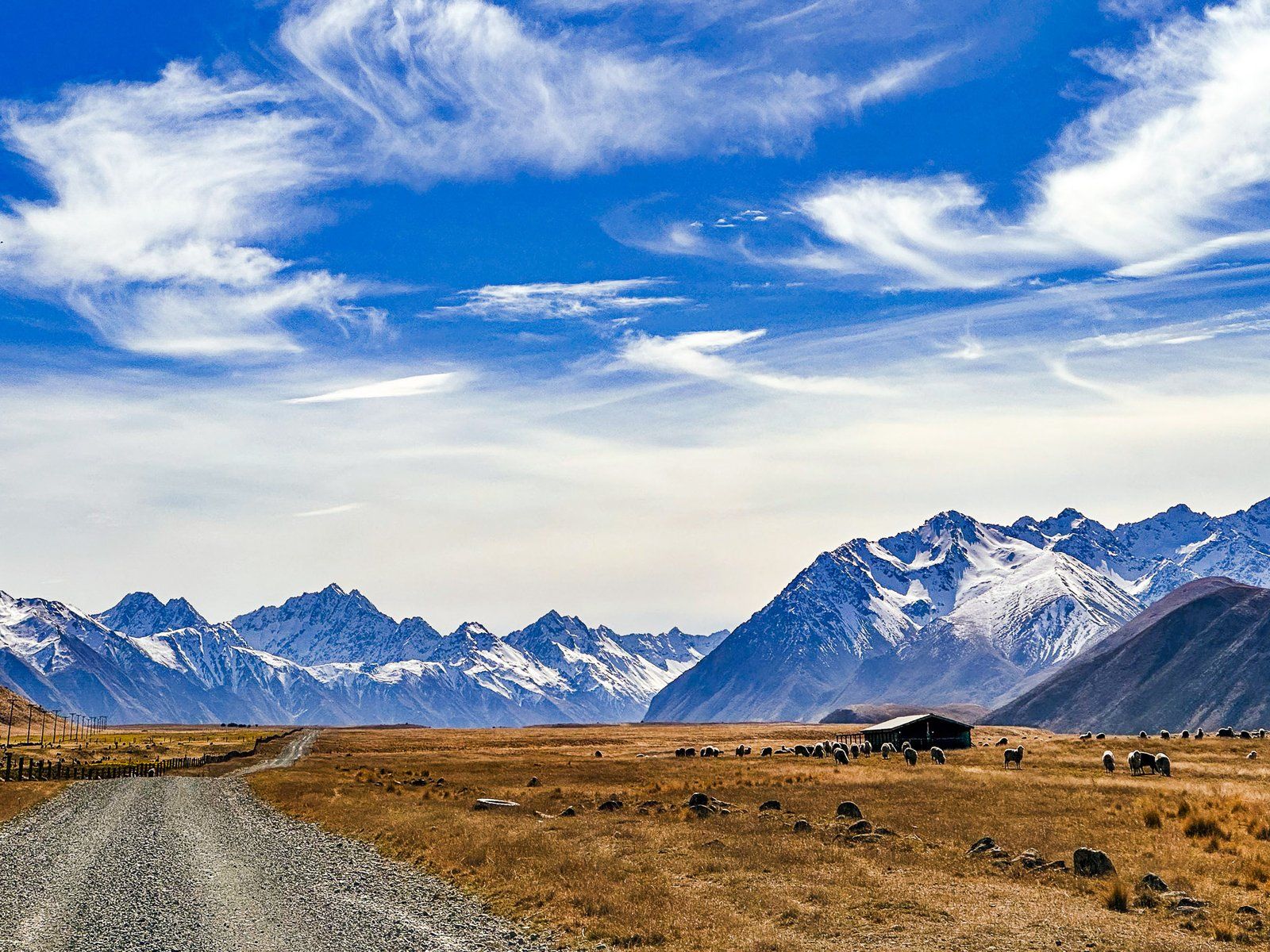
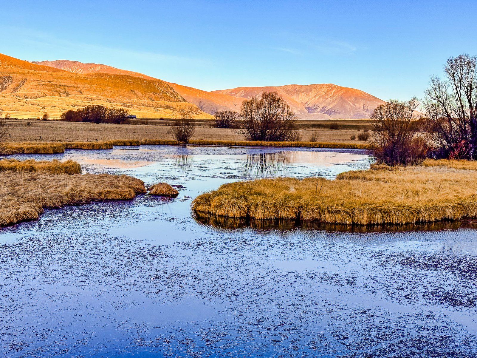
The next significant stop on the road is Ben Avon Wetland. Given how dry this part of the valley can look, the substantial lagoons and related bird life are quite a surprise. Look out for the rare kakī (black stilt).
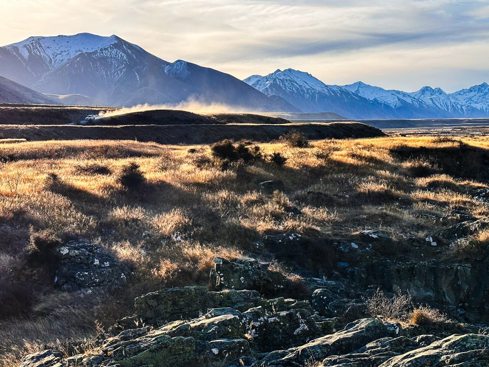
From there, the road noticeably deteriorated with many potholes. It is still doable in a 2WD but quite a lot slower. A bit further along from the wetlands is the boundary of the Ahuriri Conservation Park. This is another good river access point near the wetlands with seats and a toilet.
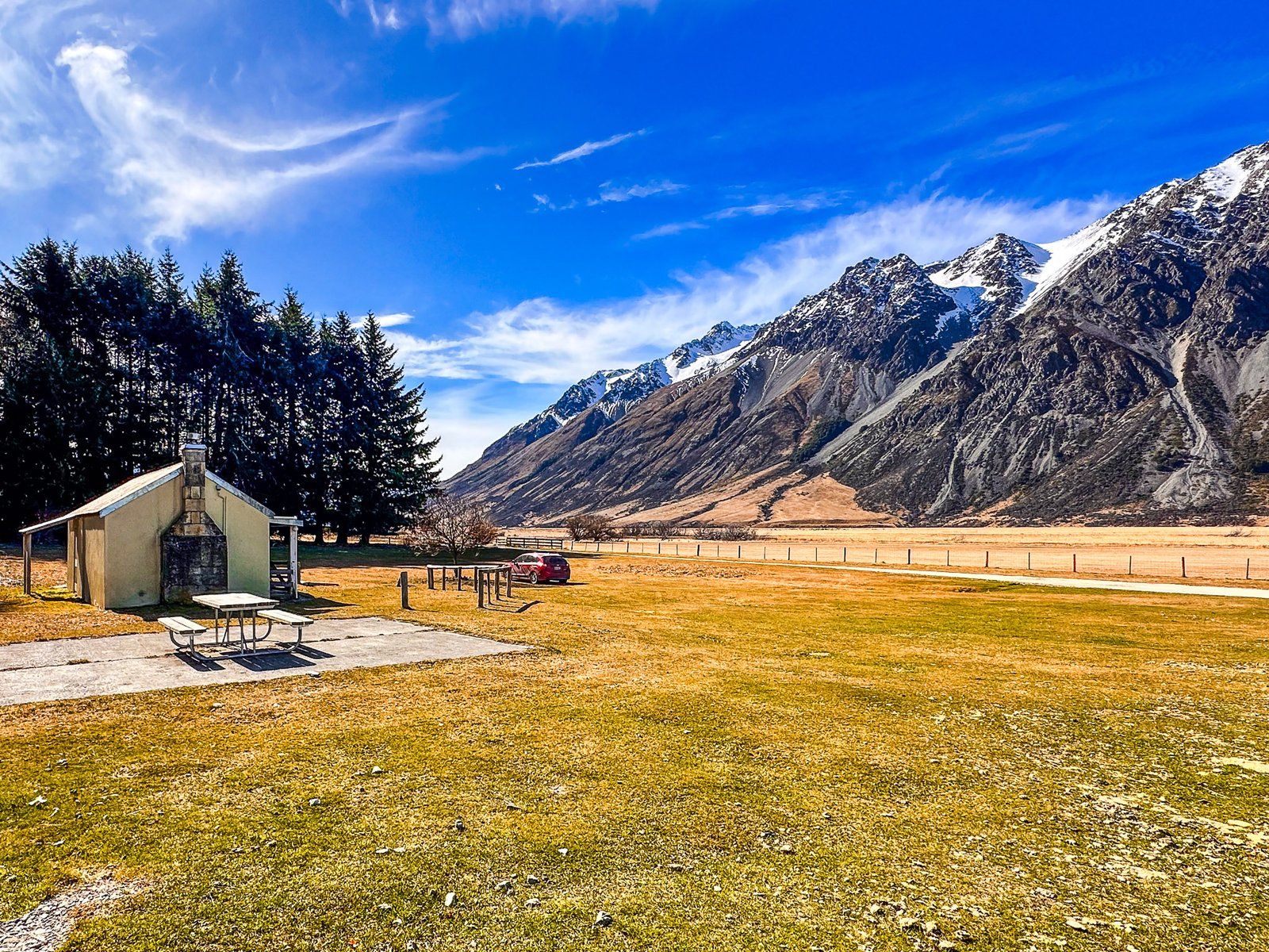
After this, the road reaches the Birchwood Picnic Area, a remnant of Birchwood Station, at the 21 km mark. There are several old farm buildings and a large open grassed area. This is also the end of the road for 2WD vehicles. The last 13 km requires a 4WD to cross road washouts confidently. A bike is another option for accessing the valley’s north end from the picnic area.
Ahuriri River
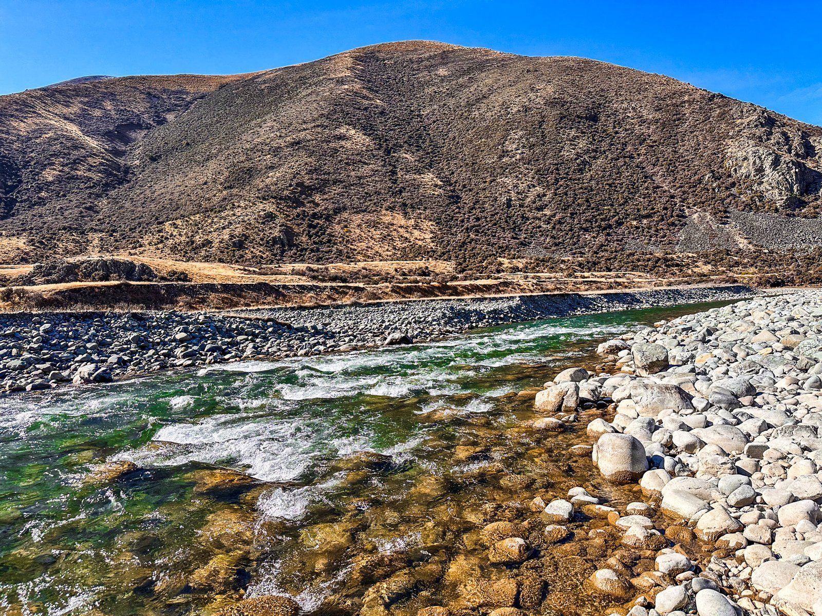
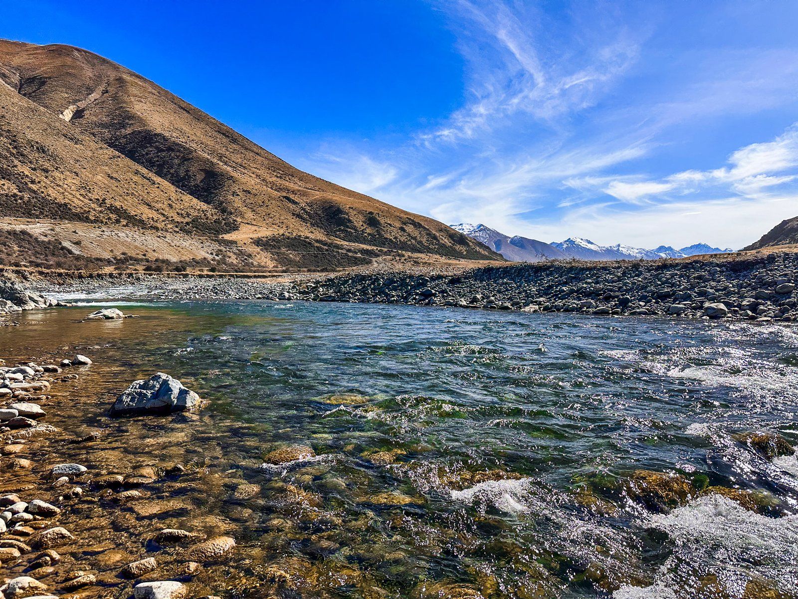
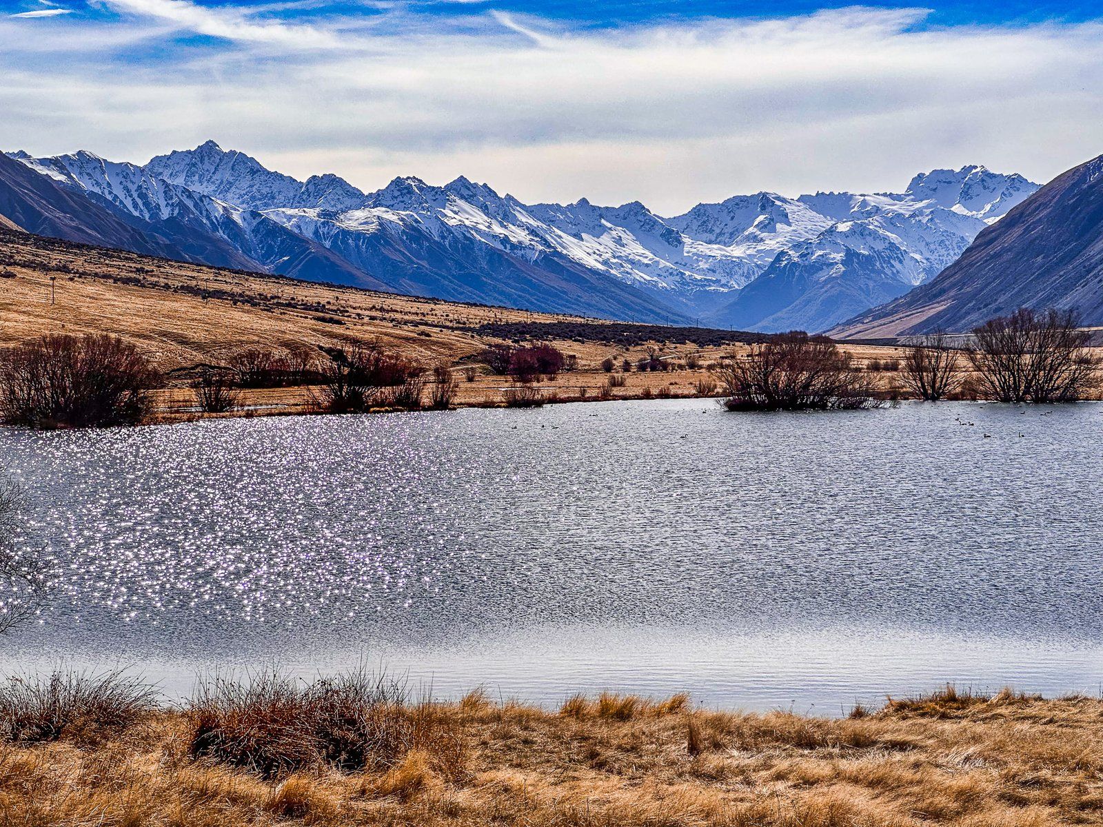
The Ahuriri River is in the Canterbury and Otago Regions of the South Island. The River starts below Mount Huxley’s glaciers at the north end of Ahuriri Valley in the Ahuriri Conservation Park. Many streams feed it as it heads south between the Huxley and Barrier Range. The water quality is high, and it is an excellent fly fishing option for brown and rainbow trout.
The river flows about 55 km down the valley and into the southern end of the Mackenzie Basin west of Omarama. From there, it continues for about 15 km to the western arm of Lake Benmore, at the head of the Waitaki Valley and hydro scheme.
The river landscape is highly variable, running down the valley and into the Mckenzie. It ranges from a braided river to a narrow gorge at Ireland Road Bridge and supports the significant Ben Avon wetlands halfway along the valley. About eight km along Birchwood Road from State Highway 8, there is a particularly interesting view of gravel river terraces carved out by the River from the 20,000-year-old glacial moraine. The well-known Clay Cliffs in the Mackenzie Basin are also on the river’s north bank, west of Omarama.
Several easy access points to the River from Birchwood Road in the Ahuriri Valley exist. The best are near the start of the road, at the Ireland Road Bridge and shortly after the Ben Avon Wetlands on the border of Ahuriri Conservation Park.
Ireland Road Bridge
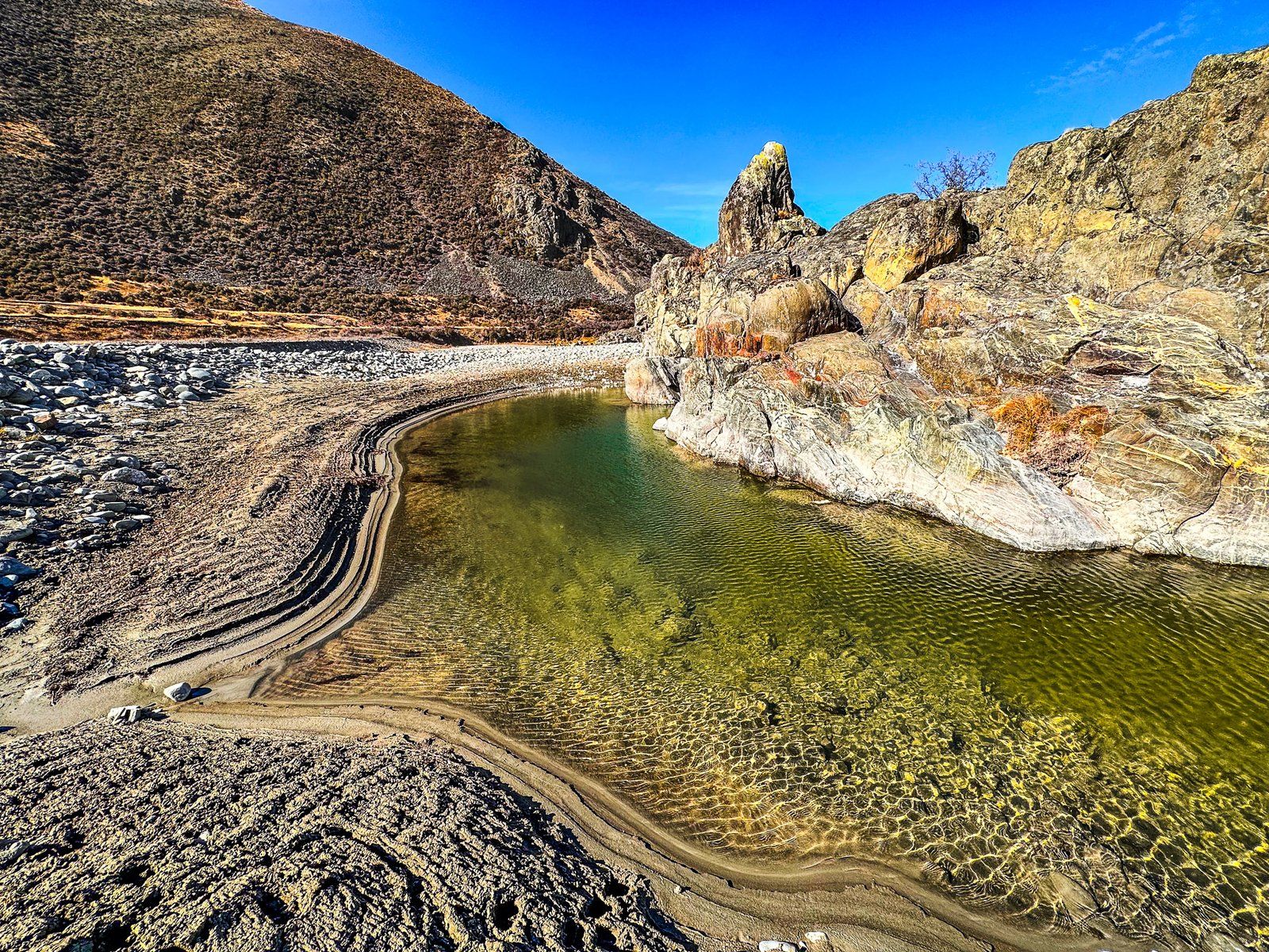
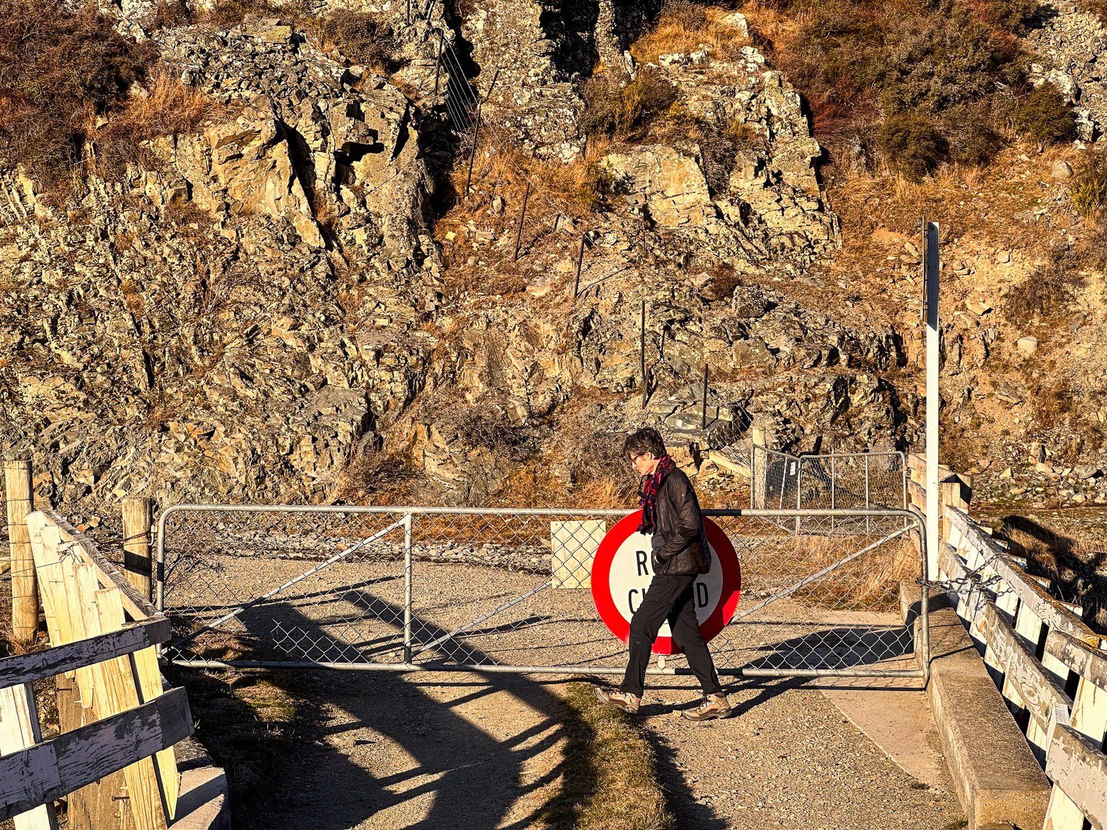
The Ireland Road Bridge is the best place to view the Ahuriri River gorge. The Ahuriri Valley narrows significantly for several km between the peaks at the valley’s south end. Take the short turnoff of Birchwood Road, about five km from the State Highway 8 turnoff. A large parking area is in front of the bridge, and the best view of the gorge is from the bridge.
The gate on the far side was locked, preventing car access to Ireland Road, but you can use the bridge to access East Ahuriri Track, also a section of Te Araroa, if the river is too high to cross safely. This track takes you to Lake Ohau to the north.
Ben Avon Wetland
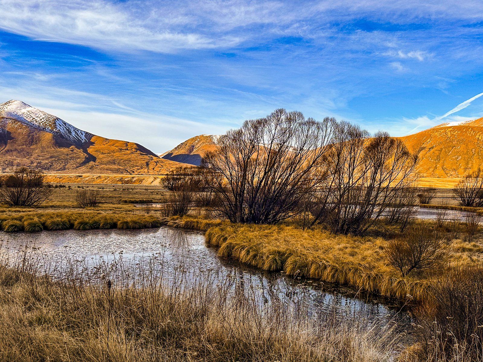
The wetlands in the wider, more central part of the Ahuriri Valley are extensive. Although they were part of the sheep stations in the area, they were mainly left untouched. The most accessible is Ben Avon Wetland, where the largest lagoon is right next to Birchwood Road, just south of the Ahuriri Conservation Park.
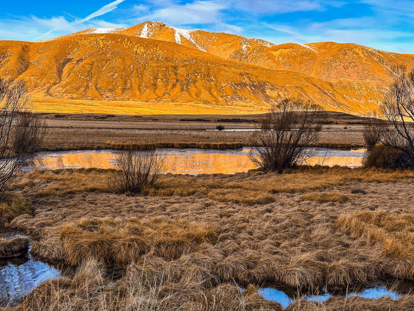
This is a particularly pretty spot on a fine windless day, with golden tussocks and reflections of the mountains surrounding the wetlands. These wetlands also support a wide range of water birds. You may even spot a kakī/ black stilt, an endangered wading bird in the Mackenzie/Waitaki region.
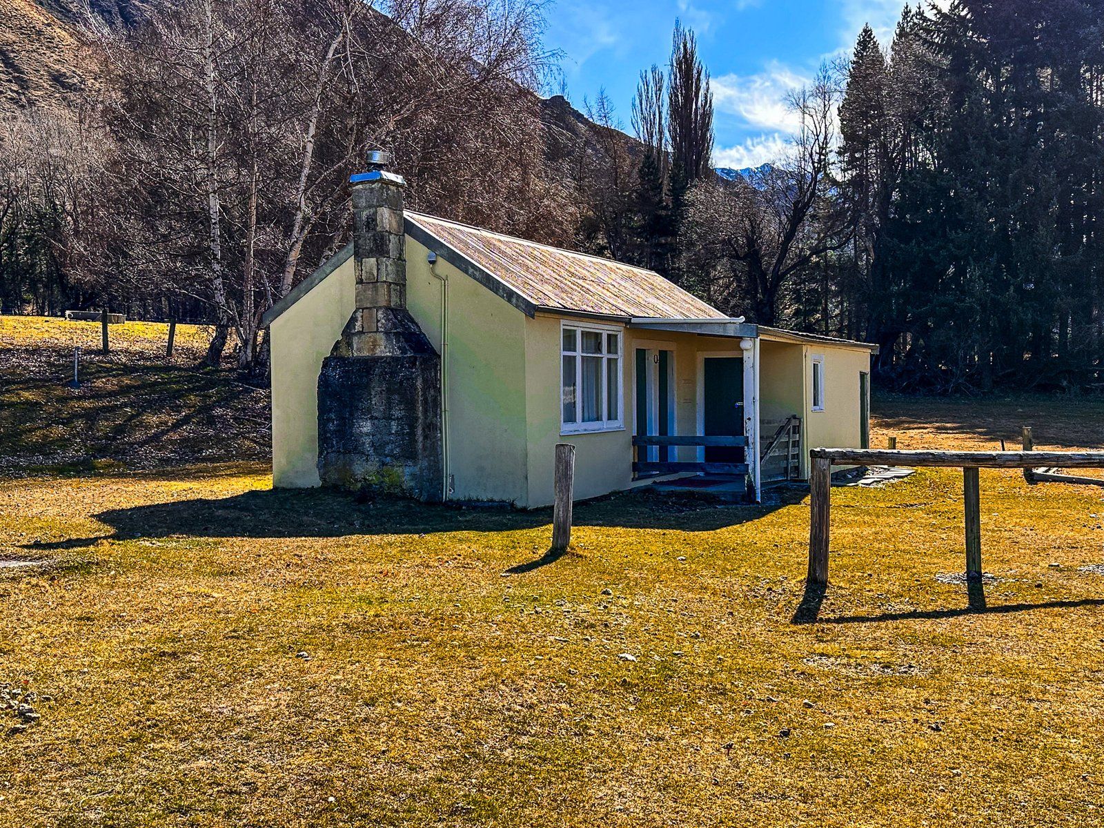
Birchwood Picnic Area
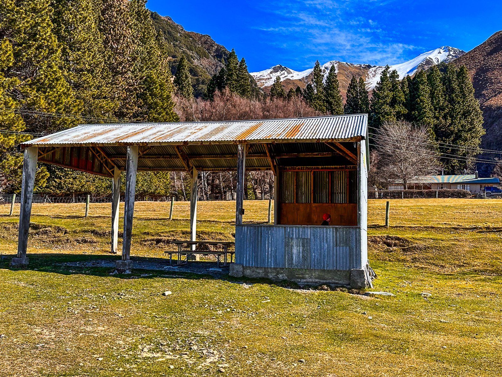
The Birchwood Picnic Area is just inside the Ahuriri Conservation Park boundary on Birchwood Road. Before passing into conservation ownership and becoming a park in 2004, Birchwood Station farmed the land. The picnic area contains several buildings from this time and a large grassed area, perfect for picnics!
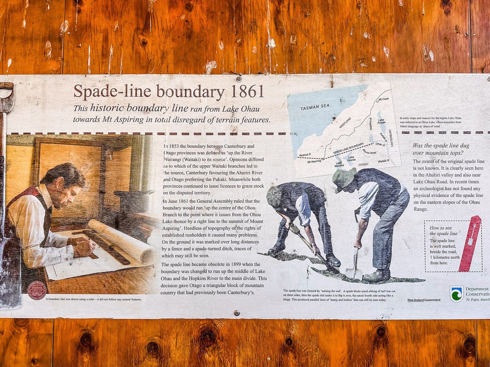
The buildings include a horse stable, a store shed, and a 1930s cottage. The shed has been converted into a picnic shelter and there is an interesting wall panel describing an oddball feature of local history, the “spade line”. This was the demarcation of the border between the original provinces of Canterbury and Otago. In 1853, it was defined as the Waitaki River to its source in the Southern Alps.
The problem was that the two new provinces could not agree on the source. According to Otago, it was Lake Pukaki to the north, while Canterbury decided it was the Ahuriri River to the east of the picnic area. Both governments happily issued conflicting high-country pastoral leases. In 1861, the NZ government set the provincial boundary along the Ohau River to Lake Ohau, then as a straight line to the peak of Mount Aspiring! Check it out on a map! The spade line marked out this boundary, a straight line over several mountain ranges. It consisted of fences or a spade-tuned earth channel and crossed the Ahuriri valley about one km north of the picnic area.
In 1899, a more common-sense boundary was implemented. It runs up Lake Ohau and the Hopkins Valley to the Main Divide in the Southern Alps and expands the mountainous part of Otago. Of course, there are no longer provincial governments anyway.
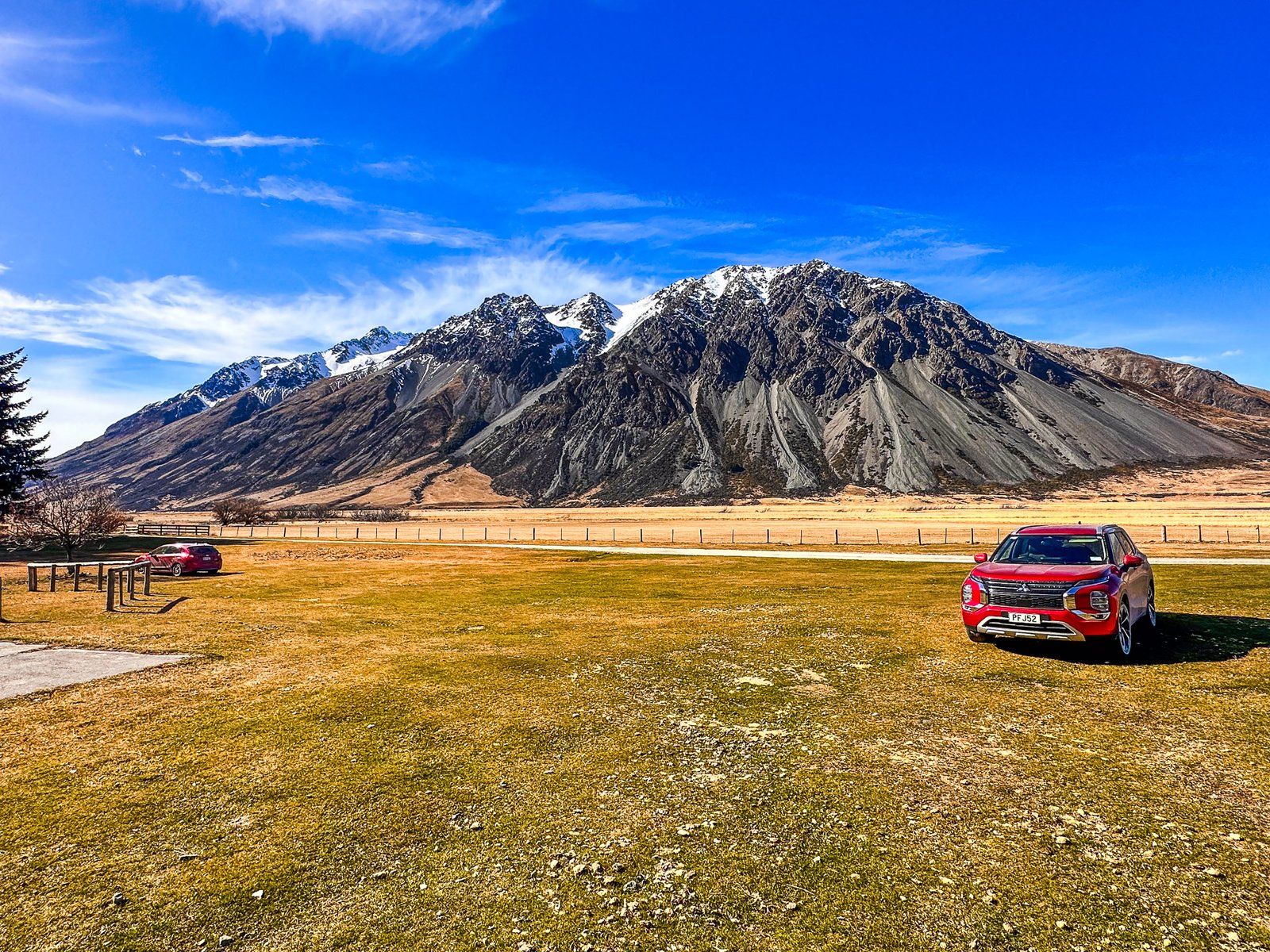
If you wish to drive further up the Ahuriri Valley to the end of Birchwood Road, you will require a 4WD vehicle.
Canyon Creek Track
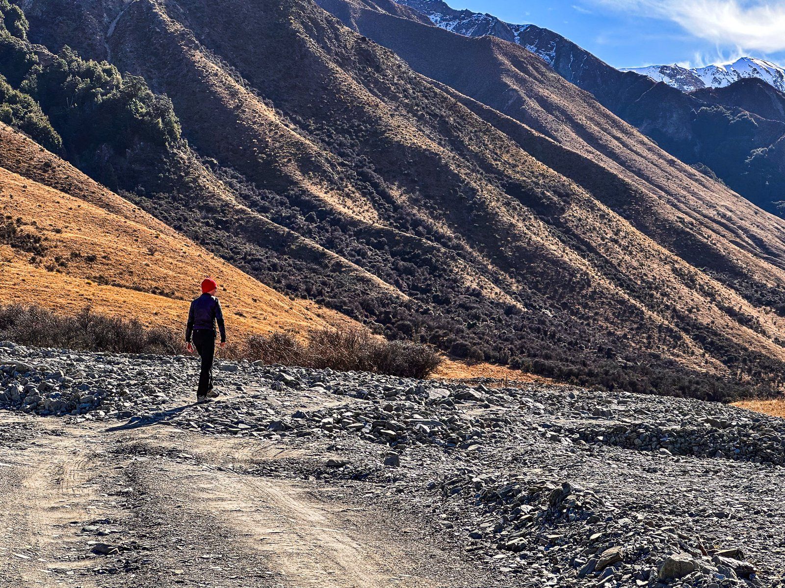
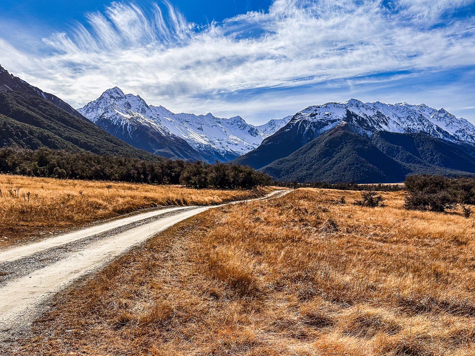
If you have a 4WD, you can continue for 11 km along Birchwood Road to the road end. Although this part of the road is mostly in reasonable condition, it is crossed by mountain streams that result in washouts and large gravel fields. From the end of the road, you can walk up the valley or take a side trip on the Canyon Creek Track.
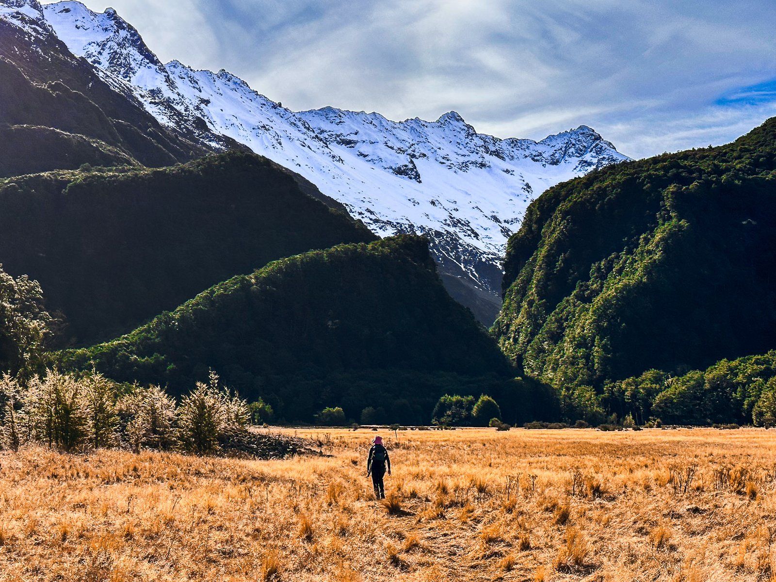
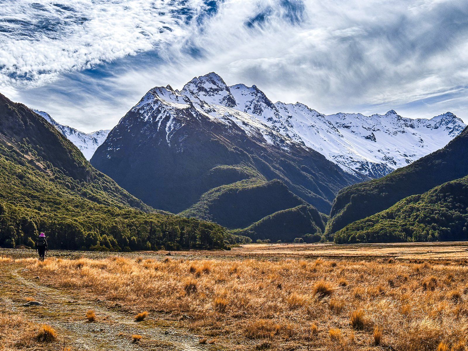
For the first 20 minutes, there is a single track, then the Canyon Creek Track heads northwest into a gap in the Huxley range, and the Ahuriri Valley Track heads northeast up the valley. This is also a campsite, although you can camp anywhere suitable in the Ahuriri Conservation Park.
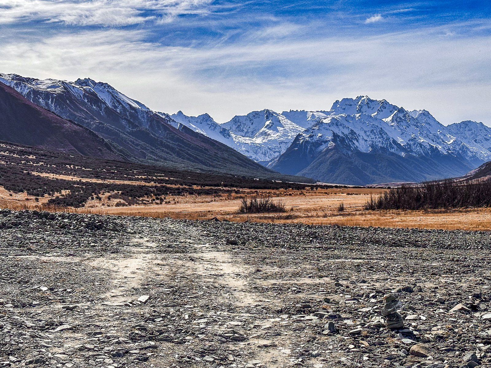
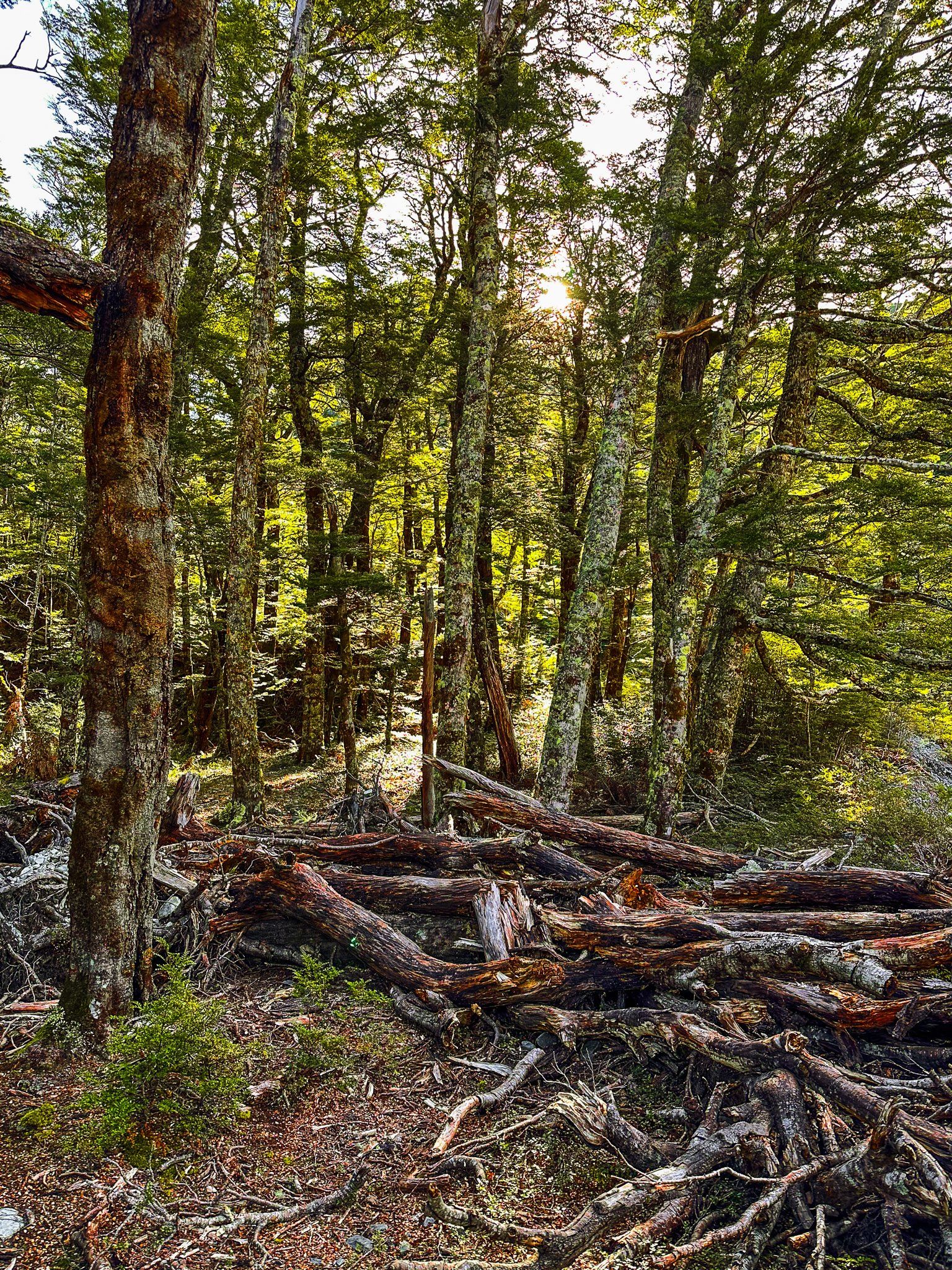
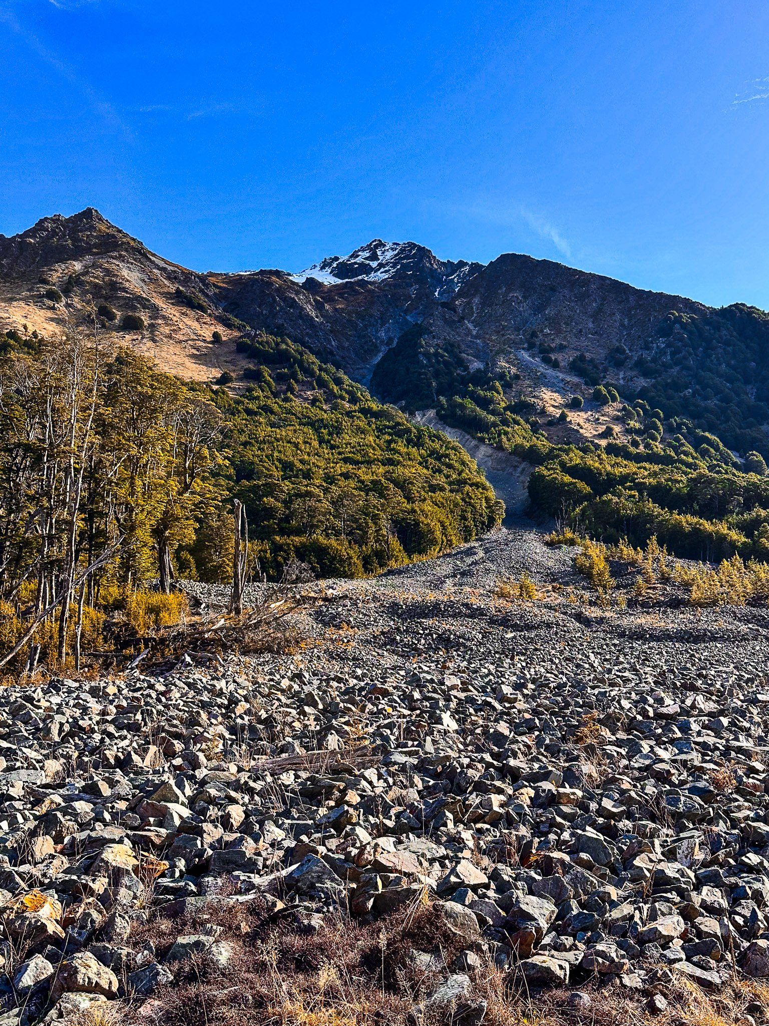
Taking Canyon Creek Track, it is about 15 minutes to the edge of the forest and the Creek. Along the way are the remnants of two very big rock and gravel sides that reach high up the surrounding mountains and bisect the beech forest. The track crosses the first of these and shirts the edge of the second. This is a reminder of how volatile and powerful erosion events can be.
The track approaches the edge of the forest, crosses Little Canyon Stream (feet wet), and climbs 100 metres through beech forest to the canyon’s edge above Canyon Creek. From there, it takes about two hours to follow the creek to a series of waterfalls and pools below a high ridge line. This is topped by several peaks ranging from Mount Heim at 2205 metres to Mount Barth at 2456 metres that overlook the Thurneysen Glacier. At the end of the track, at just under 1000 metres, is a rock bivouac if you’d like to camp.
Another alternative is to bike the upper valley, avoiding needing a 4WD from Ahuriri Picnic Area.
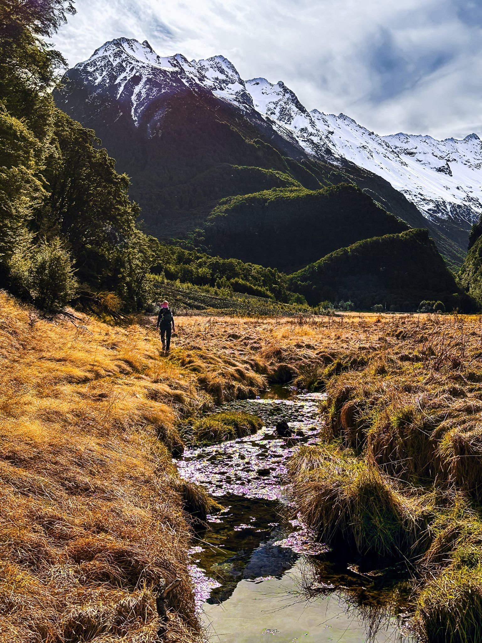
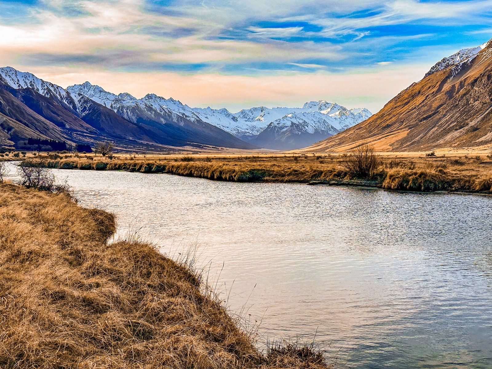
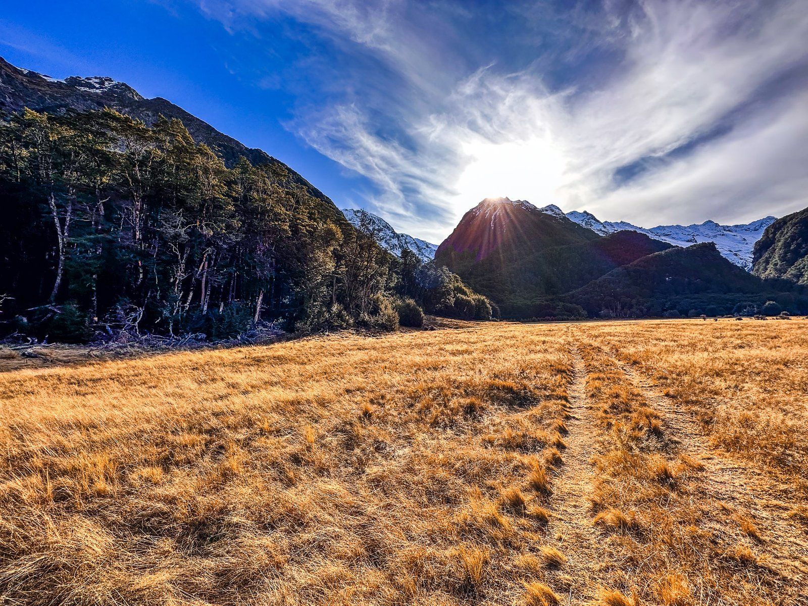
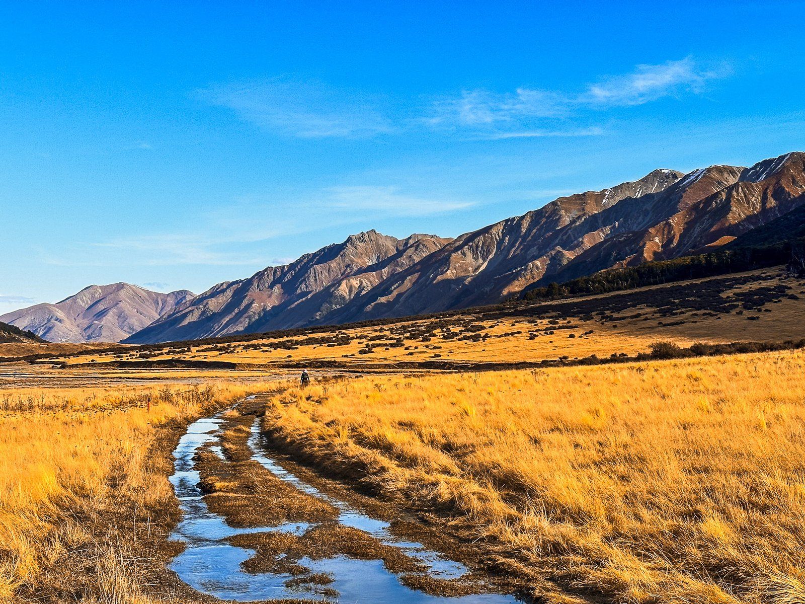
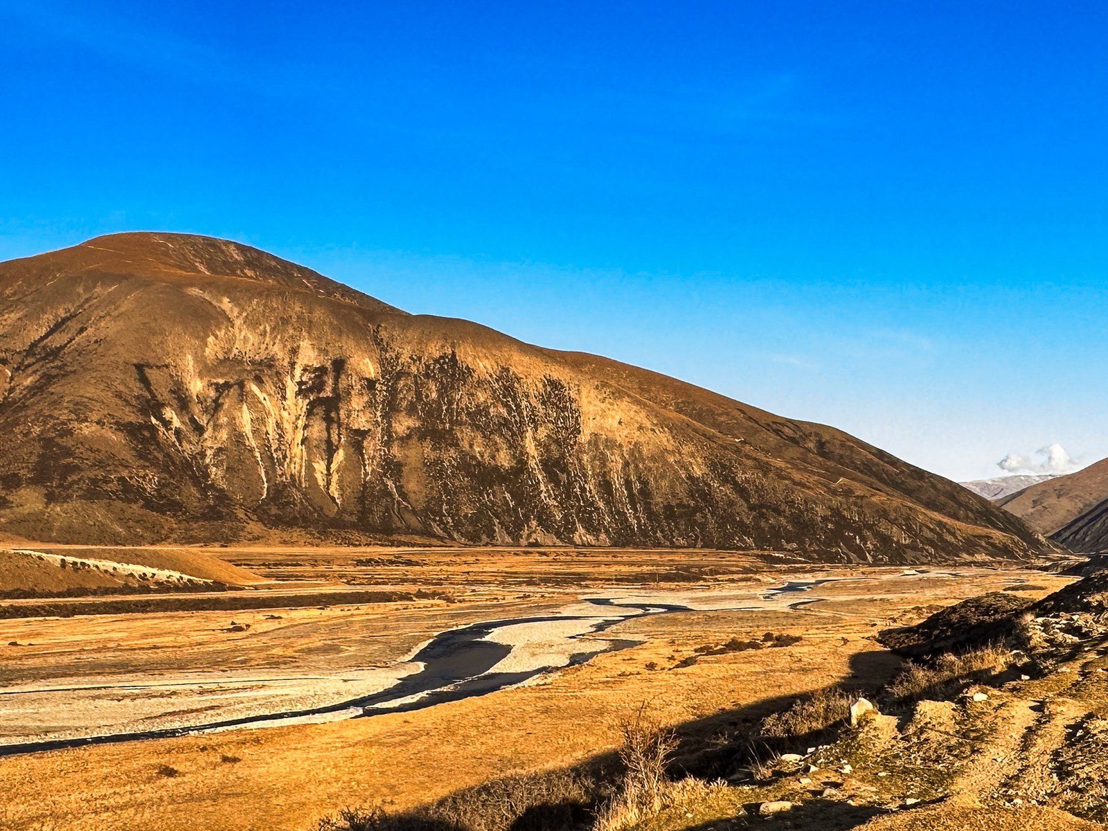
Ahuriri Valley at Golden Hour
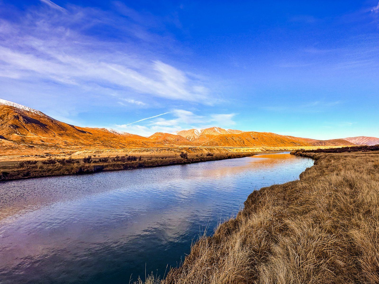
The golden tussocks of the Ahuriri Valley make for a striking golden hour.


Want more Canterbury Trip Ideas?
Check out our blogs on Waitaki Whitestone: NZ’s Most Beautiful Rock Formations, Danseys Pass – Remote and Beautiful Exploration, and Banks Peninsula: Exploring the Best of Port Hills.