Discovering Waitaki Whitestone
Waitaki Whitestone, also known as Ōamaru Whitestone, is a distinctive limestone found in the Waitaki Valley region of New Zealand's South Island. This stone is renowned for its use in the construction of Victorian and Edwardian architecture in downtown Ōamaru. Despite its historical use, the region's natural limestone formations remain largely untouched, providing a unique geological landscape for visitors.
Geological and Historical Significance
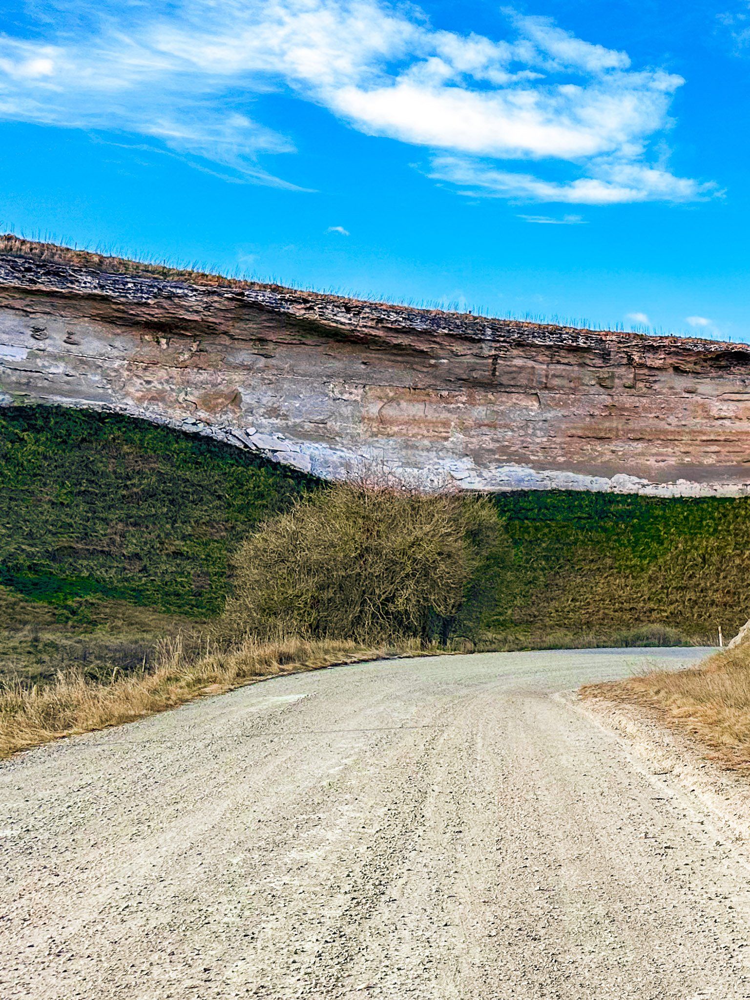
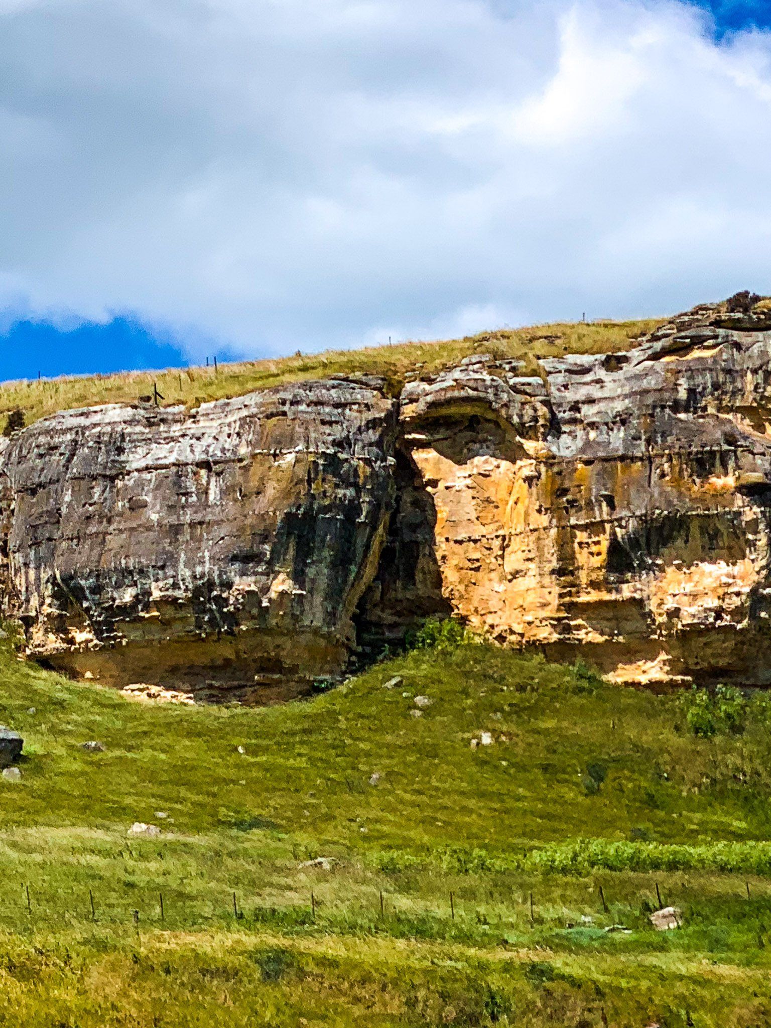
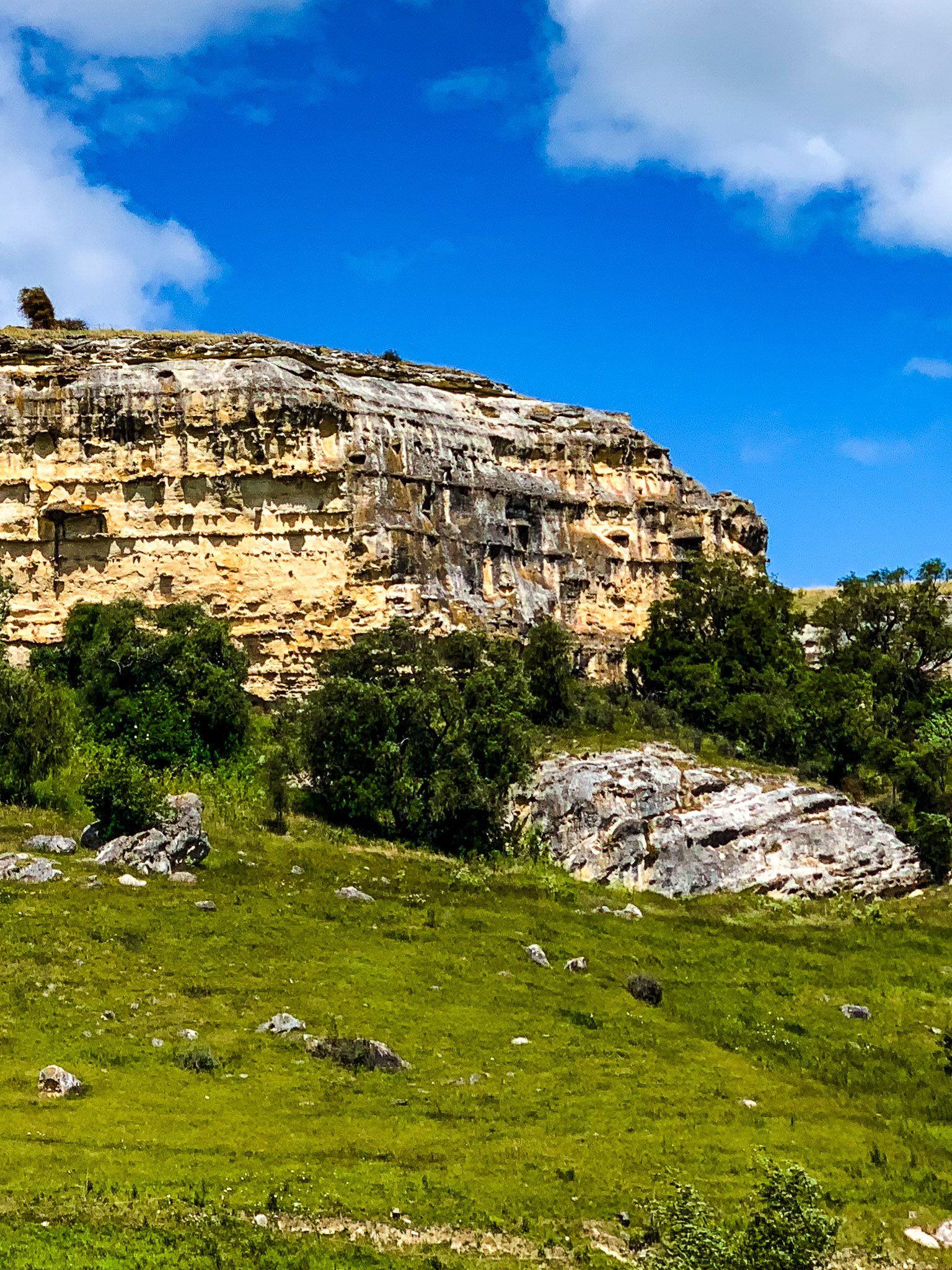
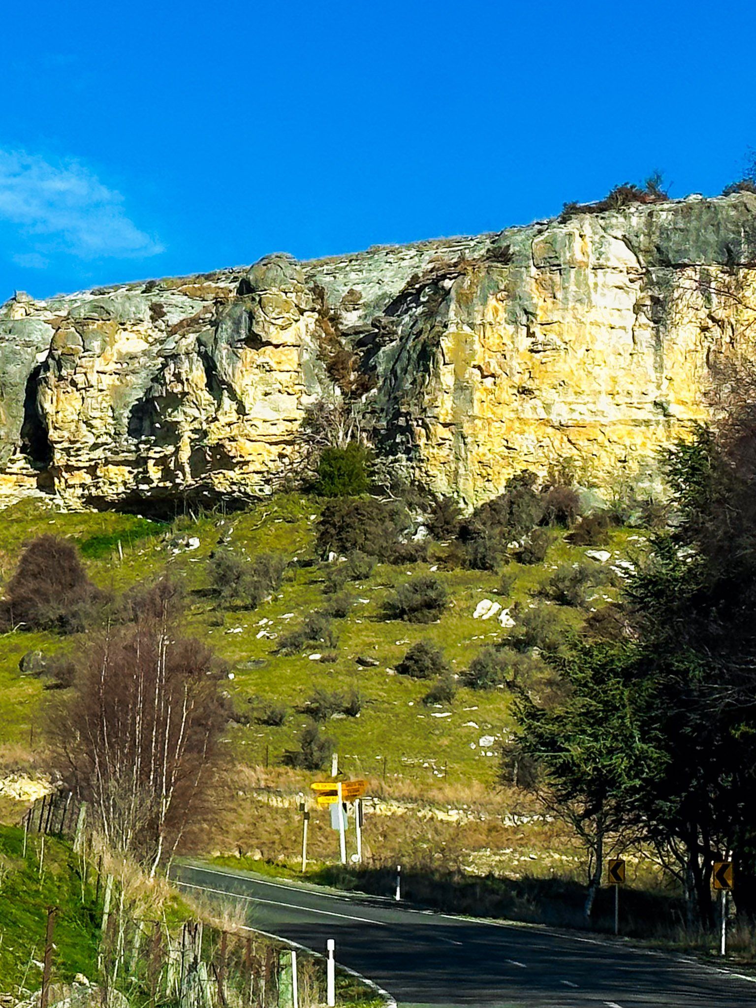
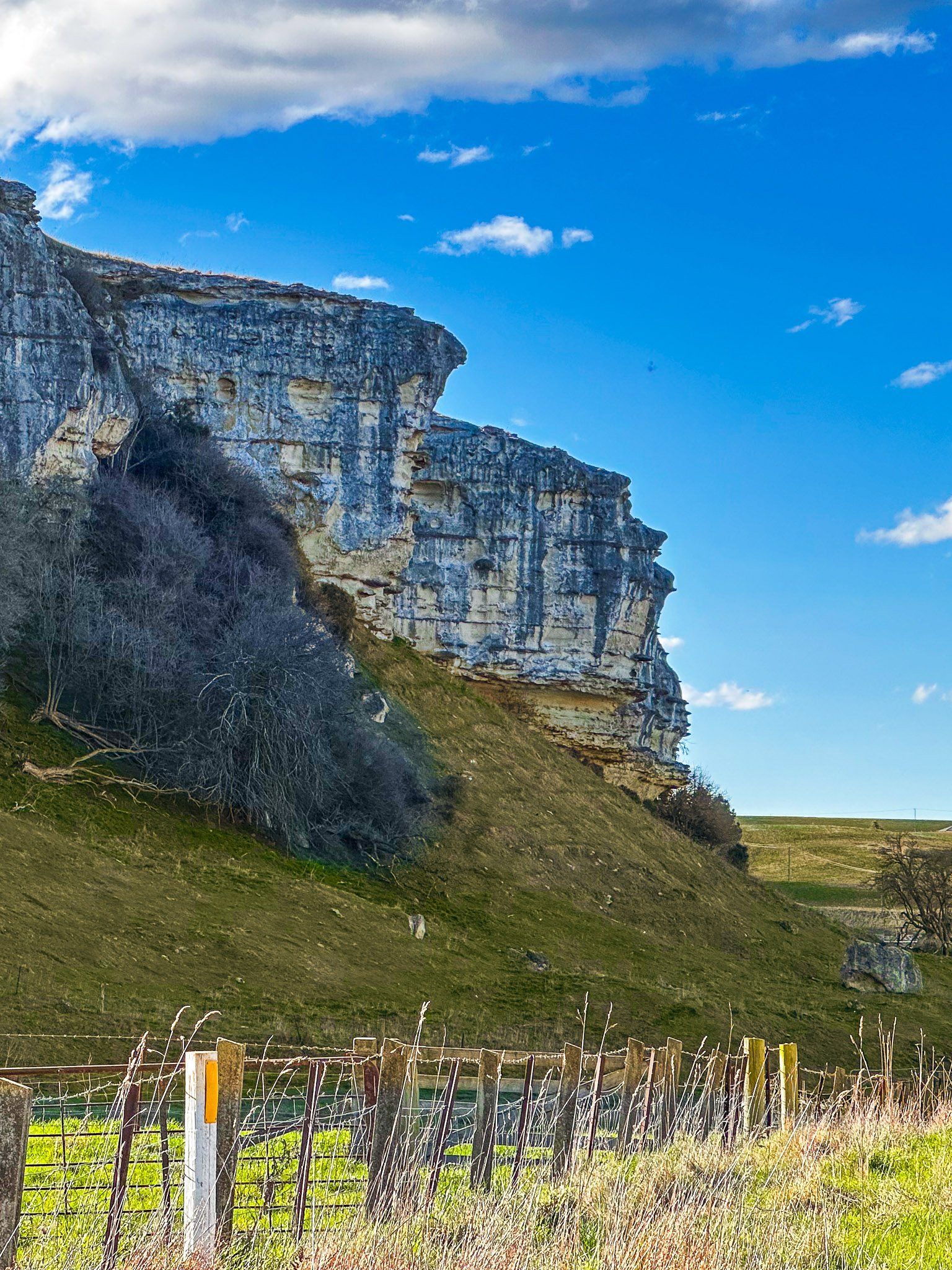
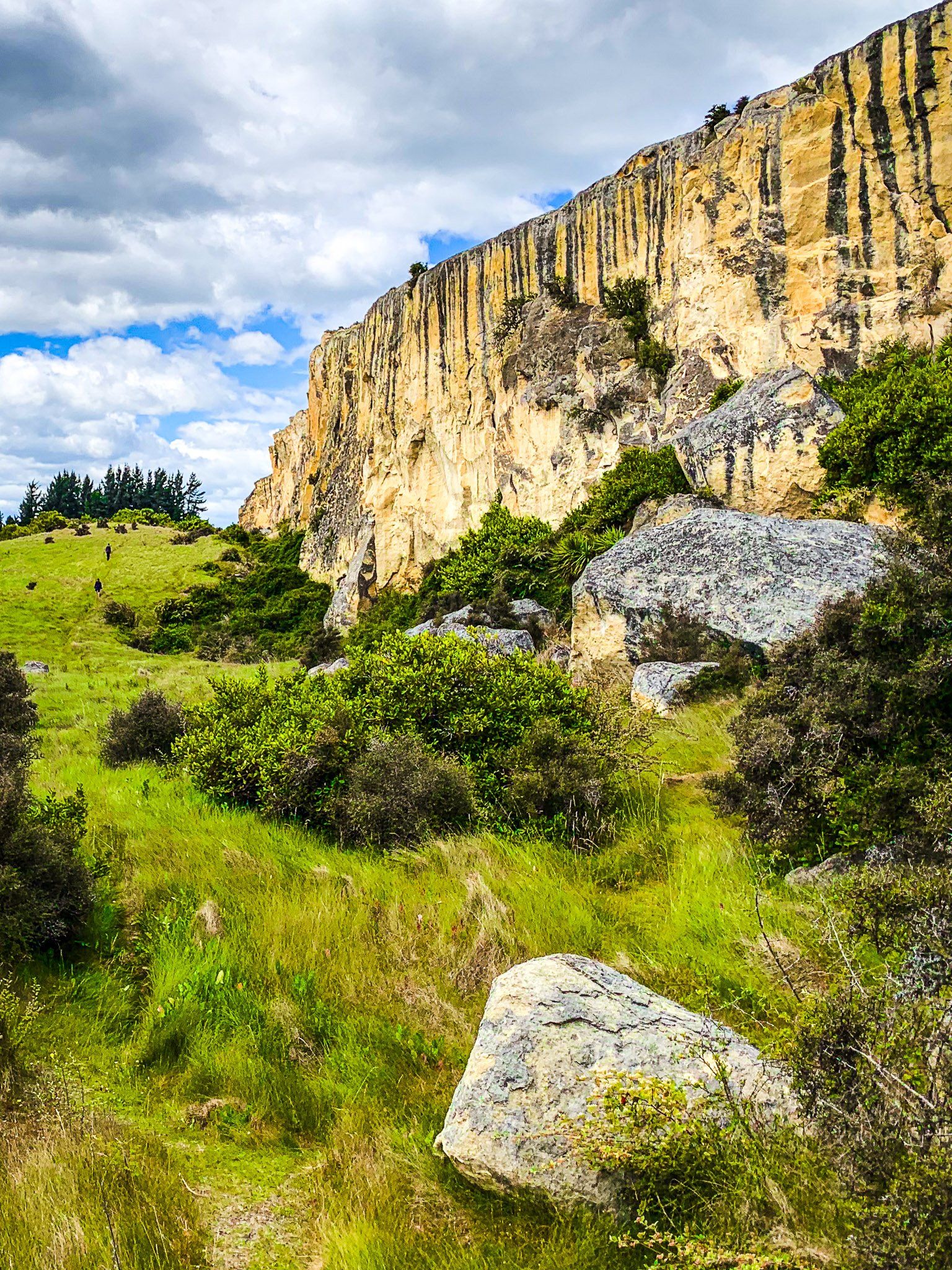
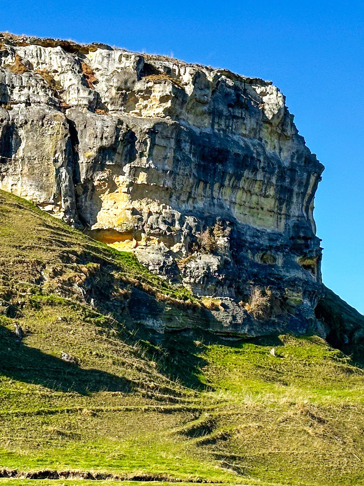
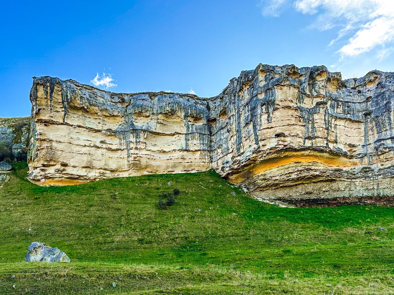
The formation of Waitaki Whitestone dates back approximately 25 million years. It originated from layers of sediment and marine animal remains that compressed under a shallow sea. Over time, these layers were uplifted, contributing to the formation of New Zealand / Aotearoa. Erosion has since sculpted the limestone into striking cliffs, ranging in colour from white to cream to yellow. The area is also rich in marine fossils from the same era as the limestone, and some cliffs feature Māori rock drawings.
The Waitaki Valley is now also part of the Waitaki Whitestone UNESCO Global Geopark, which recognises its unique geology and heritage. The park stretches from the Ahuriri Valley, along the Ahuriri River to the Waitaki Valley, then south to Kaitiki Beach, Trotters Gorge and Nenthorn. It links more than 40 geosites across inland and coastal landscapes.
Exploring the Limestone Features
The most notable limestone formations are located near Duntroon, a small town situated on the south side of the Waitaki River. You can start a self-guided one-day tour of the area at the Vanished World Centre. This centre combines a fossil and rock museum, an activity centre, and a souvenir shop. Whale bones, penguin skeletons and coral beds from an ancient sea have all been found in the cliffs and flats of this part of the valley. Visitors can obtain maps and guidance on exploring the nearby Whitestone features.
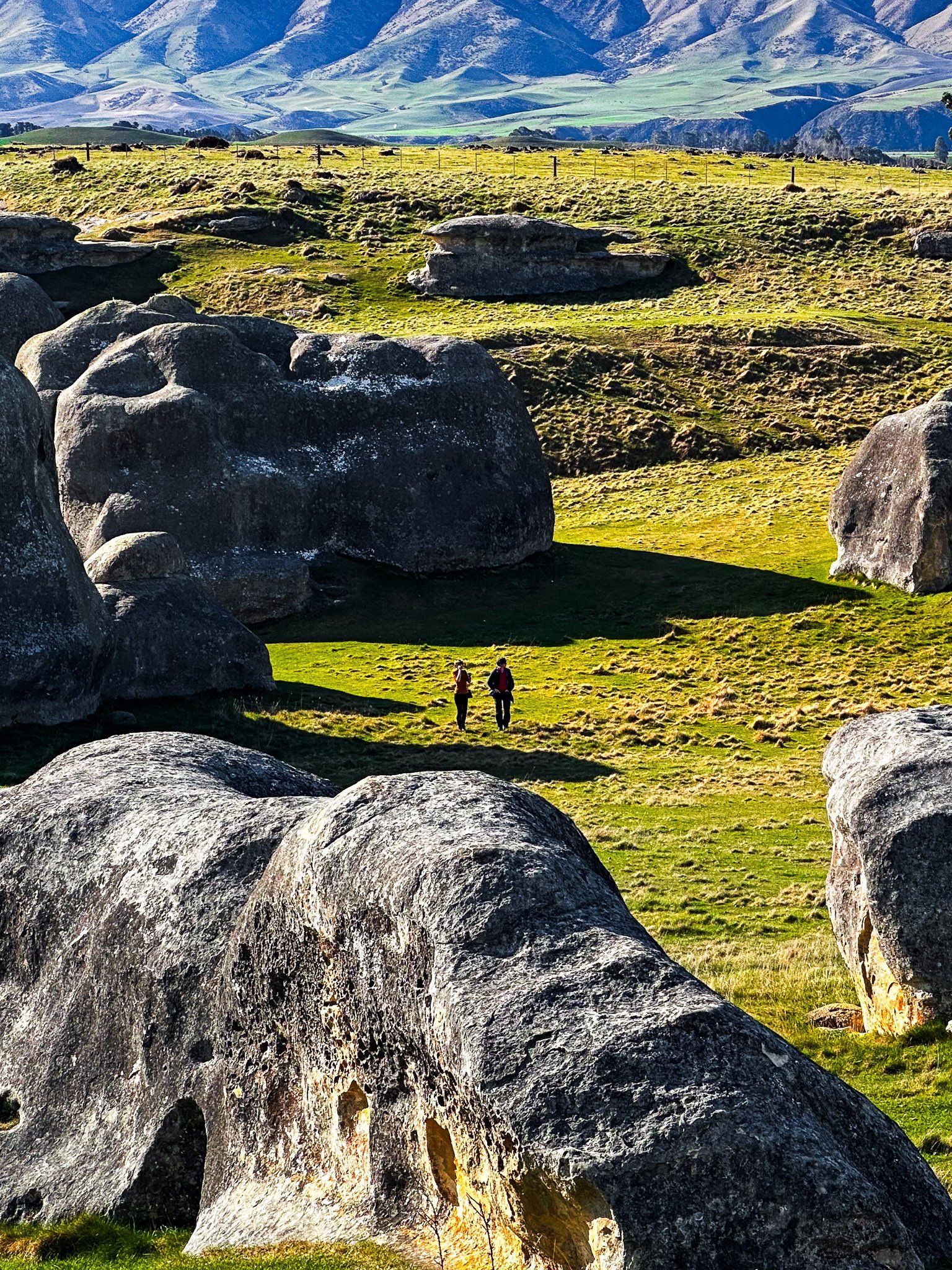
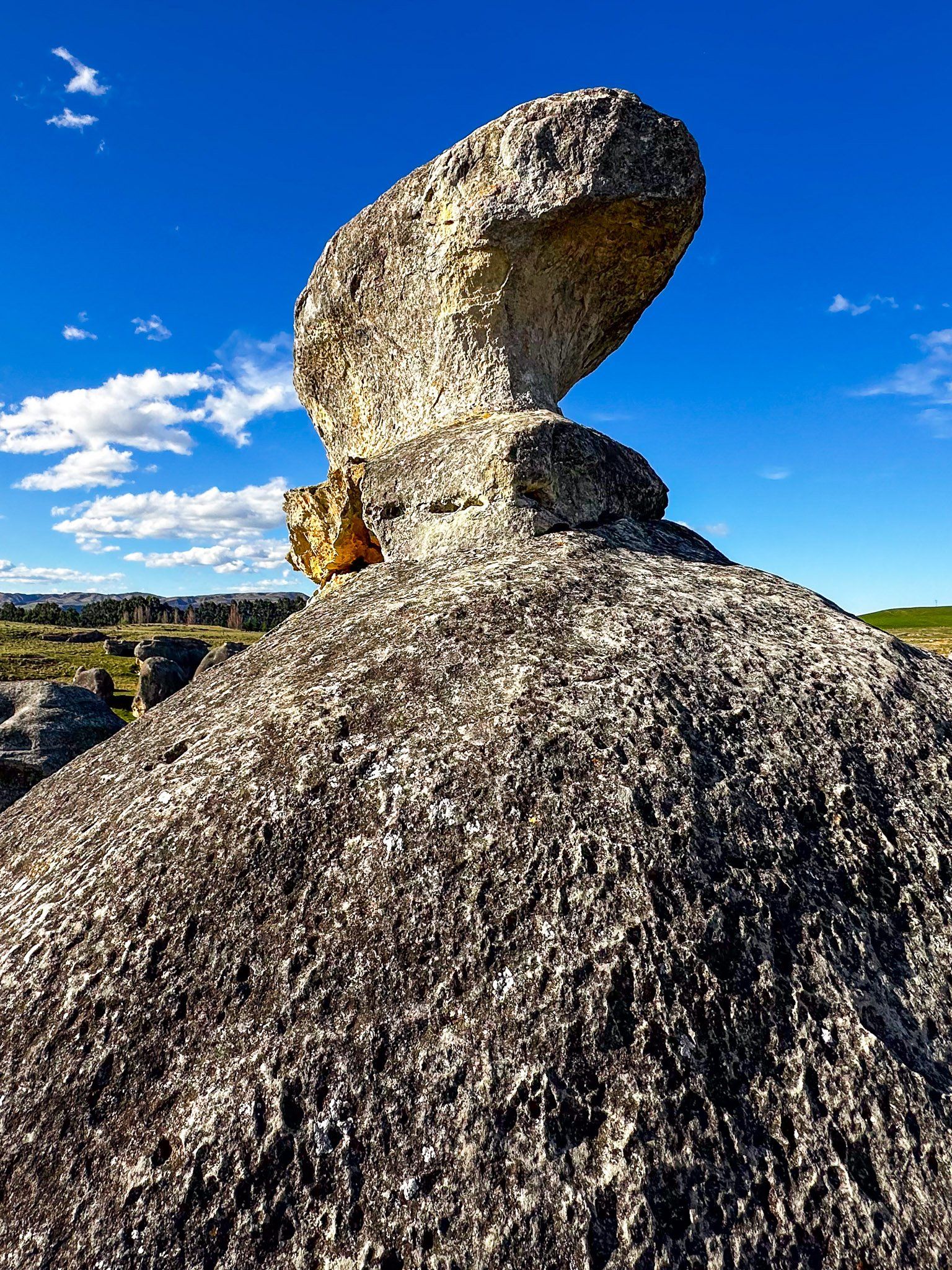
Several accessible sites show off the region’s geological richness. The best-known is Elephant Rocks, where numerous large limestone rocks, sculpted by the elements, lie in a green farm paddock. Anatini Fossils, just along the road from Elephant Rocks, features another exposed whale fossil in limestone, a rare, visible record of the ancient sea floor. Nearby Island Cliff reveals layered limestone bluffs shaped by erosion, while Earthquakes Waipata showcases dramatic karst terraces and a whale fossil.
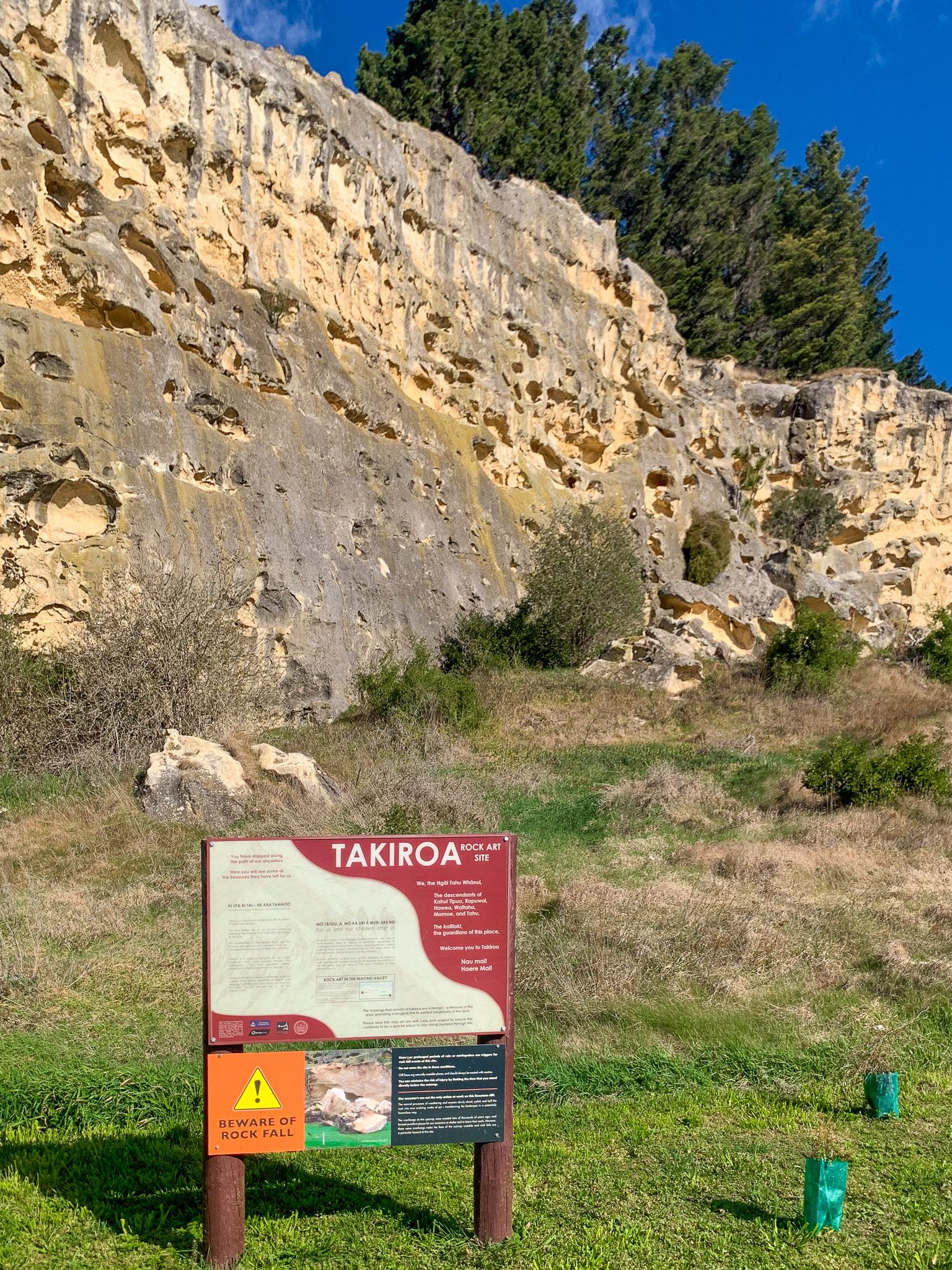
Stories are also told at Takiroa Rock Art Shelter, where Māori painted birds, people and canoes onto a cliff face using charcoal and ochre. The site sits just off State Highway 83, and you can stop to view the art from a protected boardwalk.
Many of these locations are marked by "Vanished World" road signs, though these can sometimes be hard to spot. Additionally, the Alps2Ocean Cycle Trail passes through the area, making it convenient to explore most sites by bike.
How to Get There
To reach the Waitaki Whitestone formations, travel to Duntroon via State Highway 83 from Ōamaru, a journey of about 42 km northwest. From Duntroon, you can do a looped, winding drive via Earthquake Road, Livingstone Duntroon Road, Island Cliff Duntrron Road and Tokarahi Ngapara Road to explore the main features of the area.
The area is also well-suited for cycling, with the Alps2Ocean Cycle Trail providing easy access to many of the limestone sites.
Nearby attractions include the historic town of Ōamaru, known for its well-preserved buildings and Heritage Precinct, as well as lovely Bushy Beach.