Exploring the Watchman at Karekare Beach
Karekare, located on the west coast of the Waitākere Ranges in Auckland, provides a captivating landscape for photography enthusiasts. One of its highlights is the Watchman, an obvious name for a prominent rock formation, that provides diverse photographic opportunities and connections to the region's Māori history.
Discovering the Watchman
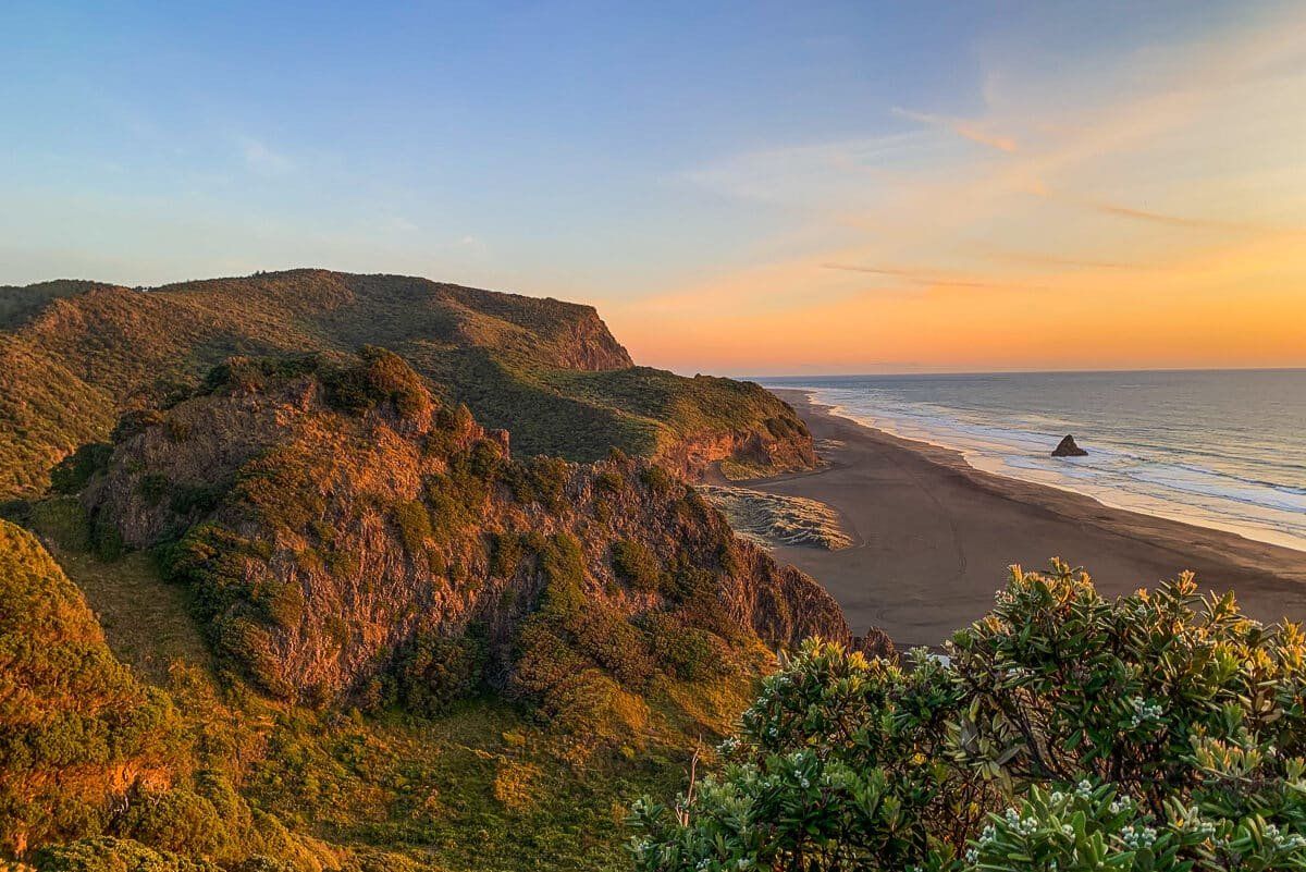
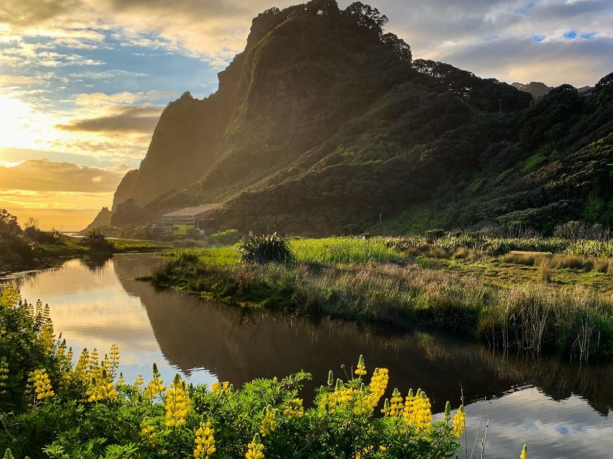
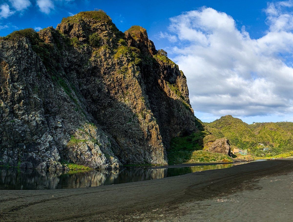
The Watchman is an ancient volcanic outcrop that lies between the lagoon on Karekare Stream as it flows to the beach and Farley Point at the north end of the beach. It is 80 metres high and about 500 metres long, as seen from the beach on the south side. The main track to the beach from the car park runs down the south side of the lagoon and the Watchman.
On the north side, short, gravel Watchman Road, with a scattering of houses in the pōhutukawa trees along its east side, takes you to the ridge between Farley Point and the Watchman. This is the start point for Comans Track and Ahu Ahu Track. In addition, an informal track takes you through an expansive area of dunes and shrubs to the beach, allowing a loop around the Watchman. A brave (or foolhardy) person can also scramble from the top of Watchman Road to the top of the Watchman.
Viewing Angles and the Shape of the Watchman
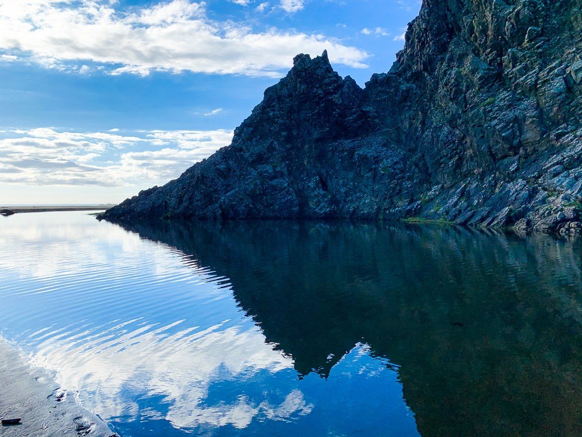
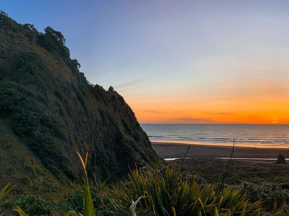
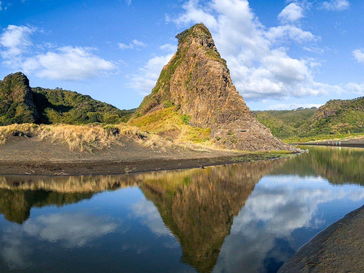
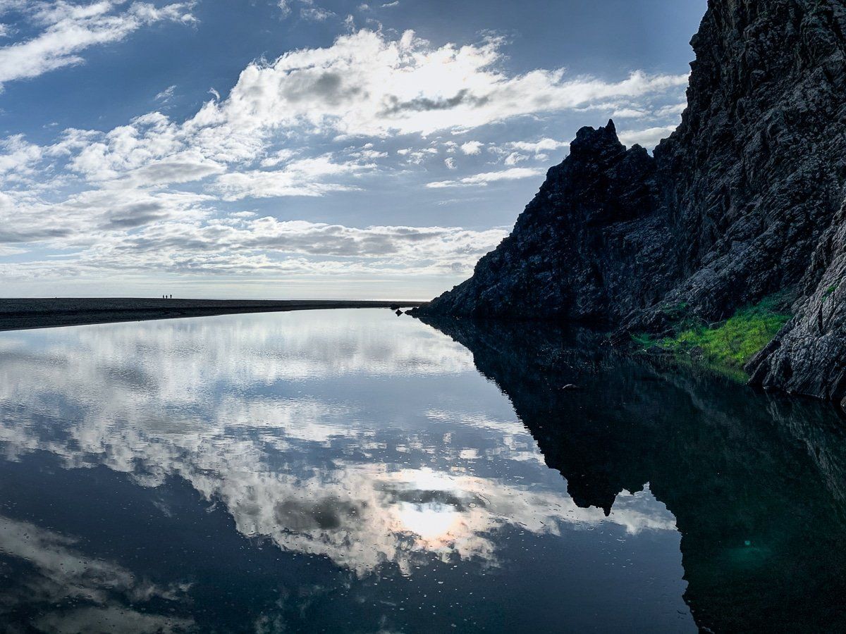
Looking from the beach south of the Watchman, the shape is reminiscent of a distorted fish fin, long with twin, rocky points. From the west, head-on from the beach, it is much more dramatic, with a narrow base and sharp spear tip. Get the right angle and a still day, and you can capture mirror reflections in the lagoon. Towards sunset, the Watchman lights up with a stunning golden glow.
Connections to Te Kawerau ā Maki
Te Kawerau ā Maki iwi, the traditional inhabitants of the region, call the Watchman Te Matua or Te Tokomatua, meaning "the parent" or similar. In the 1700s, the pā Te Kaka Whakaara (“The Kākā Standing Watch”) was established on its summit by the rangatira Kowhatu‑ki‑te‑uru, overlooking the kāinga Te Marae o Mana and the Māraroa kumara gardens up the nearby valleys. The pā and village were sadly sacked during the Musket Wars in 1826, with many killed and abandonment of the area.
Te Matua features in a local legend in which its two rock children played along the beach during the age of "Te Ao Kohatu", when rock beings could walk. Unfortunately, the children strayed too far and were frozen in place at the end of Te Ao Kohatu, one becoming nearby Paratahi Island and the other a smaller but notable rock in front of the dunes between the Watchman and Farley Point.
How to Get There
You can access Karekare from Piha Road via Lone Kauri Road or Karekare Road. Both roads have suffered storm damage over recent years and can be affected by road works from time to time. From Downtown Auckland, take the northern motorway to the Te Atatu off-ramp, then head south on Route 13, through Henderson to Forrest Hill Road. Follow Forest Hill Road to the Scenic Drive, then turn west, then south onto Piha Road. Karekare Road is shortly before you reach Piha. The drive takes about 50 minutes and is 38 km.
From Karekare, you can also take a short walk to Karekare Falls or walk south down the beach to the Paraha Valley, connecting with the Gibbons and Muir Tracks to Whatipū.