Important Note: The Lion Rock track is closed due to storm damage.
Lion Rock: A Volcanic Sentinel at Piha
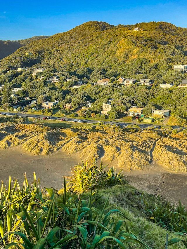
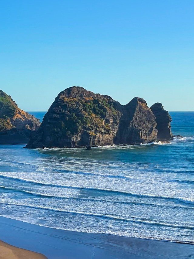
The coastline of Piha on the wild west coast of Auckland is instantly recognisable thanks to Lion Rock. This dramatic volcanic outcrop sits just west of the Piha Stream and lagoon. Located within the Waitākere Ranges, about a 50-minute drive from Downtown Auckland, this iconic natural landmark draws you in with its striking profile and panoramic views.
From the beach, Lion Rock resembles a crouching lion facing west, a silhouette immortalised in postcards and surf photos. But beyond its shape, this monolith stands as a tangible link to both Māori history and the region’s explosive geological past.
Beaches, Cliffs and Coastal Vistas
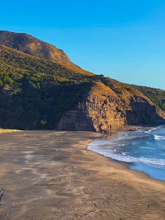
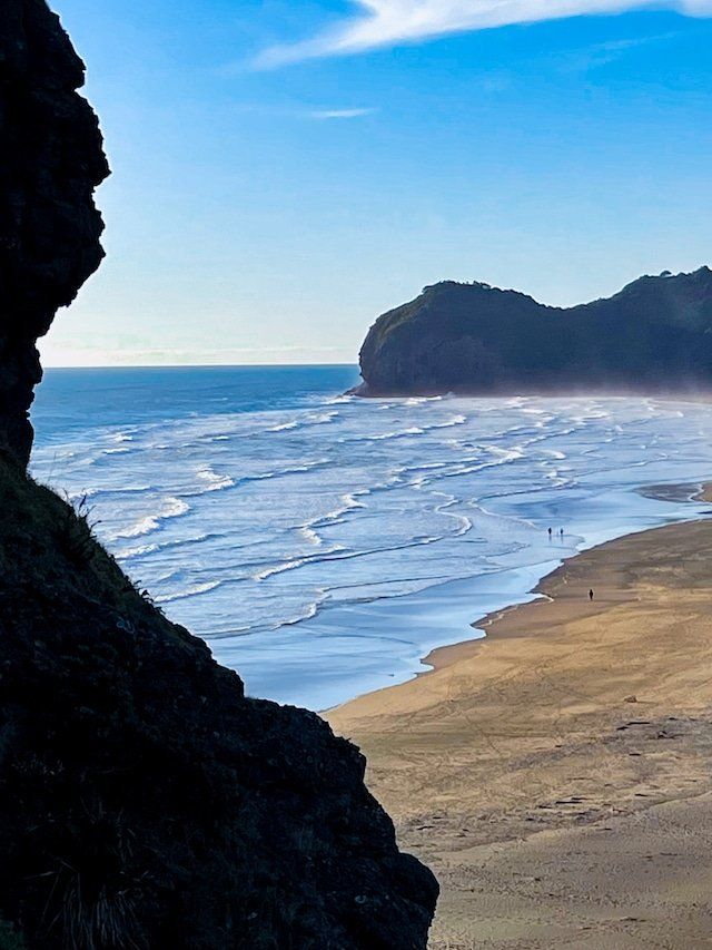
Lion Rock rises 101 metres above the black sand of Piha, a beach famous for its strong surf, exposed west-facing swell, and ever-changing tide lines. The rock itself divides the main beach into Piha Beach to the south and North Piha Beach, with the lagoon and Piha Stream flowing out to sea at its southern base.
Formed from the solidified core of an ancient volcanic vent, Lion Rock is a remnant of the Miocene-era Waitākere Volcano, which erupted over 16 million years ago beneath the sea. As the surrounding softer rock eroded, the harder andesite core was left standing, creating the steep-sided formation you see today.
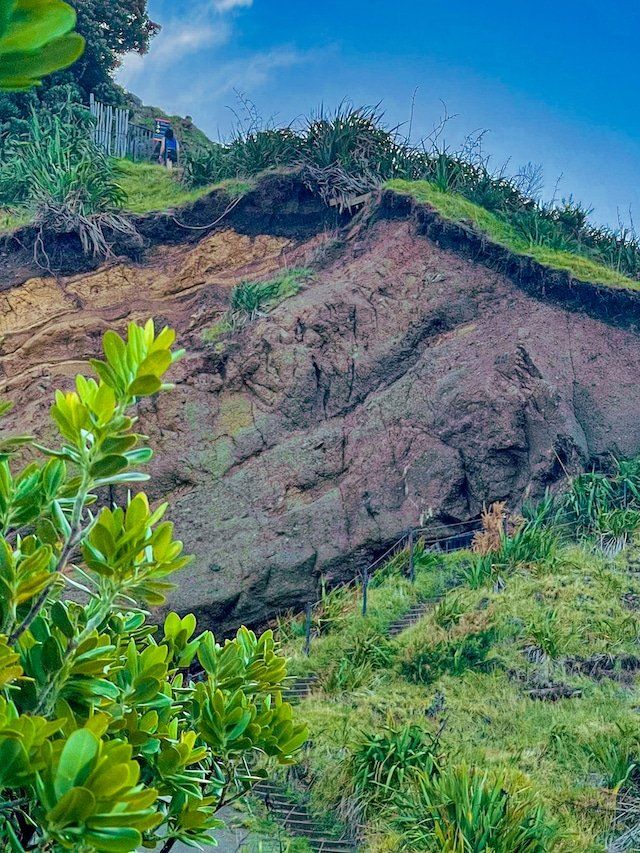
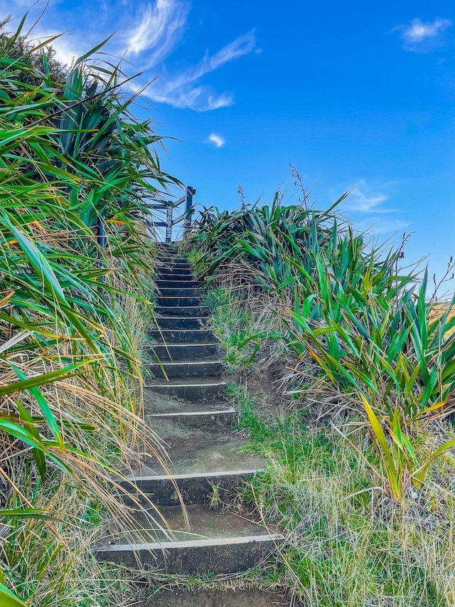
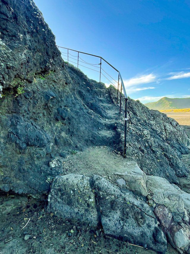
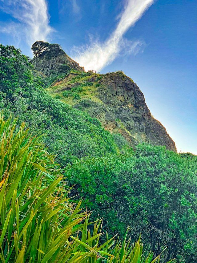
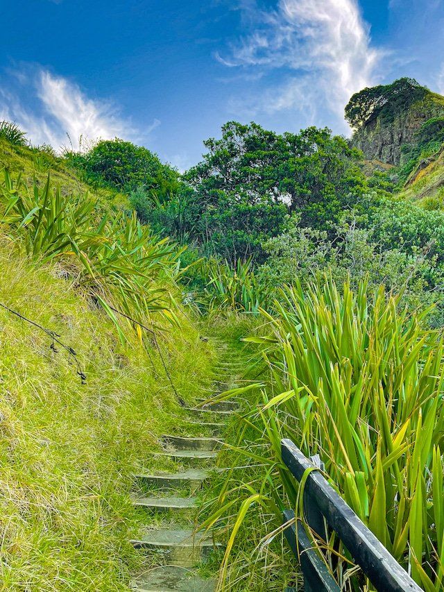
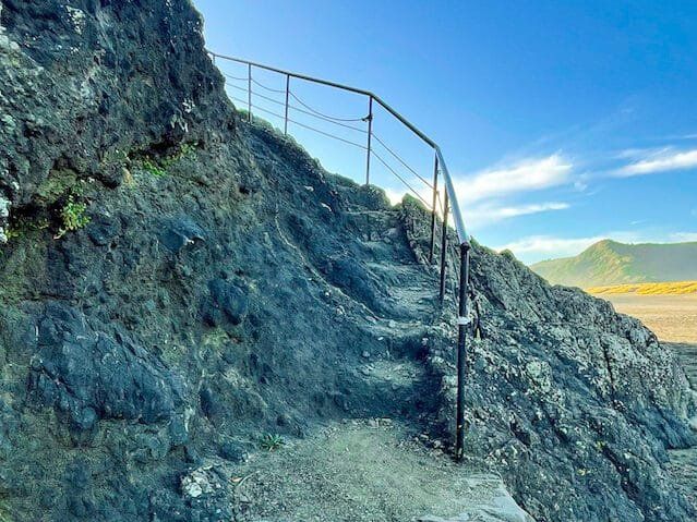
The climb up the rock provides a real sense of its verticality. While the summit path has been permanently closed due to rockfalls, a partially accessible trail, with safety rails, leads to a viewing platform partway up, with sweeping views across the beach and Piha coastline. Wear sturdy footwear and take care in wet conditions as the track can become slippery, especially during Winter.
Whakaari Pā and Lion Rock’s History
Before it was a landmark for surfers and hikers, Lion Rock was home to Whakaari Pā, a defensive pā site built by Te Kawerau ā Maki, the iwi with mana whenua over much of the Waitākere Ranges. The name Whakaari means "exposed to view", appropriate for a headland pā with commanding views of the coast.
Evidence of terracing and platforms remains visible on the rock’s flanks, though erosion and time have softened their shape. Recent storms have exposed additional middens and evidence of longer-term, pre-European occupation. It is unclear when the pā fell into disuse, but archaeological evidence suggests the site reached its peak development in the 1700s.
Early Conservation Initiatives in the Waitākere Ranges
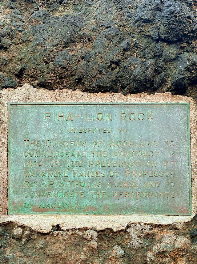
At the base of Lion Rock, a bronze plaque installed in 1894 commemorates the work of Professor Alexander P.W. Thomas, one of the first scientists to map and advocate for the protection of the Waitākere Ranges. His early calls for conservation helped pave the way for the Waitākere Ranges Regional Park, which today protects over 16,000 hectares of coastal forest, waterfalls, and historic sites.
Getting to Lion Rock
From Downtown Auckland, follow the western motorway to the Te Atatu off-ramp, then follow Route 13 south through Henderson to Forest Hill Road. Continue south all the way to Scenic Drive, then turn west, then south onto Piha Road. Arriving in Piha, drive along Seaview Road towards North Piha, and park near the corner of Seaview and Marine Parade North. Walk through the dunes to the base of Lion Rock.
Nearby places to visit include Kitekite Falls, The Gap, the Piha Blowhole, Maungaroa Track, and the Marawhara and White Tracks to Anawhata Road and Whites Beach.