Important Note: the track to Lake Wainamu is open; however, the loop track around the lake is closed and is expected to reopen during Summer 2026.
A Dune Lake in the Waitākere Ranges
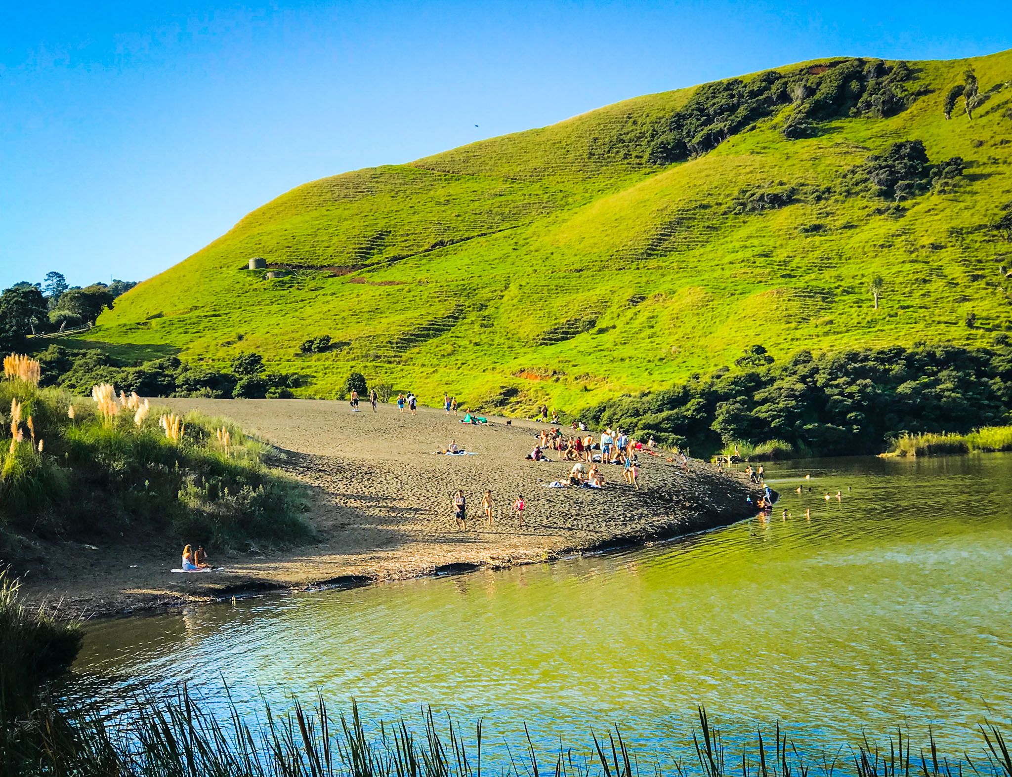
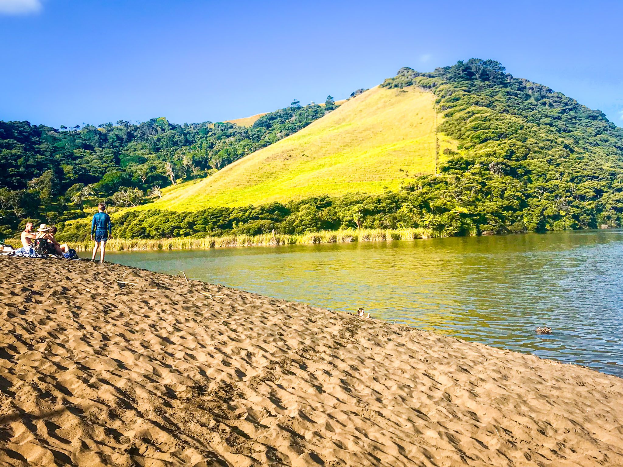
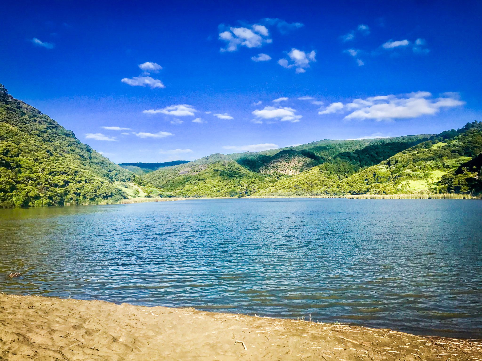
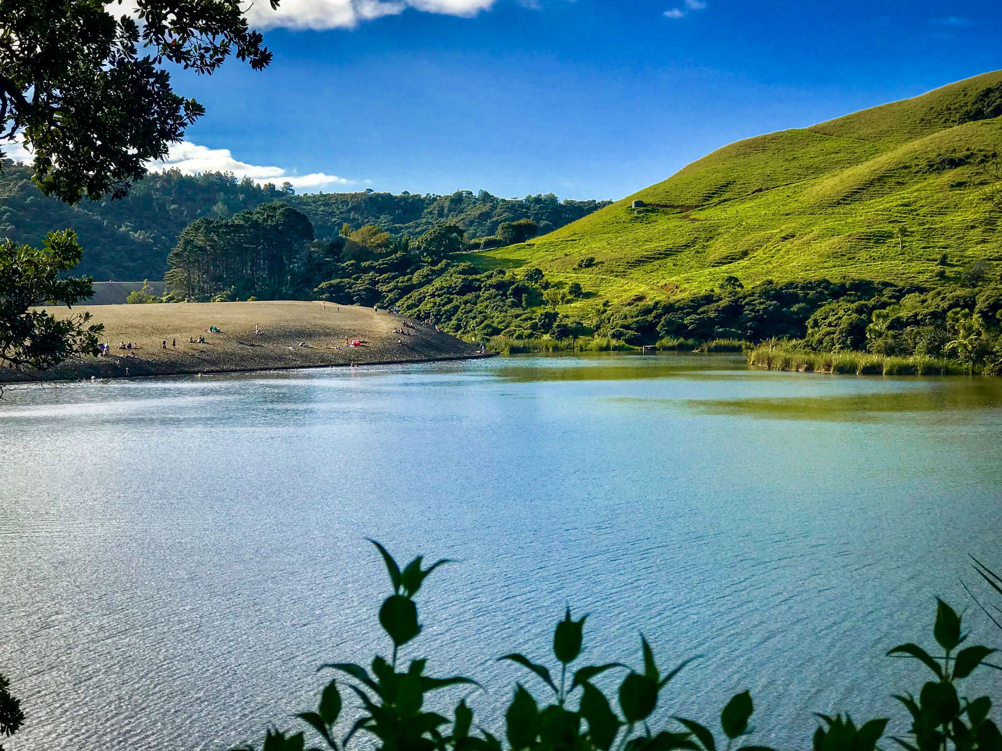
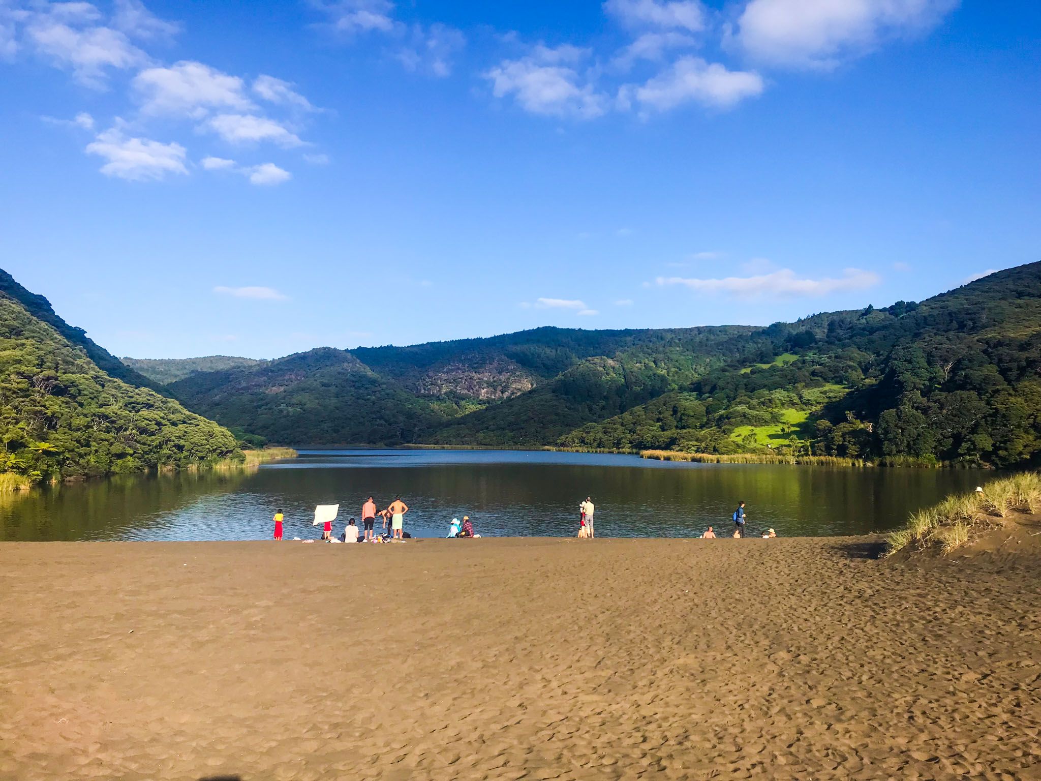
Lake Wainamu lies about 2 km inland from Te Henga / Bethells Beach on the West Auckland coast, reached by a short detour off Bethells Road just before the beach settlement. The lake is the largest natural lake in the Waitākere Ranges, reaching depths of up to 15 metres, and its setting is unlike almost anywhere else in Auckland: a freshwater lake in a bush valley, separated from the Tasman Sea by a great dune of dark iron sand. You can walk to it along the Waitī Stream at the foot of the dune, or climb over the dune itself. Either way, emerging at the lakeshore for the first time is a genuine delight.
The Walk In: Dune or Stream
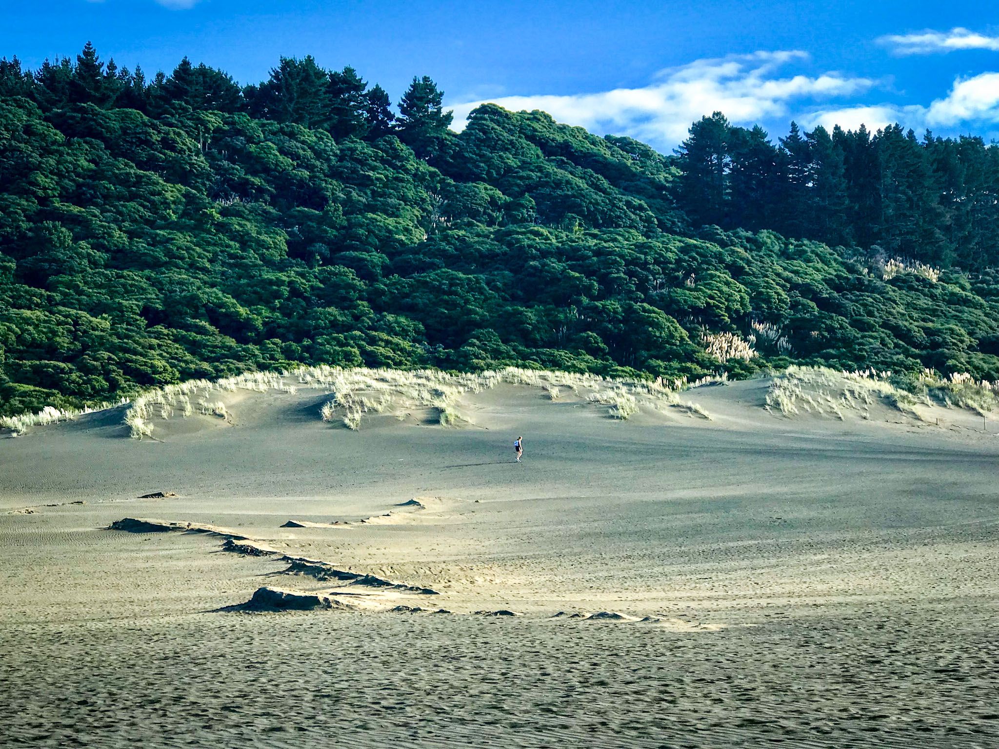
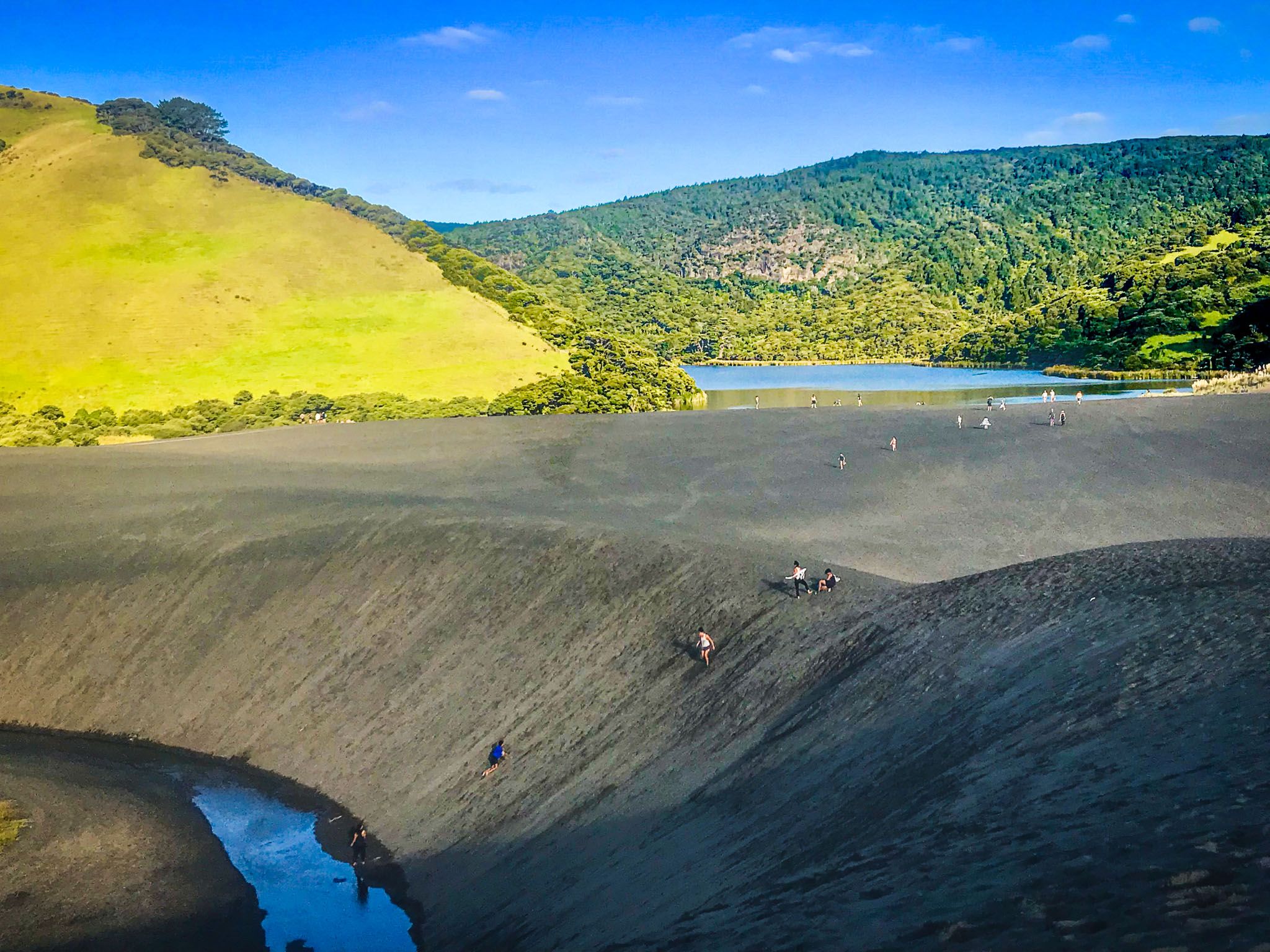
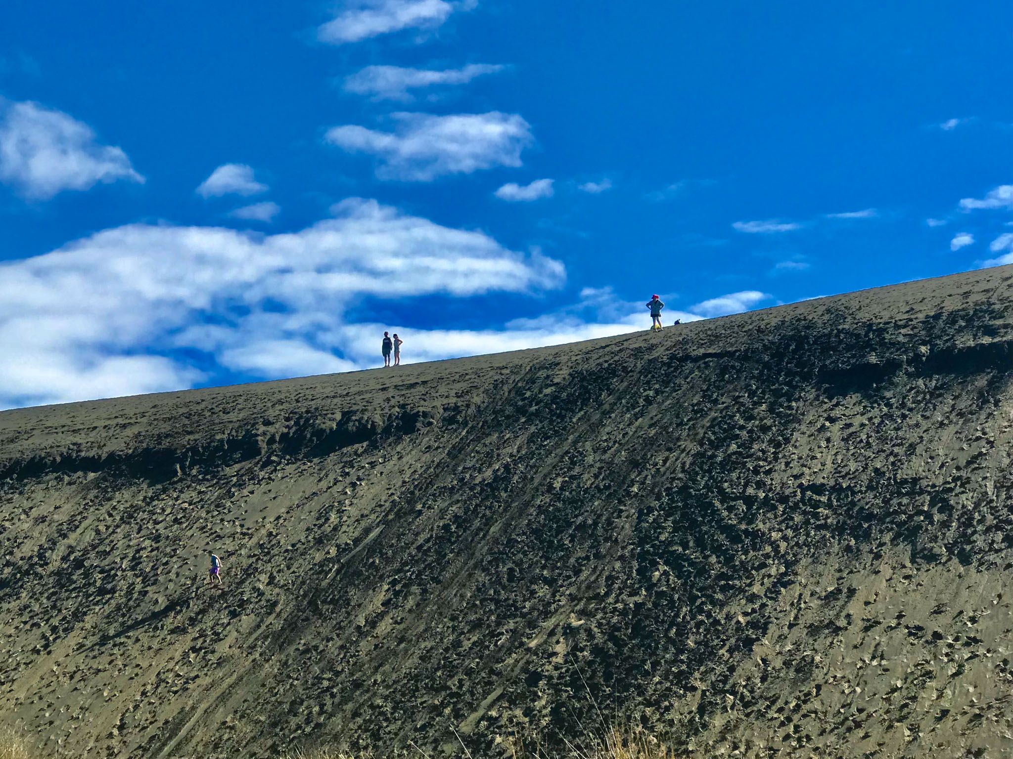
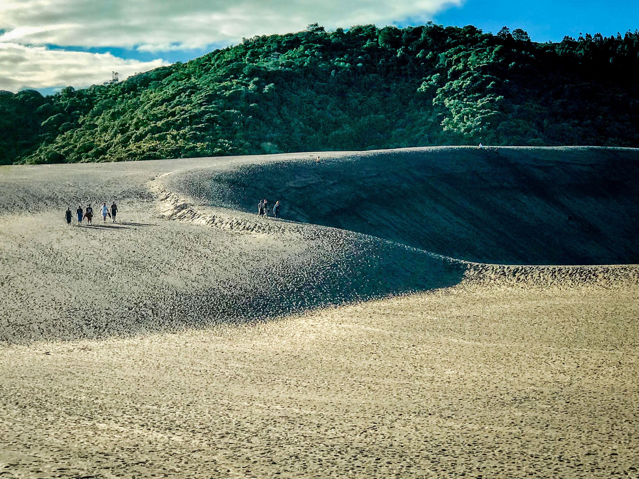
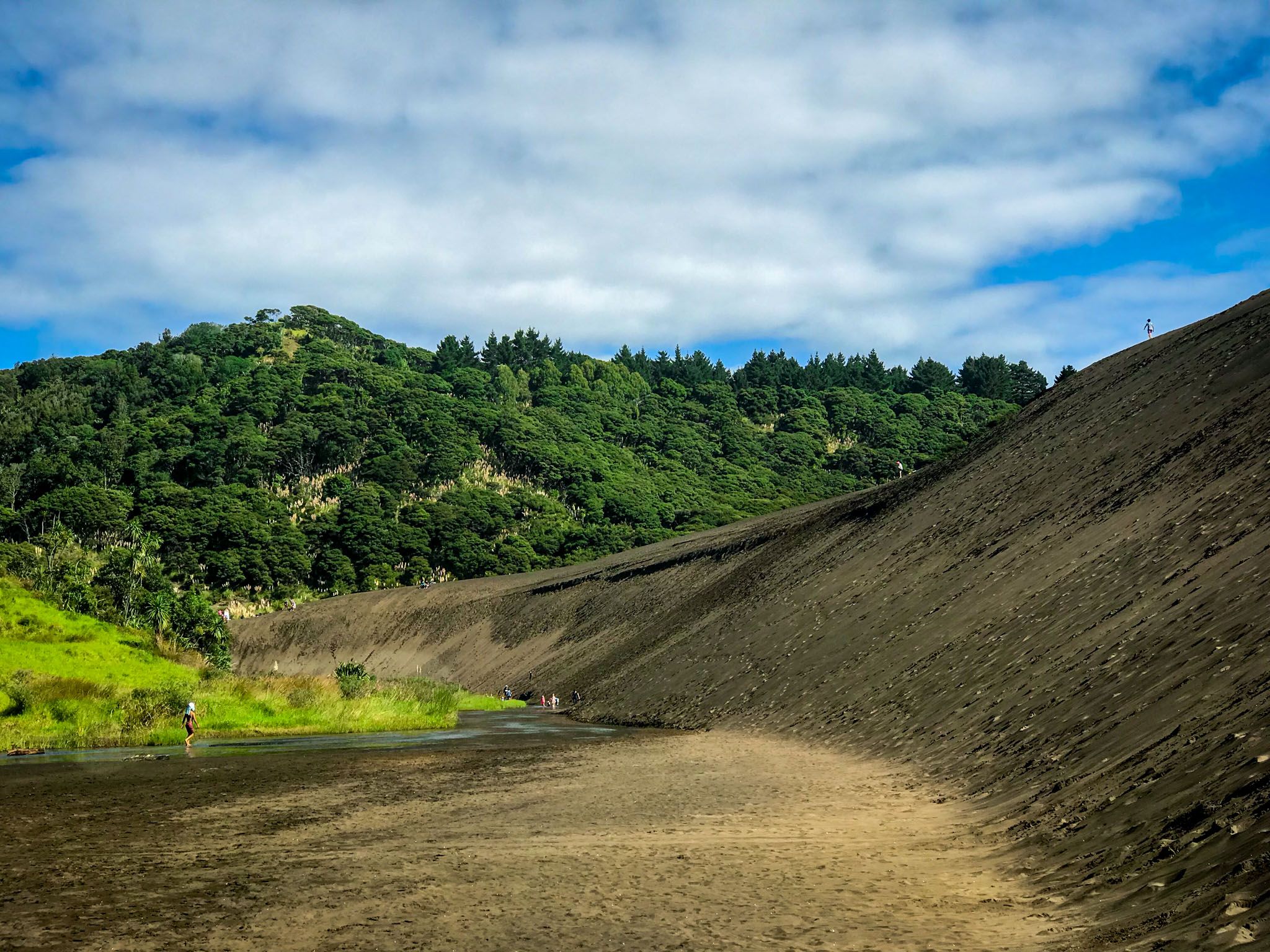
From the small car park on Bethells Road, two routes reach the lake. The first follows the Waitī Stream along the northern foot of the dune, a flat, easy walk of around 30 minutes through a narrow corridor between the dune wall and the bush edge, with the stream to one side and the black sand rising steeply up to 20 metres on the other. This is the more sheltered option and gives a strong sense of the dune's scale from ground level. The second option climbs directly over the dune from the car park end, a steeper ascent with a fabulous panoramic view from the crest. The best swimming is from the dune edge, where the sand slopes directly into deep water and the drop-off is immediate.
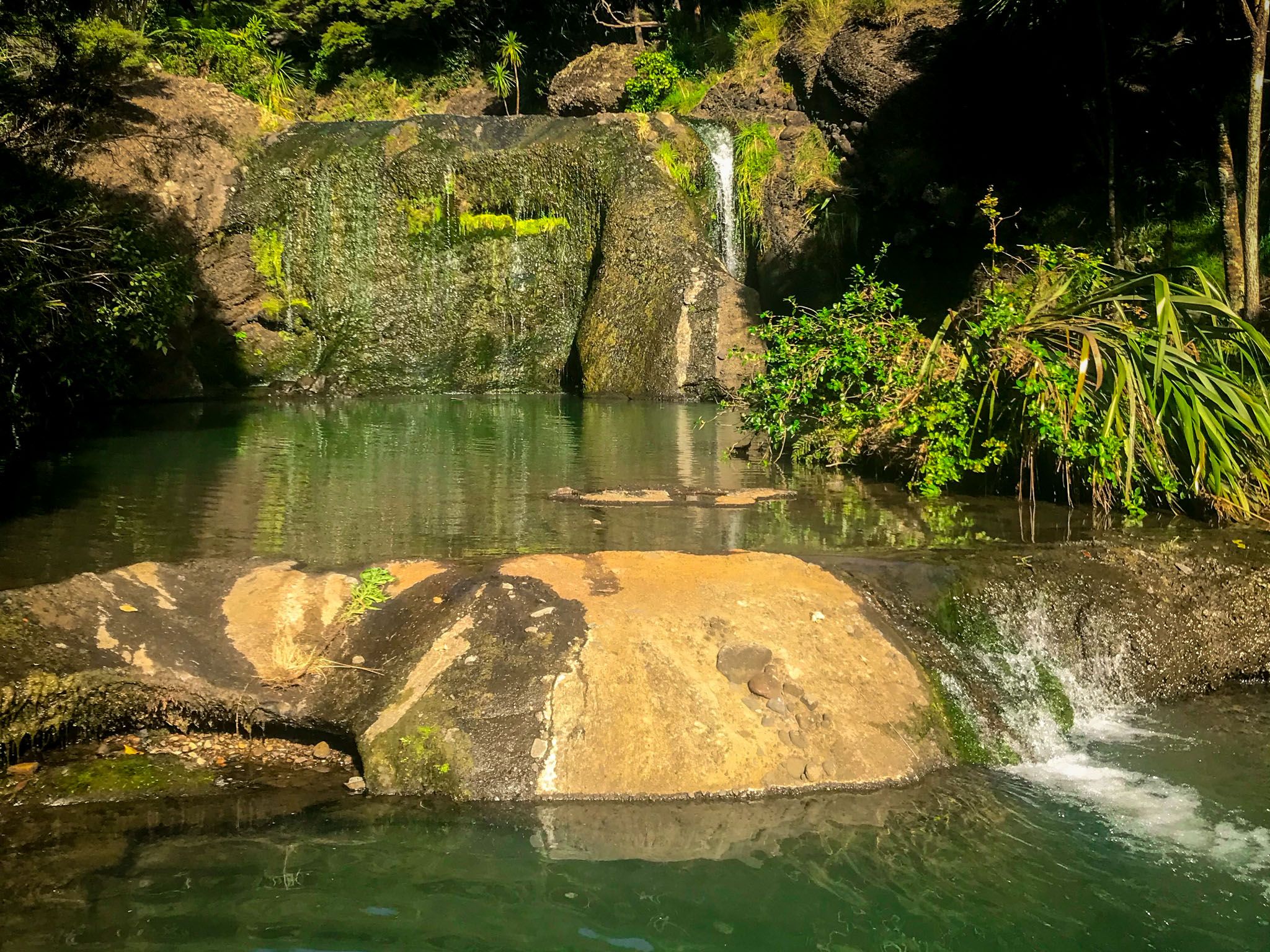
The Loop Track and Wainamu Falls
The Lake Wainamu Track loops around the lake through nikau palms, ti kōuka, kānuka and regenerating native forest, with Wainamu Falls, a modest but pretty waterfall, at the eastern end where the Wainamu Stream enters the lake. The full loop is 6.9 km and takes around two hours. The track was severely damaged in 2023, and the loop has been closed since. The track is expected to fully reopen for Summer 2026.
Te Kawerau ā Maki and the Lake's Names
Lake Wainamu sits within the traditional rohe of Te Kawerau ā Maki, the iwi of the Waitākere Ranges. The lake was known as Roto Wainamu, with the name Wainamu referring to the sandflies and mosquitoes found near the water, although these are less of a problem to a modern visitor. The three streams feeding the lake from the south carried their own names: Waitohi (a reference to baptismal rites), Waikūkū (the stream of the kūkupa, or kererū), and Toetoeroa (for the toetoe grass along its banks).
The western shore of the lake was the site of the Ōhuhu kainga, while the fortified pā of Poutūterangi and Te Pae Kākā stood to the southeast. The rangatira Kowhatukiteuru, a famed pā builder around the mid 1600s to early 1700s during the time of the Waiohua Confederation, built two stone pā near the lake, Pakowhatu and Koropōtiki.
In the 1920s, the valley was logged for kauri, with driving dams built on the Wainamu and Wheeler Streams to float logs down to the coast; the remnants of those dams are still visible along the loop track.
How a Dune Became a Dam
Lake Wainamu is a dune lake: a valley flooded by freshwater behind a barrier of wind-blown coastal sand. Around 7,500 years ago, rising sea levels following the last ice age flooded the lower Waitākere valley system, turning the coast here into a series of tidal inlets that reached inland along the Wainamu and surrounding stream valleys. As sea levels stabilised and Tasman Sea sand accumulated at Te Henga, coastal dunes began advancing inland. Those dunes, built from sand originating from the volcanic rocks of Taranaki and carried north by coastal currents, pushed across the mouth of the Wainamu valley, cutting the valley off from the sea and allowing a freshwater lake to form behind it.
The dune separating the lake from the Waitī Stream outlet is still active and still moving, with sand blowing over its crest and returning downstream to the beach. Several decades ago, dune vegetation was planted on the beach dunes behind Bethells, cutting off the supply of fresh sand. Over time, this means the Wainamu dune will shrink and eventually become a fixed remnant, though that process will take centuries.
How to Get There
The drive from Downtown Auckland takes approximately 50 minutes (37 km) via the western motorway to Lincoln Road, then Universal Drive to Swanson Road and Scenic Drive, heading southwest. From Scenic Drive, follow Te Henga Road, then Bethells Road for around 9 km to the small car park on the left, just before the road descends to the Bethells Beach settlement and next to the bridge over the Waitī Stream. The car park is small; arrive early in Summer to secure a space.
Nearby places to visit around Te Henga / Bethells Beach include Wigmore Bay. Waitakere Bay and its caves, and O’Neill Bay. The loop track in the Cascade Kauri, through an ancient kauri forest, is also near the start of Te Henga Road.