End of the Southern Musket Wars
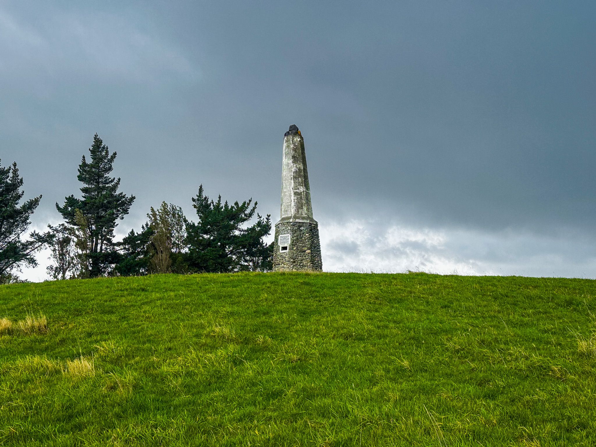
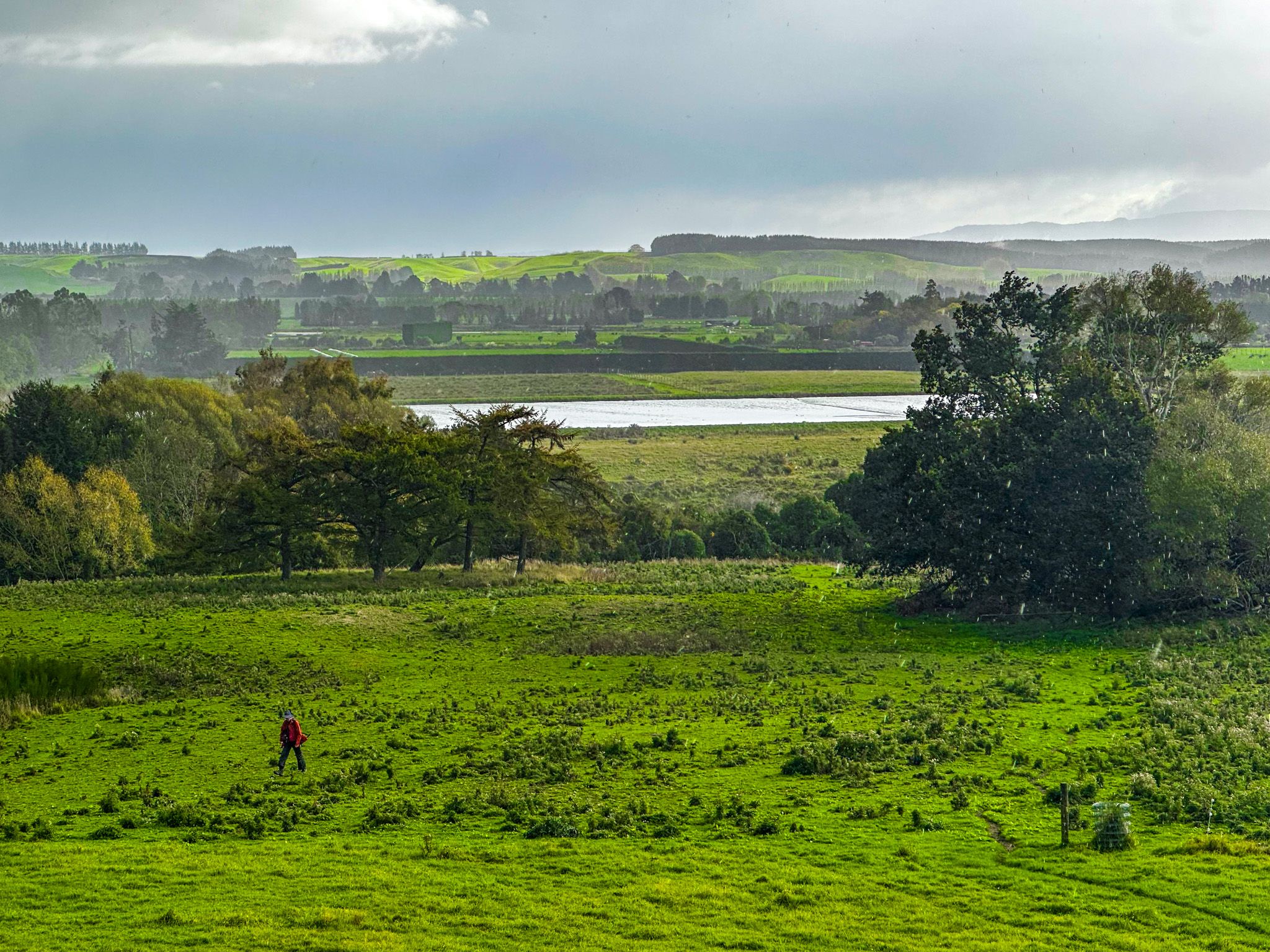
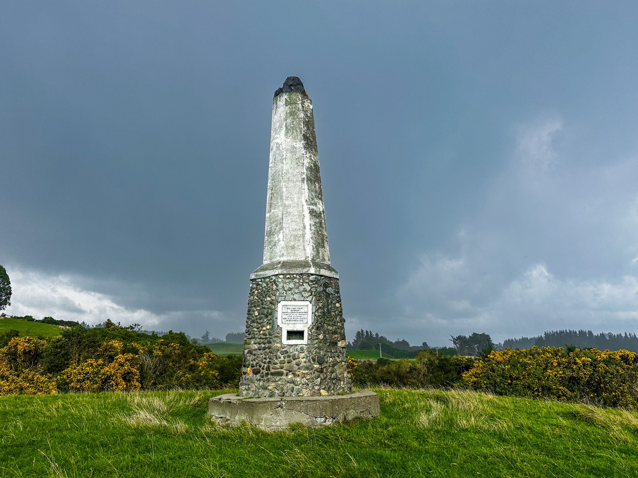
On a low hill above the Mataura River flats, near a back road between Mataura and Wyndham in eastern Southland, a concrete obelisk marks the site of the final battle of the Musket Wars in the South Island. The Tūtūrau Māori Memorial is one of the very few places in New Zealand where any substantive effort has been made to commemorate this period of devastating inter-iwi conflict. It is signposted from the road and recorded on topographic maps and Google Maps, but the route from the roadside reserve to the monument is unmarked: a short walk across a paddock studded with thistles and weeds to the hill where the obelisk stands. Hardly anyone knows it is there. The story it marks is one of the most consequential and dramatic in New Zealand history.
Te Rauparaha and the Invasion of the South Island
The Musket Wars were a period of devastating inter-iwi conflict that swept New Zealand from around 1806 to the mid-1840s, driven by the introduction of European firearms. Once any iwi acquired muskets, those without them became catastrophically vulnerable, and a desperate arms race followed. Deaths across the country are estimated at between 20,000 and 40,000 people. At the centre of the South Island campaigns was Te Rauparaha, paramount chief of Ngāti Toa, based on Kāpiti Island. Expelled from Kāwhia in 1822, he led his people south in a fighting migration, capturing Kāpiti Island and dominating the southern North Island. From around 1827, he began raiding the northern South Island, armed with muskets, driving to control the pounamu trade routes and seeking utu for earlier losses.
In 1830, Te Rauparaha used the British trading brig Elizabeth, captained by John Stewart, to carry himself and 100 warriors hidden below deck to the kainga of Takapūneke in Akaroa Harbour. The Ngāi Tahu paramount chief Tama-i-haranui was lured aboard, taken captive along with his wife and daughter, and carried to Kāpiti Island, where he was tortured to death. Several hundred of the local people were massacred in the attack on the village. Stewart was subsequently put on trial in Sydney as an accomplice to murder, but the case collapsed when Ngāi Tahu witnesses were ruled unable to testify on the grounds that, as "heathens," they were legally incompetent, and Stewart escaped justice. The incident appalled British authorities and was a direct cause of the appointment of James Busby as British Resident in 1833, which, in turn, led to He Whakaputanga, the Declaration of Independence of the United Tribes of New Zealand, in 1835, and ultimately to the Treaty of Waitangi in 1840.
In 1831 to 1832, Te Rauparaha attacked south again and sacked Kaiapohia pā north of present-day Christchurch after a three-month siege, and then took Ōnawe pā in Akaroa Harbour. These were the most devastating blows yet struck against Ngāi Tahu, and the furthest south Te Rauparaha's forces penetrated.
Ngāi Tahu Arms Up and Fights Back
The fight back was enabled by Ngāi Tahu rangatira along the Otago Coast and Foveaux Strait. They used their established relationships with Sydney-based whalers and merchants to acquire guns. One key figure was Tūhawaiki, known to Foveaux Strait whalers as Bloody Jack and for whom Jacks Bay in the Catlins is named. There are two explanations for the nickname - one that he picked up the swearword "bloody" from English sailors, the other that it referred to his and his whaling crew’s preference for redcoats, as worn by British soldiers. Based on Ruapuke Island, southeast of Bluff, and a seasoned traveller to Sydney, Tūhawaiki used his trading connection to acquire guns.
In 1832 to 1833, Tūhawaiki led a taua (war party) north with fellow rangatira Tūhawaiki, Taiaroa, Karetai, and Haereroa. They surprised Ngāti Toa at Lake Grassmere near modern-day Blenheim, winning a decisive engagement in which Te Rauparaha barely escaped. Further expeditions maintained Ngāi Tahu pressure, forcing Ngāti Toa back to the Wairau Valley. However, in 1835, a further taua was stopped by measles, when a severe outbreak forced it to come ashore at what became known as Measely Beach on the South Otago coast. Around 300 people are said to have died there, including some leading rangatira. After this catastrophe, Ngāi Tahu mounted no further large northern campaigns, and the conflict reached a stalemate.
Te Pūoho's Last Raid
It was in this context that Te Pūoho-o-te-rangi, a rangatira of Ngāti Tama allied to Ngāti Toa, conceived his audacious plan. Despite Te Rauparaha's opposition, he resolved to strike Ngāi Tahu from the rear by travelling down the full length of the South Island's west coast and crossing the Southern Alps at Haast Pass. He could then fall upon the southern settlements from an unexpected direction. In late 1836, he set out from the Whanganui Inlet in north-west Golden Bay with a taua of around 100 warriors and travelled more than 1,000 km through some of the most demanding terrain in the country. They attacked a small group near Wānaka and cannibalised two children, but by the time the taua reached Tūtūrau, a small Ngāi Tahu settlement on the Mataura River, they were exhausted.
The Battle and Its Consequences
Word of Te Pūoho's arrival reached Tūhawaiki at Awarua (Bluff). He immediately sailed to Ruapuke Island to gather his men and returned to confront the invaders. Approaching under the cover of darkness, Tūhawaiki's taua attacked at dawn on 4 December 1836. Te Pūoho was shot from the roof of the hut he had taken as his own quarters, and his followers were swiftly overwhelmed and taken captive. The engagement was brief and barely a battle, but its significance was absolute. It was the last invasion of Ngāi Tahu territory by northern forces.
By 1839, both sides had concluded that further fighting could achieve nothing; peace was established, and Ngāi Tahu captives held on Kāpiti Island were released. Tūhawaiki signed the Treaty of Waitangi at Ruapuke Island on 10 June 1840. The note beside his name on the Herald sheet reads: "the most important in the neighbourhood."
The Memorial and Its Inscription
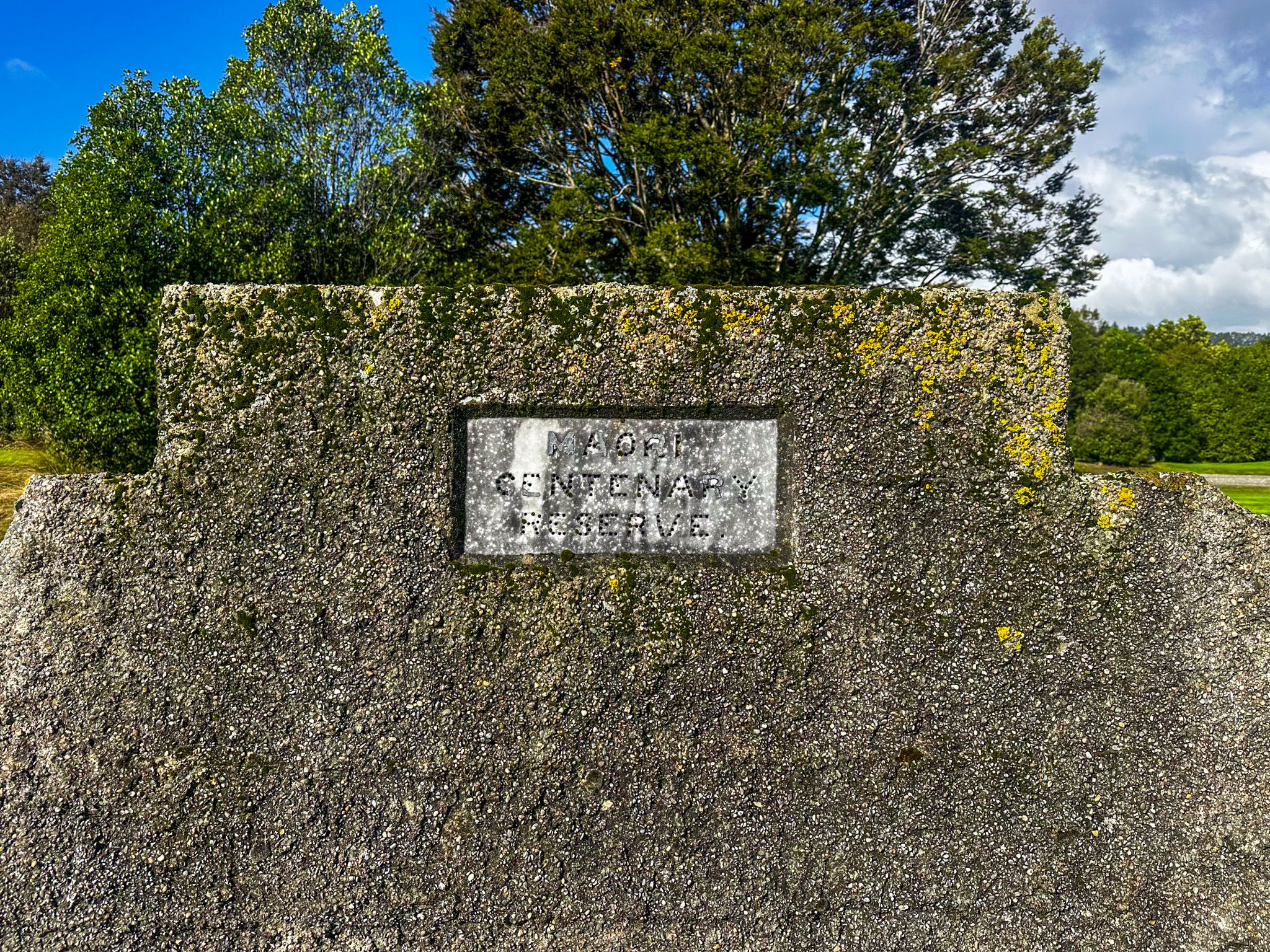
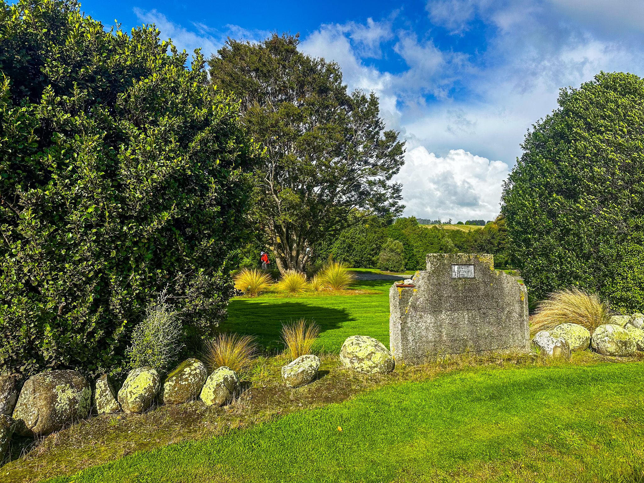
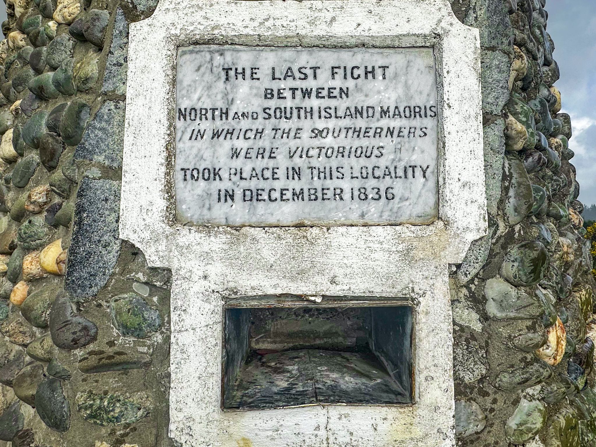
The Tūtūrau memorial was erected in 1937 to mark the centennial of the battle. It is a substantial concrete obelisk on a base built from stones sourced from around the South Island, including granite from Ruapuke Island itself. The inscription reads: "The last fight between North and South Island Maoris in which the southerners were victorious took place in this locality in December 1836." Neither Ngāi Tahu nor Ngāti Tama is named. It is the only substantial monument to the Musket Wars in the South Island. The battles it represents, the Elizabeth atrocity at Akaroa, Kaikōura, Kaiapohia and Ōnawe, the counter-raids of Tūhawaiki, reshaped the entire island.
Finding the Memorial
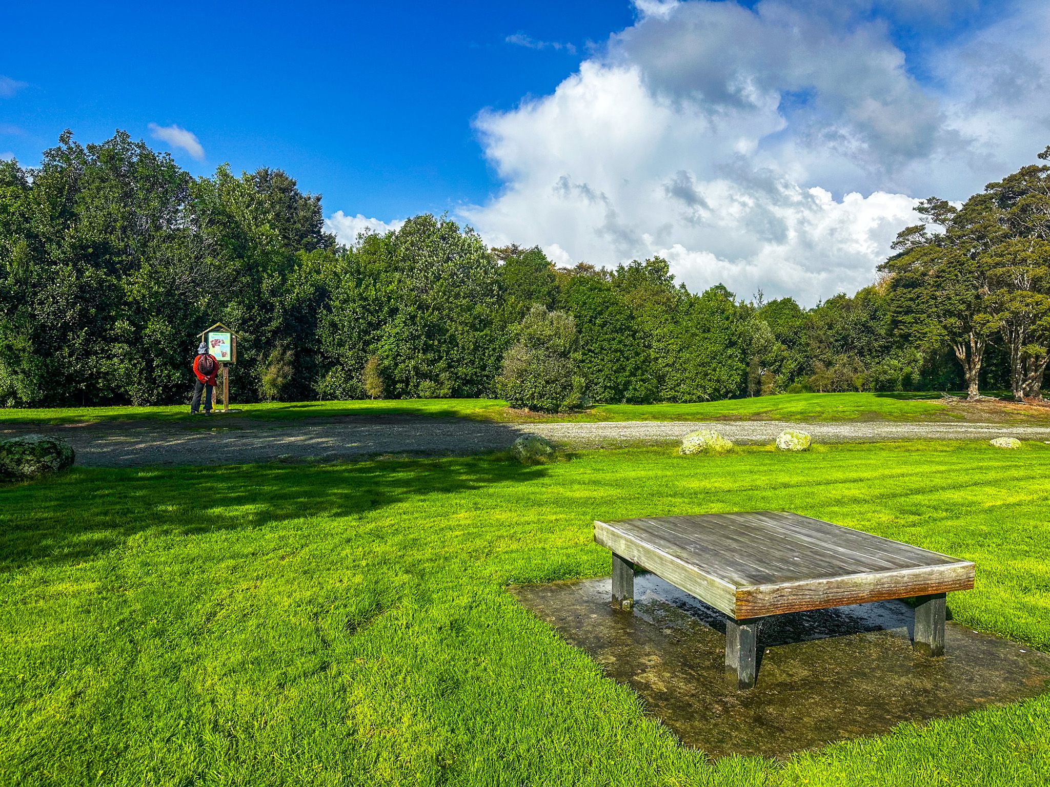
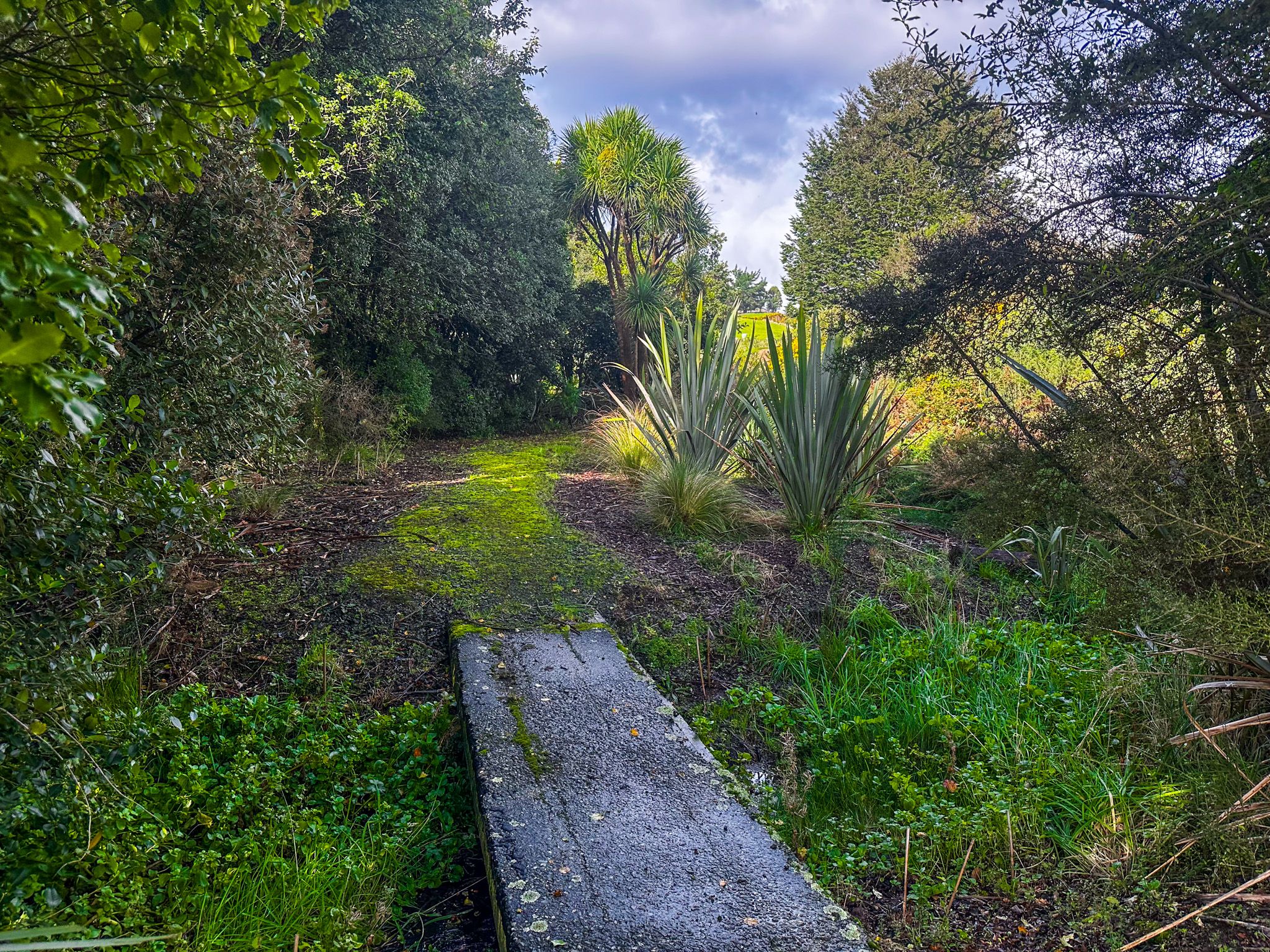
The memorial is at Tūtūrau, on Wyndham Road between Mataura and Wyndham. A small roadside reserve, the “Maori Memorial”, is signposted from the road, and an information panel describes the events. There is no signage or explanation of where the obelisk is, although you can see it on the hill from the road, and it is marked on Topo Map and Google Maps. Go through the gate at the rear of the reserve, then walk uphill across an open paddock of thistles and weeds to a better-maintained pasture with the obelisk. It is a quiet, largely unvisited site, but worth the effort to find it.
How to Get There
From Invercargill, drive northeast on State Highway 1 to Mataura. Cross the Mataura River on State Highway 93, then turn south onto Kana Road. This becomes Forth Street, then Wyndham Road. The roadside reserve and signpost are on the left, 55 km and a 41-minute drive from Invercargill.
Nearby places to visit include Gore, 13 km north. There you can discover the Old Hokonui Moonshine Museum and Distillery, the Eastern Southland Gallery, Delamore Park and the Whiskey Creek Track in the Hokonui Hills.