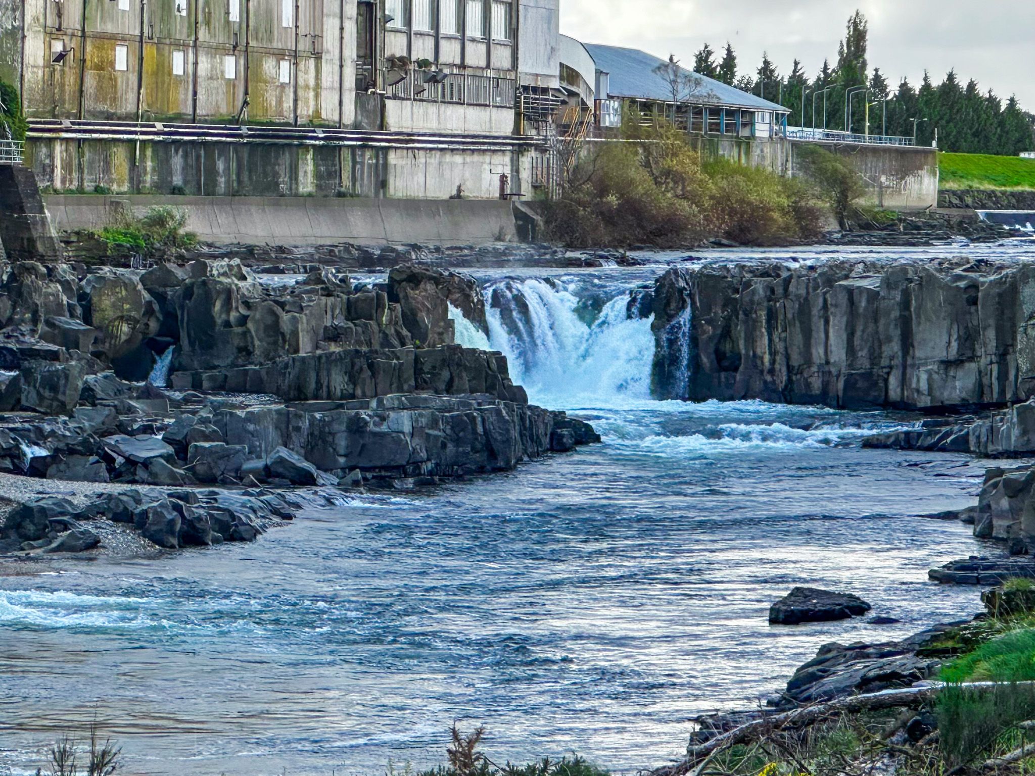
Walk onto the Bridge and Look North
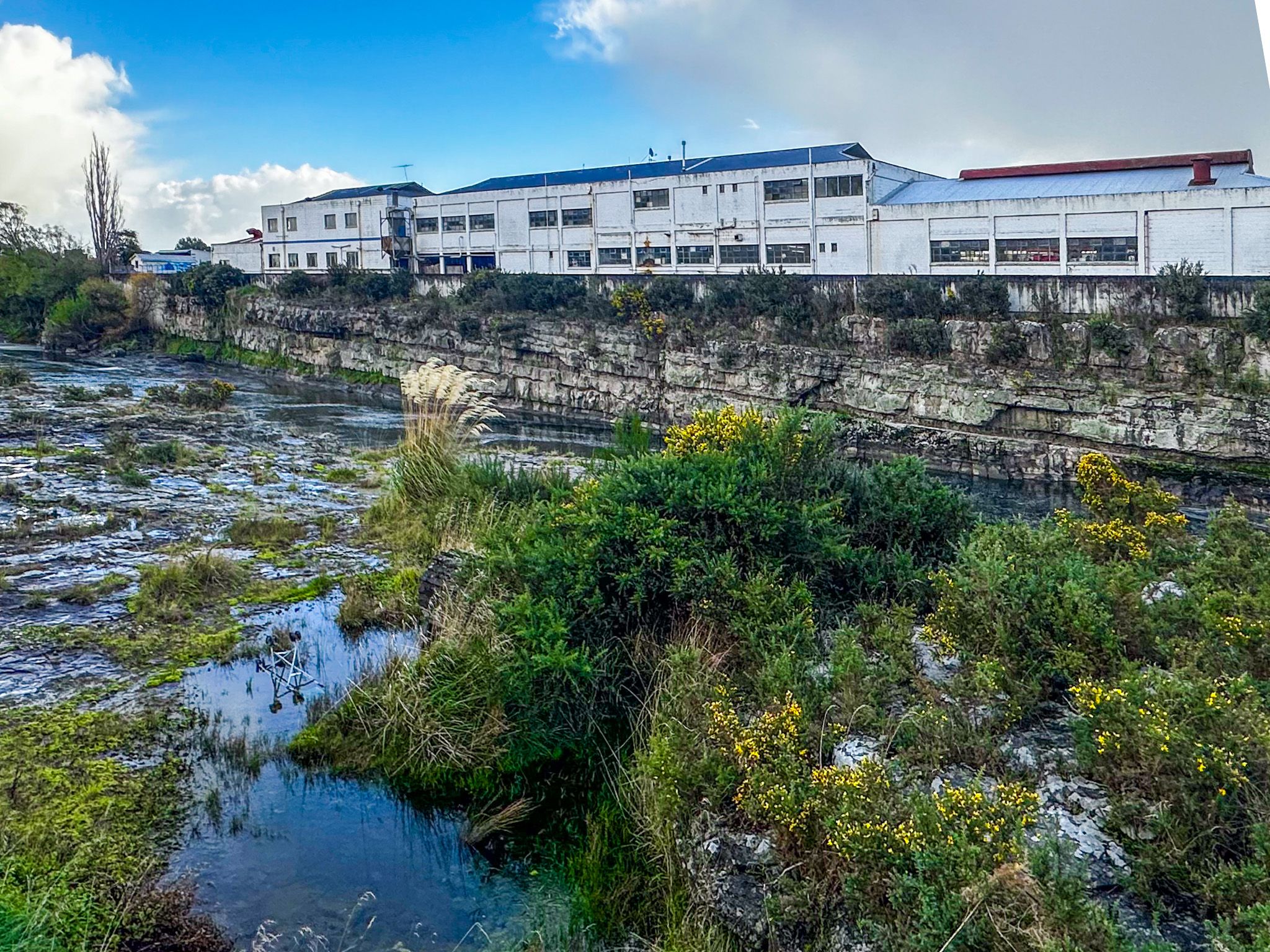
Mataura sits on State Highway 1, a short drive south of Gore and northeast of Invercargill, on the Mataura River. It is not a town that announces itself attractively: the main street has the worn, depleted look of a settlement that has absorbed significant economic blows without much investment in recovery. But walk onto the road bridge over the Mataura River and look north. A beautiful river gorge with a distant waterfall has long been dominated by enormous industrial complexes, by New Zealand standards, lining both sides of the river. The still-operating freezing works on the west bank and the silent hulk of the shuttered paper mill on the east look like something out of post-industrial Europe or the American rust belt. It is one of the most astonishing industrial landscapes in New Zealand, and largely ignored.
Te Aunui: The River and Its Falls
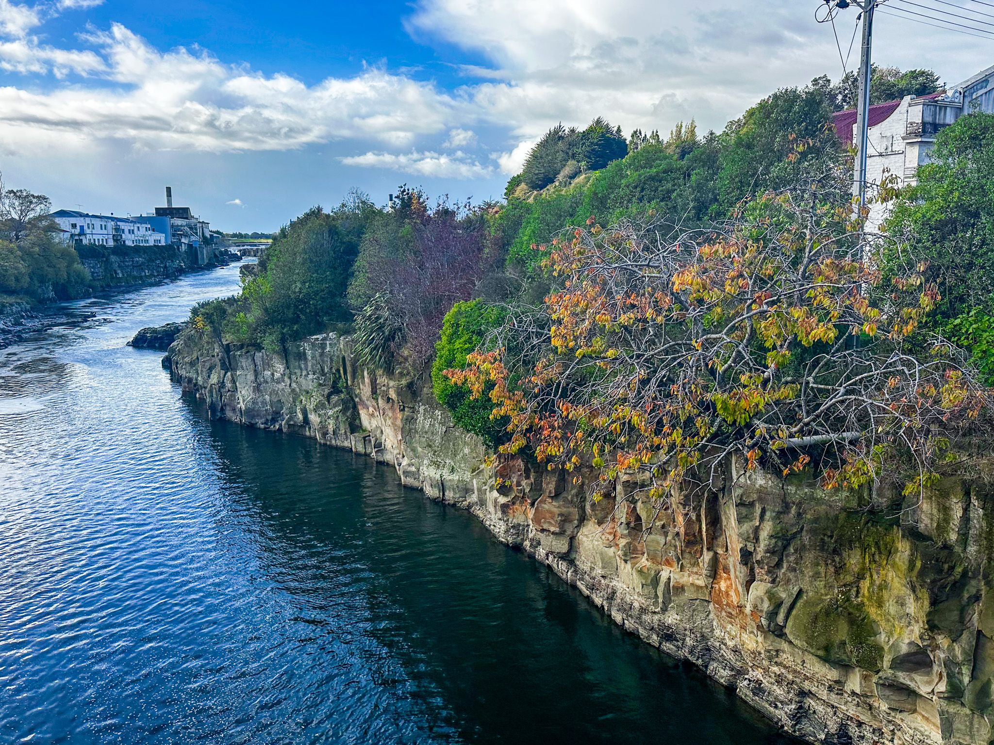
The Mataura River is 190 km long, rising in the Eyre Mountains, passing through Gore and reaching the sea at Fortrose on the Southland coast, at the western end of the Catlins. Its name comes from the Māori words mata (red) and ura (eddying), which describe the colour the water takes on from iron oxides in the upland swamps.
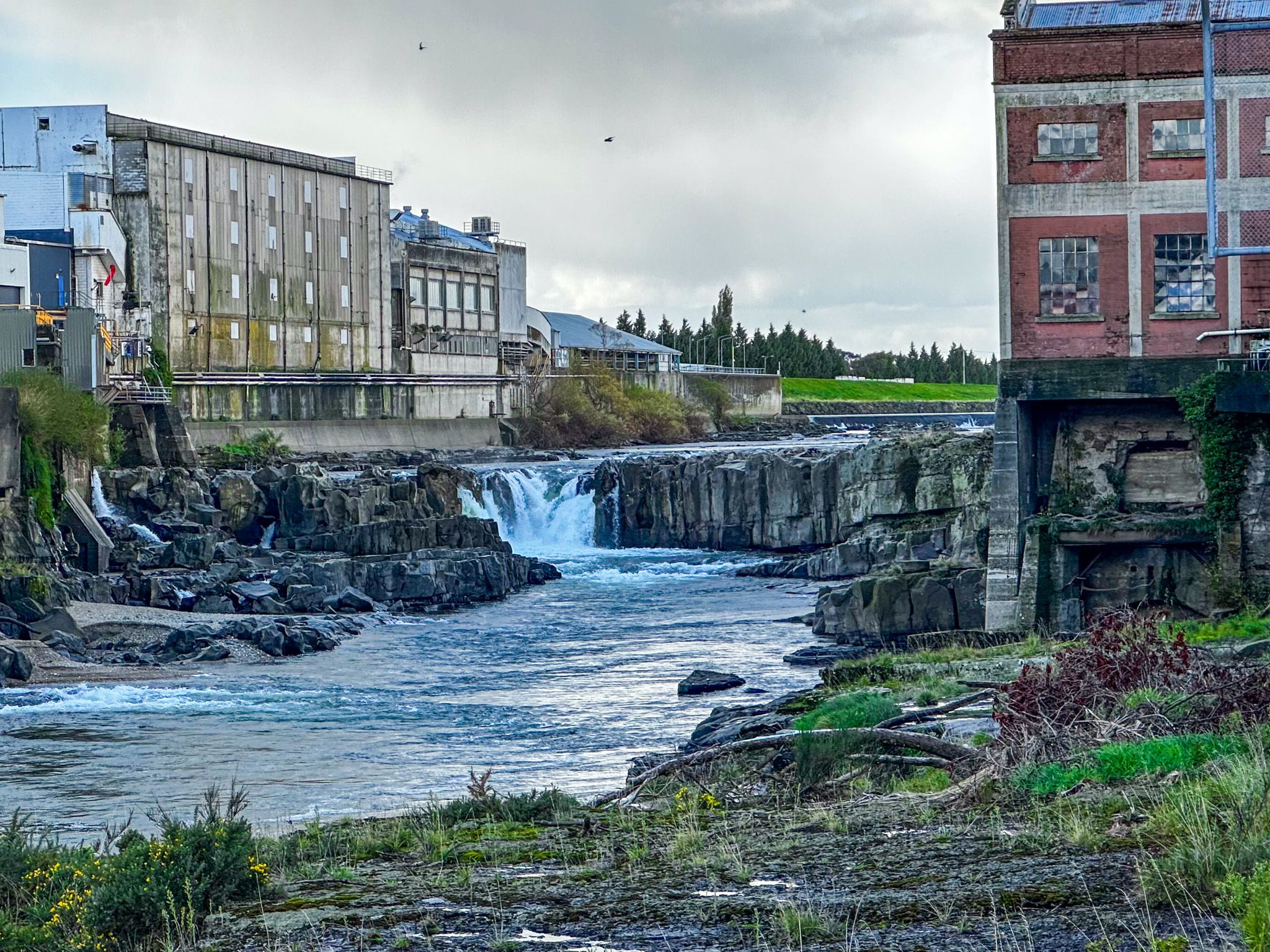
At the northern edge of the town, the river falls over a sandstone bed in what was once known as Te Aunui, meaning “great current,” with a substantial waterfall. This was a significant feature for Ngāi Tahu, who harvested lamprey (kanakana) and eels (tuna) from the falls and gorge in large numbers. The falls were declared a mātaitai reserve in 2006, the first freshwater mātaitai reserve in New Zealand, recognising Ngāi Tahu's traditional role in managing this stretch of river. However, the industrial complexes remain.
The Industrial Transformation
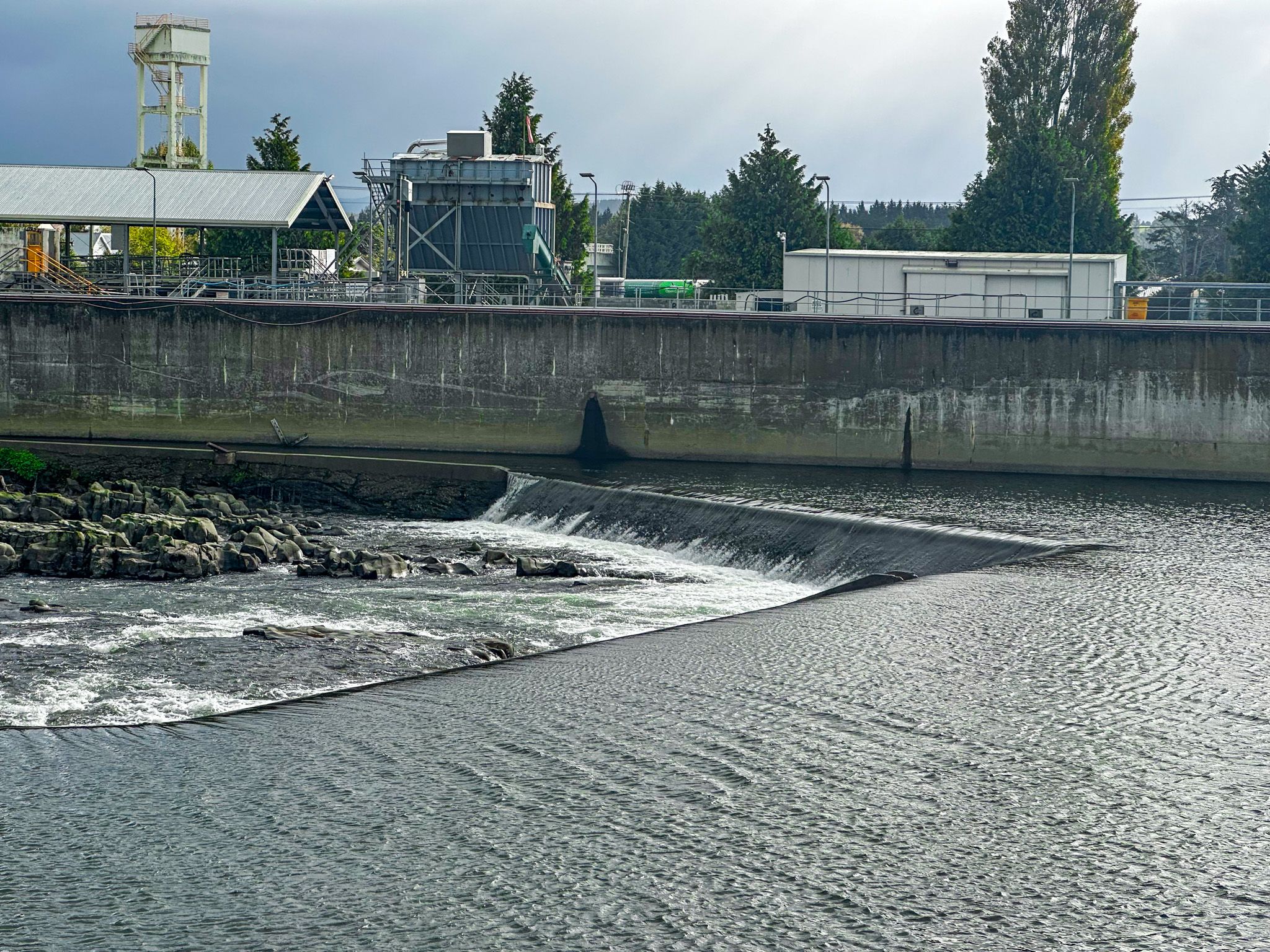
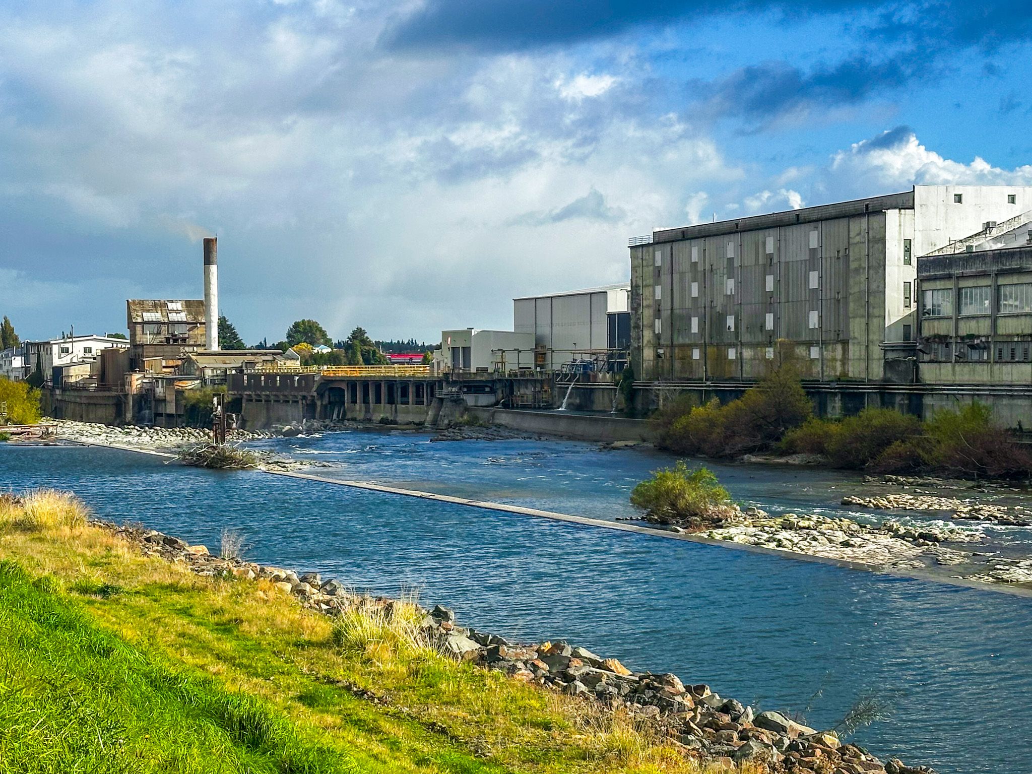
The story of what happened to Te Aunui from the 1870s onward is one of the most concentrated examples of nineteenth-century industrial extraction in New Zealand. In 1876, James Bain of Invercargill established the Mataura Paper Mill on the east bank of the river, downstream of the falls, using the water head to drive hydro generators. In 1882, the Southland Frozen Meat and Produce Export Company purchased land on the west bank and opened Southland's second freezing works in 1893.
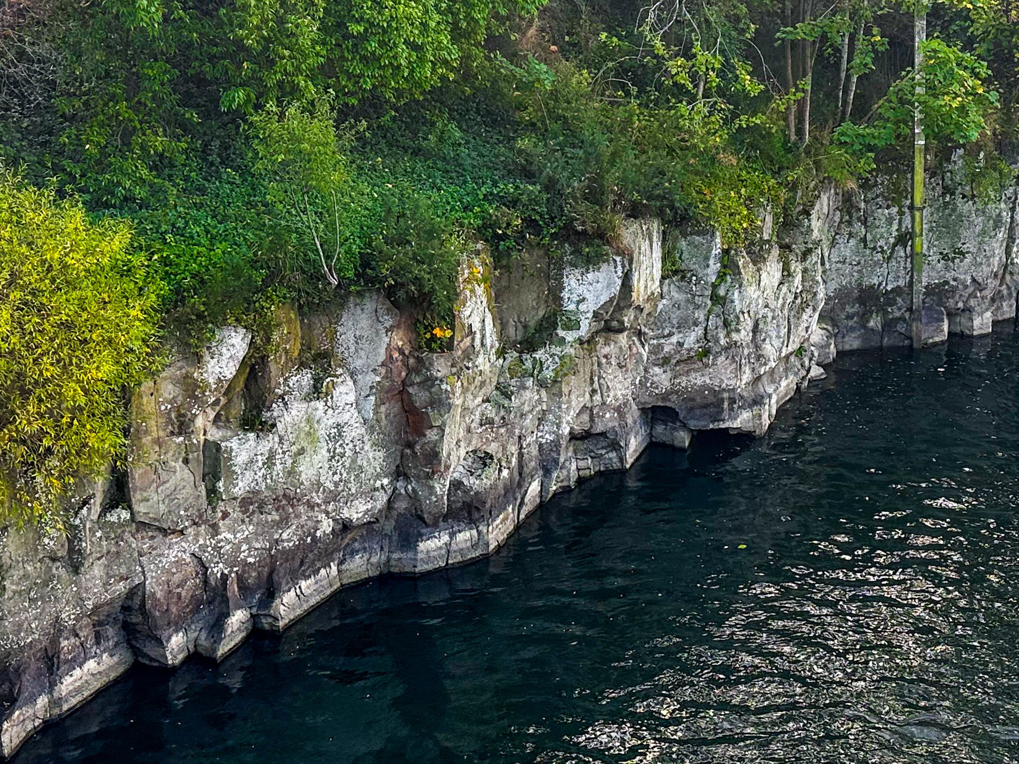
To supply water to both operations, the paper mill and the freezing works jointly built a weir in 1891, designed by engineer Nathaniel Wales, later mayor of Dunedin, that diverted the river into two hydro races, one serving each side. To improve water flow into those races, the falls themselves were blasted. Fifteen metres were removed from the top of Te Aunui, despite which, the falls are still significant. The gorge walls and the rocks below the falls survived, and kanakana, remarkably, adapted and continued returning to spawn.
The Paper Mill: Rise and Abandonment
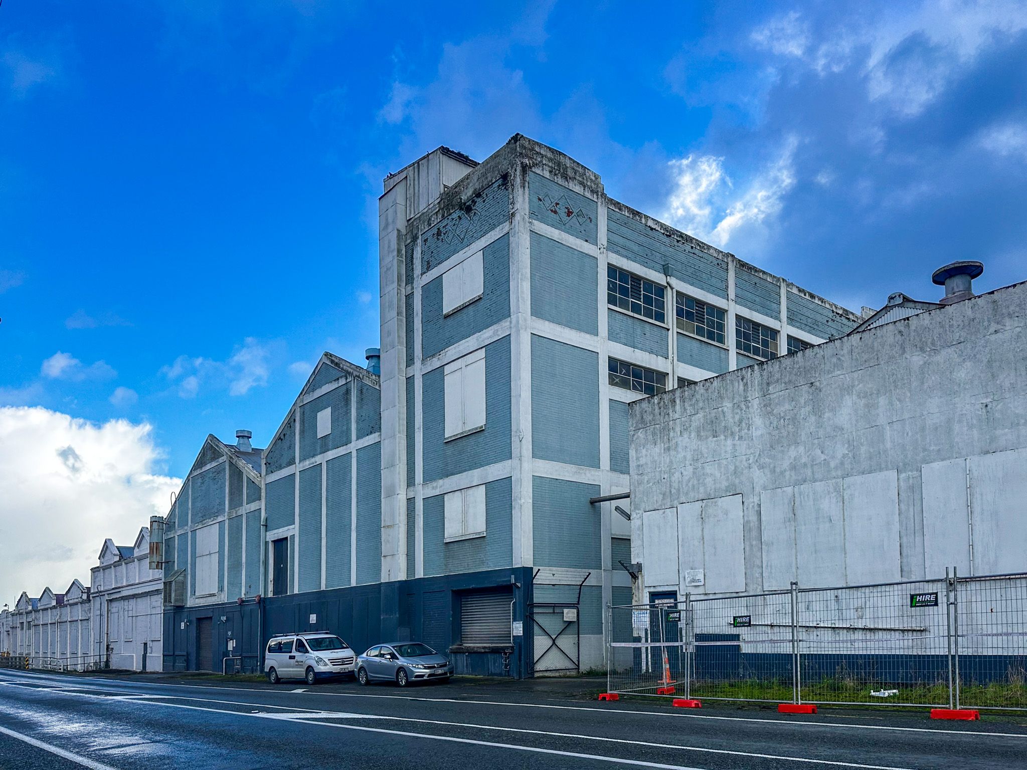
The Mataura Paper Mill grew into the most significant paper-making operation in the South Island, eventually operating as part of Carter Holt Harvey. At its peak, it employed hundreds of workers and was central to the town's economic and social life. Decades of gradual decline followed as the mill was never large enough to compete effectively with offshore production. In August 2000, Carter Holt Harvey closed the mill, bringing an end to paper making in the South Island.
However, the buildings were not demolished. They remain on the east bank of the river: a vast, deteriorating complex of industrial structures, their scale still impressive and their condition increasingly ruinous. The freezing works on the west bank continue to operate under Alliance Group.
Toxic Legacy and Slow Recovery
To add insult to injury, the abandoned mill site became the focus of a serious environmental crisis when a company contracted to handle waste from the Tiwai Point aluminium smelter moved more than 10,000 tonnes of ouvea premix, an aluminium dross that releases toxic ammonia gas when wet, into the empty buildings without permission. The company subsequently went broke, leaving a major problem unresolved.
The site, beside a river prone to flooding, held this material for years while legal battles over responsibility were fought. Sued by the Environmental Defence Society, the New Zealand government and New Zealand Aluminium Smelters eventually shared the cost of removal. In 2021, all the material was returned to the smelter at Tiwai Point for storage. No remediation plan for the site has been publicly announced.
In the meantime, Ngāi Tahu, through Hokonui Rūnanga, continues to work toward restoring the river's health, supporting the return of eels and kanakana.
What to See
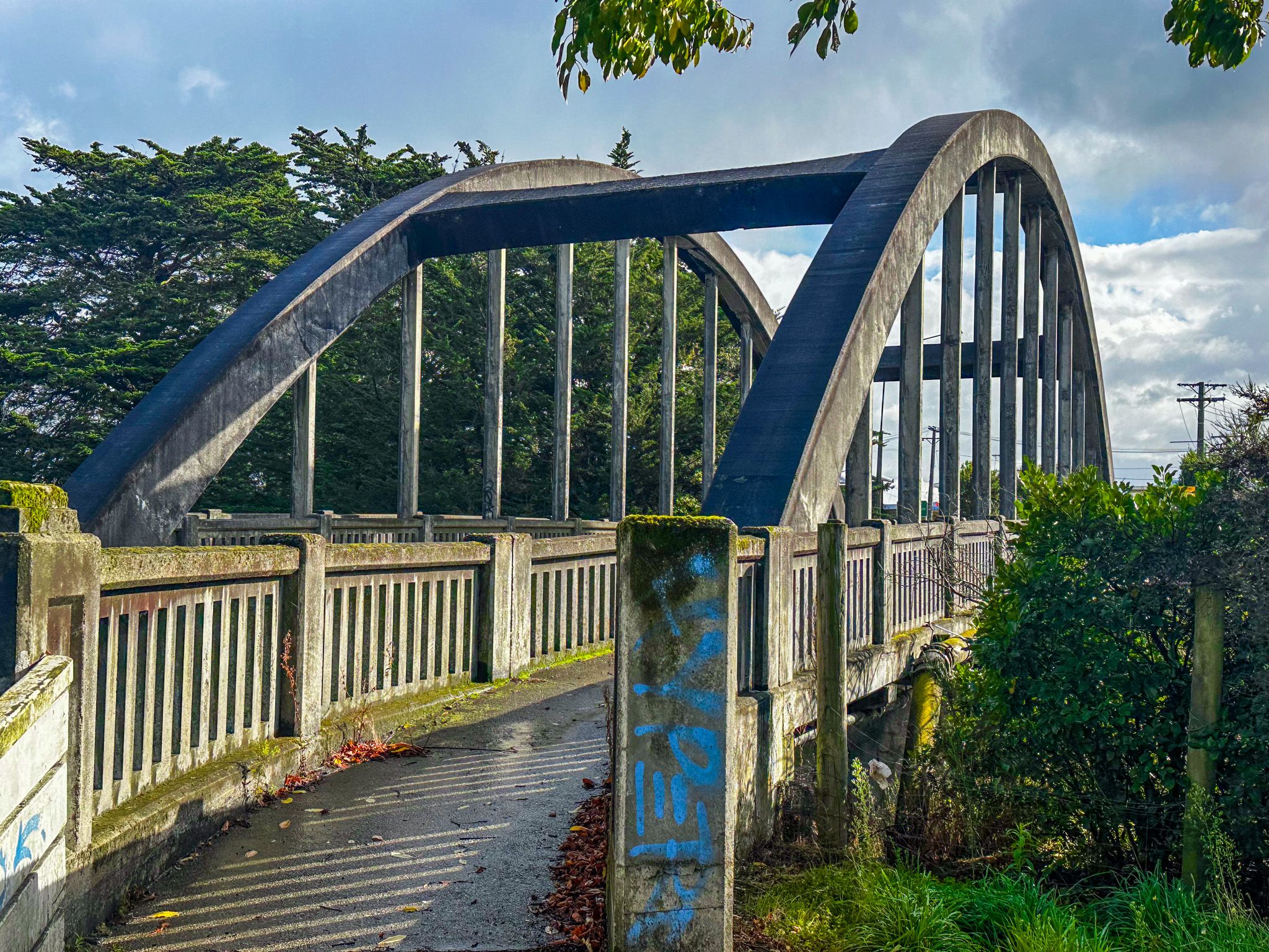
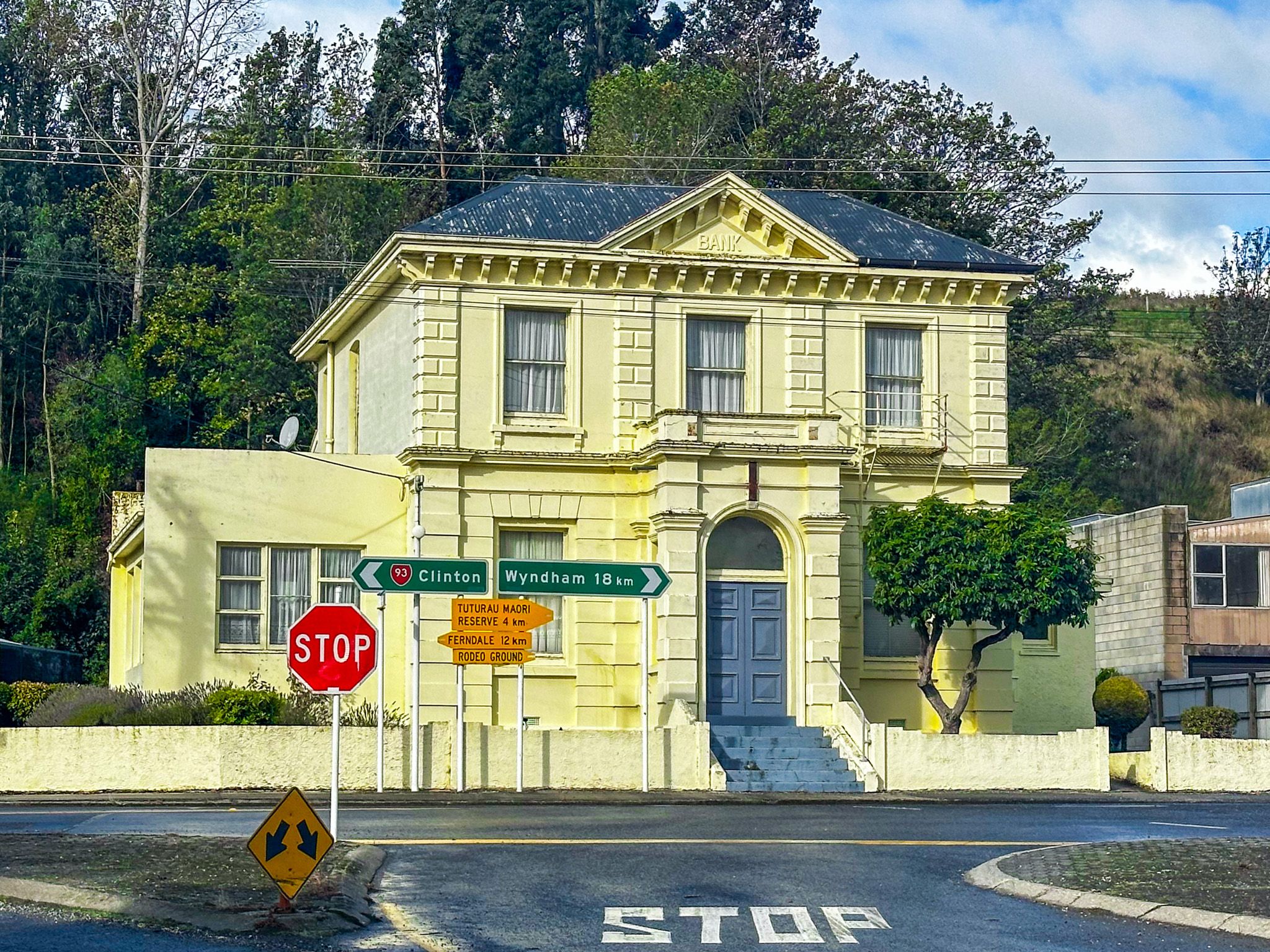
The main bridge over the Mataura River on State Highway 1, a single-span reinforced-concrete bow-arch bridge that opened in 1939, provides the most immediate view of the industrial landscape to the north, on either side of the reduced falls and gorge. Access to the falls is blocked by the buildings, but there is an unmarked car park south of the old mill buildings with a better view of the waterfall. Access is off Kana Street, State Highway 93, heading towards Clinton.
The race channels and weir can be seen from the embankment on the east side of the river, north of the mill complex. From State Highway 93, turn west onto Eden Street and park. The embankment will be in front of you, and you should be able to find steps over the fence. You can walk towards the end of the mill complex on the top of the embankment.
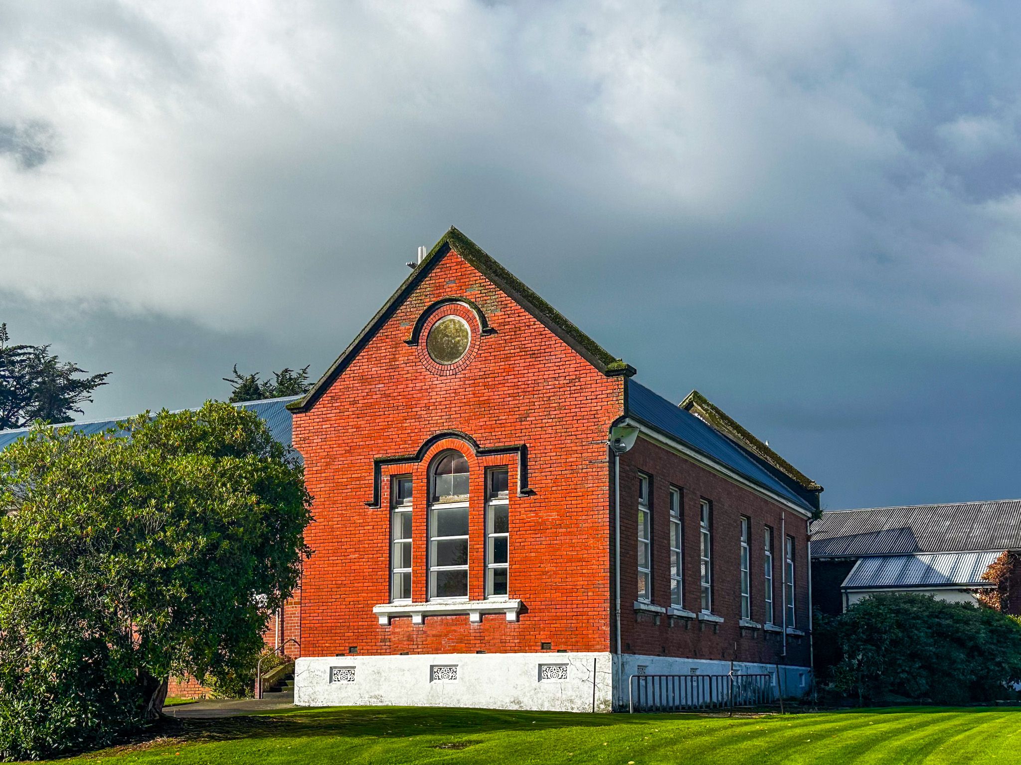
There is also the Mataura Museum, housed in an 1880s cottage on the southeast side of town on Kana Street, south of the bridge, which holds a photographic and archival collection documenting the paper mill and freezing works from the 1870s onward. It is open Friday to Sunday afternoons and is staffed by local volunteers.
How to Get There
Mataura is on State Highway 1, 13 km south of Gore and 53 km northeast of Invercargill. The bridge and river views are at the centre of the town. The Mataura Museum is on the east side of the river on Mataura Terrace. Parking is available on the main street and near the bridge.
Nearby places to visit include Gore, 13 km north. There you can discover the Old Hokonui Moonshine Museum and Distillery, the Eastern Southland Gallery, Delamore Park and the Whiskey Creek Track in the Hokonui Hills. To the south, a short distance on Wyndham Road, is the Tūtūrau Māori Memorial.