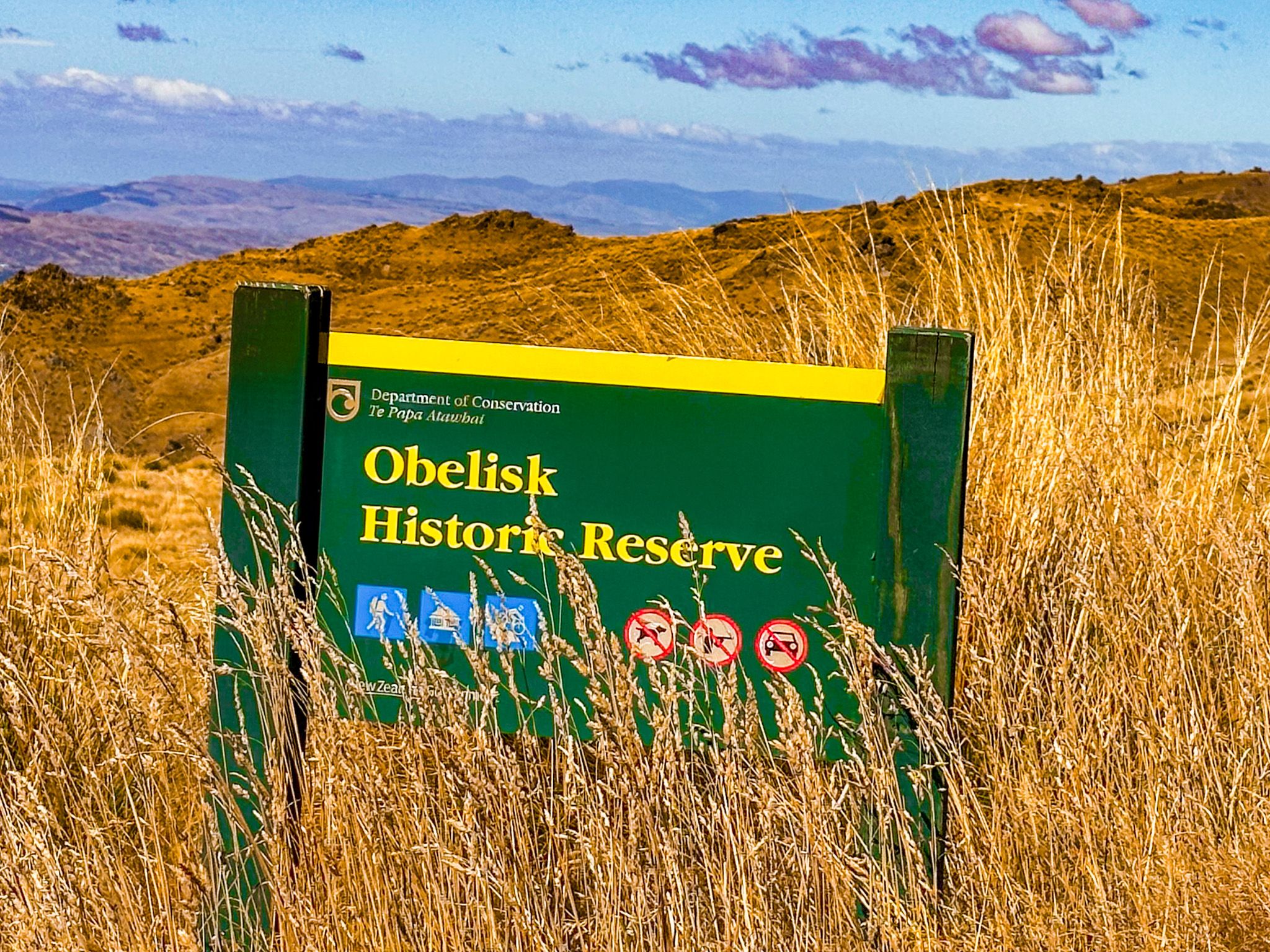
Discover Obelisk / Kōpūwai Conservation Reserve
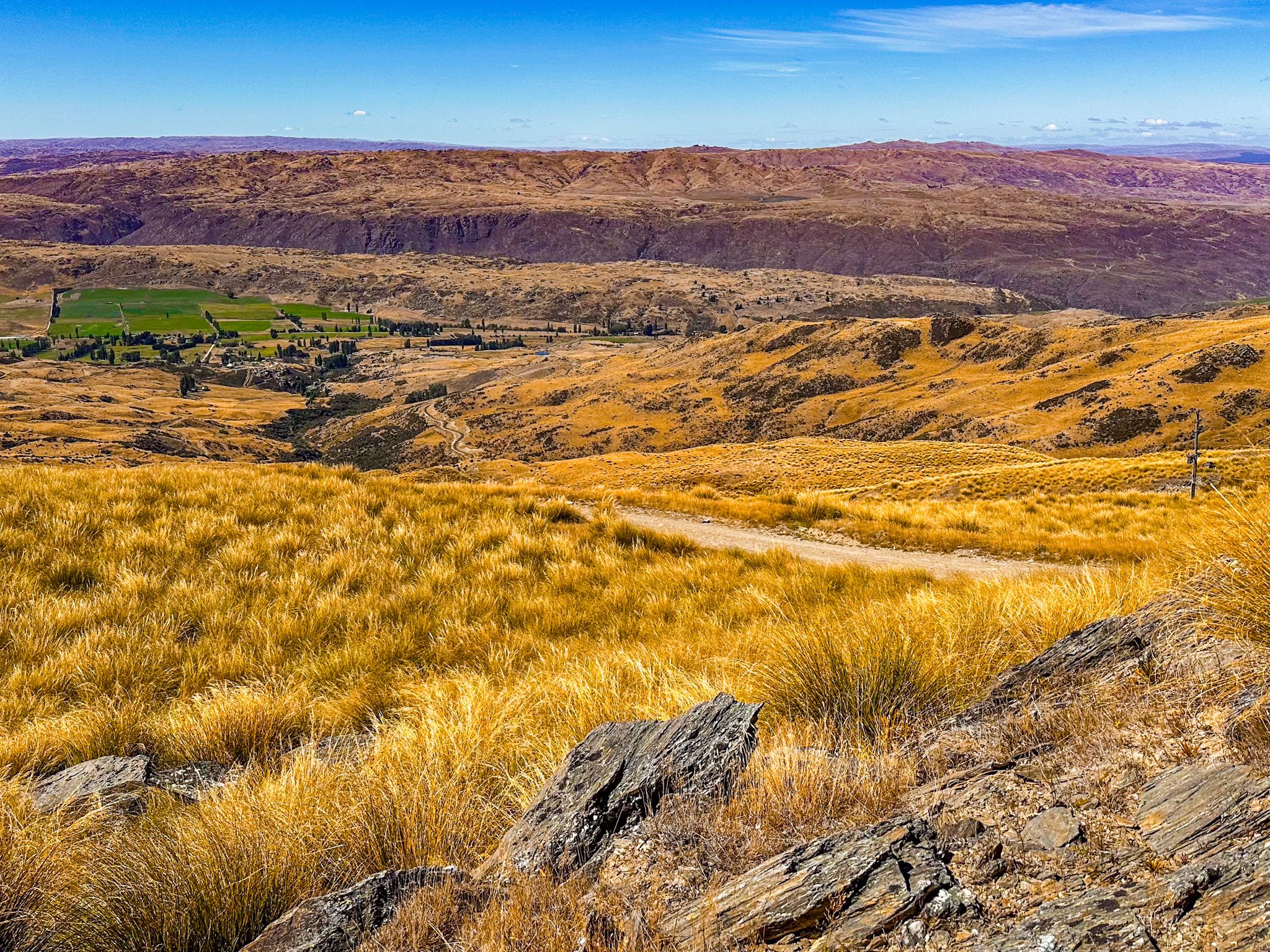
High above the Clutha Valley, the Obelisk / Kōpūwai Conservation Reserve offers panoramic views, unusual rock formations, and an otherworldly landscape of alpine tussock and schist. Accessible via Symes Road from State Highway 8 near Fruitlands, this subalpine to alpine reserve marks the highest point of the Old Man Range that’s reachable by most 2WD vehicles.
Schist Tors and High Country Views
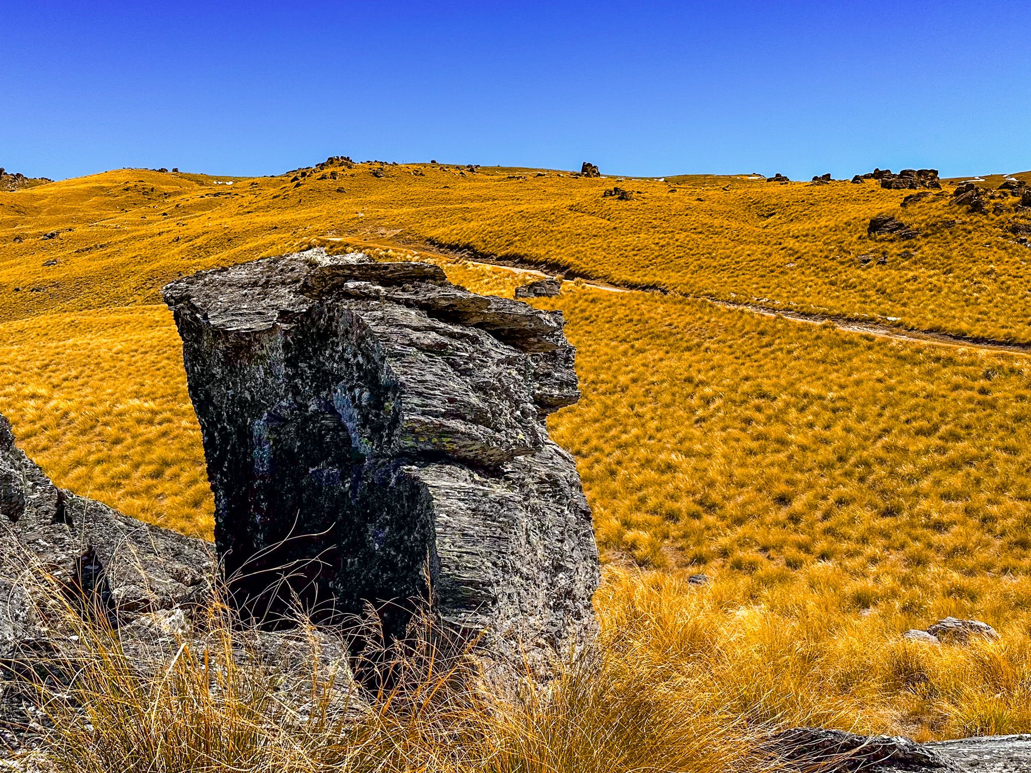
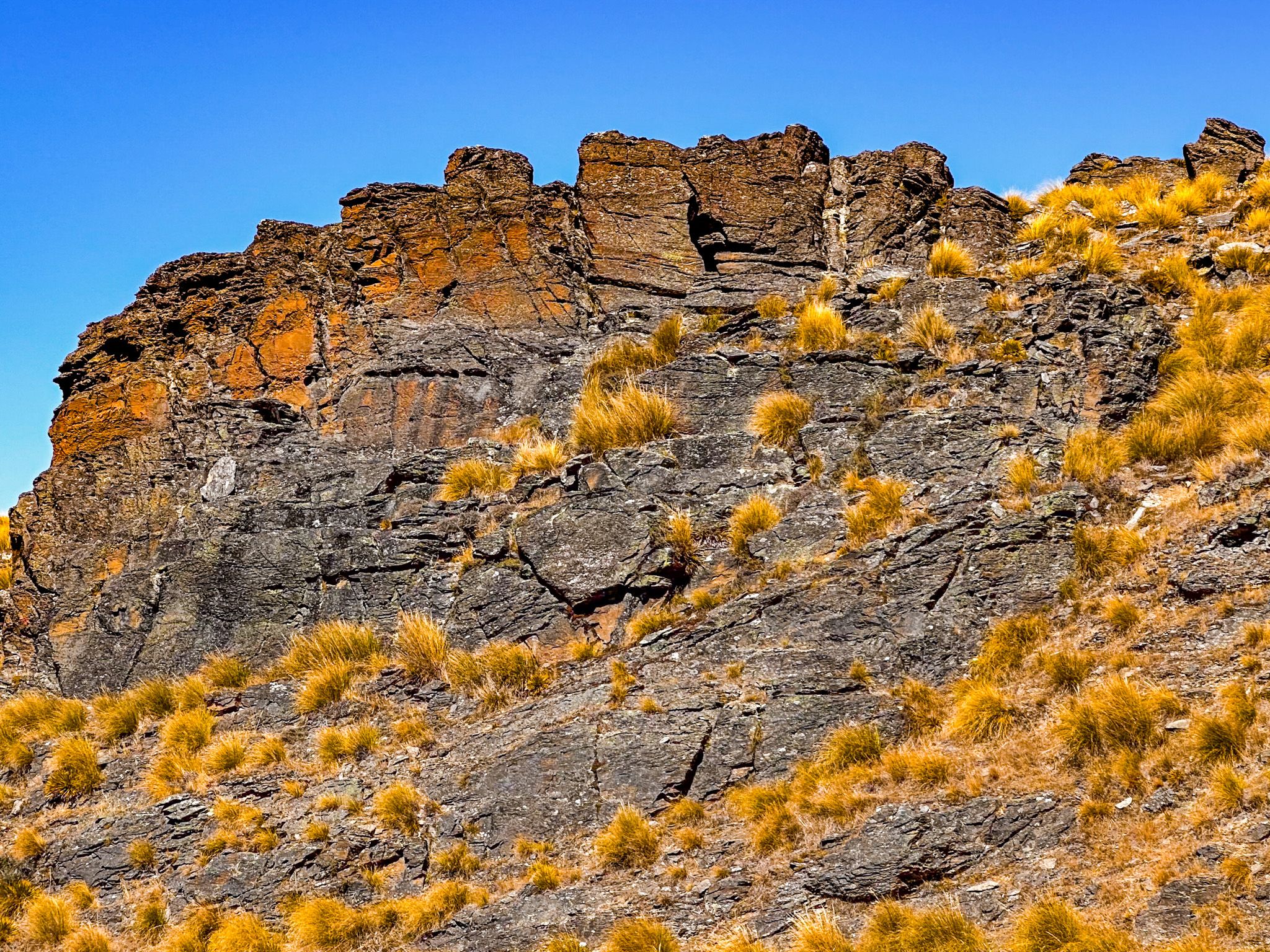
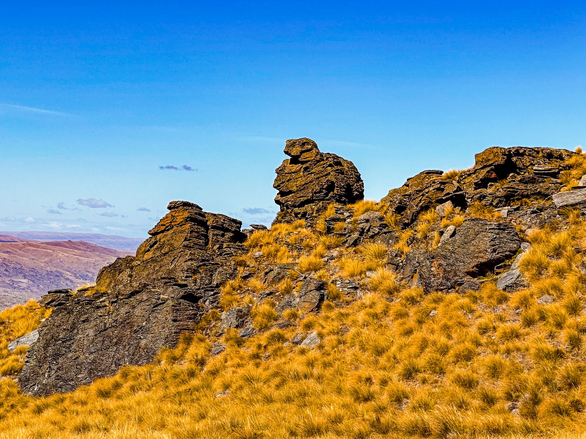
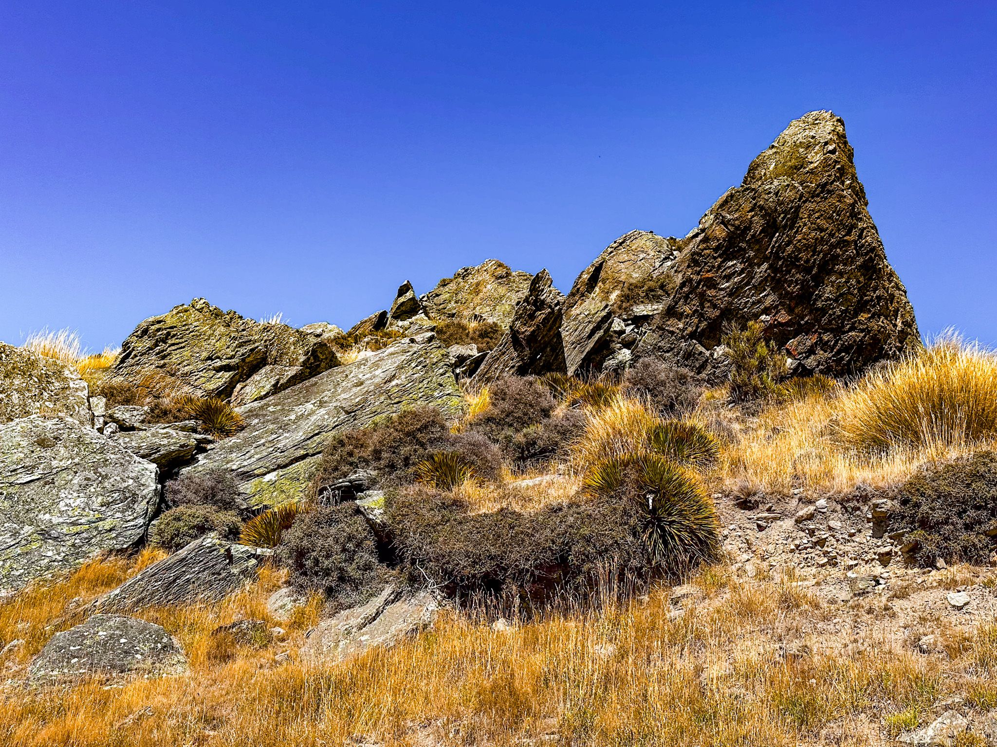
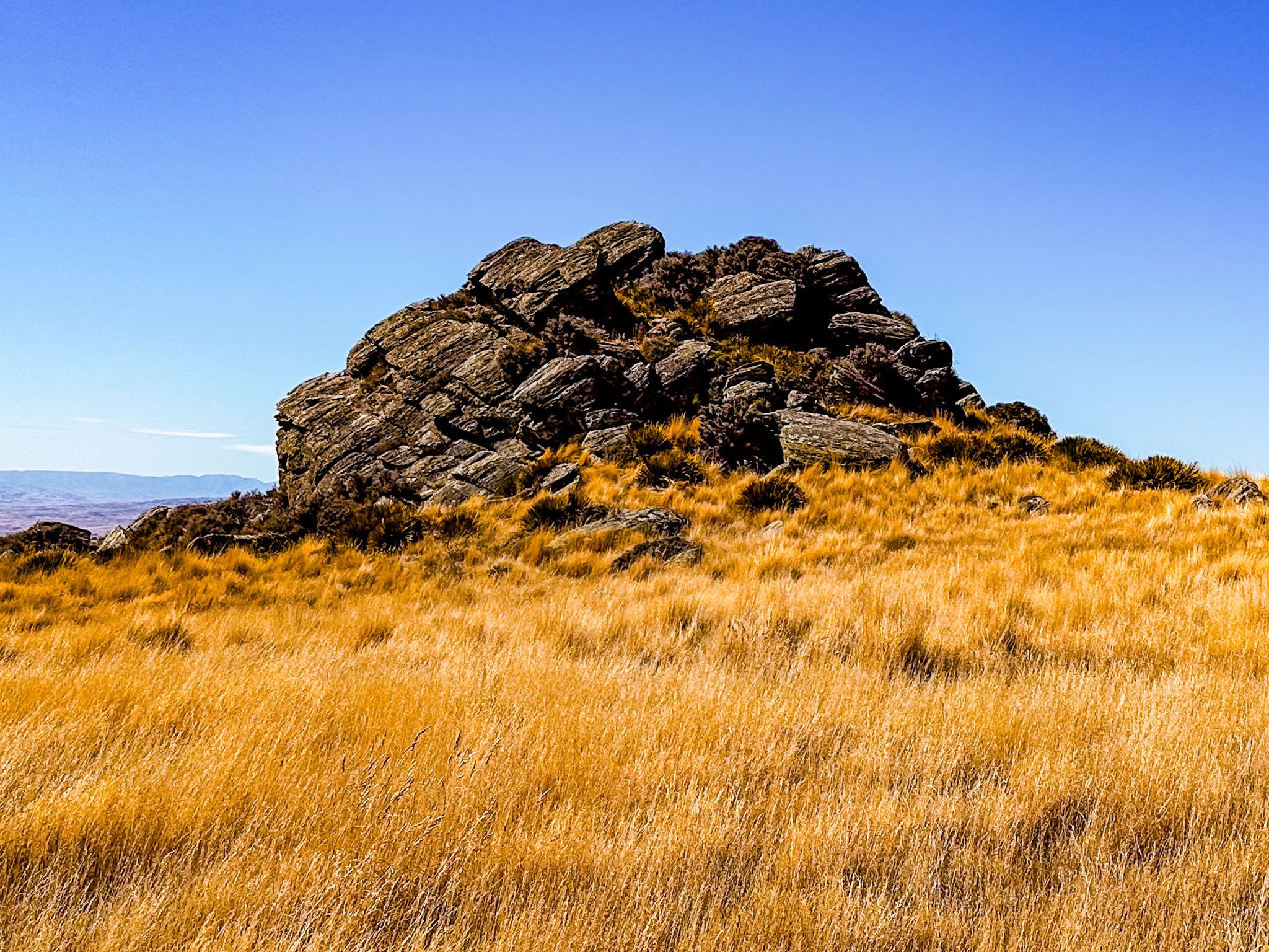
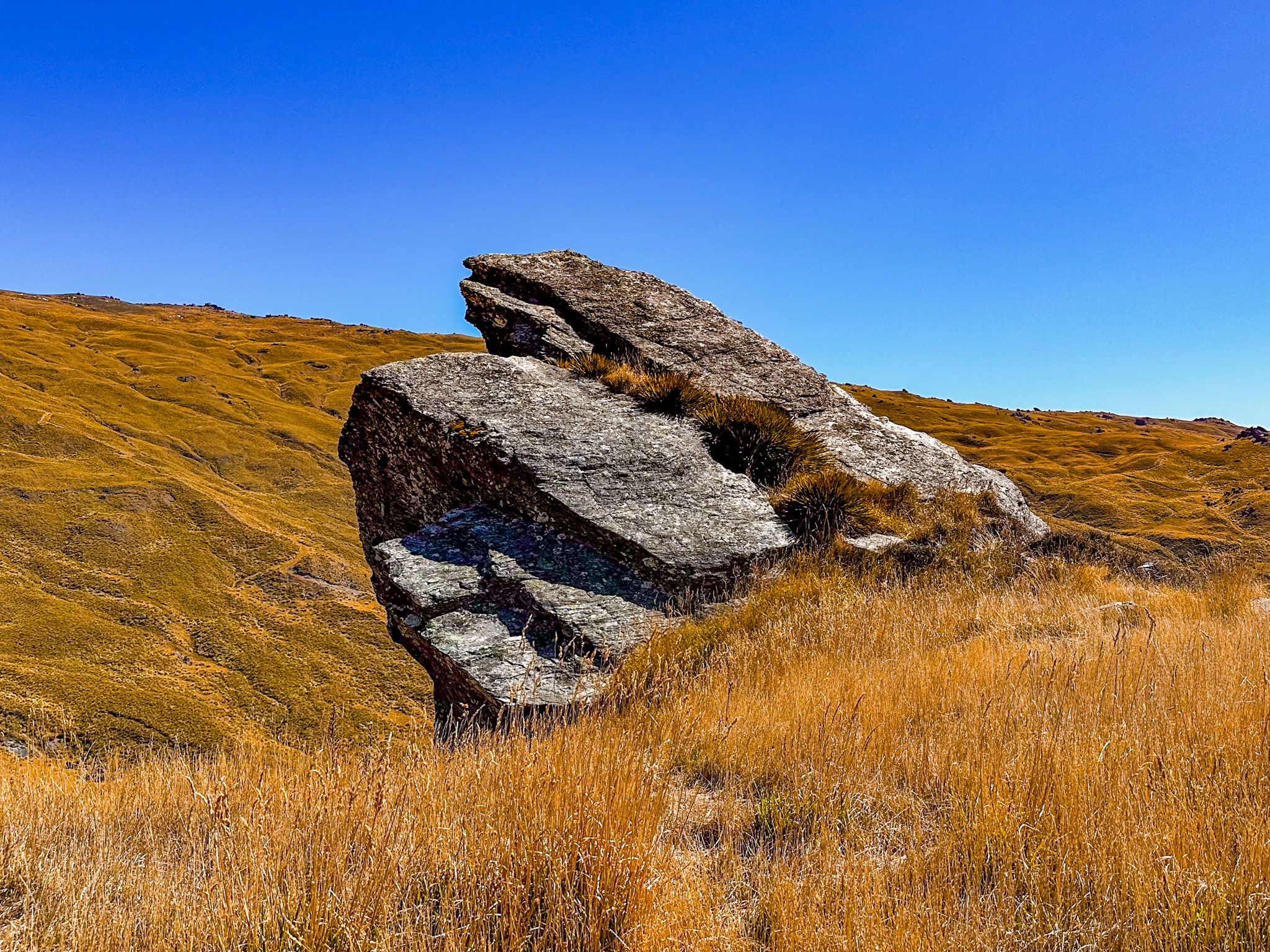
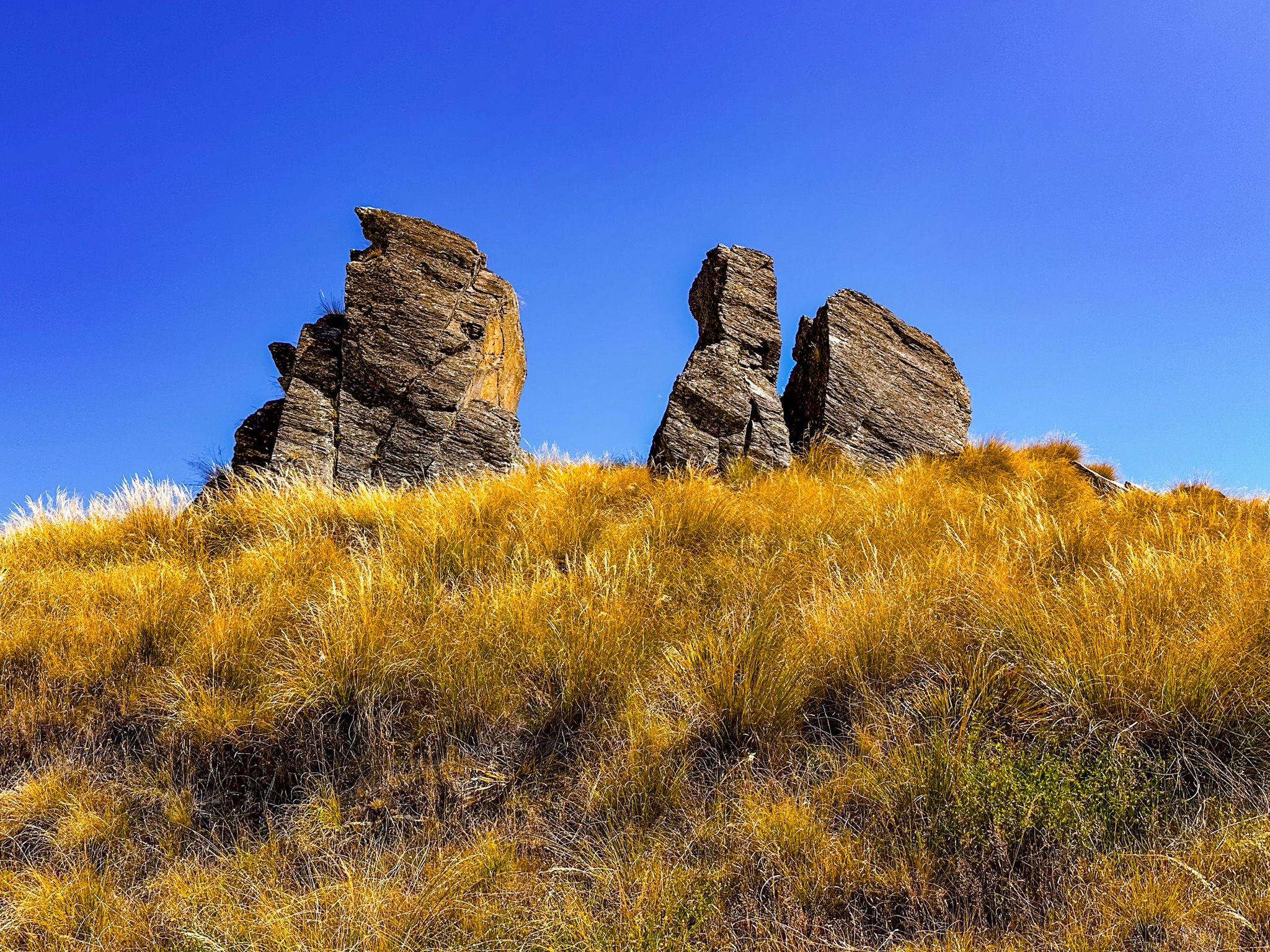
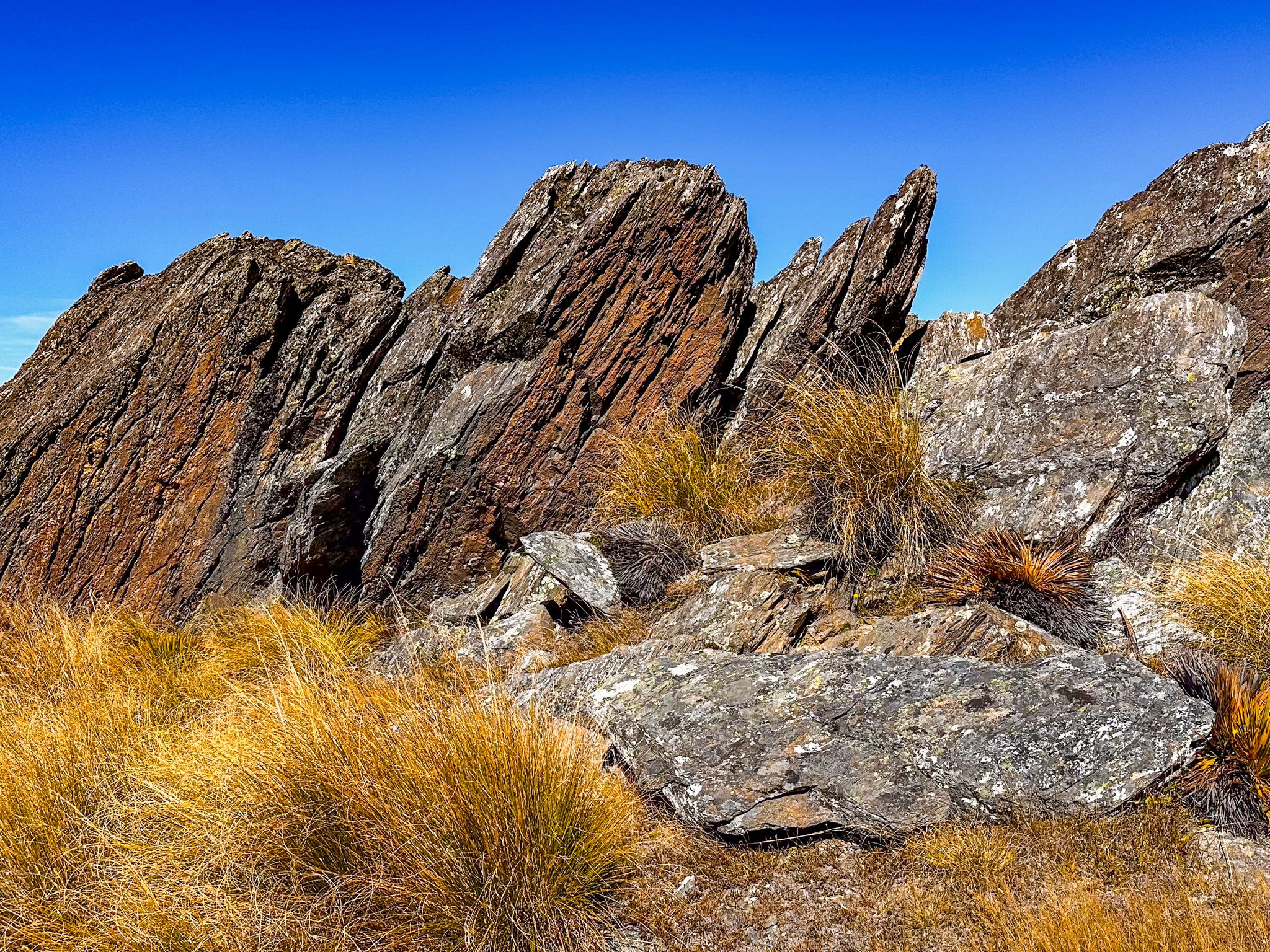
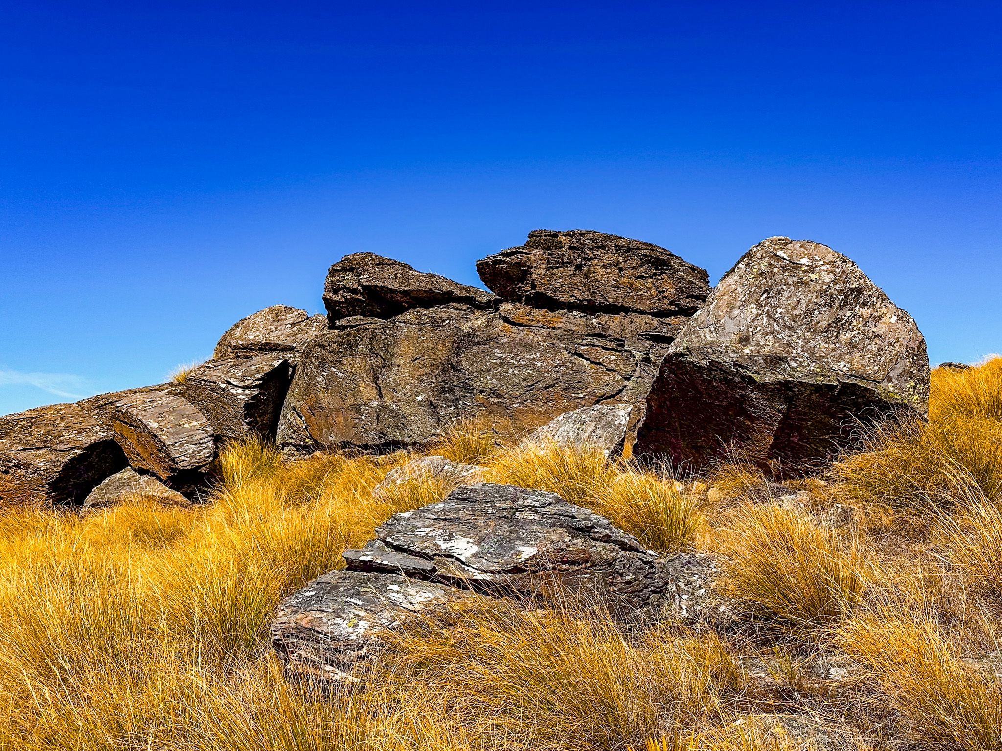
The defining feature here is the Obelisk, or Kōpūwai — a 26-metre-high pillar of eroded schist that stands like a sentinel near the summit ridge. The rock is part of a group of tors that dot the plateau, shaped over millennia by frost and wind. Some resemble stacked slabs or weathered towers, while others lean and twist into abstract forms.
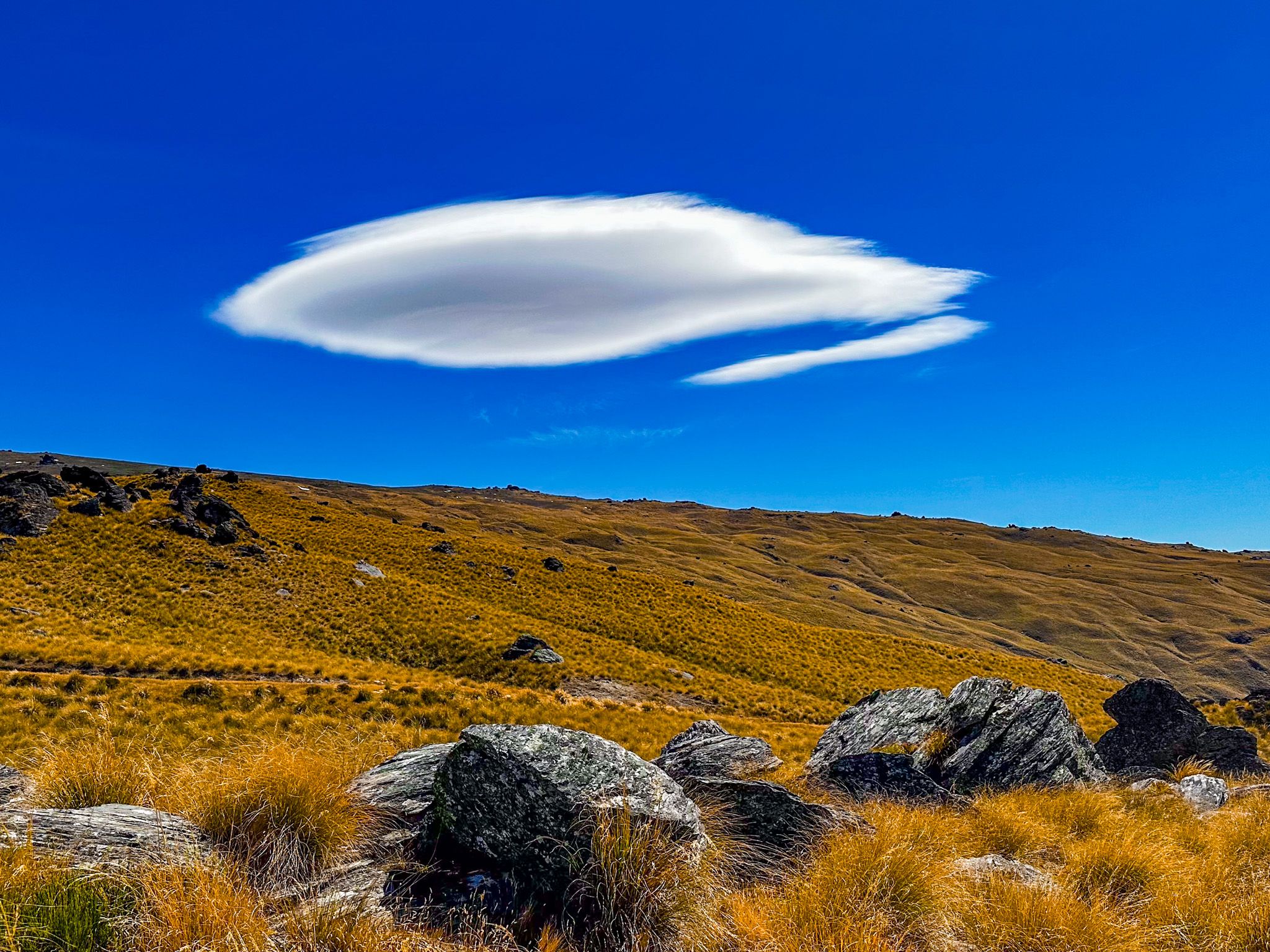
From here, you can look south over the Teviot Valley, east across the Clutha Basin, and west toward the Remarkables and the distant Southern Alps. The landscape is dry, exposed, and often silent but for wind and occasional birds.
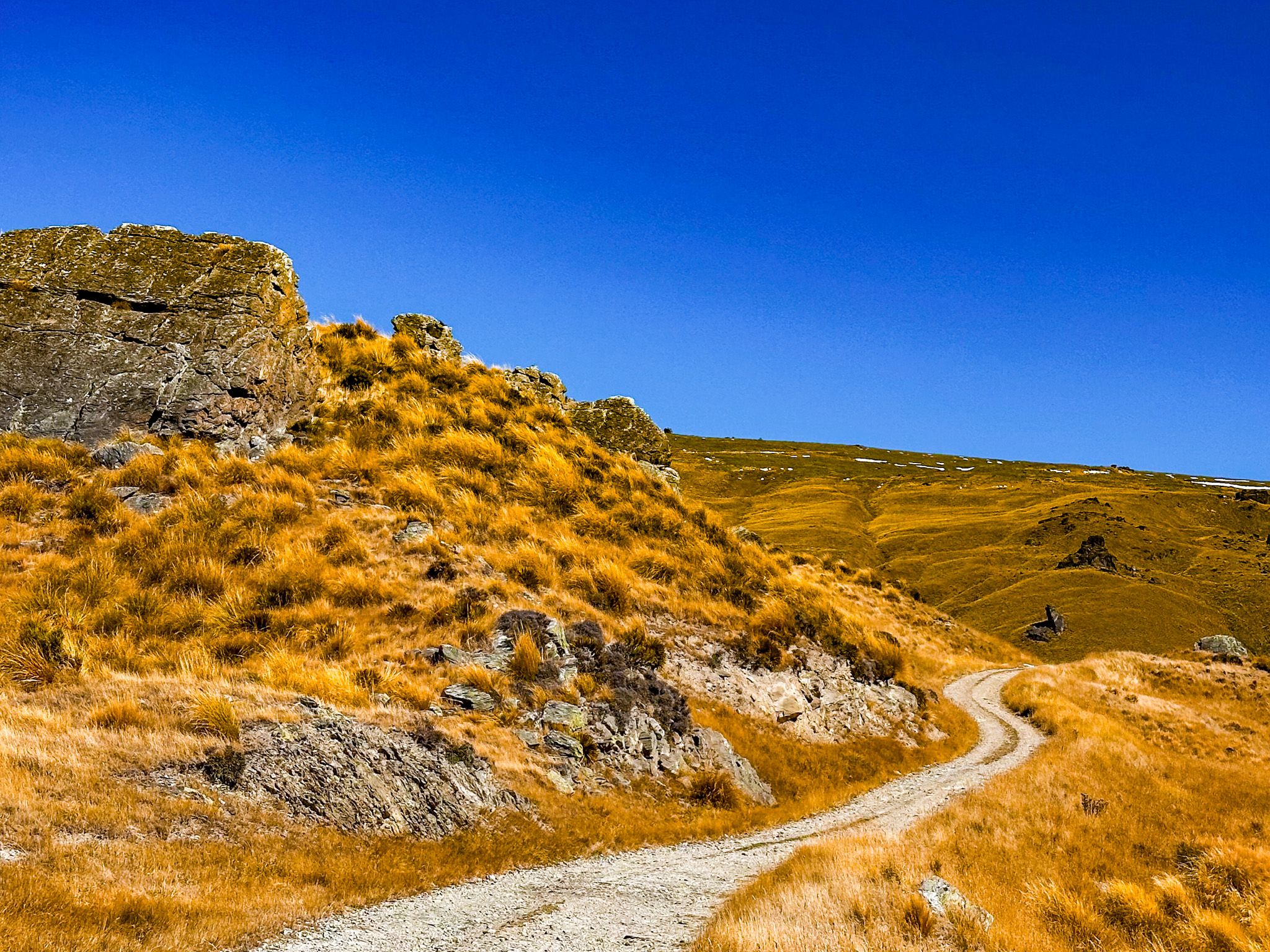
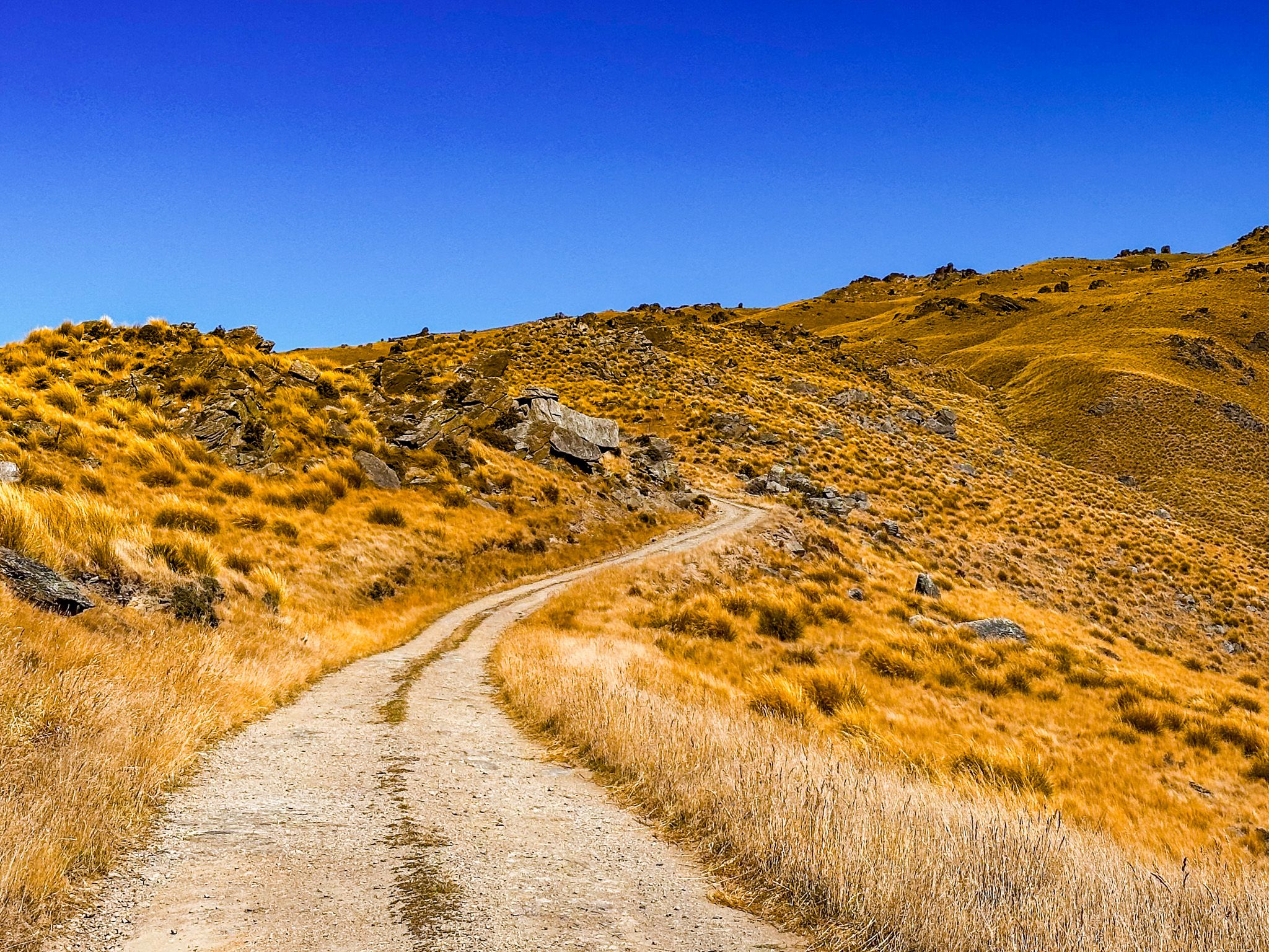
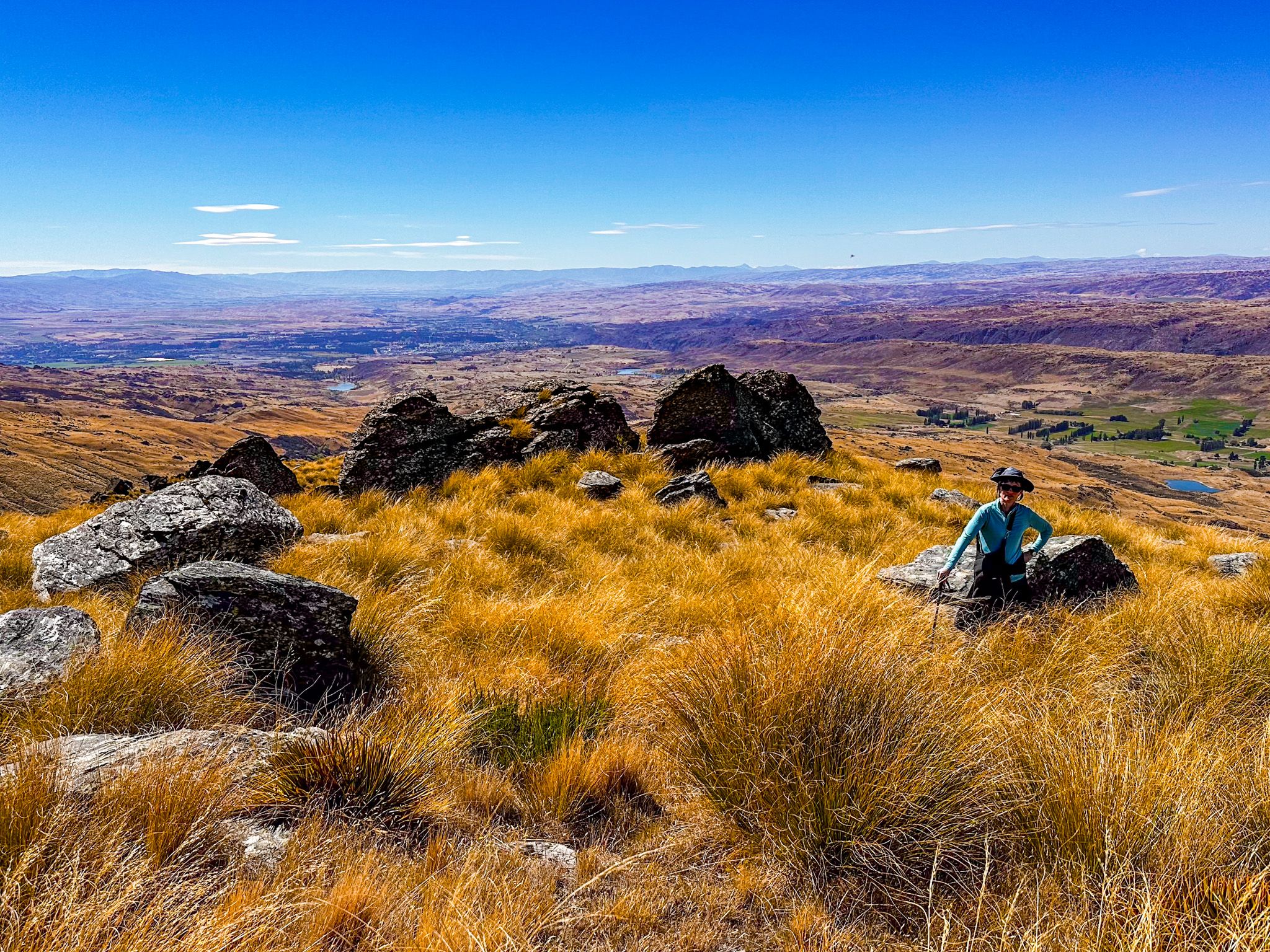
Loop Track and Short Walks
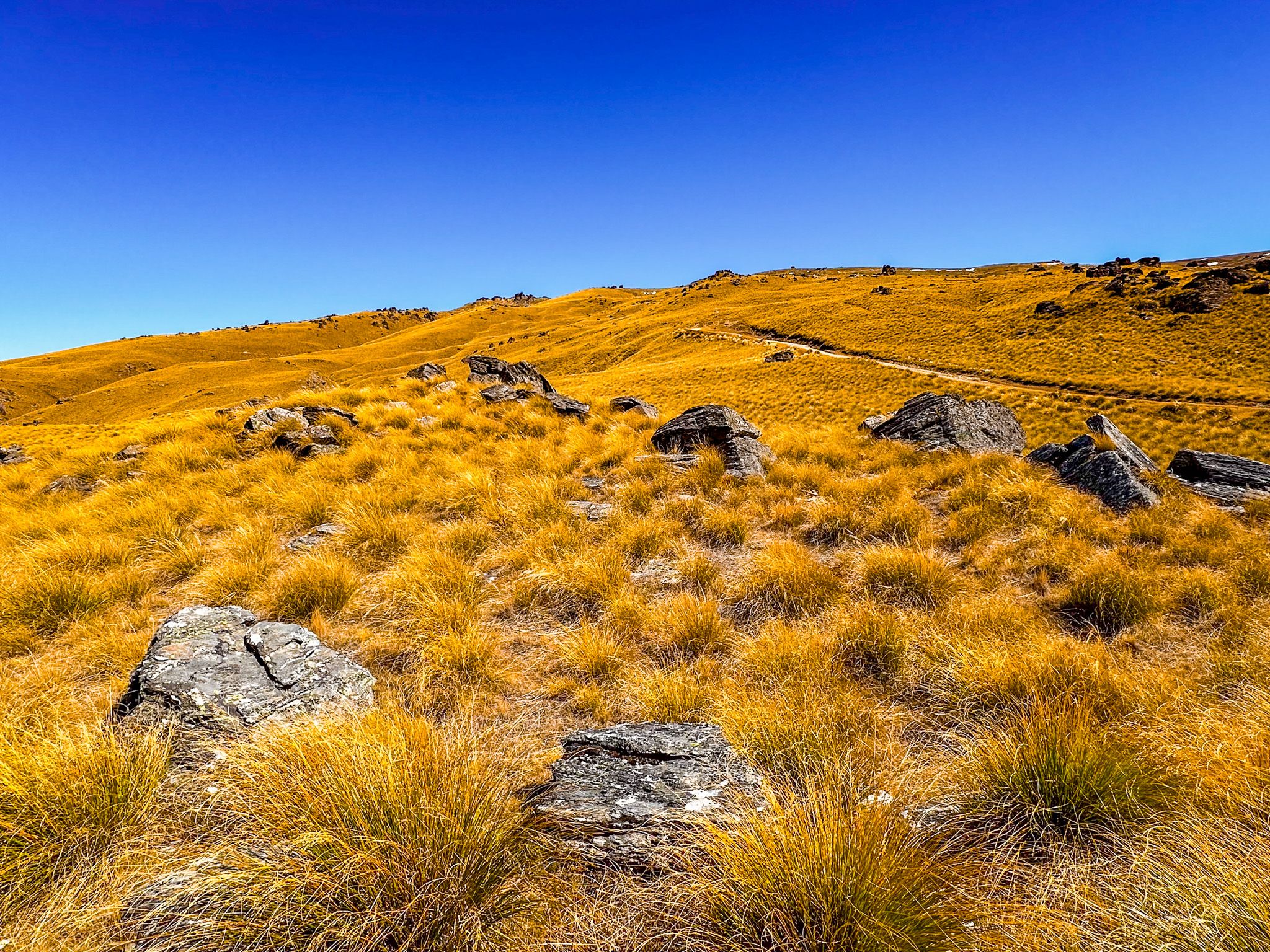
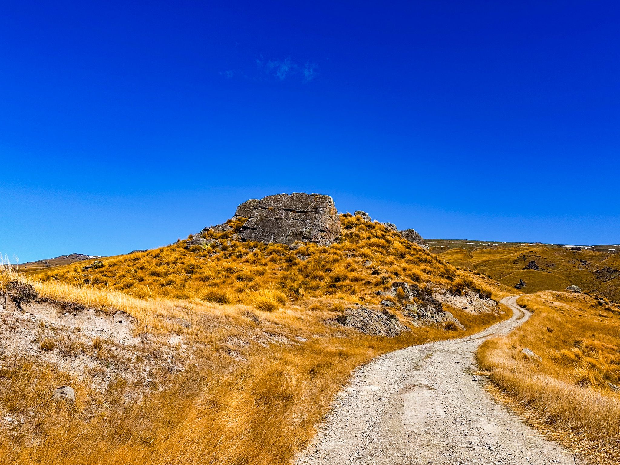
A loop track begins near the ridge-top, accessible from the upper Symes Road route. It passes several tors and offers elevated views across the valleys below. The track is informal, and sturdy footwear is recommended. Snow can fall year-round, and clouds may drop quickly, so always check the weather before heading up.
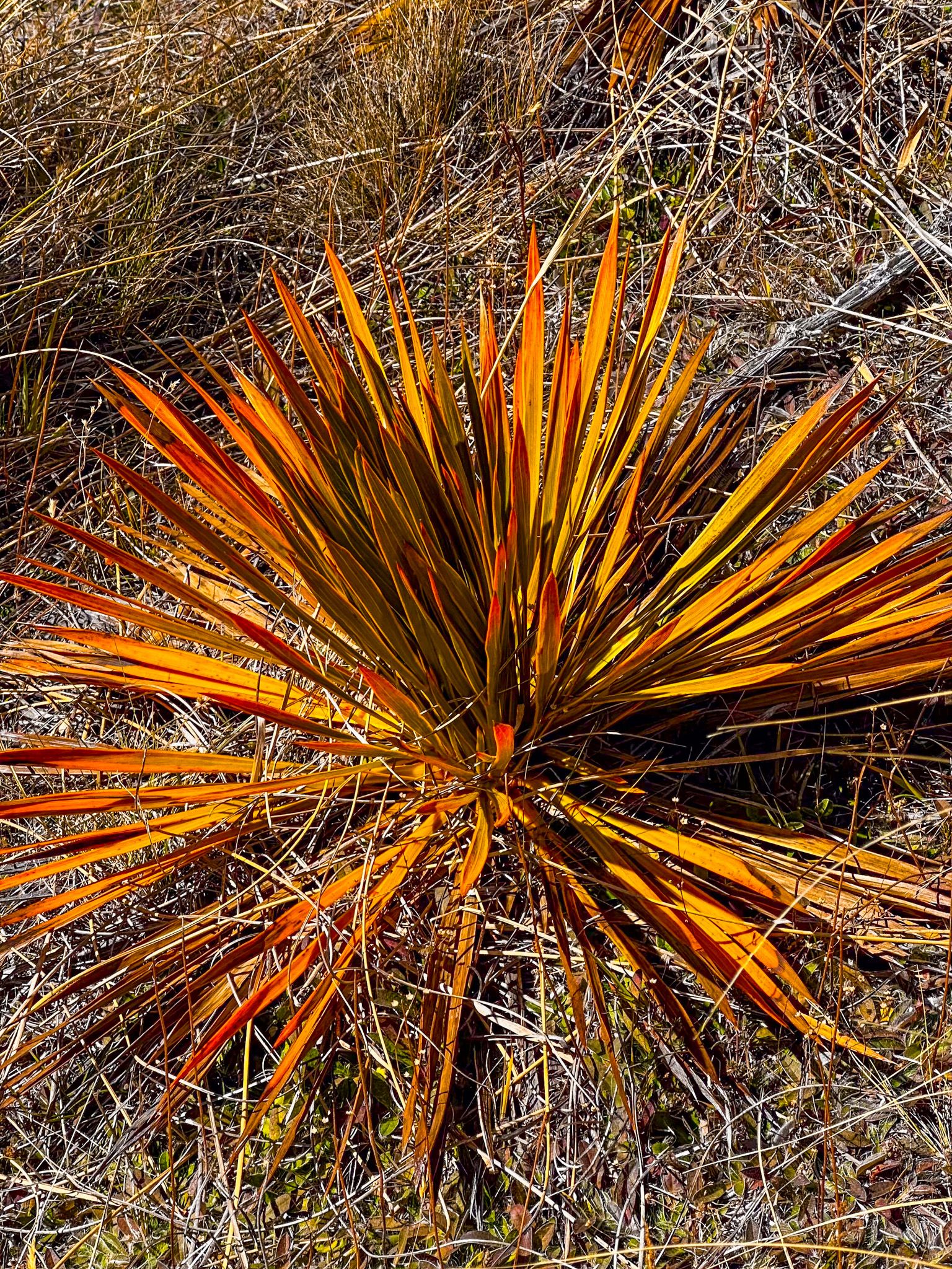
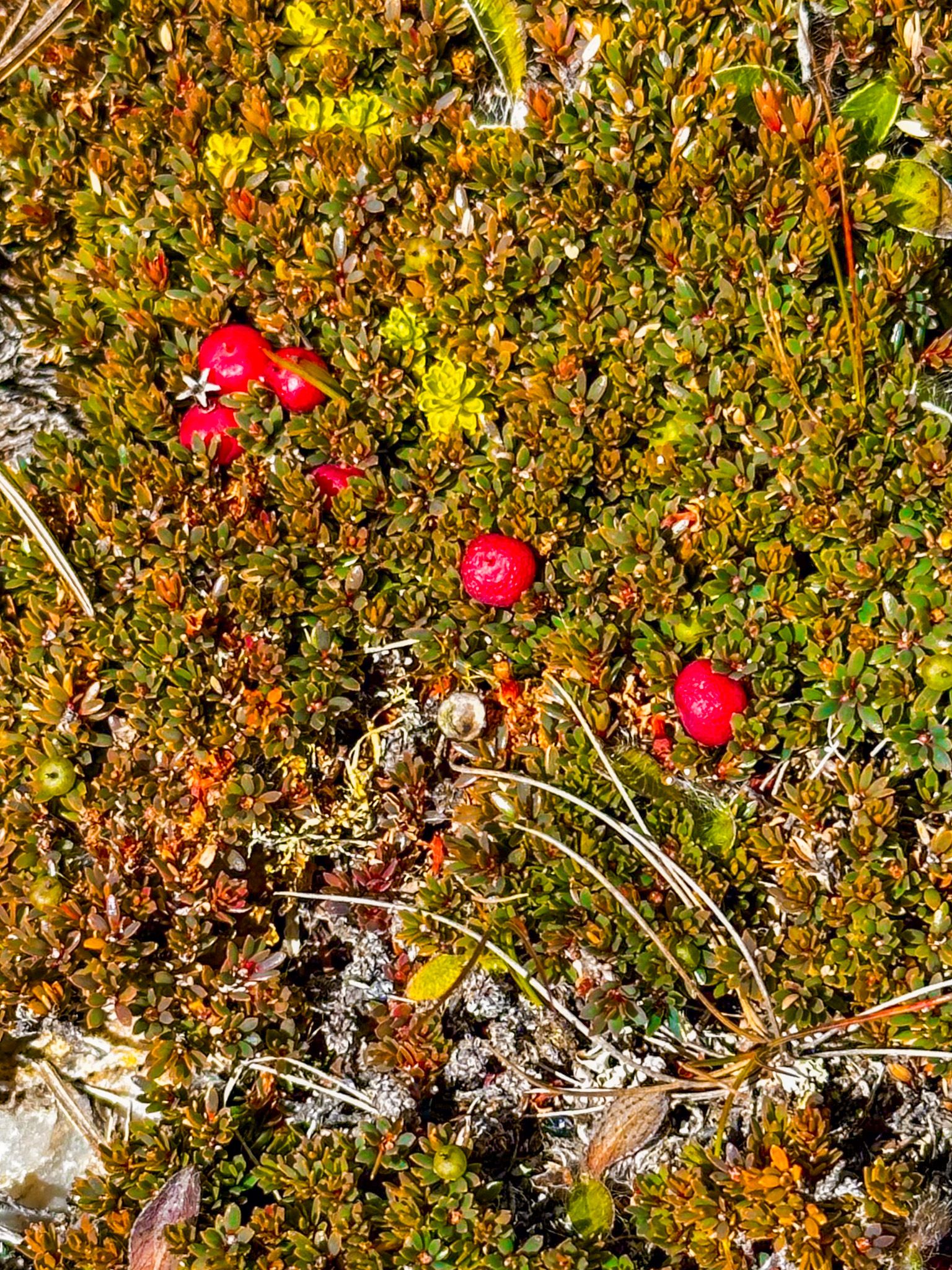
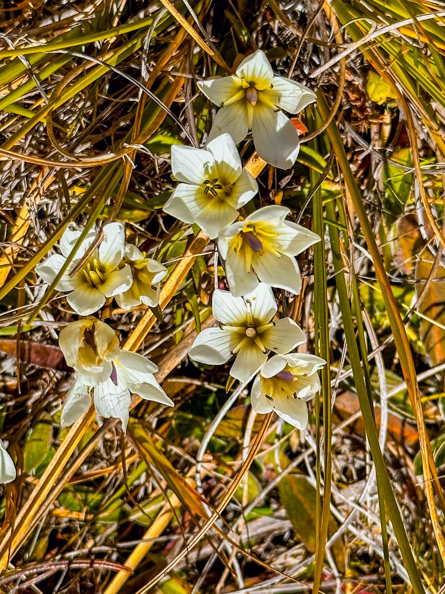
You can also walk short distances from the car park to explore nearby tors and take in the view. In the summer, native alpine plants such as Raoulia and Hebe cling to the rock bases. In winter, ice can glaze the tors and frost etches the grasses. Even from lower down on the road, you can walk around the reserve, full of tussocks, rock formations, amazing views, spikey spaniards and mountain flowers in spring and summer.
Kōpūwai: The Name and the Legend
The Māori name Kōpūwai refers to the Obelisk itself, the Old Man Range and to an ogre of local legend. Kōpūwai was a fearsome giant who roamed the high country near the Clutha River, with a pack of monstrous, two-headed dogs. He terrorised Central Otago, capturing people on hunting parties from the coast and eating them. In one instance, he kept a girl named Kaiamio as a slave, but she outwitted him and escaped along the Clutha River / Te Matua towards the coast. Kōpūwai was enraged and attempted to swallow the entire river to capture her, drying the landscape. She escaped anyway, then returned with her relatives, who trapped and killed Kōpūwai. He became the Obelisk / Kōpūwai rock on the Old Man Range, while her courage restored the river and the land.
Getting There
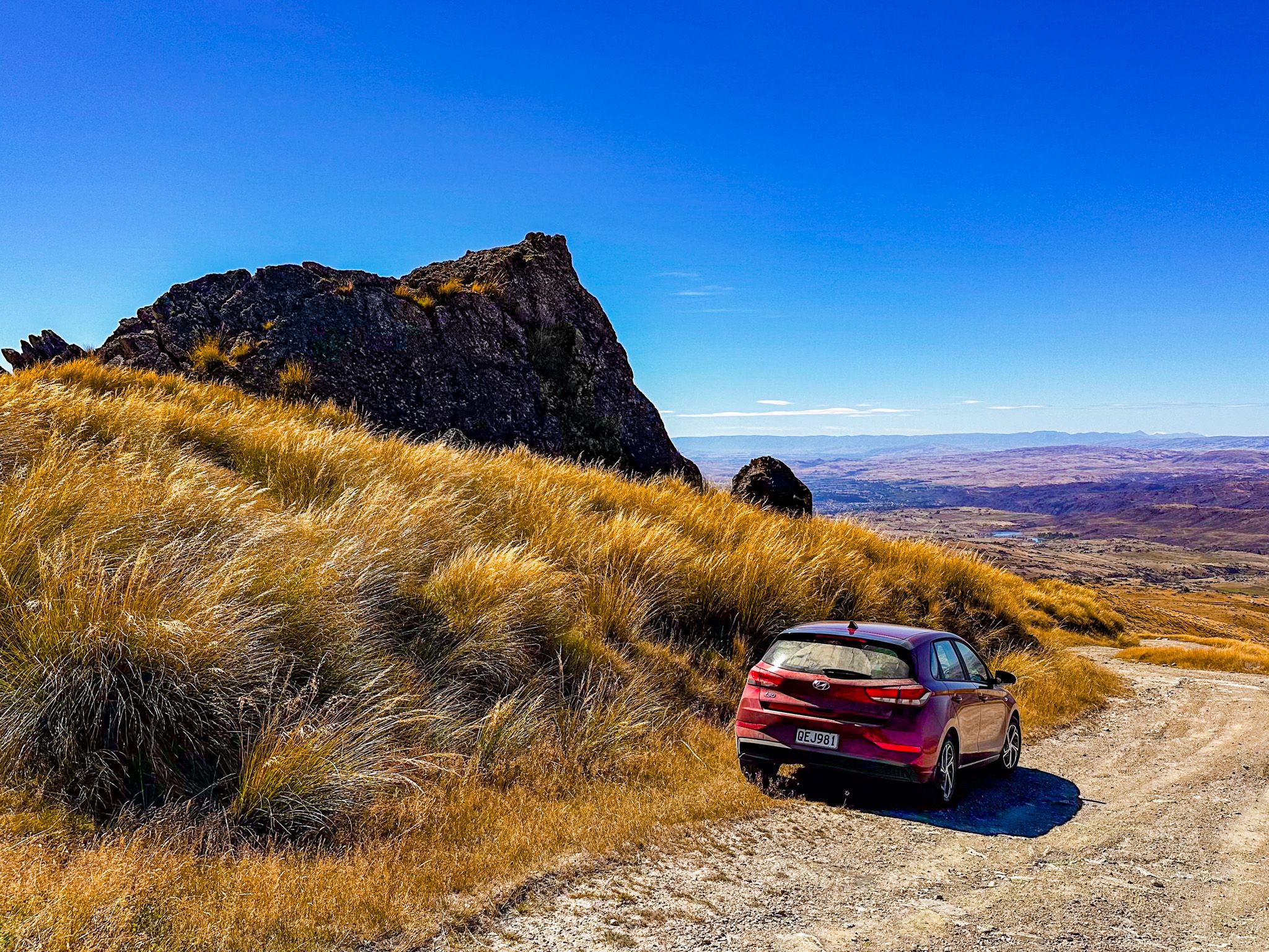
From State Highway 8 at Fruitlands, turn west onto Symes Road. Follow the road as it climbs into the hills for about 13 km. The surface is gravel, but it becomes increasingly rough, with exposed, rutted rocks as you climb up. It will be too rough for lower-slung and smaller 2WD vehicles after reaching an elevation of 700 to 800 metres. With a 4WD, you can continue to a signposted car park at the top of the range near the access point for the loop track and Obelisk.
Warning note: In winter and spring, ice and snow may make the road unsafe. Avoid the road during poor weather.
Near the base of the road, stop to visit Mitchell’s Cottage. Alexandra, Roxburgh Dam and Roxburgh are all short drives away. Another nearby adventure drive option is to Lake Onslow, in the highlands east of Roxburgh.