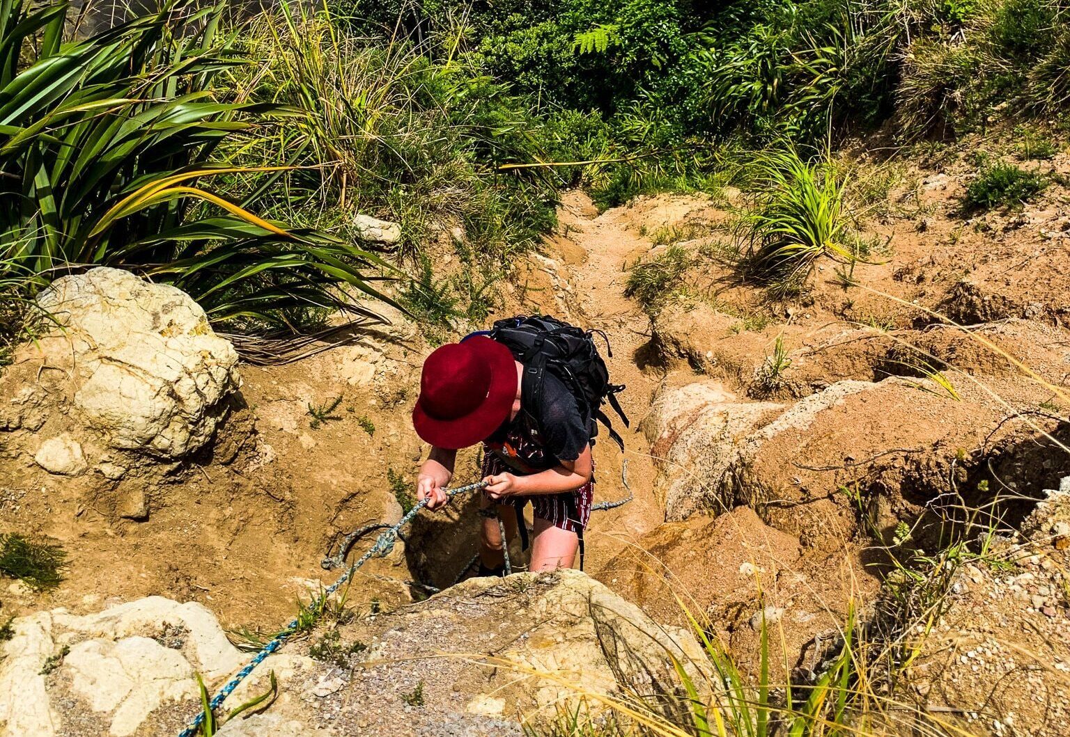
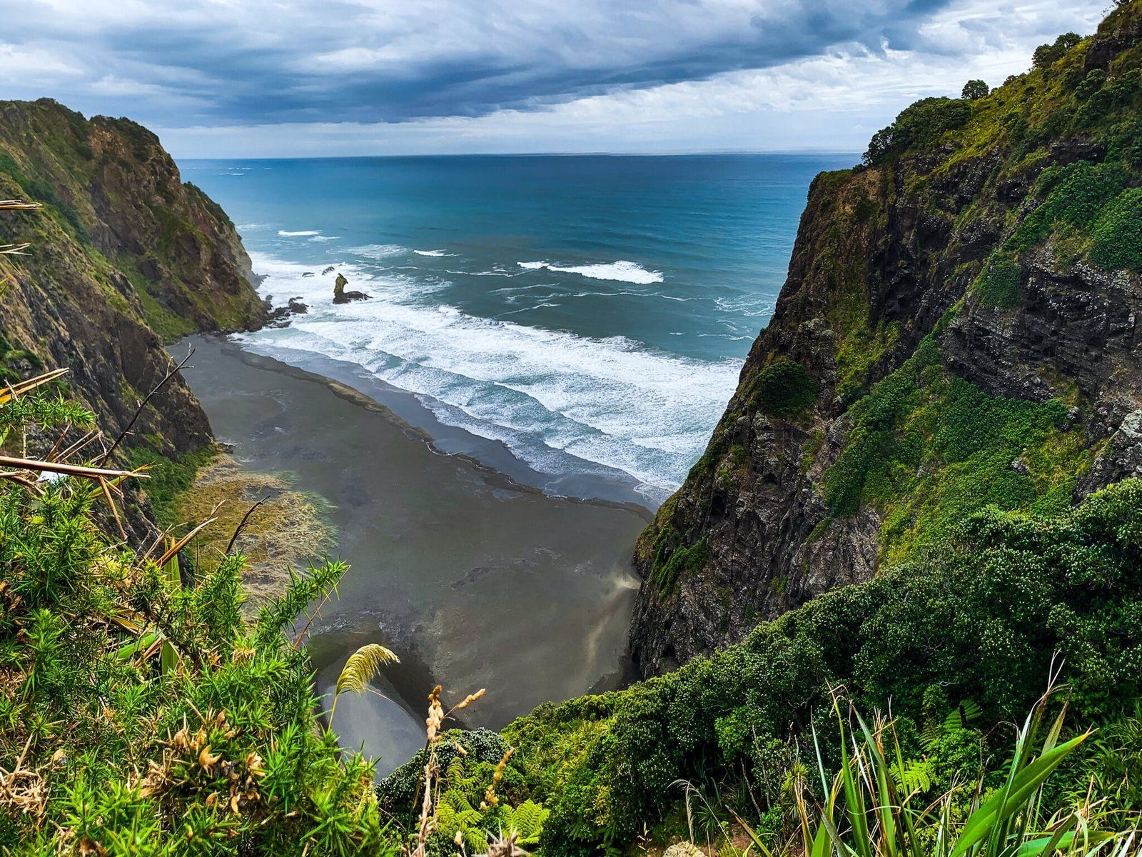
The steep tramping tack down to Mercer Bay, south of Piha in the Waitakere Ranges, is the most adventurous walking option in the Auckland region. As you approach the north end of Mercer Bay, a reasonably obvious but unmarked worn clay track from Comans Track can be seen.
You will see a warning sign as you start down the only flattish section of the track. After that, it is a series of steep drops (crumbly in places) until you reach the beach. The good news is that there is only one brief section where you may feel exposed to the cliff, and ropes have been laid in several places to make it easier. But it is best to do this in boots, with someone else in case of an emergency and only in dry weather. Ensure you have plenty of water, as it is quite a slog coming back up the 200+ metre climb.
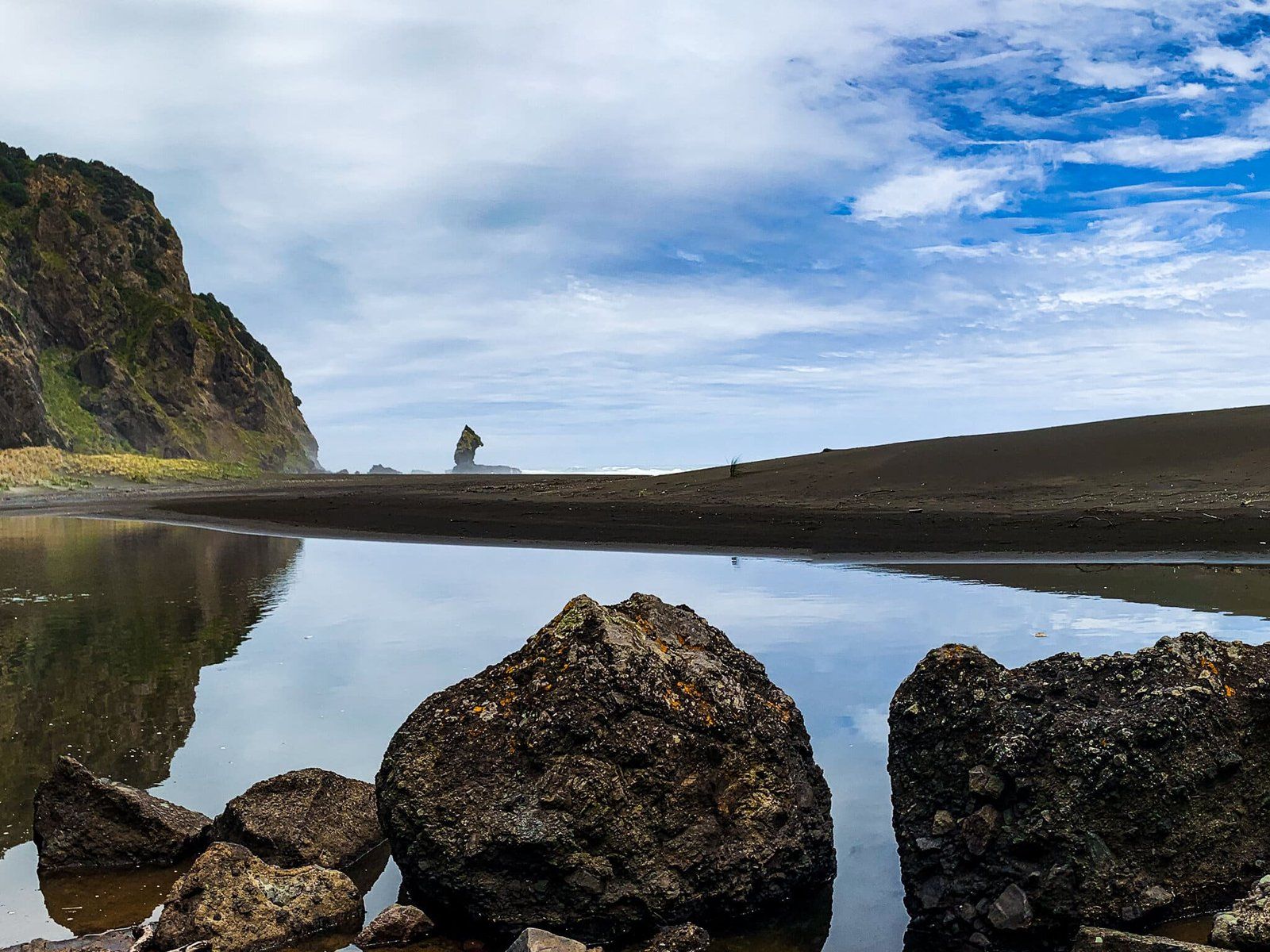
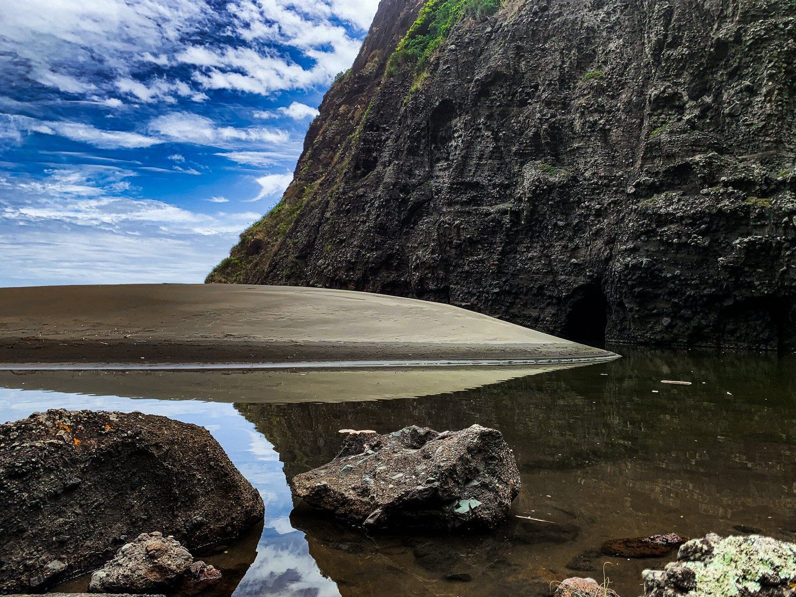
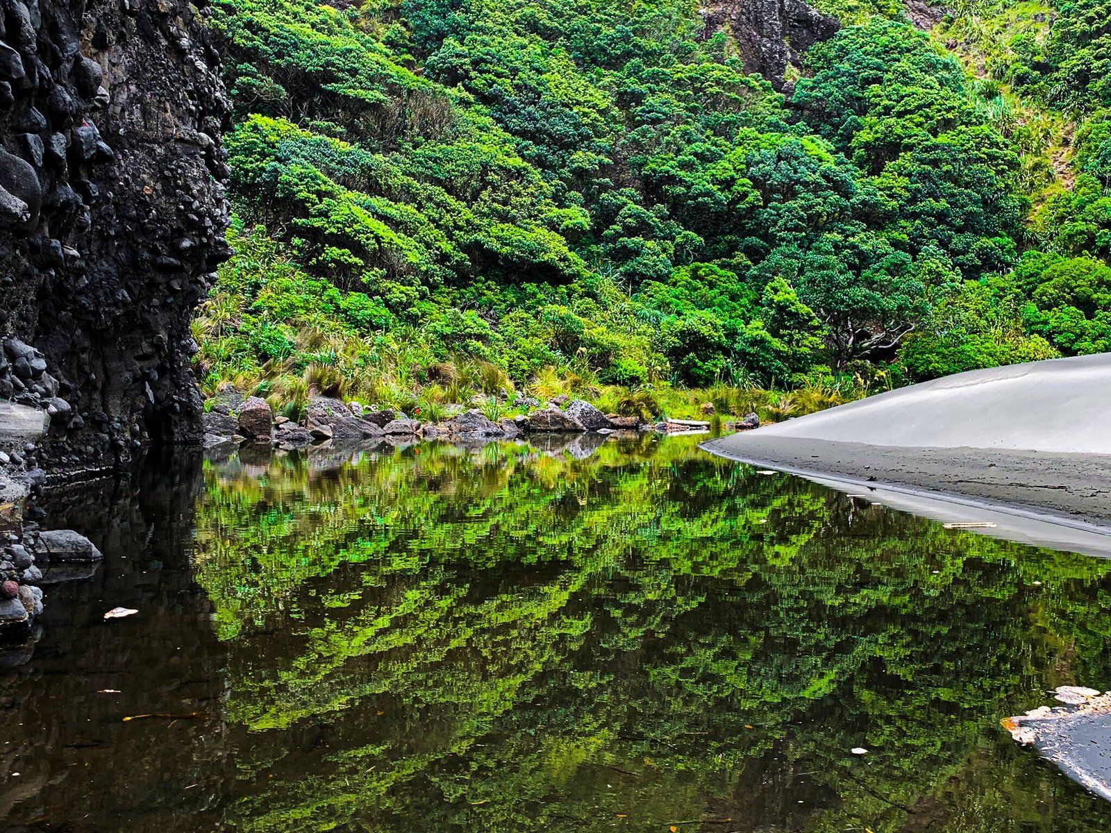
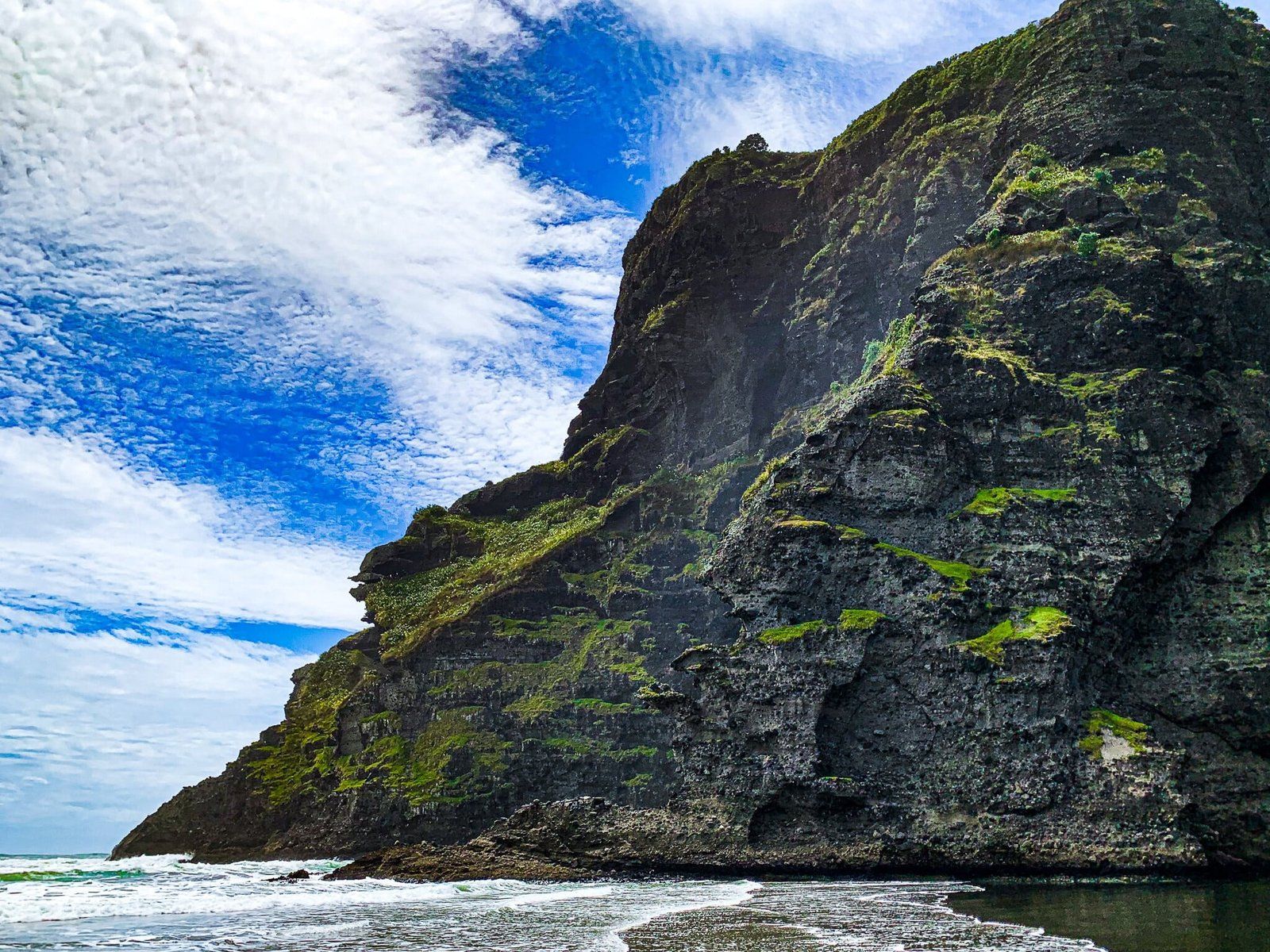
At the bottom of the walk, you must cross a lagoon to reach the black sand beach. If the sand is hot, ensure you have protection for your feet, as it’s a bit of a walk over a low dune to the tide line.
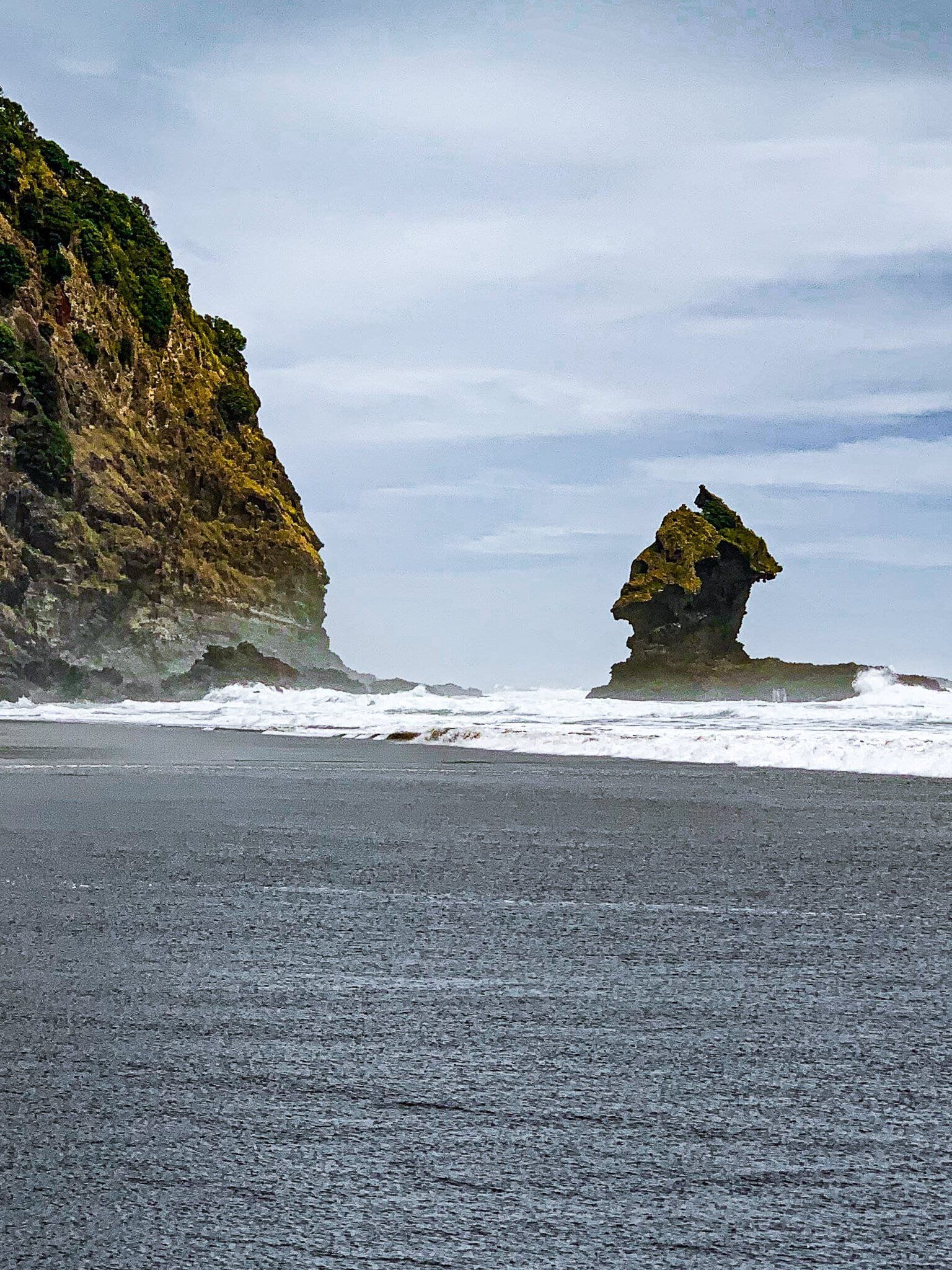
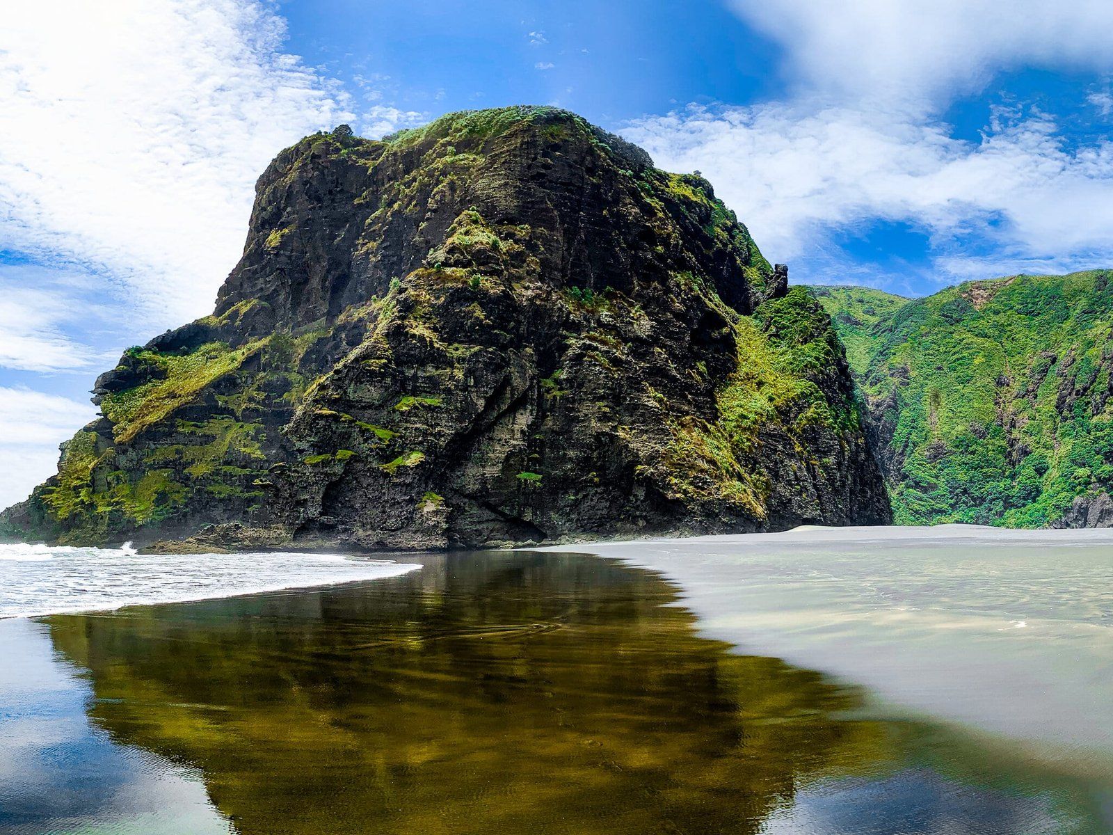
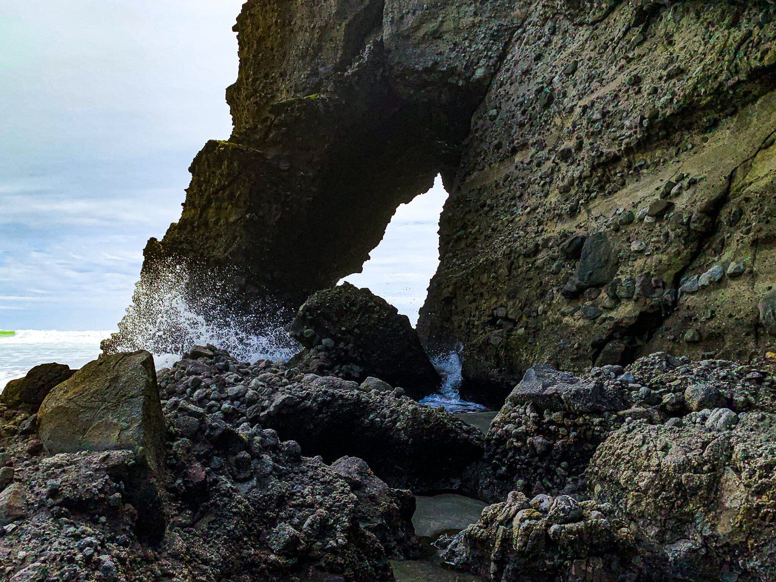
On the right side, some modest caves and an arch are accessible at low tide. To the left in the surf is the unusual rock that you probably noticed from the top. It looks like a handle from high up, but as you get closer, it looks more like an uplifted head. Swimming in the surf is unsafe, so take extreme care if you find it irresistible and never swim alone.
The easiest way to Mercer Bay is via the Mercer Bay Loop Track, onto Comans Track, from the car park at the end of Te Ahuahu Road.