Exploring the Scenic Mercer Bay Loop
Nestled in the Waitākere Ranges, the Mercer Bay Loop is a coastal walk situated between Karekare and Piha. This track is renowned for its stunning coastal views, making it one of the most picturesque spots in Auckland. The area is steeped in history, featuring a World War II radar station and a Māori pā site at Te Ahua Point.
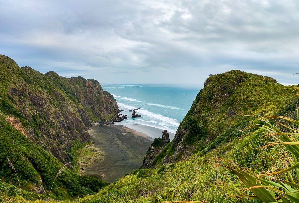
Discovering the Cliffs and Te Ahua Point
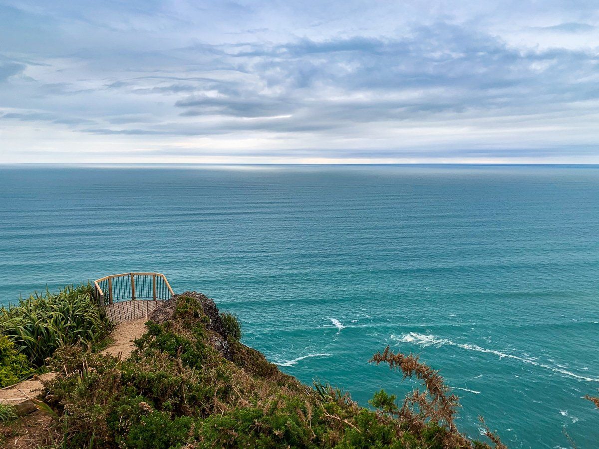
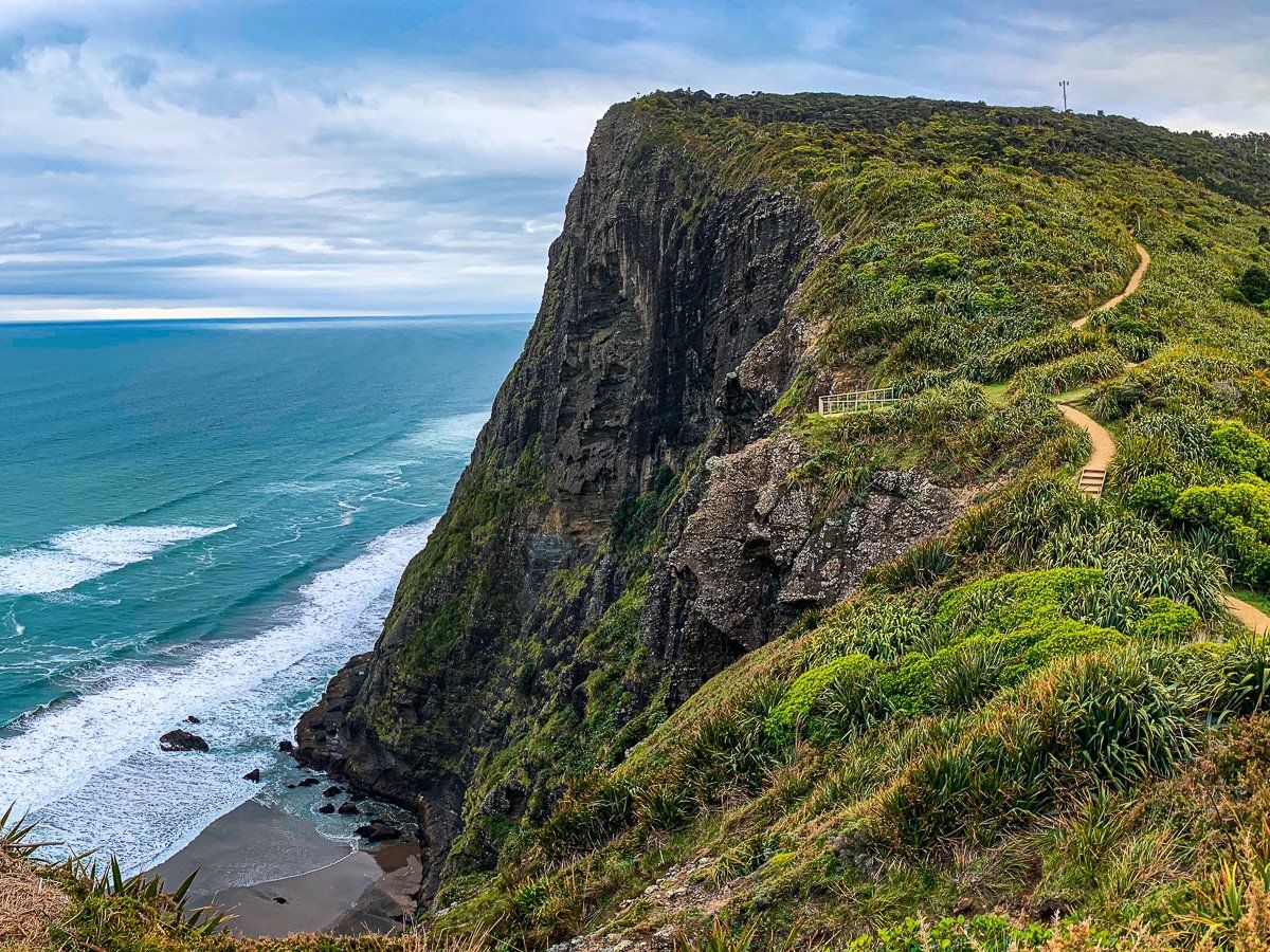
Your journey begins at the parking area near the historic World War II radar station, located at the end of Log Race Road close to Piha. From here, the track follows the cliff line on the west side, leading you to Te Ahua Point. Early in the walk, there is a viewpoint with a striking view back to Piha Beach. As you ascend the first flight of steps, 200 metres above the ocean, another viewpoint provides a stunning southern vista. Approaching Te Ahua Point, you'll encounter the view of a small bay surrounded by cliffs towering 180 metres high.
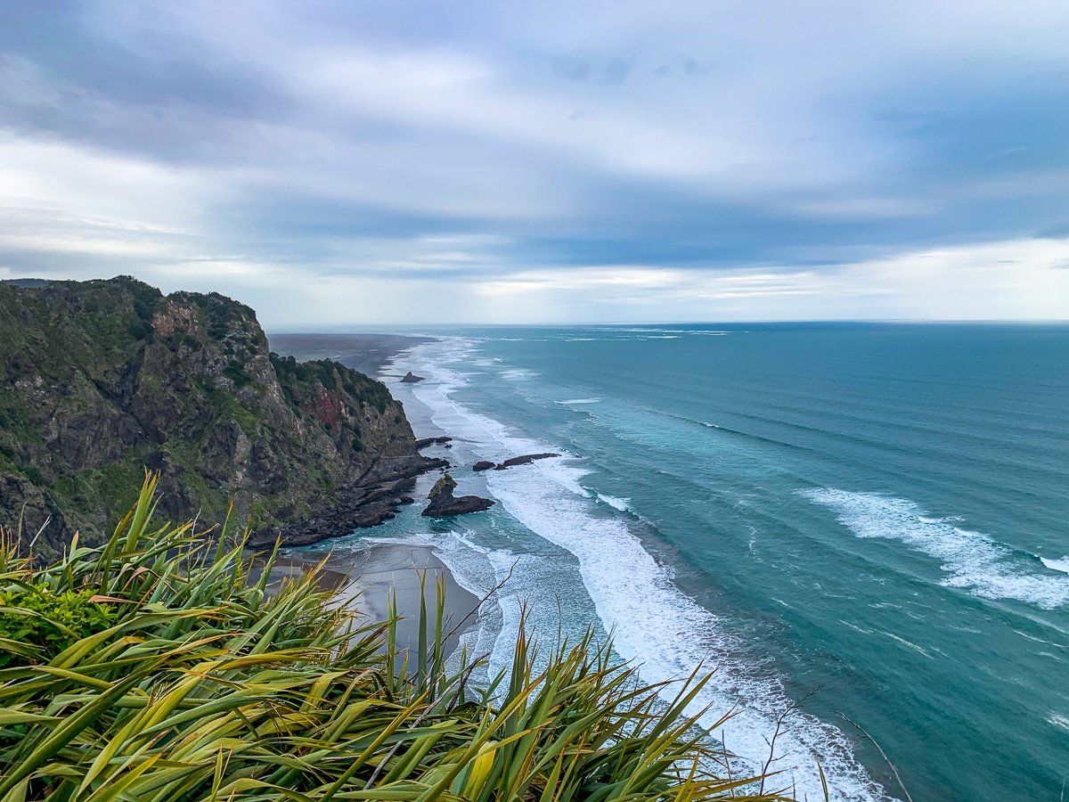
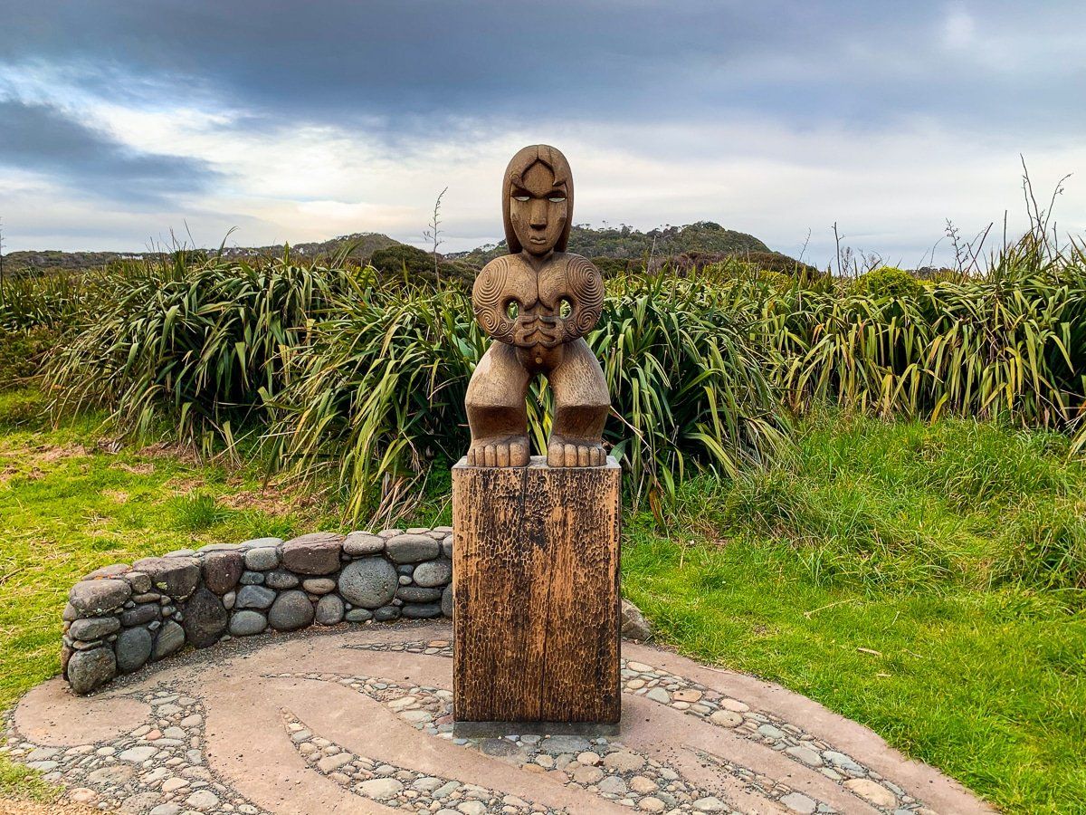
Te Ahua Point, once the site of a Māori pā, is marked by a large Māori carving and informative panels. A short track with moderate cliff exposure leads to a fenced viewpoint offering 270-degree views, including Mercer Bay and the southern coast past Karekare towards Whatipu.
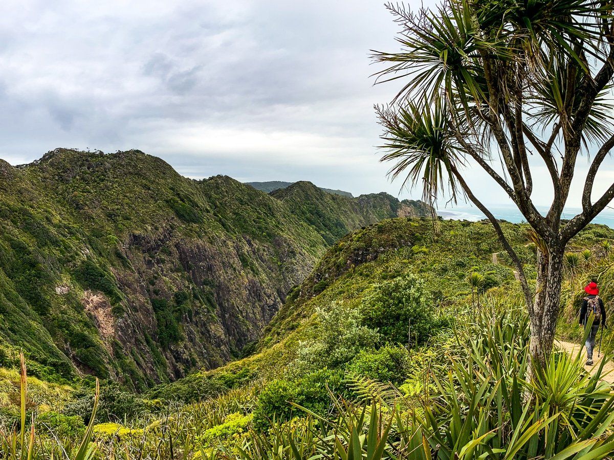
The Return Journey
The return loop on the track's east side is moderately steep and can be challenging, but it rewards you with sweeping views of the Waitākere Ranges and the ridge separating Mercer Bay from Karekare. Completing the loop back to the car park takes about 90 minutes at a leisurely pace, allowing you to fully appreciate the stunning coastal landscapes.
How to Get There
To reach the track, take Piha Road and turn onto Ahuahu Road after the Karekare turnoff on Karekare Road. Before Piha Road turns sharply north and descends to the beach, Ahuahu Road becomes a gravel road. Follow it to the end, where you'll find ample parking near the former World War II radar station.
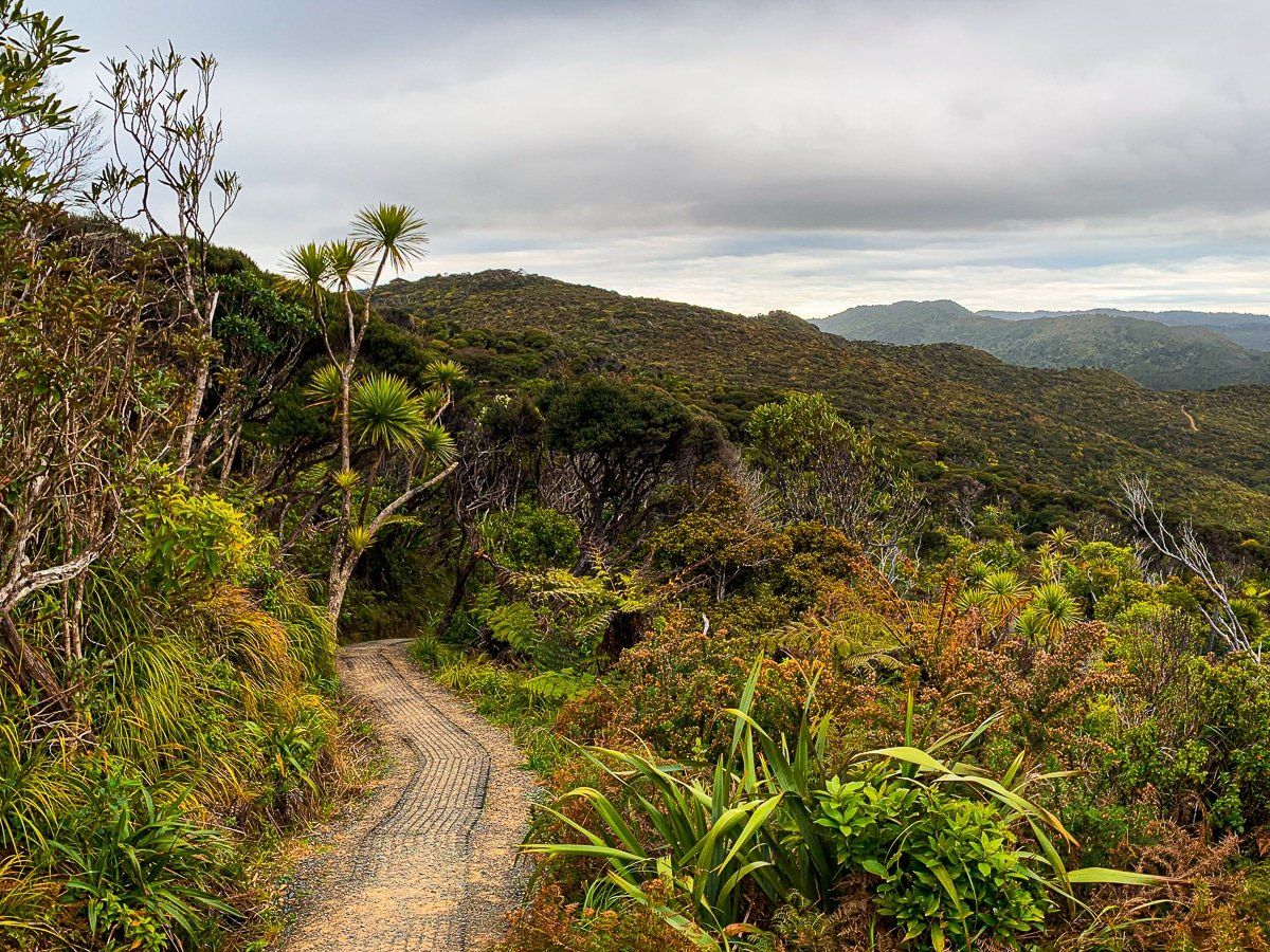
From the Mercer Bay Loop, you can also explore Comans Track, with scenic views along the high ridge above Mercer Bay to Karekare. Alternatively, the Ahu Ahu Track provides an easier, though less captivating route. If you incorporate these tracks into your Mercer Bay Loop adventure, plan for at least two hours each way to Karekare and back, with a steep climb from Karekare.
For the more adventurous, a scramble down to Mercer Bay from Comans Track is possible, though it is a very steep, rough, and unmarked path with warning signs.