Discover the Hereheretaura Point Walk
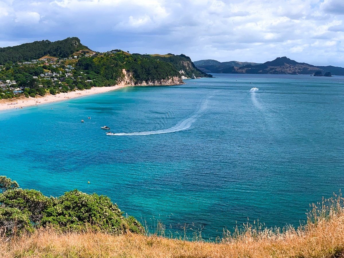
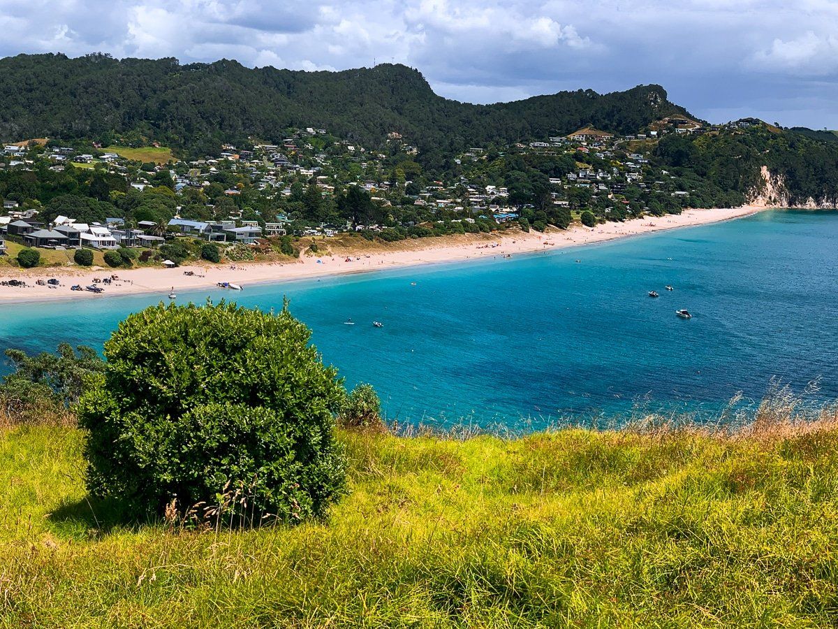
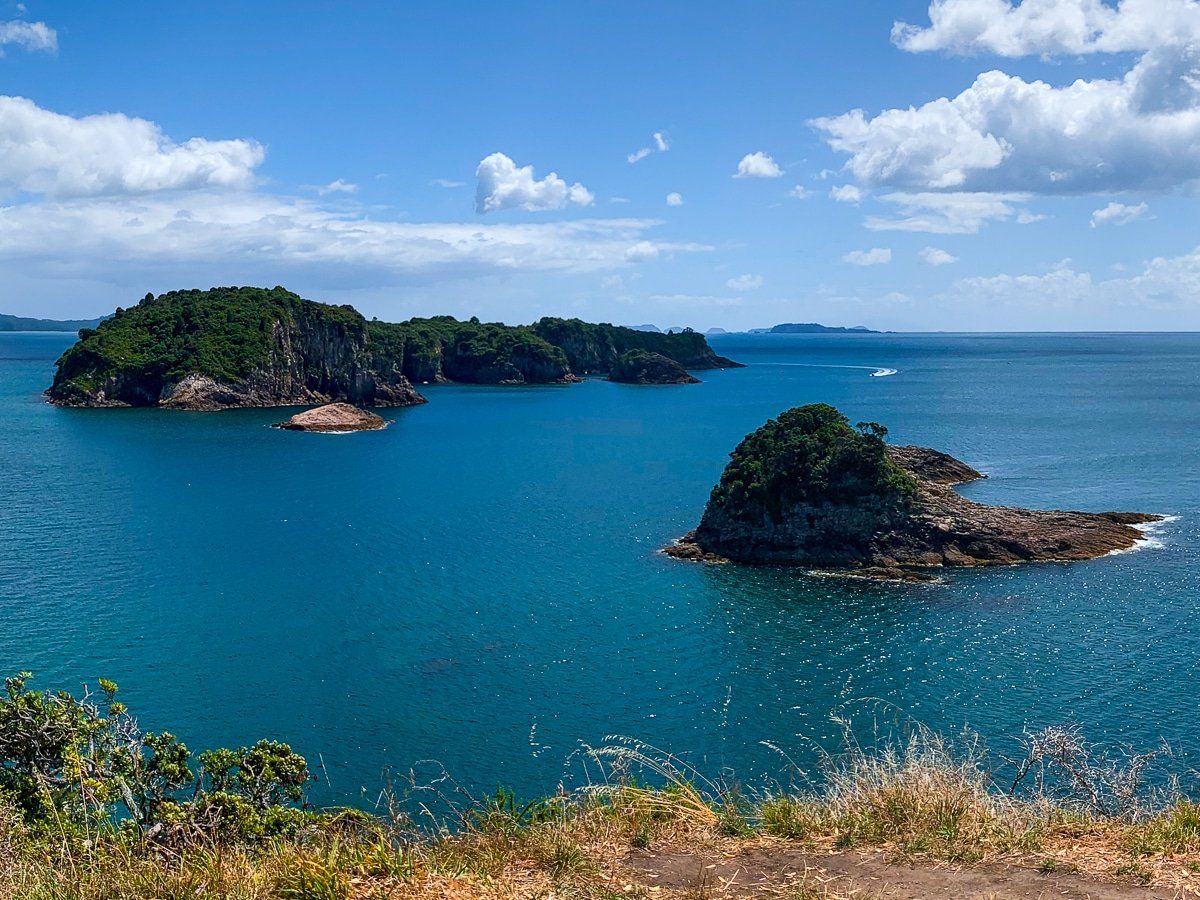
Located at the southern end of Hahei Beach on the east coast of the Coromandel Peninsula, the Hereheretaura Point Walk is an alternative to the popular Cathedral Cove Walkway. This short track through Te Pare Reserve is an opportunity to explore historic sites and enjoy breathtaking clifftop coastal views across the south side of the beach and out to Mahurangi Island and the Tasman Sea.
Walk Through Te Pare Historic Reserve
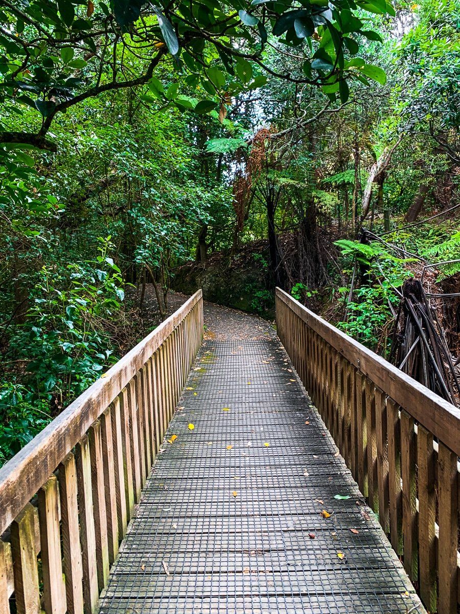
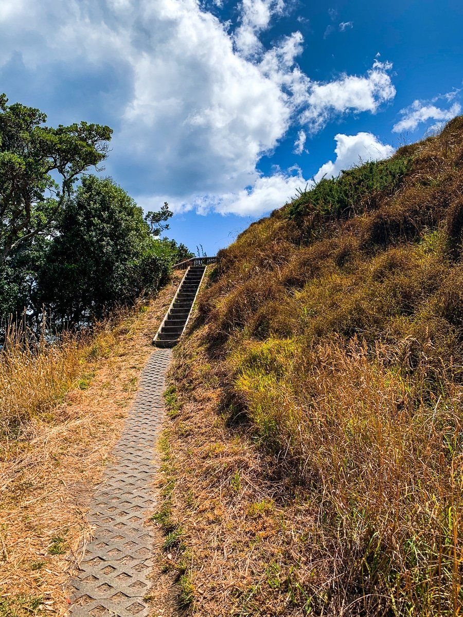
The walk into Te Pare Reserve begins at the southern end of Pa Road, leading you through a grove of magnificent, ancient pōhutukawa trees. As you exit the grove, you will see Te Pare, the peak on the right, which is also a historic pā site. On your left are the first views north across the beach. There are some steps down the cliffside to the southern end of the beach, which tends to be quieter than further north towards the township.
The main path continues around the southeast end of Hahei Beach, with a narrow section with a cliff on the east side, then ascends a set of steps to reach the grassy Hereheretaura Point. This is home to the Hereheretaura pā site. Features of the pā are immediately apparent with remnant terraces and pits.
The walk takes 20 minutes each way.
Spectacular 360 Degree Views
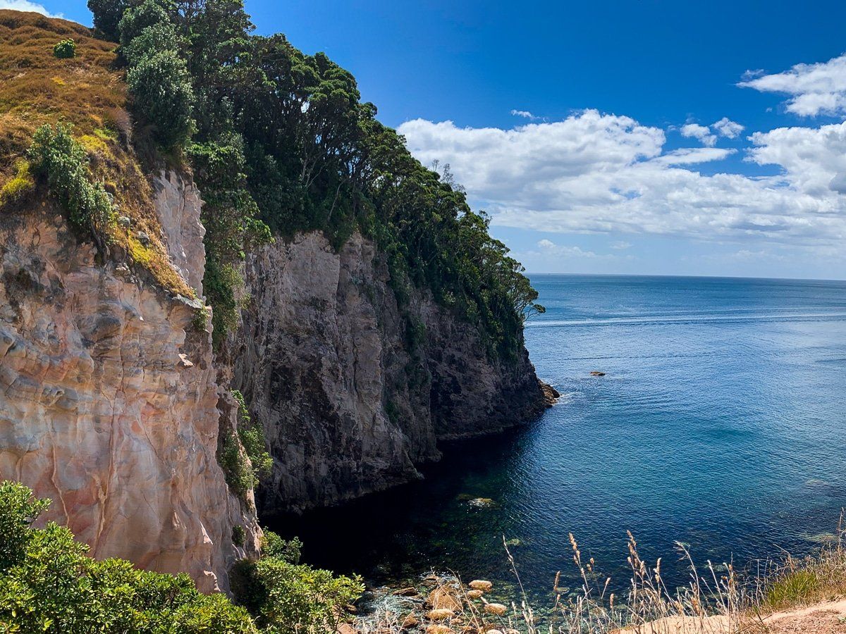
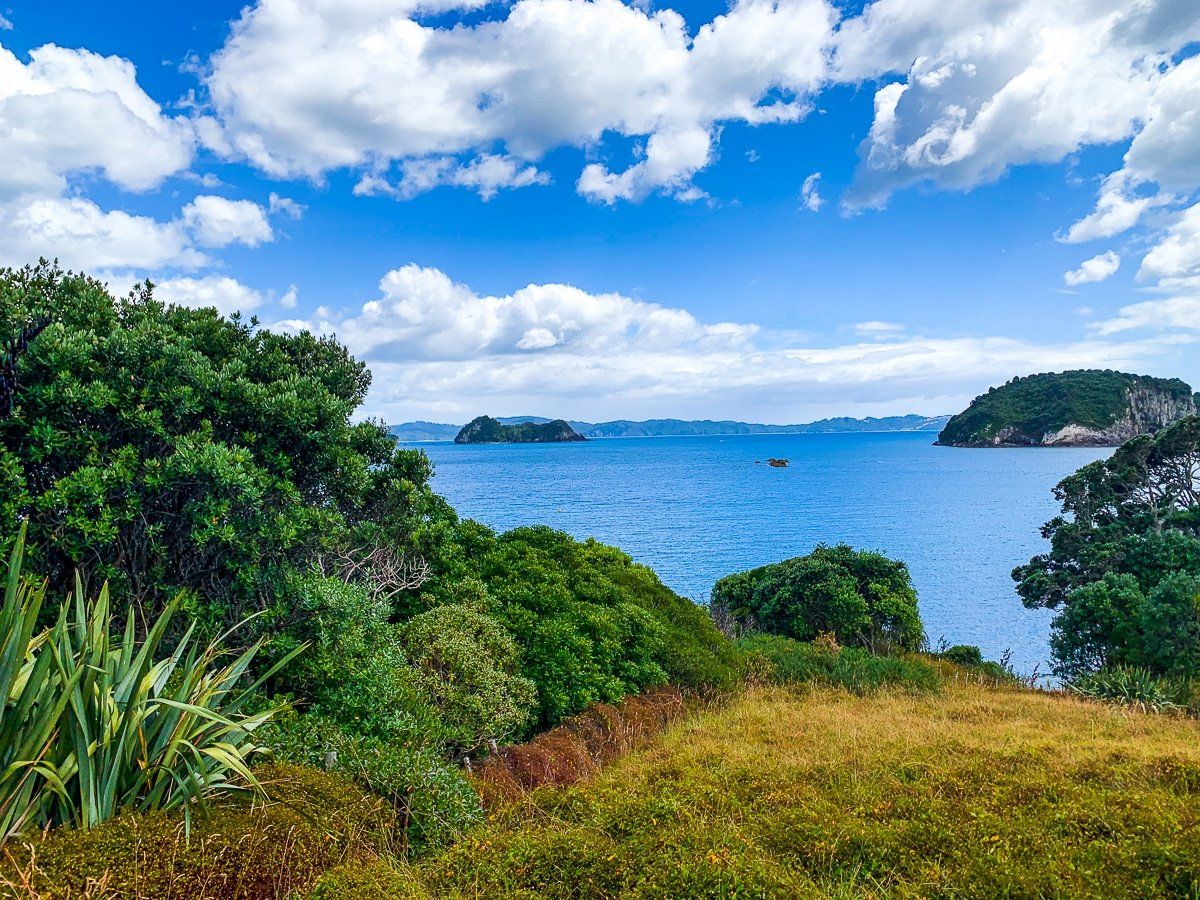
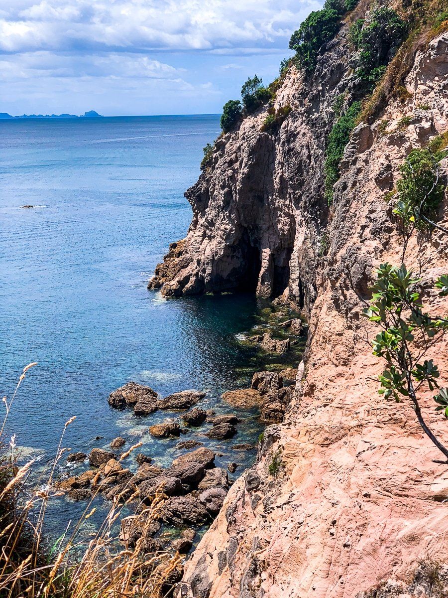
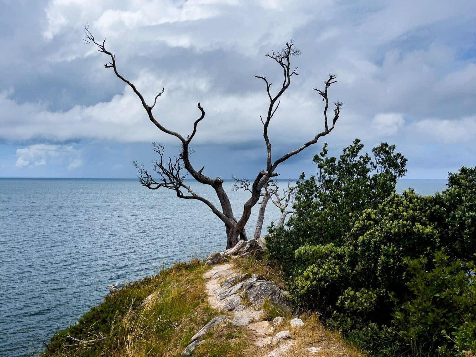
Hereheretaura Point is particularly striking, with panoramic views extending from Hahei to Mahurangi Island and several smaller islands. From the top, you can take a short, informal walk along a narrow spine to the very tip of the point, marked by a distinctive dead tree. This vantage point provides a remarkable perspective of the cliff-lined coast to the south.
History of Hereheretaura Pā and Te Pare Pā
Hereheretaura Pā with Te Pare Pā are ancient Ngāti Hei fortifications in the Hahei area. Like other coastal pā around Mercury Bay, they were constructed long before the arrival of Europeans as defensive strongholds and settlements, with terraces, ditches and storage pits. The sites were naturally strategic and defensive, taking advantage of narrow access points and backed by high cliffs, while having access to fresh water. Māori settlements were in the area from at least the mid‑1500s, and the two pā were occupied through later periods of inter‑tribal conflict. The sites, and the broader Hahei settlement, were largely abandoned after devastating Ngāpuhi musket‑war raids in 1818, the early period of the Musket Wars, when Ngāti Hei suffered heavy losses, and survivors fled the area, leaving it largely vacant in the 1800s as European settlement accelerated.
Explore Te Pare
A side trip to Te Pare is possible, though the track is poorly defined, and includes a steep 80-metre climb. This historic pā site is located at the top of the peak on the edge of cliffs up to 100 metres high.
Accessing the Track
From Hahei Beach Road, head east on Pa Road before entering the main part of the township. Follow the road to the end and park near the track entrance. Parking is limited, so you may find you need to park farther down the road and walk to the entrance. You can also walk east along the beach for up to 1 km to the small cove below the track, then take the steps up to the track. This will add about 20 minutes each way to the walk and is best done as the tide retreats.
Other nearby places to visit include Cathedral Cove, Hot Water Beach, Cooks Beach, Lonely Bay and Shakespeare Cliff.