
Northland’s Kauri Coast is a bit of a misnomer, at least these days. About a century ago, the 60+ year project to exploit the enormous kauri forests of Te Tai Tokerau and Tāmaki Makaurau largely came to an end. There were a few pockets of ancient trees and the odd giant left. However, much of the land had been converted to the grassy landscape you will see today, replacing mature forest ecosystems with pastoral farming. This included the entire Kaipara Harbour region in northwest Auckland/southwest Northland, all the way north to Waipoua Forest. Fortunately, just in the nick of time there was enough of a groundswell to protect the few remaining forests and groves.
We recommend taking a couple of days to follow the Kauri Coast with a drive from Auckland through Kaipara to Dargaville, then on to Waipoua Forest. Take State Highway 16 from Kumeu to State Highway 1 at Wellsford. Along the way, stop at Omeru Scenic Reserve with its several waterfalls and kauri regrowth. Then look out for a couple of the giant sculptures at Gibbs Farm and access the Kaipara Harbour at Ātiu Creek Regional Park of Port Albert.
From Wellsford, drive north on State Highway 1 and turn off onto State Highway 12 for the Kauri Coast at Brynderwyn. Drive around the north side of the Kaipara Harbour and along the Wairoa River to Dargaville, then on to Waipoua Forest. Along the way, there are three worthwhile kauri stops: the Kauri Bushman’s Memorial Walk just beyond Paparoa, the exceptional Kauri Museum at Matakohe, and the Trounson Kauri Park north of Dargaville.
There should also be enough time to do something apart from staring in wonder at kauri trees. We chose a trip to Baylys Beach on the west coast near Dargaville.
Kaipara
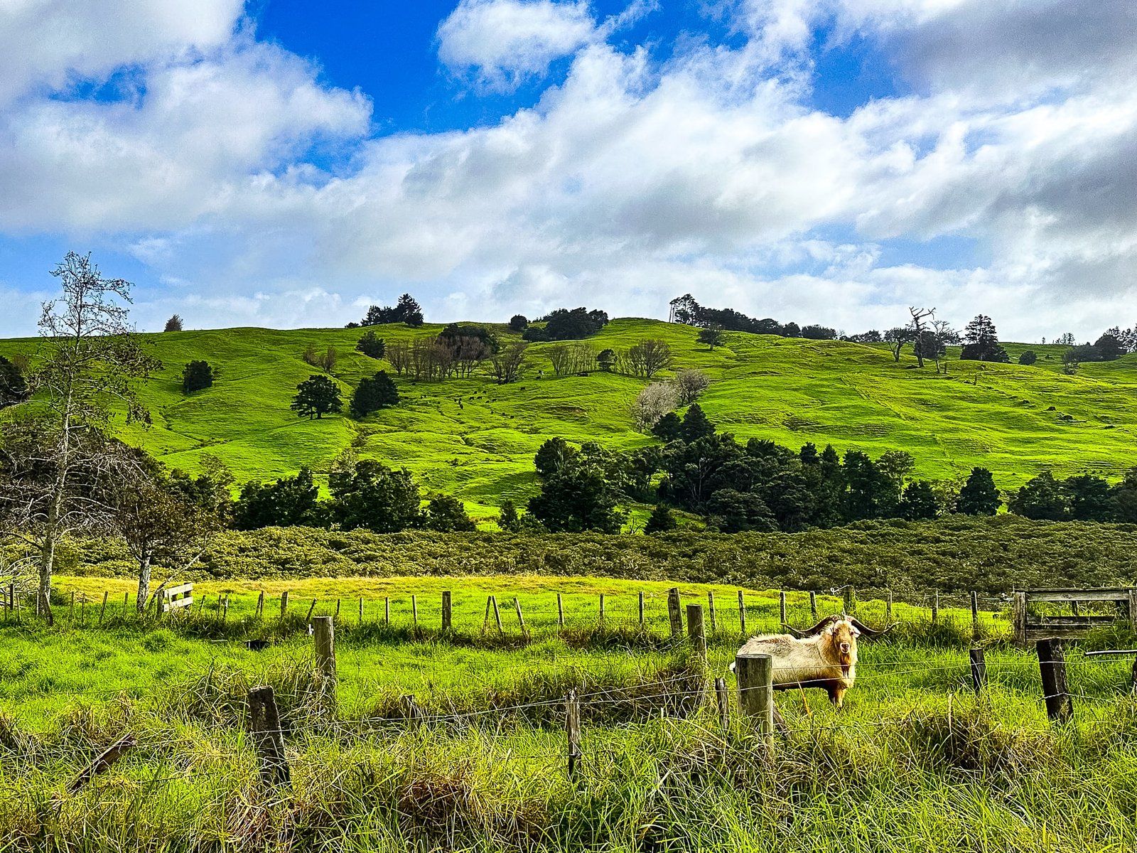
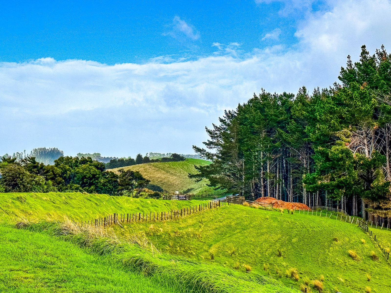
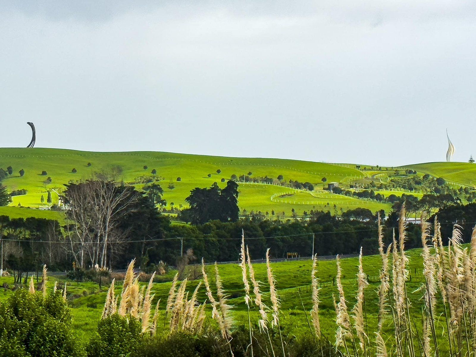
Driving on State Highway 16 north from Helensville will take you through the Kaipara region, with the Kaipara Harbour to the west. The region is mostly hilly pastoral farmland and sparsely inhabited. It’s a very scenic drive, especially when the light creates a “green glow” during golden hour or changeable weather. Look out for Gibbs Farm, about 5 km north of Omeru Scenic Reserve. Although Gibbs is not open to the public on a daily basis, there are a couple of enormous, spectacular sculptures on the ridge of the farm which are visible from the road.
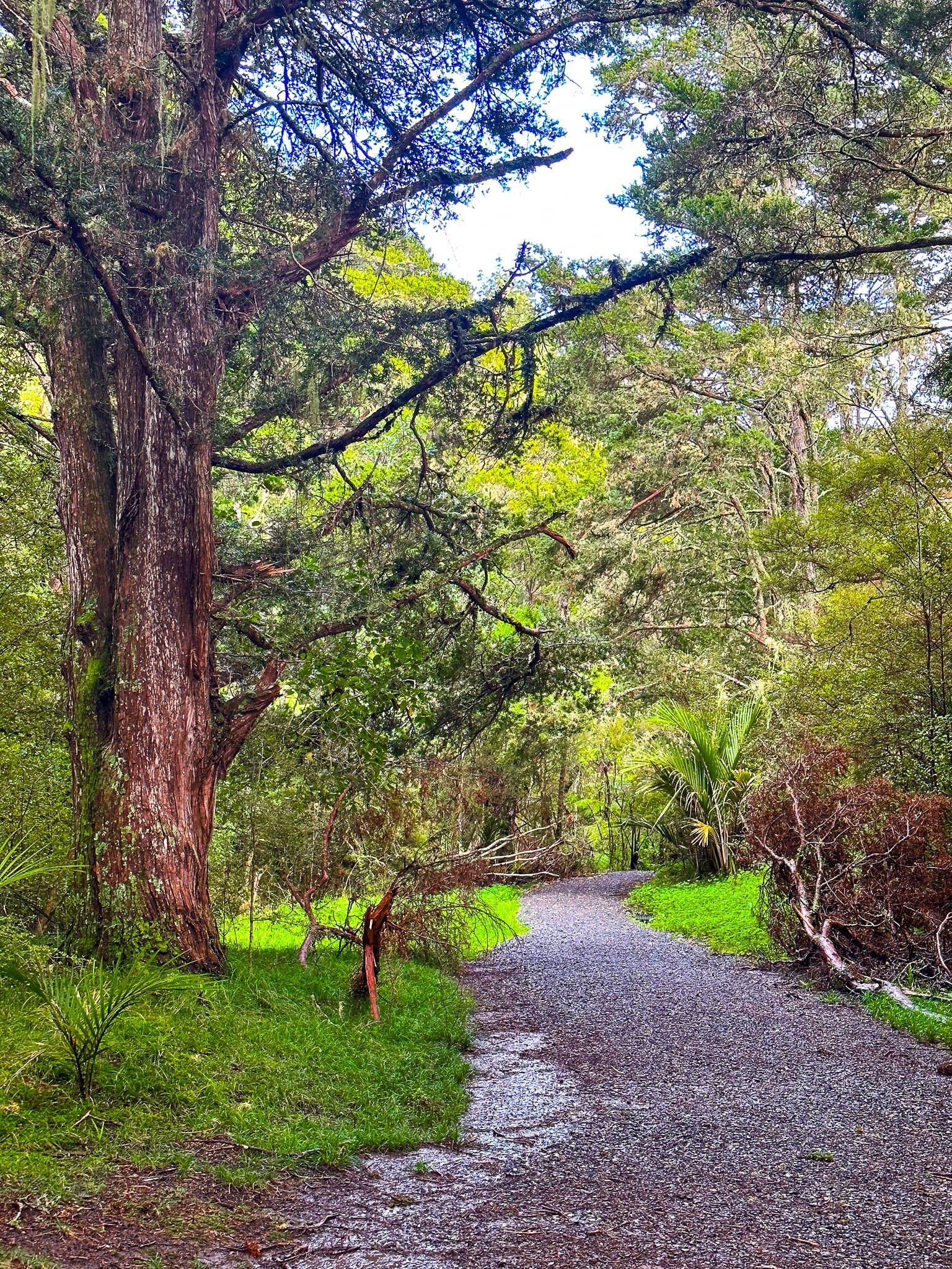
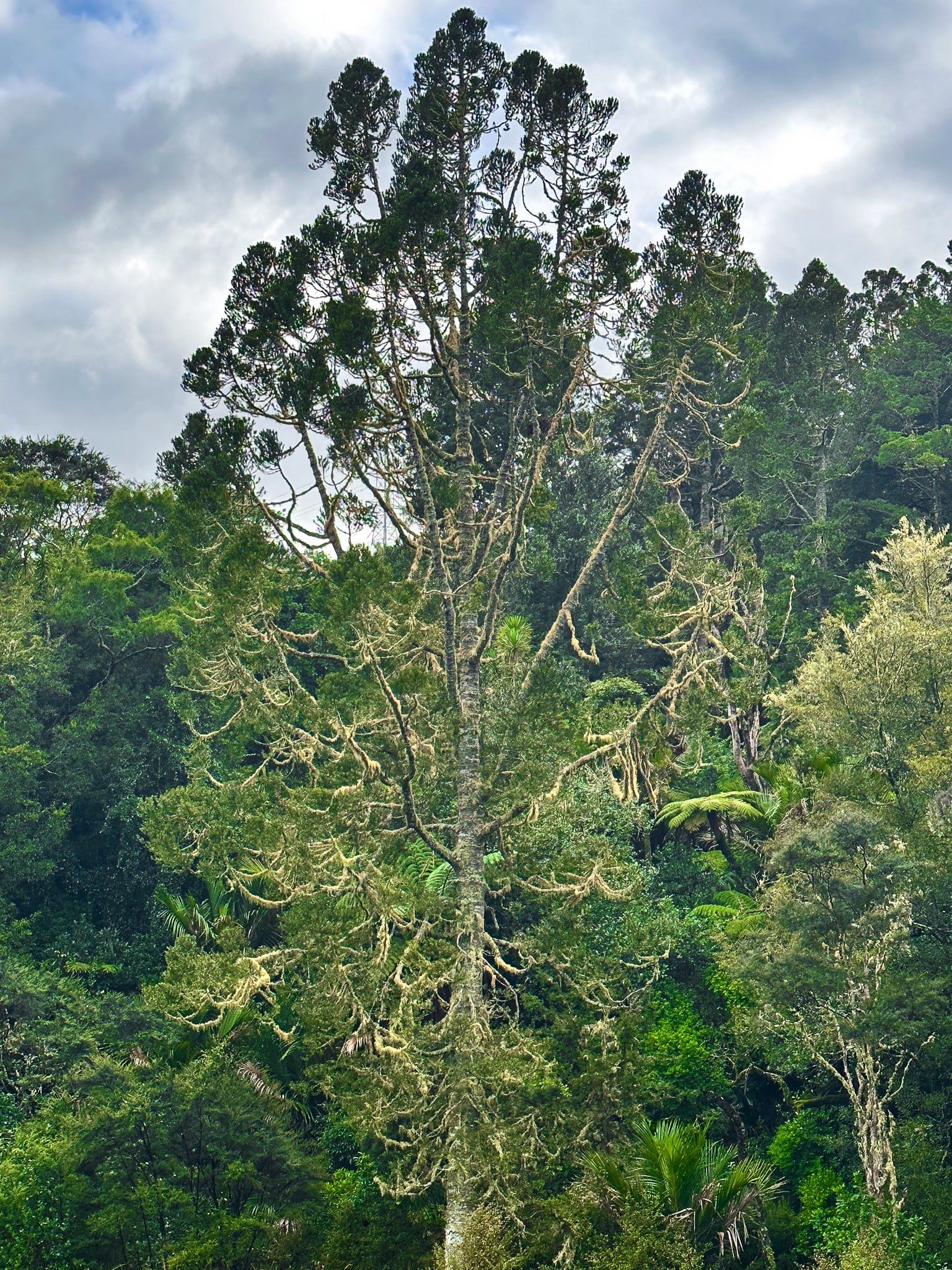
A bit further to the north is 304 m Mount Auckland, surrounded by native forest, including kauri regrowth. There is a track over the top but it is presently closed due to kauri dieback risks.
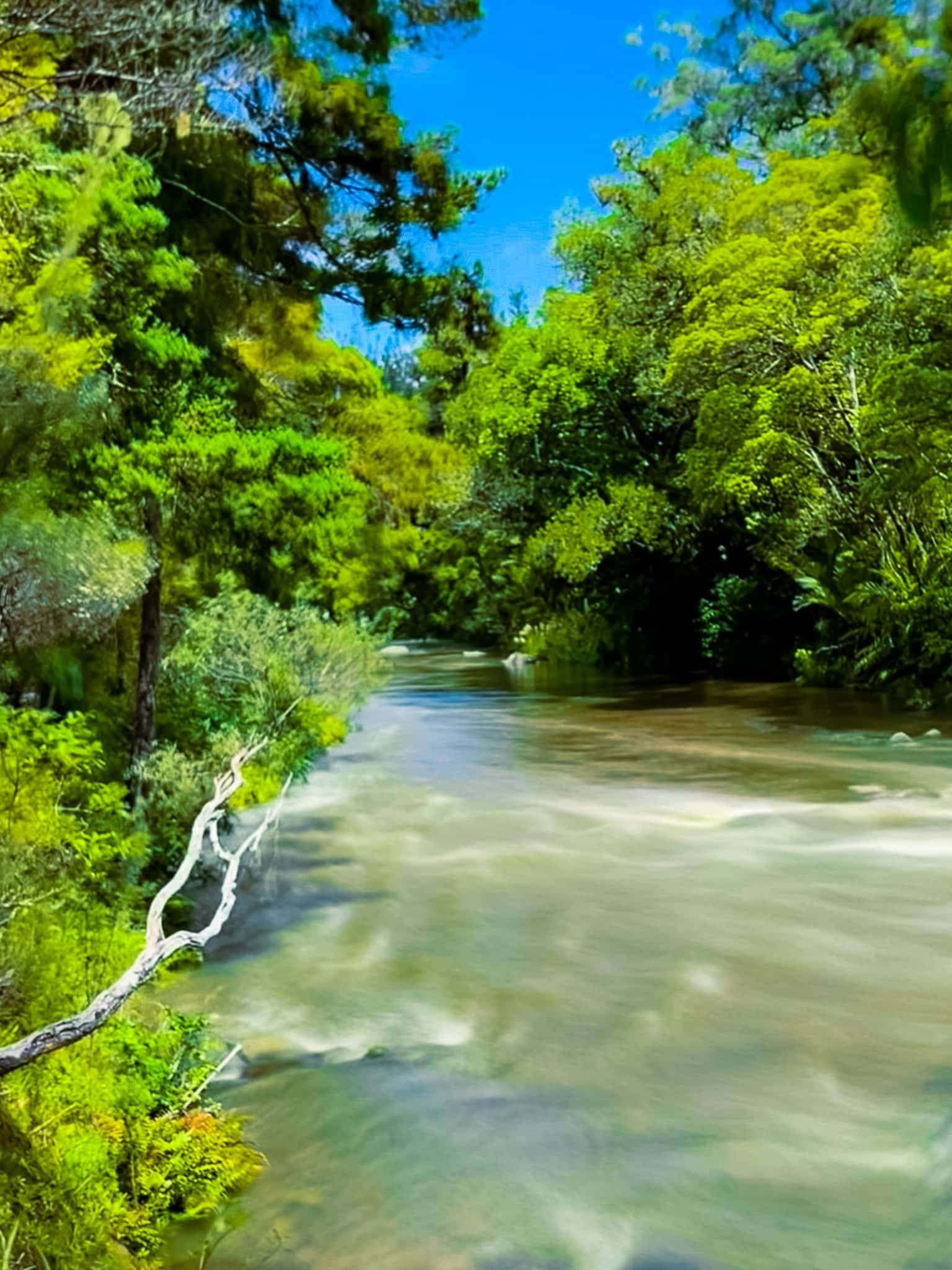
But the main feature of the drive is Kaipara Harbour. Although it is the largest in NZ by area, and one of the largest in the world, you barely glimpse it from the highway as it is mainly surrounded by farms. It is also shallow, with extensive flats at low tide. Several rivers and many streams flow into the Harbour, creating numerous tidal tributaries. It was important to Māori as a food source, and initially for European settlers. The harbour was used to ship kauri logs as the trees were cut down, followed by extensive kauri gum extraction. As these resources dwindled, it was converted to farmland and much of the population left.
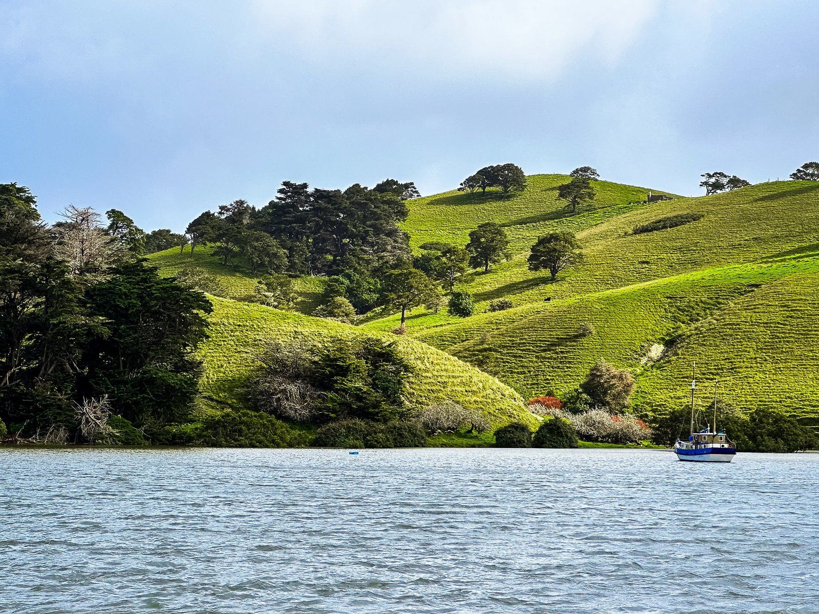
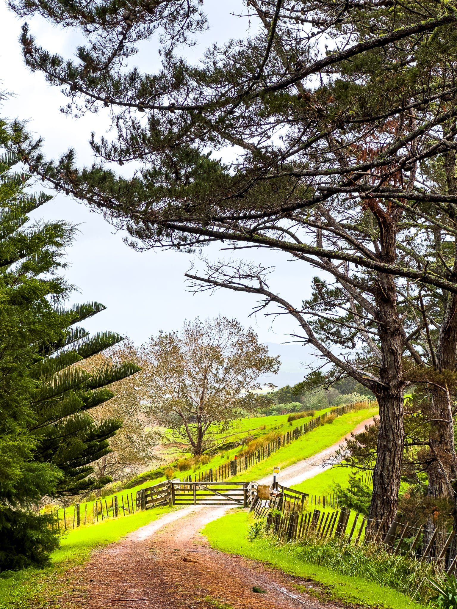
On its east side, the Harbour is most easily accessible on the Oruawharo River tributary. Heading north on the highway, turn off onto Wharehine Road just beyond the hamlet of Tauhoa, then left into Run Road. Continue to the sign for Ātiu Creek Regional Park, an Auckland Regional Park. Follow the access road to the top of the hill and car park. From there, walk/cycle/horseride/camp around what was a private farm, including access to the tidal river tributary.
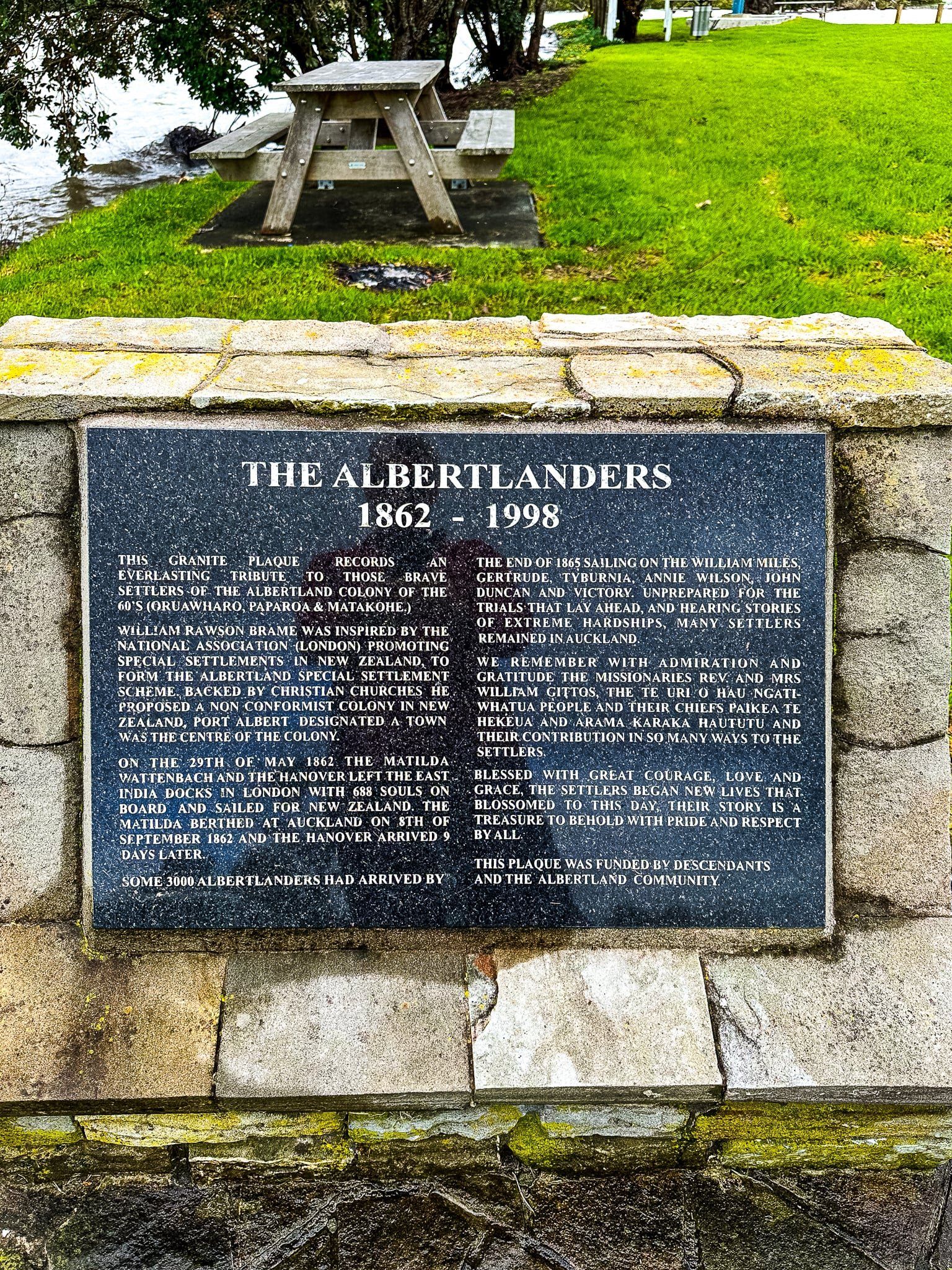
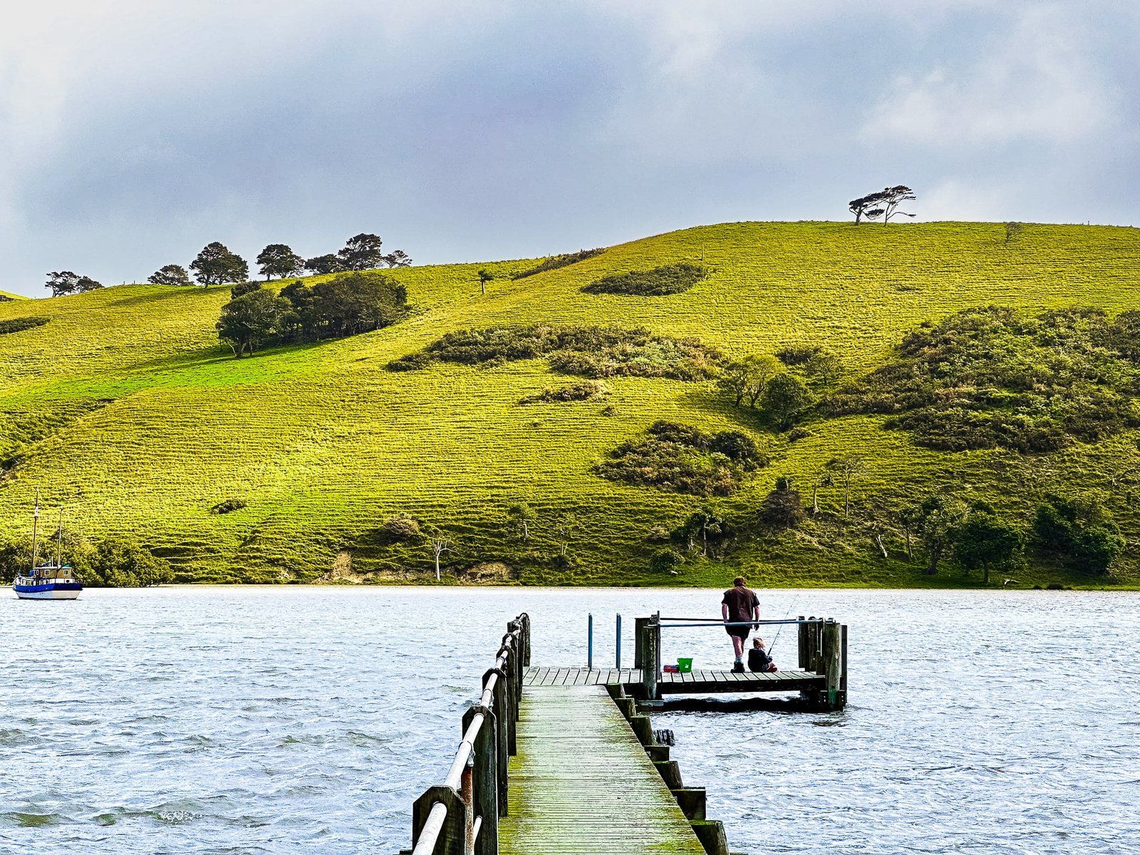
From Ātiu Creek, take Run Road back to Wharehine Road and turn left towards Port Albert. This also takes you to the Oruawharo River tributary. There is a long jetty across the flats to the river channel and an interesting sign and plaque that describe the European settlement of Port Albert, about 160 years ago, encouraging visitors to consider for a moment how tough it must have been.
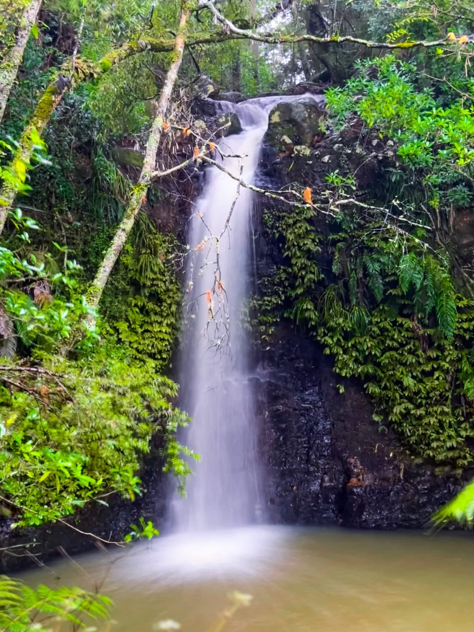
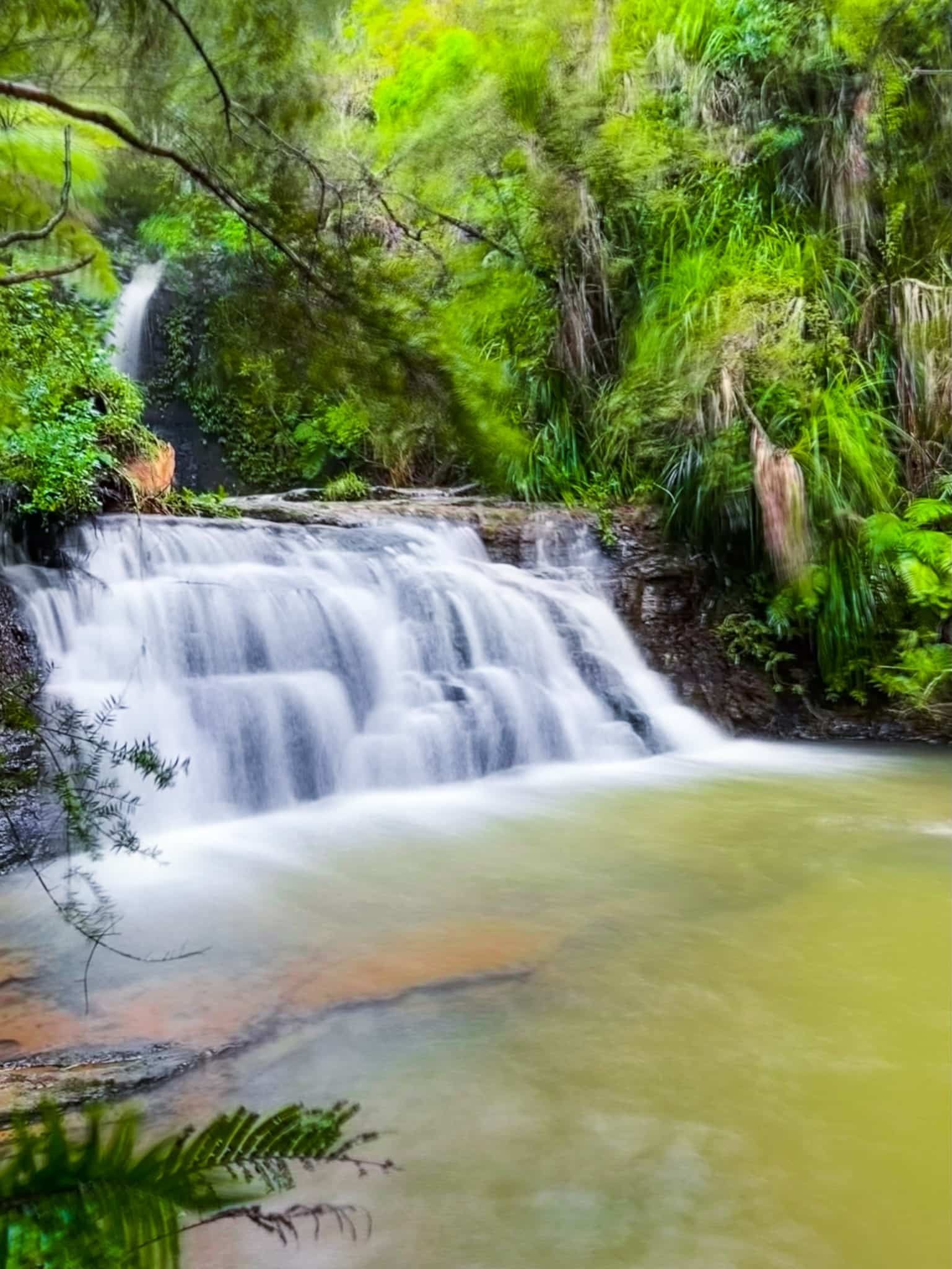
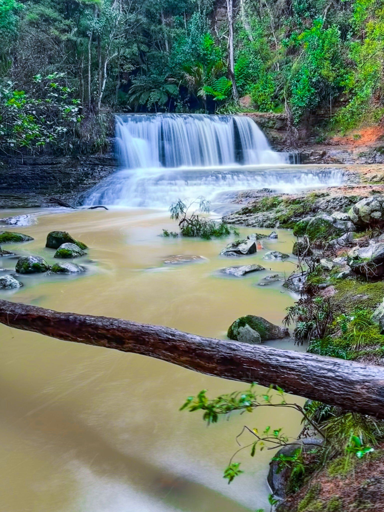
Omeru Scenic Reserve – Omeru Falls
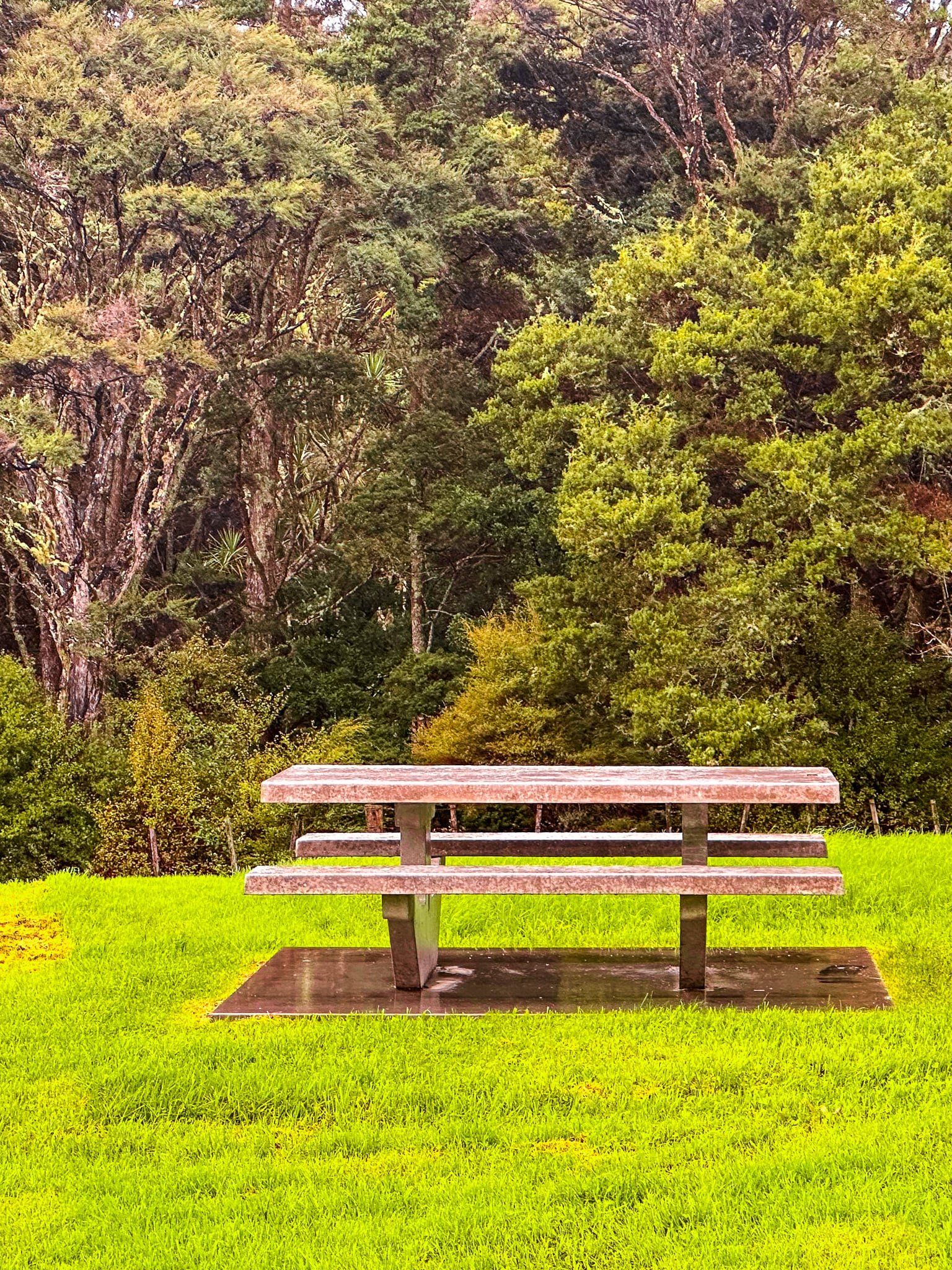
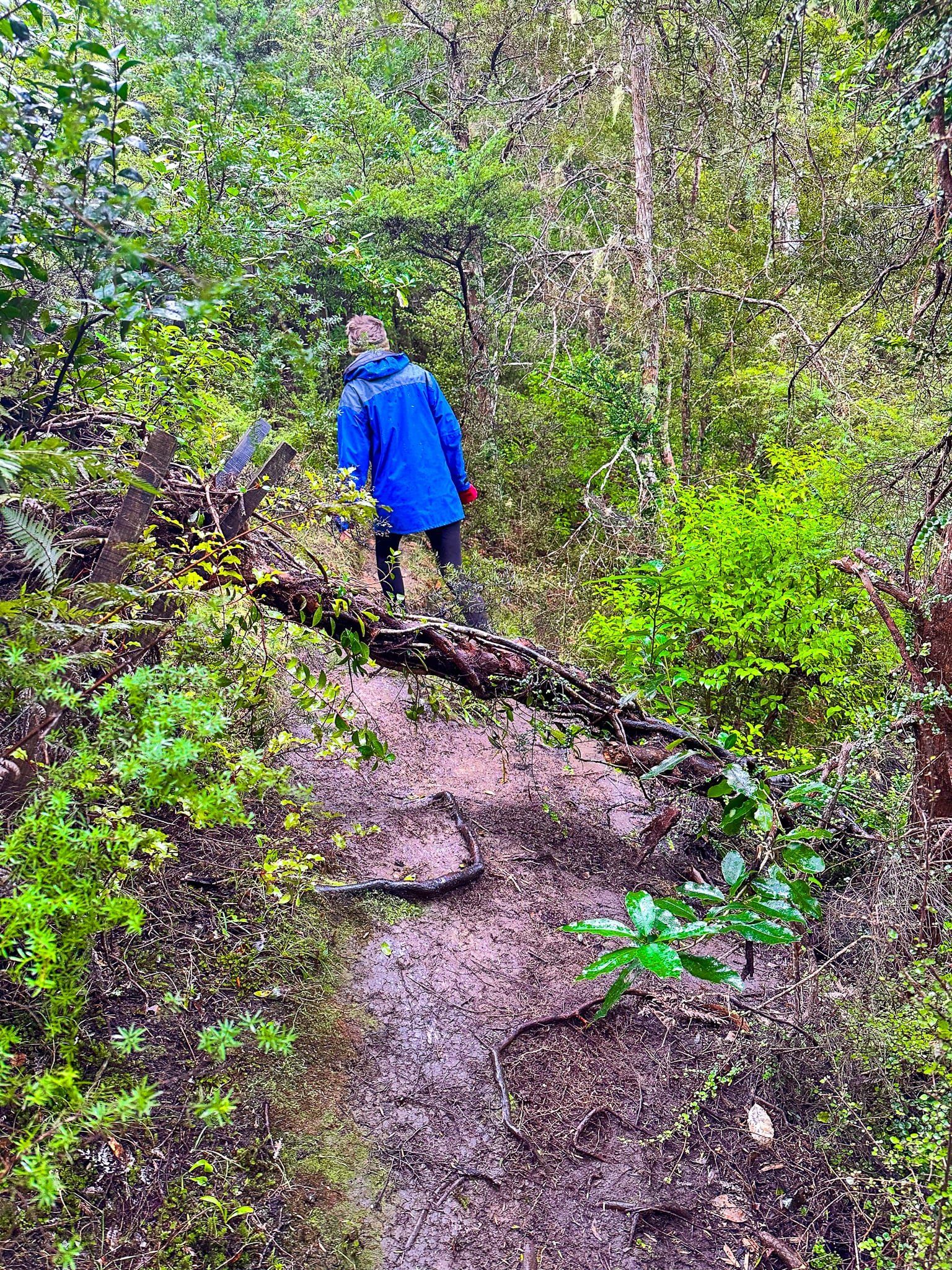
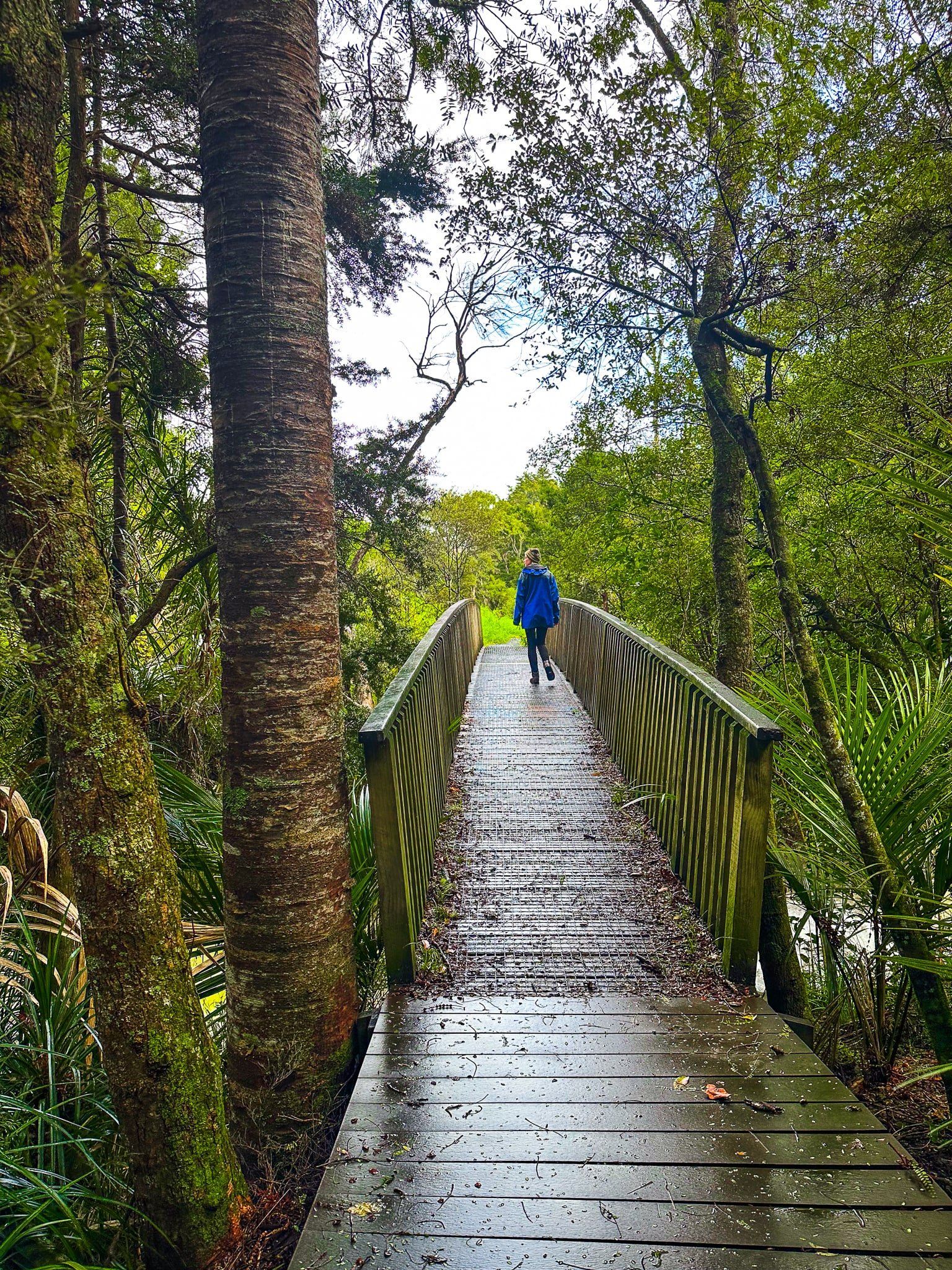
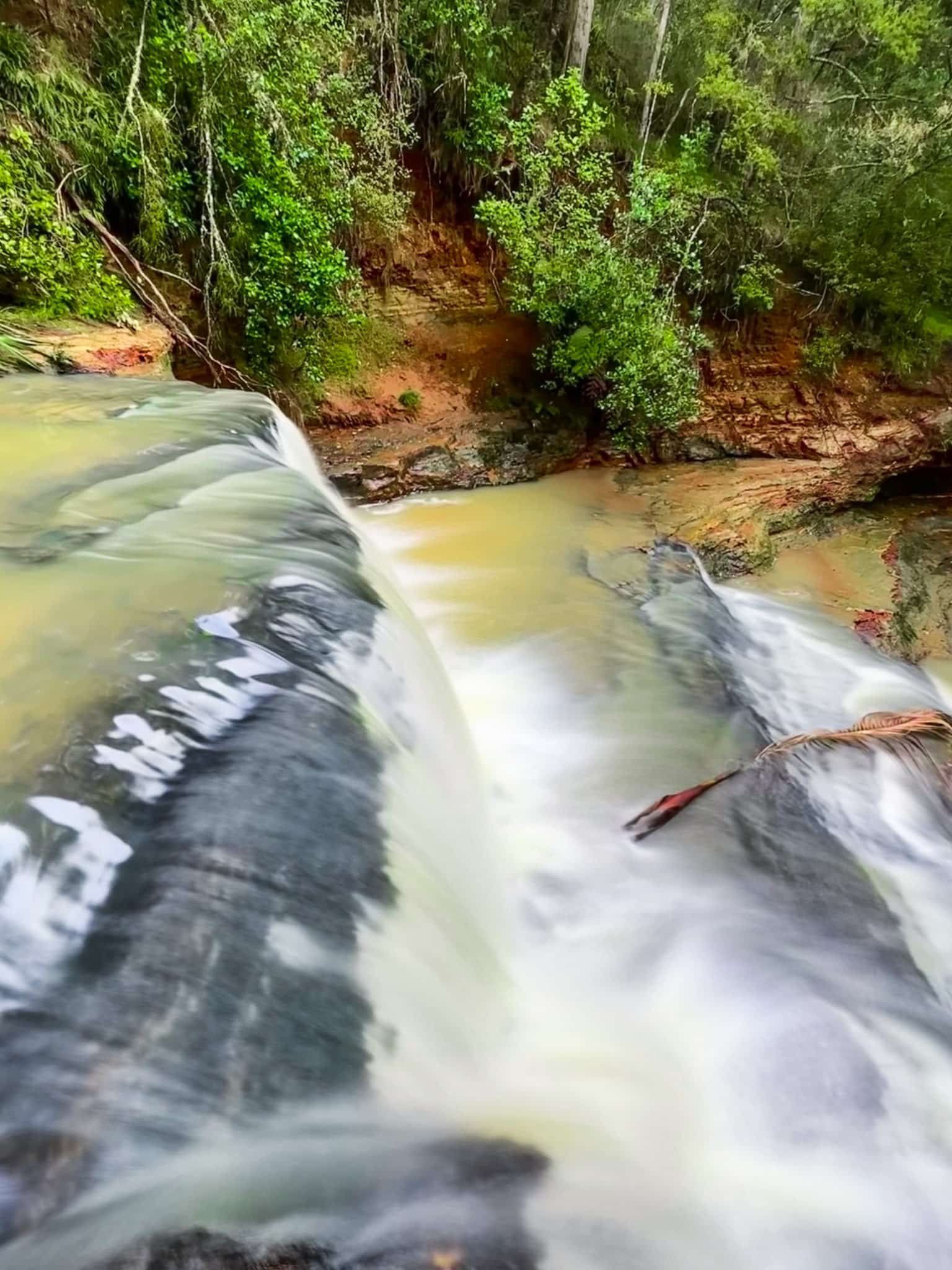
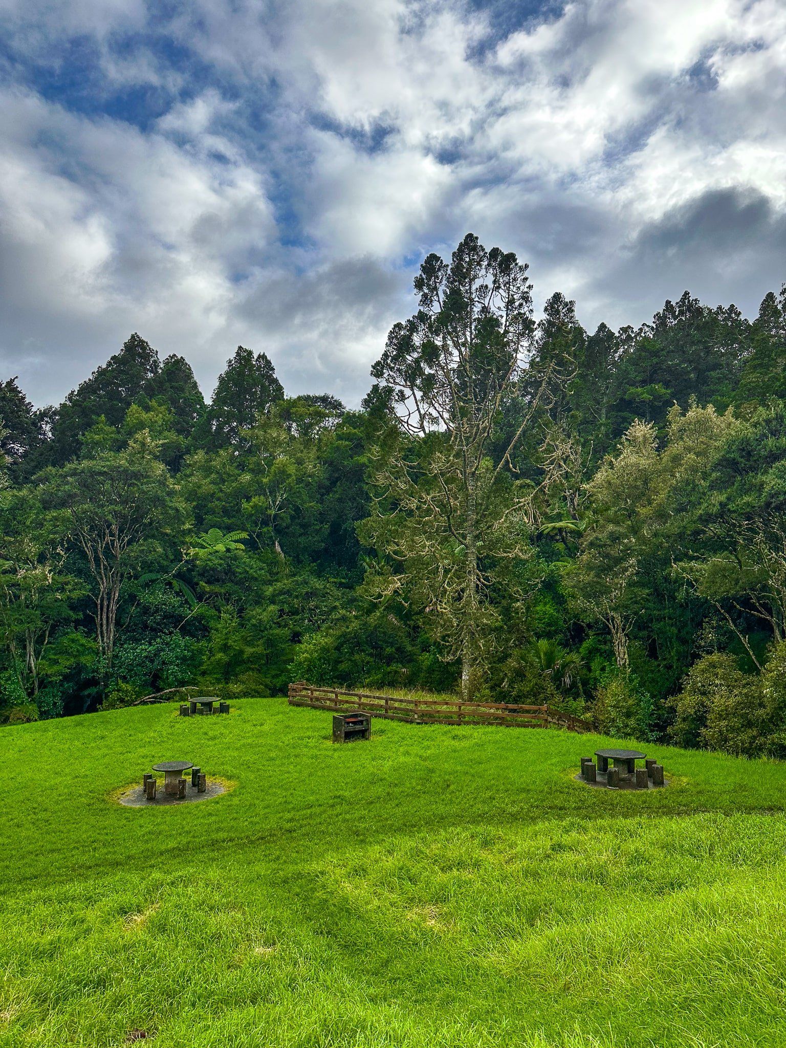
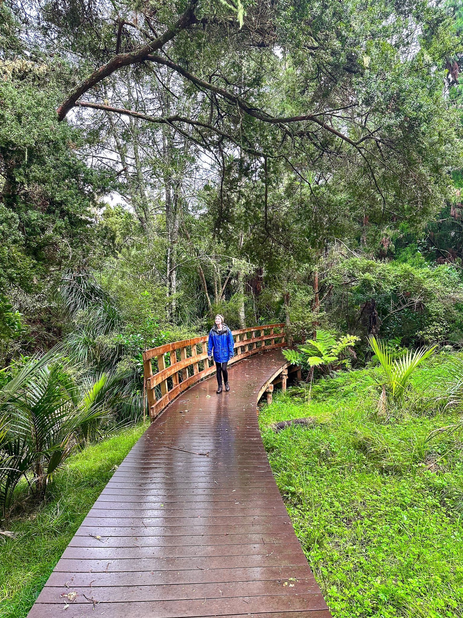
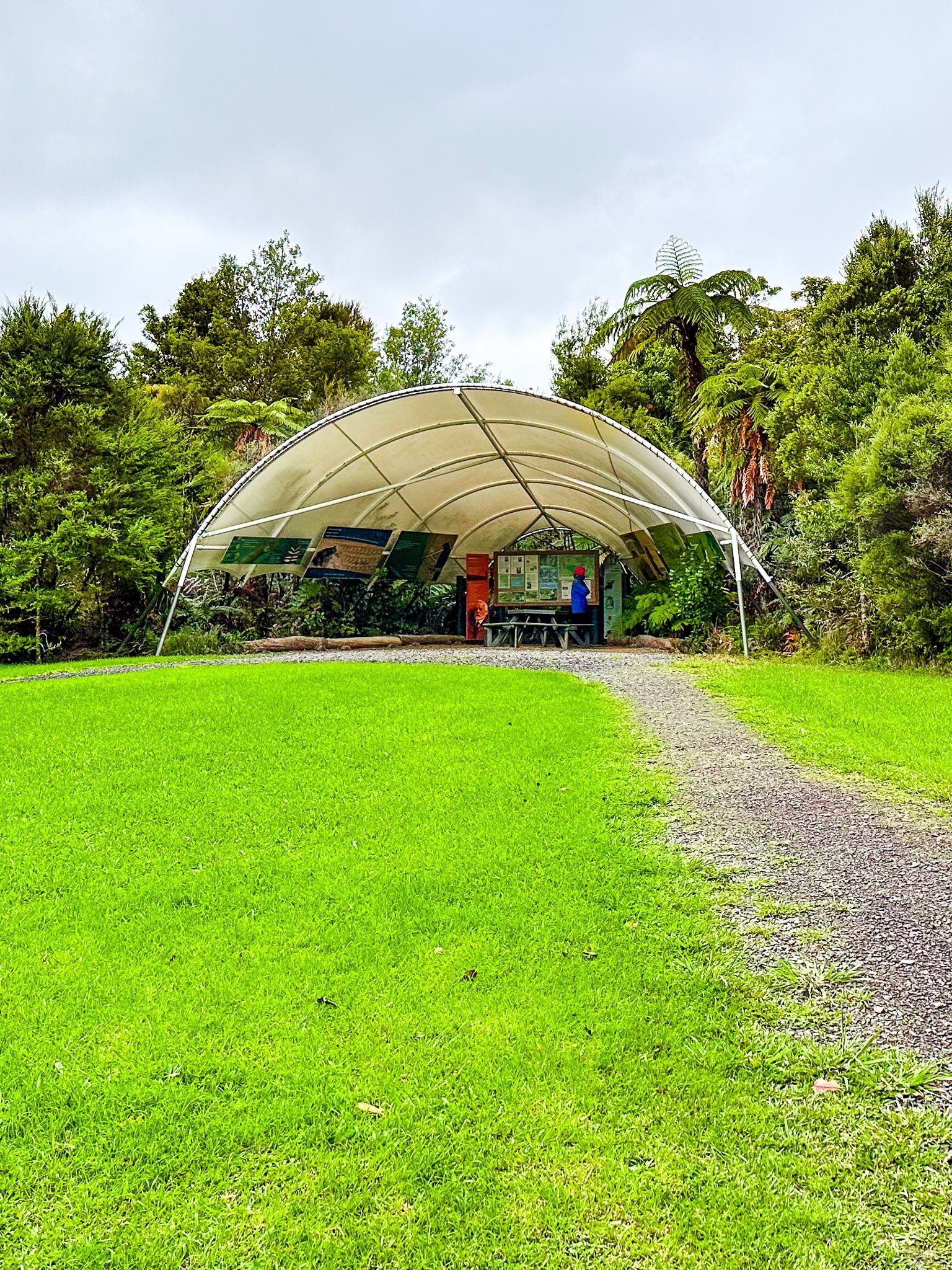
State Highway 16 from Kumeu to Welllsford is mostly a drive through rolling green farmland. But along the way is Omeru Scenic Reserve. This is an exceptional stop, featuring the convergence of two streams, both with waterfalls, recovering kauri forest, and an old pā site. The two higher waterfalls are named – Omeru Falls at 5 metres and Waitangi Falls at 7 metres – and there are several smaller falls. The track follows the two streams to each of the falls and it takes about 30 to 40 minutes for the circuit, with multiple places to swim. There is a lovely grassed area with seating for picnics at the pā site.
For Omeru Falls (five metres), it’s an easy ten-minute walk to the base of the waterfall. From the carpark, walk down the access road and cross the footbridge over the first stream. The pā site and picnic area is to the left, but turn right for the Falls. Follow the track near the first stream on the right until you see the second steam and a shorter waterfall on the left. Stay right for another three minutes for Omeru Falls, including a modest climb and drop to access the pool at the base.
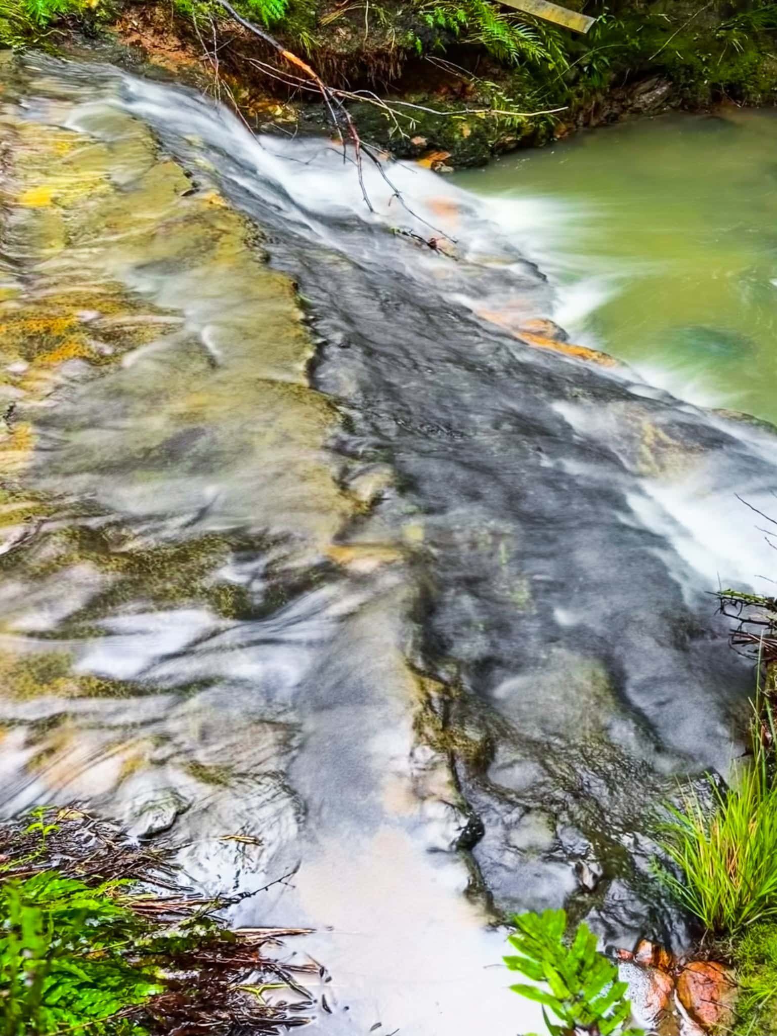
There are also a couple of rough side tracks that get you to smaller secondary waterfalls below Omeru Falls on the first stream. But take care as it can be wet and slippery. Swimming at the base of the falls is popular in summer when the water is clearer. Note that it does get muddy with heavy rain.
Return the same way and head through the pā site and picnic area over a bridge on the second stream to get to Waitangi Falls.
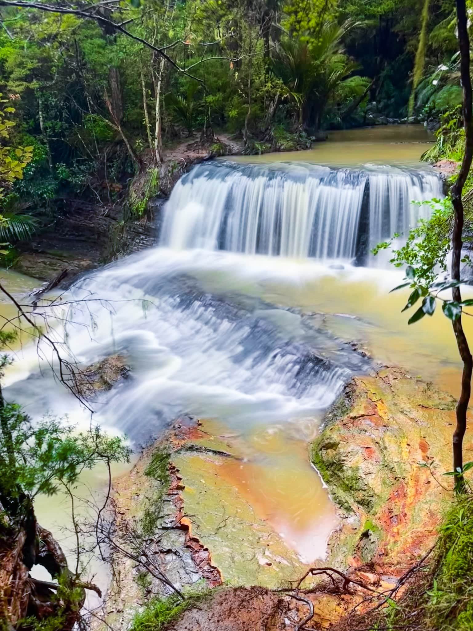
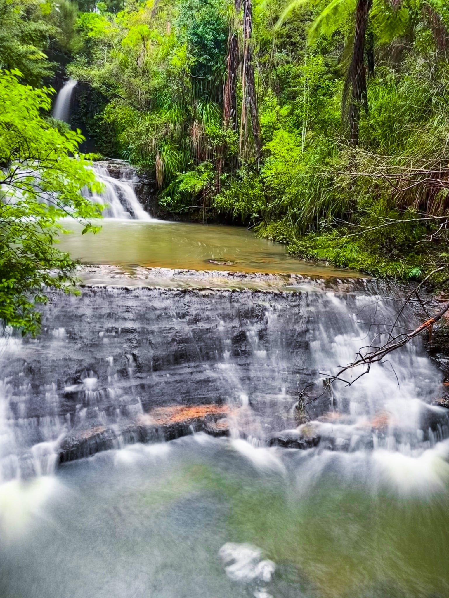
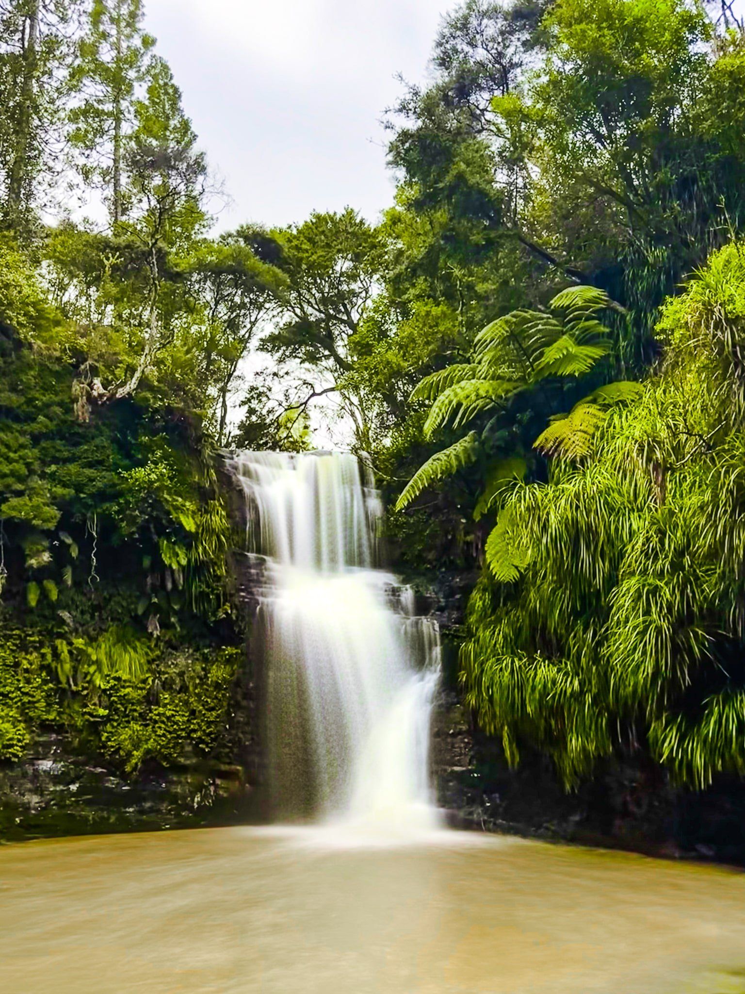
Omeru Scenic Reserve – Waitangi Falls
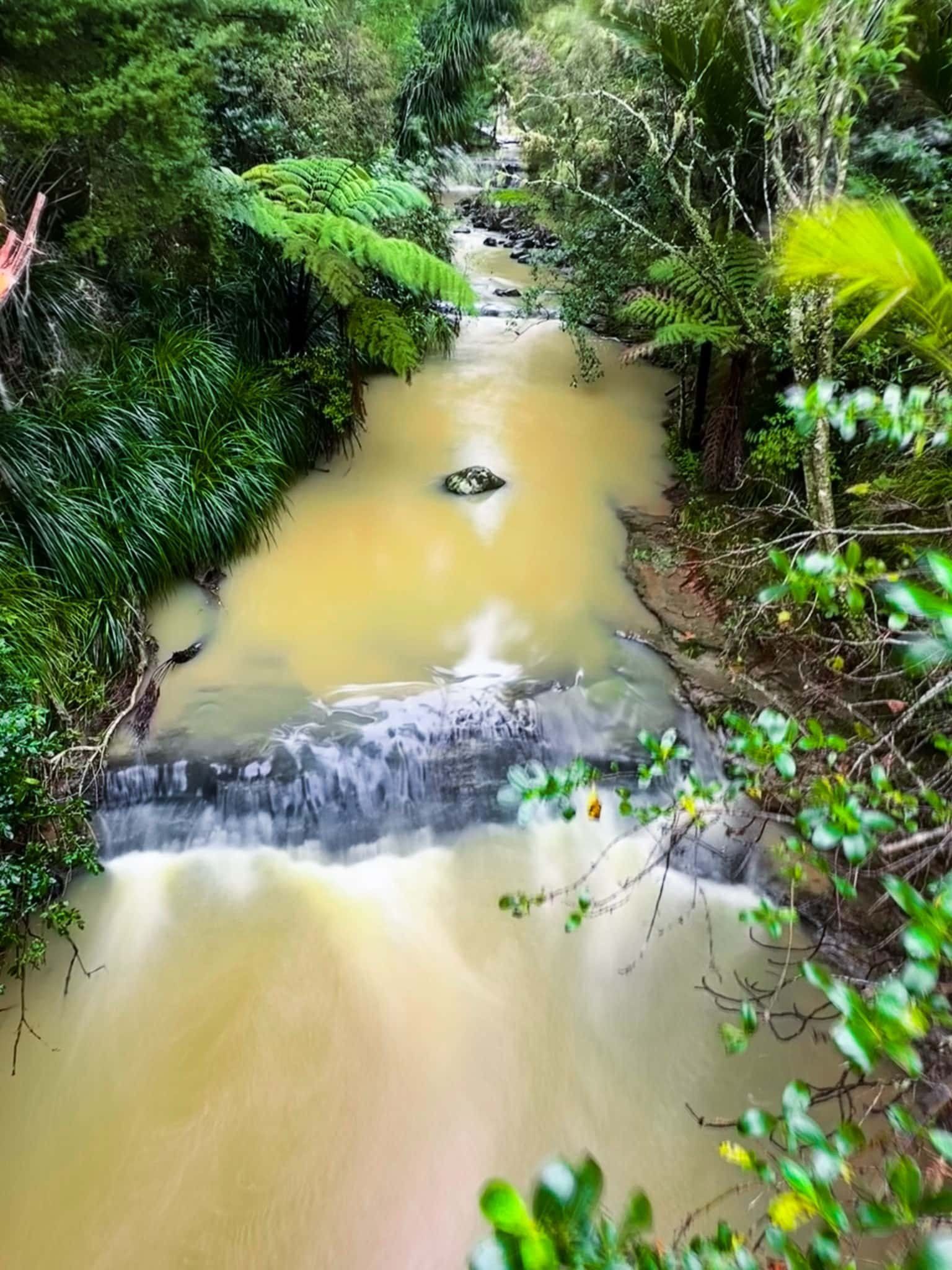
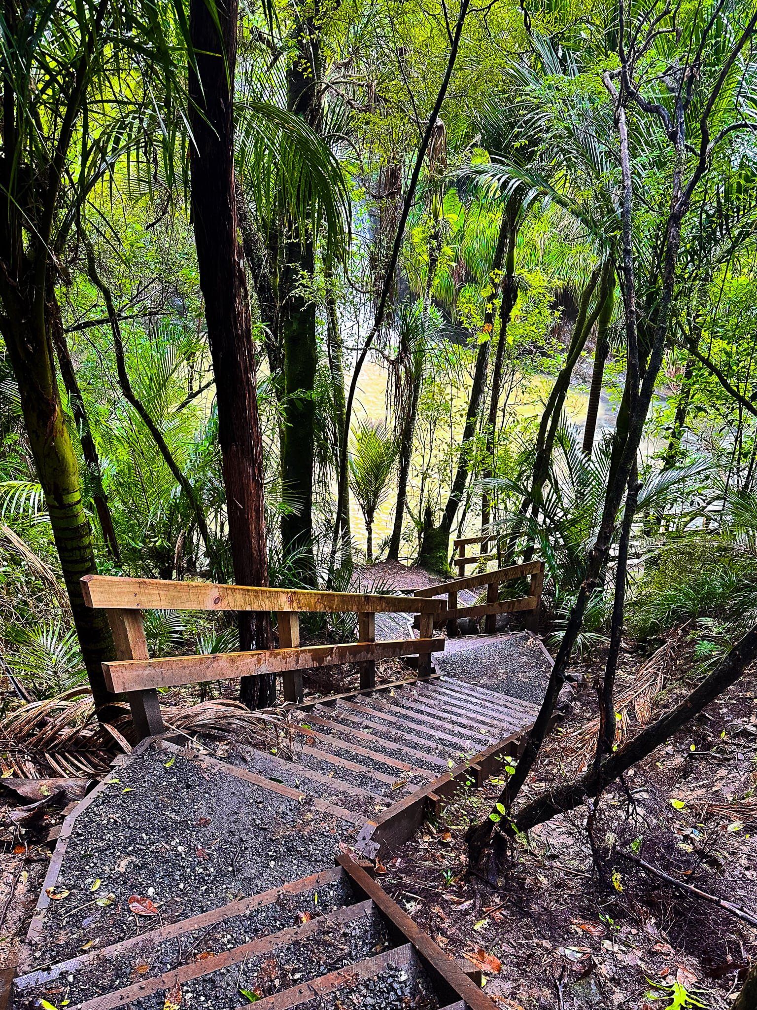
Waitangi Falls (seven metres) is a 20 minute walk from the car park. Walk down the hill, over the bridge on the first stream, and head left across the grassed pā site and picnic area. Cross a second bridge and follow the boardwalk through a pretty kauri grove and above the second stream. The track then rises up gently through forest with some views of the stream. At the end, there is a quite steep but short set of stairs down to a viewing platform at the base of the falls.
Swimming at the base of the falls is popular in summer when the water is clearer. Note that it does get muddy with heavy rain.
Return the same way and head through the pā site and picnic area. Turn left onto the track to Omeru Falls near the bridge over the first stream.
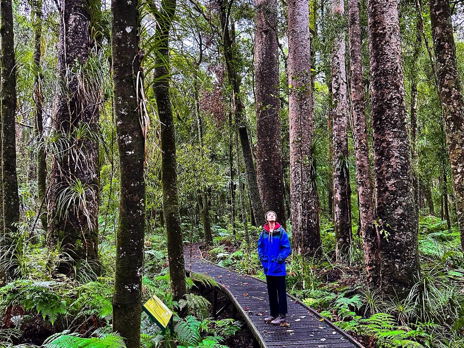
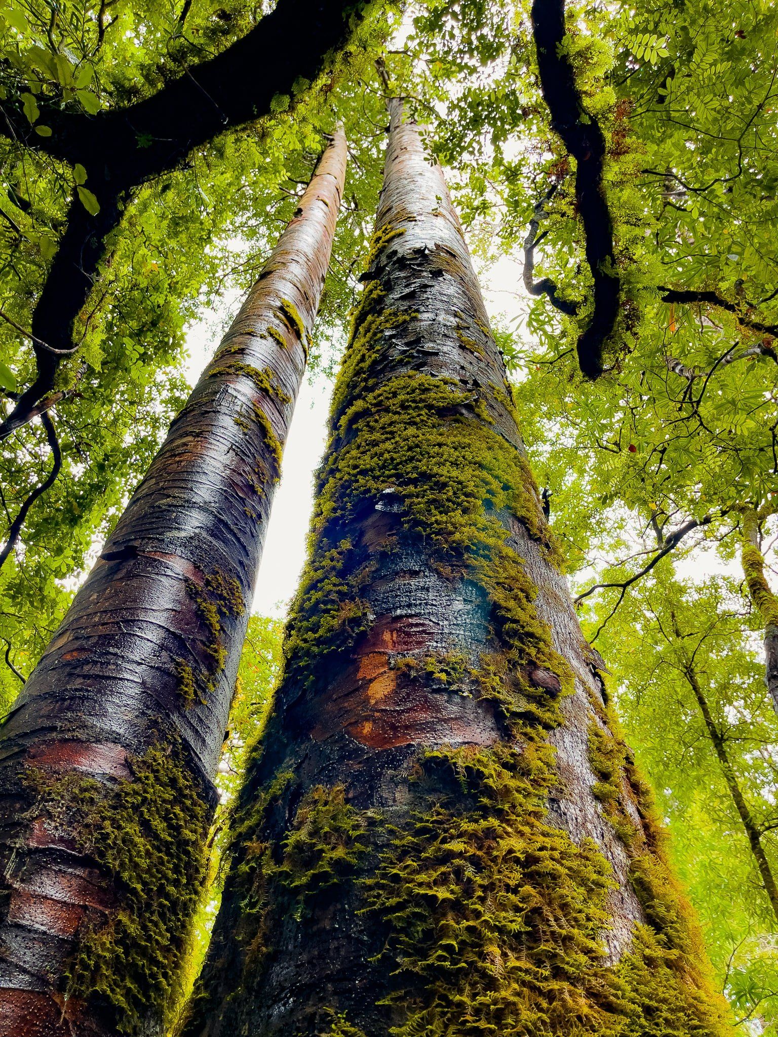
Kauri Bushman’s Memorial Walk
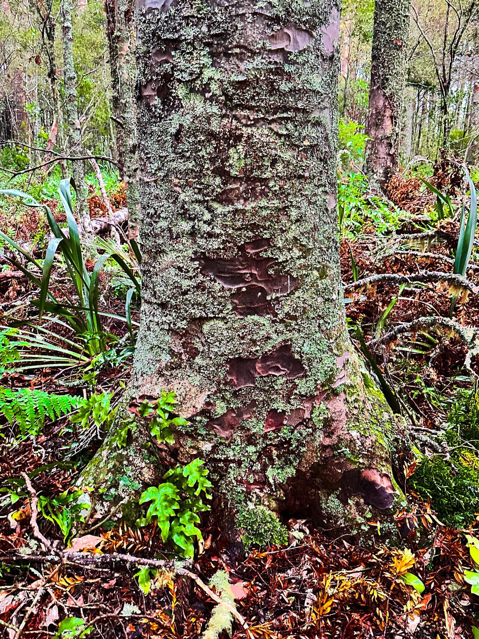
At Brynderwyn, turn left from State Highway 1 onto State Highway 12, the Kauri Coast route. Despite the moniker, the land is mainly rolling pastoral farmland. The first sign of kauri is an easily missed road sign for Kauri Bushman’s Memorial Walk, between Paparoa and the turnoff to the Kauri Museum at Matakohe. Turn right onto Stirling Road and stay left on the road until you see the sign and car park.
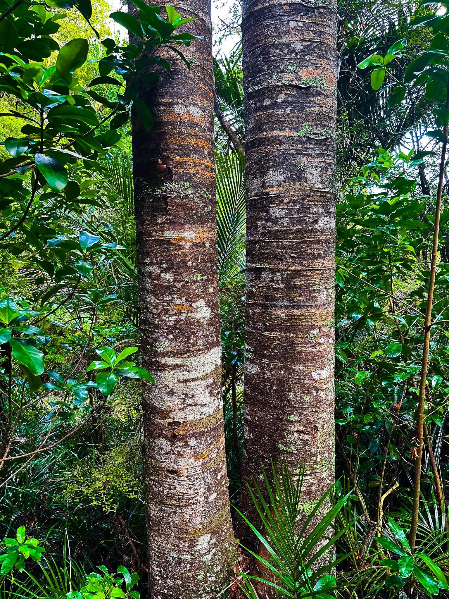
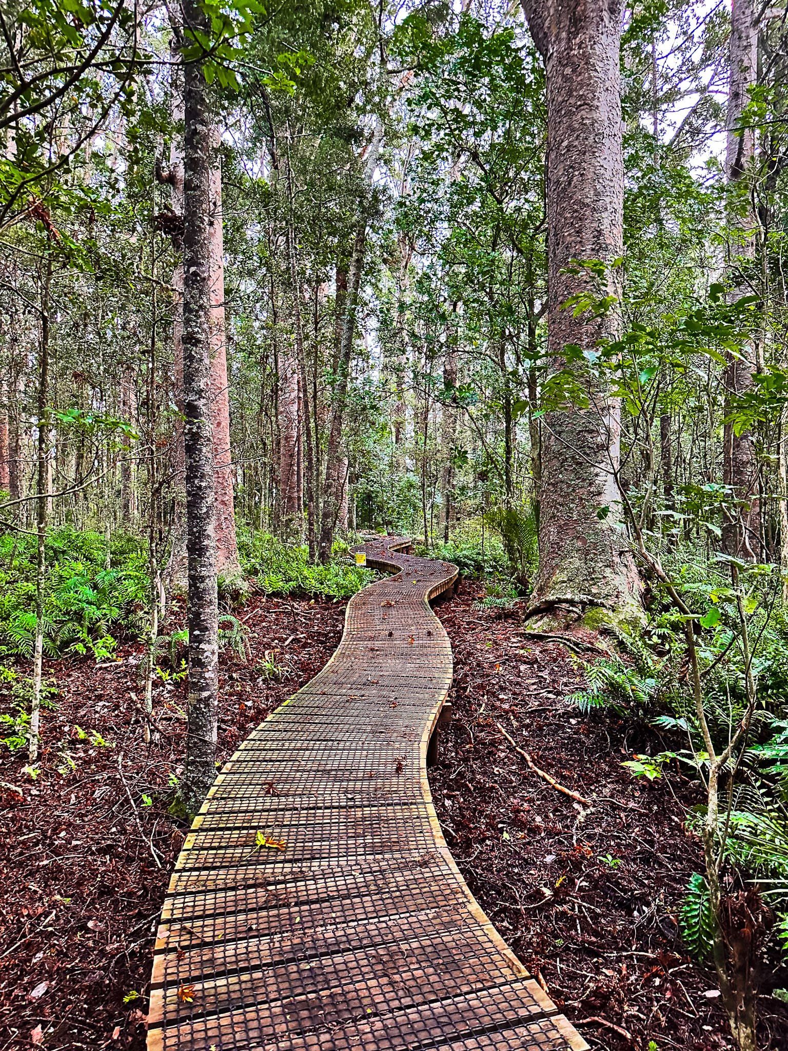
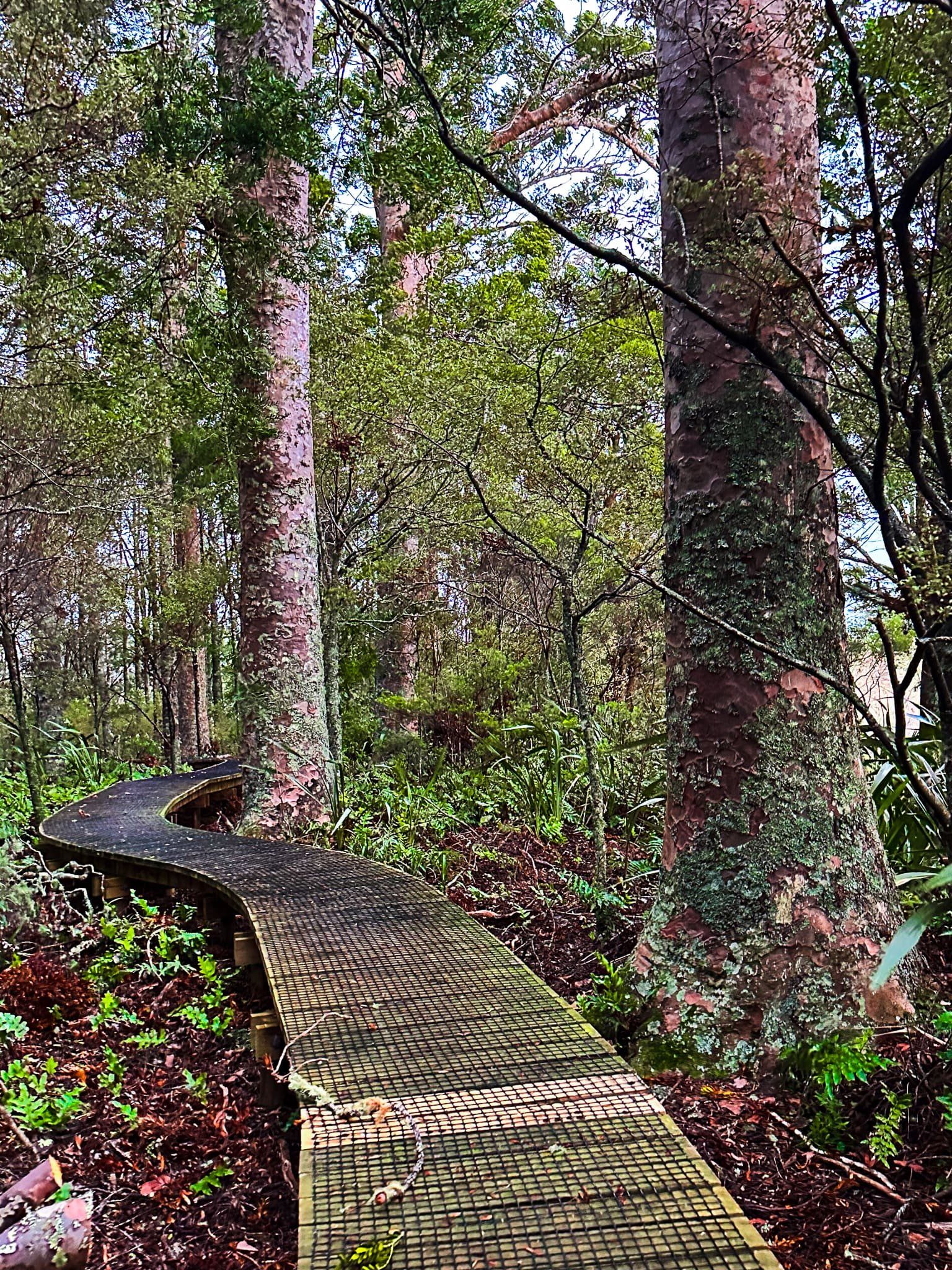
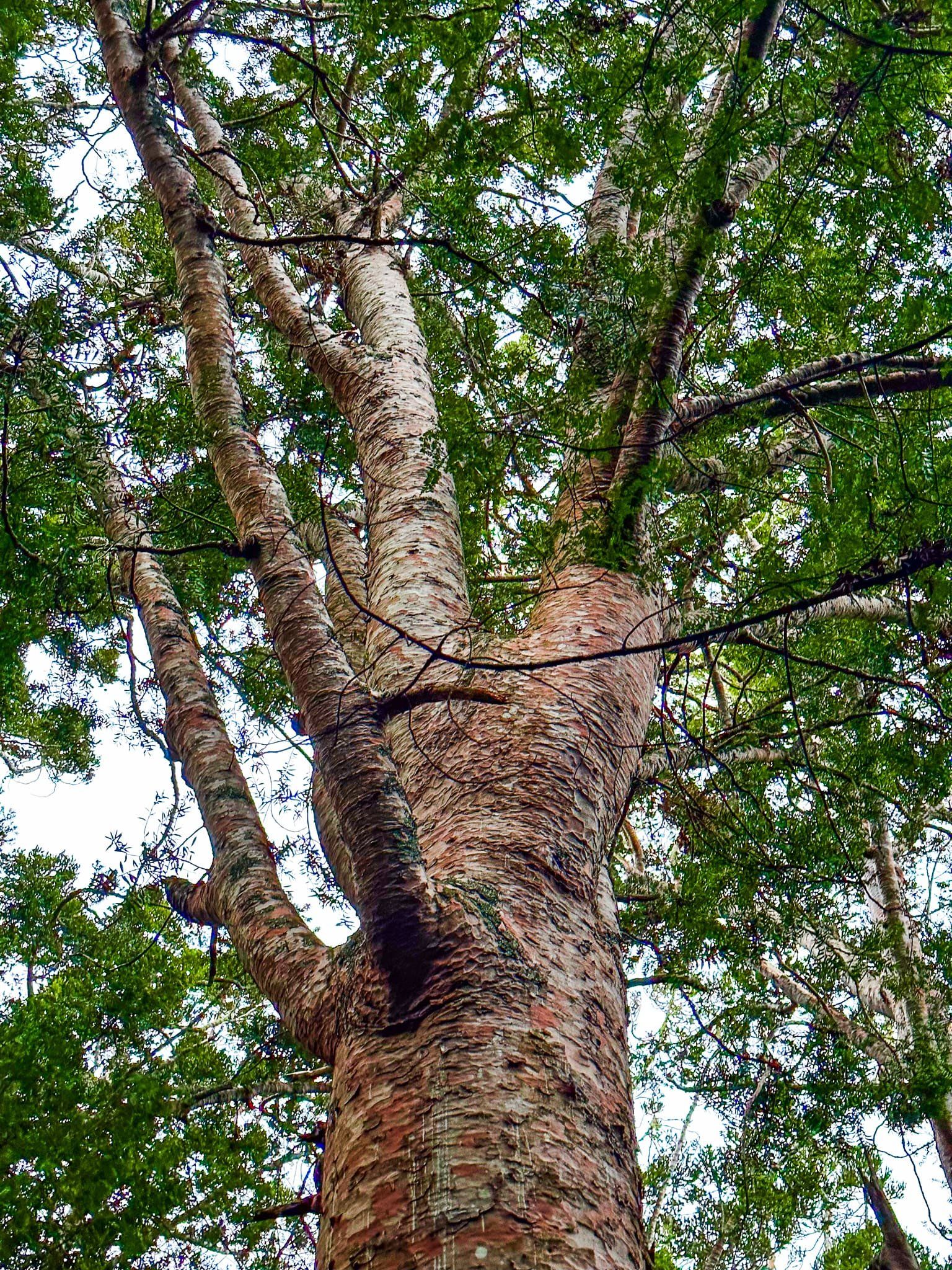
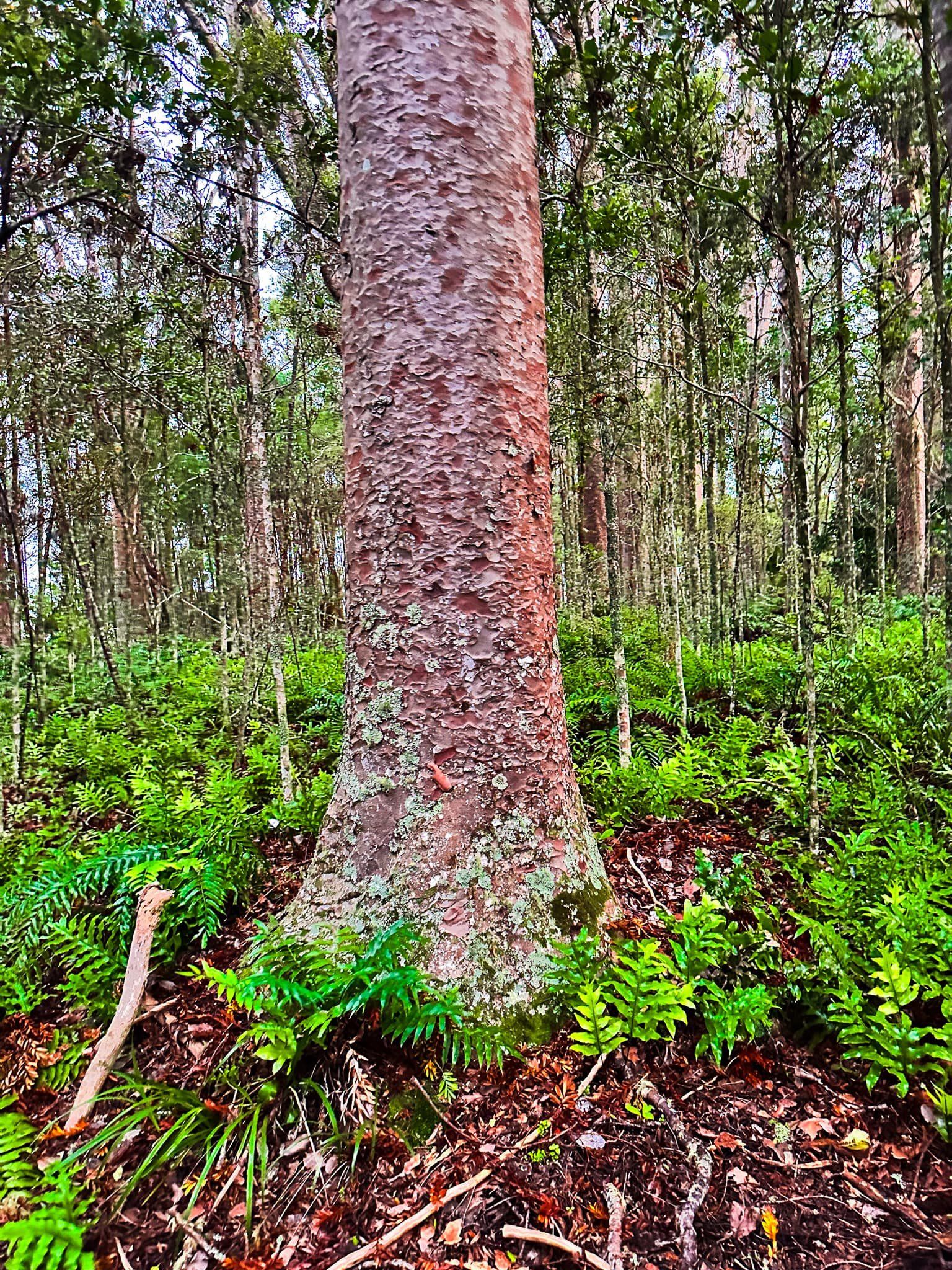
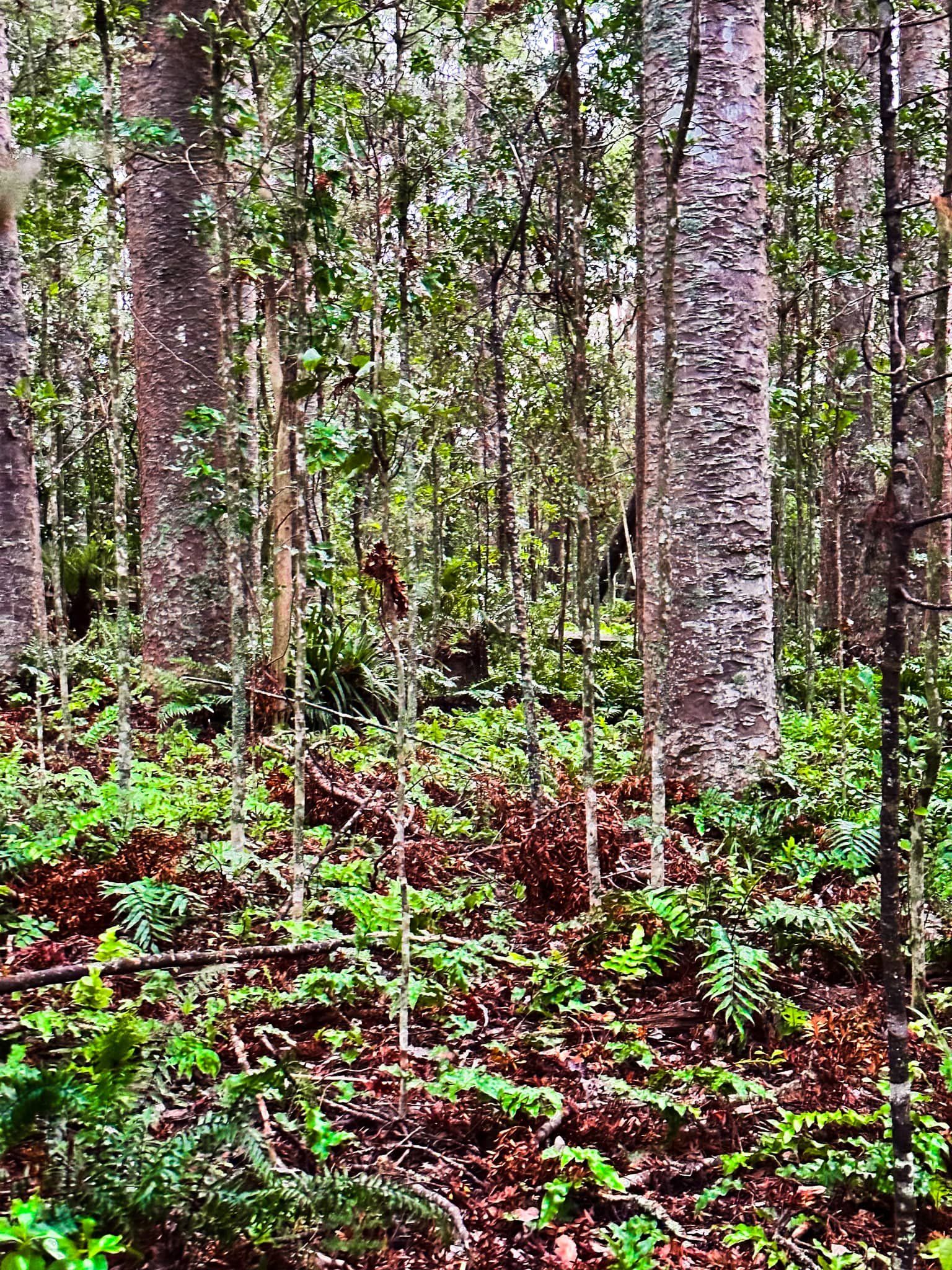
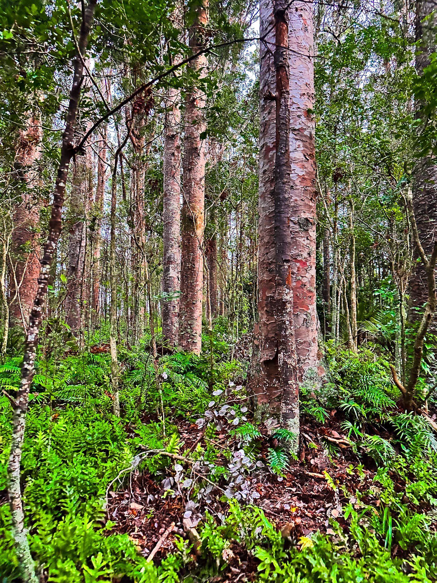
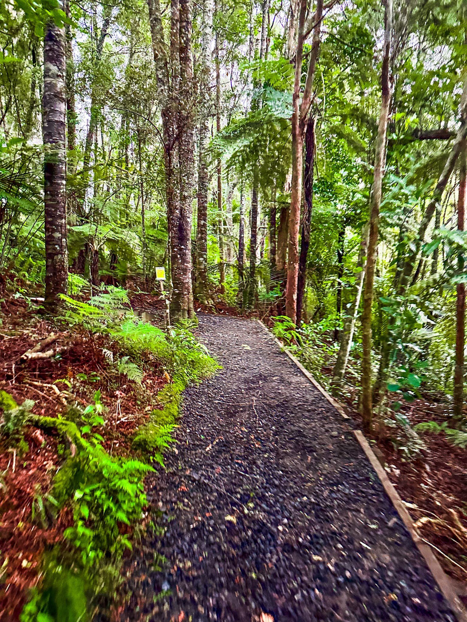
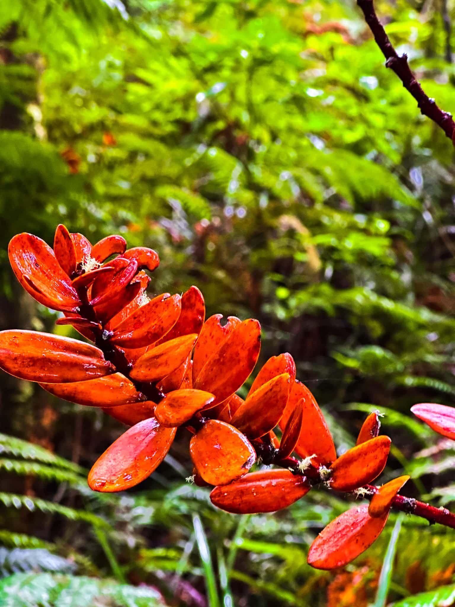
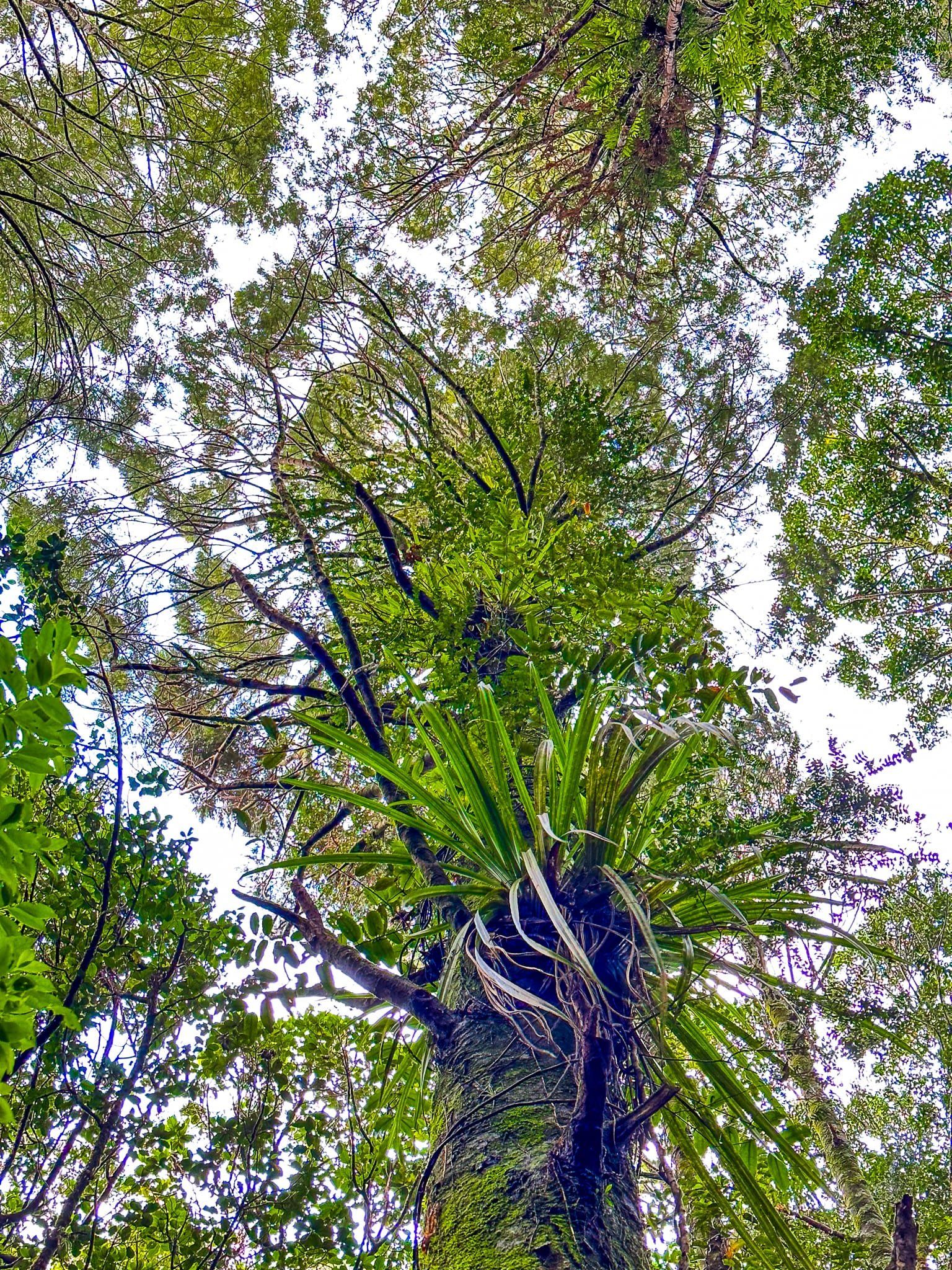
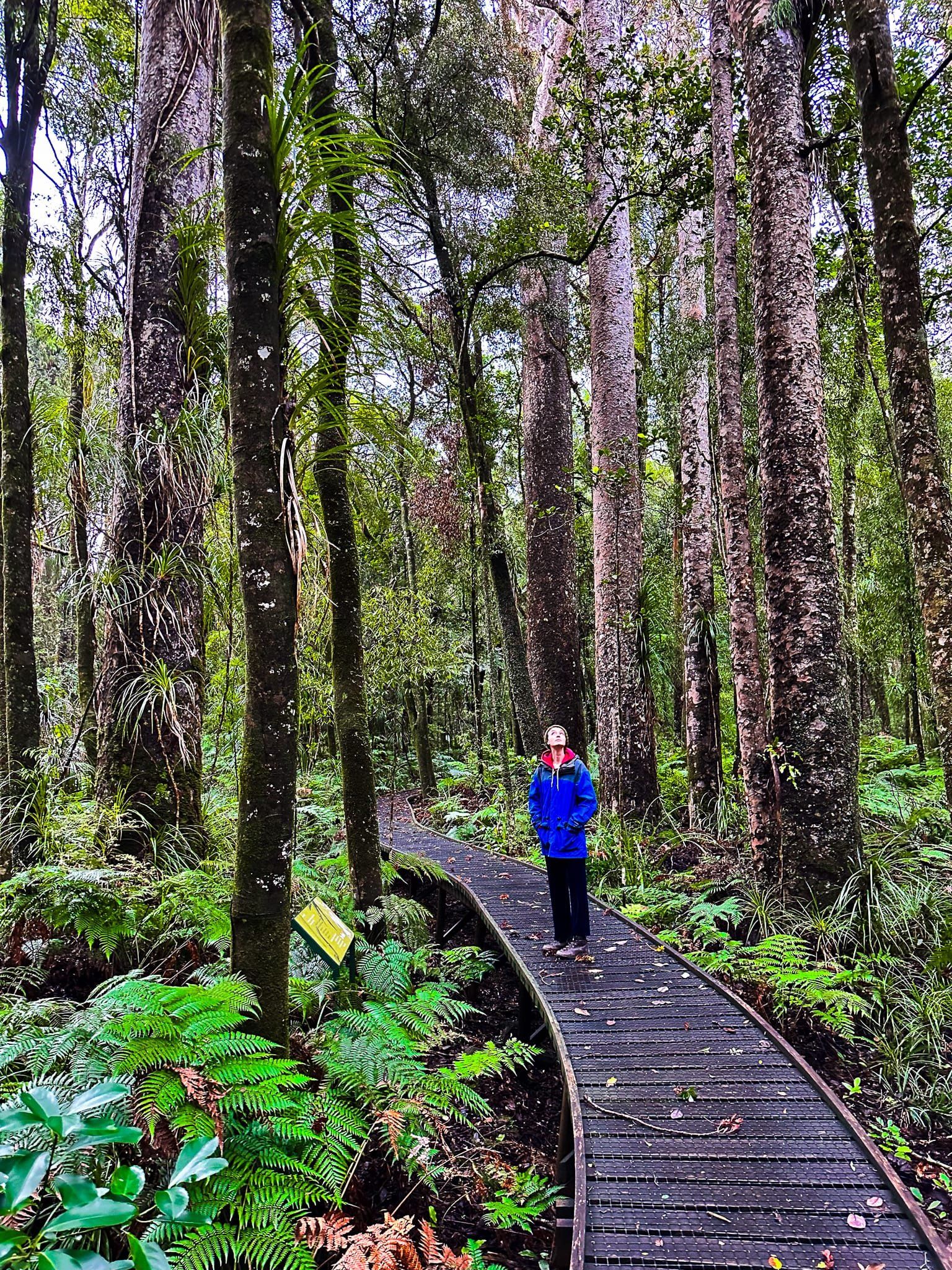
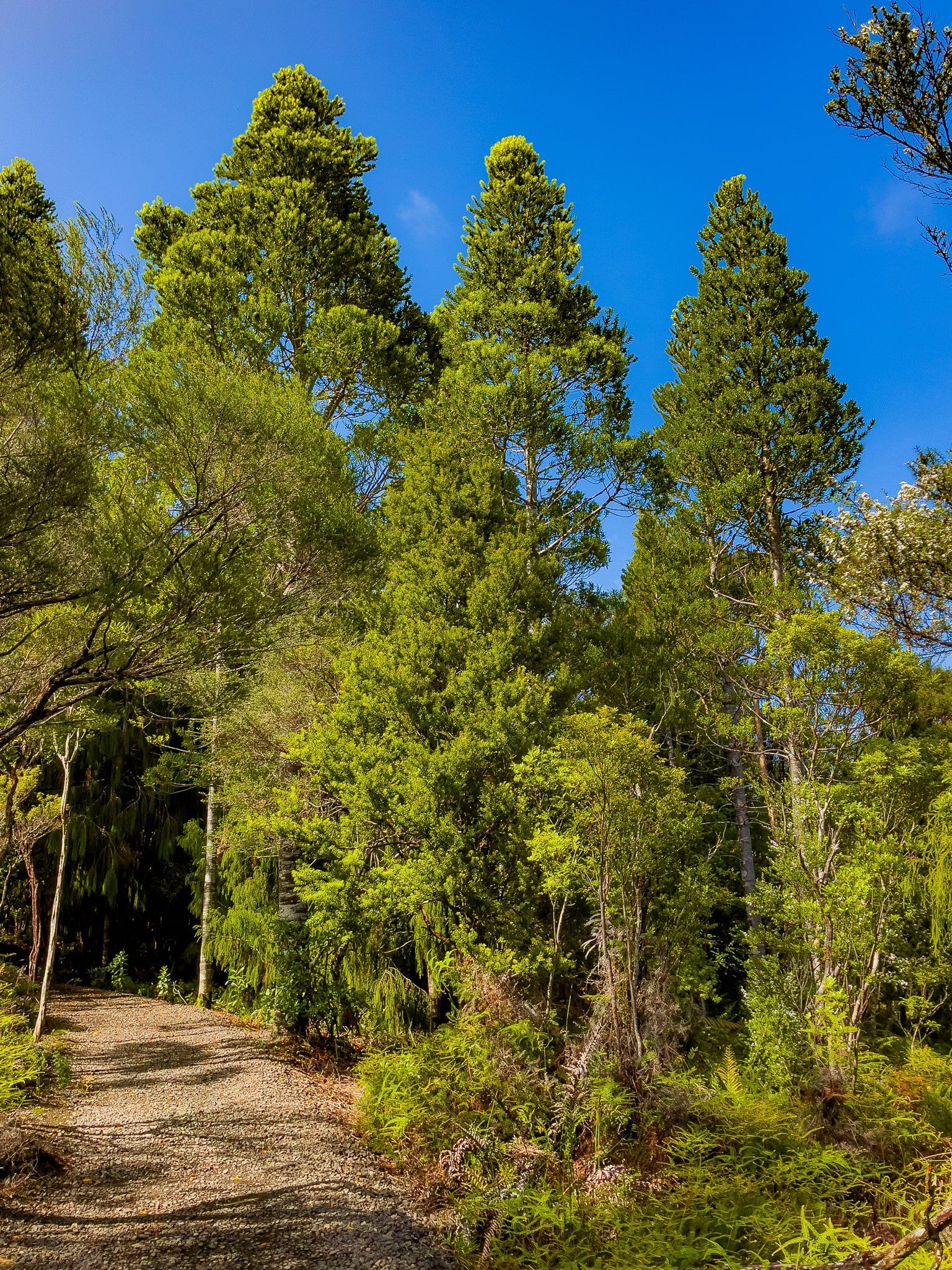
The reserve offers a short 300 m boardwalk loop through a regenerating kauri forest. The oldest trees are probably around the 200 year old mark, so at relatively early stages of crown development. However, it is an almost purely kauri forest, which is a bit unusual.
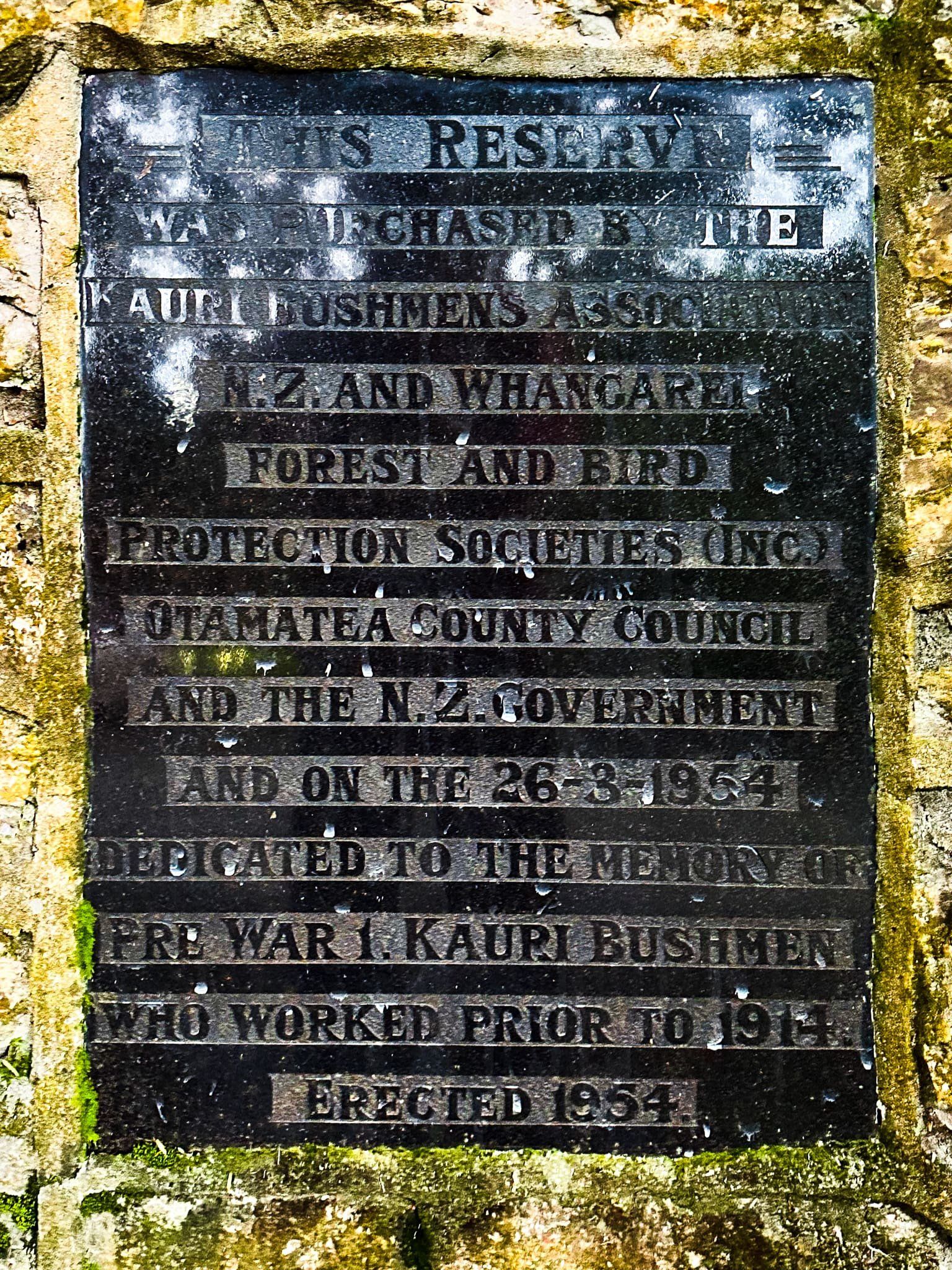
A plaque at the entrance explains that the section of forest was acquired by NZ Forest and Bird in partnership with the government and the Kauri Bushman’s Association to commemorate the people who worked in the kauri forests prior to 1914, the start of WWI.

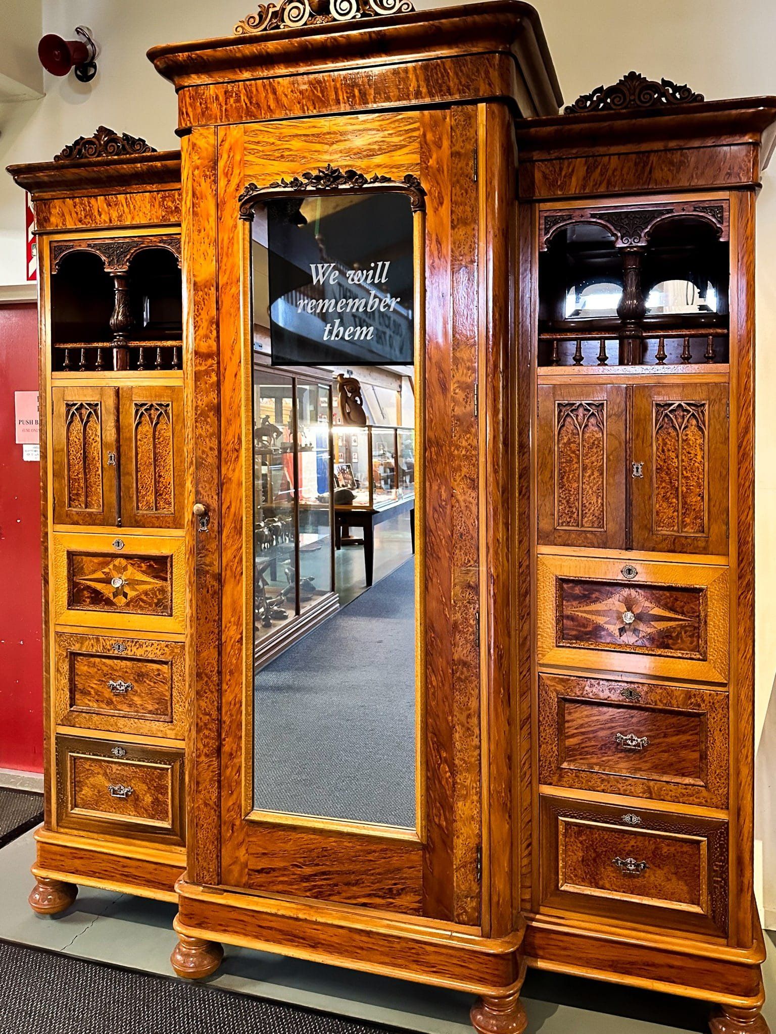
Kauri Museum
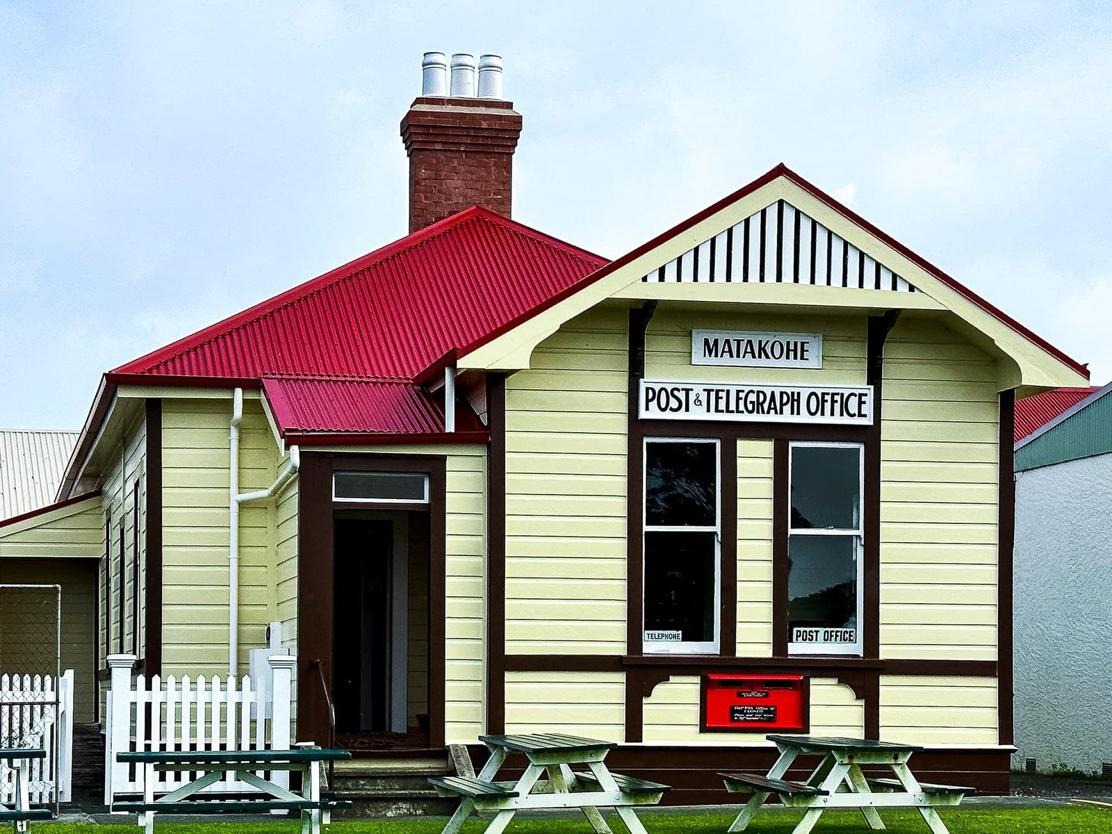
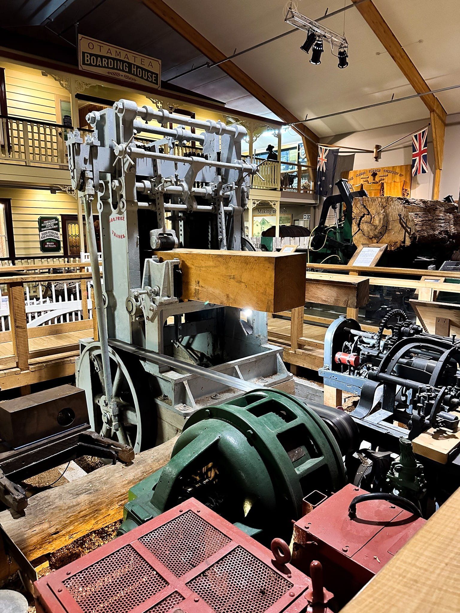
The Kauri Museum is a highlight of any trip up through the Kauri Coast in Northland. It is well-signposted at the turn off to Matakohe from State Highway 12, with parking and access on Church Road. The museum is also across the road from a historic church and post office, plus one of the few cafes on the route.
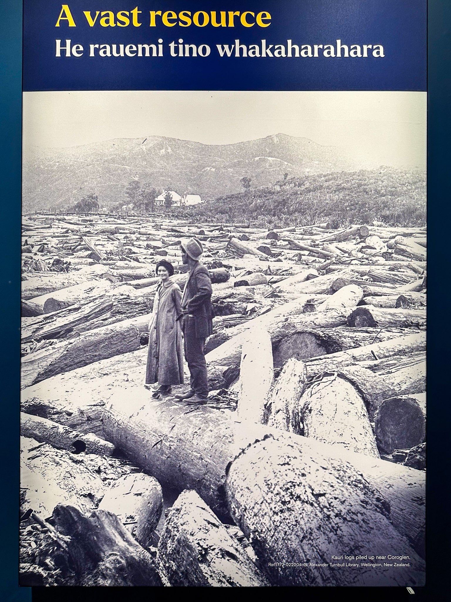
For European settlers, the kauri forests were a major resource. The ancient forests covered most of what is now farmland from north Waikato and the Coromandel to the Far North of Te Tai Tokerau. The lumber was used to build much of early Auckland, Royal Navy ship masts, and a vast array of consumer products. Kauri gum was also valuable for high quality varnish and widely exported. As the trees disappeared, this led to extensive diggings for buried gum troves.
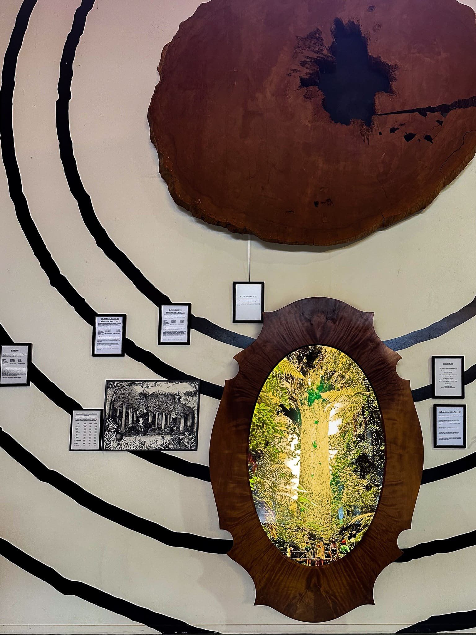
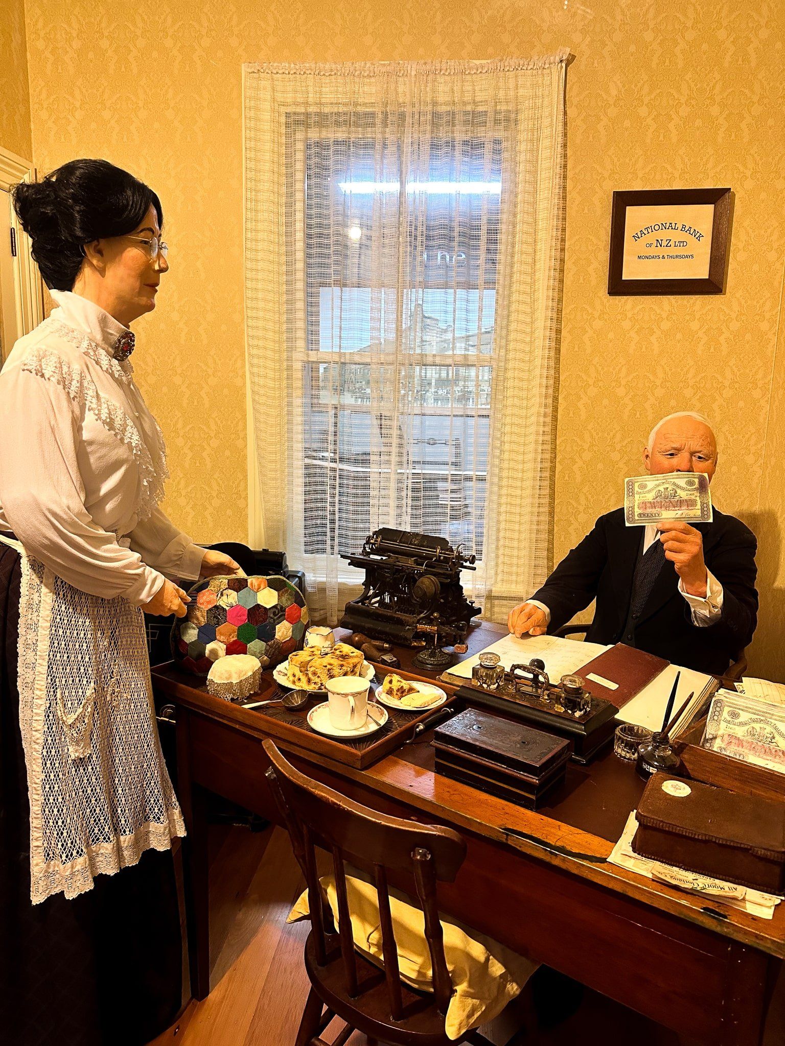
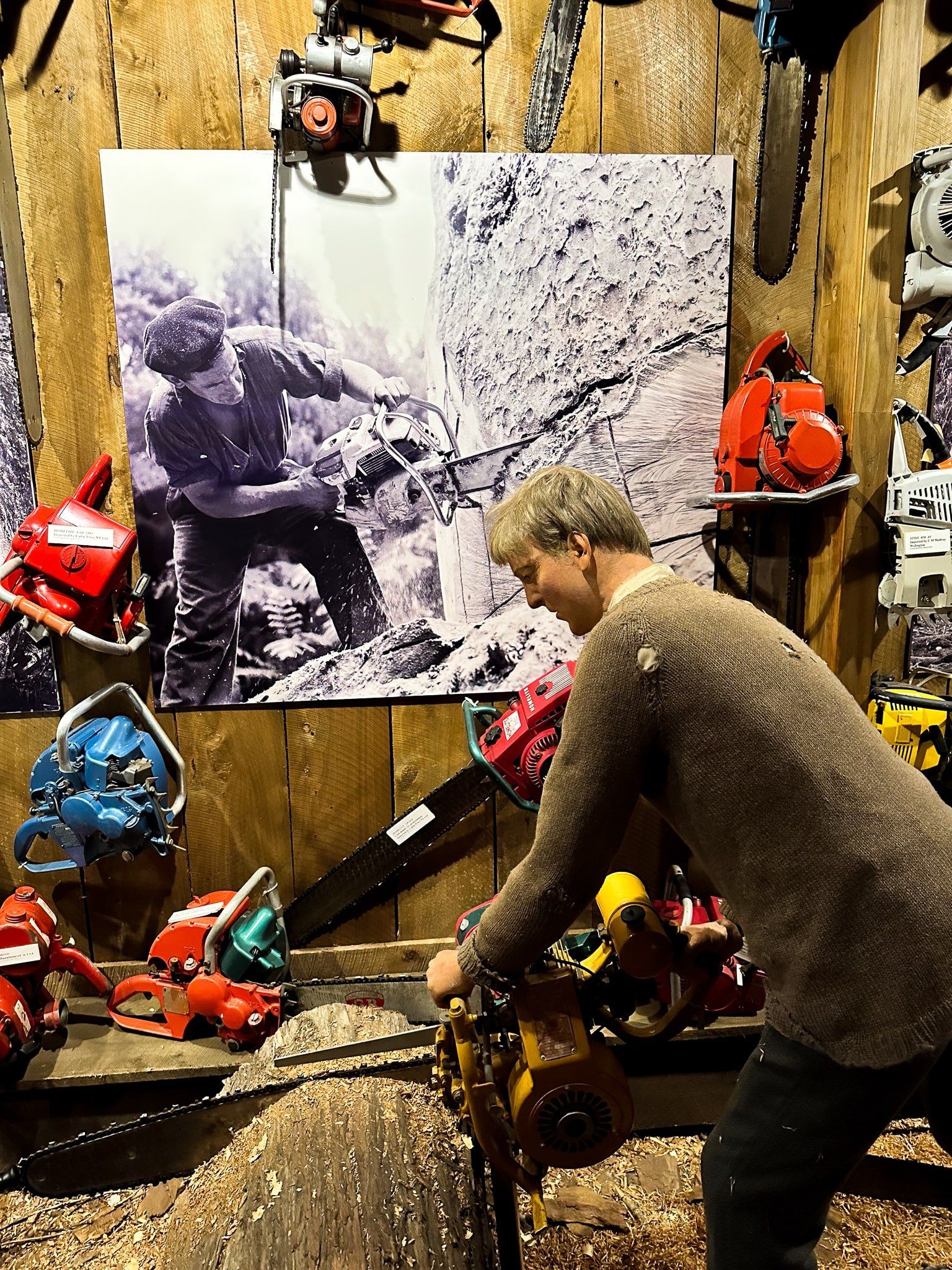
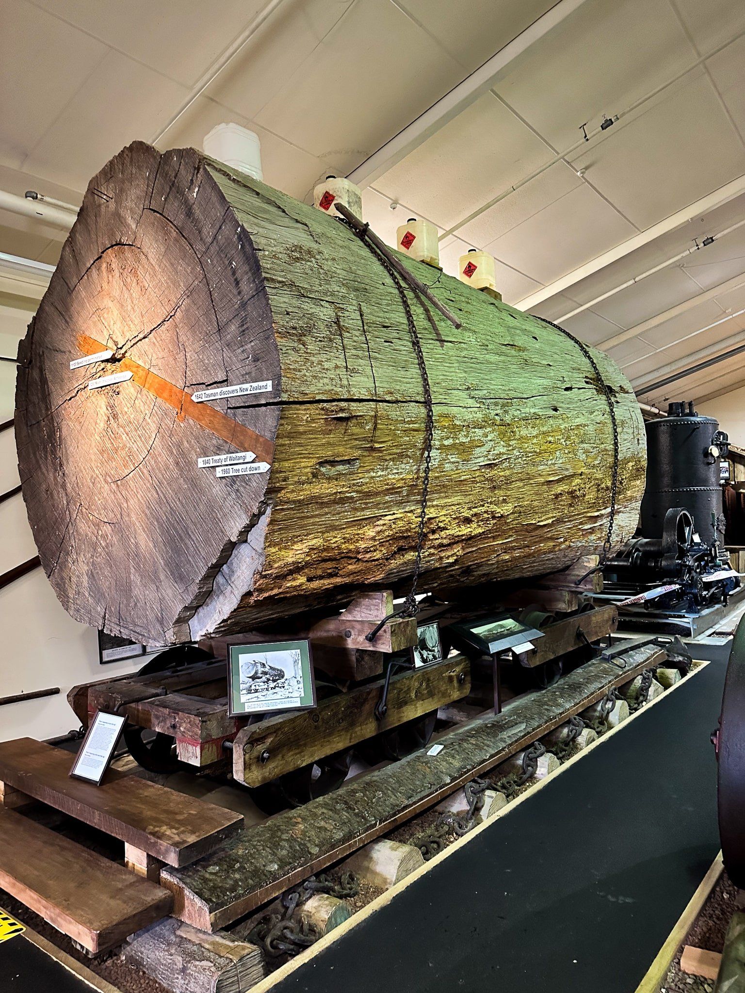
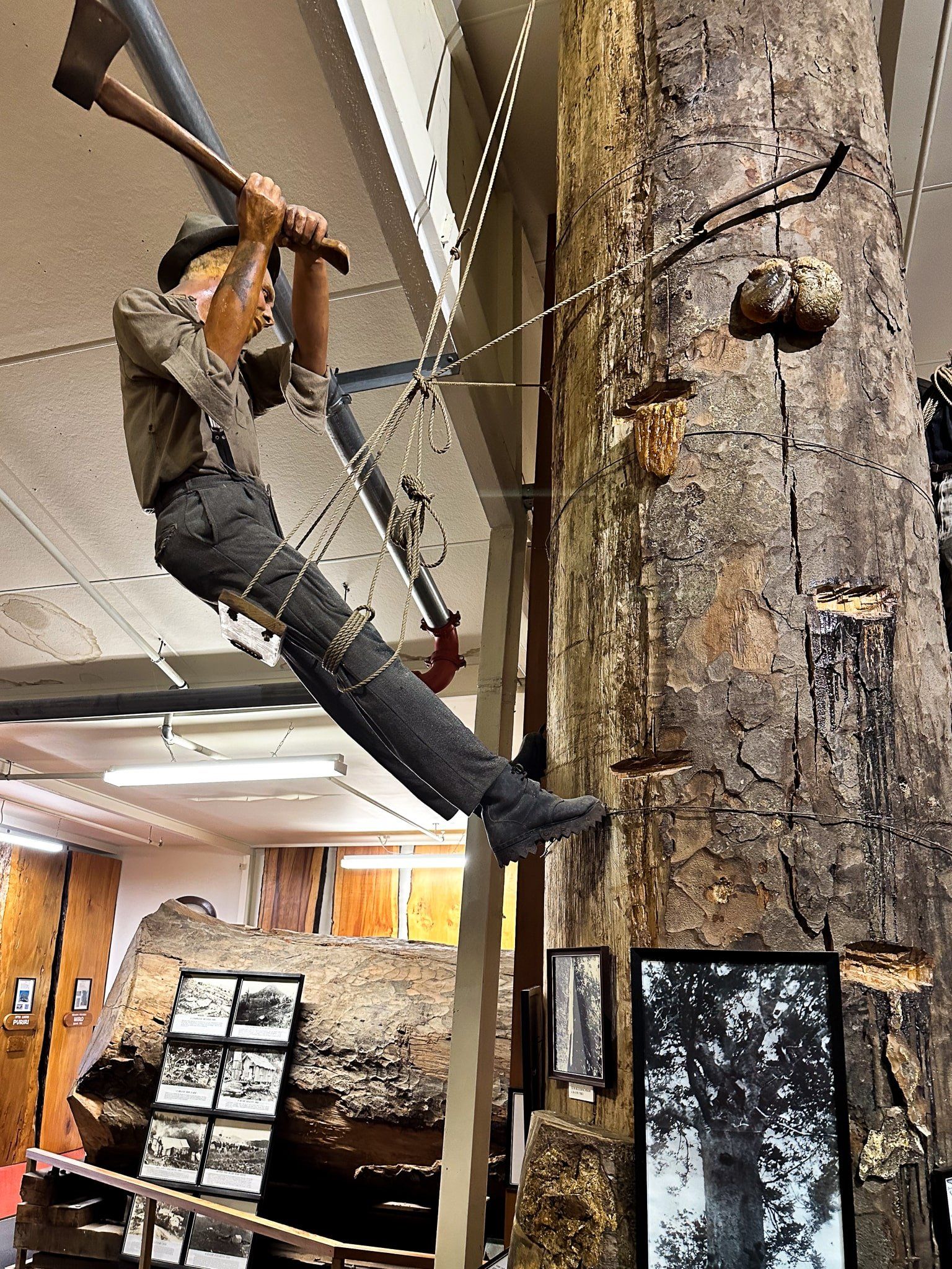
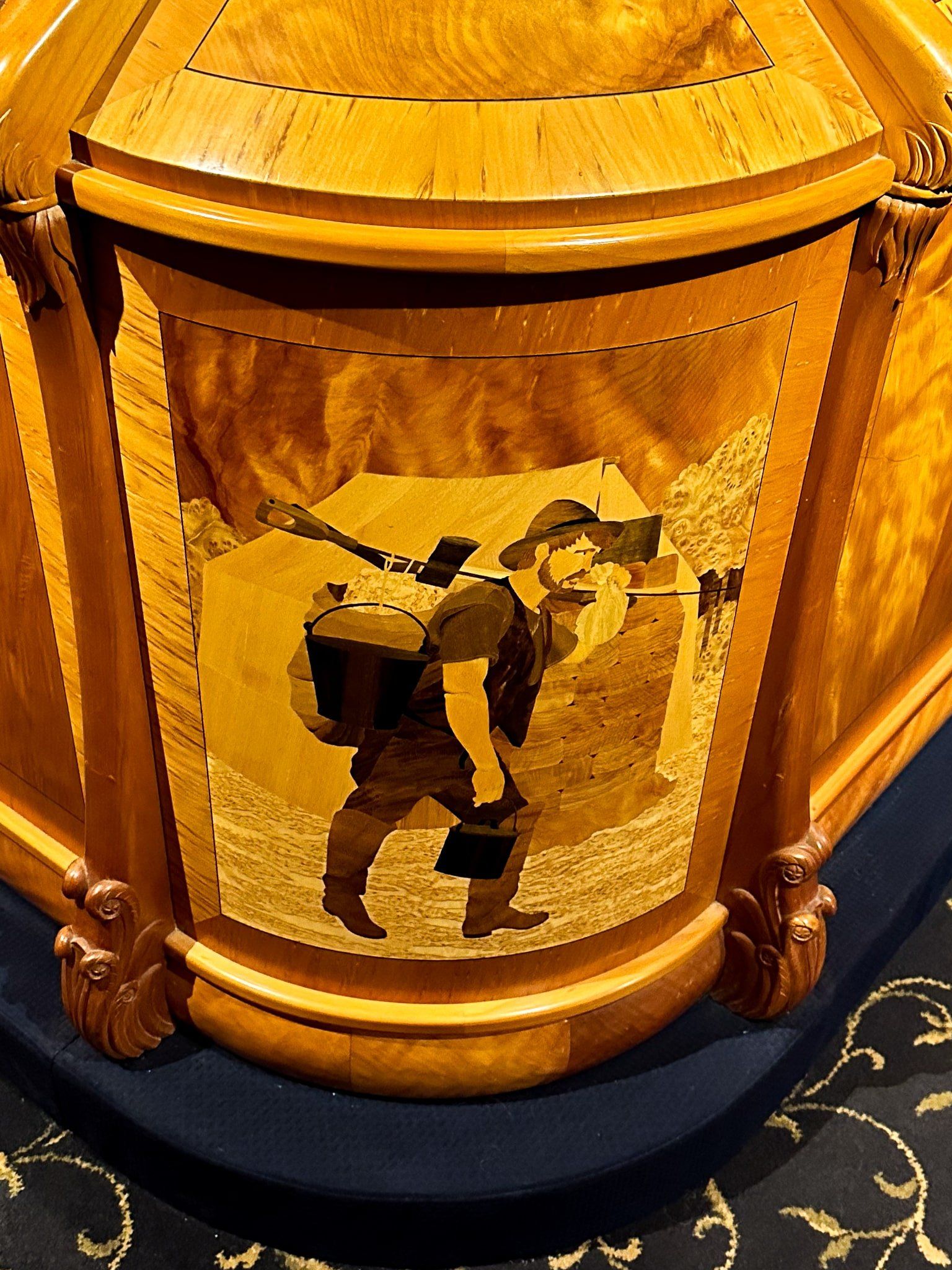
The Kauri Museum does a superb job of telling this story, including a life-size exhibition showing the blow-by-blow process of turning a tree into lumber. There are also extensive collections of artefacts and photos of the various aspects of the kauri industry. The dioramas include incredibly detailed scenes of settler home and business life, arguably the best examples in any NZ museum.
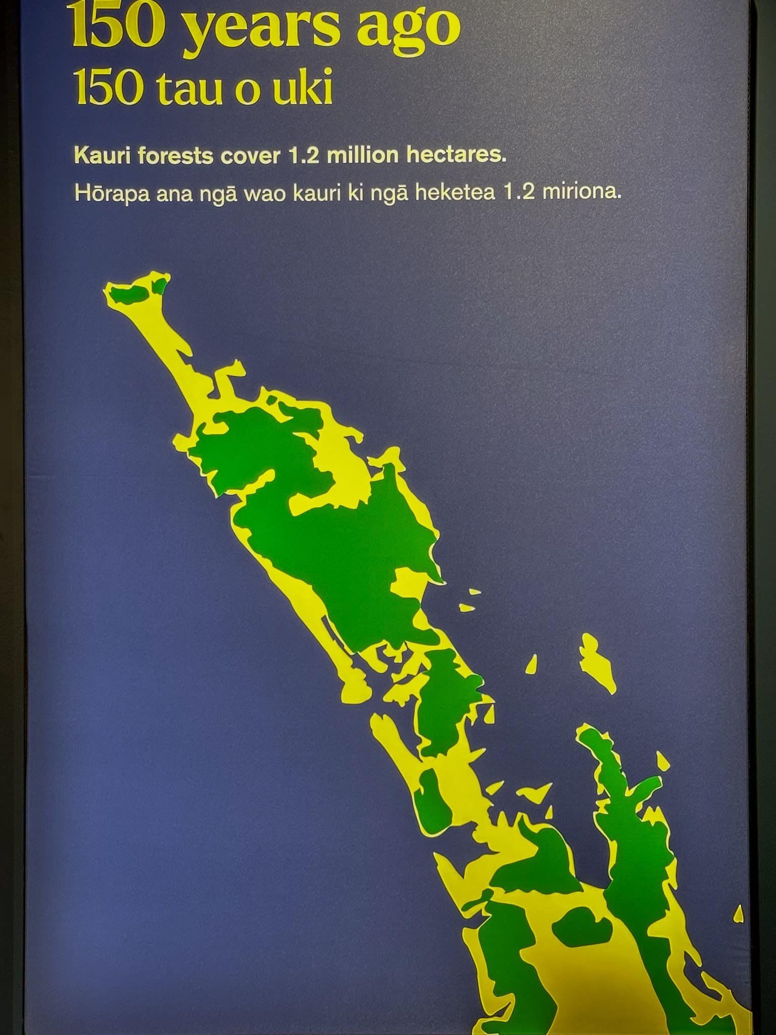
Inevitably, the museum also depicts the massive loss of kauri forest. Today, these ancient trees that were largely unique to the northern part of the North Island occupy about 4% of the land they occupied around 1840. Consider also that the biggest trees today – Tāne Mahuta and Te Matua Ngahere – in Waipoua Forest are not the biggest recorded. There were several significantly larger trees that have fallen due to natural events over the last 200 years. The museum has a stunning graphic comparing the trunk dimensions of today’s giants to those of the past.
Artefacts of the Kauri Museum
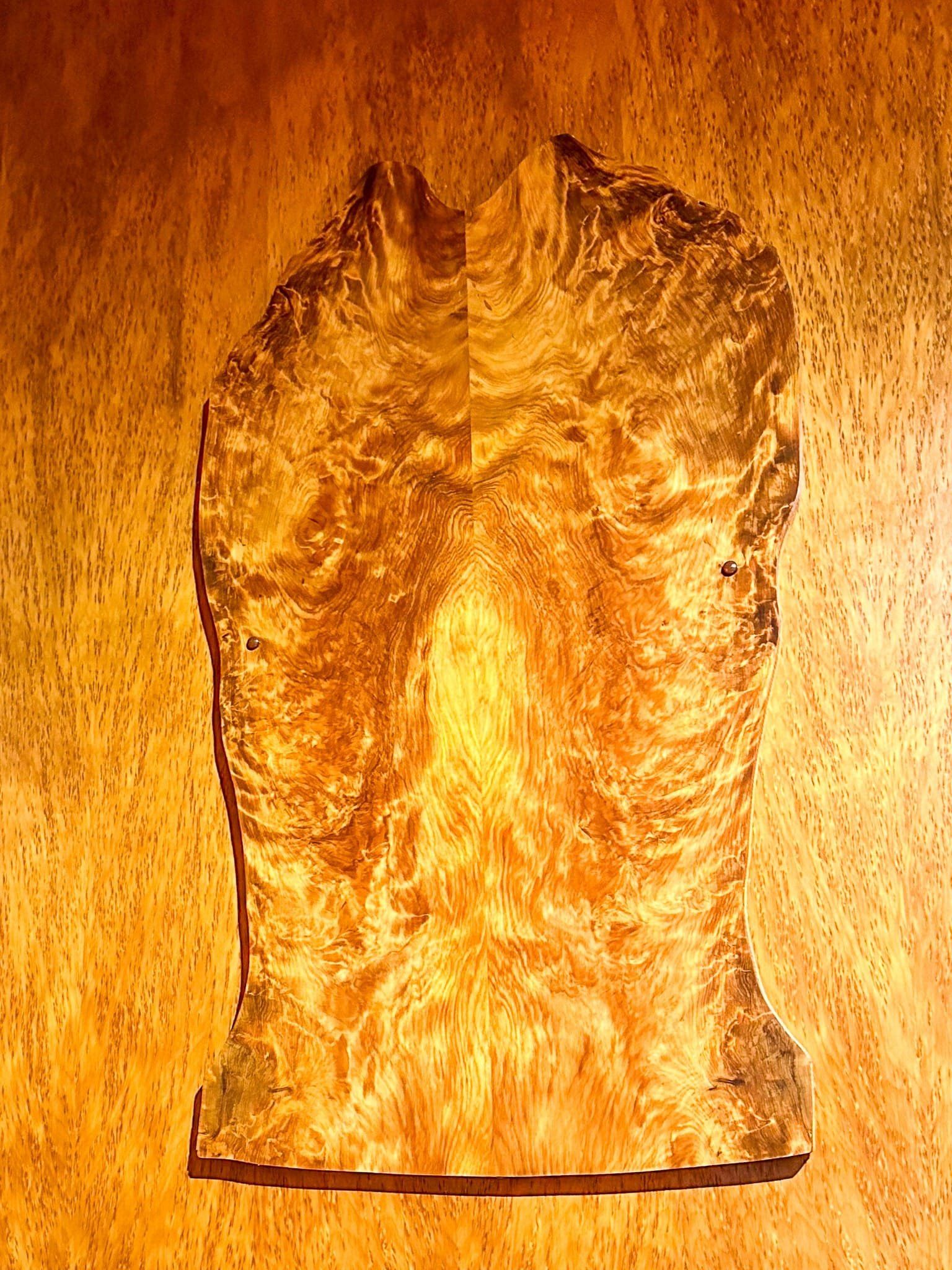
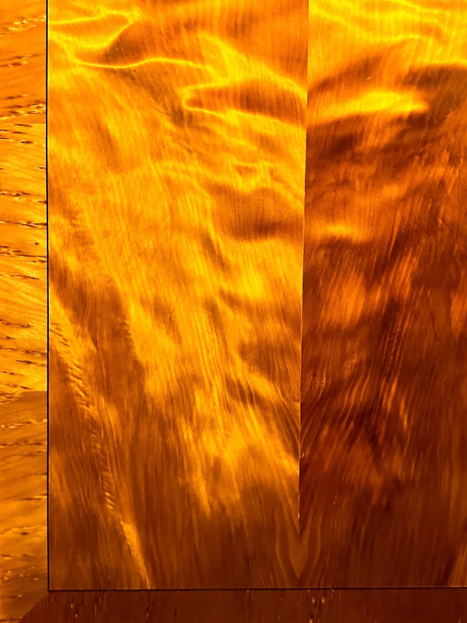
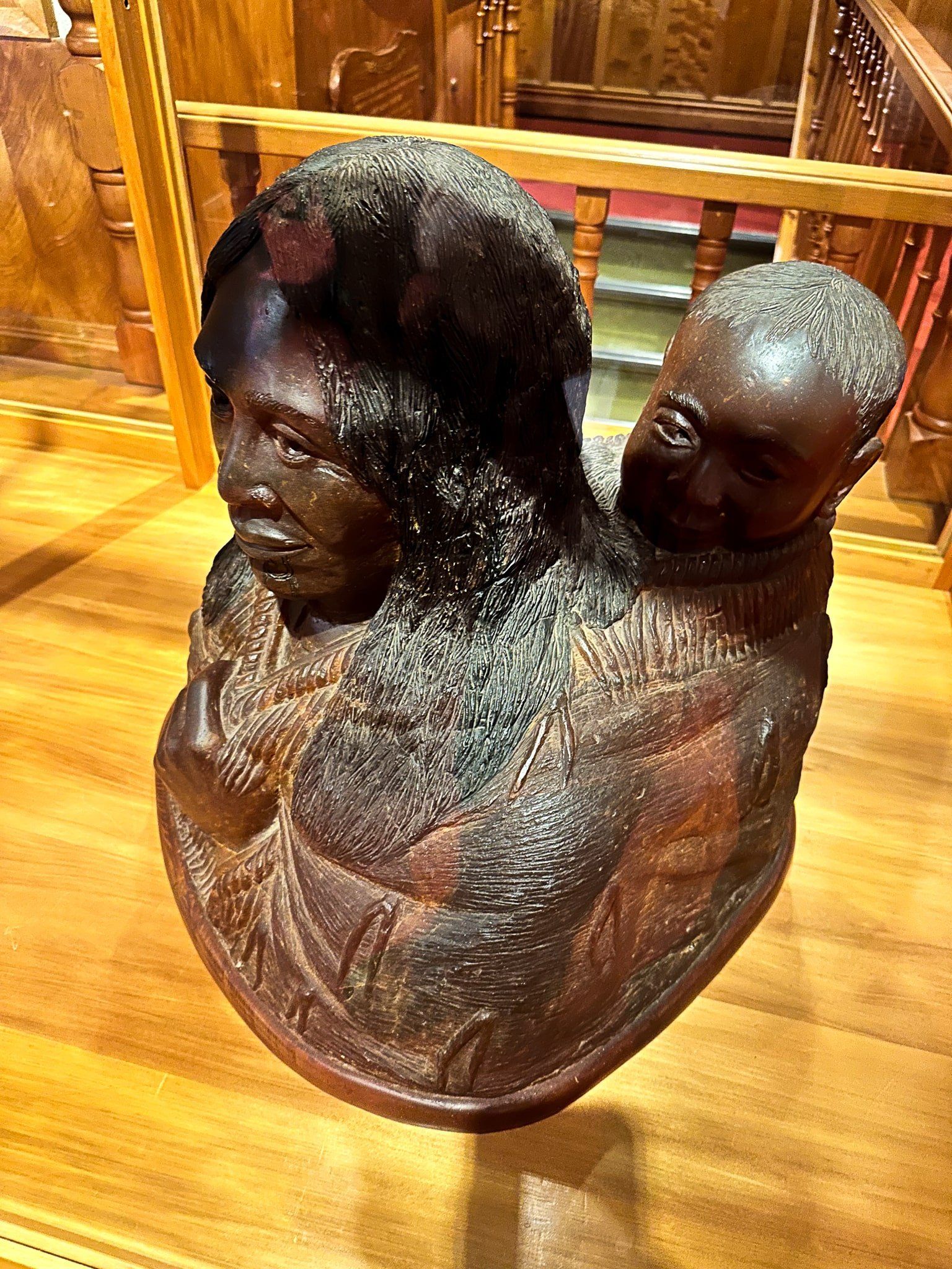
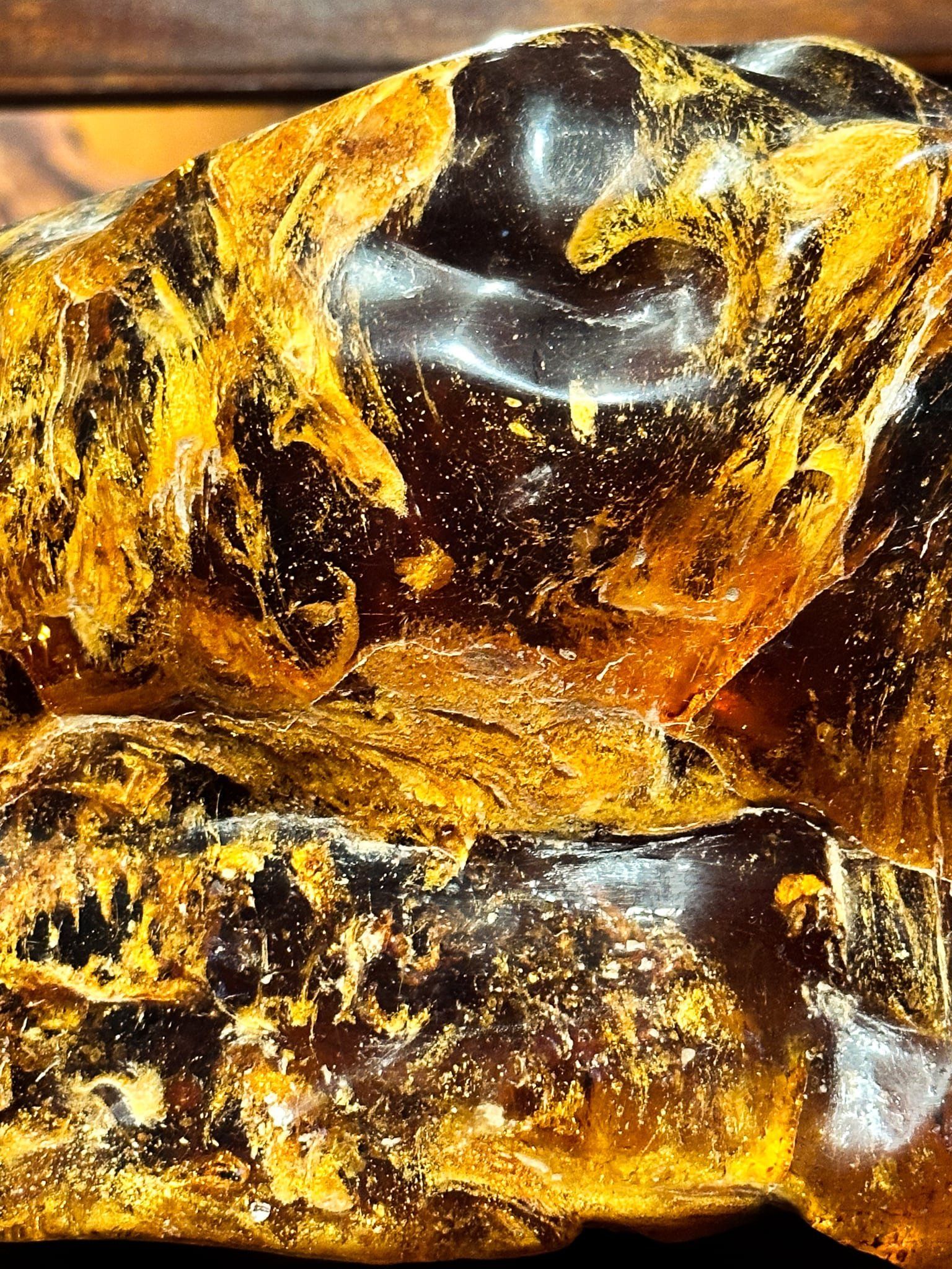
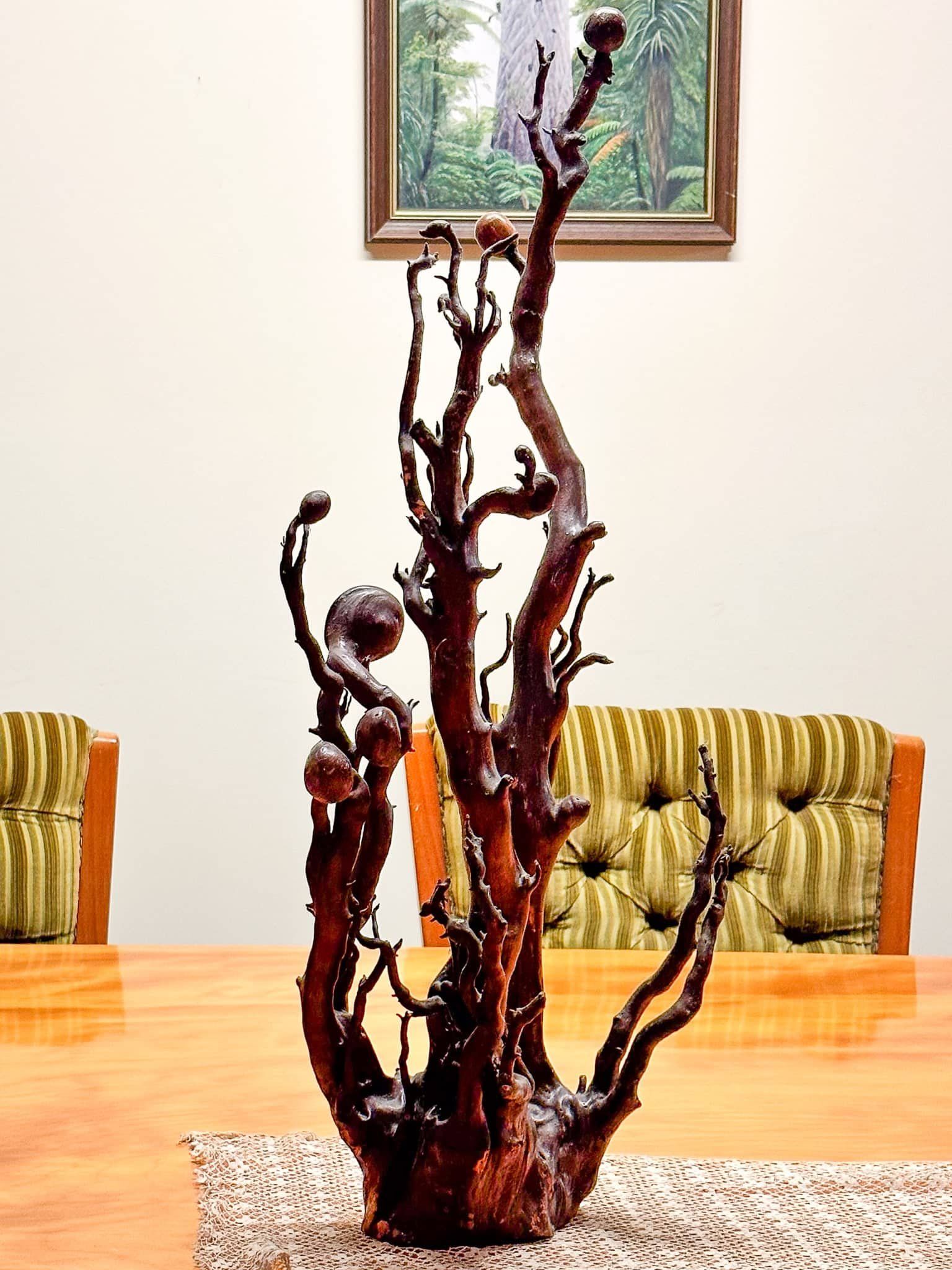
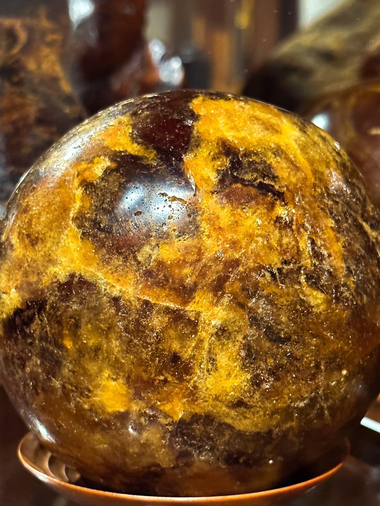
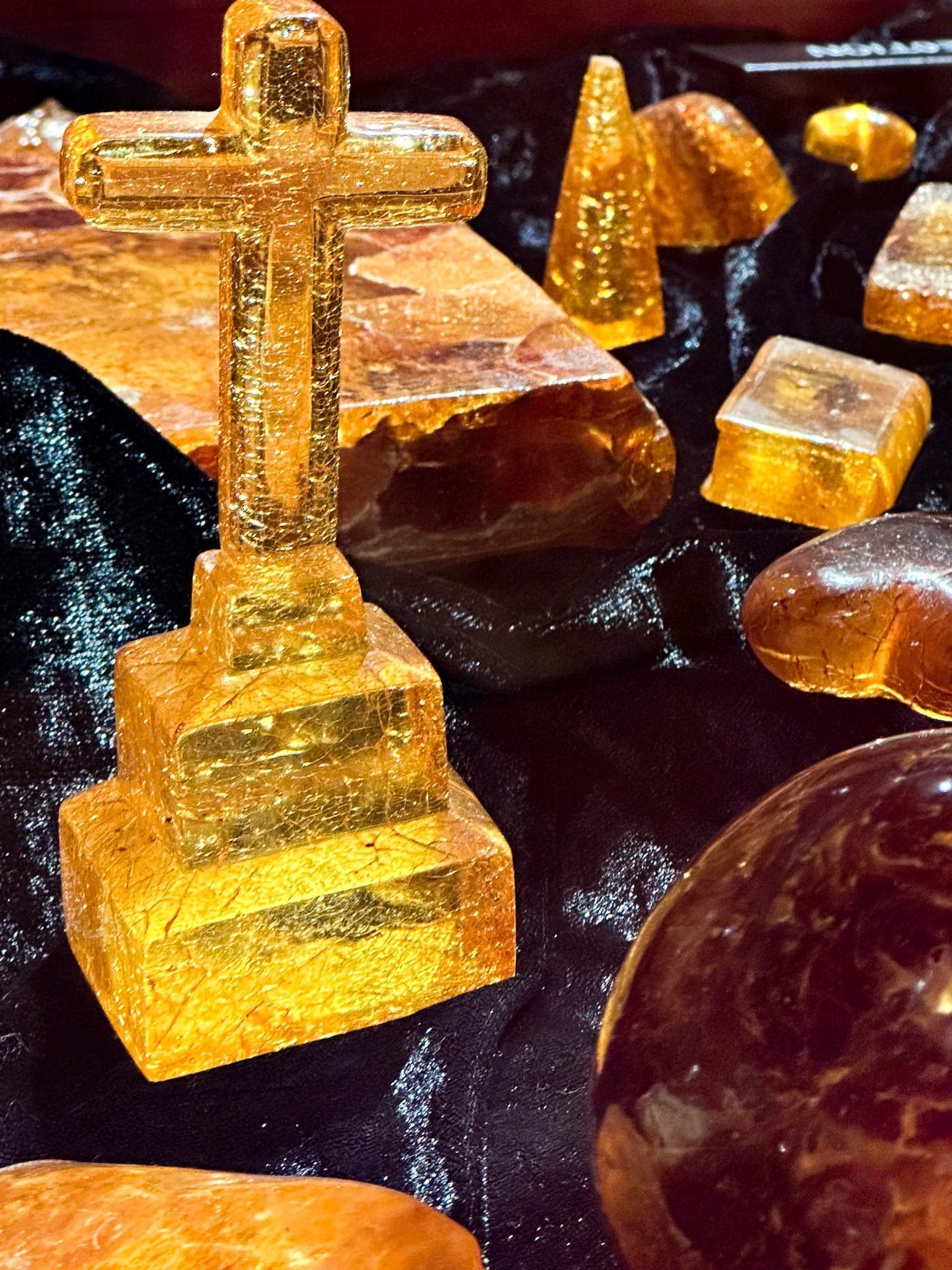
The Kauri Museum has a superb collection of products derived from kauri. This includes ornate furniture, art works, ornaments, a few boats, and an amazing collection of kauri gum. Fire kauri is particularly stunning, with wood panels made of cuts through the roots. There are also unworldly examples of polished roots, including some featuring round nodule parasites.
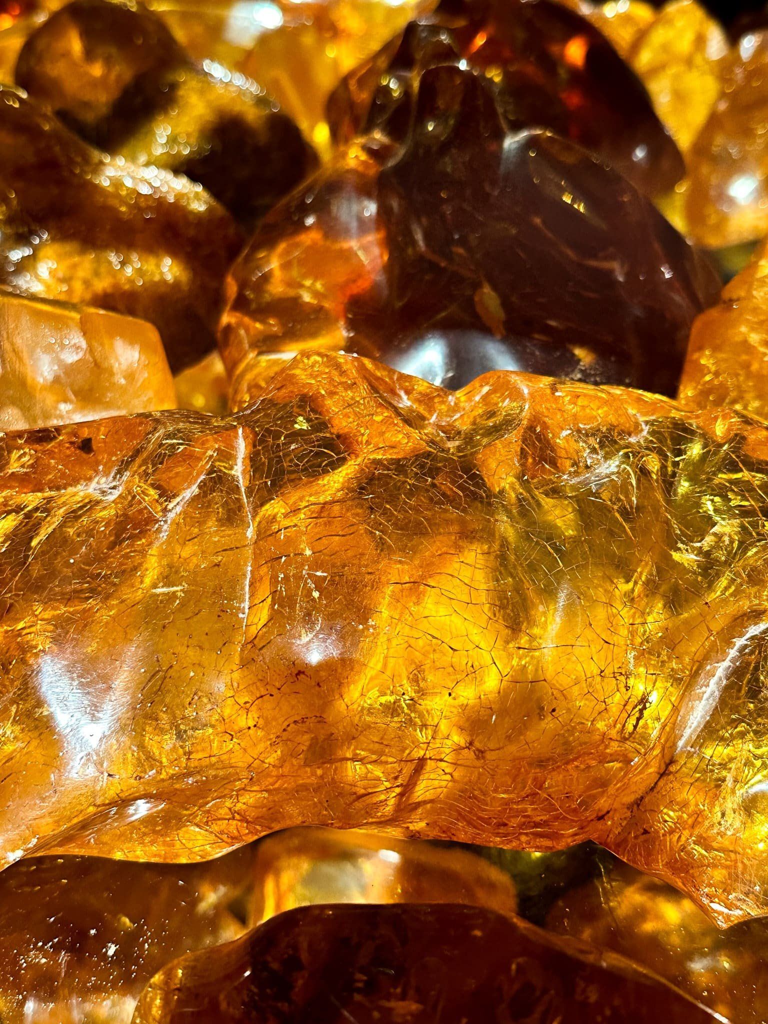
The gum collection includes large pieces of natural gum of various hues, polished balls, necklaces, insects frozen in time and so on. At least it all didn’t end up as varnish!
Baylys Beach
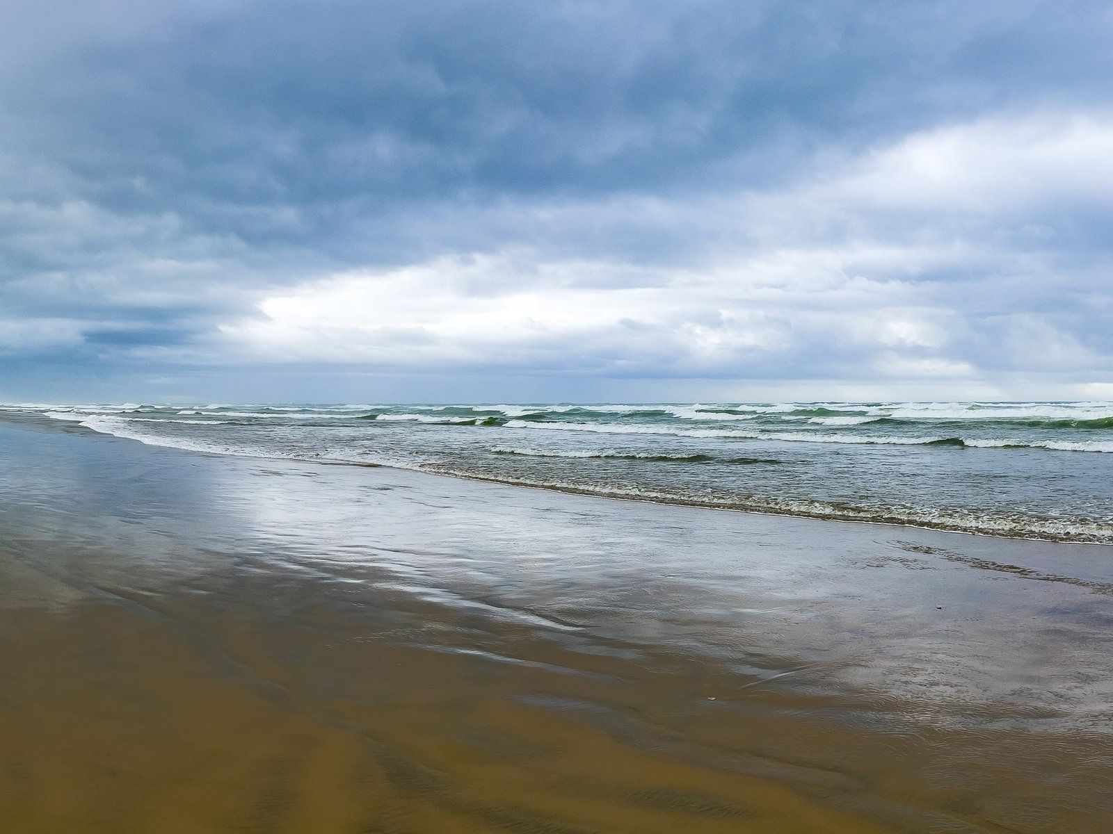
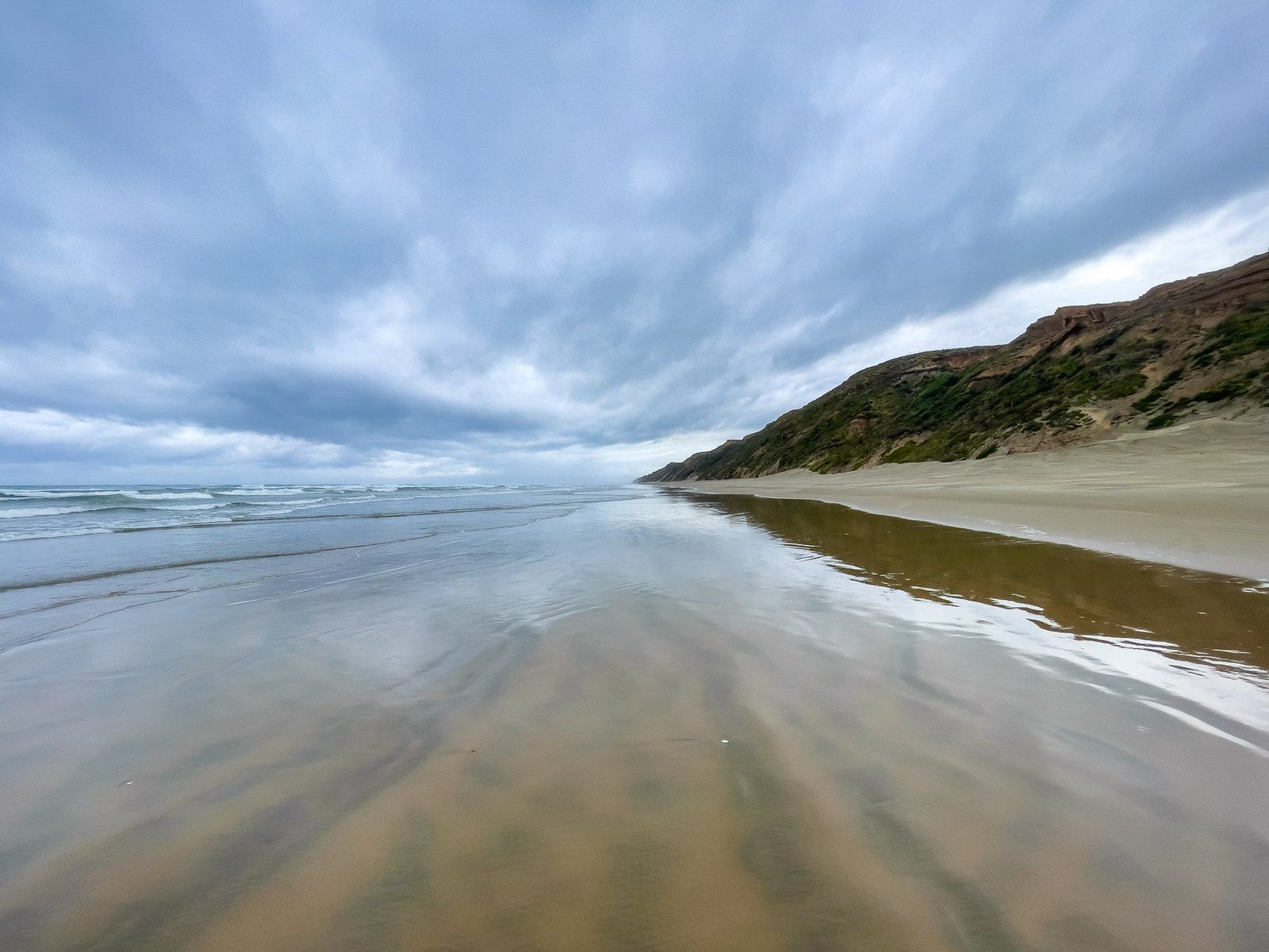
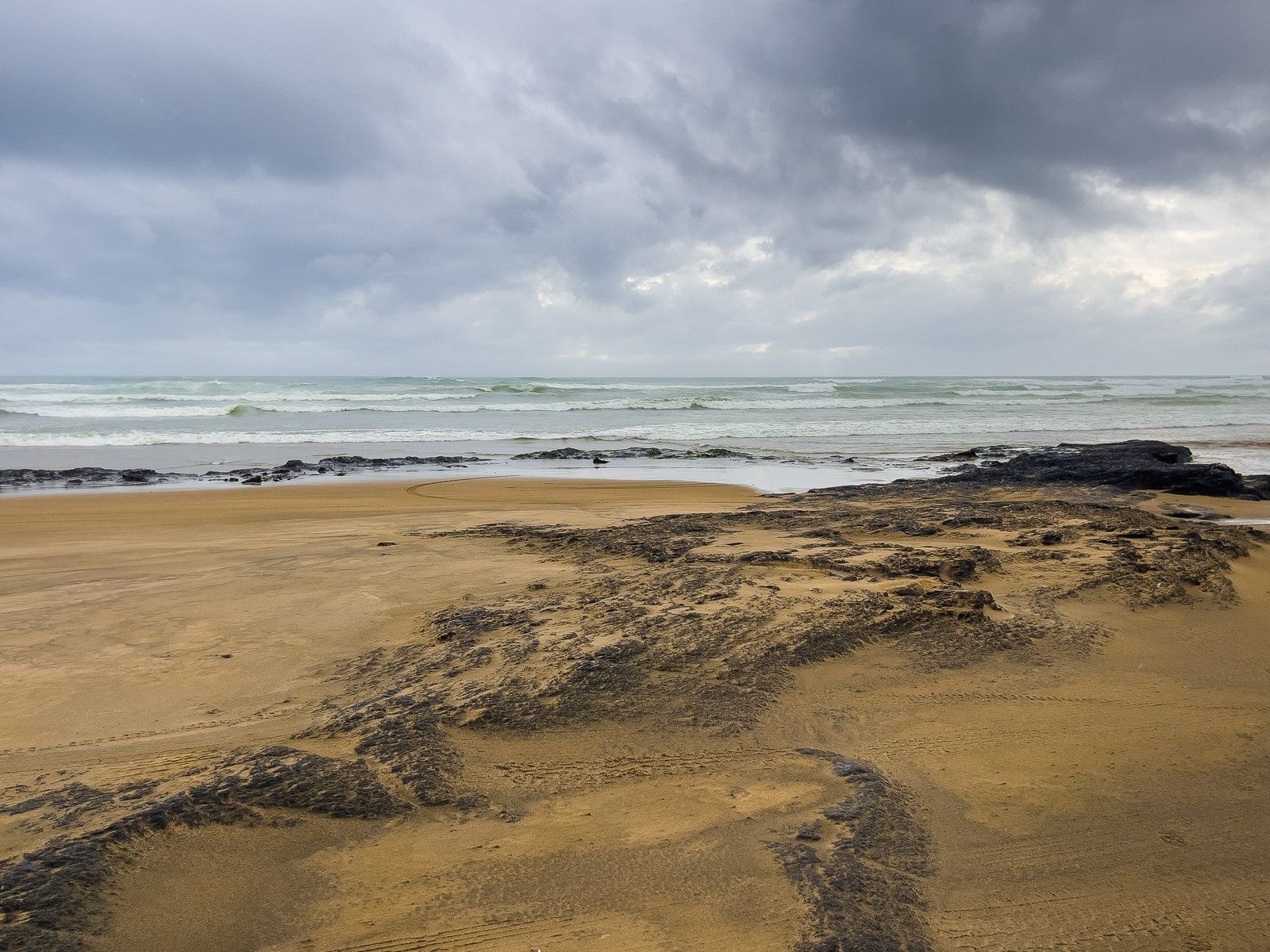
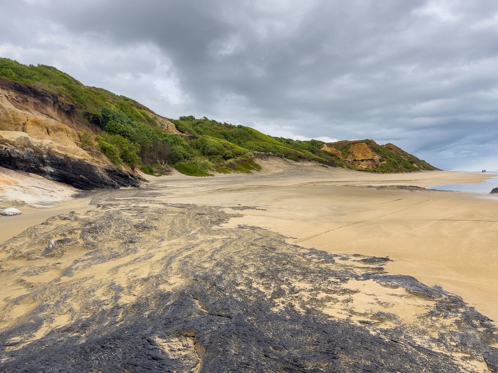
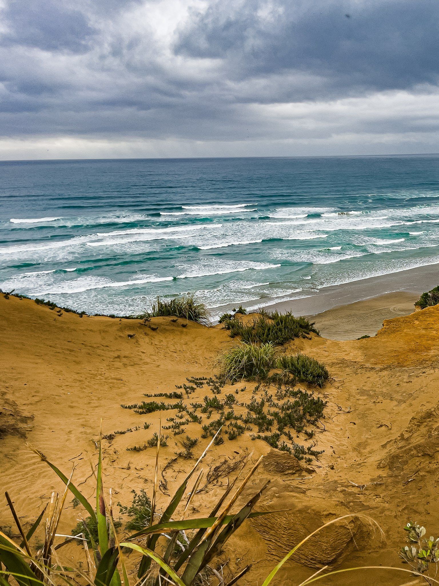
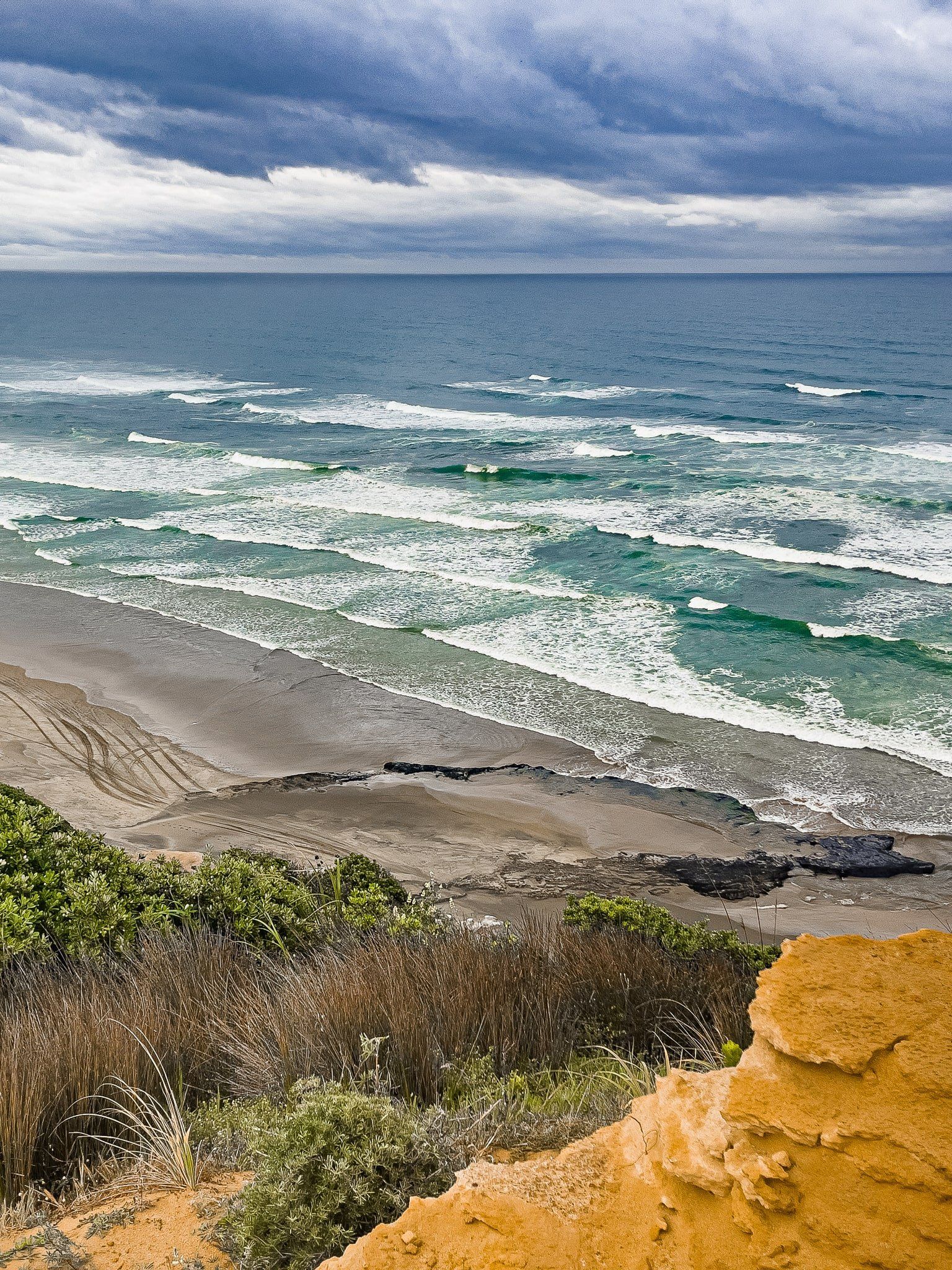
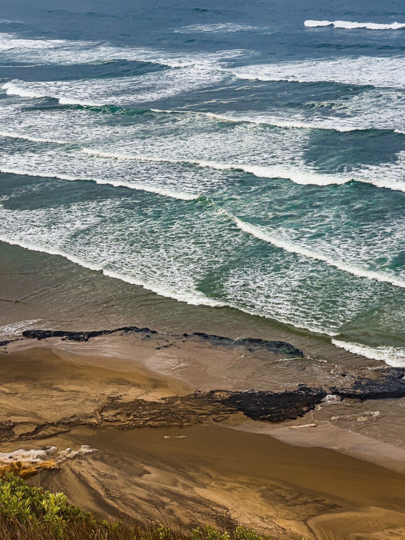
The coastline of the Kauri Coast is dominated by west-facing Ripiro Beach. At 107 km, it is the longest beach in NZ (noting that 90 Mile Beach was misnamed and is actually about 90 km) and runs from the Kaipara Heads in the south to Maunganui Bluff in the north. Baylys Beach is essentially the short section of Ripiro around the Baylys Beach community, about 9 km from State Highway 12 heading north from Dargaville. It is accessed through the high dunes and cliffs that run along much of Ripiro through Chases Gorge. You can drive a car onto the beach to access most of the length of Ripiro.
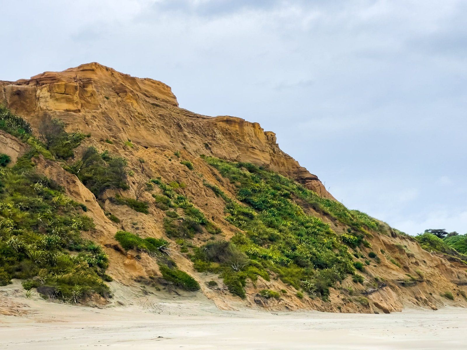
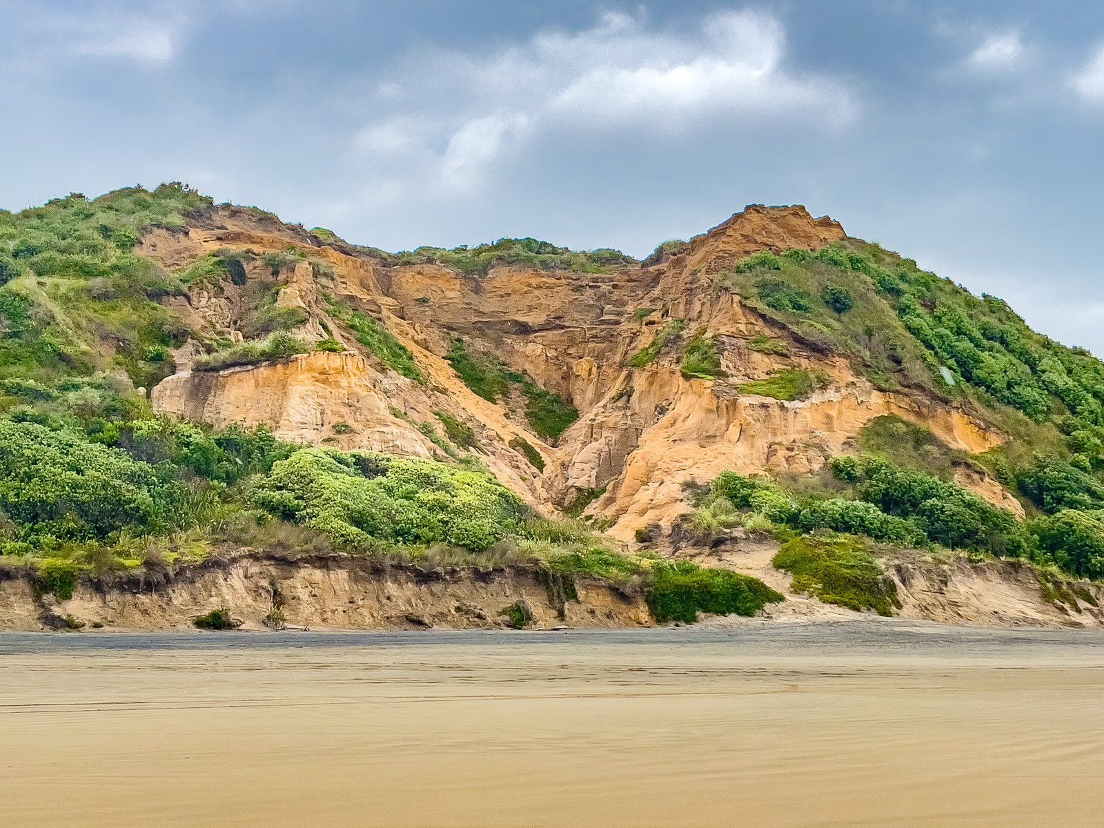
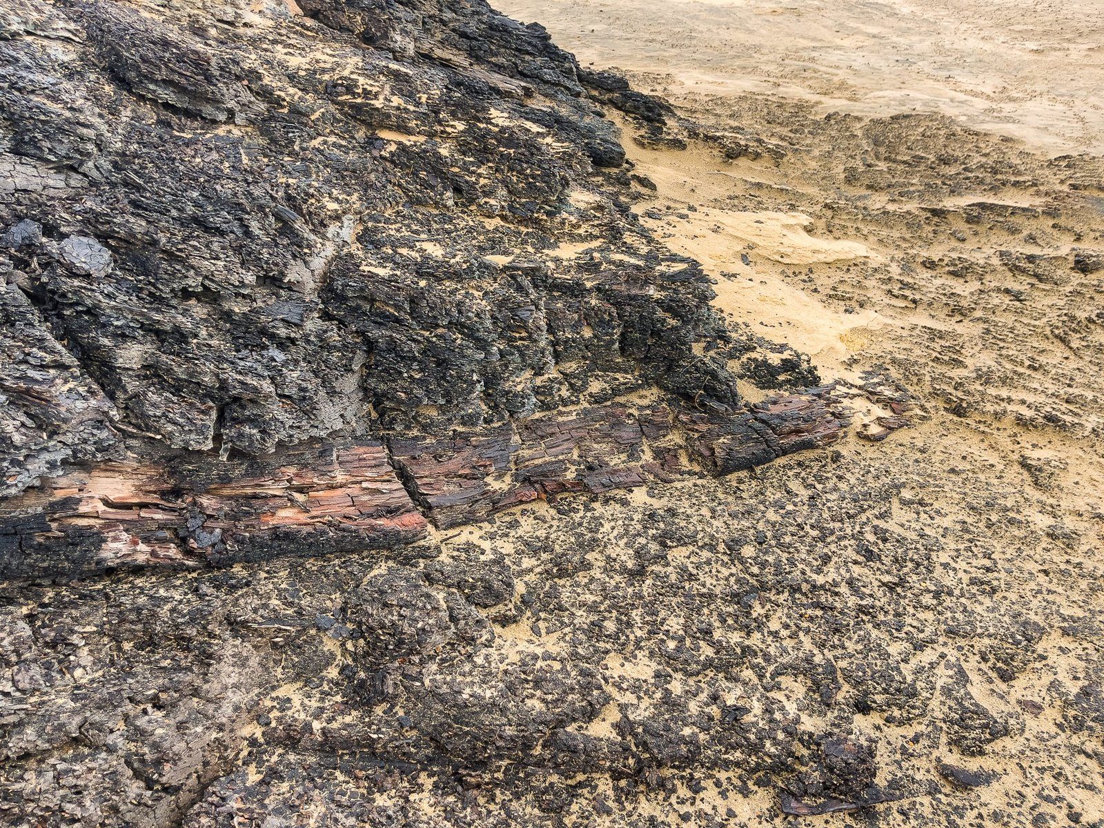
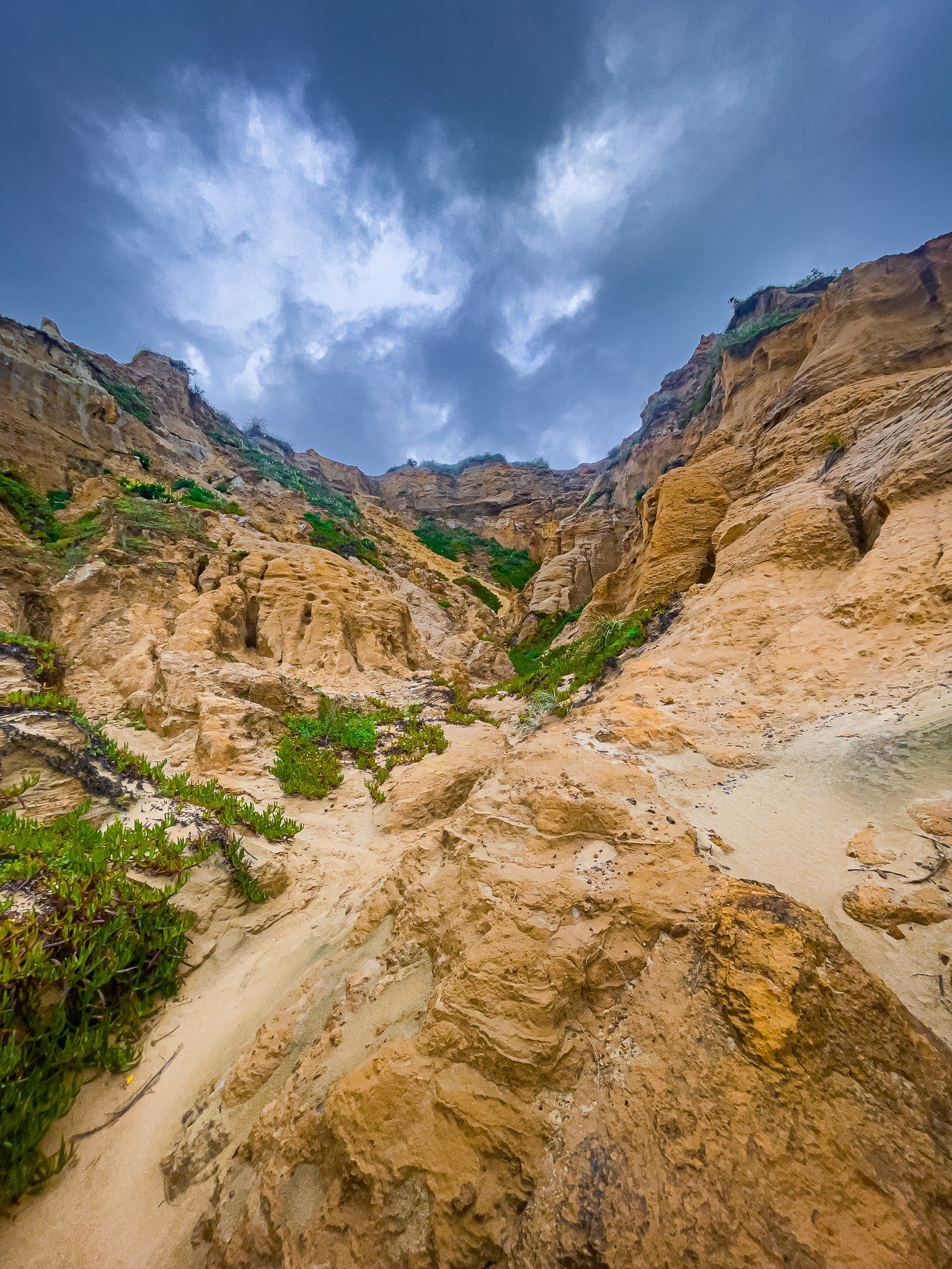
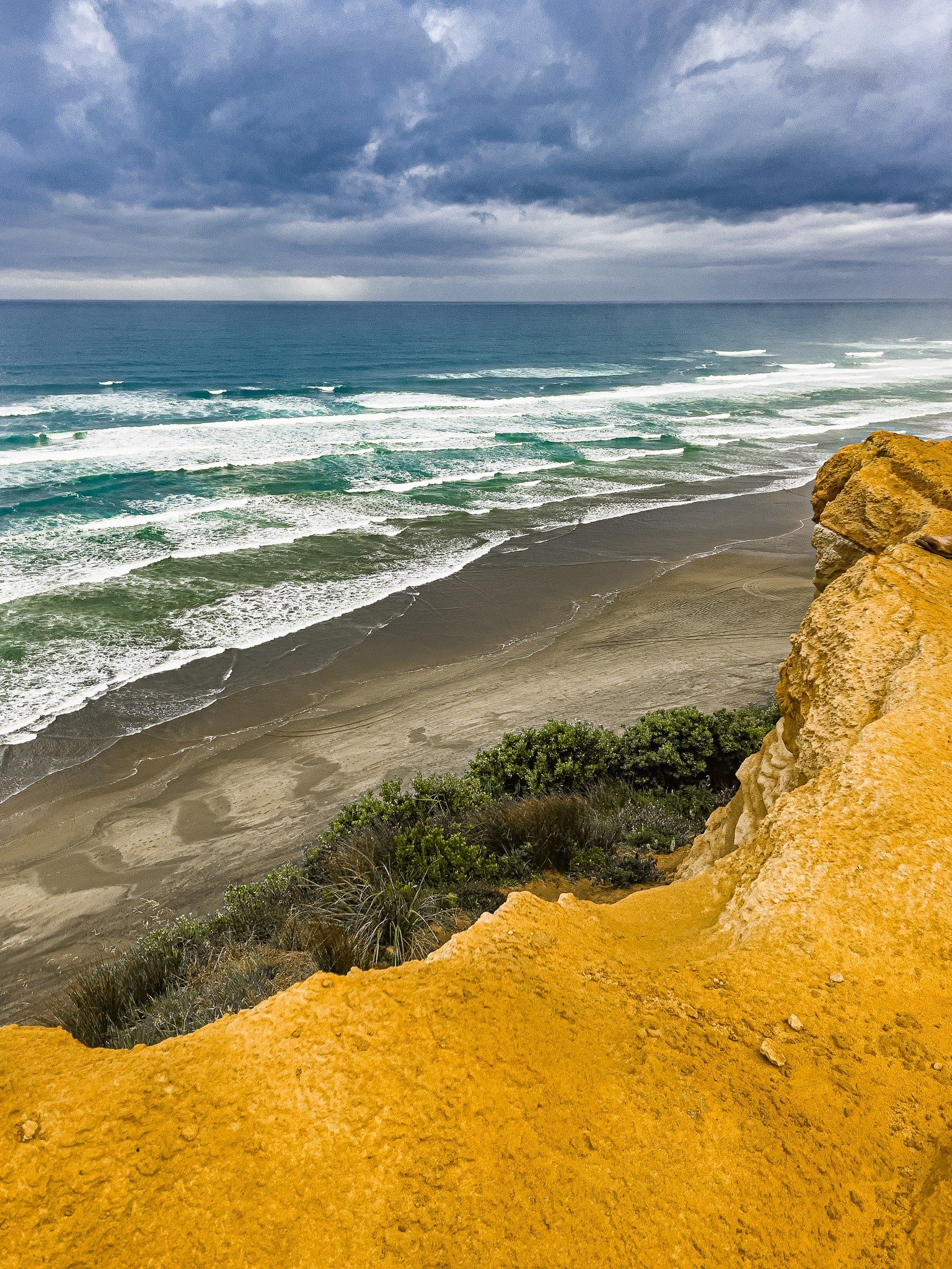
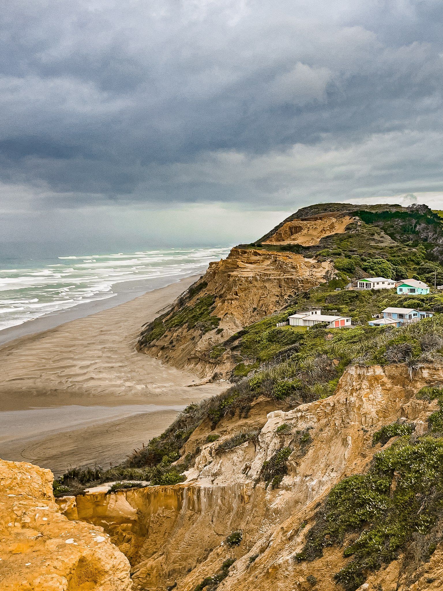
The beach is not an ideal place to swim; it is wide with rough surf, with people driving cars and buggies on it. So it’s more of a place for surfing, sand yachts and surf cast fishing. To the left of the beach entrance, there is an interesting feature – fossilised ancient kauri trees and gum in lignite rocks. The seam is apparently at least 50,000 years old and shows up as a large black outcrop in the otherwise orange to yellow coloured cliffs. You can also see the seam continuing towards the surf in the sand, depending on conditions.
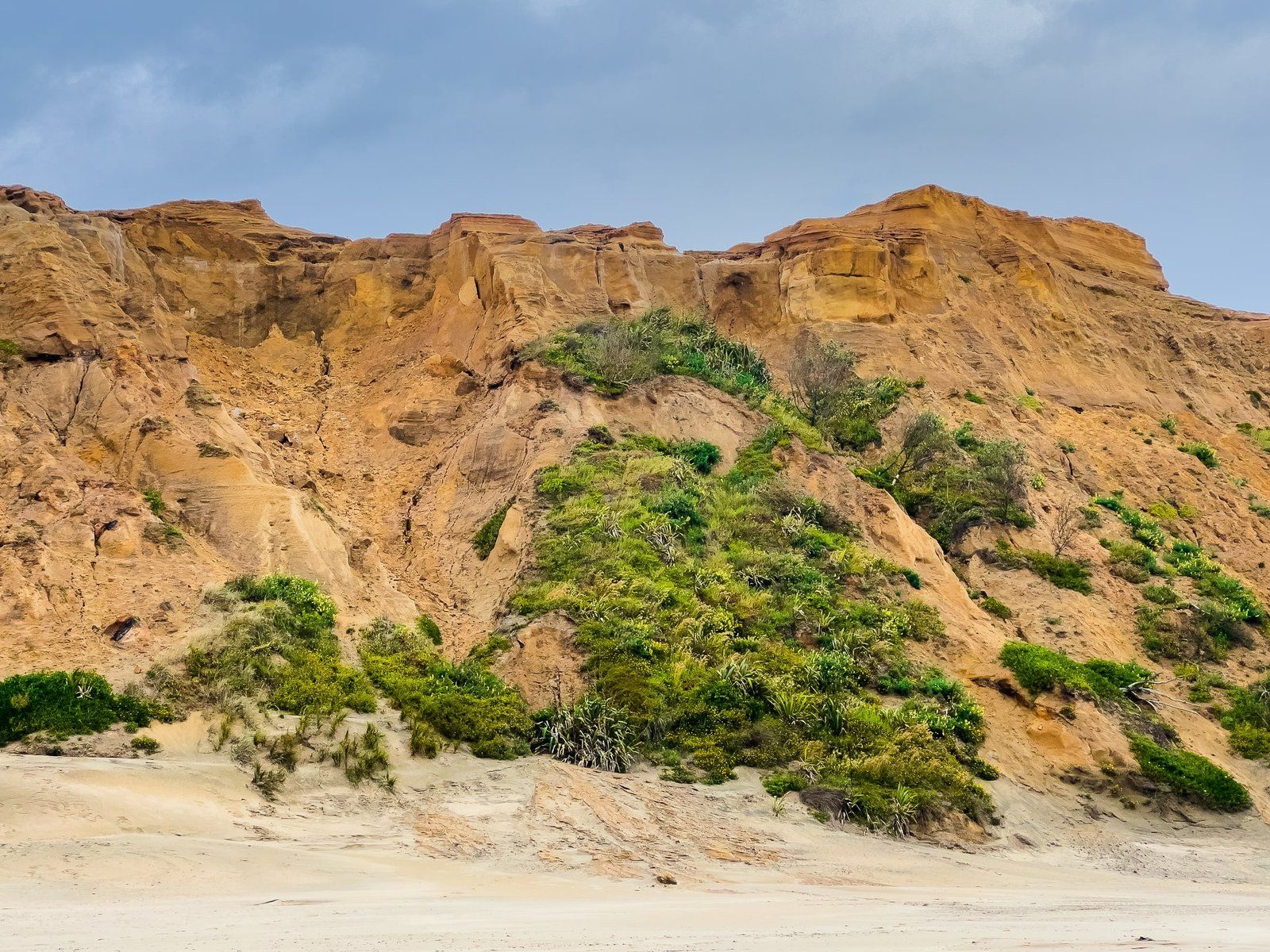
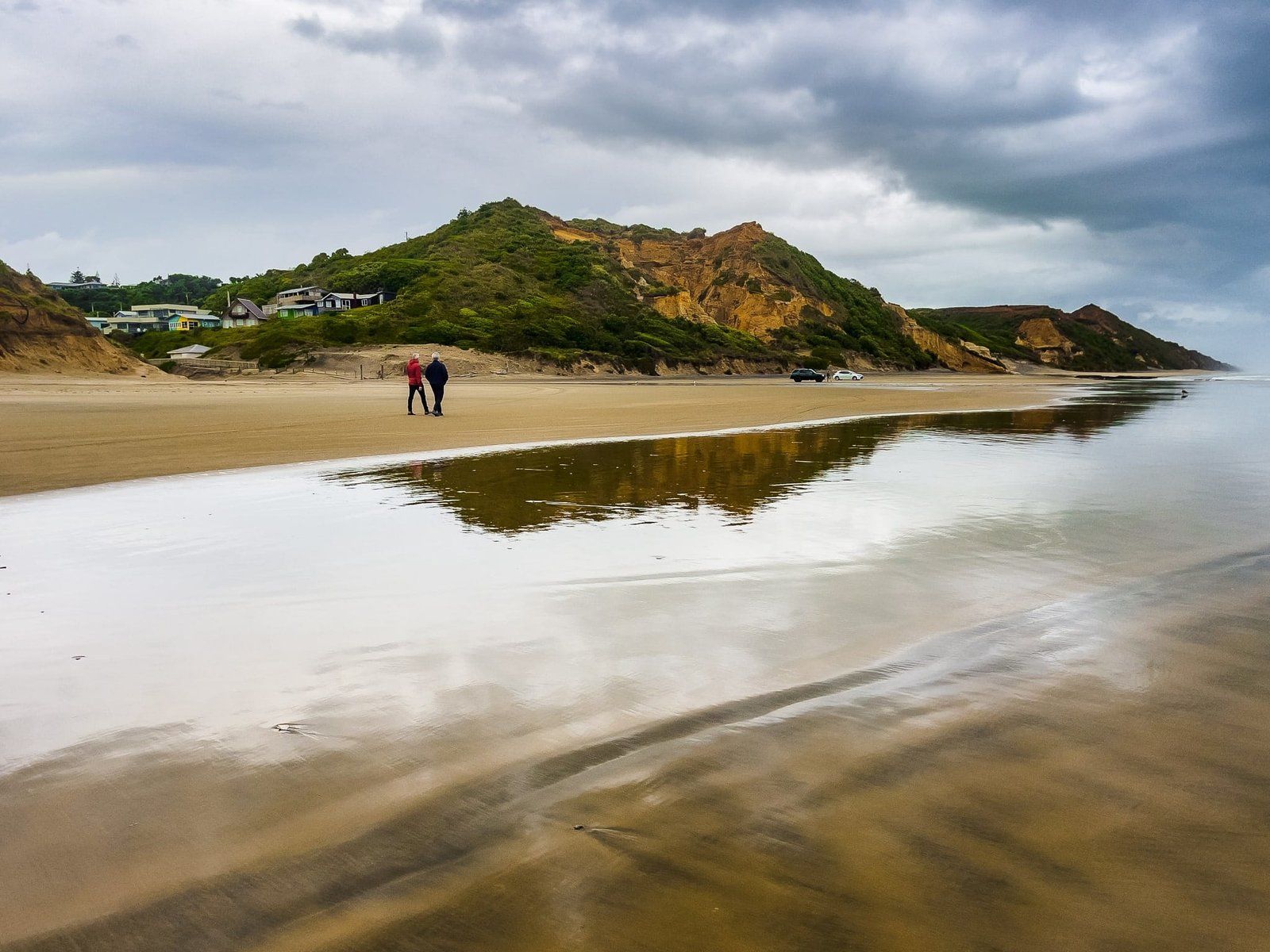
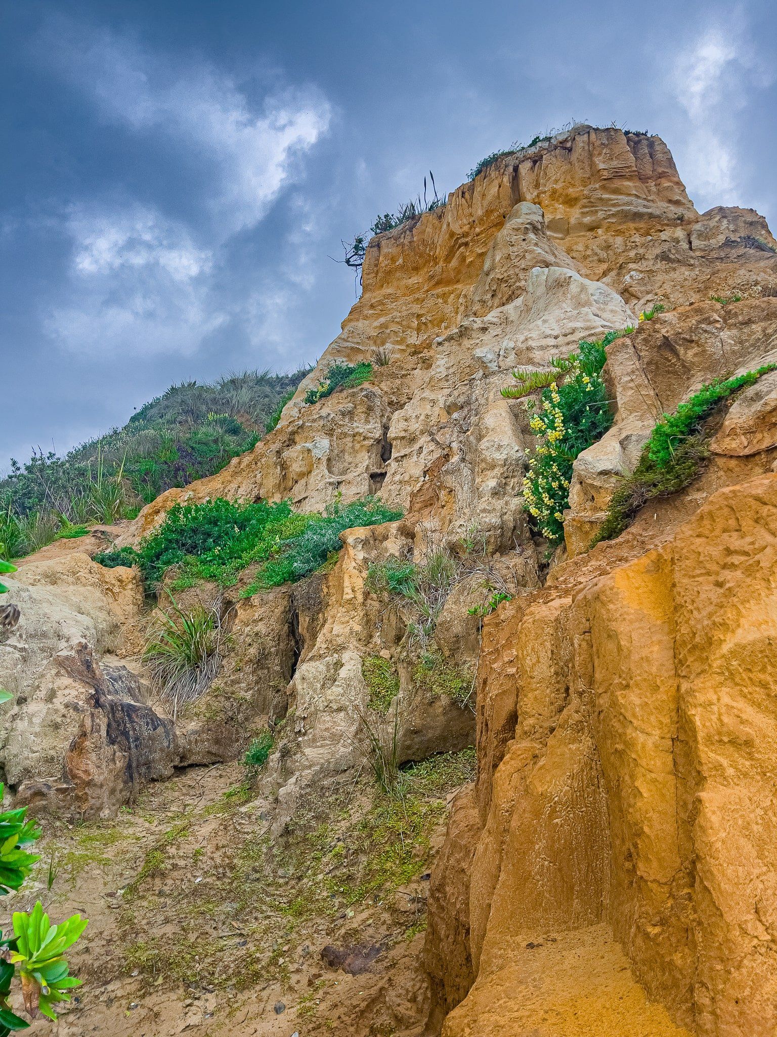
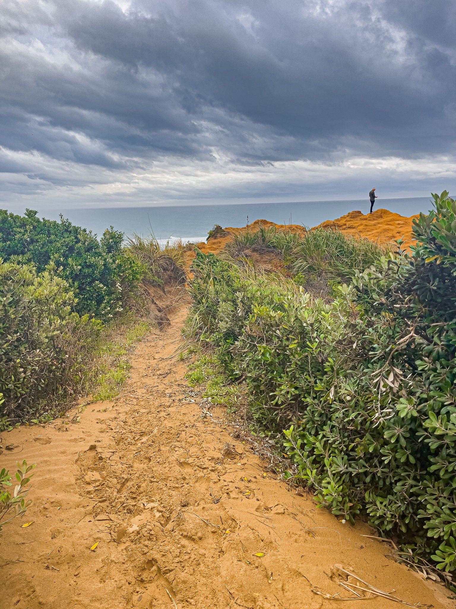
The cliffs around the gorge and along the beach are a feature, shaped and eroded by the environment. There is a nondescript grass reserve on the left side of the gorge entering the beach with a track to the top of the cliffs. It only takes a few minutes to walk up and the views are superb.
Baylys Beach also has a colourful local cafe/bar/takeaways shop.
Baylys Beach Clifftop
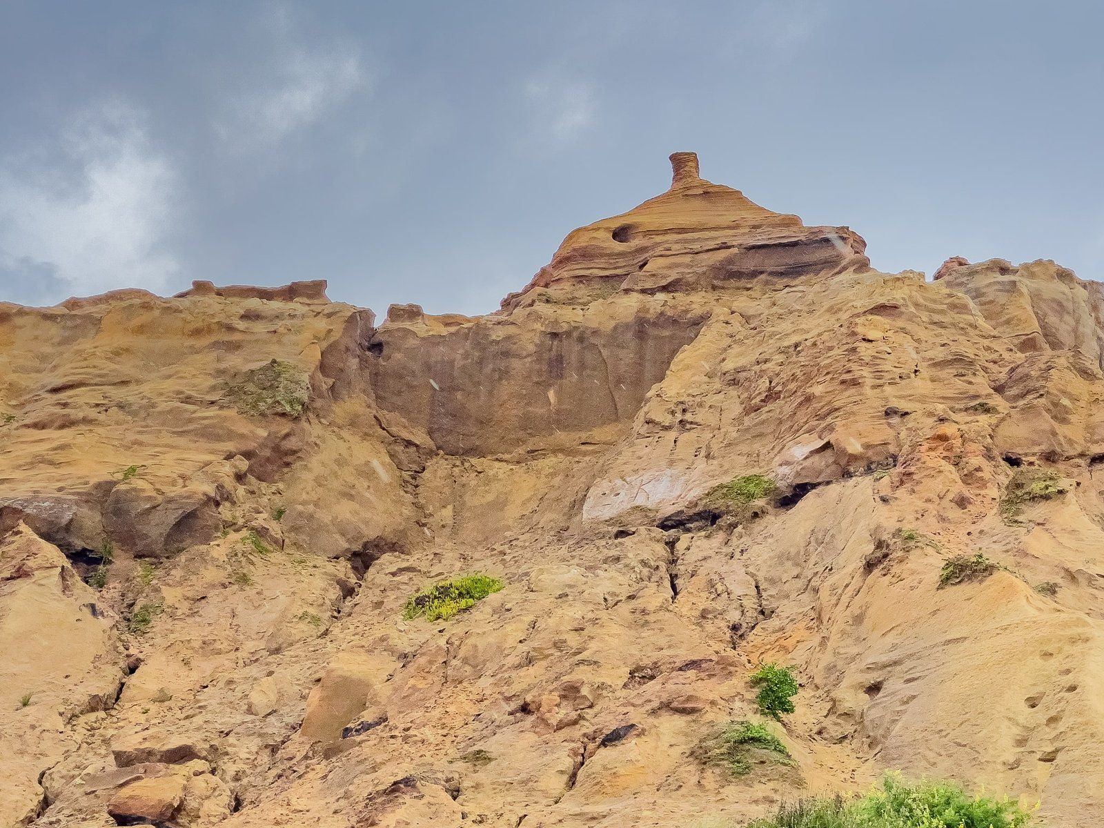
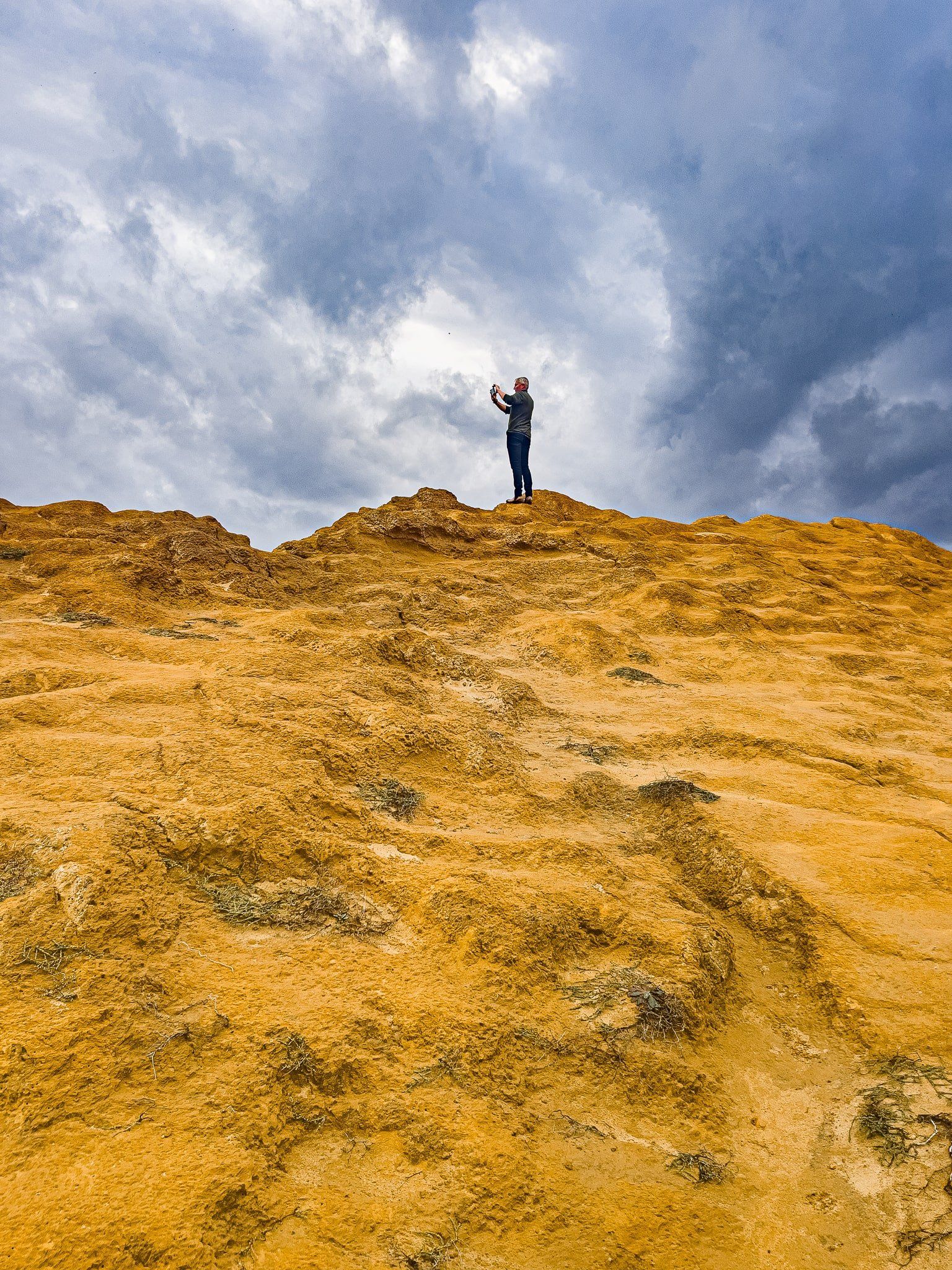
The cliffs around Chases Gorge and along the beach are a feature, shaped and eroded by the environment. Before the beach access at the end of Sea View Road, turn left onto Ocean View terrace. There is a nondescript grass reserve on the left side of the gorge with a track to the top of the cliffs.
It only takes a few minutes to walk up and the views are superb. The sandstone is also an amazing shade of yellow, at least in the stormy light we had.
From there, continue around the top of the cliffs south, then down to the beach of Cynthia Place.
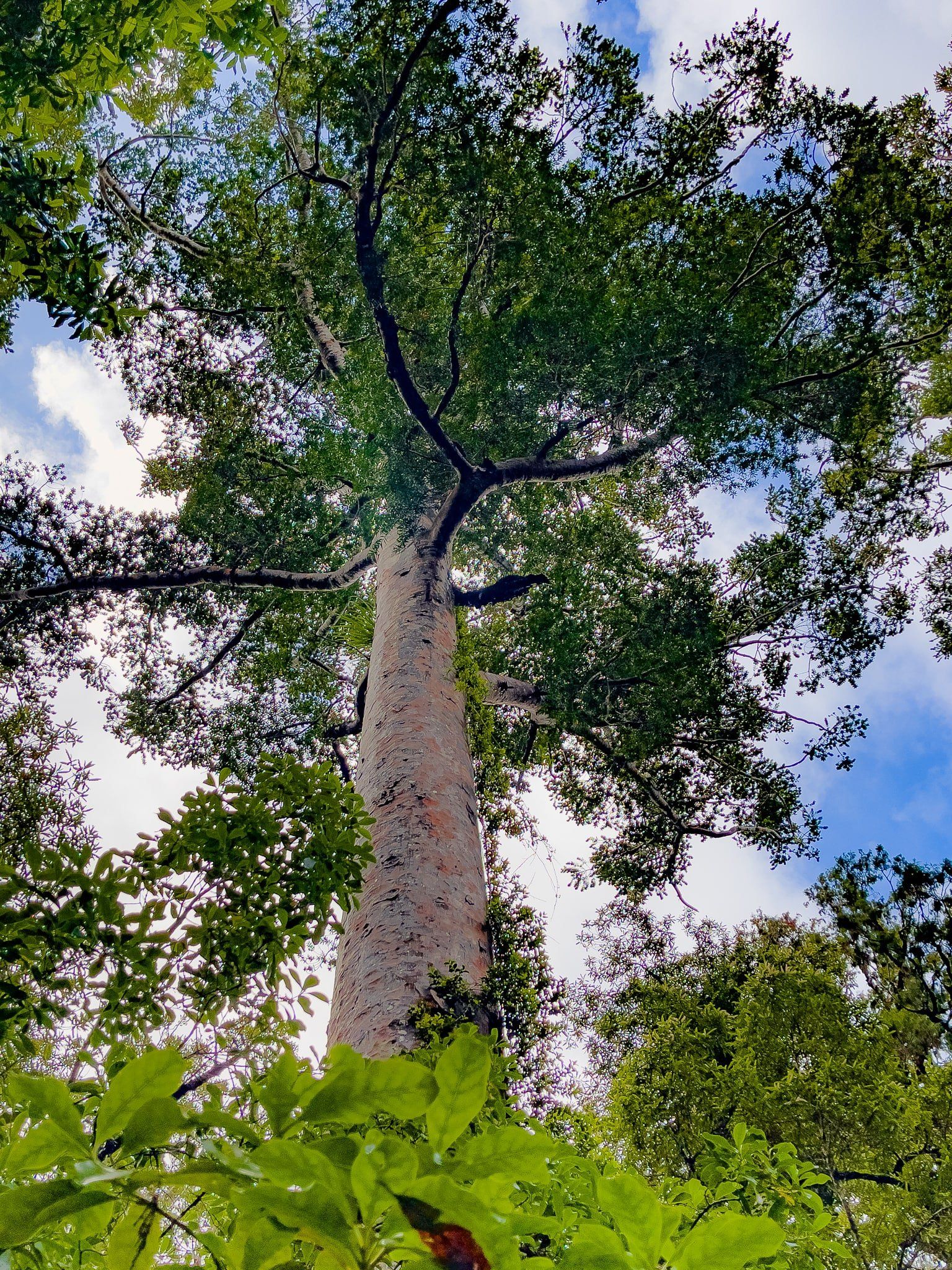
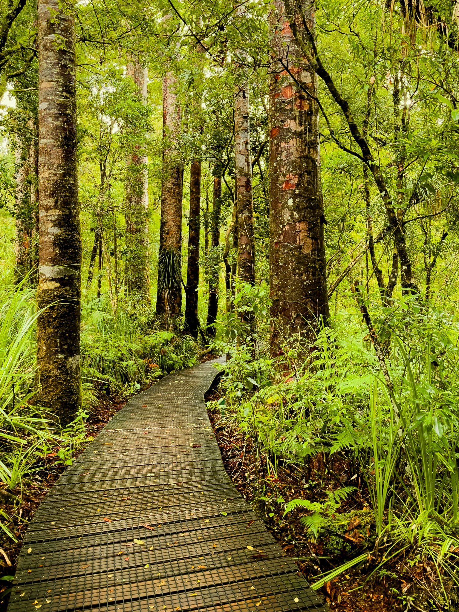
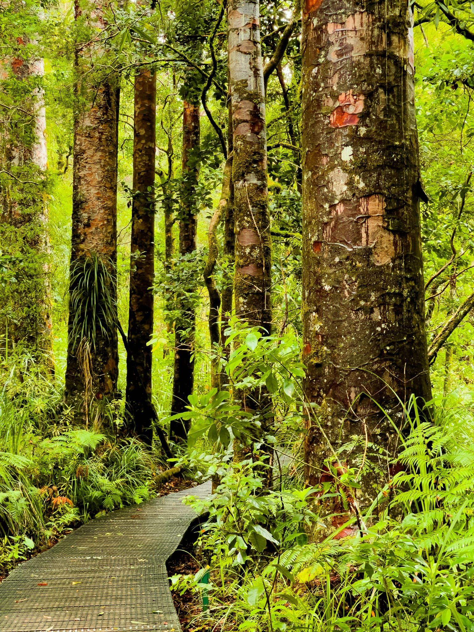
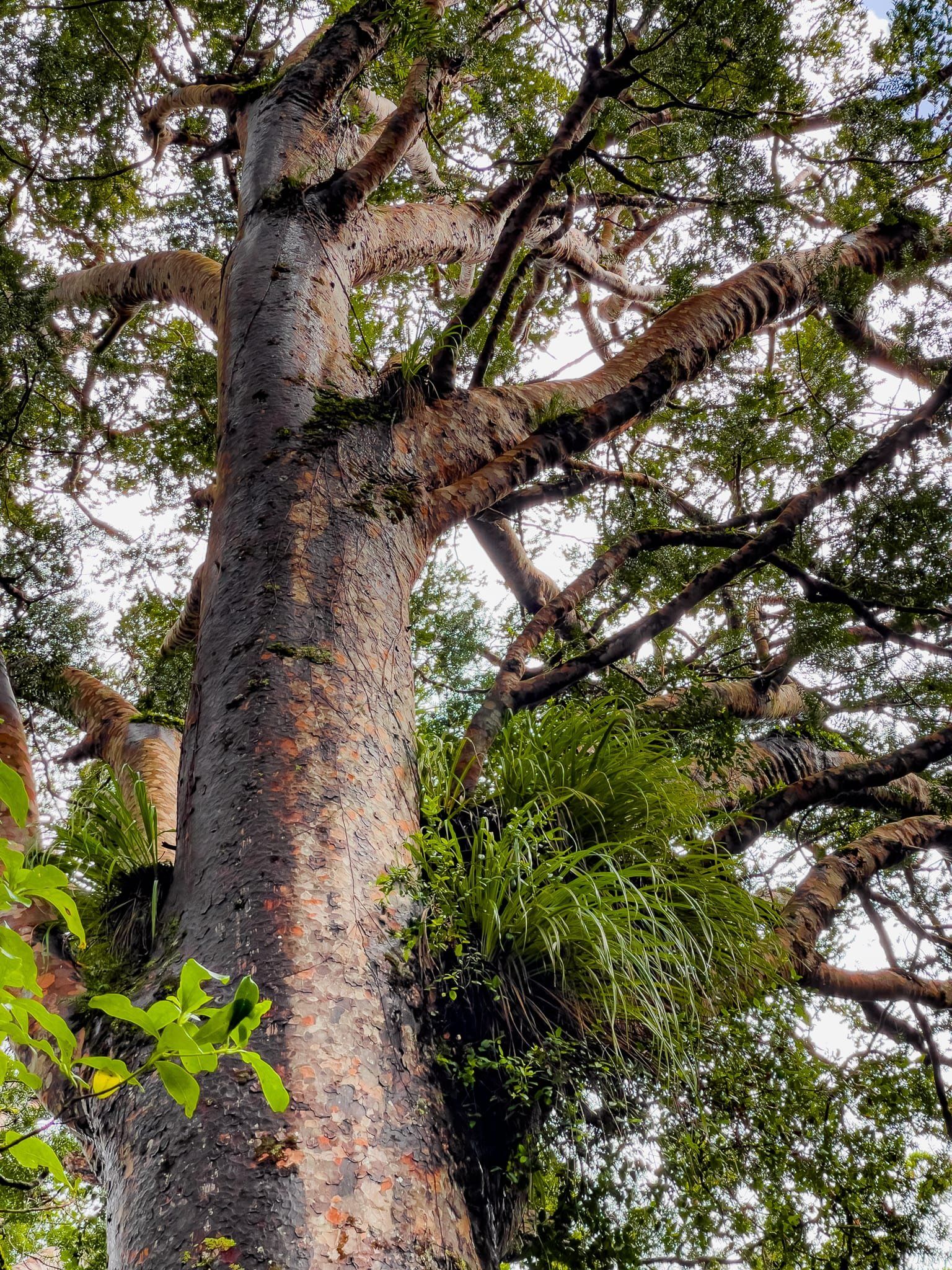
Trounson Kauri Park
The 473 hectare Trounson Kauri Park was gifted to the public of NZ by James Trounson, an early settler, and opened in 1921. The intention was to protect one of the few remaining significant ancient kauri forests in the region. It became the first “mainland island” with a strict focus on pest control to reestablish native birds, although it is not fenced.
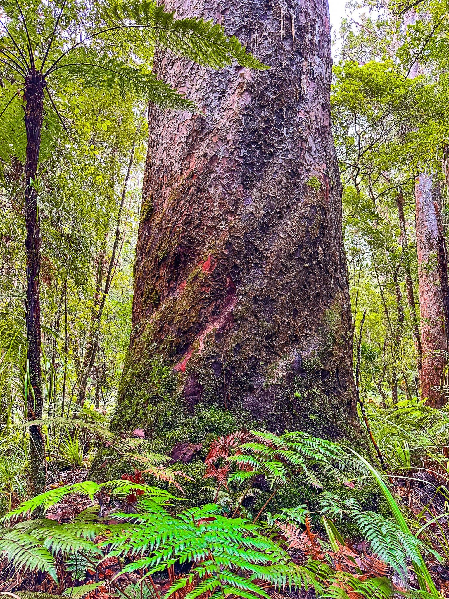
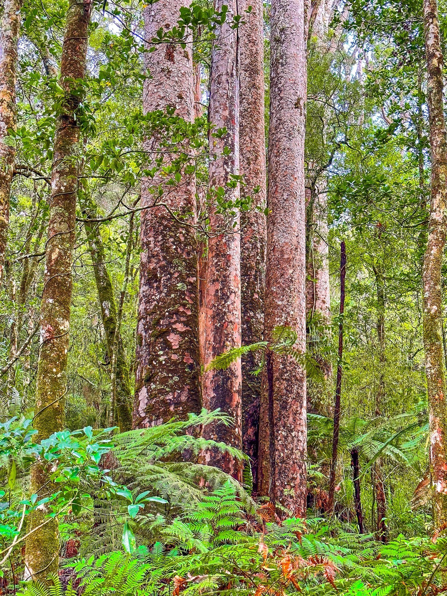
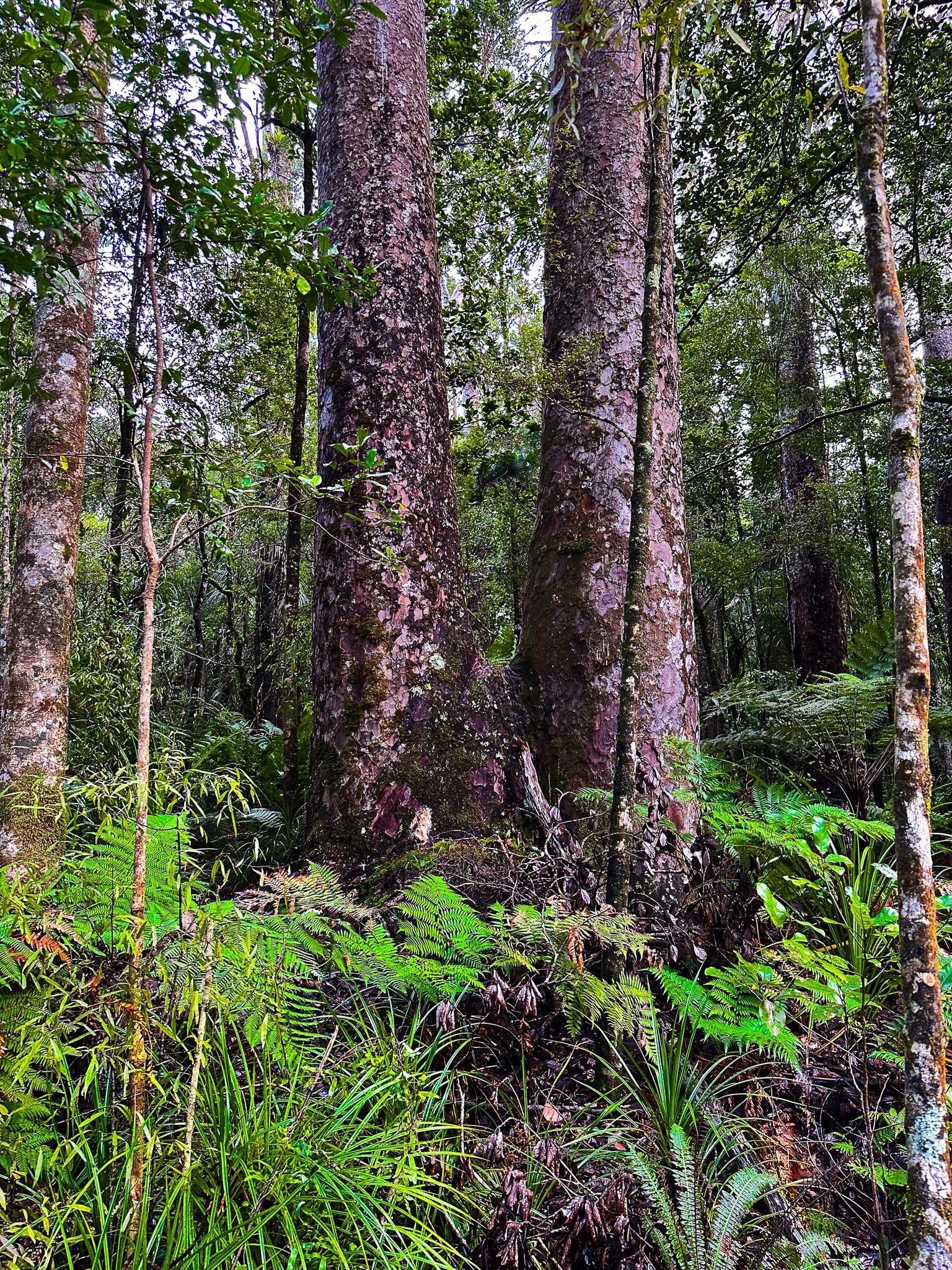
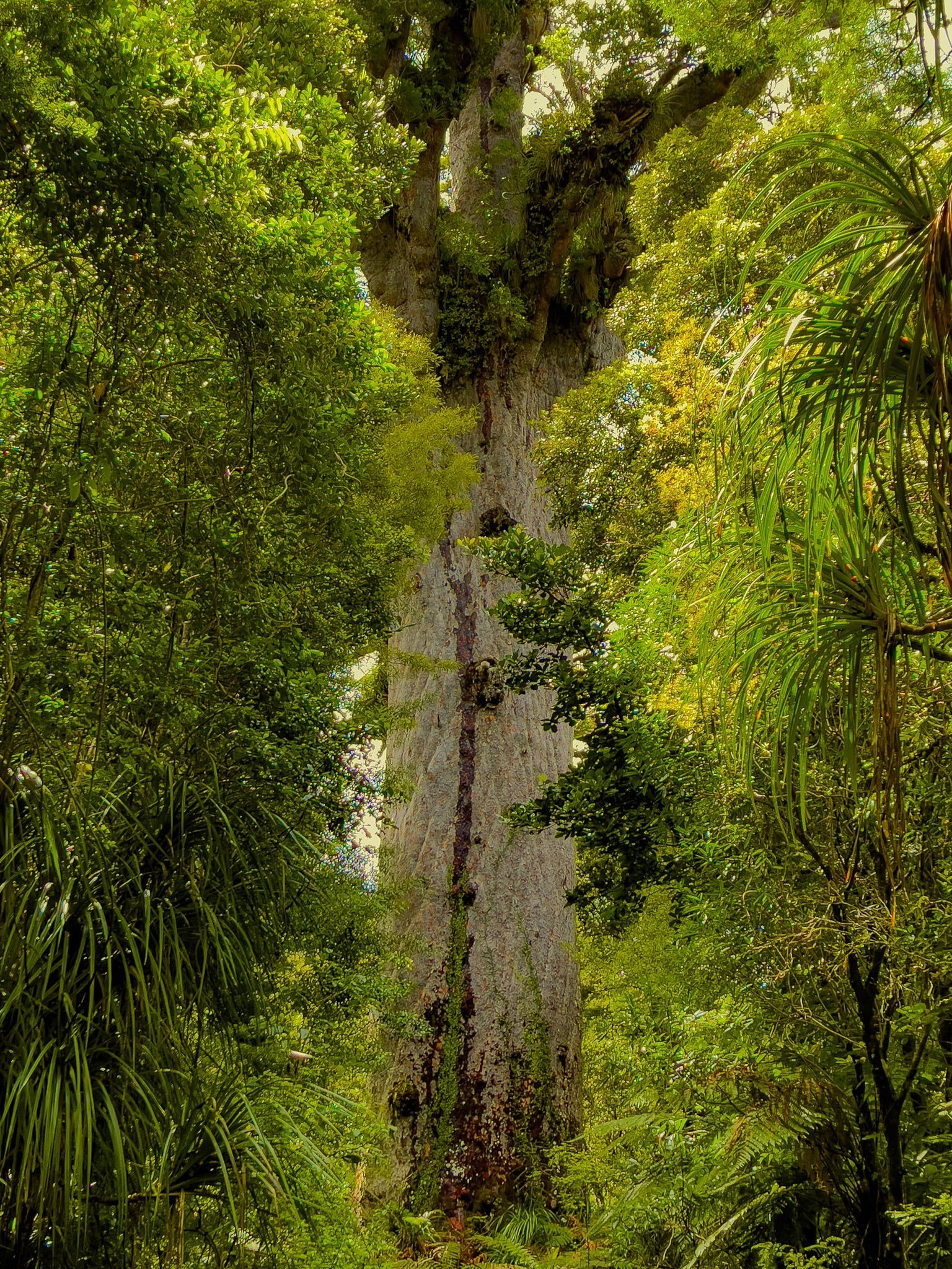
To get to Trounson Kauri Park, head north from Dargaville on State Highway 12 for 32 km to turn off at Trounson Park Road. Follow the road to the park entrance and campground. From the car park, follow the footbridge into a grassed area with an excellent information centre. From there, the walk is an easy 40-minute loop, much of it boardwalk, through big mature kauri. These include the Four Sisters, a pair of twin trees close together. The oldest tree is marked as being about 1,200 years old, a relative youngster compared with Tāne Mahuta and Te Matua Ngahere further along State Highway 12 in Waipoua Forest. But they are still spectacular!
A particular feature of the walk is the presence of big fallen kauri. This creates a gap in the otherwise dense canopy, with younger trees competing for dominance of the freed up space! You will also notice a (thankfully) small number of large trees affected by kauri dieback disease. The good news is that the impact is well understood and the risks to the wider forest well managed by Kauri Ora.
From Trounson Kauri Park, it is a short drive northwest to Waipoua Forest and State Highway 12, via Donnellys Crossing.


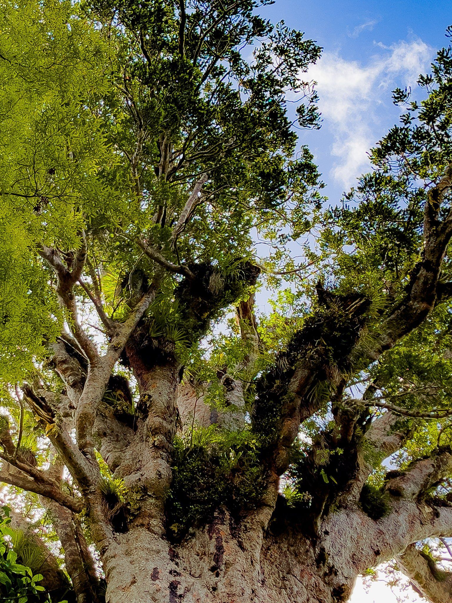
Waipoua Forest
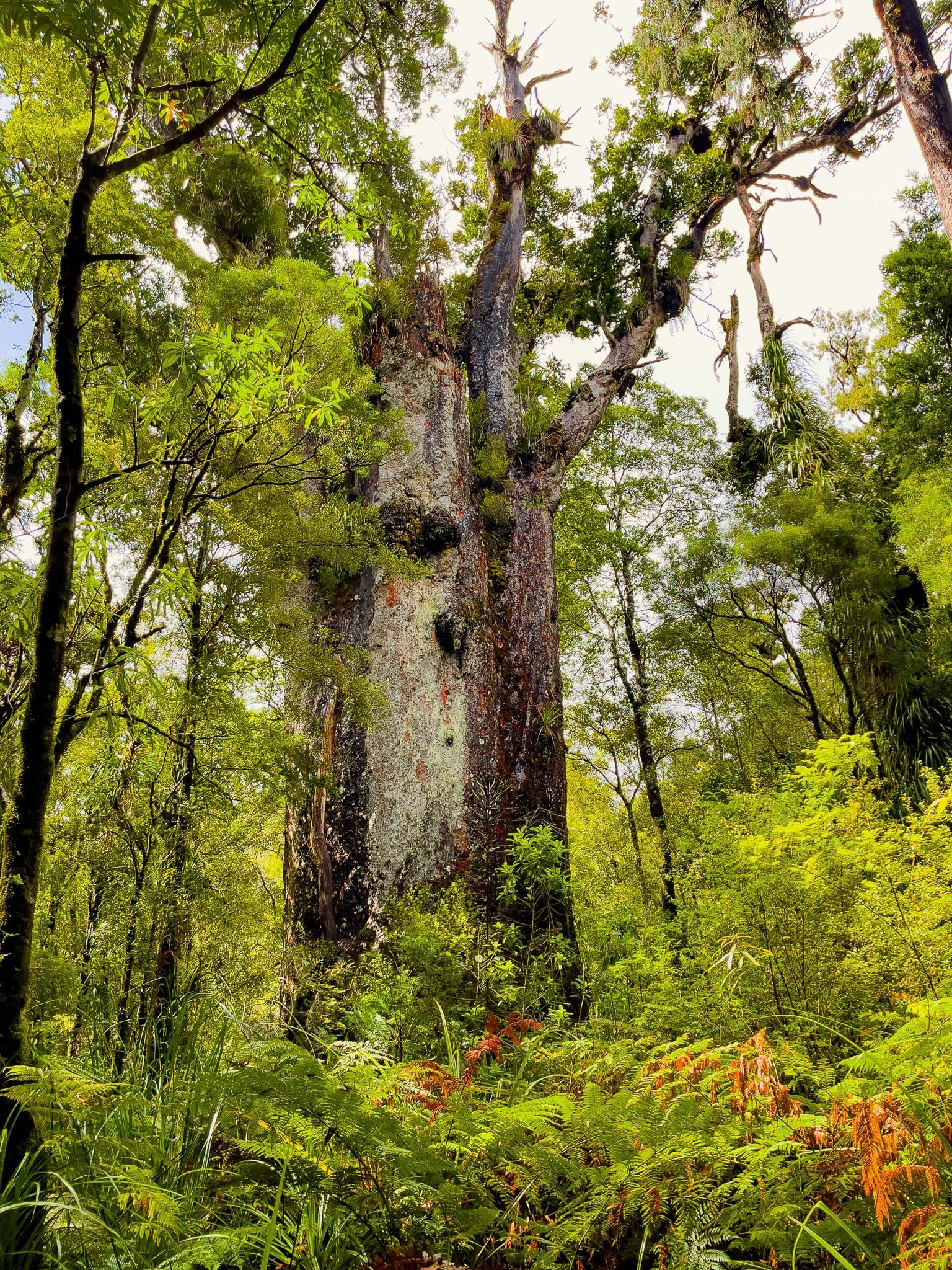
State Highway 12 takes you directly through Waipoua Forest, thick with large kauri. The road is windy with limited stopping options, but even from the car, you get a real sense of the scale of the trees and the forest.
There are obvious separate car parks for the tracks to Te Matua Ngahere and Tāne Mahuta. Tāne Mahuta is only a five minute walk and always popular. Te Matua Ngahere takes about 40 minutes but has the advantage of an extended walk amongst many giant trees, resulting in a superb experience. You can also access the campground on Waipoua River Road, off State Highway 12.
There are other trails in the forest but they are presently closed due to kauri dieback risks.
Want more Northland Trip Ideas?
Check out our blogs In Awe of Tāne Mahuta at Waipoua Forest and Wandering the Vast Coastlines of Northland.