
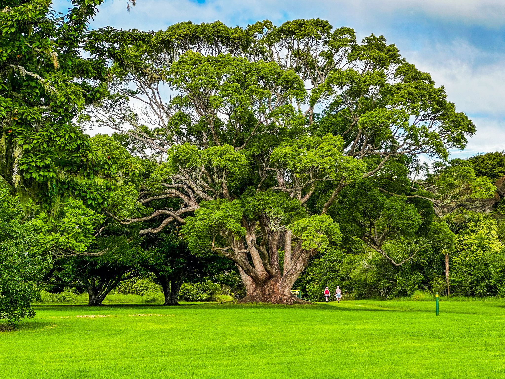
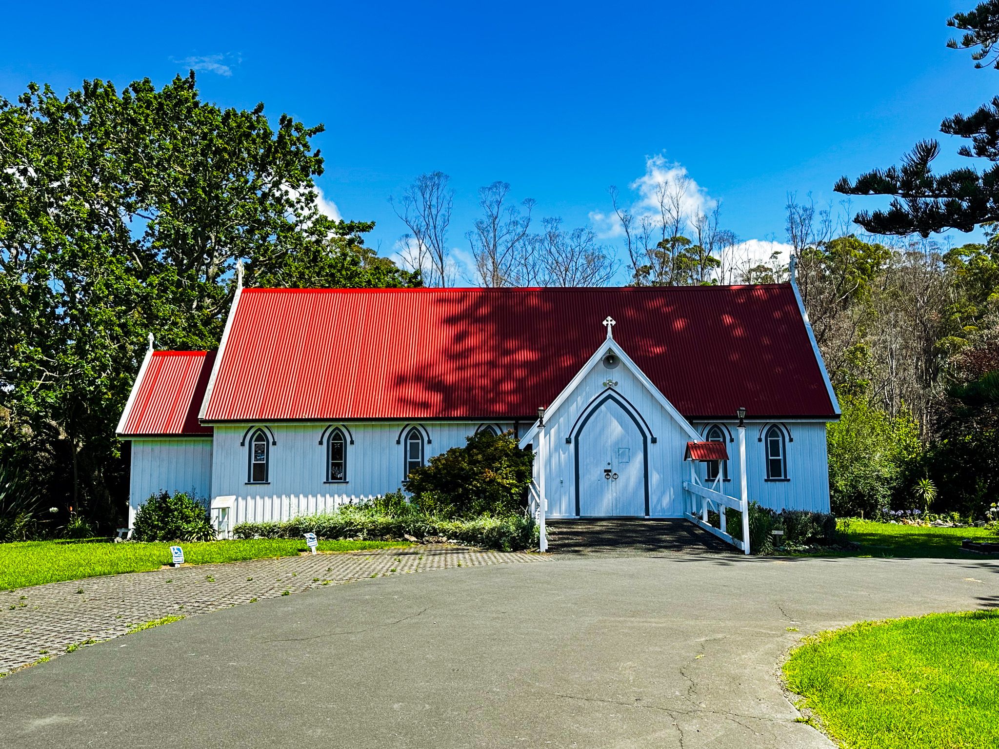
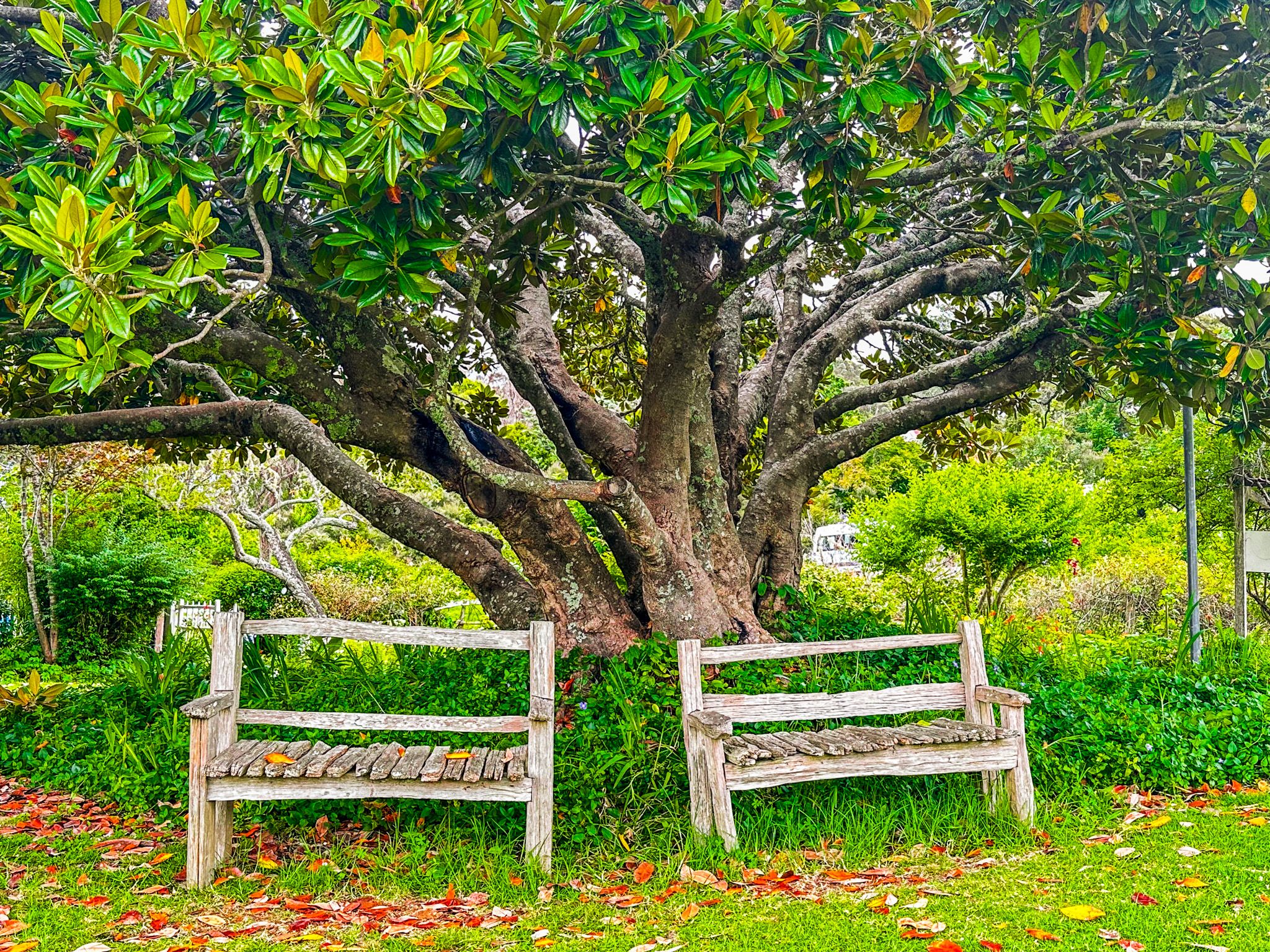
Kerikeri is an attractive town of around 8,000 people in Northland, at the northwest end of the Bay of Islands. It is both scenic and historic. The town centre is away from the main highway and well maintained with several restaurants and cafes. The palm trees are an unusual feature, and there is a beautiful town to forest walk with two waterfalls, Rainbow Falls and Wharepoke Falls, on the Kerkeri River Track. The edge of the town is dominated by horticultural farms, with the odd shop and cafe and two other shorter walks to waterfalls, Charlies Rock and Te Wairere.
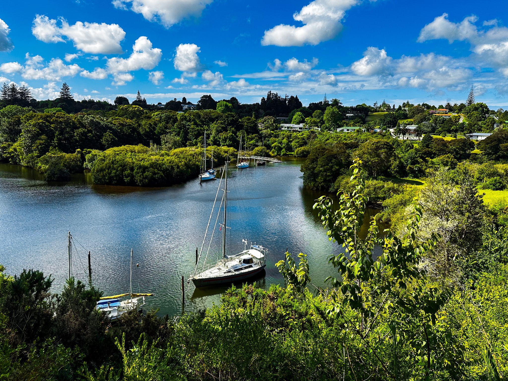
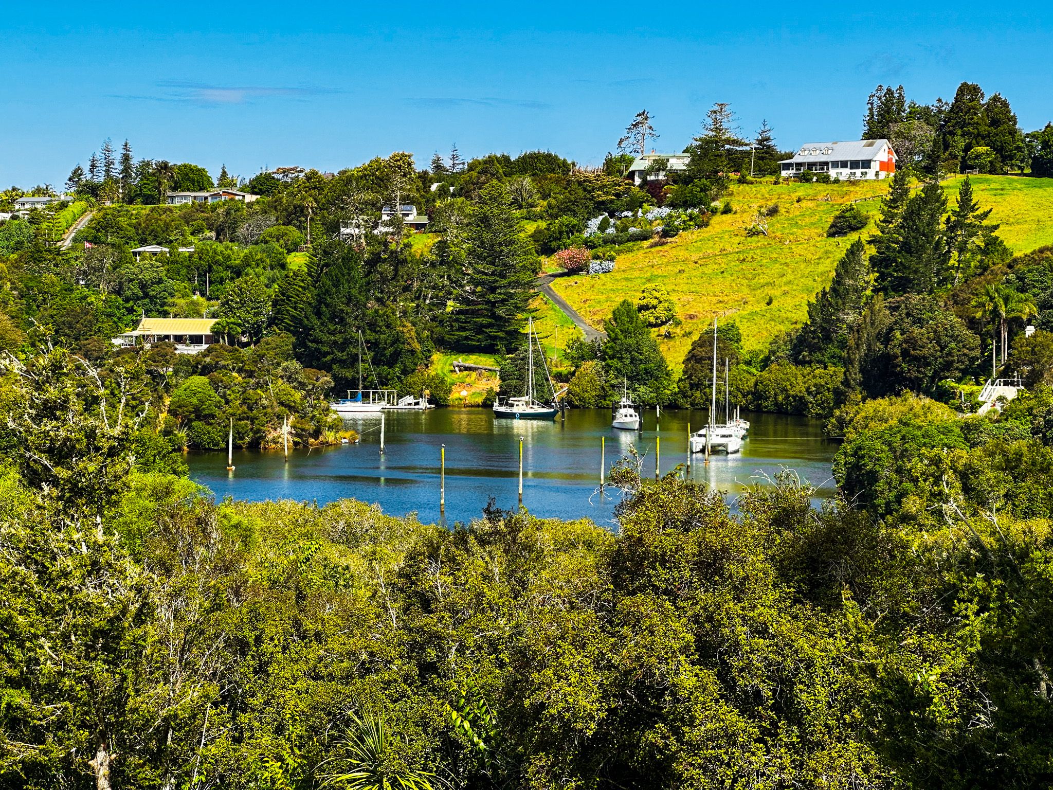
The town's historical features, such as the Kororipo pā, the Stone Store, and Mission House, are around Kerikeri Basin, where the Kerikeri River flows into the Kerikeri Inlet. This, in turn, connects to the Bay of Islands. Depending on which side of the basin you want to park on, it is a 6 to 13-minute drive from the town centre.
The town is an excellent jumping-off point for exploring the wider region. Puketi Forest to the west, the beaches of the Pacific Coast to the north/northwest and the Bay of Islands to the southeast are all less than a 30-minute drive.
An oddball feature of Kerikeri as a tourist town is its informal moniker, "It's So Nice They Named It Twice". An anonymous backpacker wrote it in the Visitors' Book at the Kerikeri Youth Hostel in the 1980s. The Kerikeri Chronicle newspaper then published it, and the rest is history!
Kerikeri is about a 3-hour and 20-minute drive from Auckland (240 km) and 80 km north of Whangārei, the only city in Northland. Most of the drive north is on State Highway 1, with a short section on State Highway 10.
Kerikeri Basin
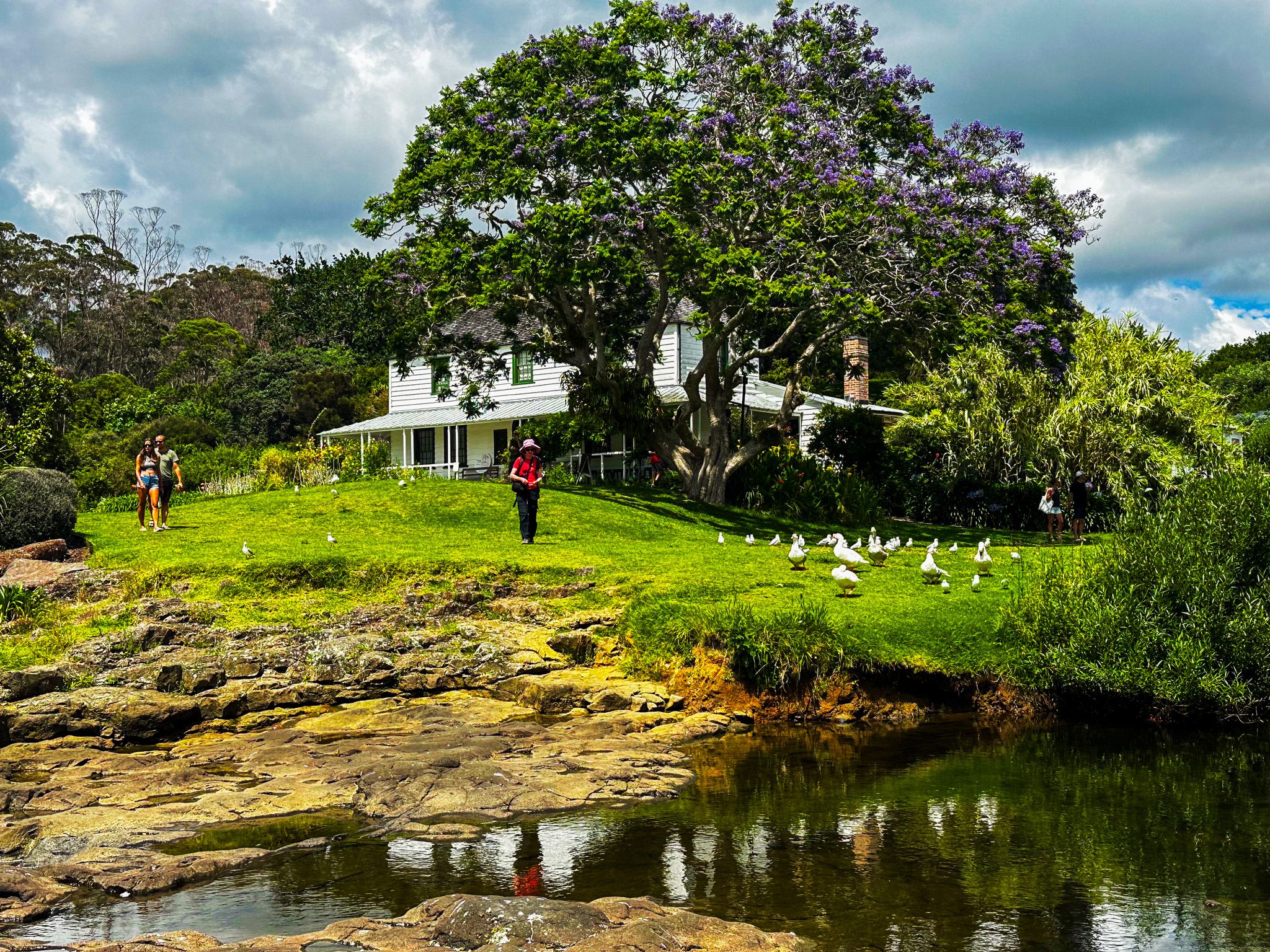
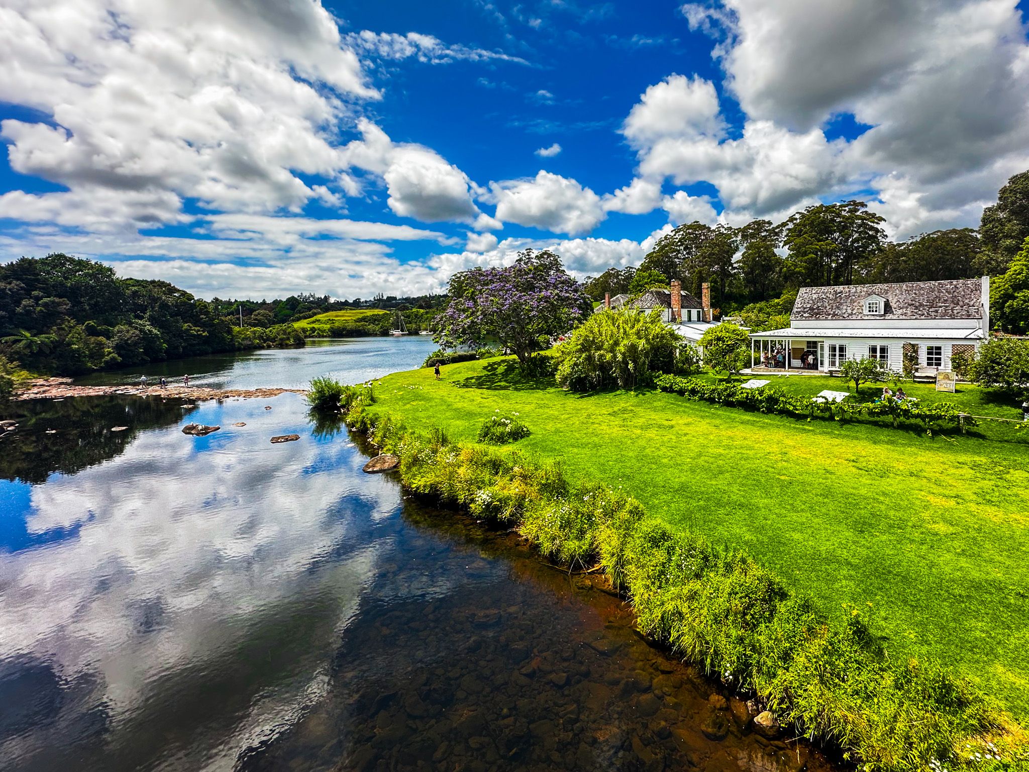
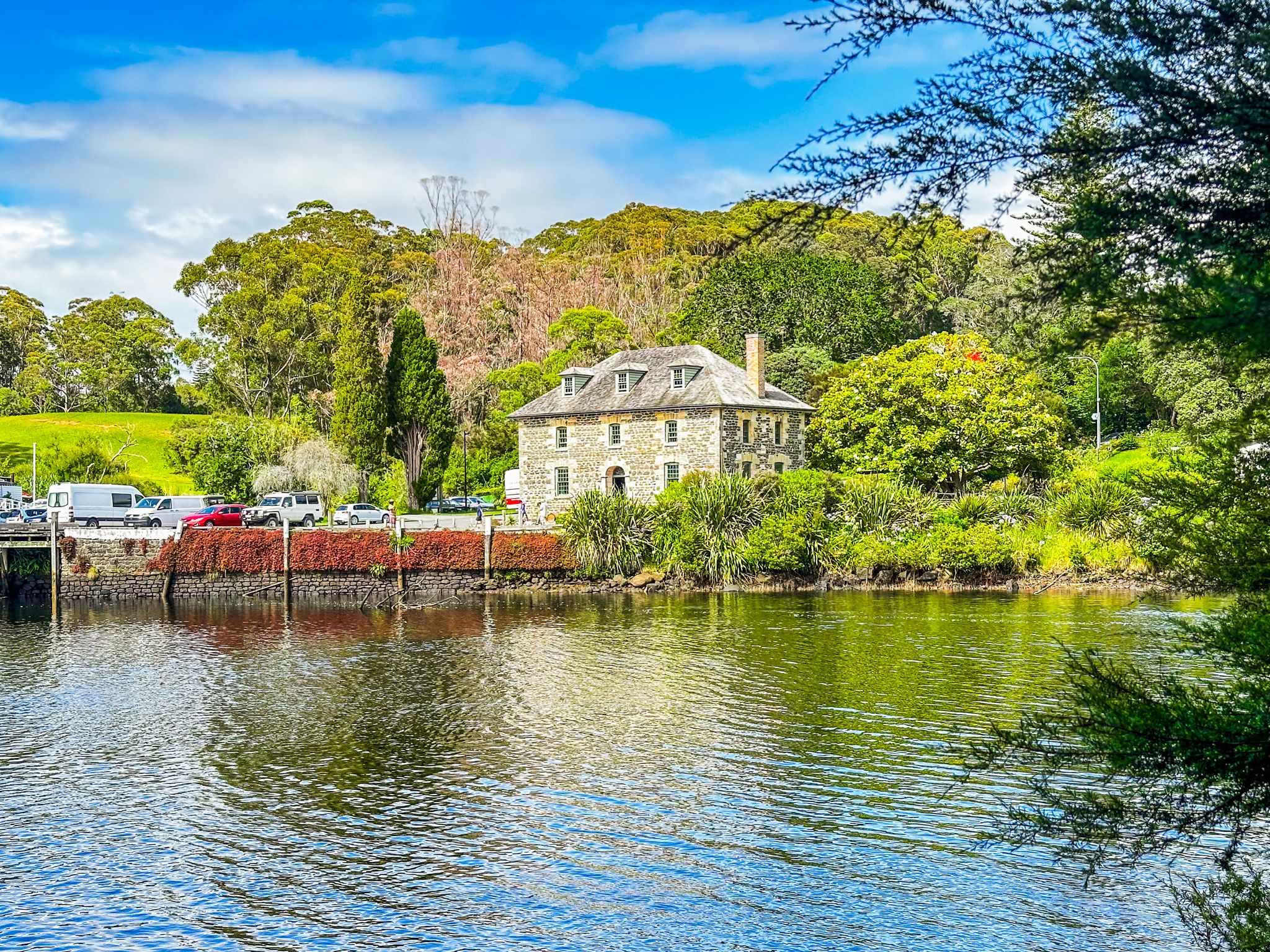
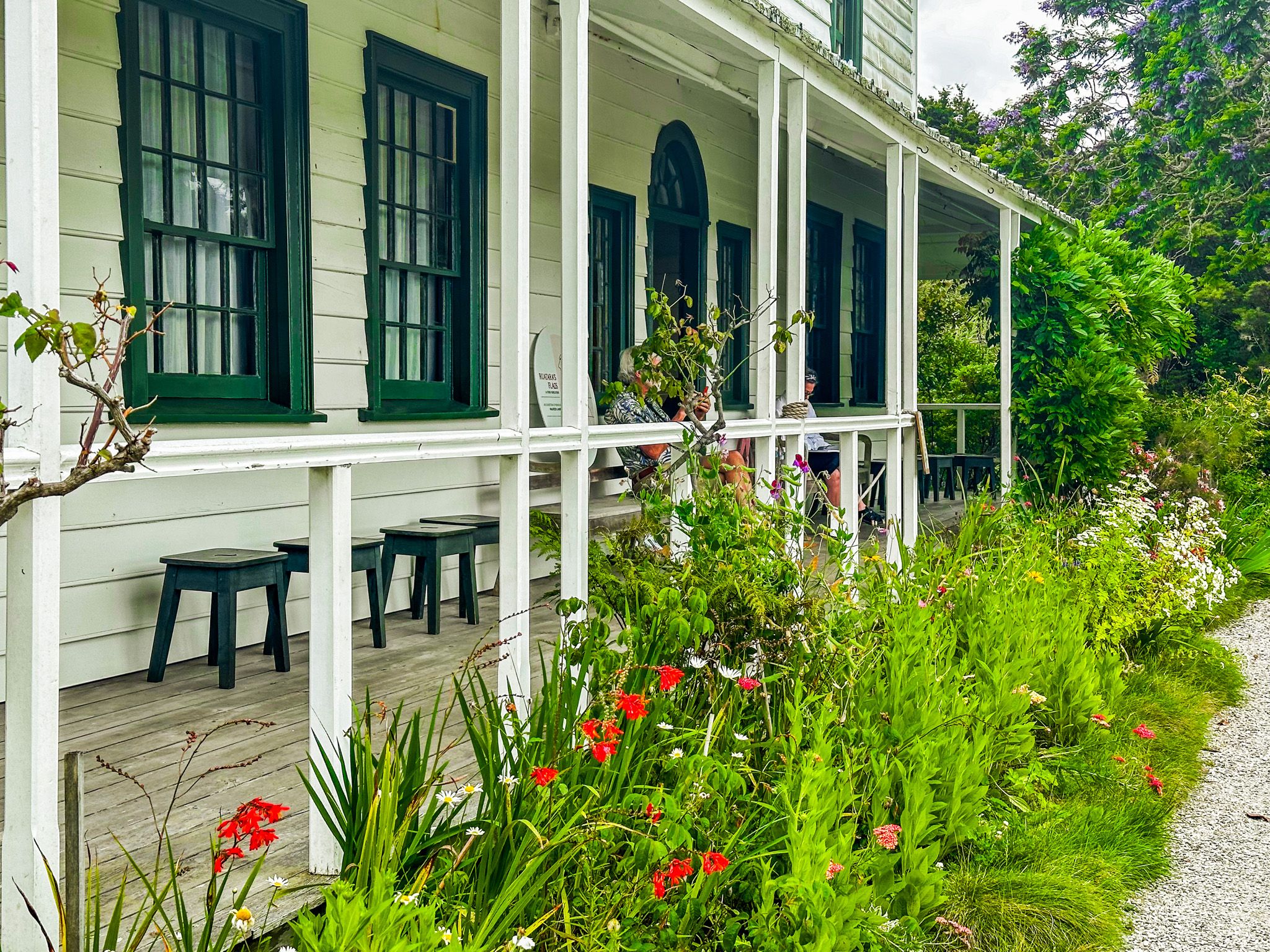
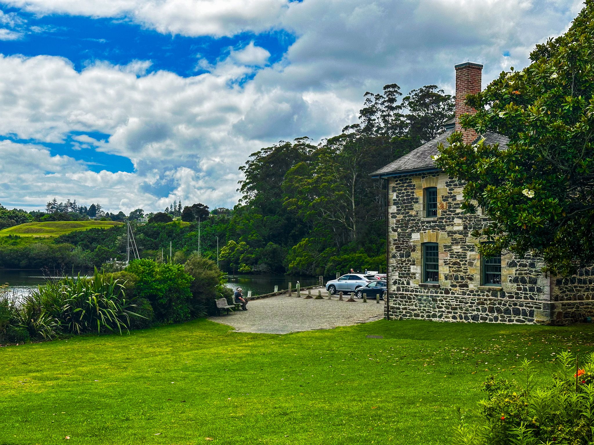
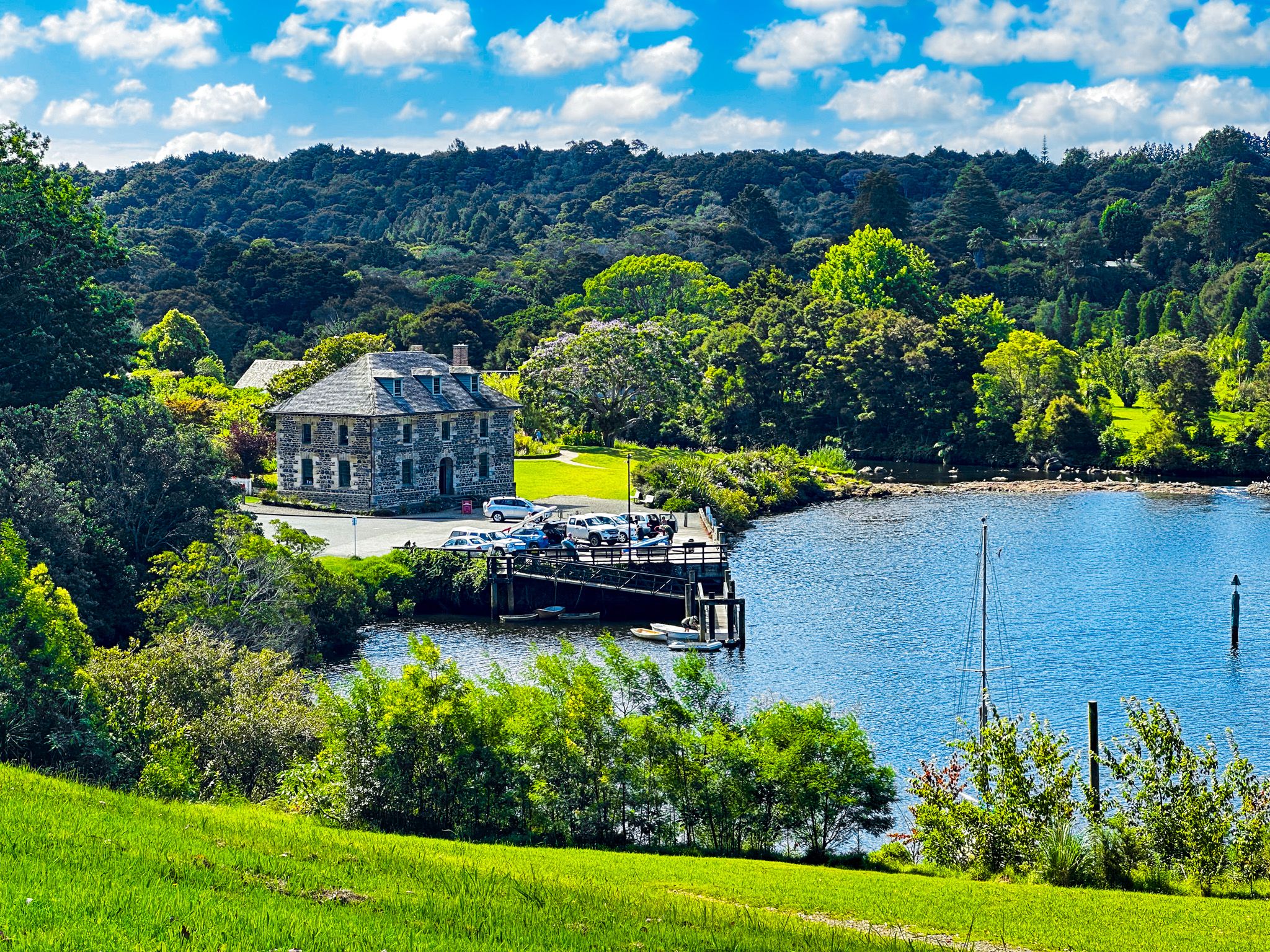
The historical features of Kerikeri are mainly clustered around Kerikeri Basin, where the Kerikeri River flows into Kerikeri Inlet, leading to the Bay of Islands and the Pacific Ocean. At the time of early European interaction, there was a substantial Māori presence around the basin, with pā, kāinga (a non-fortified village) and their gardens a feature of the area. The soil was particularly productive, reflected in the name Kerikeri, which means "dig dig". Some of the most substantive early interactions between Maori and Europeans occurred here. The focus was establishing a missionary station, including Mission House and what became the Stone Store.
The European activities reflected a strong and, initially, supportive Māori presence. Ngāpuhi, led by Hongi Hika in the early 1800s, quickly saw the advantages of trading with Europeans, including opportunities to access guns. In 1814, Hongi Hika sold 53 square km of land, including land around the basin, to Samual Marsden for the use of the Church Missionary Society. The pā, Kororipo, was just to the east, and a nephew of Hongi Hika, Ruatara, provided protection. Grape vines and citrus were successfully planted as early as 1819, and the Reverend John Butler was the first to use a plough in NZ in 1820. Mission House was built in 1822, and the Stone Store to the southeast in 1832-36, respectively, the oldest wood and stone buildings in NZ. Some surrounding gardens and exotic trees are also historic, although the cafe behind the house is much more modern.
It took a while to establish Kerikeri, initially called Gloucester Town. Fortunately, the name did not stick, and the Māori name of “Keddi Keddi” or “Kiddeekiddee”, possibly based on the river's name, took hold. The “d” is a soft rolled “r”, hence the name Kerikeri as Māori became a written language.
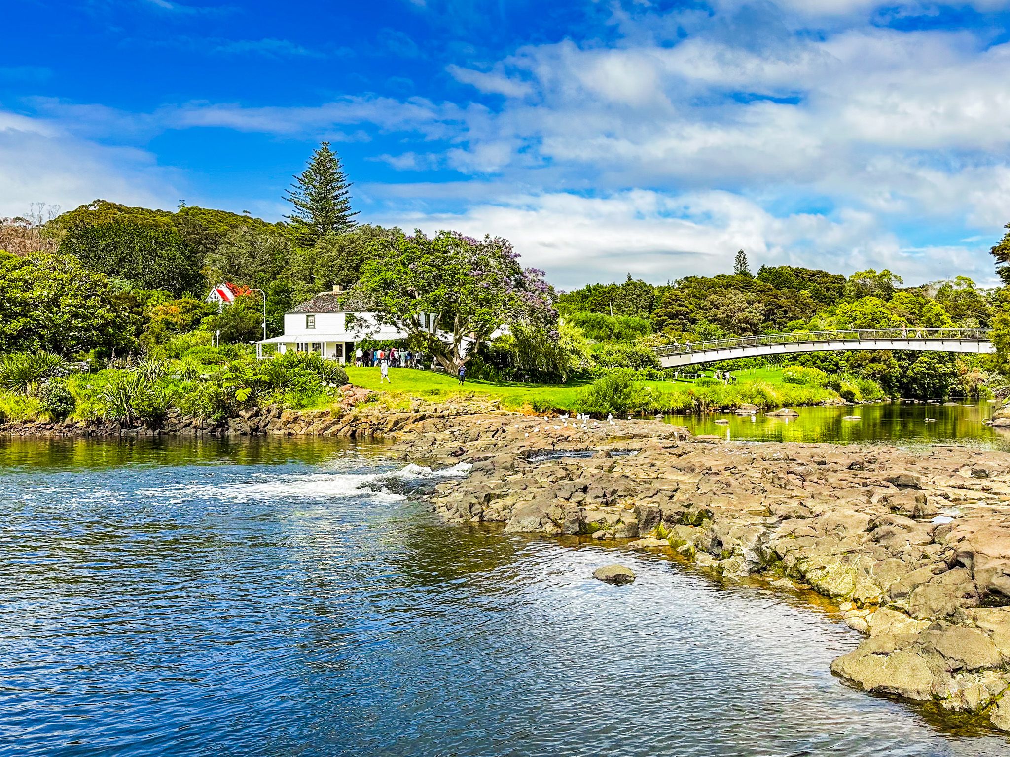
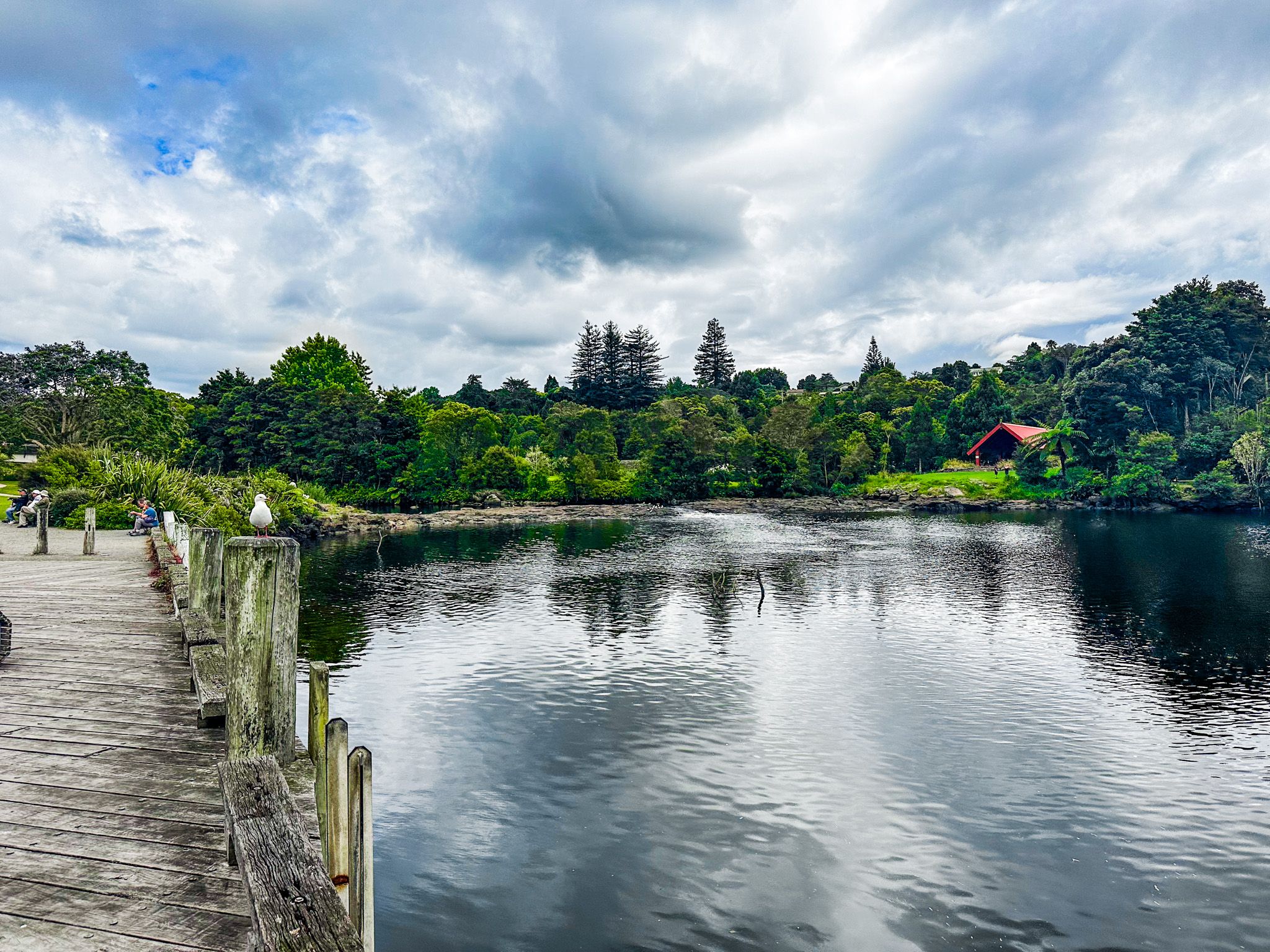
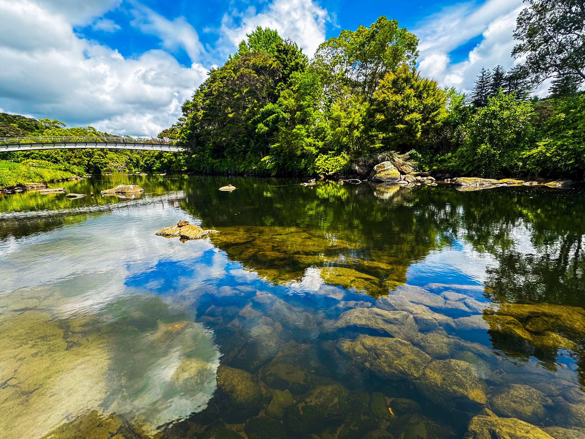
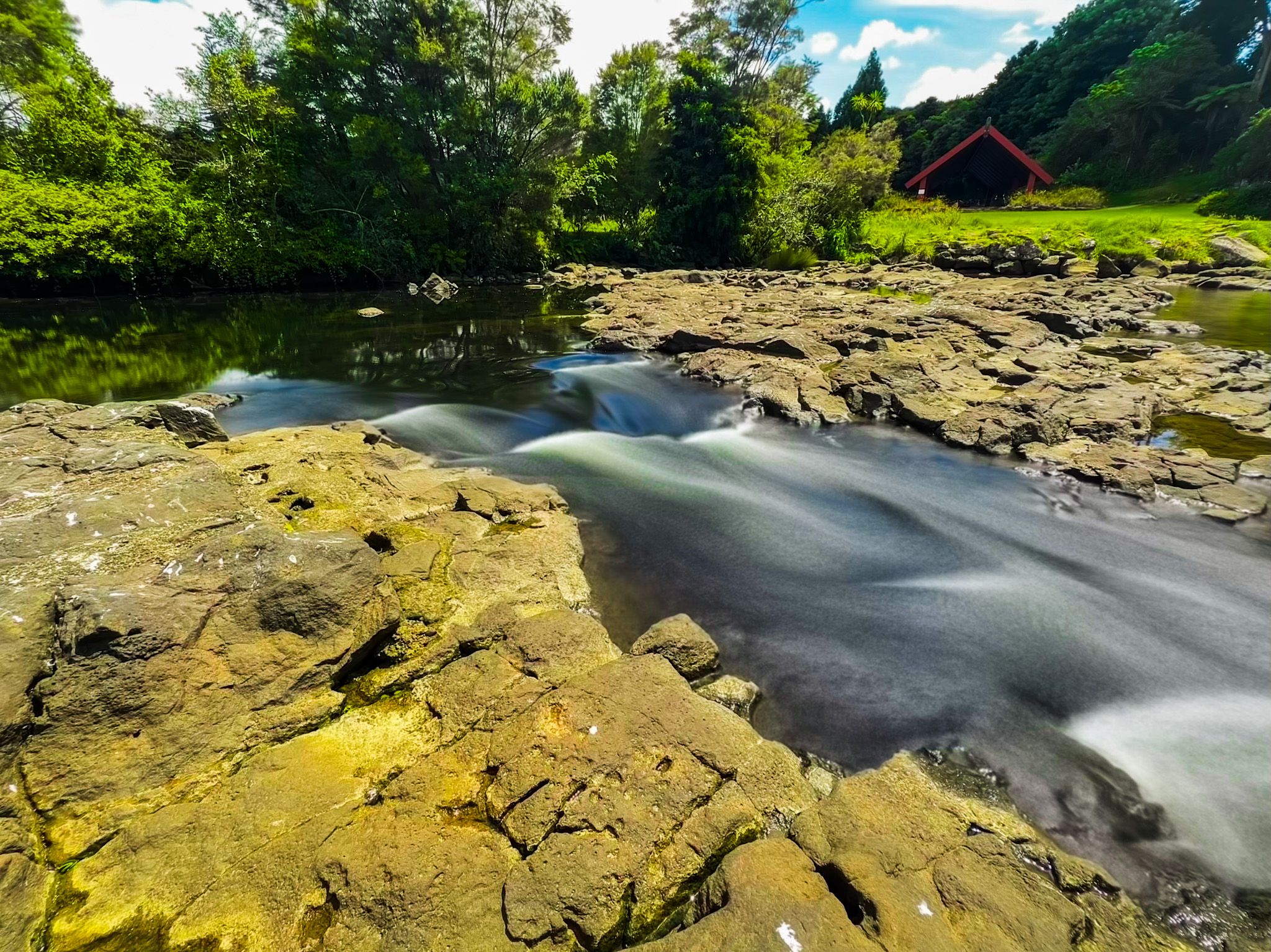
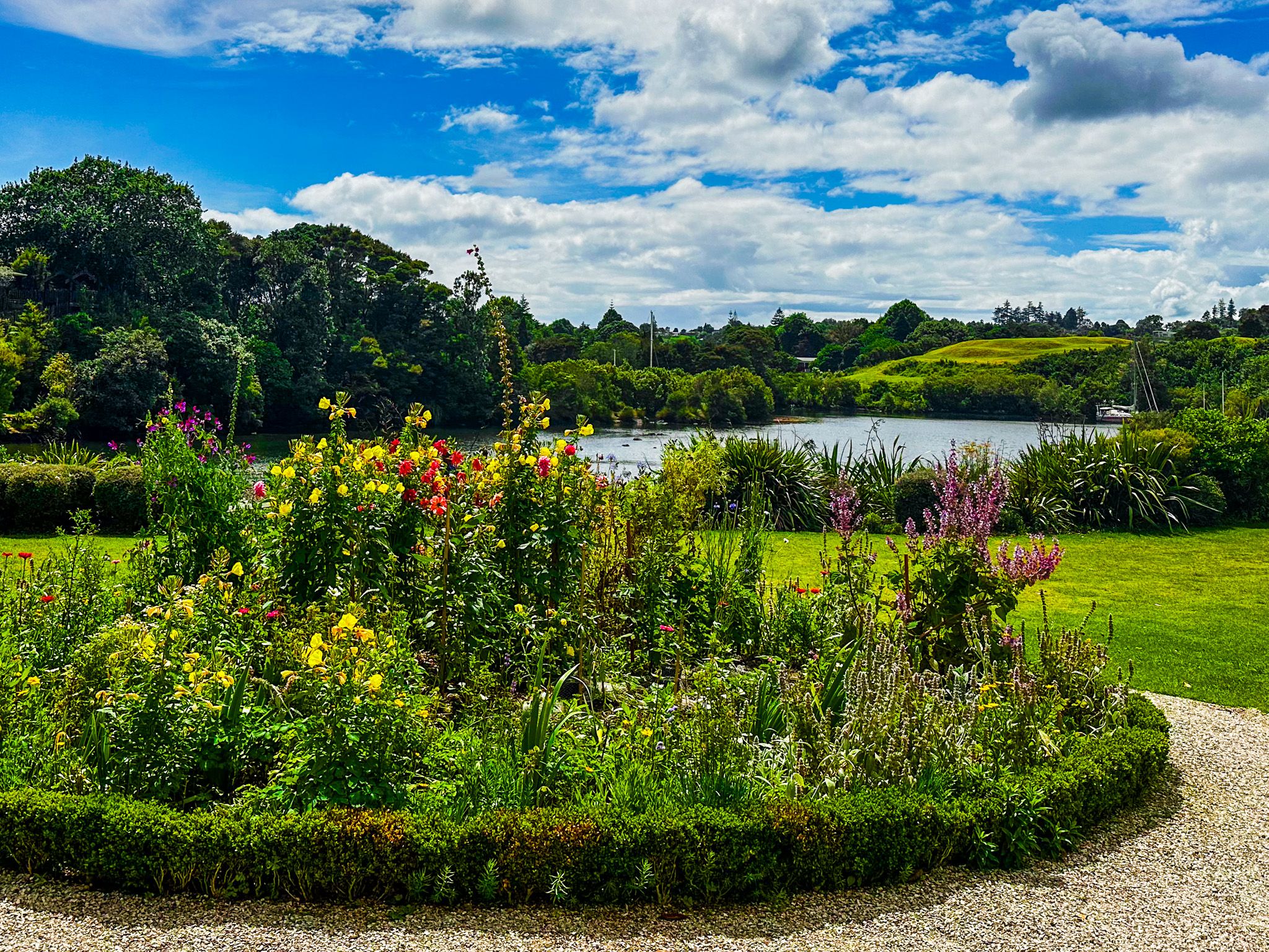
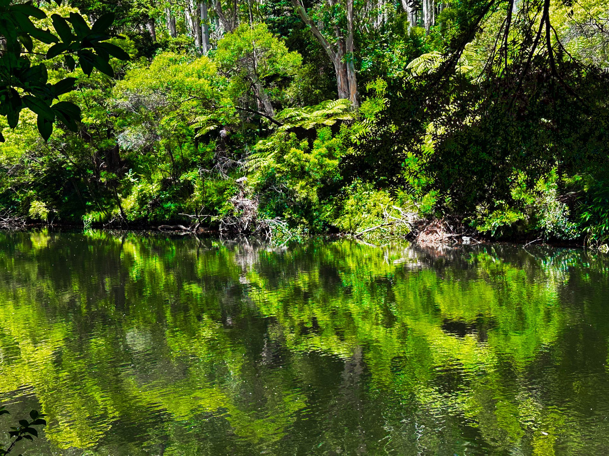
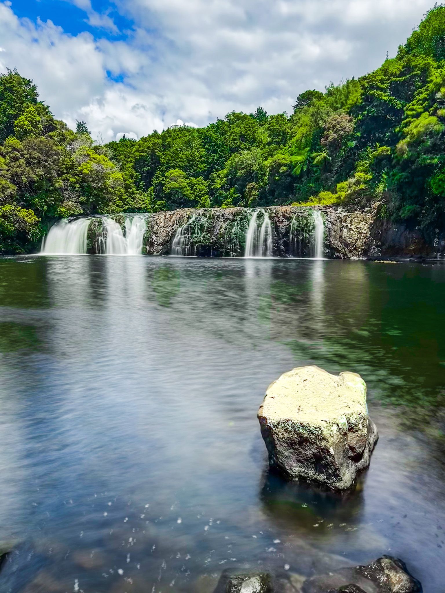
Today, the Kerikeri Basin is beautiful. On the east side are the historic buildings and Kororipo pā, with a large grass reserve surrounded by trees on the west side. At the river mouth, between the reserve and historic buildings, is an accessible rock barrier with a narrow but low waterfall. It was once higher but was reduced in the early 1900s to make it easier to build a bridge.
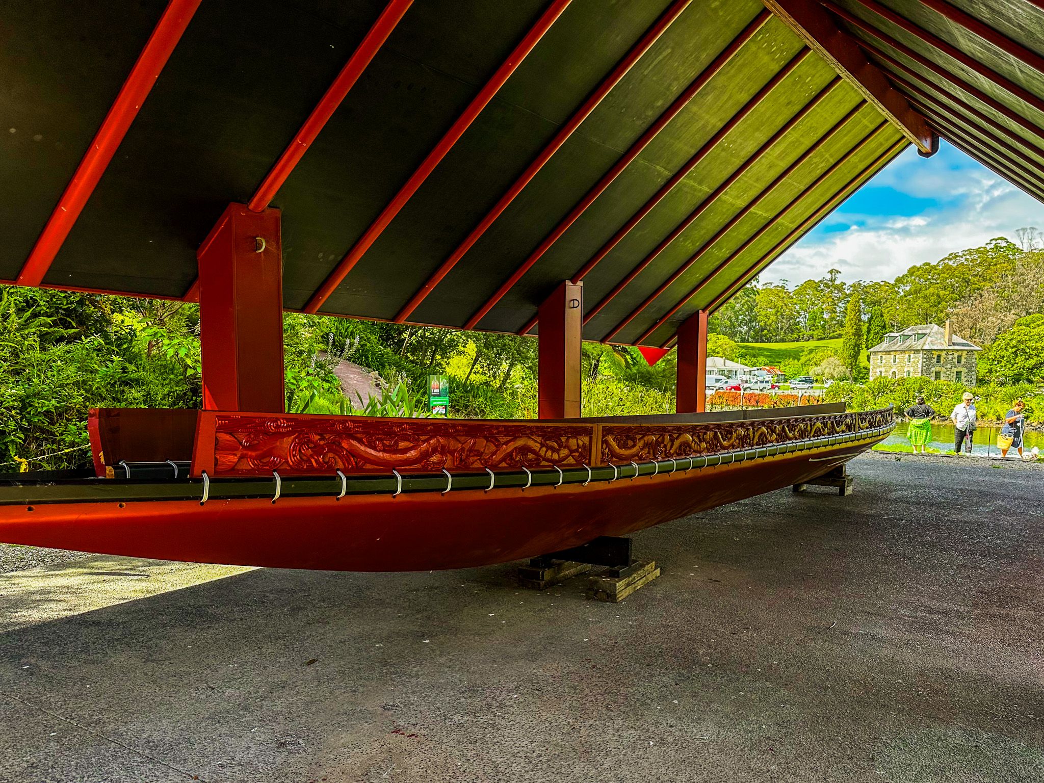
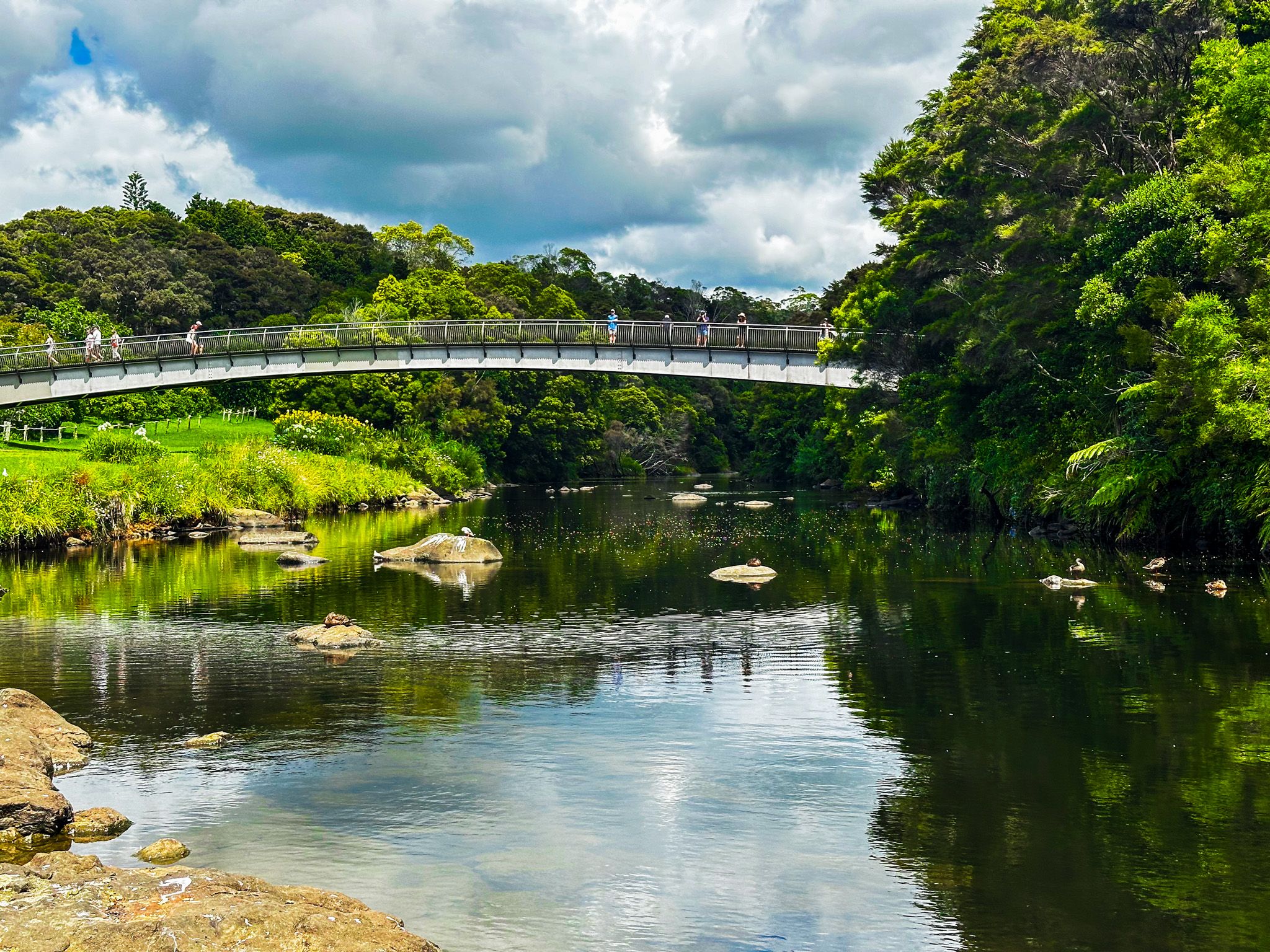
The east side of Kerikeri Basin can be accessed from the town centre heading northeast along Kerikeri Road, with a car park on the wharf next to the Stone Store. Alternatively, access the west side of Landing Road with a more extensive car park next to the reserve and start the Kerikeri River Track. There are two Māori canoes next to the river, and a short walk takes you to Te Ahurea, a reconstruction of a kāinga. There is also a food bridge between the reserve and historic buildings with lovely views up and down the river.
Mission House and Stone Store
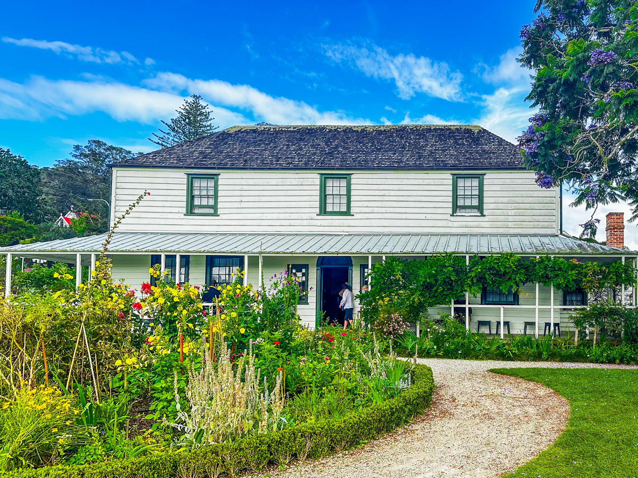
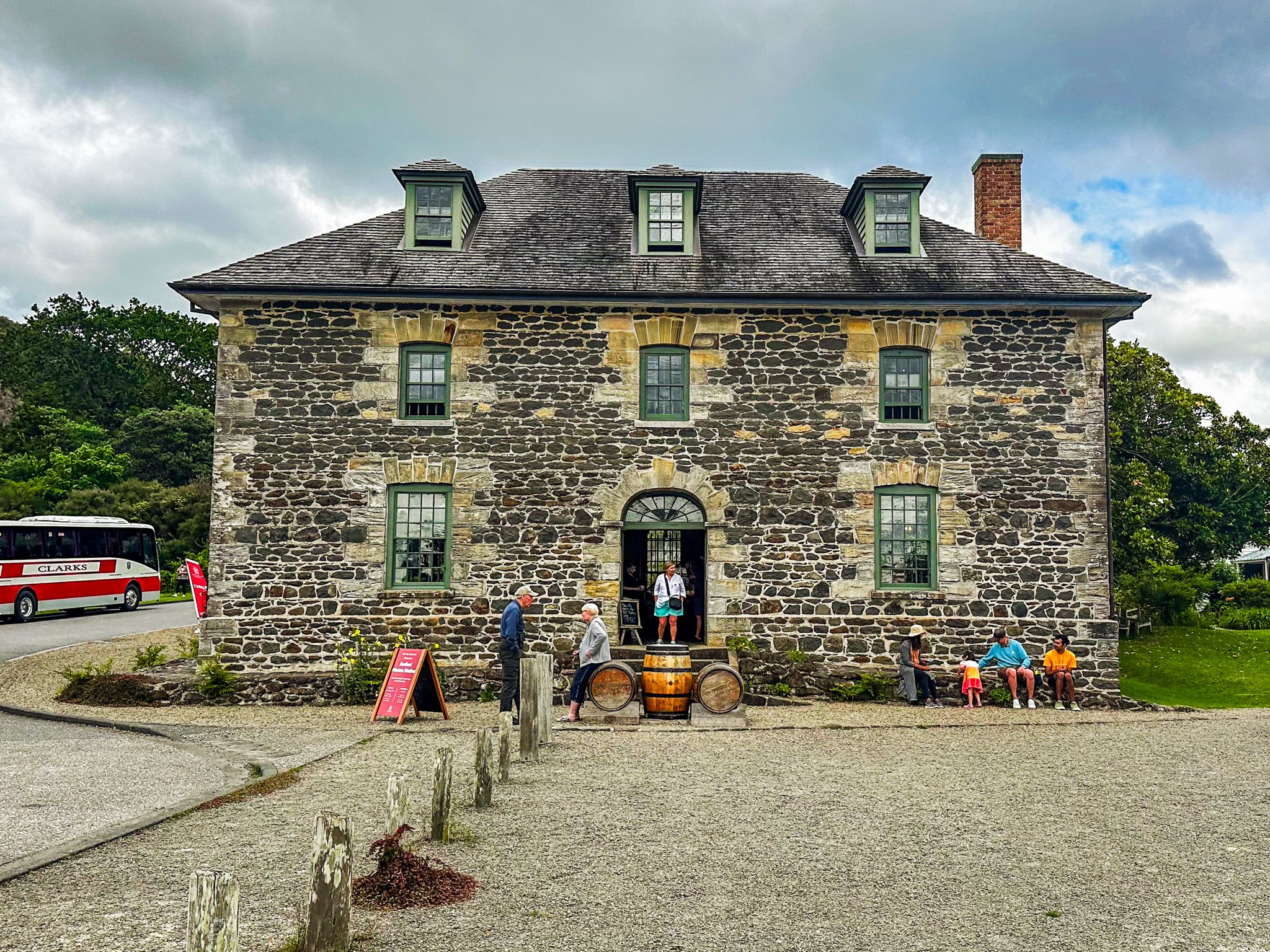
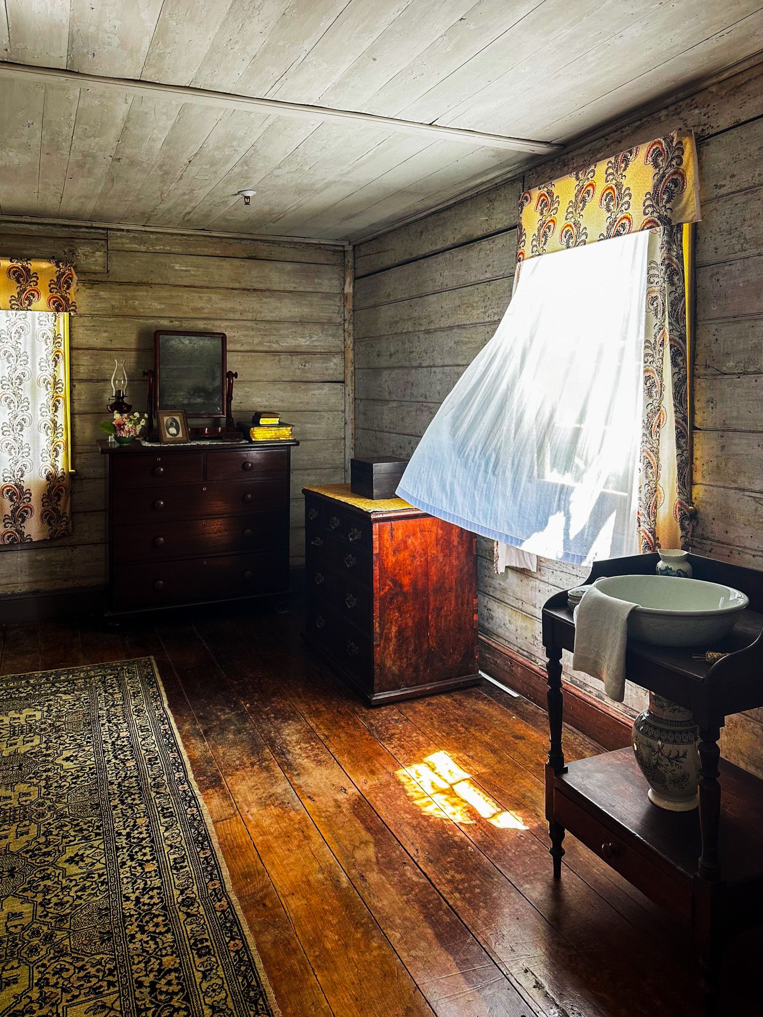
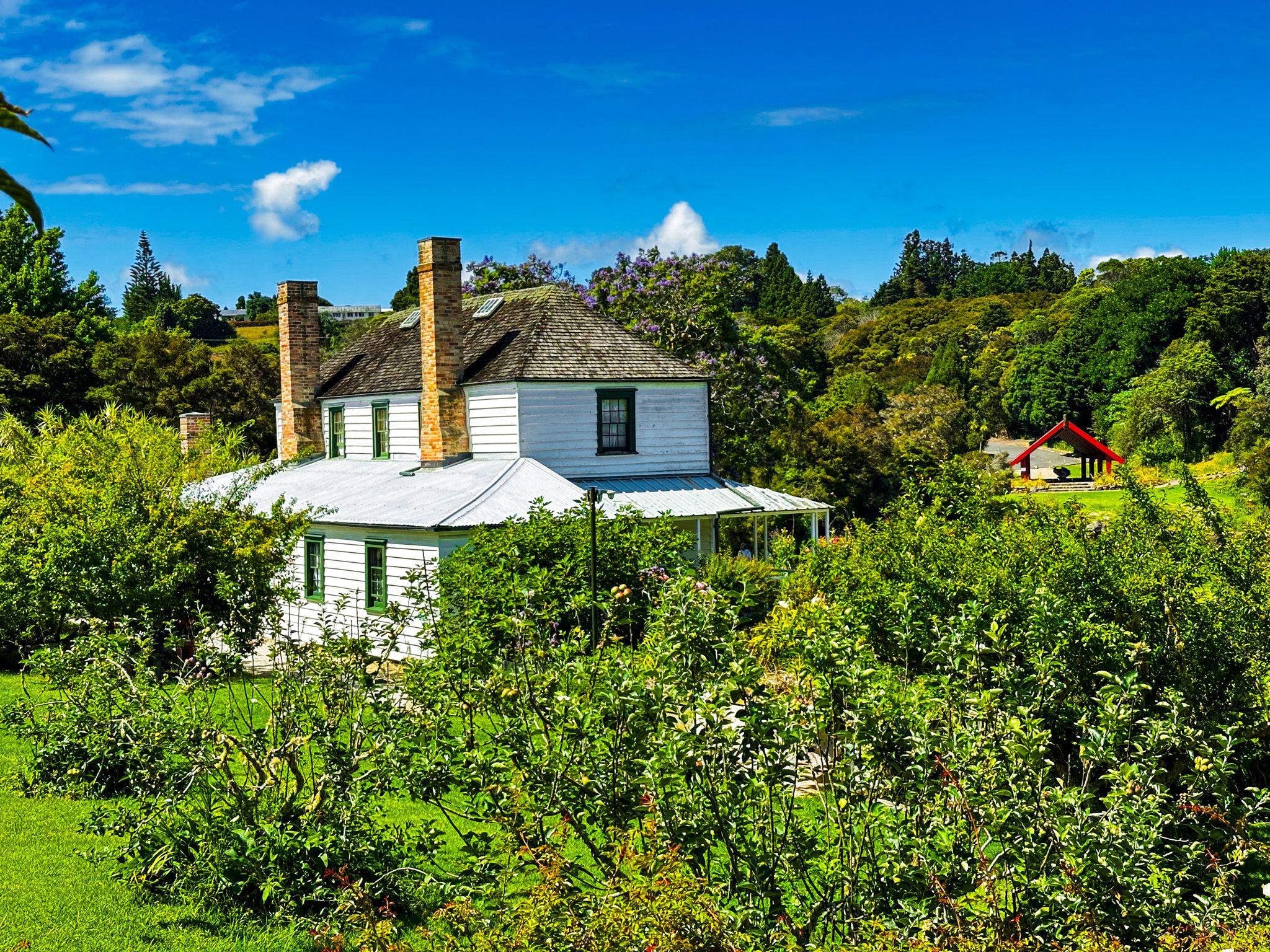
Mission House, also known as Kemp House, was built on the edge of the Kerikeri River in 1822, and the Stone Store was built about 20 metres to the southeast in 1832-36. The two buildings are the oldest wood and stone buildings in NZ. In front of the Stone Store is a small wharf. Although not easy to pick out with various upgrades, it was also originally built in stone, dating back to the early development of Kerikeri. Immediately behind Kemp House is a cafe.
Mission House was the first of various mission houses built in NZ that pre-dated the Treaty of Waitangi in 1840. Several historic mission houses are scattered around Northland, especially from the Bay of Islands up to Whangaroa Harbour and west to the Hokianga. These houses were built to accommodate the missionaries of various Christian sects keen on bringing formal education and Christianity to Māori in the early 1800s.
The first missionary was Reverend John Butler, who was charged with erecting the buildings. Kororipo Pā to the southeast provided protection. While Marsden, Thomas Kendall and Hongi Hika took a trip to Britain, Mission House was built by 1822, mostly from locally milled kauri, by a mix of Māori and European labour.
Butler was sacked in 1823, and the house was occupied by George Clark until James and Charlotte Kemp took it over in 1832. The Kemps subsequently became owners of the property in 1859. It was in the Kemp family until 1974, when it was given to the NZ by Ernest Kemp, a great-grandson of James and Charlotte Kemp. Heritage NZ now manages it.
Today, it is a museum, with a modest fee, which records the early history of European and Māori interactions. There is also a pleasant heritage garden, orchard, and a cafe in a separate heritage building immediately behind the house.
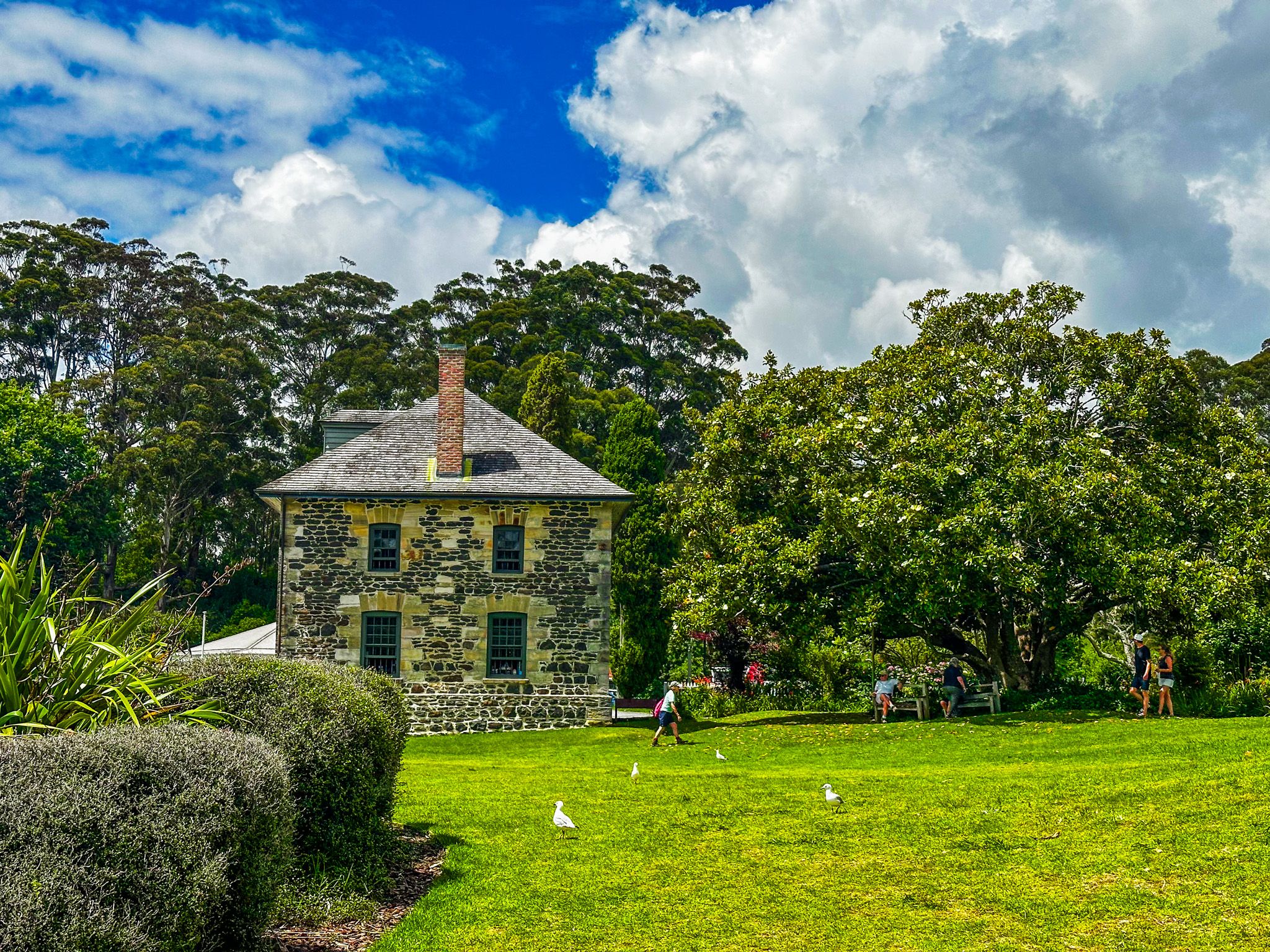
A store was part of the Church Missionary Society’s mission in Kerikeri Basin. A wooden one was initially established for trade between Europeans and Māori. A flour mill was also planned but constructed at Waimate instead. In the early 1830s, it was decided to upgrade the wooden structure to stone.
However, by the mid-1830s, the store was uncompetitive as other settlers and Māori developed their businesses. The new building was used as the mission library by Bishop Selwyn in the early 1840s, then as a magazine and barracks by Governor Grey during the Flagstaff War of the mid-1840s. After the war, it became a kauri gum trading centre, then a boys' school in the 1860s.
The Kemp family bought the building in 1874, and it became a general store, then a tourist destination. In 1975, the Kemps sold it to Heritage NZ. It still operates as a store with a range of craft products. Upstairs is the Kerikeri Museum, which has a modest entry fee.

Kororipo Heritage Reserve
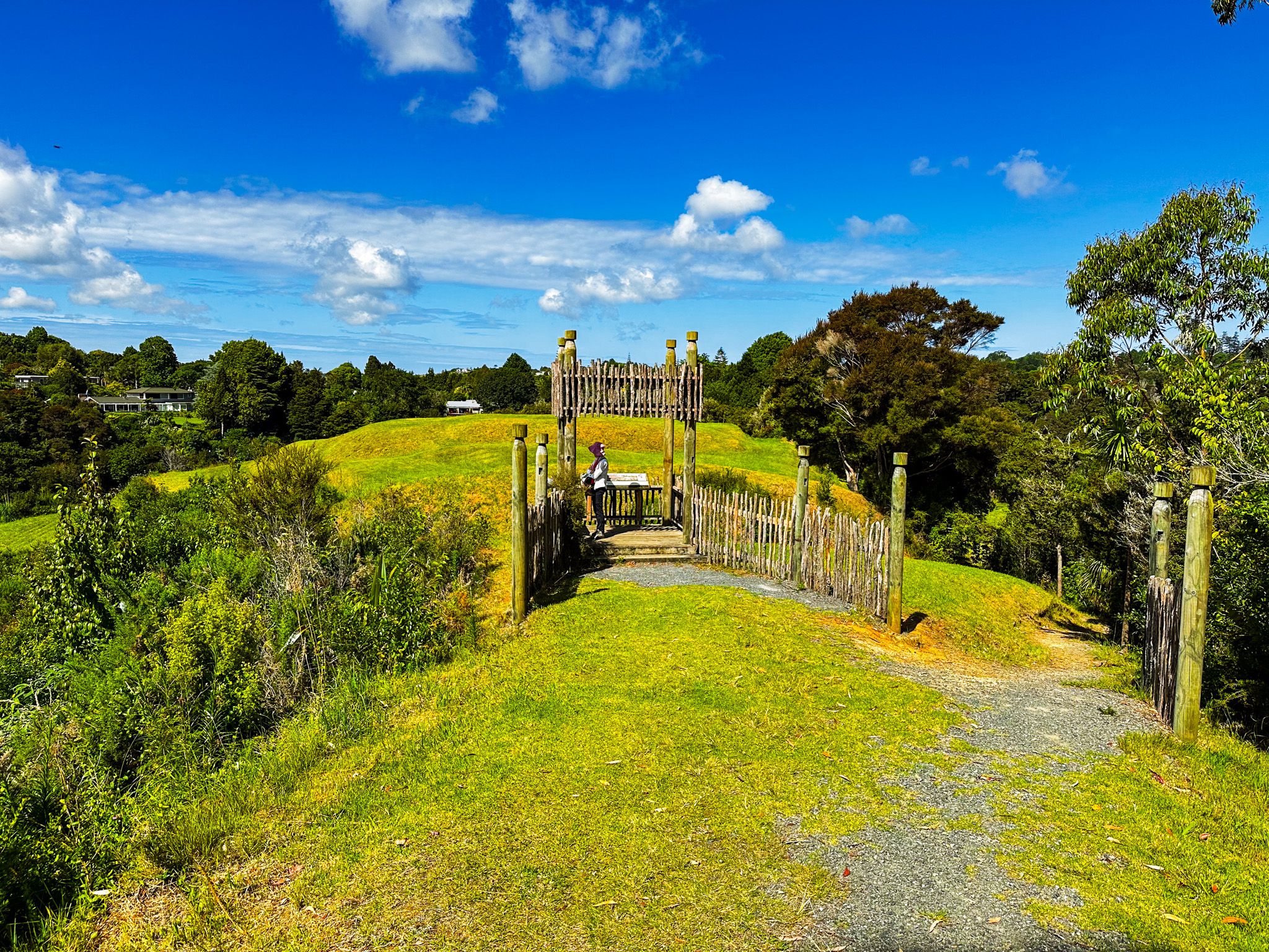
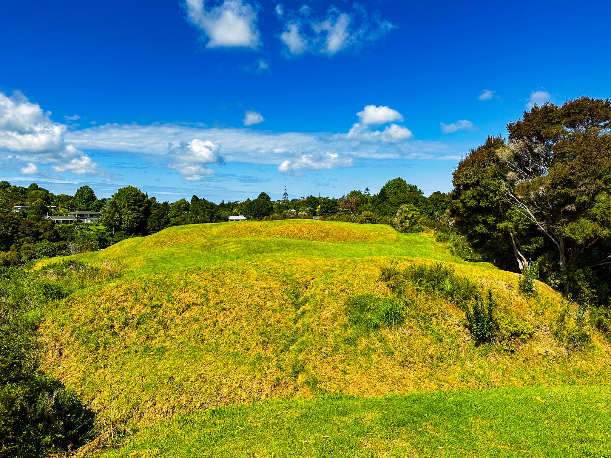
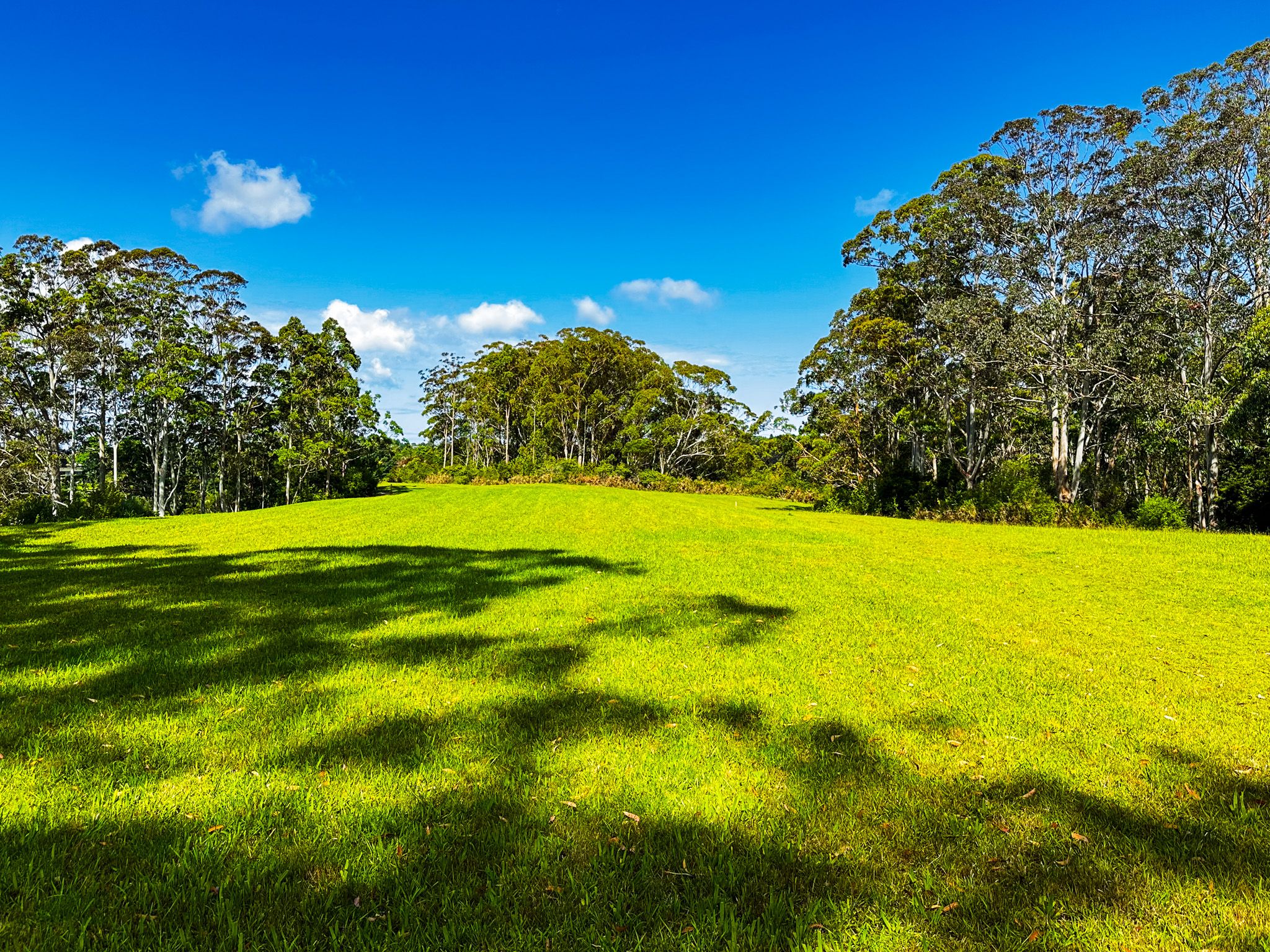
Kororipo Heritage Reserve is the large hill overlooking Kerikeri Basin to the southeast of the Stone Store and wharf. You can pick out the terraced shape of the historic grassed Kororipo pā from the pier to the east, overlooking the basin. A loop walking track from the Stone Store car park starts at the edge of the inlet past the pier and then climbs up the hill to a broad ridge with a grassy meadow surrounded by mature eucalypts. From there, continue east along the ridge to a viewpoint over the pā and basin. There are several explanatory panels at the viewpoint. You can continue onto and around the pā.
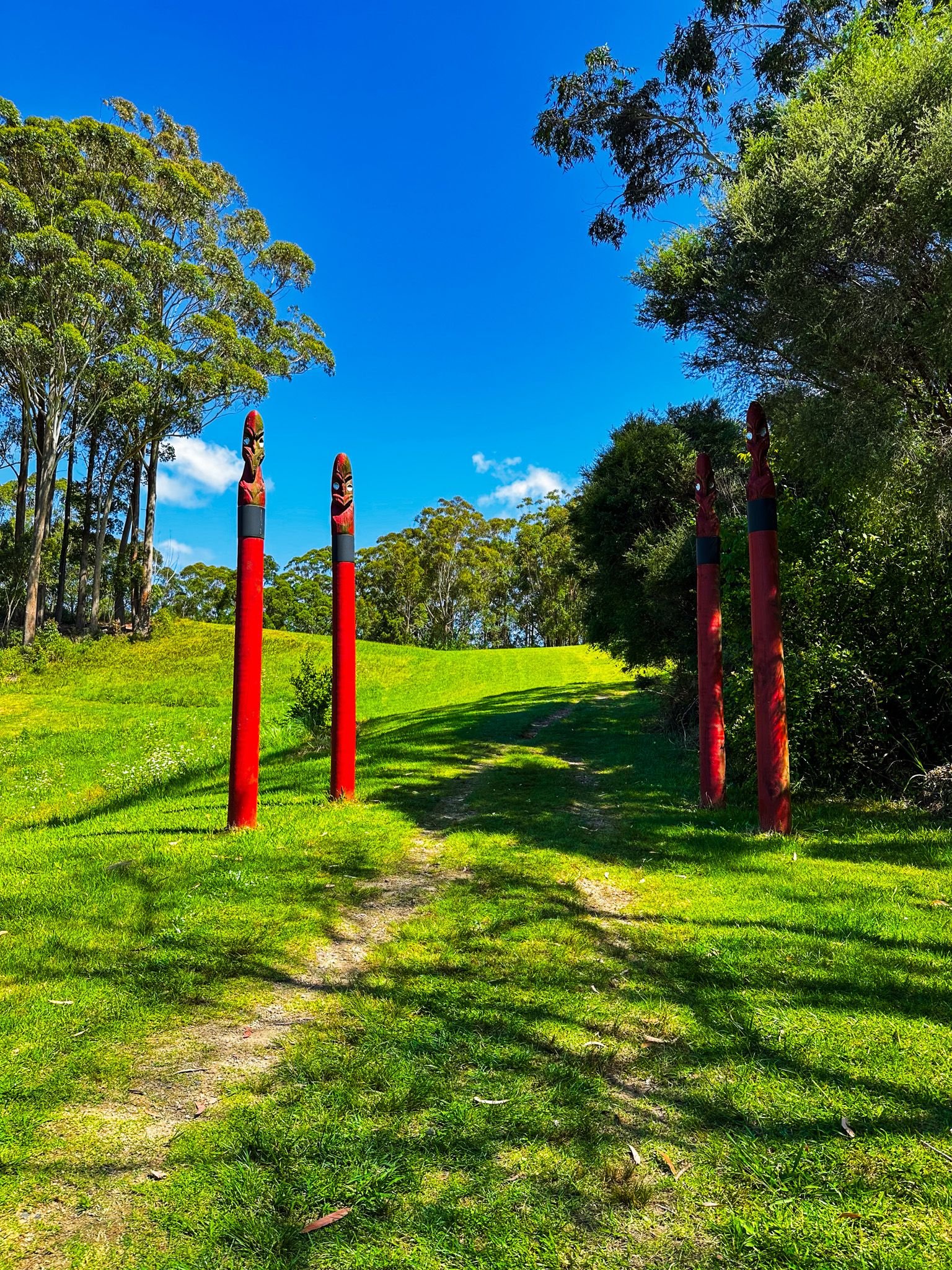
Head back the same way but continue along the wide grassy meadow till you see the track back down to a second car park, off Kerikeri road and about 20 metres west of the Stone Store. The entrance is marked by several pou and additional explanatory panels. From the southwest end of the ridge meadow, you can also walk to Te Wairere Falls or take the Hongi Hika Walk to Hone Heke Road. From there, walk back down Kerikeri Road to the car park, or take a short deviation to the town centre.
Kororipo pā was a Māori fortified settlement in the Kerikeri basin. From this position, it could command the basin and any attempts to access it by canoe. Like many pā, it is very steep on three sides, with the main entrance below the viewpoint protected by a ditch. Historically, Ngāi Tawake defended the pā as their outlet to the sea in the 1770s.
It is most famous as a pā of Hongi Hika from the early 1800s to the 1820s. It provided guardianship to the nearby mission station and Mission House. Less salubrious was its use to launch Hongi Hika’s military campaigns against other iwi during the Musket Wars. This began in earnest after he travelled to Britain around 1820 with Thomas Kendall and returned with 1,000 muskets.

Kerikeri River Walk
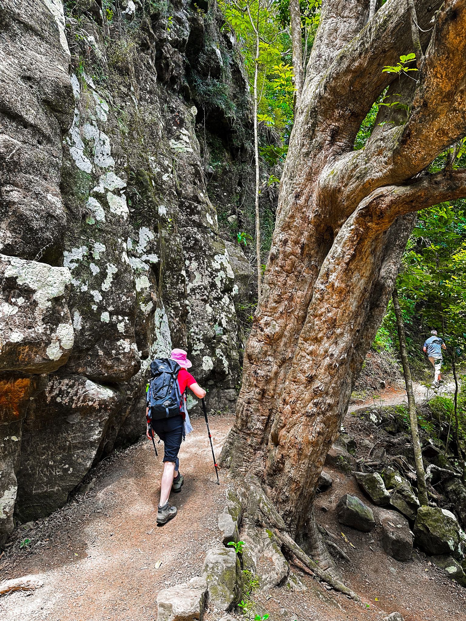
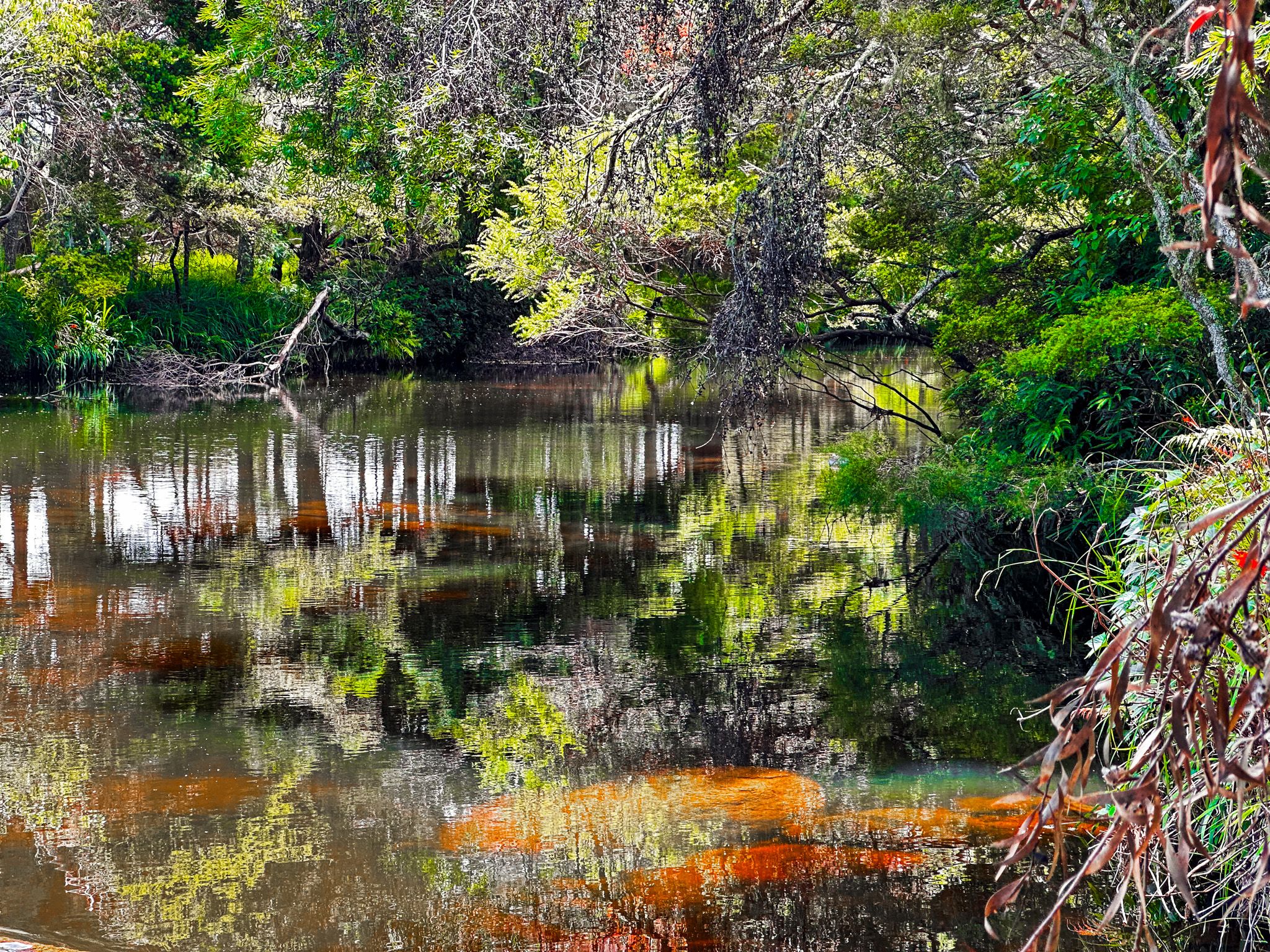
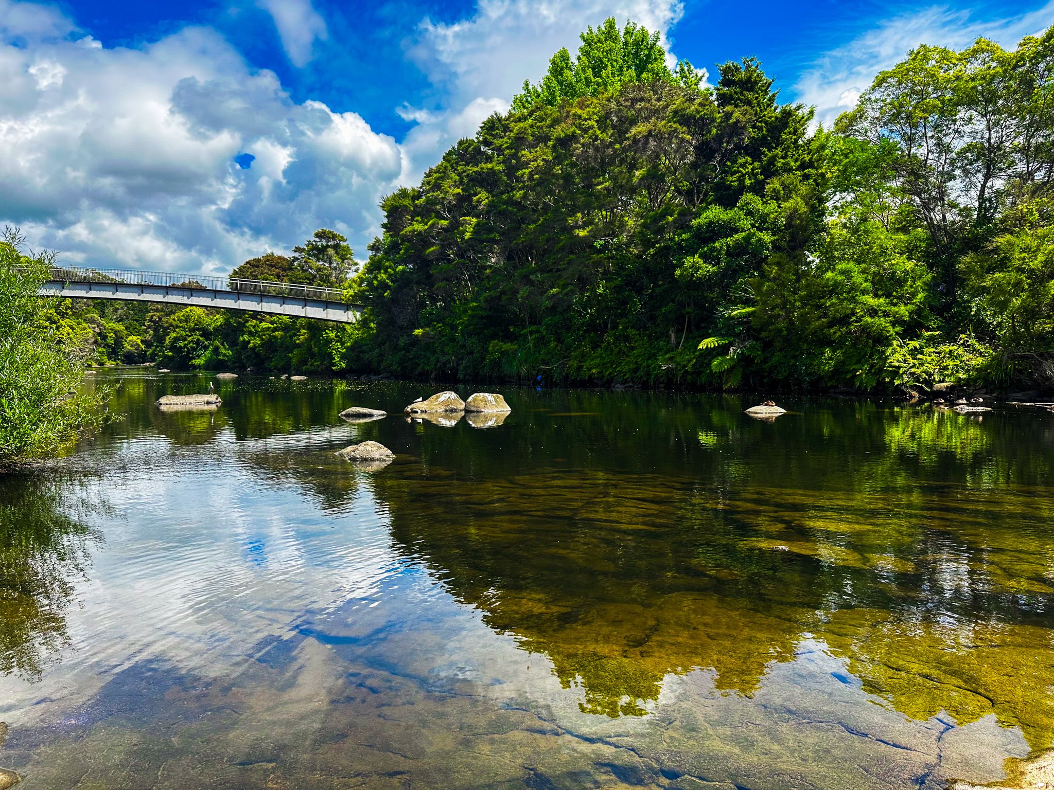
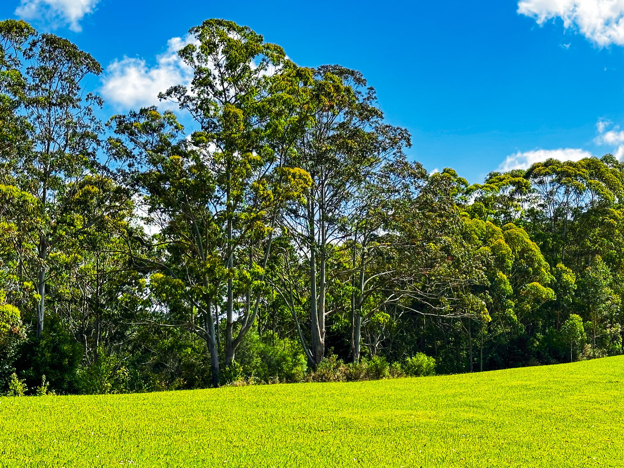
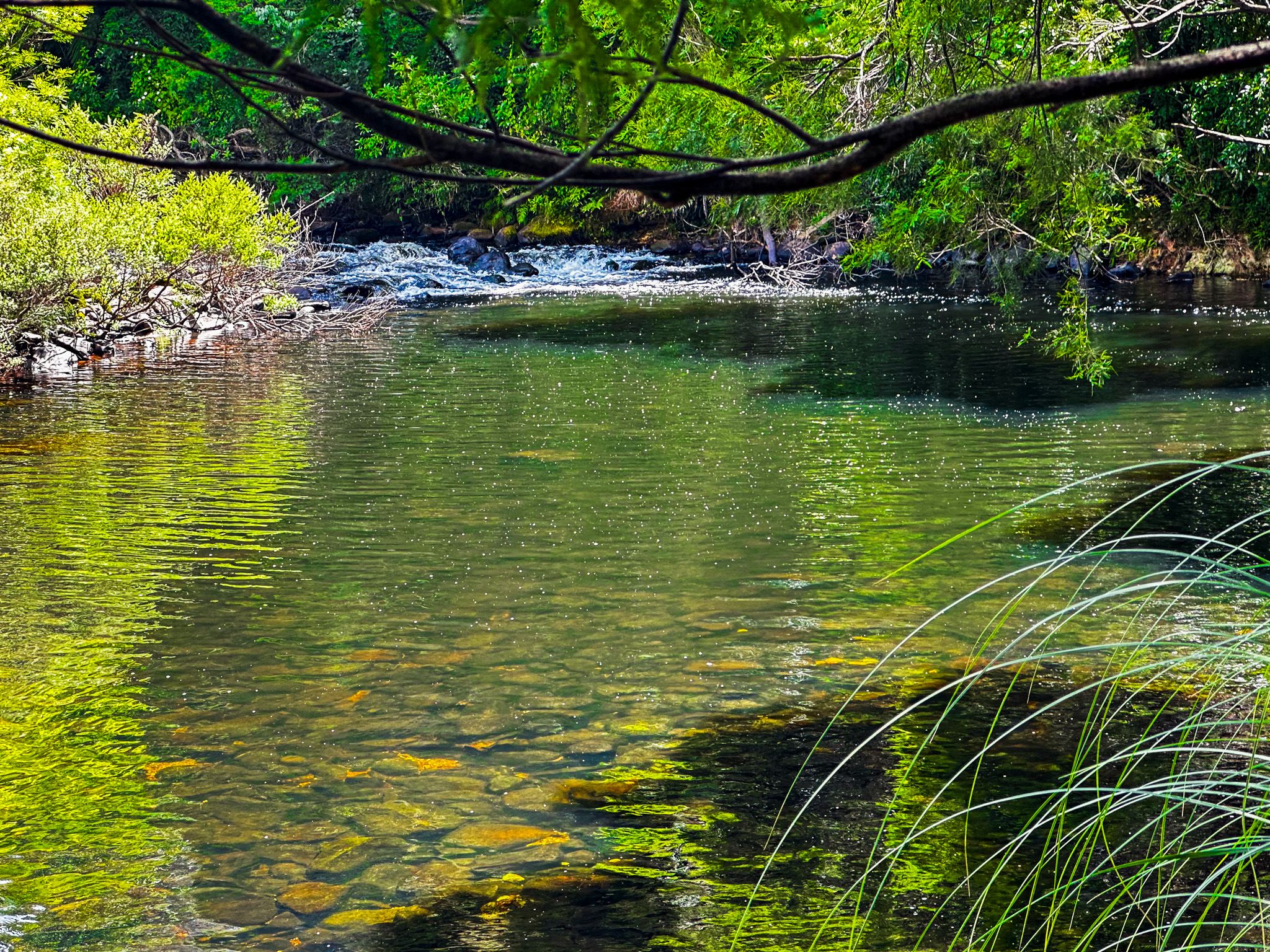
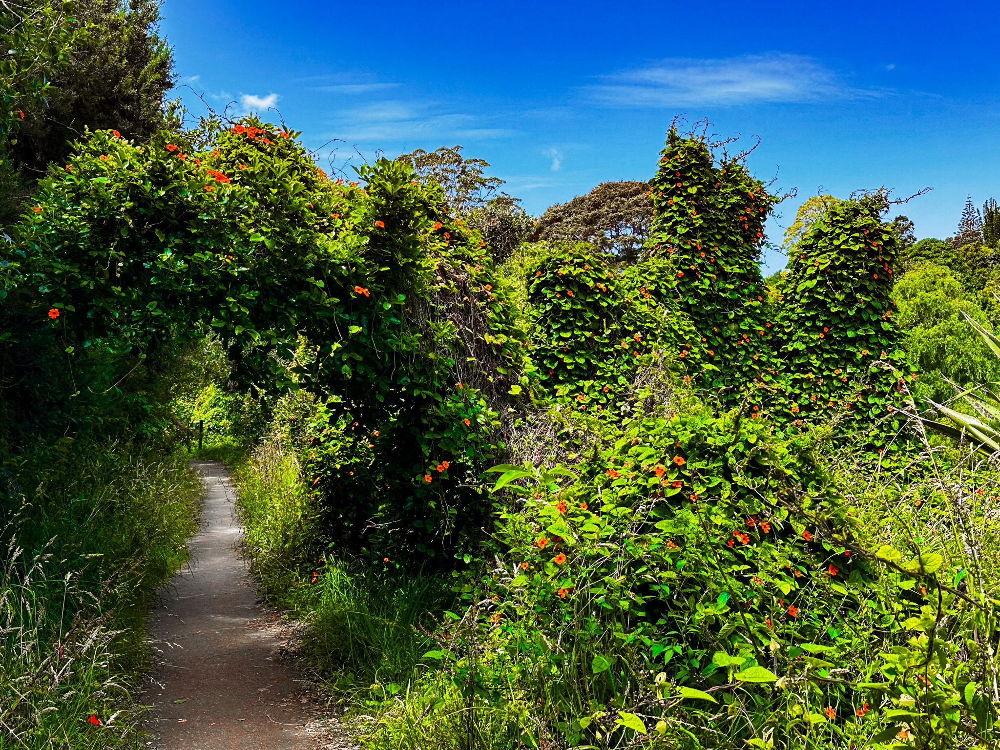
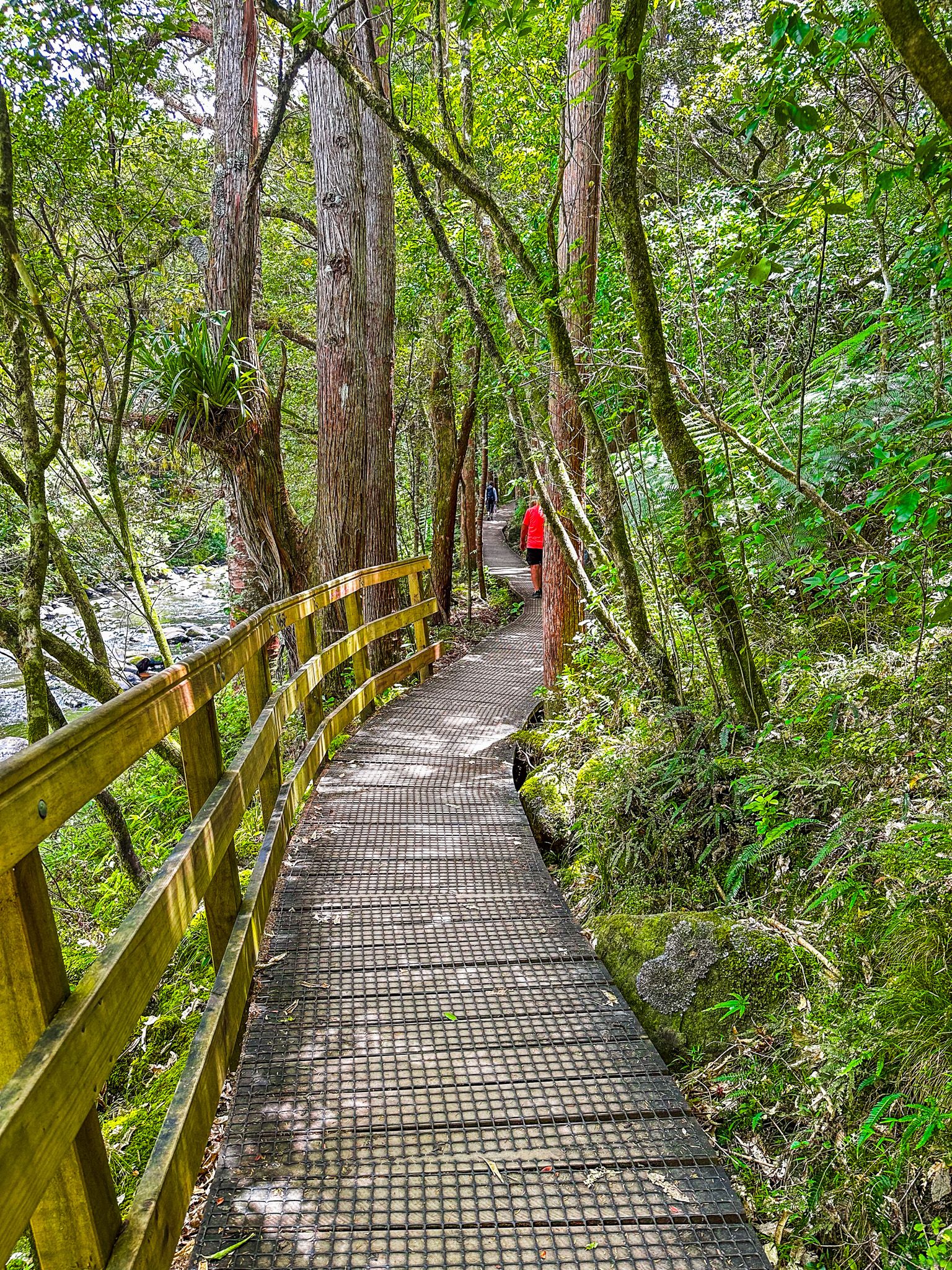
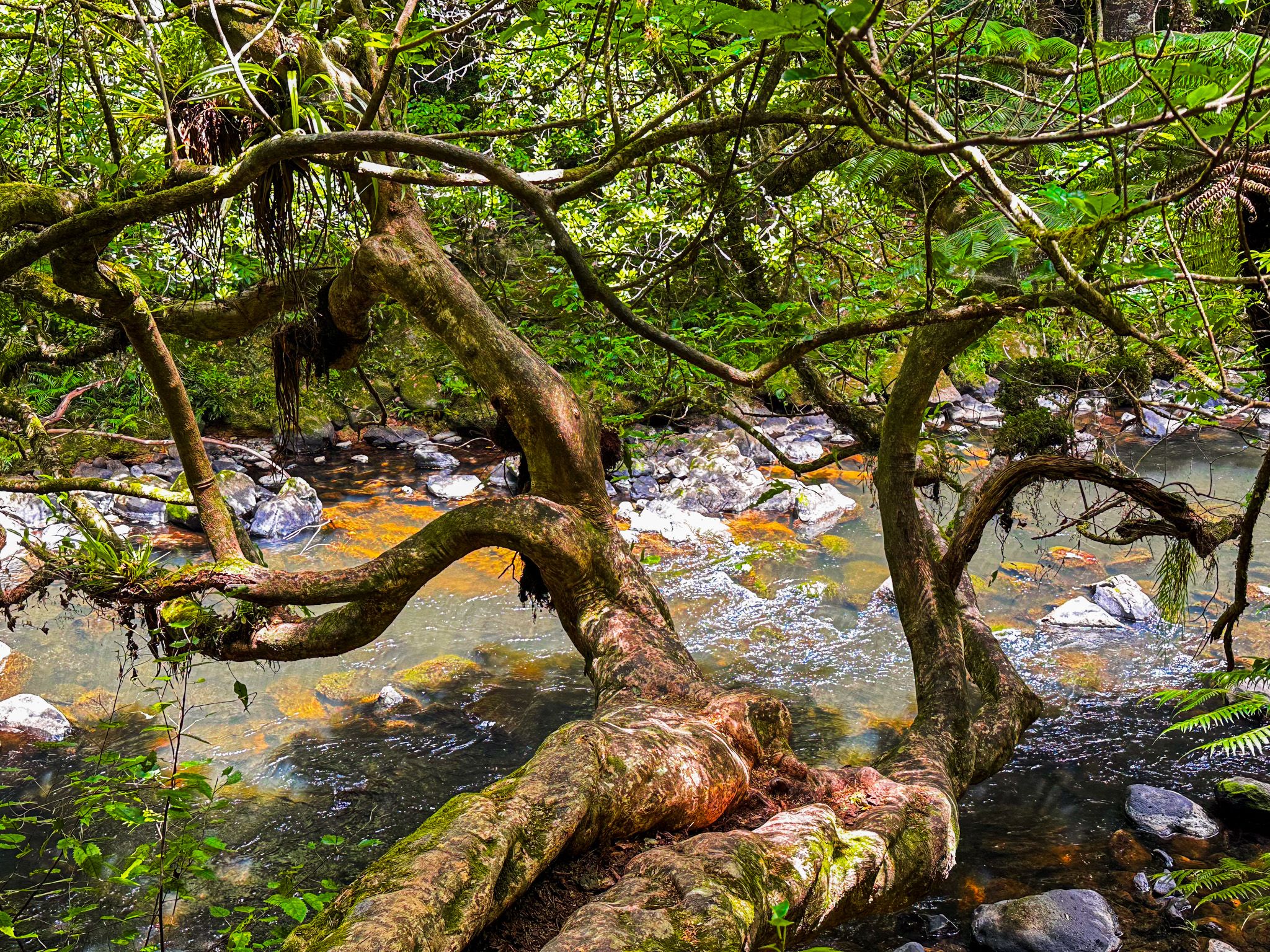
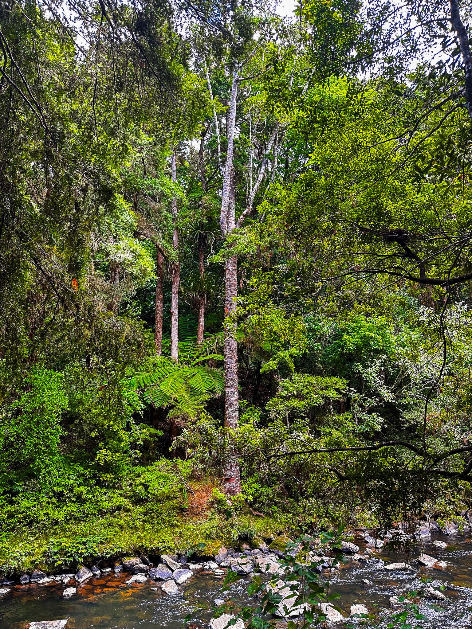
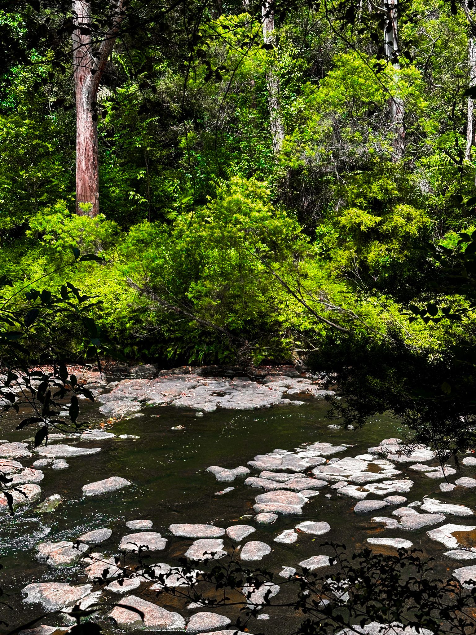
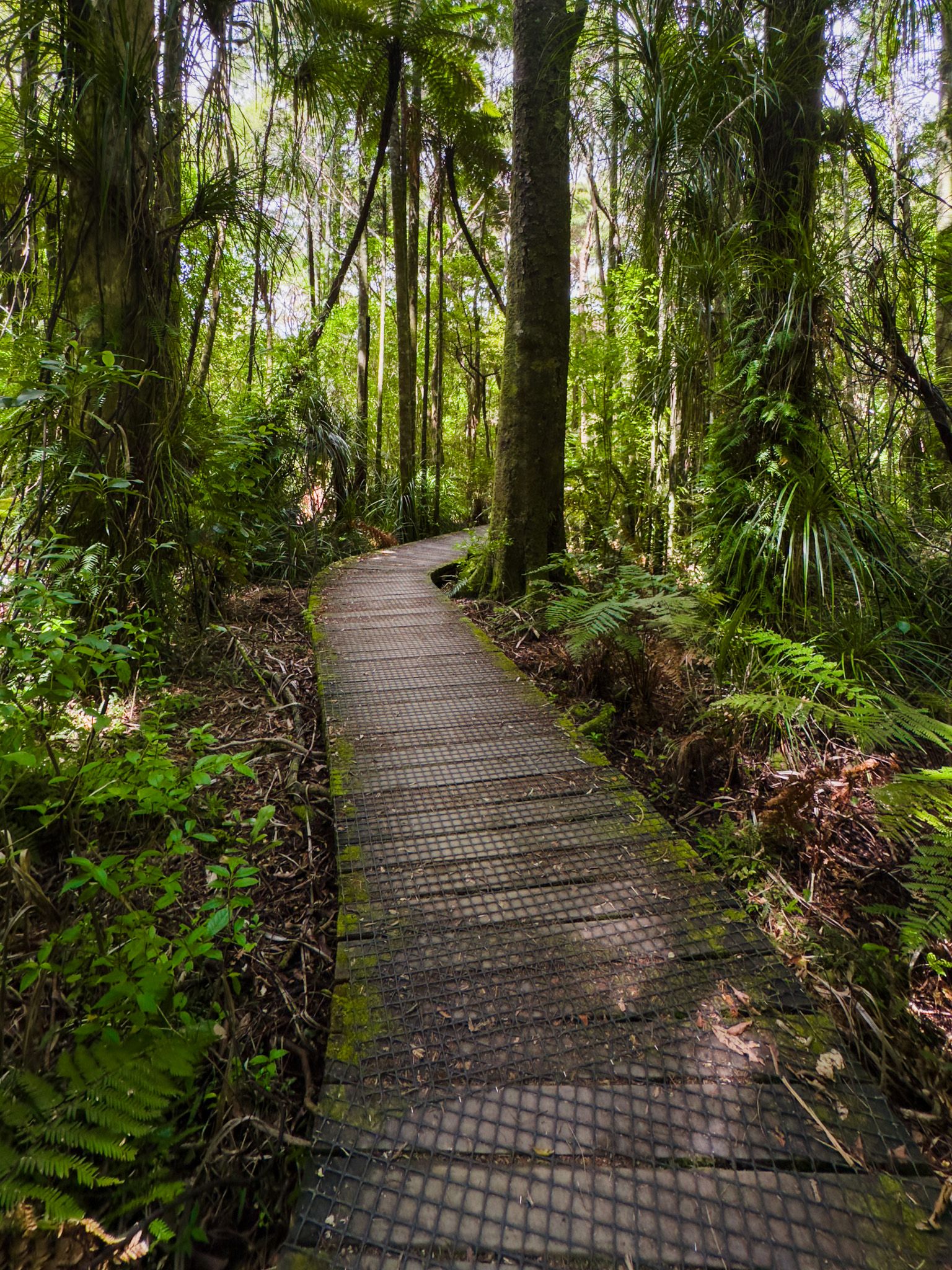
The Kerikeri River Walk is a scenic and leisurely, well-maintained walk alongside the Kerikeri River. In addition to generally following the river, it takes in two waterfalls and some modest rapids, recovering native forest, carved-out embankments and rock falls, farmland and suburban fringe. The most popular section runs from Kerikeri Basin to Rainbow Falls, a bit over an hour each way. Parking is available at the east end of the track by the Stone Store or in the reserve on the west side of the river. You can also access the track from Rainbow Falls Road. The track is also part of Te Araroa.
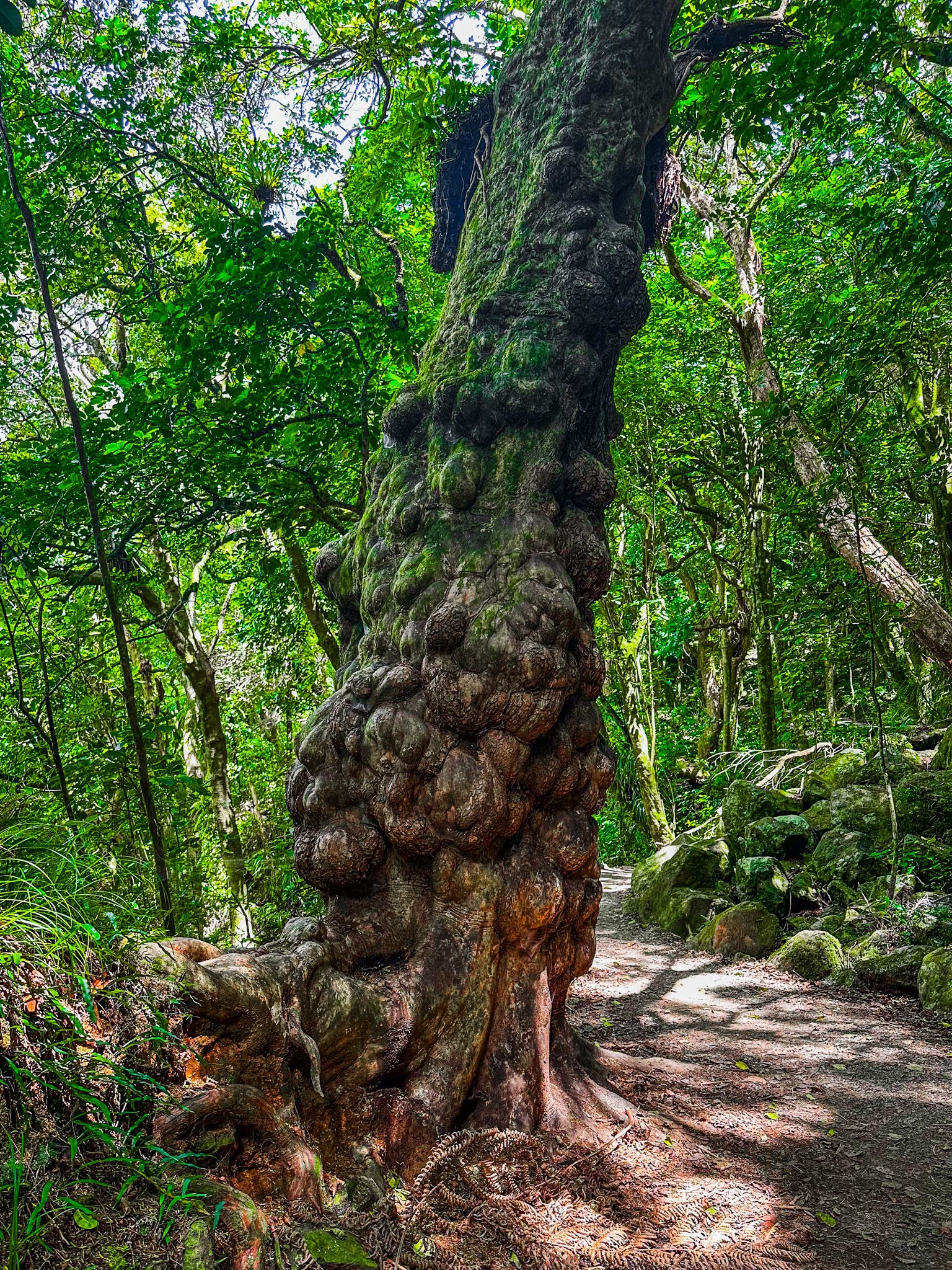
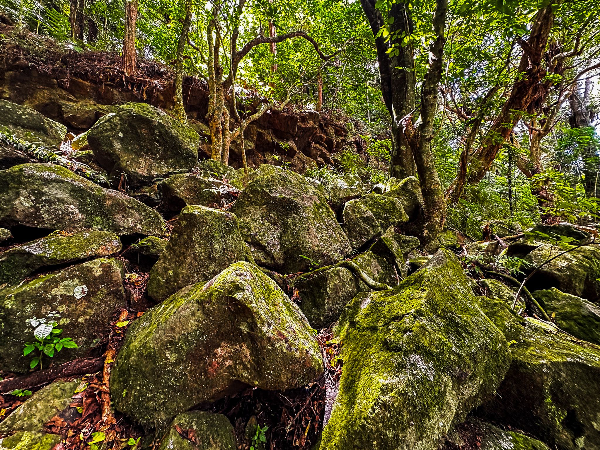
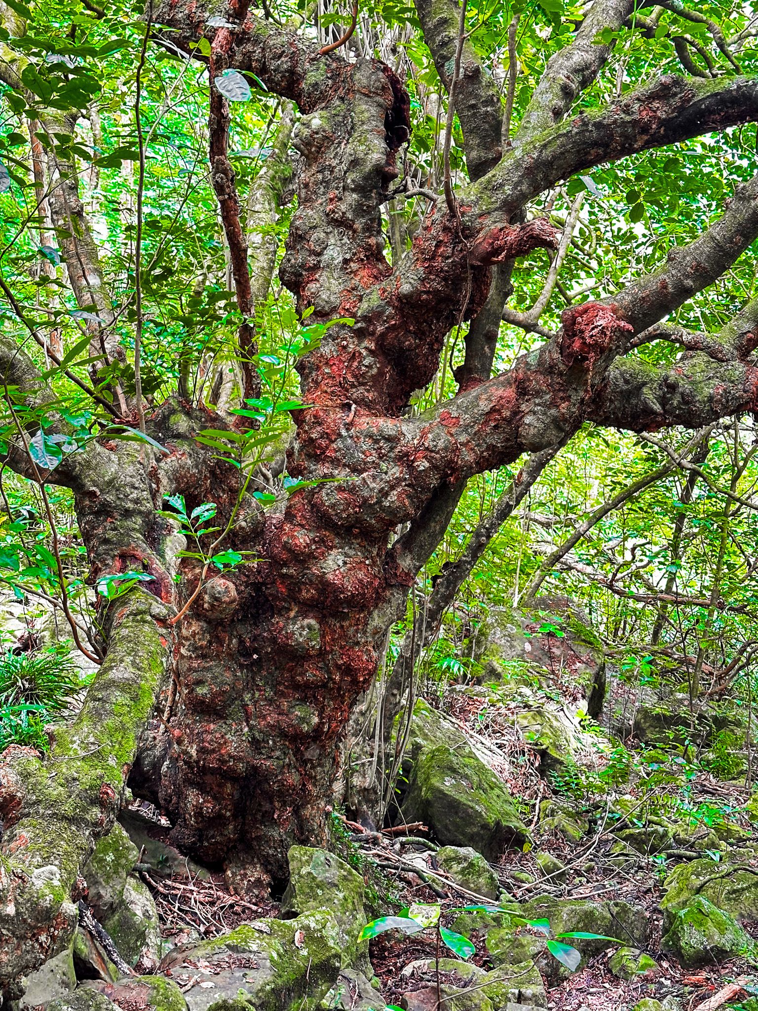
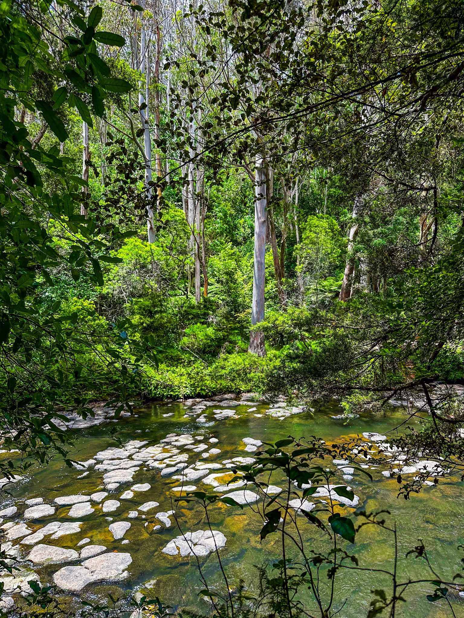
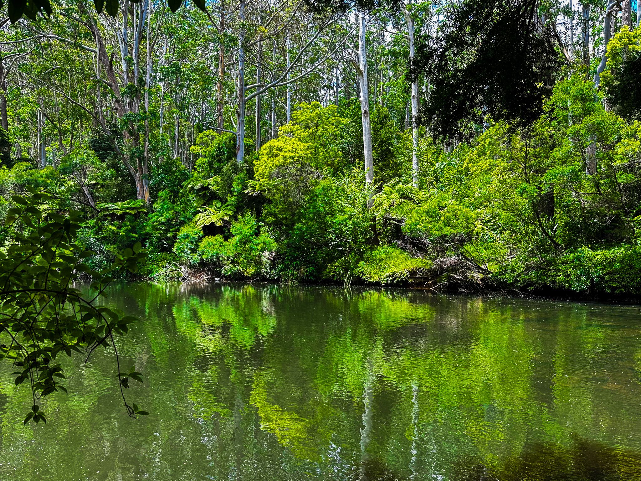
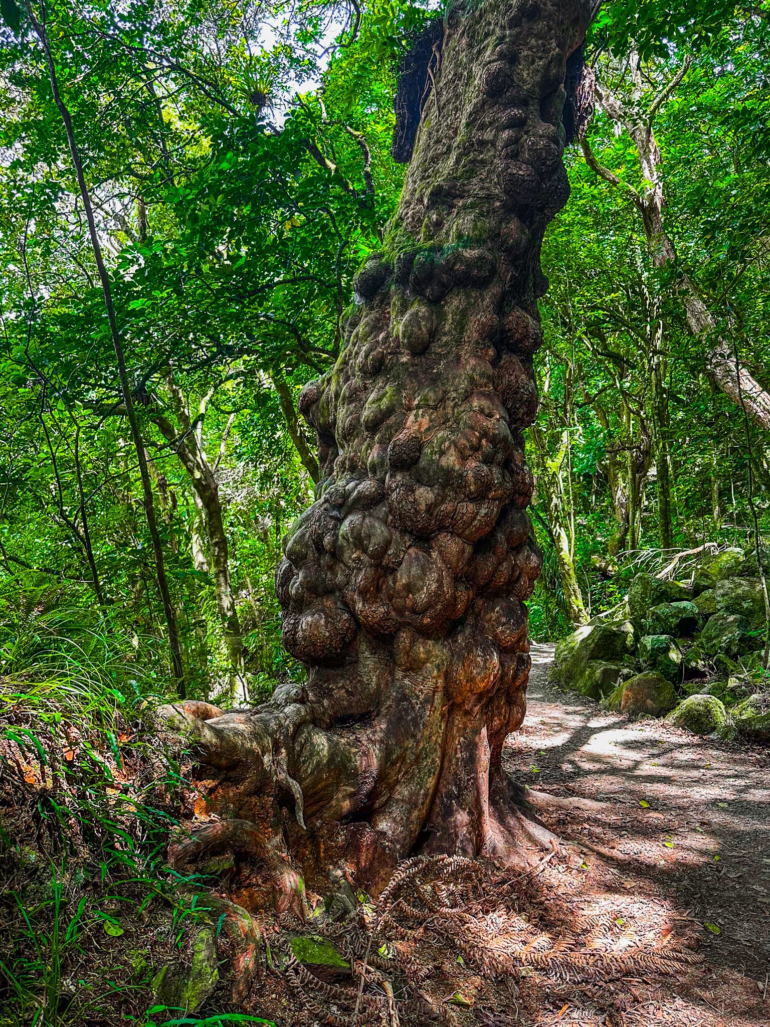
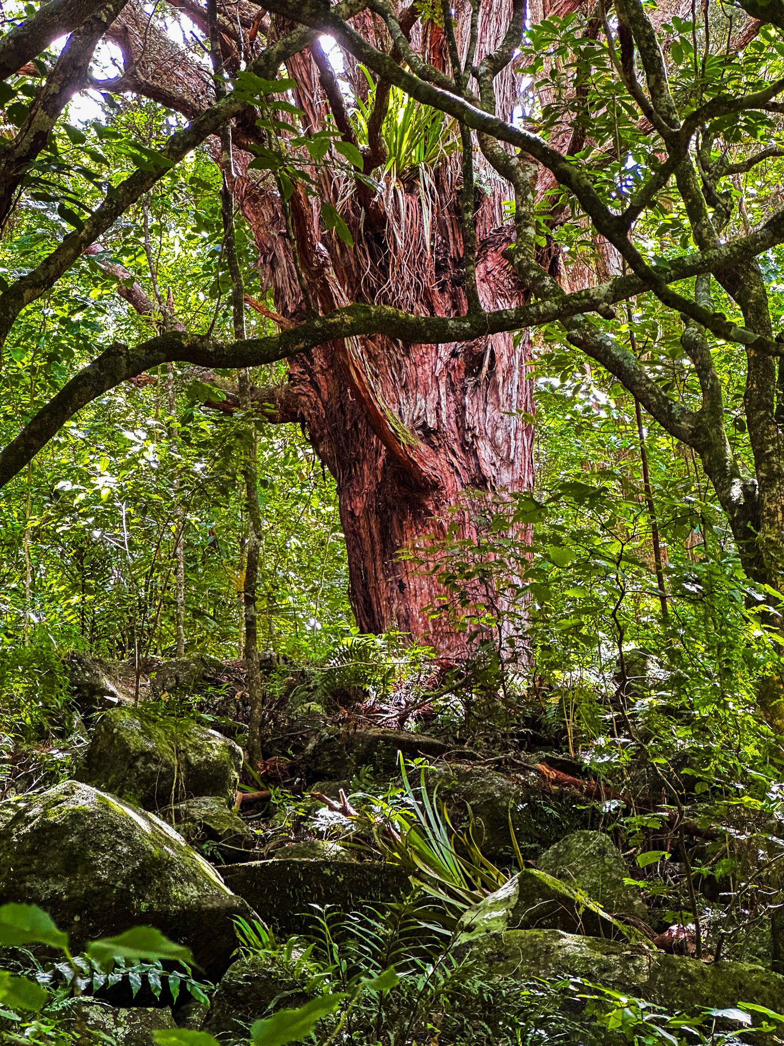
The walk has several distinct sections. It starts by crossing the grassy reserve to the west. It enters a strip of regenerating native forest, dominated by young totara trees, supported by the odd mature tree. Along the way are views of the river, with the opposite side mainly covered in tall, mature, exotic eucalypt trees. It climbs briefly within the forest to a rocky cliff face, long carved out by the river and marked by several old rock slips. Some amazingly gnarled puriri trees feature on this part of the track.
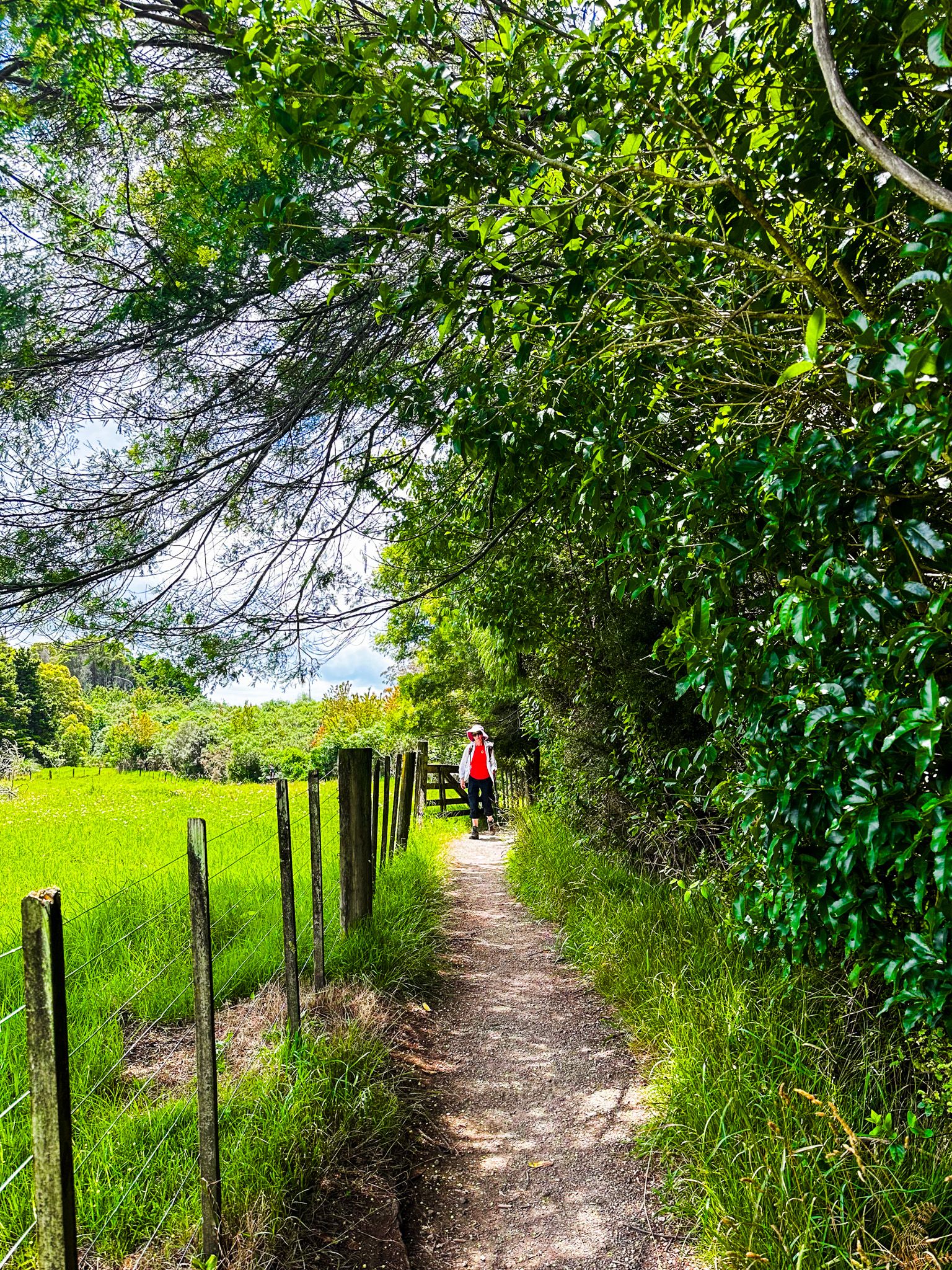
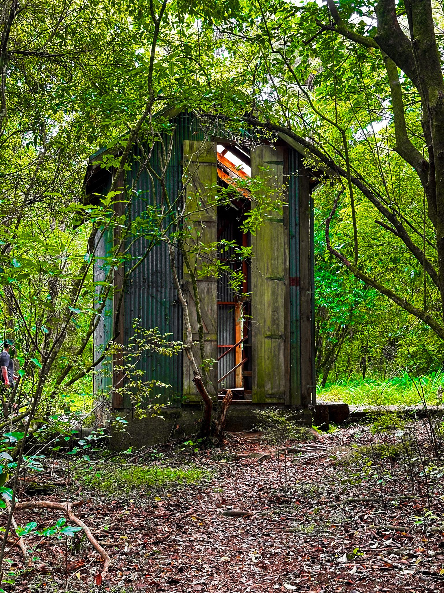
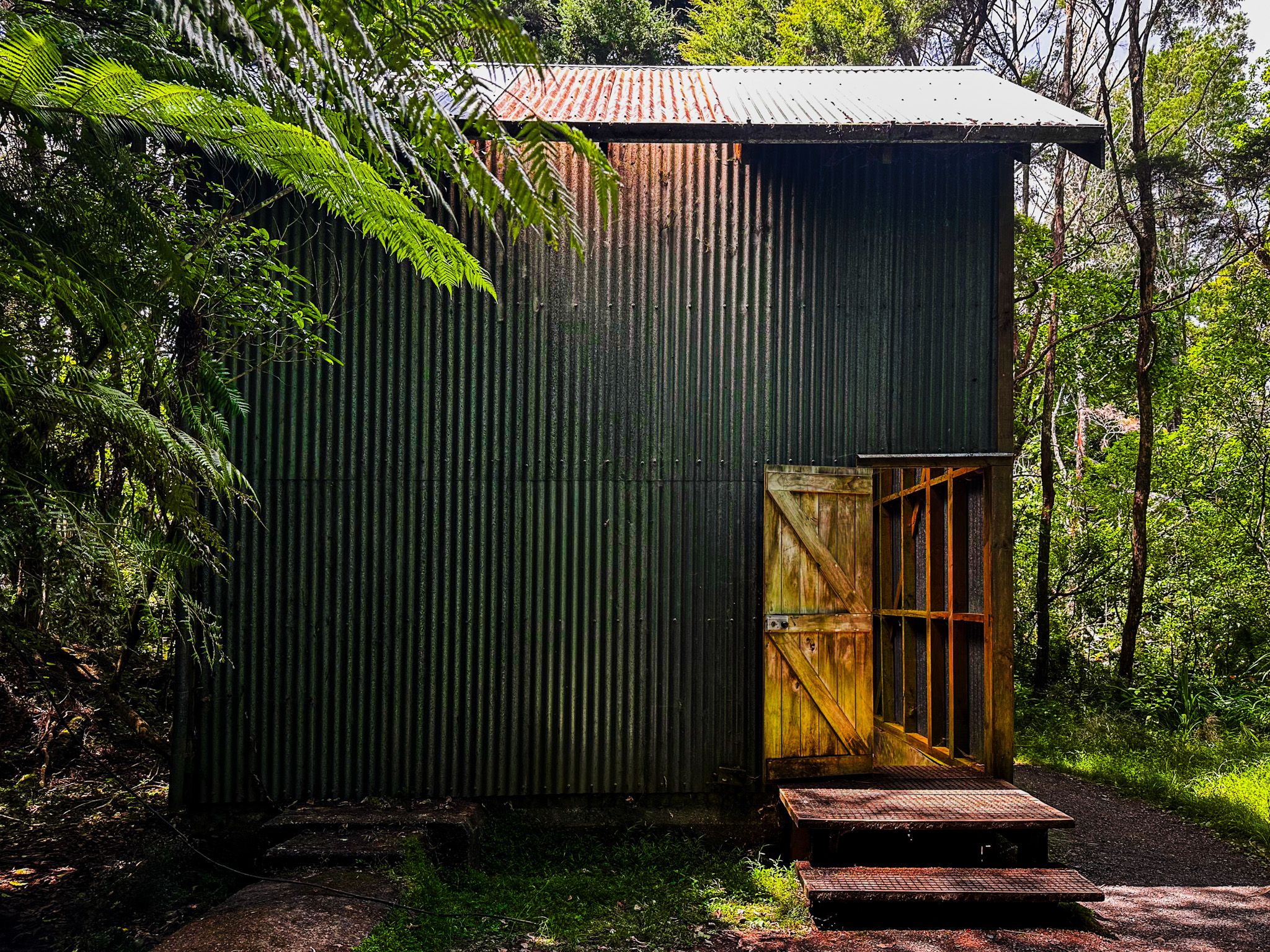
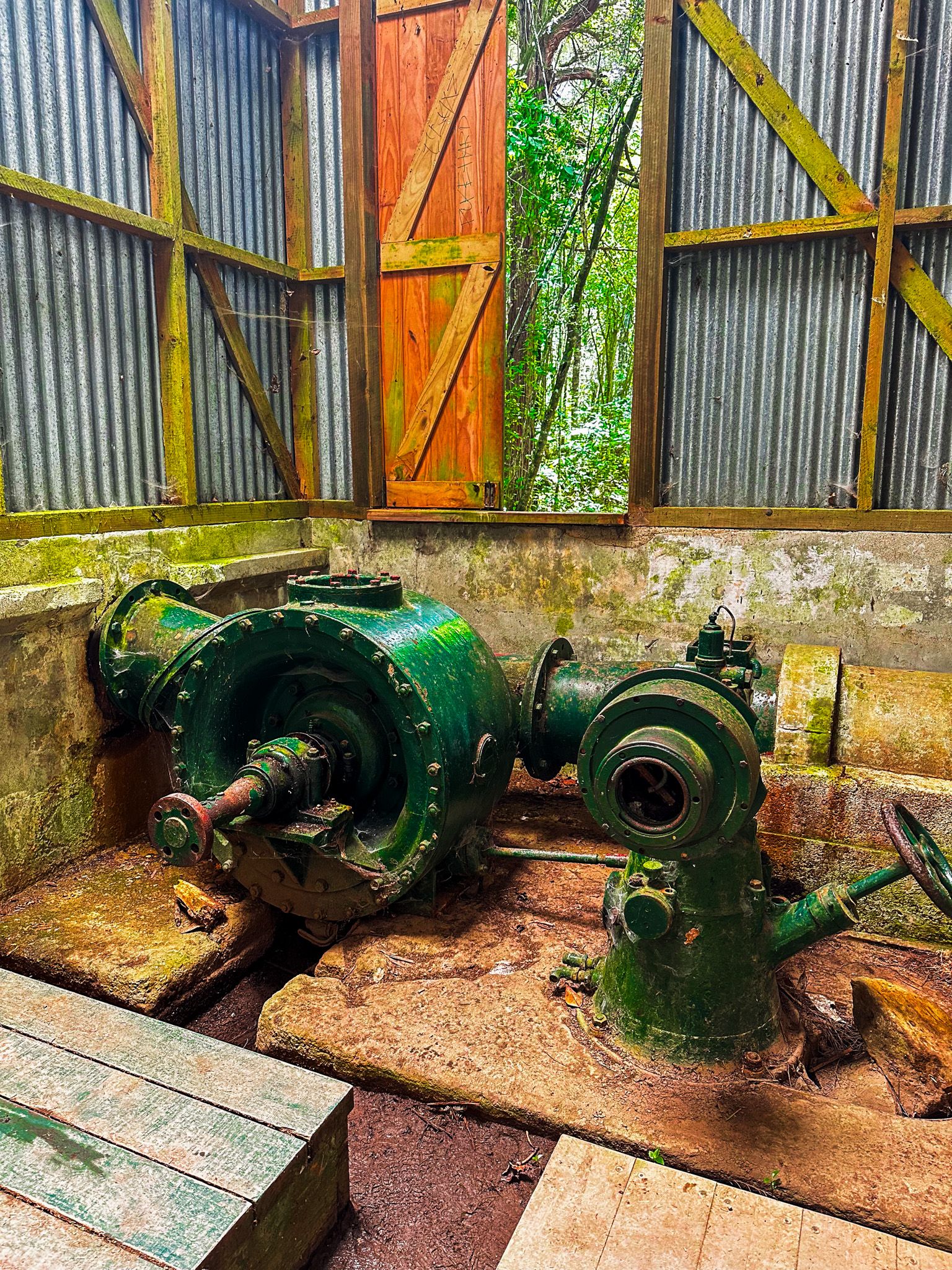
After 20 minutes, you reach the small Historic Power Station and just after that is Wharepoke Falls. After the falls, there is more totara regrowth before the track opens up into scrub, crosses under the Heritage Bypass road, and then follows a fence line on the edge of farmland.
After leaving the fenceline, the track runs closer to the river. Some sections are 20 to 30 metres above the river with steep but bush-clad drops. This provides some pretty views across and along the river.
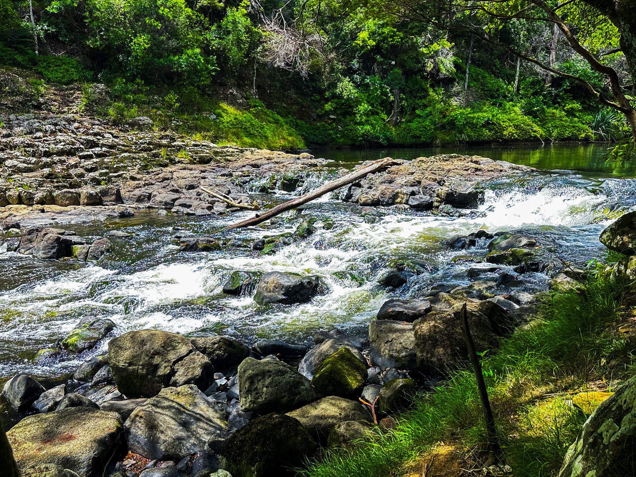
There is one location where the river is accessible, with a reasonably obvious side track. You will see some relatively sedate rapids; the section above is called Fairy Pools. However, the sign for the pools is a bit further on where there is no apparent access. Plus, some wag has removed the “l”, so it reads as Fairy Poos. In any event, no one had chosen to swim there when we walked through.
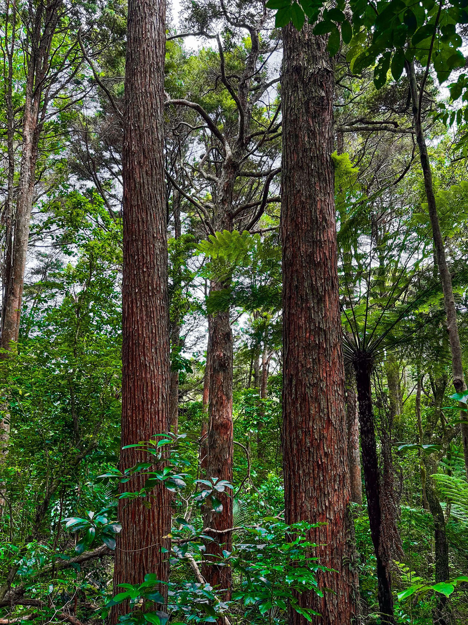
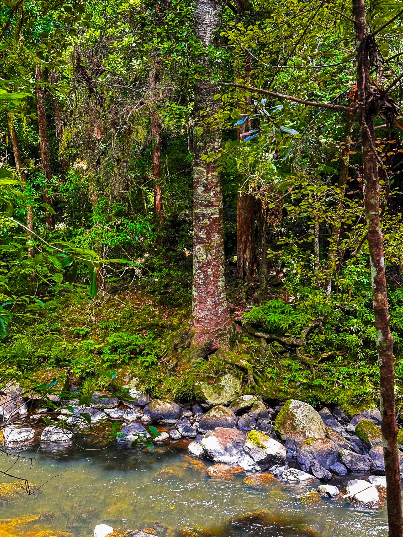
Not long after Fairy Pools, you start to see kauri trees on both sides of the river, which explains the shoe-cleaning station at the start of the track. Some trees are a good height and look at least 150 years old, with crowns starting to appear. The predecessors were probably among the first kauri milled in NZ to support the first European buildings, including Mission House.
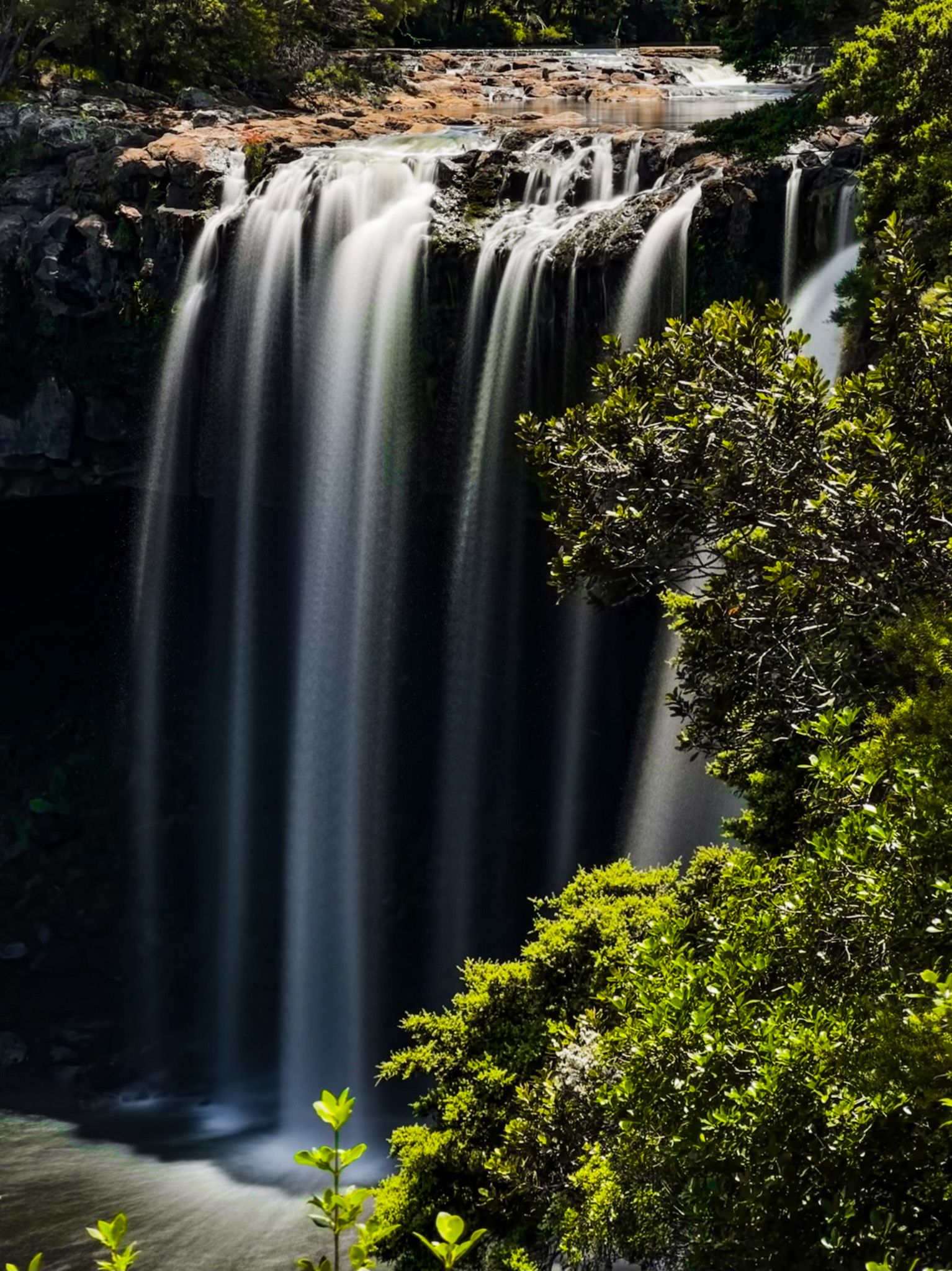
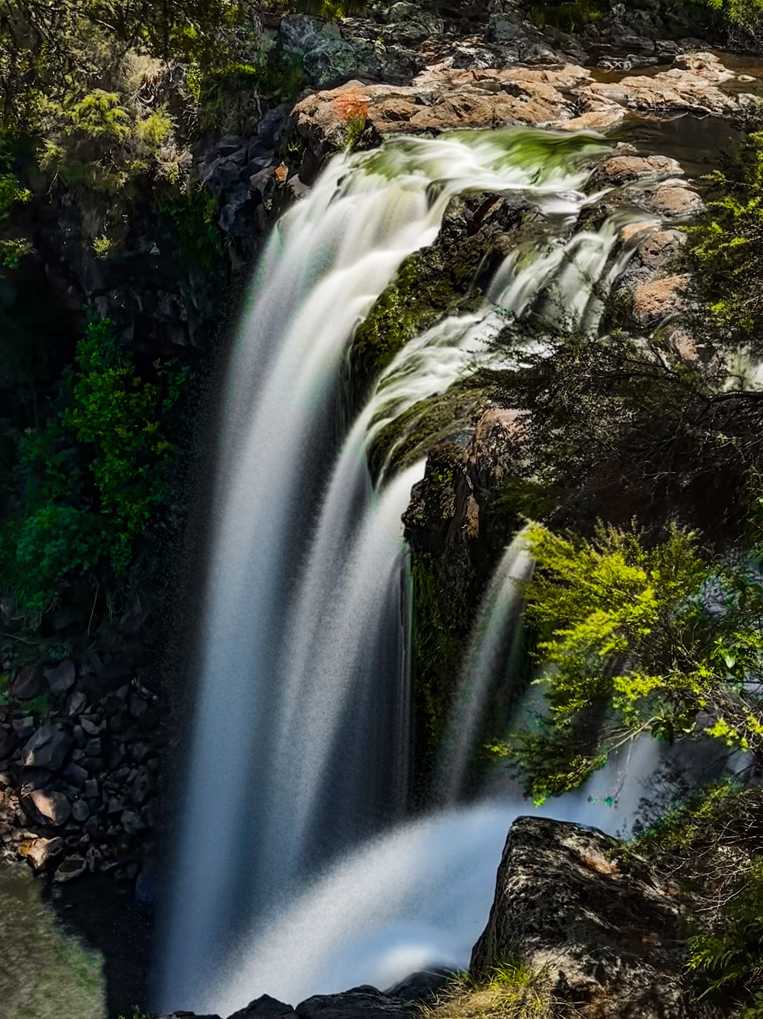
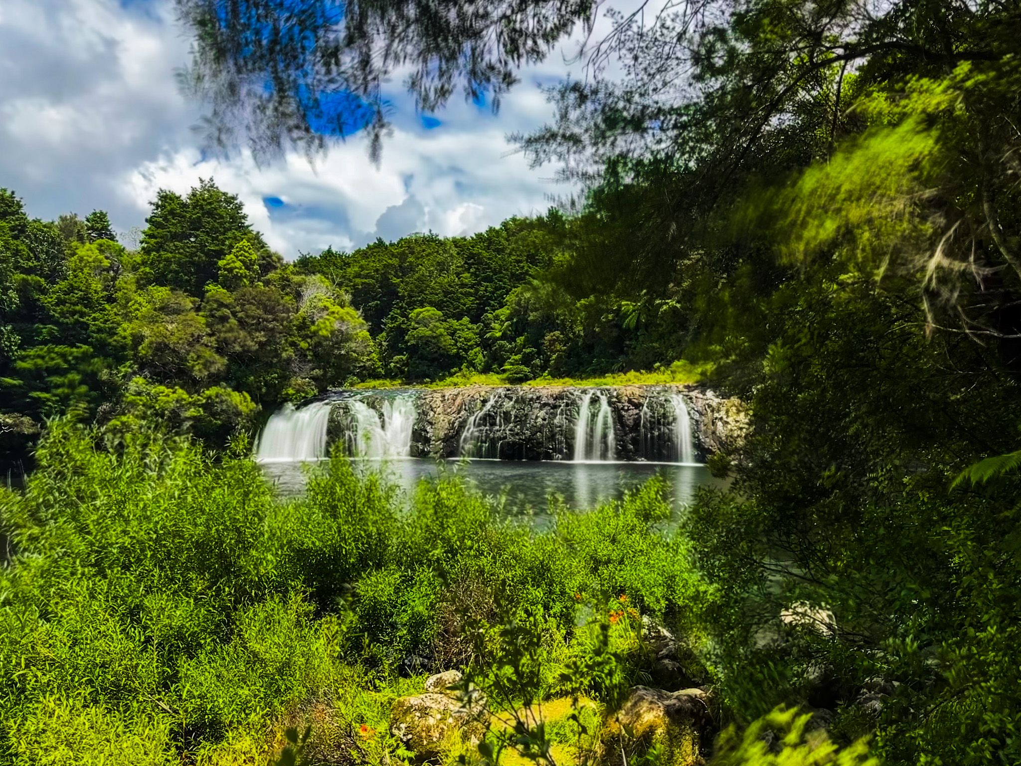
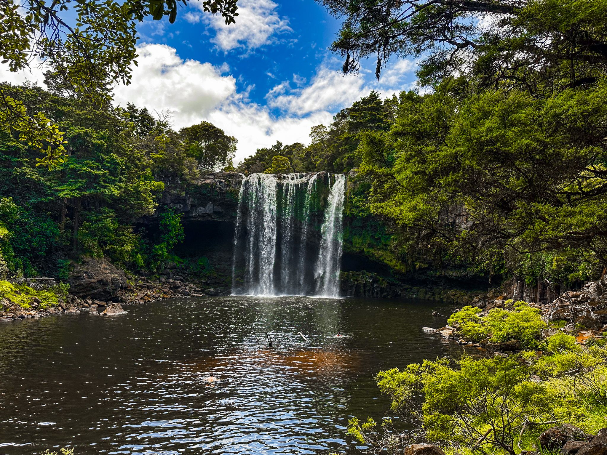
Towards the end of the walk, you will hear Rainbow Falls, arguably one of the most photogenic falls on the North Island. After visiting the large swimming hole below the falls, walk to the viewpoints at the top before heading back.

Historic Power Station and Wharepoke Falls
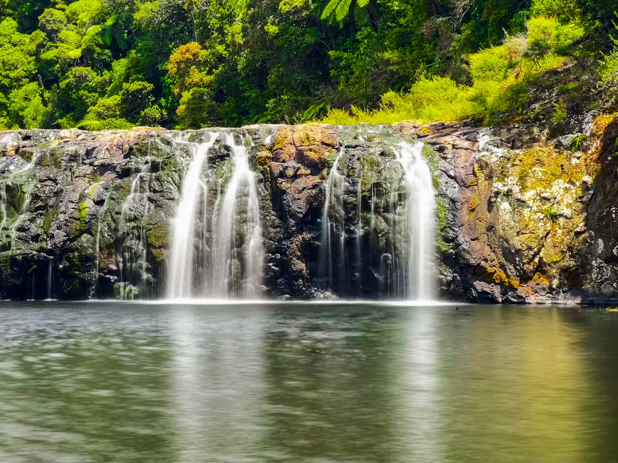
The Historic Power Station is a feature on the Kerikeri River Walk. Beyond it is the attractive Wharepoko Falls, the first of two waterfalls on the walk.
The small hydropower station was developed around 1930 and was the first electricity supplier to Kerikeri, which probably indicates how basic life was at the time. The project was developed by George Alderton, a property developer who saw an offer of power as a way to sell land. Some of his would-be buyers were the wives of ex-British civil servants from Asia who were used to having servants to support their households. Electricity was the alternative for relatively new-fangled things like washing machines!
Alderton hired Lloyd Mandeno to investigate the project requirements. He was employed to examine the potential of a hydro station on the Kerikeri River. He planned to take water from the river and the Puketotara Stream. Local gum diggers dug a 1.5 km open channel to divert water to the power station, which started with 17 customers in 1930. Eventually, the enterprise was made redundant by connecting Kerikeri to the national power grid.
The Wharerpoke Falls are a short distance west along the track. They are photogenic at 5 metres high with a 20 metres wide basalt face. There is a large pool at the base, but the access is rocky and less conducive for swimmers than Rainbow Falls, 45 minutes west on the track.
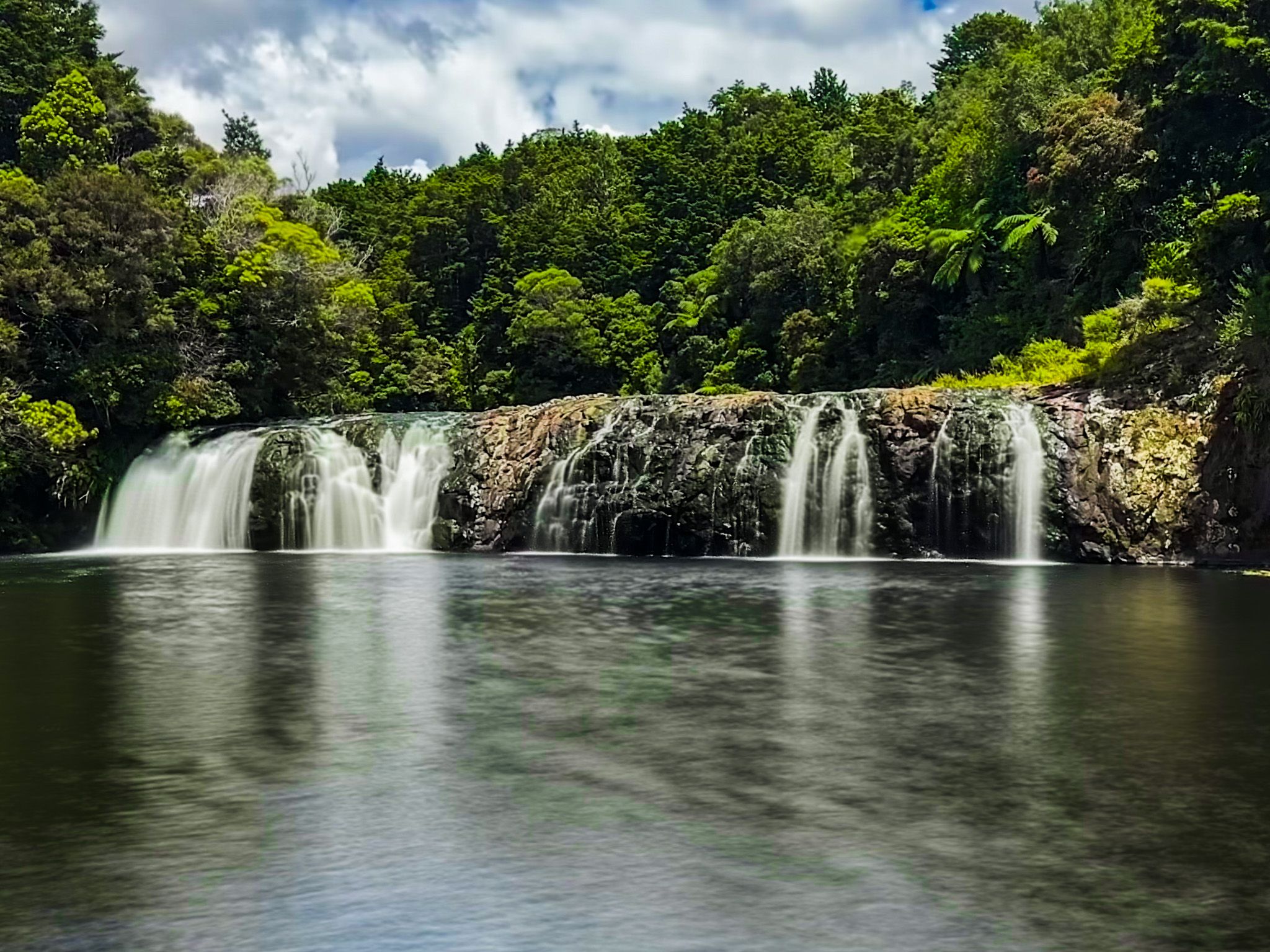
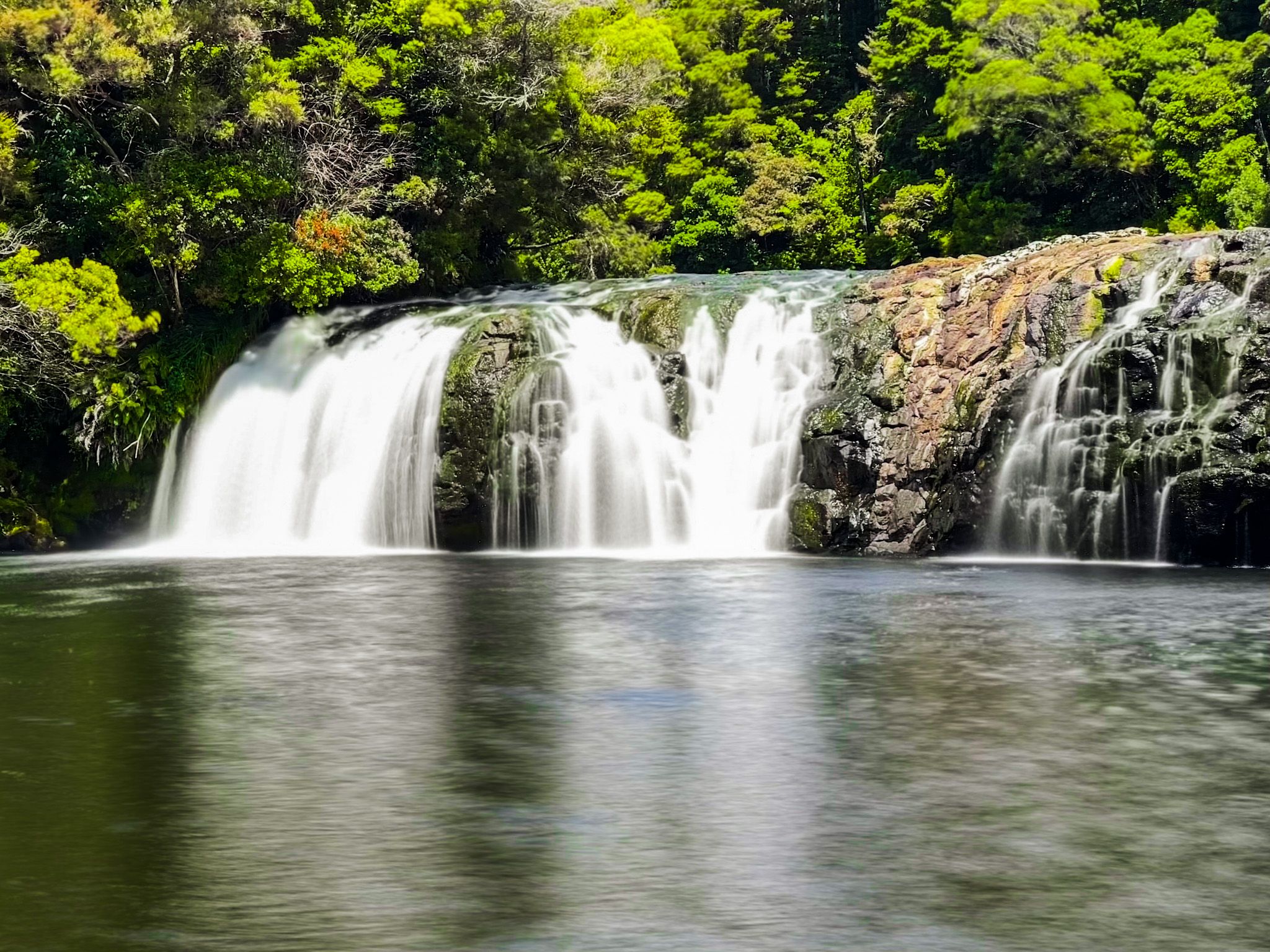
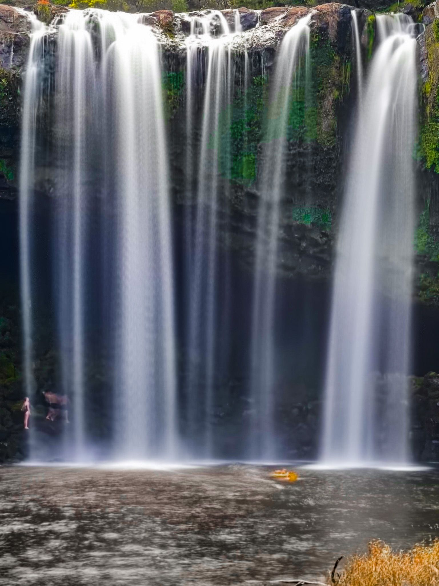
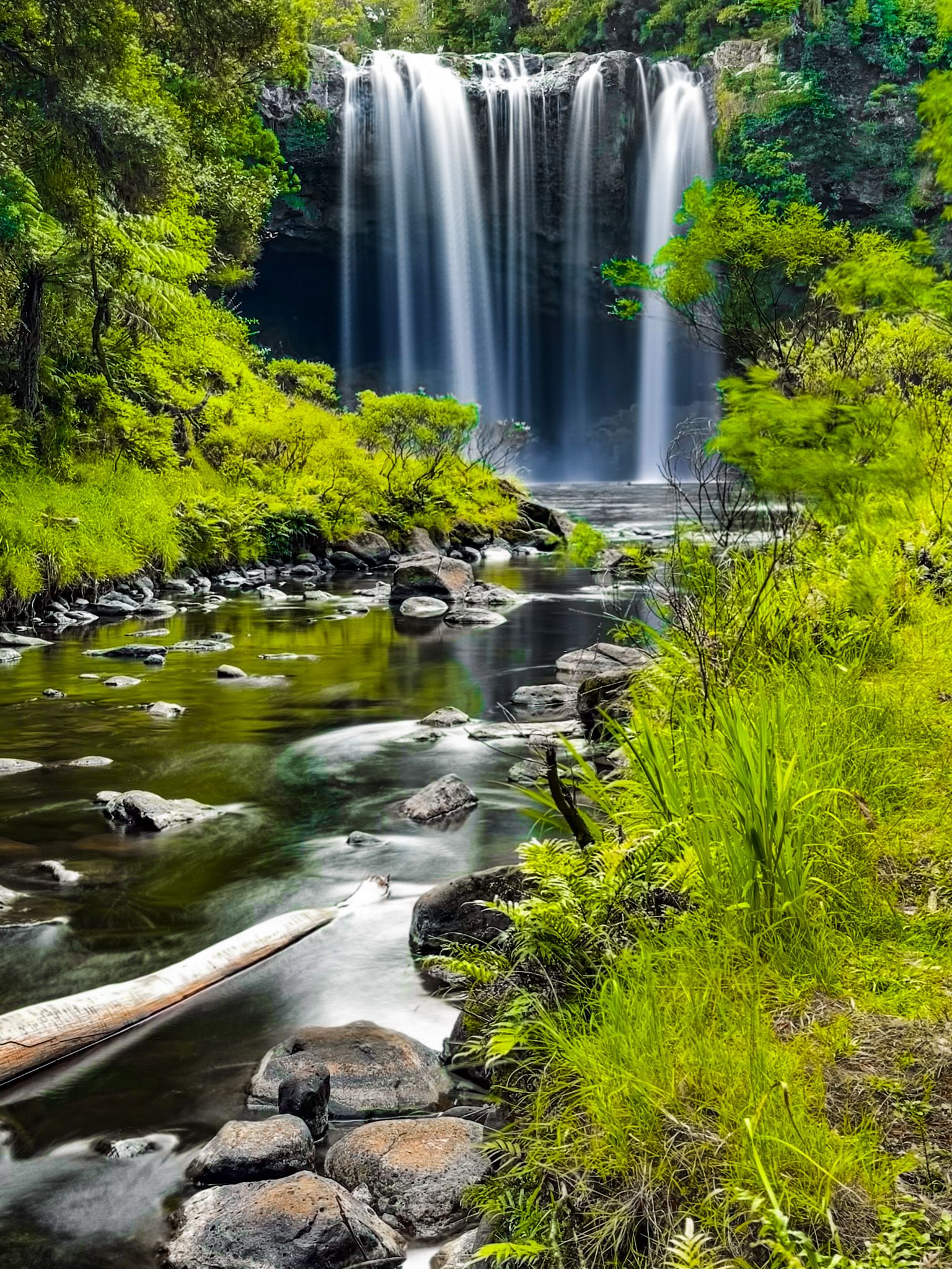
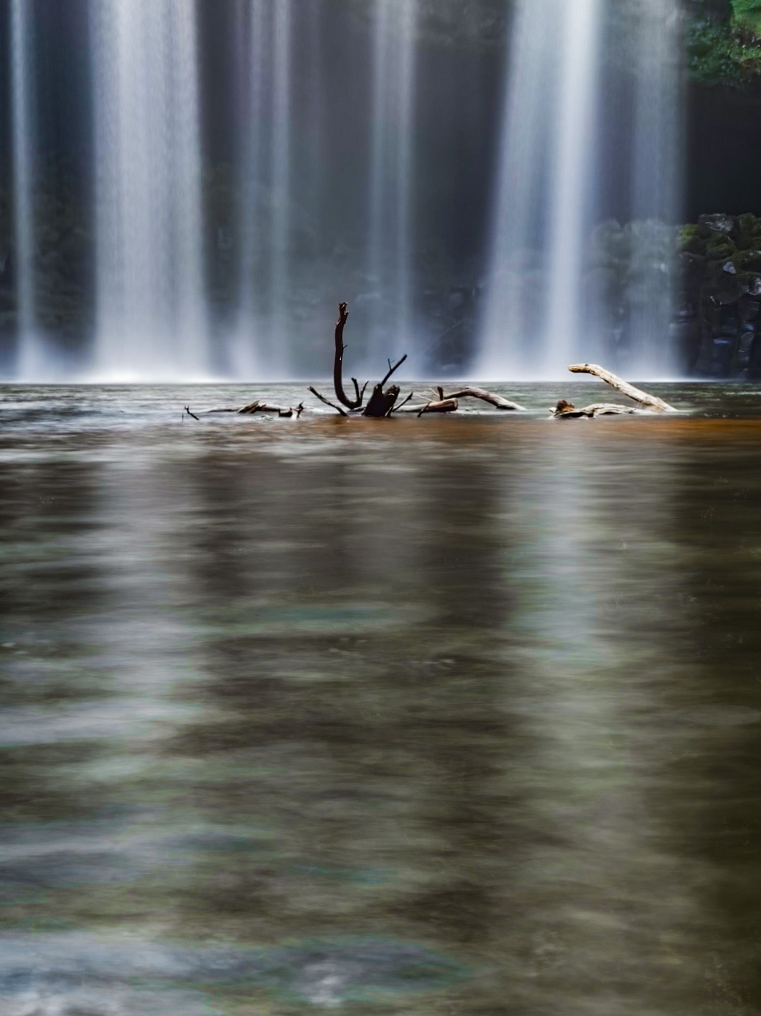
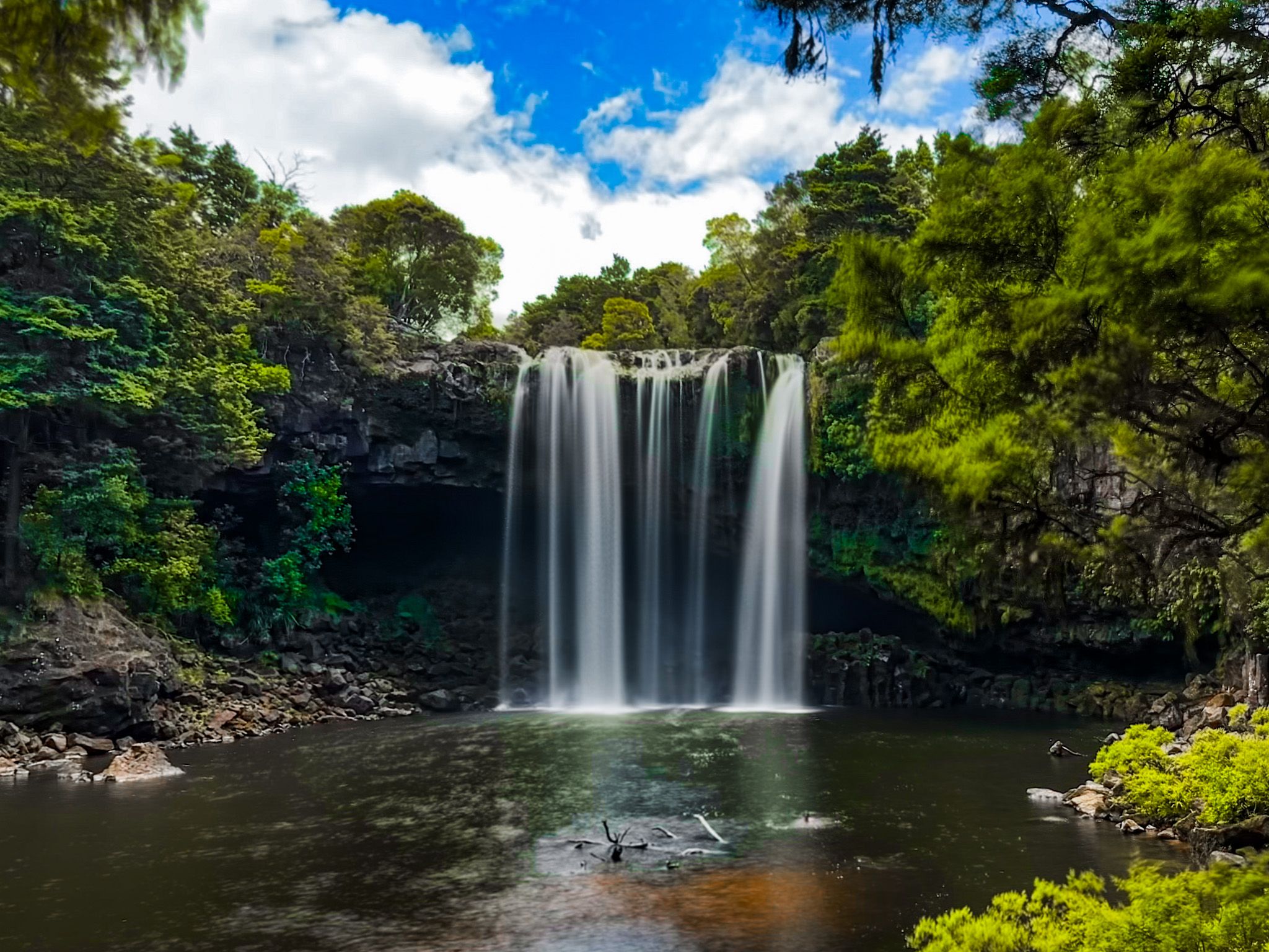
Rainbow Falls
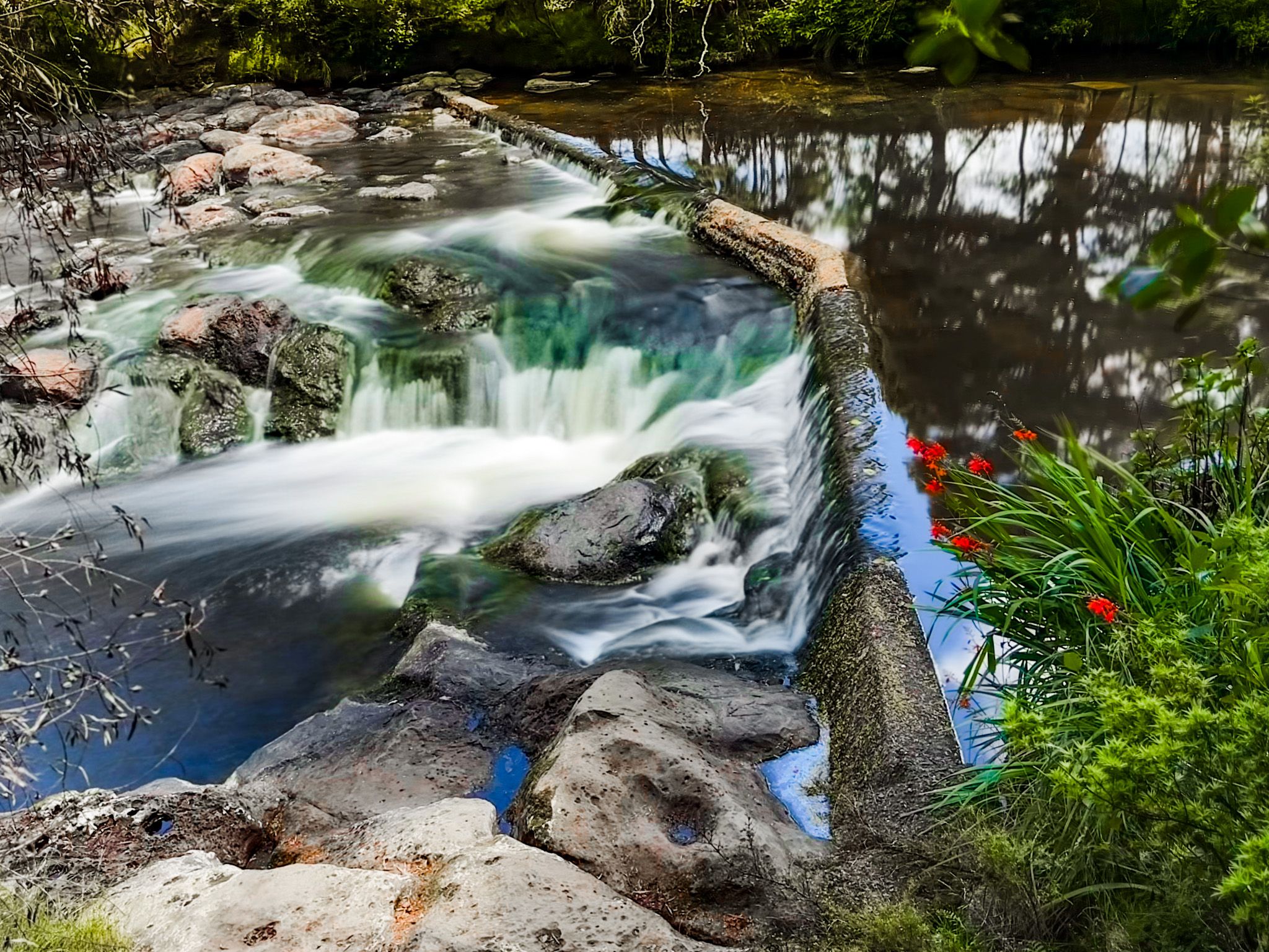
Rainbow Falls is a beautiful 27-metre waterfall. In Māori, the falls are known as Waianiwaniwa, which means "Waters of the Rainbow". They are on the Kerikeri River Walk, an hour from the historical sites of the Kerikeri Basin. Alternatively, you can easily access the falls from the end of Rainbow Falls Road, where there is a campground.
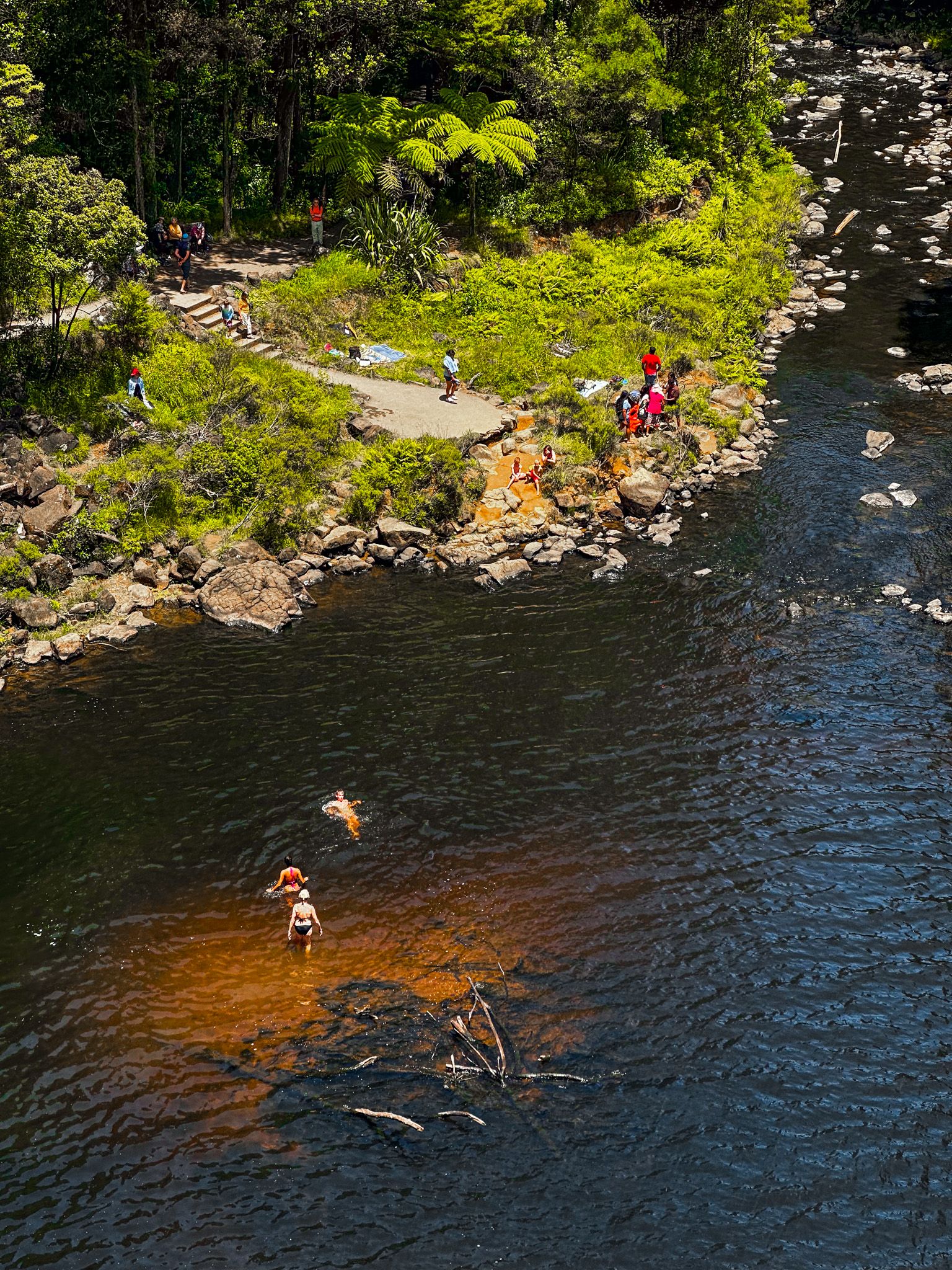
A short, well-maintained but steep track links the top and bottom. At the top are several views of the water dropping over the edge of a basalt rock face and, a little further up the river, of an old weir and some modest rapids. At the bottom is a large swimming hole, making the falls a popular destination.
A feature of the falls is the large amphitheatre and pool, shrouded in forest and moss-covered rocks. It is possible to scramble around the edge of the rocky amphitheatre and get behind the falls, but take care and protect your camera/phone! Another easier option is to walk from the pool below the falls alongside the river for a short distance on an unmarked track. Look back for a view of the river and falls shrouded by the forest.