Exploring the Tongariro Crossing
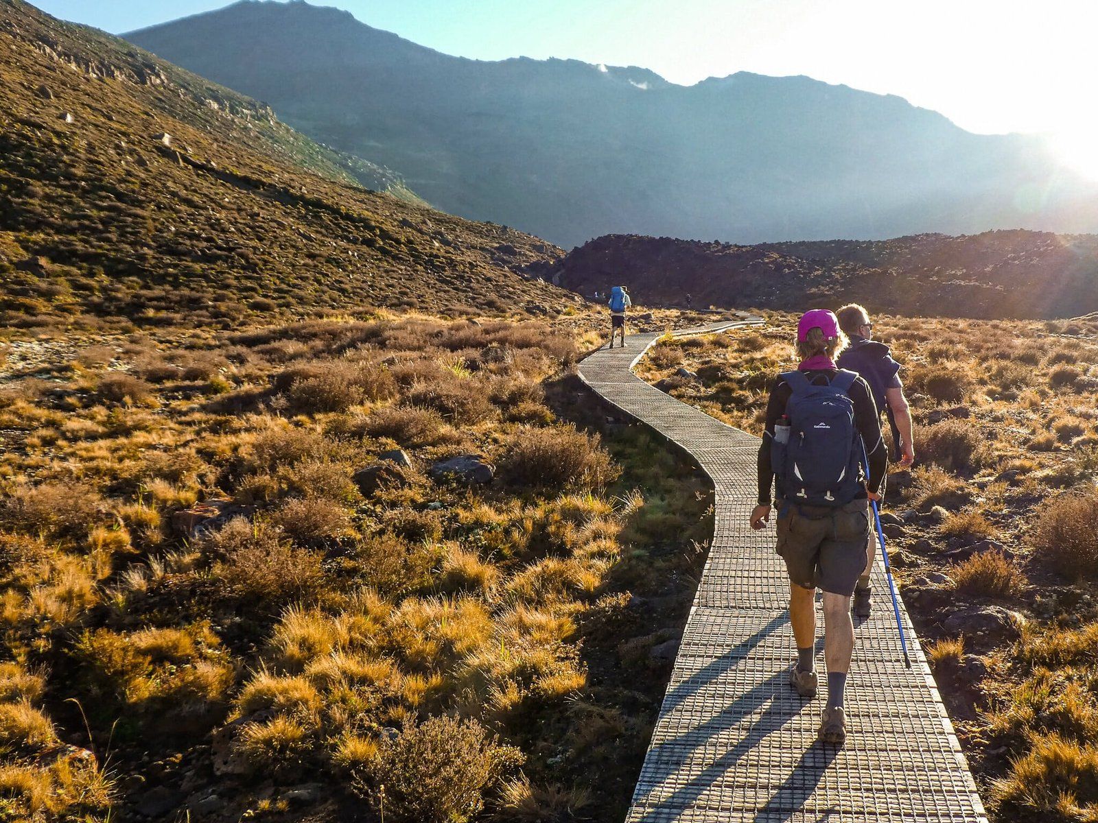
The Tongariro Crossing, located in New Zealand's Tongariro National Park, is famous as one of the world's best mountain day walks. This 19.4 km trek attracts around 120,000 hikers annually, drawn by its stunning volcanic landscapes and challenging terrain. On a clear summer day, you might find yourself sharing the path with thousands of others, all eager to experience its dramatic views.
Track Details and Highlights
The hike begins at the end of Mangatepopo Road, accessible from State Highway 47, and concludes at Ketetahi Road, off State Highway 46. The walk typically takes about seven hours to complete. You'll need to arrange transport back to the start, either by car or bus.
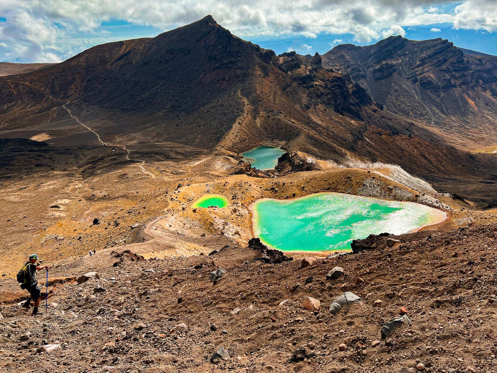
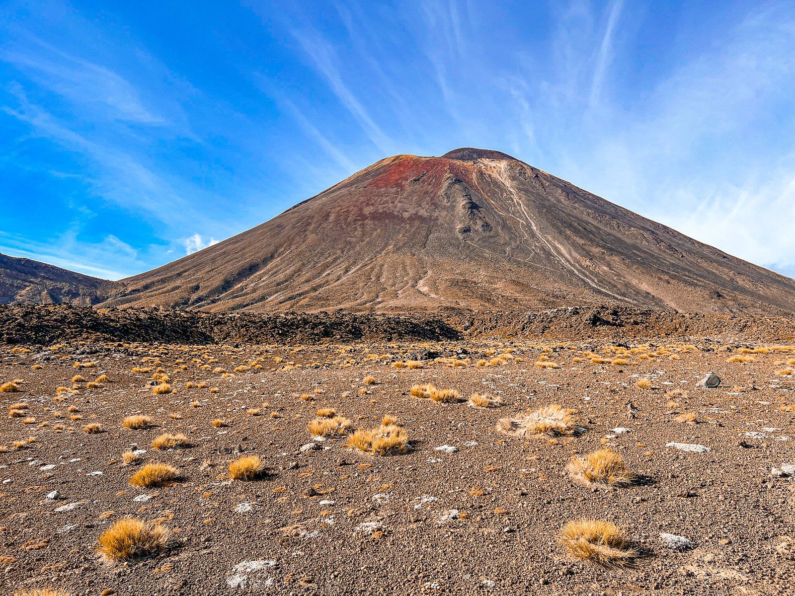
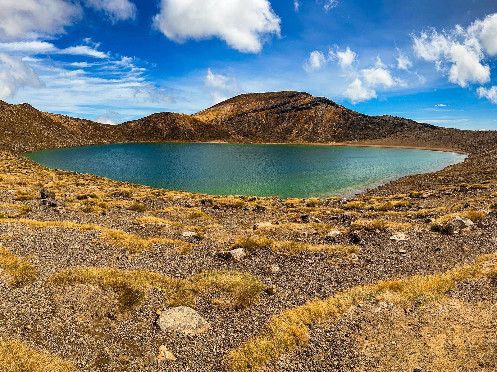
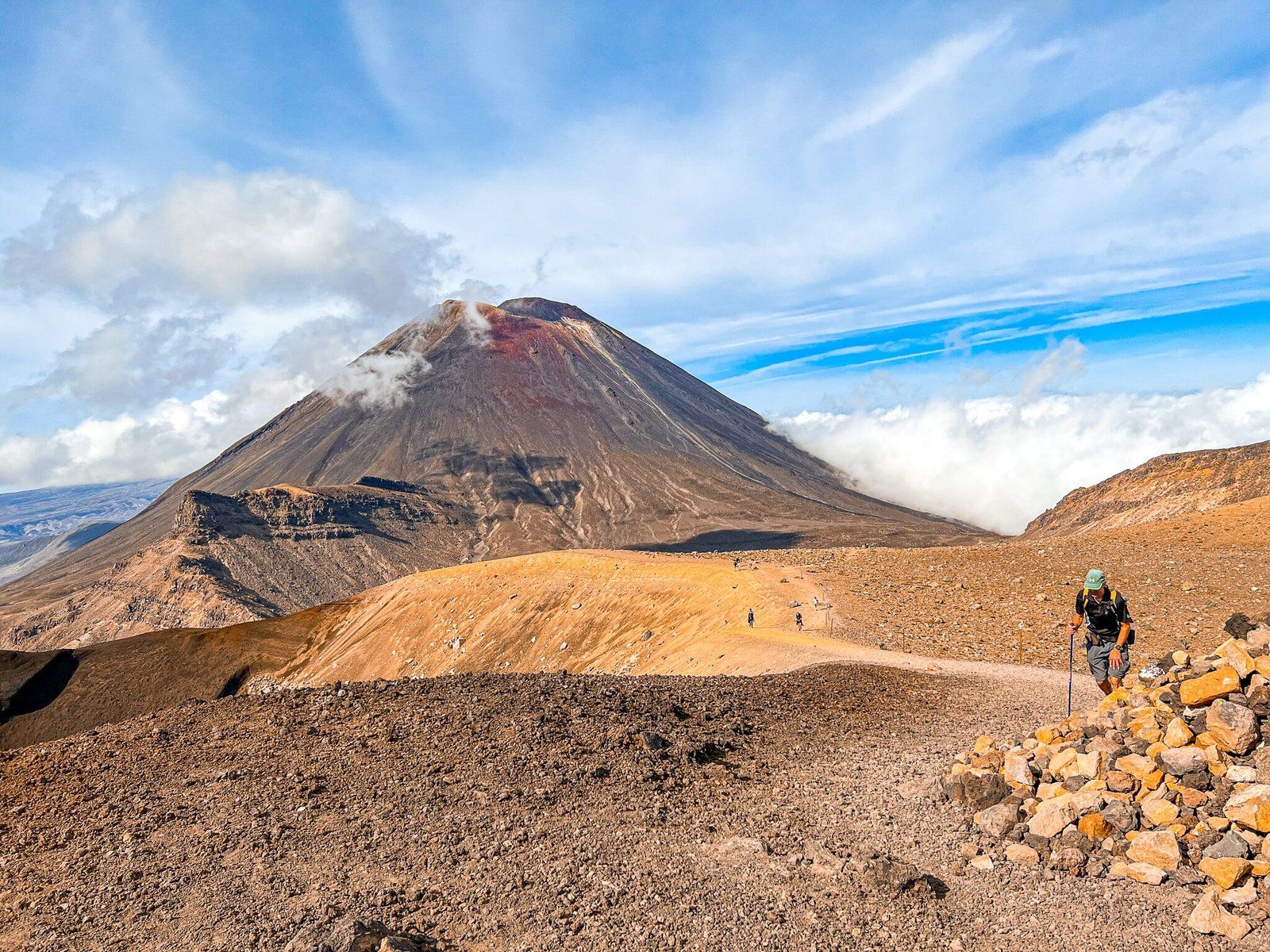
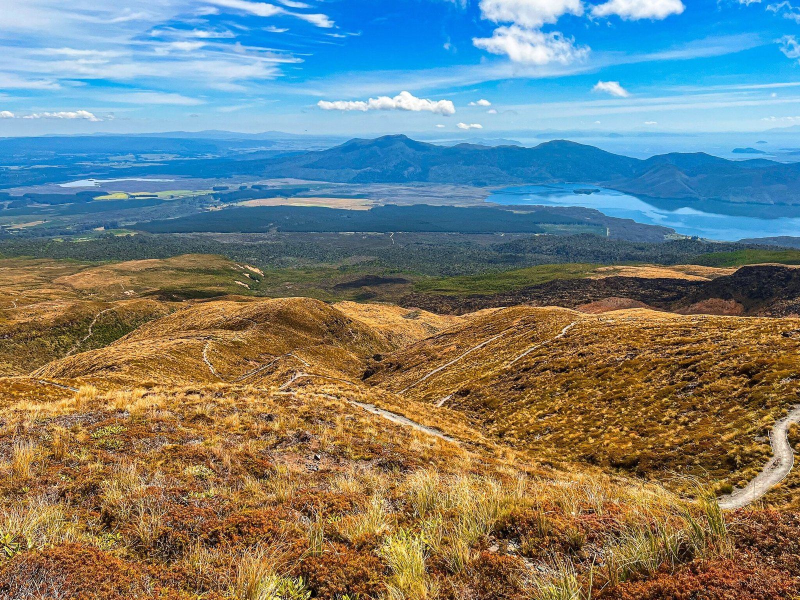
Starting at over 1,100 metres above the tree line, the track initially ascends gently for 5 km to Soda Springs. A steep 300-metre climb follows, leading you onto Tongariro’s South Crater, with the imposing Ngauruhoe to your right. After crossing the flat expanse of South Crater, another steep ascent takes you to the summit of Tongariro at 1,960 metres. From here, you can enjoy breathtaking views of the North and Central Craters, the Emerald Lakes, the Blue Lake, and Ngauruhoe.
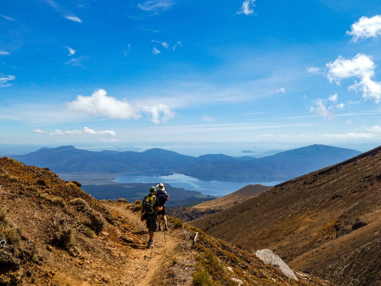
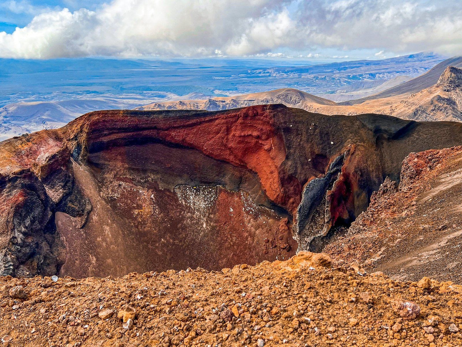
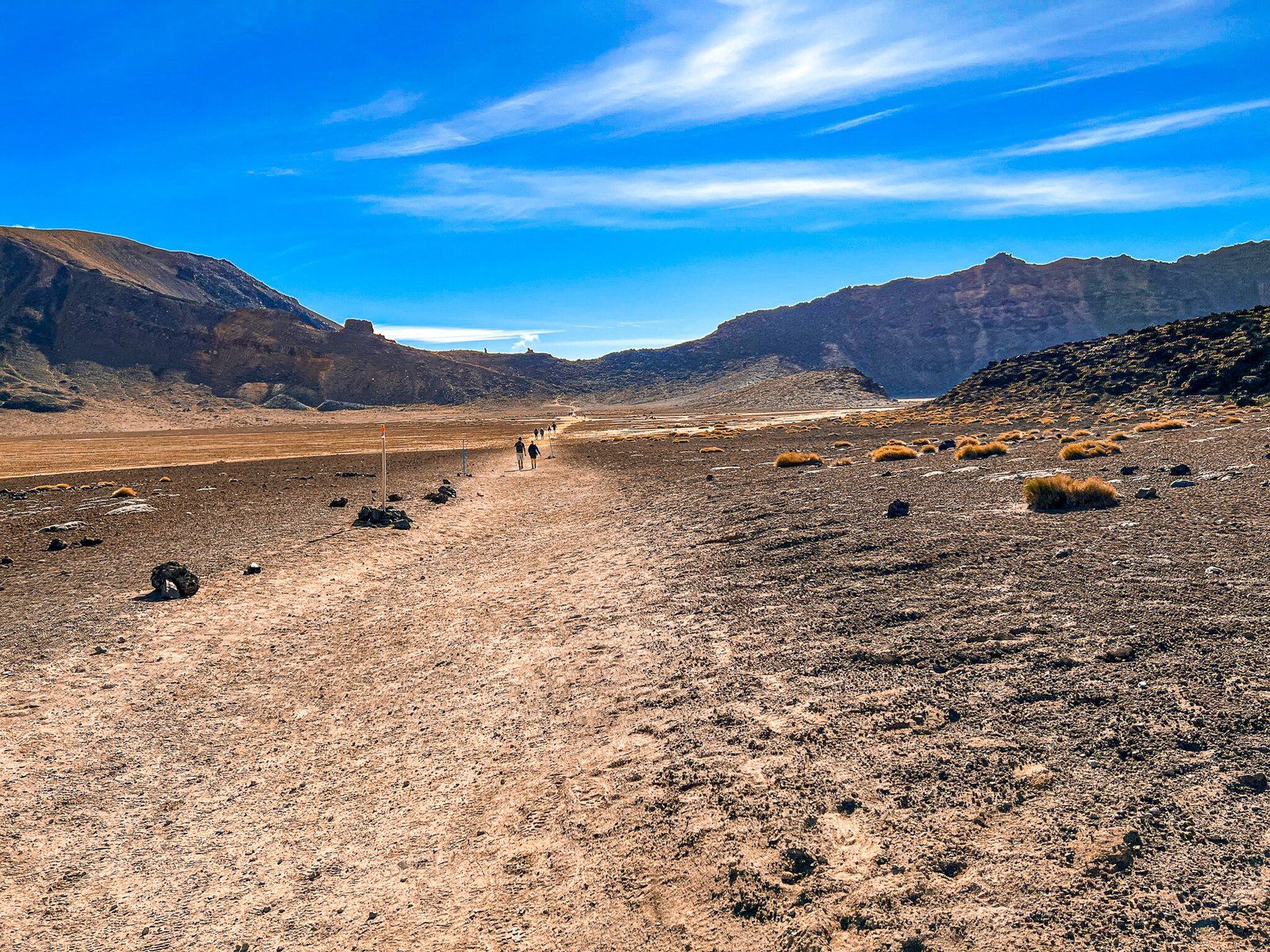
The descent from the rim involves a 1,200-metre vertical drop to the Ketetahi Road end. This includes a scree section from the top, which will be challenging for some. Along the way, you'll pass the Red Crater and Emerald Lakes, then traverse Central Crater. The final stretch, over 7 km, leads through a forested area, offering a respite from the exposed volcanic terrain.
Seasonal Considerations and Safety
The main walking season for the Tongariro Crossing is from November to May. Outside these months, snow and ice are likely, increasing the risk. While the track is still doable in winter, it's advisable to seek guidance at the Ohakune DOV centre, and, if needed, hire a guide. Regardless of the season, it's crucial to be prepared for the high-mountain environment, where weather conditions can change rapidly. Avoid wearing open footwear such as sandals and jandals, and ensure you have extra clothing, food, and water.
How to Get There
To reach the start of the Tongariro Crossing, head to Mangatepopo Road via State Highway 47. From Ohakune, it is a 42-minute, 54 km drive and from Waimarino, it's 20 minutes and 19 km. From Auckland, it takes 4 hours, 344 km.
The track ends at Ketetahi Road, accessible from State Highway 46. Make sure to arrange transportation back to your starting point, whether by car or bus.
An alternative, less-crowded adventure, is to take the gondola at Whakapapa skifield up Mount Ruapehu, then hike to the top and walk to the crater lake rim.
There is a range of other walks in the park that provide a broad range of experiences, from easy to a few hours, such as Tawhai Falls, Taranaki Falls, and Tama Lakes near Whakapapa, and Mangawhero Falls, Waitonga Falls, and Rimu Walk from Ohakune.