The Historic Wairau Affray Site
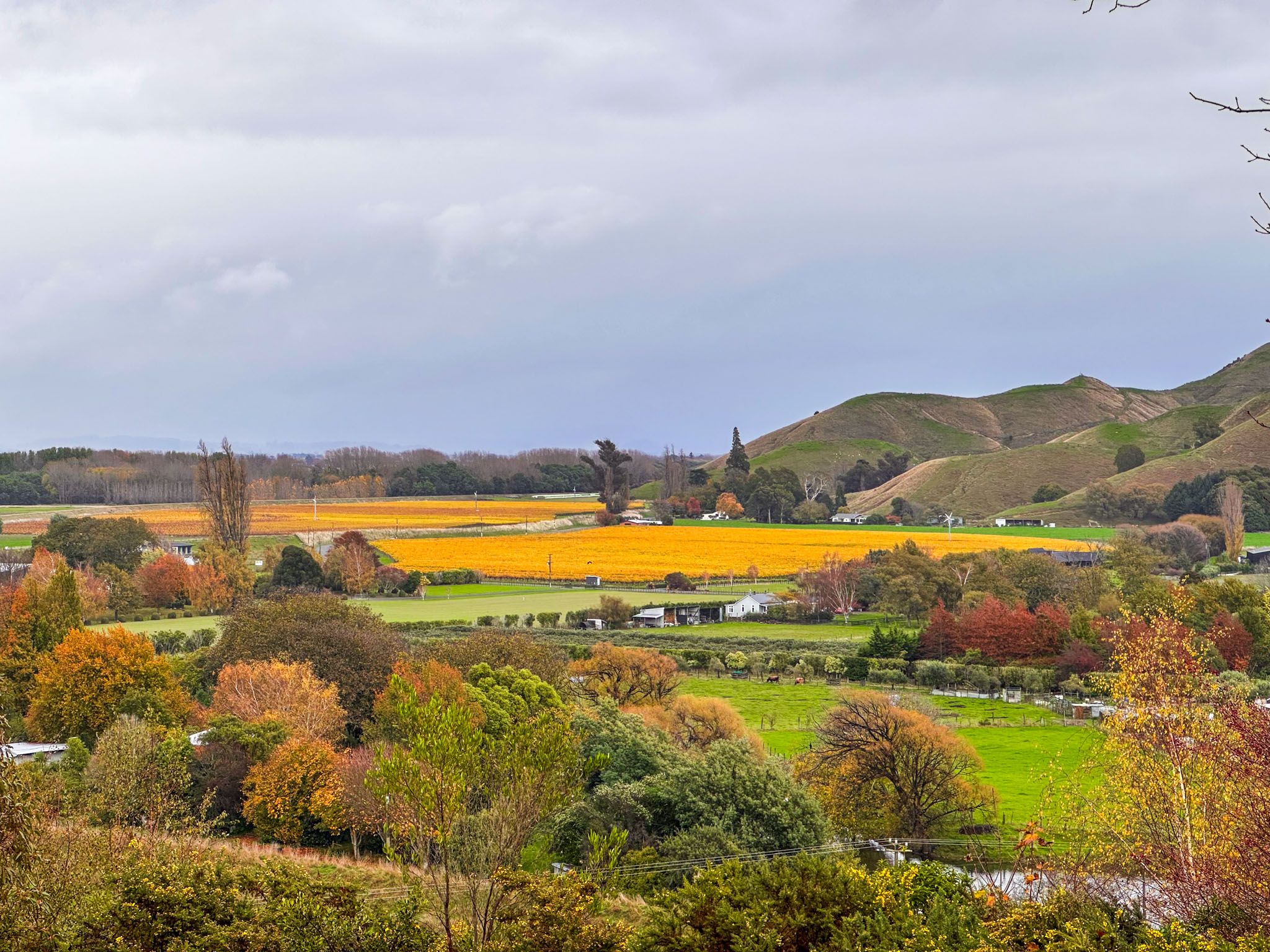
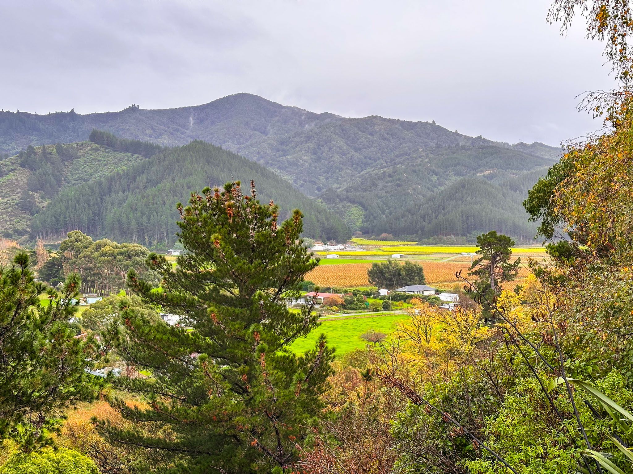
The Wairau Affray marks the first violent clash between Māori and European settlers following the signing of Te Tiriti o Waitangi in 1840. This significant event occurred near Tuamarina, approximately 10 km north of Blenheim, at the edge of the Wairau Valley in Marlborough. Today, State Highway 1 traverses this historic location as it enters the Tuamarina River valley en route to Picton.
The Land Dispute
Central to the Wairau Affray was a contentious land dispute involving the New Zealand Company and the iwi Ngāti Toa. The New Zealand Company, a private enterprise backed by British investors, claimed to have purchased land in the Wairau Valley in a transaction supposedly completed in Wellington in 1839. However, this claim was false, and Ngāti Toa, led by Te Rauparaha and Te Rangihaeata, refused to acknowledge it. Ngāti Toa had gained control of the northern South Island during the Musket Wars of the 1820s and 1830s.
Escalation and Confrontation
The British government, asserting preemption over land purchases from Māori under Te Tiriti o Waitangi, began a formal review of the Company’s extensive land claims. Te Rauparaha was open to resolving the issue through this review, but insisted that surveyors stay out of the Wairau Valley in the meantime.
Despite this, the New Zealand Company, eager to secure a large land block for commercial purposes, sent surveyors into the Wairau in 1843. This led to a confrontation, during which the surveyors’ tools and shelters were destroyed. In response, Nelson magistrate Henry Thompson issued arrest warrants for Te Rauparaha and Te Rangihaeata, accusing them of arson.
The Affray and Its Aftermath
In June 1843, about 50 settlers, including officials, police, and deputised civilians, set out from Nelson to make the arrests. They encountered Te Rauparaha’s group of 90, including warriors, on opposite sides of the Tuamarina River. A shot was fired, sparking a gunfight that resulted in the deaths of four Māori and eleven settlers, including Thompson.
Eleven settlers were captured while fleeing, and two were quickly killed. Among the Māori casualties was Rongo, Te Rangihaeata’s wife and a relative of Te Rauparaha. In accordance with the customary practice of utu, Te Rangihaeata demanded the execution of the remaining captives, including Arthur Wakefield, a key figure in the New Zealand Company.
Official Inquiry and Resolution
At the time, the European population in New Zealand was sparse, and conflict with well-armed Māori was not feasible. Governor Robert Fitzroy, dealing with numerous fraudulent land claims by the New Zealand Company, conducted an official inquiry. The inquiry found that the settlers acted unlawfully and placed blame on the Company.
Although the killing of prisoners was deemed unacceptable, no further action was taken. In 1846, Ngāti Toa sold the Wairau while Te Rauparaha was detained for a time by the government.
The 100 Year Aftermath
A later government inquiry, 100 years on, determined this sale was illegitimate, as Rangitāne iwi were the true tangata whenua before Ngāti Toa’s invasion in the late 1820s.
Visiting the Wairau Affray Site
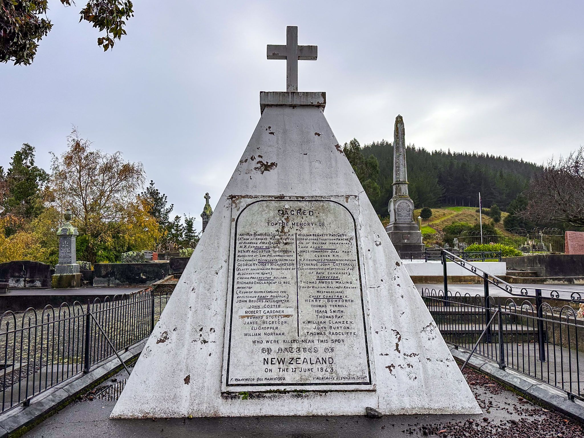
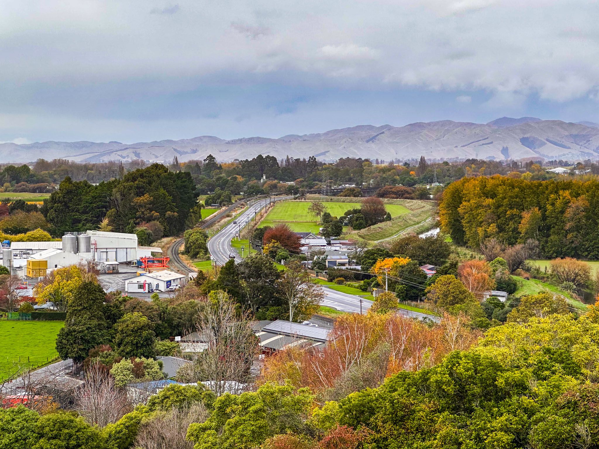
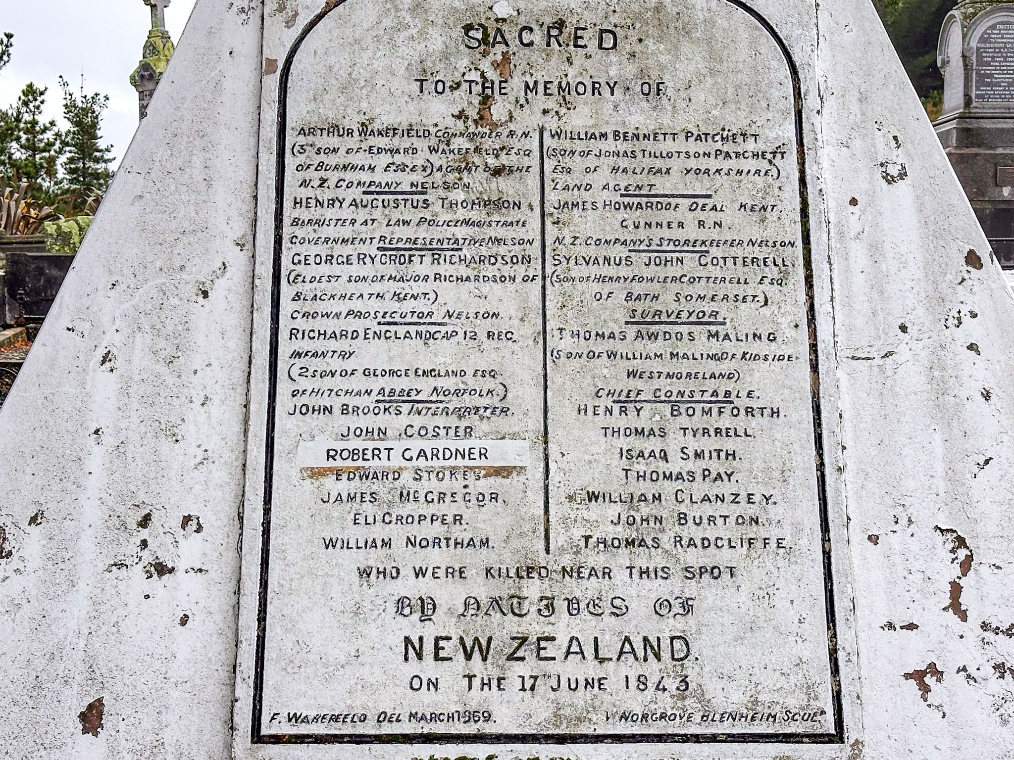
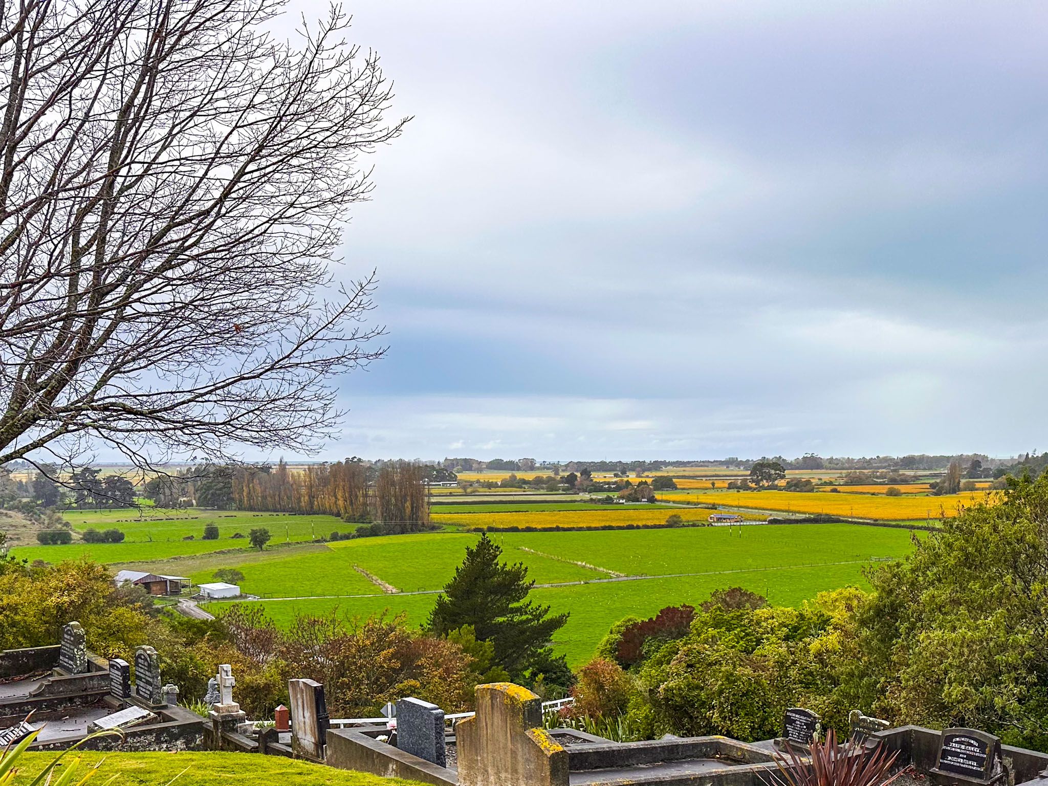
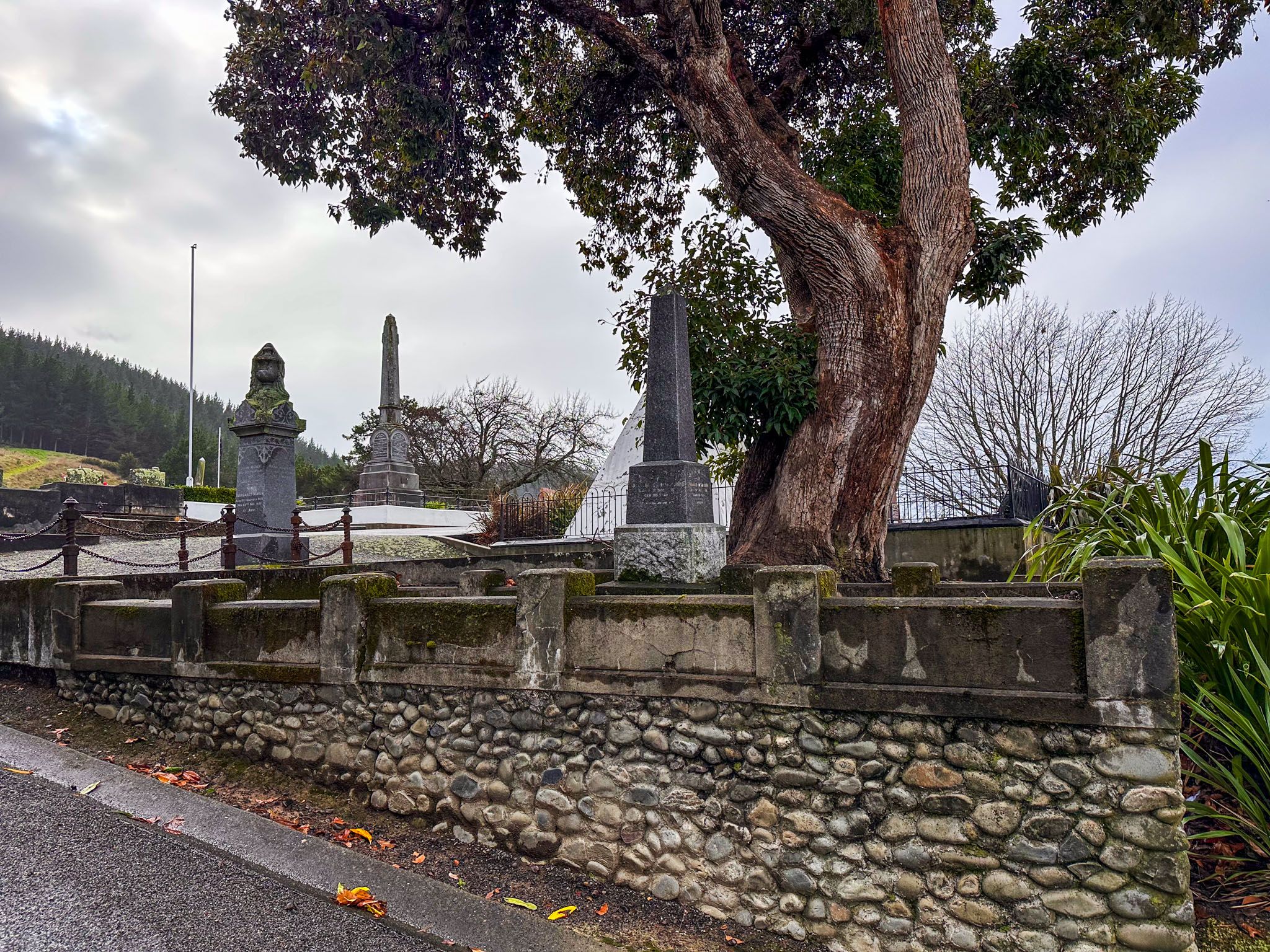
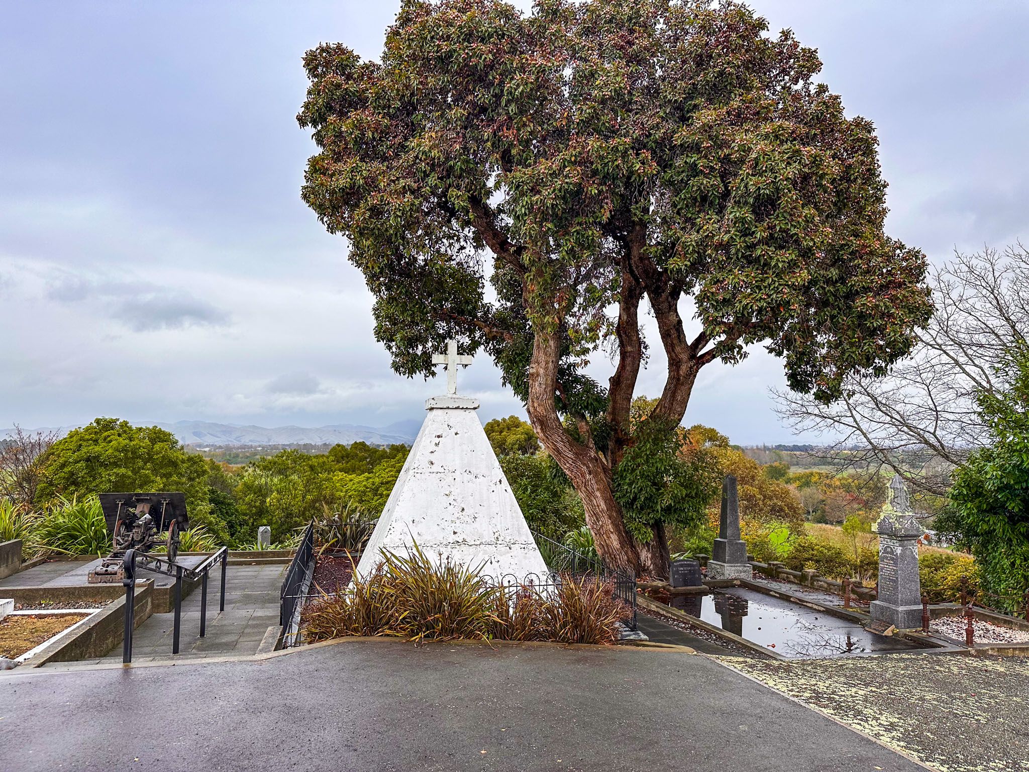
A memorial to European casualties stands at the Tuamarina Cemetery, on the south side of the hill that marks the western entrance to the Tuamarina River Valley. The cemetery is accessible at the end of Cotterill Street, with a panoramic view over the northern end of the Wairau Valley.
The site where the first shots were fired is situated between the river and State Highway 1 on Pioneer Place, just north of Tuamarina and opposite the hill with the cemetery. An informational panel at the site provides details about the affray.


How to Get There
From Blenheim, or Picton, take State Highway 1 to Tuamarina, about halfway between the two towns. Pinoneer Place is the reserve area on the north side of this small township. Drive slowly as it is easy to miss. Park there and you will see teh informational panel. To get to the cemetery, turn east onto Hunters Road, roughly in the middle of the township, then immediately north onto Campbells Road. This becomes Cotterill Street as it winds up the hill to the cemetery. There is room for a few cars to park. The large white pyramid is the memorial to the European victims.
Other nearby historical places include Marshlands, the Wairau Bar, the Wairau Lagoon, the Blenheim Museum and the Picton Museum.