Discover Slope Point
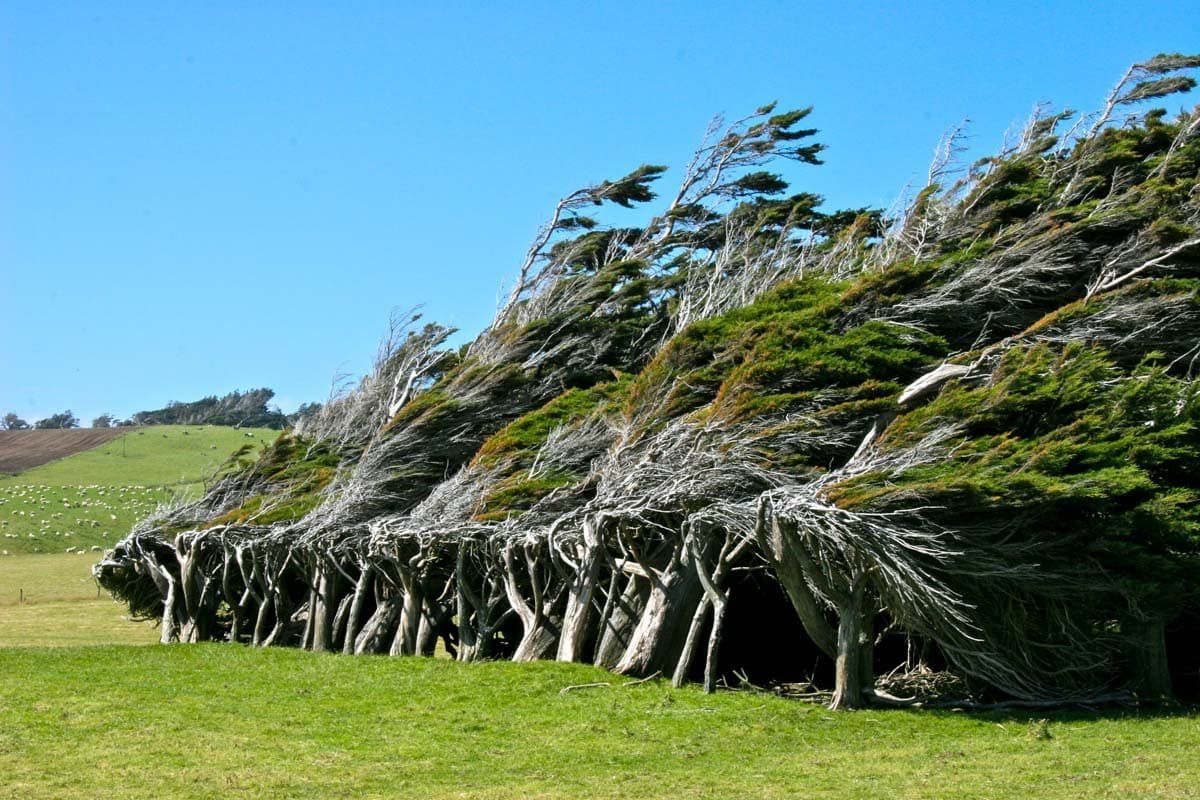
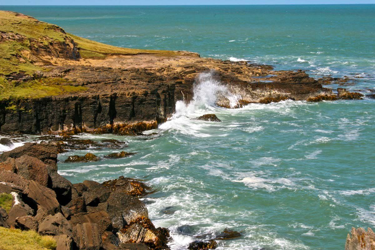
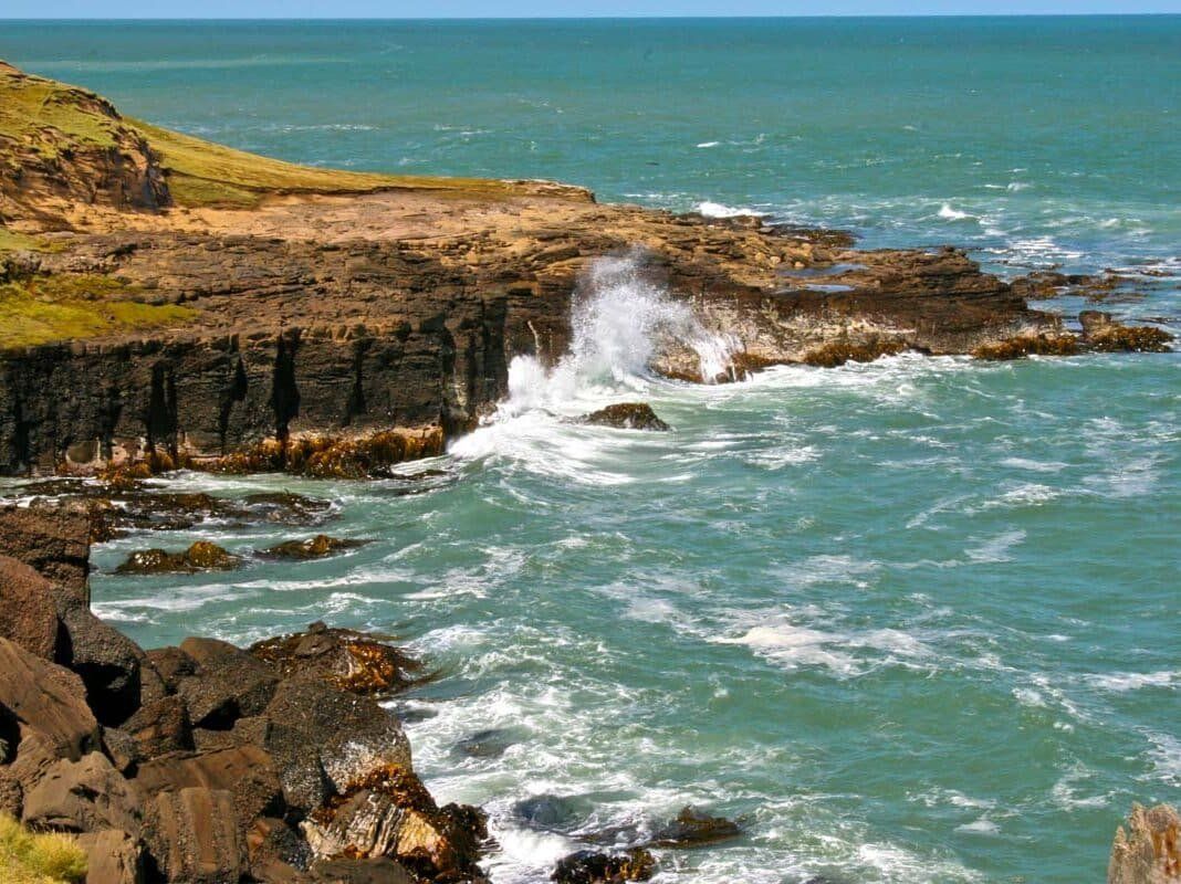
Slope Point, located near the southwest end of the Catlins, is the southernmost point of the South Island. This remote location is known for its striking cliffs and the iconic trees near the car park, which have been shaped by years of relentless southerly winds. The area is surrounded by pastoral farmland, adding to its isolated charm.
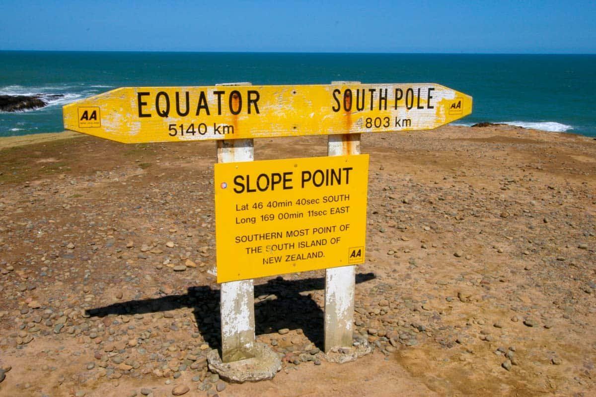
At Slope Point, you'll find an AA signpost marking the distances to the Equator (5,140 km) and the South Pole (4,803 km). A small solar-powered lighthouse is also situated nearby on the farmland. To reach the point, walk for about 20 minutes from the car park through open farmland. Be prepared for the elements, as the area is completely exposed to the weather. Note that the path is closed from September to November due to lambing.
How to Get There
To visit Slope Point, drive west from Curio Bay on the gravel Haldane Curio Bay Road for 9.1 km, then turn south onto gravel Slope Point Road. Follow this road for 5.4 km to reach the car park. Slope Point is 70 km east of Invercargill via the Southern Scenic Route and gravel Tokanui Haldane Road, taking about 70 minutes by car. Alternatively, it is 82 km from Owaka, which takes approximately 80 minutes to drive.
After exploring Slope Point, you can return via Slope Point Road, head west on Tokanui Haldane Road for 1.5 km, and then take the mostly sealed Otara Haldane Road southwest to Waipapa Otara Road. From there, continue south to Waipapa Point.