Discovering Oakley Creek Falls in Auckland
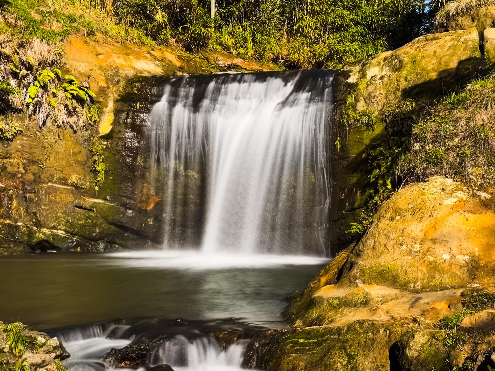
Located in Waterview, central-west Auckland, Oakley Creek Falls is a hidden gem within the urban landscape. This six-metre waterfall, the highest natural falls in central Auckland, is in the Waterview Glades Reserve. The waterfall cascades over a basalt ledge into a large pool, a striking natural feature. While the area is scenic, swimming is discouraged due to water quality concerns.
Exploring Waterview Glades Reserve
The Waterview Glades Reserve, developed atop the southeastern motorway tunnel, features a grassy area with a steep slope leading down to a gully. This gully contains Oakley Creek / Te Auranga and a stretch of replanted native bush. The reserve includes the most picturesque section of the Oakley Creek Walkway, with various views of the creek's winding path. Te Piringa Bridge, a footbridge and cycleway, provides an excellent vantage point for observing the lush bush and the stream below.
The Waterfall
Oakley Creek Falls is surprisingly impressive, with water cascading into the pool below. An upper viewing platform gives a broad perspective, while a path to the base allows you to get closer to the falls. Despite some erosion and storm damage near the falls, the main access points remain open.
Historical and Cultural Significance
Oakley Creek / Te Auranga, the longest creek on the Auckland isthmus at 15 km, begins in Mount Roskill and flows northwest through Mt Albert and Avondale, then north through Waterview to the Waitematā Harbour. The Māori name, Te Auaunga, meaning "swirling waters," reflects the creek's flow through lava-formed channels. Historically, the creek was surrounded by wetlands and was a food source for Māori, providing crayfish, eels, and weka. Harakeke (flax) and raupō (rushes) were harvested for weaving.
In 1845, Edwin Oakley established a flax mill powered by the creek's water, giving the creek its English name. European settlement led to the draining of wetlands and the introduction of exotic trees. Urban development further altered the creek's course. The Friends of Oakley Creek, established in 2004, has worked to protect the creek, leading to extensive replanting of native vegetation.
Navigating the Oakley Creek Walkway
The Oakley Creek Walkway extends much of the creek's length, though storm damage in 2023 has affected some bridges. Two bridges, north and south of the waterfall, remain unrepaired, limiting access to the northern end of the walkway. The easiest way to reach the waterfall is to walk south from the Great North Road entrance to Waterview Glades. Pass the Unitec accommodation facilities until you see a sign for Te Auaunga Oakley Creek Walkway, then follow the path down to the gully and the waterfall.
How to Get There
From Downtown Auckland, take the western motorway to the Great North Road off-ramp. Follow Great North Road for a short distance, then turn right into Allford Street and park anywhere. Walk back to Great North Road and take the pedestrian crossing to the Waterview Glades Reserve. The drive is 9 minutes nd is 8 km.
Nearby, you can also visit Western Springs, Auckland Zoo and MOTAT.