Discover the Enchanting Kura Tāwhiti / Castle Hill
Kura Tāwhiti, also known as Castle Hill, is a captivating limestone outcrop located just south of Castle Hill Village along the Great Alpine Highway, State Highway 73. This highway serves as the main route connecting Canterbury with the West Coast. Just a short drive from Arthur’s Pass and about 90 minutes from Christchurch, Kura Tāwhiti is renowned for its dramatic natural beauty and easy accessibility.
Exploring the Limestone Formations
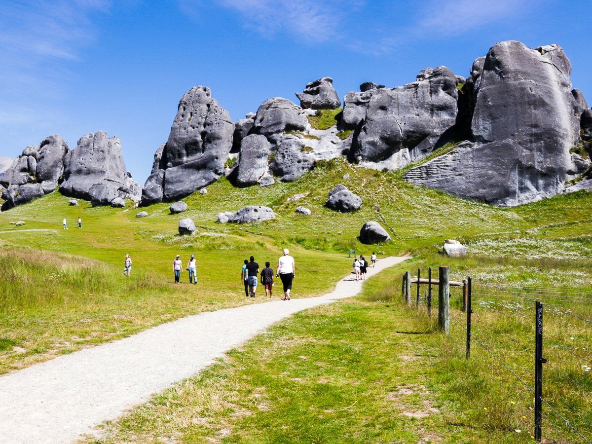
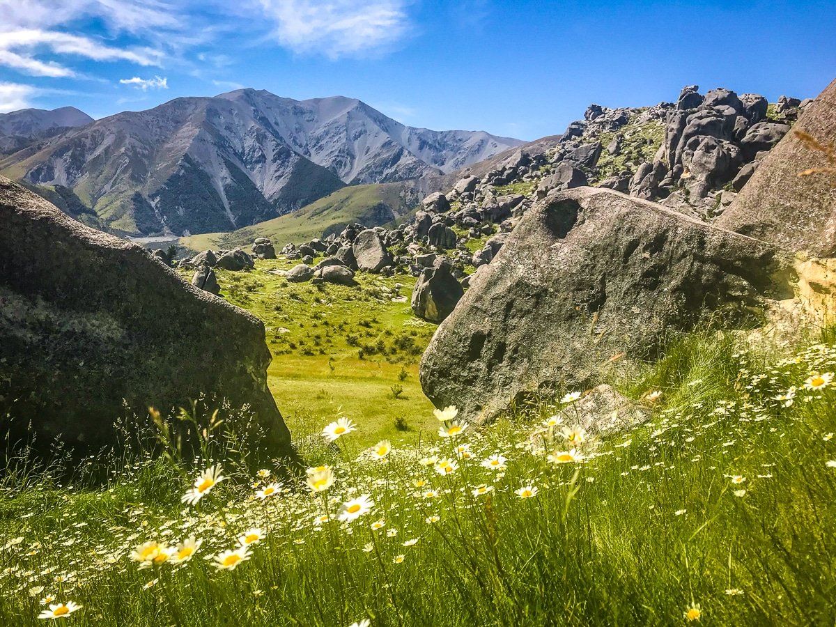
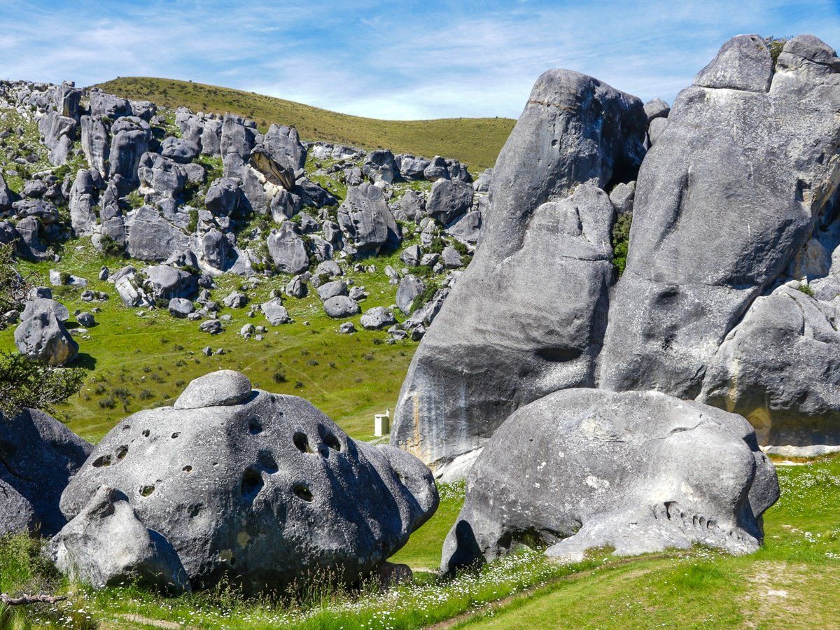
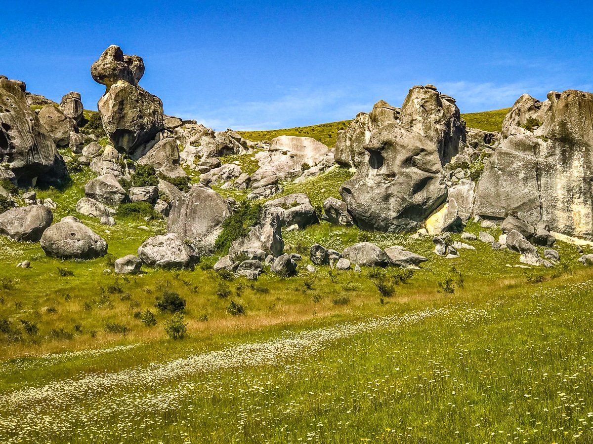
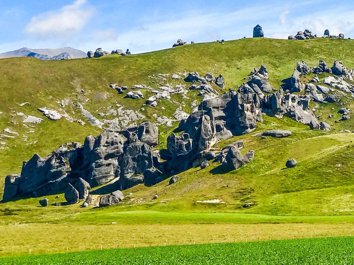
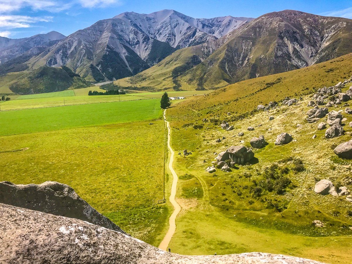
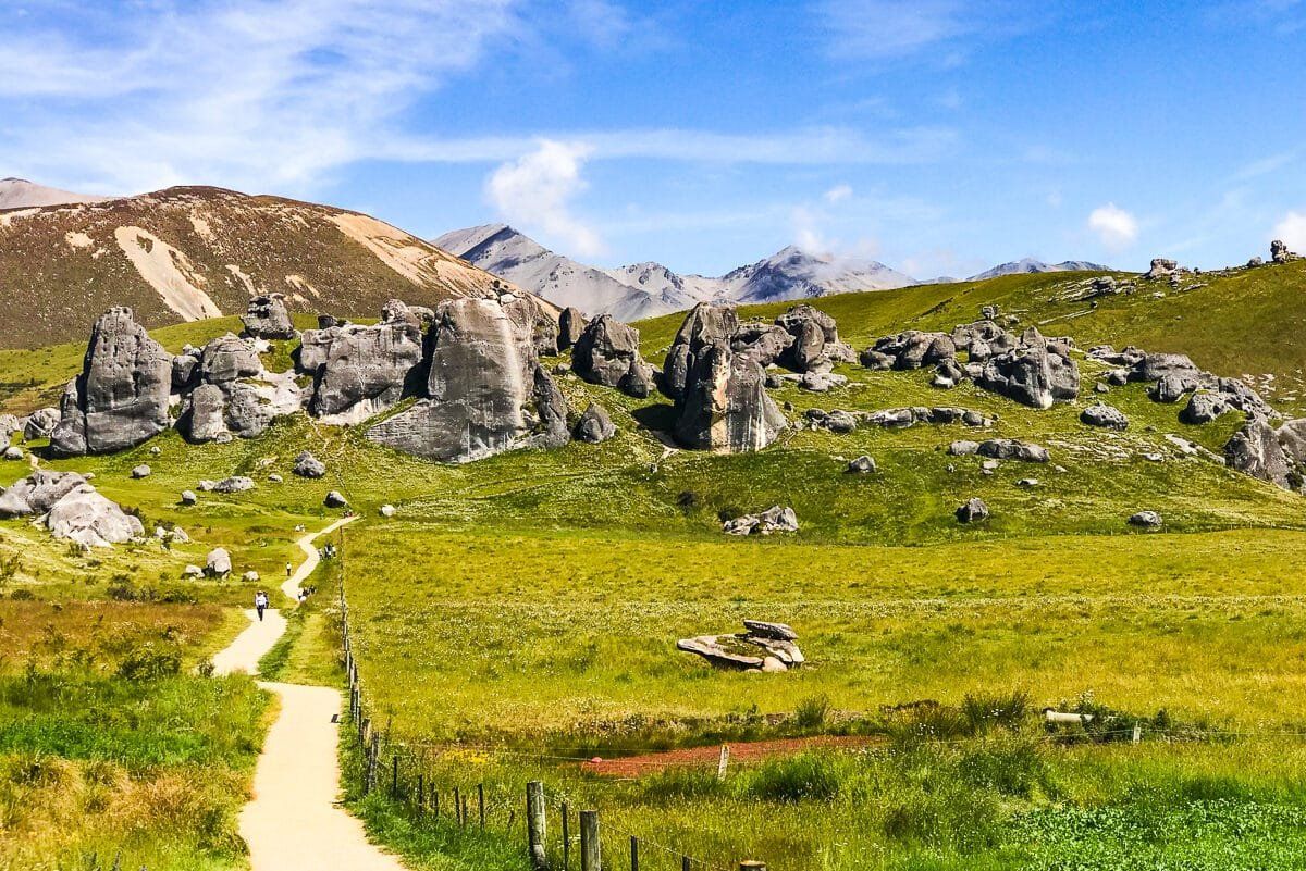
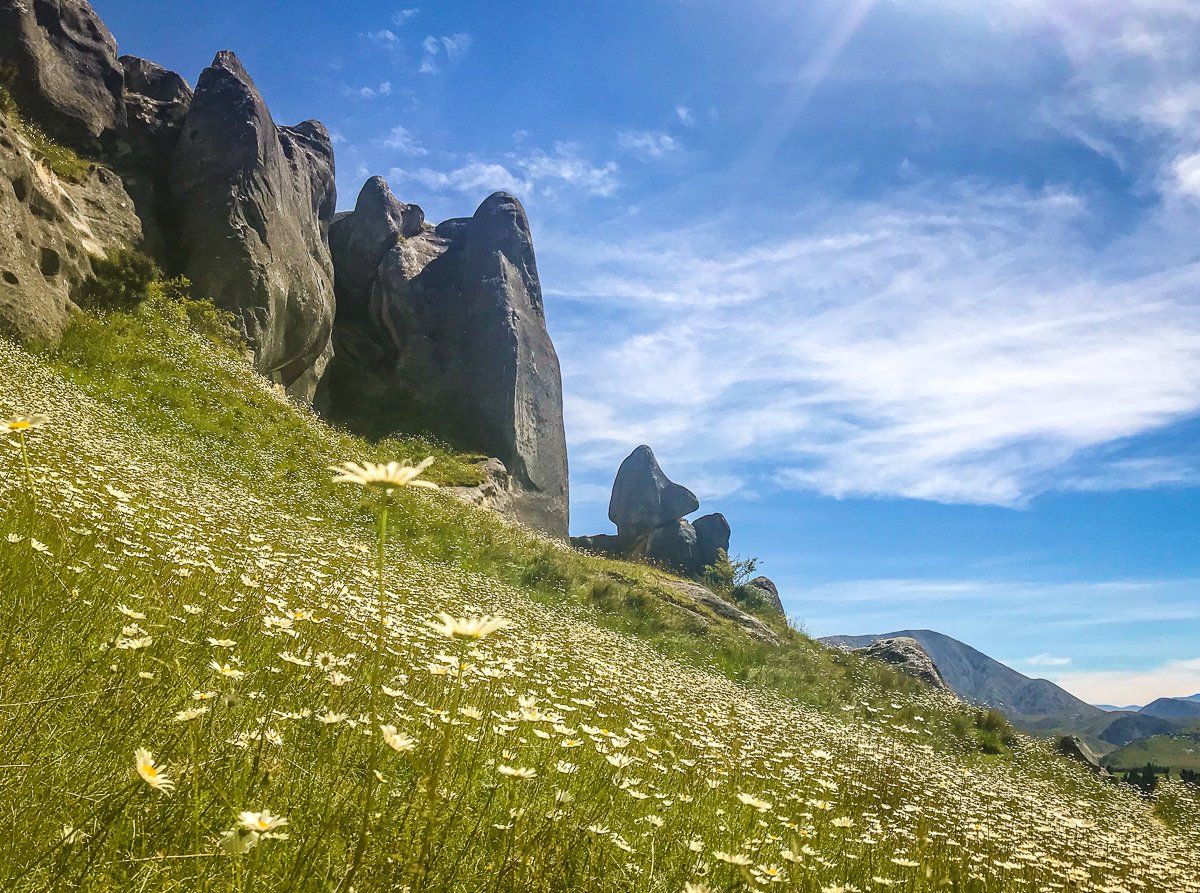
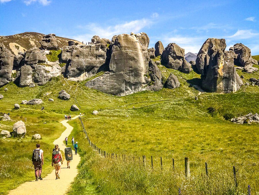
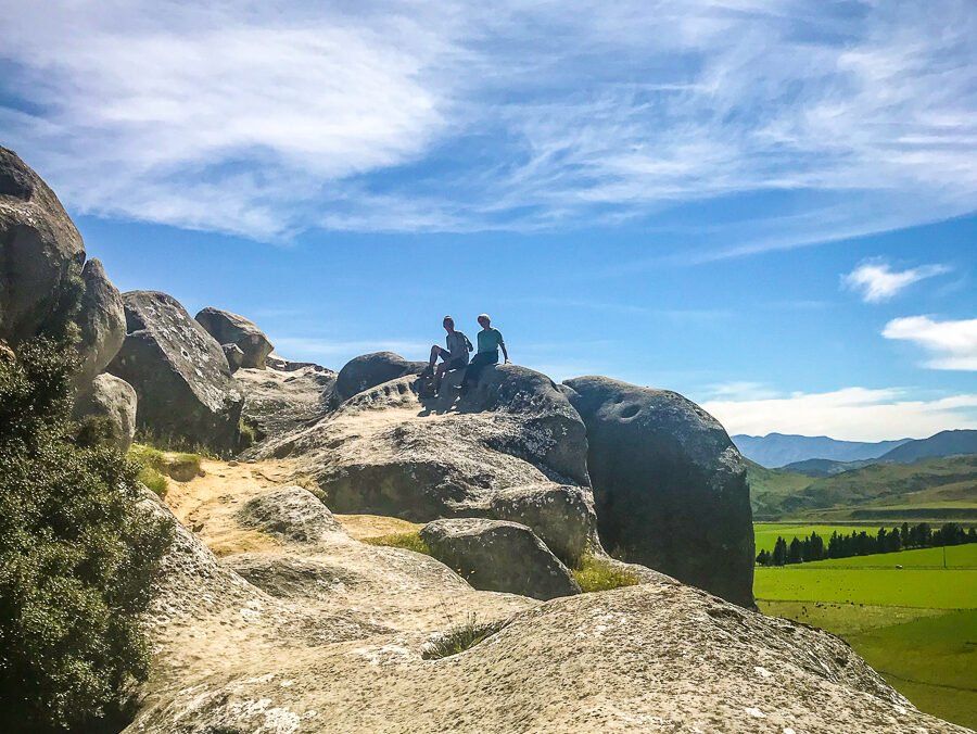
Upon arrival at the marked car park, a wide gravel track leads you to an extraordinary collection of massive, weathered rocks. These formations resemble the crumbling walls of an ancient fortress or giant ruined teeth, creating a unique landscape to explore. There is no designated trail, allowing you to wander freely among the rocks. Some formations are clustered together, while others form passageways, clearings, or ledges that offer sweeping views of the surrounding basin. Be cautious near cliff edges and enjoy vistas of the Torlesse Range and tussock-covered valleys.
Geological and Historical Significance
The limestone rocks at Kura Tāwhiti were formed from layers of organic material deposited in ancient oceans, subjected to immense pressure over millions of years. The area was once a shallow inland sea, which began to fill in around 30 million years ago. Geological processes such as uplift, folding, and faulting led to the formation of the Torlesse and Craigieburn Ranges, while erosion shaped the karst formations seen today. The grasslands surrounding Kura Tāwhiti are relatively recent. Originally covered in tōtara and tall shrubs, much of this vegetation was destroyed by fire 600 years ago, allowing tussock to dominate. Only one tōtara remains nearby.
Cultural Connections and Conservation
The Māori name Kura Tāwhiti, meaning "the treasure from a distant land," was given by Ngāi Tahu iwi. It refers to the kūmara brought to Aotearoa and cultivated in the region. The area was originally claimed by Tane Tiki for his daughter, Hine Mih, as it was known for kākāpō, whose skins and feathers were highly prized for clothing. Today, Kura Tāwhiti holds Tōpuni status, acknowledging the connection with Ngāi Tahu. You are encouraged to respect the area by staying off delicate vegetation and avoiding marked cultural sites.
How to get to Kura Tāwhiti / Castle Hill
Kura Tāwhiti is located directly off State Highway 73, about five minutes south of Castle Hill Village and roughly halfway between Springfield and Arthur’s Pass. Look for the large Department of Conservation sign and car park. The walk from the car park to the rock formations is approximately 1 km and suitable for most fitness levels. After exploring Kura Tāwhiti, consider visiting Cave Stream, a dramatic limestone cave system just a few minutes north. If conditions permit, you can walk through the cave itself for an adventurous experience. Other nearby attractions include Lake Pearson, the Bealey Spur Track, and several options around Arthur's Pass, such as Devils Punchbowl Falls and the Otira Valley Track.